

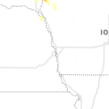
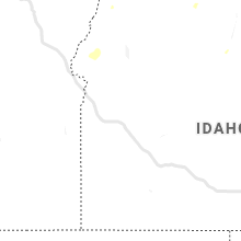
Hail Map for Thursday, August 5, 2021

Number of Impacted Households on 8/5/2021
0
Impacted by 1" or Larger Hail
0
Impacted by 1.75" or Larger Hail
0
Impacted by 2.5" or Larger Hail
Square Miles of Populated Area Impacted on 8/5/2021
0
Impacted by 1" or Larger Hail
0
Impacted by 1.75" or Larger Hail
0
Impacted by 2.5" or Larger Hail


Cities Most Affected by Hail Storms of 8/5/2021
| Hail Size | Demographics of Zip Codes Affected | ||||||
|---|---|---|---|---|---|---|---|
| City | Count | Average | Largest | Pop Density | House Value | Income | Age |
| Sioux Falls, SD | 2 | 2.25 | 2.50 | 788 | $105k | $45.3k | 35.0 |
| Wentworth, SD | 1 | 1.75 | 1.75 | 15 | $60k | $41.8k | 49.1 |
| Springview, NE | 1 | 1.75 | 1.75 | 1 | $27k | $23.3k | 50.5 |
Hail and Wind Damage Spotted on 8/5/2021
Filter by Report Type:Hail ReportsWind Reports
Nebraska
| Local Time | Report Details |
|---|---|
| 4:25 PM CDT | Quarter sized hail reported near Wood Lake, NE, 14.3 miles E of Valentine, NE |
| 5:15 PM CDT | Golf Ball sized hail reported near Springview, NE, 49.3 miles E of Valentine, NE, very heavy rain with hail up to golf ball size was observed. |
| 5:15 PM CDT | Wind gusts estimated at 80 mph. several trees uprooted and broken off. a camper was rolled over and a grain bin was damaged. power was also los in keya paha county NE, 49.3 miles E of Valentine, NE |
| 5:45 PM CDT | Storm damage reported in brown county NE, 46.9 miles SSE of Valentine, NE |
| 6:03 PM CDT | Quarter sized hail reported near Stuart, NE, 27.2 miles WNW of Oneill, NE |
Minnesota
| Local Time | Report Details |
|---|---|
| 4:42 PM CDT | 8 inch diameter branch dow in lincoln county MN, 42.6 miles SW of Montevideo, MN |
| 5:30 PM CDT | Quarter sized hail reported near Arco, MN, 47.8 miles SSW of Montevideo, MN, report from mping: quarter (1.00 in.). |
| 11:38 PM CDT | Quarter sized hail reported near Cottage Grove, MN, 19.8 miles ESE of Minneapolis, MN |
Oregon
| Local Time | Report Details |
|---|---|
| 3:00 PM PDT | 100 foot tree snapped in half due to high winds. 2.09 inches of rain with stor in umatilla county OR, 75.1 miles SSW of Walla Walla, WA |
South Dakota
| Local Time | Report Details |
|---|---|
| 4:10 PM MDT | Storm damage reported in fall river county SD, 66.9 miles SW of Rapid City, SD |
| 5:40 PM MDT | Storm damage reported in fall river county SD, 62.6 miles S of Rapid City, SD |
| 7:15 PM CDT | Quarter sized hail reported near Colman, SD, 39.3 miles N of Sioux Falls, SD |
| 7:25 PM CDT | Ping Pong Ball sized hail reported near Elkton, SD, 48.9 miles NNE of Sioux Falls, SD, report via social media with photo. |
| 7:26 PM CDT | Quarter sized hail reported near Elkton, SD, 49.6 miles NNE of Sioux Falls, SD |
| 7:29 PM CDT | Half Dollar sized hail reported near Madison, SD, 33.4 miles NNW of Sioux Falls, SD, report via social media with a photo. |
| 7:35 PM CDT | Quarter sized hail reported near Elkton, SD, 48.9 miles NNE of Sioux Falls, SD |
| 7:43 PM CDT | Ping Pong Ball sized hail reported near Colman, SD, 37.9 miles N of Sioux Falls, SD |
| 7:53 PM CDT | Ping Pong Ball sized hail reported near Colman, SD, 30.3 miles N of Sioux Falls, SD, report via social media. |
| 8:00 PM CDT | Golf Ball sized hail reported near Wentworth, SD, 32.3 miles NNW of Sioux Falls, SD |
| 8:00 PM CDT | Ping Pong Ball sized hail reported near Wentworth, SD, 31.5 miles NNW of Sioux Falls, SD, report via social media with photos. |
| 8:35 PM CDT | Quarter sized hail reported near Baltic, SD, 14.8 miles N of Sioux Falls, SD, report via social media. |
| 9:04 PM CDT | Tennis Ball sized hail reported near Sioux Falls, SD, 6.6 miles N of Sioux Falls, SD, report via social media. |
| 9:08 PM CDT | Quarter sized hail reported near Sioux Falls, SD, 5.6 miles E of Sioux Falls, SD |
| 9:10 PM CDT | Hen Egg sized hail reported near Sioux Falls, SD, 5.6 miles E of Sioux Falls, SD |
| 10:45 PM CDT | Tree reported knocked dow in lincoln county SD, 29.2 miles S of Sioux Falls, SD |
Idaho
| Local Time | Report Details |
|---|---|
| 4:19 PM MDT | Mesonet station rfti1 - raft river raw in cassia county ID, 61.8 miles E of Twin Falls, ID |
| 4:24 PM MDT | Public reports a measured wind gust to 78.7 mph on yale rd just south of 400 n. corroborated by nearby 67 mph gust at the raft river raws 5 minutes earlie in cassia county ID, 63.8 miles E of Twin Falls, ID |
| 4:35 PM MDT | Mesonet station los - lost river rest are in butte county ID, 48.8 miles W of Idaho Falls, ID |
| 4:40 PM MDT | Mesonet station gri - inl intec/grid in butte county ID, 45.6 miles W of Idaho Falls, ID |
| 5:51 PM MDT | Thunderstorm winds knocked out power to residents west of aberdeen and springfield/id-3 in bingham county ID, 54.6 miles SW of Idaho Falls, ID |
| 6:21 PM MDT | Pocatello regional airpor in power county ID, 47.6 miles SW of Idaho Falls, ID |
| 6:30 PM MDT | Mesonet station rwm - inl radioactive waste managemen in butte county ID, 50.7 miles W of Idaho Falls, ID |
| 6:31 PM MDT | Thunderstorm winds knocked out power to portions of michaud and fort hall reservatio in power county ID, 48.6 miles SW of Idaho Falls, ID |
| 6:35 PM MDT | Mesonet station arc - arc in butte county ID, 63.8 miles W of Idaho Falls, ID |
| 6:35 PM MDT | Mesonet station 690 - inl central facilitie in butte county ID, 45.7 miles W of Idaho Falls, ID |
| 6:35 PM MDT | Mesonet station pbf - inl critical infrastructure comple in butte county ID, 41.8 miles W of Idaho Falls, ID |
| 6:45 PM MDT | Mesonet station tra - inl reactor technologies comple in butte county ID, 47 miles W of Idaho Falls, ID |
| 6:45 PM MDT | Itd rwis station at the inl puzzle/us-2 in butte county ID, 42.6 miles W of Idaho Falls, ID |
| 7:30 PM MDT | Mesonet station rob - roberts. thunderstorm outflow wind in jefferson county ID, 17.7 miles NNW of Idaho Falls, ID |
| 8:45 PM MDT | Mesonet station ho in butte county ID, 51.1 miles WNW of Idaho Falls, ID |
| 8:50 PM MDT | Thunderstorms knocked out power to residents south and east of ashton. reported around 900 pm. fall river rural electric cooperative reports power was restored by 11:11 in fremont county ID, 48.4 miles NE of Idaho Falls, ID |
| 9:44 PM MDT | Mesonet station ohoi1 - ohio gulc in blaine county ID, 72.5 miles N of Twin Falls, ID |
| 10:58 PM MDT | Powerlines dow in jefferson county ID, 18.1 miles NNW of Idaho Falls, ID |
| 12:58 AM MDT | Multiple power outages affecting over 500 customers near milner... hobson... and hynes. a wind gust to 59 mph was observed nearby at the itd rwis i-84 valley interchang in cassia county ID, 28.1 miles E of Twin Falls, ID |
Montana
| Local Time | Report Details |
|---|---|
| 5:08 PM MDT | Storm damage reported in park county MT, 28.3 miles E of Bozeman, MT |
| 5:15 PM MDT | Storm damage reported in park county MT, 21.1 miles E of Bozeman, MT |
| 6:12 PM MDT | Storm damage reported in park county MT, 45.7 miles NE of Bozeman, MT |
Connect with Interactive Hail Maps