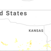
Hail Map for Saturday, July 31, 2021

Number of Impacted Households on 7/31/2021
0
Impacted by 1" or Larger Hail
0
Impacted by 1.75" or Larger Hail
0
Impacted by 2.5" or Larger Hail
Square Miles of Populated Area Impacted on 7/31/2021
0
Impacted by 1" or Larger Hail
0
Impacted by 1.75" or Larger Hail
0
Impacted by 2.5" or Larger Hail
Regions Impacted by Hail on 7/31/2021
Cities Most Affected by Hail Storms of 7/31/2021
| Hail Size | Demographics of Zip Codes Affected | ||||||
|---|---|---|---|---|---|---|---|
| City | Count | Average | Largest | Pop Density | House Value | Income | Age |
| Pratt, KS | 1 | 2.00 | 2.00 | 28 | $58k | $36.1k | 40.9 |
Hail and Wind Damage Spotted on 7/31/2021
Filter by Report Type:Hail ReportsWind Reports
States Impacted
Missouri, Alabama, Wisconsin, Nevada, Utah, South Carolina, Texas, Oklahoma, Kansas, Tennessee, Idaho, Arkansas, Washington, North CarolinaMissouri
| Local Time | Report Details |
|---|---|
| 1:50 PM CDT | Some tree damage reported in the are in butler county MO, 51.5 miles SW of Cape Girardeau, MO |
| 9:00 PM CDT | Tree reported down across highway 95 approximately 1 mile from the intersection with highway in ozark county MO, 51.8 miles SE of Springfield, MO |
| 9:35 PM CDT | A tree was reported down on the paved road going to glade near a highway. time estimated via rada in douglas county MO, 40.6 miles SE of Springfield, MO |
Alabama
| Local Time | Report Details |
|---|---|
| 3:05 PM CDT | Trees and powerlines were blown down in raglan in st. clair county AL, 40.5 miles ENE of Birmingham, AL |
| 3:10 PM CDT | The asos at dothan municipal airport measured a 64-mph wind gust at 3:10pm cdt/4:10pm ed in houston county AL, 83.7 miles NE of Miramar Beach, FL |
| 3:18 PM CDT | A tree was blown down on meyer street in columbian in shelby county AL, 26.2 miles SSE of Birmingham, AL |
| 3:24 PM CDT | Trees and powerlines were blown down on cherry avenue... in birmingha in jefferson county AL, 9.7 miles NW of Birmingham, AL |
| 3:25 PM CDT | Trees and powerlines were blown down on cherry avenue... near fultondal in jefferson county AL, 3.9 miles WNW of Birmingham, AL |
| 3:37 PM CDT | Tree down on pine ridge roa in jefferson county AL, 4.1 miles ESE of Birmingham, AL |
| 3:40 PM CDT | A very large pecan tree was blown down in concor in jefferson county AL, 13.1 miles WSW of Birmingham, AL |
| 3:45 PM CDT | Trees were blown down on shades creek road... in vestavia hill in jefferson county AL, 4.5 miles SSE of Birmingham, AL |
| 3:53 PM CDT | Two trees were blown down... near chelse in shelby county AL, 16.7 miles SSE of Birmingham, AL |
| 4:50 PM CDT | Multiple trees down on whaley ferry road south of new sit in tallapoosa county AL, 32.8 miles NW of Auburn, AL |
| 4:54 PM CDT | Trees and powerlines down on county rd 79 southwest of davisto in tallapoosa county AL, 30.5 miles NNW of Auburn, AL |
| 4:56 PM CDT | Trees down around in several locations near horseshoe ben in tallapoosa county AL, 29.7 miles NNW of Auburn, AL |
Wisconsin
| Local Time | Report Details |
|---|---|
| 3:28 PM CDT | At the intersection of manette st and lenwood st. a few tree bracnhes and powerlines down. via social media in brown county WI, 3.2 miles NW of Green Bay, WI |
| 3:35 PM CDT | Multiple tree limbs on a fence and a garage. just east of perkins park. via social medi in brown county WI, 2.4 miles NW of Green Bay, WI |
Nevada
| Local Time | Report Details |
|---|---|
| 2:16 PM PDT | Corrects previous tstm wnd gst report from 7 e tonopah. tonopah airport asos 7 e of tonopah... from nearby thunderstorm. station elevation 5426 f in nye county NV, 144.2 miles SW of Ely, NV |
| 2:16 PM PDT | Corrects previous tstm wnd gst report from 7 e tonopah. tonopah airport asos 7 e of tonopah... from nearby thunderstorm. station elevation 5426 f in nye county NV, 144.2 miles SW of Ely, NV |
| 3:26 PM PDT | Union pacific railroad (upr) station up011 1 ene deeth... from nearby thunderstorm. station elevation 5356 f in elko county NV, 31.9 miles ENE of Elko, NV |
Utah
| Local Time | Report Details |
|---|---|
| 3:55 PM MDT | Reports of a tree on a powerlin in beaver county UT, 52.2 miles WSW of Monroe, UT |
| 5:40 PM MDT | A tree fell on the tech building at zion np. received via social media. time based on rada in washington county UT, 36.3 miles ENE of Saint George, UT |
South Carolina
| Local Time | Report Details |
|---|---|
| 6:30 PM EDT | Calhoun co dispatch reported a very large tree was downed at calhoun rd at bank sculpture rd. time estimate in calhoun county SC, 59.4 miles NW of Charleston, SC |
Texas
| Local Time | Report Details |
|---|---|
| 6:05 PM CDT | Storm damage reported in hutchinson county TX, 41.9 miles NE of Amarillo, TX |
| 10:05 PM CDT | Storm damage reported in gray county TX, 56.2 miles ENE of Amarillo, TX |
| 10:05 PM CDT | Palo duro reservoir 1 nw mesonet reported the wind gus in hansford county TX, 87.6 miles NNE of Amarillo, TX |
| 10:15 PM CDT | Storm damage reported in gray county TX, 54.3 miles ENE of Amarillo, TX |
| 3:15 AM CDT | Measured by the ttu mesonet in lynn county TX, 42.9 miles S of Lubbock, TX |
Oklahoma
| Local Time | Report Details |
|---|---|
| 6:15 PM CDT | Kavk awos in woods county OK, 46.7 miles ENE of Woodward, OK |
Kansas
| Local Time | Report Details |
|---|---|
| 6:59 PM CDT | Hen Egg sized hail reported near Pratt, KS, 83.4 miles W of Wichita, KS |
| 7:13 PM CDT | Quarter sized hail reported near Pratt, KS, 86.3 miles NNE of Woodward, OK |
Tennessee
| Local Time | Report Details |
|---|---|
| 7:32 PM CDT | A few trees down in the southeastern portion of the count in montgomery county TN, 33.3 miles WNW of Nashville, TN |
| 7:40 PM CDT | Trees and powerlines down along hwy 4 in cheatham county TN, 19.6 miles WNW of Nashville, TN |
| 8:30 PM CDT | Several trees down in bells bend at 3964-4001 old hickory blvd in davidson county TN, 7.5 miles W of Nashville, TN |
| 8:42 PM CDT | Trees uprooted and some small hail. trees on a house and the roa in davidson county TN, 6.1 miles S of Nashville, TN |
| 8:44 PM CDT | Delayed report...tspotter report of multiple mature trees down on lealand lane between battery and stonewall from first round of storm in davidson county TN, 5.4 miles S of Nashville, TN |
| 10:10 PM CDT | Tree down in burn in dickson county TN, 30.8 miles WSW of Nashville, TN |
| 10:10 PM CDT | Three down on road at spencer mill rd near deal r in dickson county TN, 28 miles WSW of Nashville, TN |
| 10:15 PM CDT | Numerous trees and power lines were knocked down in the humboldt area. wind damage also occurred in the brazil area and the gibson wells are in gibson county TN, 31.1 miles SW of Mc Kenzie, TN |
| 10:20 PM CDT | Tree down across mill r in hickman county TN, 34.3 miles WSW of Nashville, TN |
| 10:39 PM CDT | Tspotter report of a tree down at the entrance of shelby park on 19t in davidson county TN, 2.2 miles E of Nashville, TN |
| 10:45 PM CDT | Tree down across hwy 70 south of spring creek in madison county TN, 26.6 miles SSW of Mc Kenzie, TN |
| 10:45 PM CDT | Trees down along fitzroy circle and stewart campbell point in maury county TN, 30.5 miles SSW of Nashville, TN |
| 10:53 PM CDT | Tree fell on a house. power is out in the are in williamson county TN, 31 miles S of Nashville, TN |
| 10:53 PM CDT | Tspotter report of power lines... trees down... and a tree down on a roof. 6900 block of flat creek roa in williamson county TN, 30.9 miles S of Nashville, TN |
| 11:37 PM CDT | Large tree down on belmont avenue in bedford county TN, 50.9 miles SSE of Nashville, TN |
Idaho
| Local Time | Report Details |
|---|---|
| 9:10 PM MDT | Report from mping: 3-inch tree limbs broken; power poles broke in gooding county ID, 20.7 miles NW of Twin Falls, ID |
| 9:30 PM PDT | A trained spotter reported damage from outflow winds at the art on the green festival in downtown coeur dalene. winds toppled tents... knocked over tables... and damage in kootenai county ID, 30 miles E of Spokane, WA |
Arkansas
| Local Time | Report Details |
|---|---|
| 10:15 PM CDT | Damaging winds destroyed a metal carport and caused sporadic damage... including tree damage... in the city of ash flat. time estimated from rada in sharp county AR, 97.1 miles S of Salem, MO |
Washington
| Local Time | Report Details |
|---|---|
| 11:00 PM PDT | Power pole and lines down; blowing dust across highway 28. ephrata airport with gusts to 33 mp in grant county WA, 70.5 miles S of Omak, WA |
North Carolina
| Local Time | Report Details |
|---|---|
| 5:52 AM EDT | Tree down on hampton roa in davidson county NC, 58.5 miles NNE of Charlotte, NC |
| 6:05 AM EDT | Tree down in celmmons on idols roa in forsyth county NC, 61.2 miles NNE of Charlotte, NC |












Connect with Interactive Hail Maps