Hail Map for Monday, June 18, 2012

Number of Impacted Households on 6/18/2012
0
Impacted by 1" or Larger Hail
0
Impacted by 1.75" or Larger Hail
0
Impacted by 2.5" or Larger Hail
Square Miles of Populated Area Impacted on 6/18/2012
0
Impacted by 1" or Larger Hail
0
Impacted by 1.75" or Larger Hail
0
Impacted by 2.5" or Larger Hail
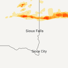
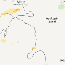
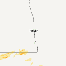
Regions Impacted by Hail on 6/18/2012
Cities Most Affected by Hail Storms of 6/18/2012
| Hail Size | Demographics of Zip Codes Affected | ||||||
|---|---|---|---|---|---|---|---|
| City | Count | Average | Largest | Pop Density | House Value | Income | Age |
| Gladstone, MI | 2 | 1.88 | 2.00 | 151 | $81k | $39.8k | 45.6 |
| Lynd, MN | 1 | 2.00 | 2.00 | 11 | $68k | $41.5k | 37.0 |
| Neenah, WI | 1 | 2.00 | 2.00 | 716 | $106k | $50.6k | 38.4 |
| Larsen, WI | 1 | 1.75 | 1.75 | 58 | $122k | $52.7k | 45.4 |
| Ray, ND | 1 | 1.75 | 1.75 | 2 | $40k | $29.7k | 46.9 |
| Colby, WI | 1 | 1.75 | 1.75 | 45 | $74k | $37.6k | 36.7 |
| Summit Lake, WI | 1 | 1.75 | 1.75 | 18 | $110k | $35.3k | 49.1 |
| Rudyard, MI | 1 | 1.75 | 1.75 | 5 | $66k | $37.5k | 41.9 |
Hail and Wind Damage Spotted on 6/18/2012
Filter by Report Type:Hail ReportsWind Reports
States Impacted
Michigan, Virginia, Ohio, Wisconsin, Pennsylvania, North Carolina, North Dakota, South Dakota, MinnesotaMichigan
| Local Time | Report Details |
|---|---|
| 9:50 AM EDT | Tree fell on car at cascade and cherry dr. person pinned in ca in kent county MI, 3.6 miles ESE of Grand Rapids, MI |
| 10:05 AM EDT | 3 foot dia tree down on ware rd between montcalm rd and conklin r in ionia county MI, 31 miles E of Grand Rapids, MI |
| 10:40 AM EDT | Small tree downed at wooodbury rd. and doyle r in shiawassee county MI, 34 miles WSW of Flint, MI |
| 12:38 PM EDT | Trees and powerlines downed in lenawee county MI, 72.9 miles SSW of Flint, MI |
| 12:56 PM EDT | Storm damage reported in wayne county MI, 56.9 miles SSE of Flint, MI |
| 1:13 PM EDT | Trees and powerlines downed in lenawee county MI, 77.8 miles NE of Fort Wayne, IN |
| 1:15 PM EDT | Grosse ile bridge closed due to wind damag in wayne county MI, 66.7 miles SSE of Flint, MI |
| 1:19 PM EDT | Powerlines reported dow in wayne county MI, 63.3 miles SSE of Flint, MI |
| 2:29 PM EDT | Ping Pong Ball sized hail reported near Gulliver, MI, 81.5 miles N of Traverse City, MI, 1.5 inch hail measured at seul choix point lighthouse. |
| 3:30 PM EDT | Golf Ball sized hail reported near Gladstone, MI, 50.9 miles SSE of Marquette, MI, golf ball sized hail. just stopped. not much wind. |
| 3:35 PM EDT | Hen Egg sized hail reported near Gladstone, MI, 51.6 miles SSE of Marquette, MI, on the north side of gladstone. most hail stones were dime to quarter sized. |
| 4:21 PM EDT | Golf Ball sized hail reported near Rudyard, MI, 21.7 miles SSW of Sault Sainte Marie, MI, at least golfball size at 11155 w main st. |
| 7:54 PM EDT | Two 6 inch diameter trees down on m 37 near chateau grand travers in grand traverse county MI, 15.8 miles NNE of Traverse City, MI |
| 8:10 PM EDT | Red cardinal lane and adam lane off blair town hall road. windows blown out of house...antenna blew off roof...uprooted very large maple tree...roof damage...fences blo in grand traverse county MI, 8.1 miles SSW of Traverse City, MI |
| 9:30 PM EDT | Tree uprooted. delayed report from monday nigh in presque isle county MI, 10.9 miles N of Alpena, MI |
| 9:45 PM EDT | Trees down in city. roof damage to two downtown buildings. time estimated by rada in missaukee county MI, 35.8 miles SE of Traverse City, MI |
Virginia
| Local Time | Report Details |
|---|---|
| 1:42 PM EDT | Tree down on valley view blvd in city of roanoke county VA, 2.2 miles NNW of Roanoke, VA |
| 1:42 PM EDT | Tree down on carlos drive in roanoke county VA, 4.2 miles NNE of Roanoke, VA |
| 4:08 PM EDT | Several large tree limbs down on north briar mountain roa in pittsylvania county VA, 36.7 miles SE of Roanoke, VA |
| 5:10 PM EDT | Large trees and limbs down from thunderstorm wind in rockingham county VA, 58.7 miles SE of Elkins, WV |
| 5:30 PM EDT | Quarter sized hail reported near Bridgewater, VA, 60 miles SE of Elkins, WV |
| 5:41 PM EDT | Limbs down from thunderstorm wind in rockingham county VA, 61.7 miles SE of Elkins, WV |
| 5:42 PM EDT | Damage to shed doors. leaf debris coated side of hous in rockingham county VA, 61.7 miles SE of Elkins, WV |
| 5:42 PM EDT | Siding peeled from house. trees and limbs down. hail also occurred but size was unobserve in rockingham county VA, 61.7 miles SE of Elkins, WV |
| 5:45 PM EDT | Healthy walnut tree had 6-10 inch limbs snapped. plywood roof panel removed from shed. ventilator ripped from roof of garage. a-frame swing set blown across neighboring in rockingham county VA, 62.1 miles SE of Elkins, WV |
Ohio
| Local Time | Report Details |
|---|---|
| 2:15 PM EDT | Tree down on route 28 and straye in lucas county OH, 88.7 miles ENE of Fort Wayne, IN |
| 2:20 PM EDT | A couple of trees dow in lucas county OH, 82.7 miles ENE of Fort Wayne, IN |
| 2:20 PM EDT | Quarter sized hail reported near Maumee, OH, 82.7 miles ENE of Fort Wayne, IN, grape size. |
| 2:40 PM EDT | Large limbs dow in ottawa county OH, 75.7 miles W of Cleveland, OH |
| 2:45 PM EDT | One tree down on rudolph road...near rudolp in wood county OH, 77 miles ENE of Fort Wayne, IN |
| 2:50 PM EDT | Large limbs down across the count in sandusky county OH, 74.5 miles W of Cleveland, OH |
| 2:55 PM EDT | Half Dollar sized hail reported near Bowling Green, OH, 77.9 miles ENE of Fort Wayne, IN |
| 3:03 PM EDT | Large limbs dow in erie county OH, 58.6 miles W of Cleveland, OH |
| 3:10 PM EDT | Powerpoles and lines down downtow in erie county OH, 53 miles W of Cleveland, OH |
| 3:13 PM EDT | Storm damage reported in huron county OH, 51.2 miles WSW of Cleveland, OH |
| 3:15 PM EDT | Storm damage reported in huron county OH, 51.2 miles WSW of Cleveland, OH |
| 3:15 PM EDT | Numerous powerpoles down. reported by police dept via medi in huron county OH, 51.2 miles WSW of Cleveland, OH |
| 3:25 PM EDT | Tree dow in seneca county OH, 68.1 miles WSW of Cleveland, OH |
| 3:26 PM EDT | Storm damage reported in erie county OH, 43.4 miles WSW of Cleveland, OH |
| 3:41 PM EDT | Storm damage reported in huron county OH, 40.6 miles WSW of Cleveland, OH |
| 3:50 PM EDT | Numerous trees and powerlines down over the western portion of the count in lorain county OH, 23.4 miles WSW of Cleveland, OH |
| 3:50 PM EDT | Powerpoles and lines dow in lorain county OH, 31.5 miles WSW of Cleveland, OH |
| 4:05 PM EDT | Four trees down across the count in ashland county OH, 54.7 miles SW of Cleveland, OH |
| 4:05 PM EDT | One tree down on route 4 in ashland county OH, 46.9 miles SW of Cleveland, OH |
| 4:05 PM EDT | A few limbs down on 30 in medina county OH, 35.2 miles SW of Cleveland, OH |
| 4:05 PM EDT | One tree down on 16 in medina county OH, 36.4 miles SW of Cleveland, OH |
| 4:10 PM EDT | Large limbs down in the roa in lorain county OH, 33.3 miles W of Cleveland, OH |
| 4:40 PM EDT | Tree dow in wayne county OH, 47.5 miles SSW of Cleveland, OH |
| 5:00 PM EDT | Tree dow in wayne county OH, 57.8 miles SSW of Cleveland, OH |
| 5:20 PM EDT | Numerous trees and limbs down across the county. two roads closed because of downed tree in holmes county OH, 66.9 miles S of Cleveland, OH |
| 5:25 PM EDT | Storm damage reported in holmes county OH, 66.2 miles S of Cleveland, OH |
| 5:45 PM EDT | Trees dow in guernsey county OH, 70.8 miles E of Columbus, OH |
| 6:02 PM EDT | Tree down on state route 93 in tuscarawas county OH, 63.2 miles S of Cleveland, OH |
| 6:10 PM EDT | Trees down on route 146... county road 10... and county road 271 in coshocton county OH, 64.4 miles ENE of Columbus, OH |
| 6:10 PM EDT | Tree down on schilling hill road between dover and sugarcree in tuscarawas county OH, 68.6 miles S of Cleveland, OH |
| 6:20 PM EDT | Tree down on i-77 near mile marker 7 in tuscarawas county OH, 76.6 miles S of Cleveland, OH |
Wisconsin
| Local Time | Report Details |
|---|---|
| 2:20 PM CDT | Quarter sized hail reported near Irma, WI, 23 miles SSW of Rhinelander, WI, time estimated |
| 2:21 PM CDT | Quarter sized hail reported near Colby, WI, 68.2 miles SW of Rhinelander, WI, just larger than a quarter. |
| 2:22 PM CDT | Golf Ball sized hail reported near Colby, WI, 67 miles SW of Rhinelander, WI |
| 2:25 PM CDT | Quarter sized hail reported near Colby, WI, 64.5 miles SW of Rhinelander, WI |
| 2:27 PM CDT | Quarter sized hail reported near Abbotsford, WI, 61.8 miles SW of Rhinelander, WI, 42 mph wind gust |
| 2:45 PM CDT | Golf Ball sized hail reported near Summit Lake, WI, 20.8 miles SSE of Rhinelander, WI |
| 3:08 PM CDT | Half Dollar sized hail reported near Wausau, WI, 43.6 miles SSW of Rhinelander, WI |
| 4:09 PM CDT | Quarter sized hail reported near Waupaca, WI, 56.8 miles WSW of Green Bay, WI |
| 4:09 PM CDT | Half Dollar sized hail reported near Clintonville, WI, 37.1 miles W of Green Bay, WI |
| 4:10 PM CDT | Quarter sized hail reported near Clintonville, WI, 37.1 miles W of Green Bay, WI |
| 4:28 PM CDT | Ping Pong Ball sized hail reported near Marinette, WI, 38.6 miles NNE of Green Bay, WI |
| 4:40 PM CDT | Camper trailer destroyed. delayed report in shawano county WI, 18.3 miles NW of Green Bay, WI |
| 5:04 PM CDT | Golf Ball sized hail reported near Larsen, WI, 39.9 miles WSW of Green Bay, WI, near intersection of hwy 45 and hwy 10 |
| 5:12 PM CDT | Half Dollar sized hail reported near Neenah, WI, 31.3 miles SW of Green Bay, WI |
| 5:15 PM CDT | Half Dollar sized hail reported near Neenah, WI, 31.3 miles SW of Green Bay, WI |
| 5:18 PM CDT | Half Dollar sized hail reported near Neenah, WI, 31.3 miles SW of Green Bay, WI |
| 5:19 PM CDT | Quarter sized hail reported near Menasha, WI, 30.3 miles SW of Green Bay, WI |
| 5:20 PM CDT | Quarter sized hail reported near Appleton, WI, 27.5 miles SW of Green Bay, WI |
| 5:26 PM CDT | Quarter sized hail reported near Menasha, WI, 29 miles SW of Green Bay, WI |
| 6:00 PM CDT | Hen Egg sized hail reported near Neenah, WI, 34.8 miles SW of Green Bay, WI, a few 2 |
| 4:38 AM CDT | Half Dollar sized hail reported near Prescott, WI, 28.2 miles SE of Minneapolis, MN |
| 5:21 AM CDT | A few trees down. scattered power outages in stetsonvill in taylor county WI, 57 miles SW of Rhinelander, WI |
| 5:25 AM CDT | Tree down on house in taylor county WI, 58.3 miles SW of Rhinelander, WI |
| 5:28 AM CDT | Corrected for time and wind gust in taylor county WI, 57.2 miles SW of Rhinelander, WI |
| 5:40 AM CDT | Small tree down. time estimate in dunn county WI, 74.4 miles NNW of La Crosse, WI |
| 5:40 AM CDT | Trees down at intersection of hwy 97 and county hwy f in marathon county WI, 51 miles SW of Rhinelander, WI |
| 5:50 AM CDT | Powerlines down. time estimate in eau claire county WI, 70.6 miles N of La Crosse, WI |
| 6:10 AM CDT | Large trees uprooted. street floodin in lincoln county WI, 34.2 miles SSW of Rhinelander, WI |
| 6:10 AM CDT | Trees down-time approximate in lincoln county WI, 34.2 miles SSW of Rhinelander, WI |
| 6:10 AM CDT | Trees down in marathon county WI, 48 miles SSW of Rhinelander, WI |
| 6:15 AM CDT | Downed barn and damaged garden on east side of wausau off of hwy z. relayed by wsa in marathon county WI, 47.8 miles SSW of Rhinelander, WI |
| 6:30 AM CDT | 16 inch tree snapped in half. relayed by wsa in langlade county WI, 36 miles SSE of Rhinelander, WI |
| 6:35 AM CDT | Numerious large trees down north of city on hwy 45 and county rd aa in langlade county WI, 35.4 miles SSE of Rhinelander, WI |
| 6:55 AM CDT | Numerous large pine trees down. one tree knocked out powerlin in langlade county WI, 45.8 miles SE of Rhinelander, WI |
Pennsylvania
| Local Time | Report Details |
|---|---|
| 5:45 PM EDT | Trees dow in washington county PA, 30.9 miles SW of Pittsburgh, PA |
North Carolina
| Local Time | Report Details |
|---|---|
| 6:18 PM EDT | Several large tree limbs and one tree blown down at the stone mountain golf clu in wilkes county NC, 65.7 miles ESE of Bristol, TN |
North Dakota
| Local Time | Report Details |
|---|---|
| 6:54 PM CDT | Quarter sized hail reported near Williston, ND, 3.7 miles N of Williston, ND, ground covered with hail. hailed for past 5 minutes and still hailing. |
| 6:54 PM CDT | Spotter estimated 60 mph wind in williams county ND, 0.4 miles WNW of Williston, ND |
| 7:03 PM CDT | Relayed by media. 1.25 of rainfal in williams county ND, 0.4 miles WNW of Williston, ND |
| 7:03 PM CDT | Storm damage reported in williams county ND, 2.4 miles NNW of Williston, ND |
| 7:09 PM CDT | Golf Ball sized hail reported near Ray, ND, 19.6 miles E of Williston, ND, hail started as dime and got to golfballs... with high winds reported. |
| 7:18 PM CDT | Quarter sized hail reported near Watford City, ND, 21.3 miles ESE of Williston, ND |
| 7:30 PM CDT | Quarter sized hail reported near Keene, ND, 34.6 miles ESE of Williston, ND |
South Dakota
| Local Time | Report Details |
|---|---|
| 12:05 AM CDT | Several trees and large branches down in tow in kingsbury county SD, 64.9 miles NNW of Sioux Falls, SD |
| 12:05 AM CDT | Ping Pong Ball sized hail reported near De Smet, SD, 70.7 miles NNW of Sioux Falls, SD |
| 12:45 AM CDT | Quarter sized hail reported near Volga, SD, 54.3 miles N of Sioux Falls, SD |
| 12:50 AM CDT | Half Dollar sized hail reported near Brookings, SD, 59.7 miles N of Sioux Falls, SD |
| 12:55 AM CDT | 1 foot diameter tree knocked down and several small branches stripped from tree in brookings county SD, 52.9 miles N of Sioux Falls, SD |
| 1:07 AM CDT | Half Dollar sized hail reported near White, SD, 58.4 miles SW of Montevideo, MN |
| 12:18 AM MDT | Pea size hail and 1.5 inches of rain in bennett county SD, 47 miles WNW of Valentine, NE |
| 3:00 AM CDT | Dime sized hail fell for an estimated 20 to 30 minutes. hail caused significant damage to corn. 3 to 4 inch diameter branches down as wel in clark county SD, 54.5 miles ESE of Aberdeen, SD |
| 3:00 AM CDT | Ping Pong Ball sized hail reported near Wallace, SD, 55.3 miles ESE of Aberdeen, SD |
| 3:20 AM CDT | Trees and branches down in watertown resulting in power outages in codington county SD, 71.3 miles W of Montevideo, MN |
| 3:24 AM CDT | Measured at watertown airport in codington county SD, 71.3 miles W of Montevideo, MN |
| 3:50 AM CDT | Quarter sized hail reported near Frederick, SD, 29.9 miles NNE of Aberdeen, SD |
Minnesota
| Local Time | Report Details |
|---|---|
| 1:37 AM CDT | Ping Pong Ball sized hail reported near Tyler, MN, 47.8 miles SSW of Montevideo, MN |
| 1:50 AM CDT | Quarter sized hail reported near Russell, MN, 45.1 miles SSW of Montevideo, MN |
| 1:54 AM CDT | Ping Pong Ball sized hail reported near Russell, MN, 44.9 miles SSW of Montevideo, MN |
| 1:54 AM CDT | Storm damage reported in lyon county MN, 46.7 miles SSW of Montevideo, MN |
| 1:55 AM CDT | Golf Ball sized hail reported near Russell, MN, 45.1 miles SSW of Montevideo, MN |
| 1:57 AM CDT | Hen Egg sized hail reported near Lynd, MN, 42.6 miles SSW of Montevideo, MN |
| 2:05 AM CDT | Storm damage reported in lyon county MN, 41 miles S of Montevideo, MN |
| 3:20 AM CDT | Numerous large trees downed in scott county MN, 19 miles SSW of Minneapolis, MN |
| 3:30 AM CDT | Quarter sized hail reported near Gaylord, MN, 55.5 miles WSW of Minneapolis, MN, enough hail to make the ground white |
| 3:35 AM CDT | Large tree on house. time estimated by rada in mcleod county MN, 38.6 miles W of Minneapolis, MN |
| 3:45 AM CDT | Numerous medium to large maple...oak and pine trees toppled. some trees over two feet in diameter. at least 30 trees felled with numerous six inch diameter or slightly in carver county MN, 35 miles WSW of Minneapolis, MN |
| 3:48 AM CDT | Six to eight inch tree limbs severed. telephone pole leaning against tre in carver county MN, 33.5 miles WSW of Minneapolis, MN |
| 3:52 AM CDT | Mndot road sensor in scott county MN, 40.6 miles SW of Minneapolis, MN |
| 3:55 AM CDT | Storm damage reported in scott county MN, 34.7 miles SW of Minneapolis, MN |
| 3:55 AM CDT | 50 to 60 trees down. power lines dow in scott county MN, 34.7 miles SW of Minneapolis, MN |
| 3:55 AM CDT | Quarter sized hail reported near Belle Plaine, MN, 34.7 miles SW of Minneapolis, MN |
| 3:59 AM CDT | Measured by spotter at co rd 2 and 21. reported by emergency manage in scott county MN, 32.6 miles SSW of Minneapolis, MN |
| 4:00 AM CDT | Aprswxnet sensor. time estimate in scott county MN, 15.6 miles SSW of Minneapolis, MN |
| 4:00 AM CDT | Numerous large trees downed. time correcte in scott county MN, 19 miles SSW of Minneapolis, MN |
| 4:00 AM CDT | Several trees down at intersection of hwy 13 and 150th s in scott county MN, 15.8 miles SSW of Minneapolis, MN |
| 4:03 AM CDT | Storm damage reported in scott county MN, 19 miles SSW of Minneapolis, MN |
| 4:05 AM CDT | Tree down on knox between 82nd and american blvd. tin shed blown to next yard near 100 st. time estimate in hennepin county MN, 10.6 miles SSW of Minneapolis, MN |
| 4:05 AM CDT | Several trees down on bursville parkway at hwy 35w. time estimate in dakota county MN, 15.1 miles S of Minneapolis, MN |
| 4:10 AM CDT | 14 power poles knocked down or snapped in half along pilot knob road between county rd 42 and county road 46...closing road. time estimate in dakota county MN, 16.1 miles SSE of Minneapolis, MN |
| 4:10 AM CDT | 10 inch diameter tree downed in dakota county MN, 20.7 miles S of Minneapolis, MN |
| 4:15 AM CDT | 30 ft tree down. wood fence blown over. near intersection of shannon parkway and hwy 46. time estimated by rada in dakota county MN, 19.8 miles SSE of Minneapolis, MN |
| 4:20 AM CDT | Fifty five inch diameter oak tree snapped off above main stump. main stump 150 inches in diameter at the base. damage occurred on italy pat in dakota county MN, 20.7 miles S of Minneapolis, MN |
| 4:23 AM CDT | 30 ft tall pine tree uprooted. branches broken off other tree in dakota county MN, 12.1 miles SSE of Minneapolis, MN |
| 4:25 AM CDT | Large tree limbs snapped in half. small trees down. time estimated. media also reporting utility poles down in south st paul near interstate 49 in dakota county MN, 12.6 miles ESE of Minneapolis, MN |
| 4:25 AM CDT | Large trees down. road to neighborhood blocked near intersection of hwy 494 and co rd 56. time estimate in dakota county MN, 13.8 miles ESE of Minneapolis, MN |
| 4:25 AM CDT | Quarter sized hail reported near Dundas, MN, 38 miles S of Minneapolis, MN |
| 4:29 AM CDT | Reported at st paul downtown airport in ramsey county MN, 8.3 miles ESE of Minneapolis, MN |
| 4:30 AM CDT | 18 inch diameter tree uproote in dakota county MN, 26.7 miles SE of Minneapolis, MN |
| 4:30 AM CDT | 2 ft diameter tree downed in southeast st. paul near maplewood border. time estimate in ramsey county MN, 8.3 miles ESE of Minneapolis, MN |
| 4:33 AM CDT | Reported at stanton airfield in goodhue county MN, 37.2 miles SSE of Minneapolis, MN |
| 4:35 AM CDT | 1 ft diameter tree downed near intersection of bailey road and radio drive. time estimate in washington county MN, 17.6 miles ESE of Minneapolis, MN |
| 6:51 AM CDT | Several two to three inch diameter branches severed and several trees down near intersection of hwy 13 and 150th s in scott county MN, 15.8 miles SSW of Minneapolis, MN |









Connect with Interactive Hail Maps