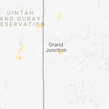
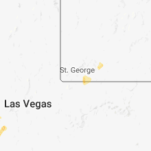
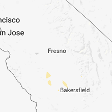
Hail Map for Wednesday, October 3, 2018

Number of Impacted Households on 10/3/2018
0
Impacted by 1" or Larger Hail
0
Impacted by 1.75" or Larger Hail
0
Impacted by 2.5" or Larger Hail
Square Miles of Populated Area Impacted on 10/3/2018
0
Impacted by 1" or Larger Hail
0
Impacted by 1.75" or Larger Hail
0
Impacted by 2.5" or Larger Hail
Regions Impacted by Hail on 10/3/2018
Cities Most Affected by Hail Storms of 10/3/2018
| Hail Size | Demographics of Zip Codes Affected | ||||||
|---|---|---|---|---|---|---|---|
| City | Count | Average | Largest | Pop Density | House Value | Income | Age |
Hail and Wind Damage Spotted on 10/3/2018
Filter by Report Type:Hail ReportsWind Reports
Wisconsin
| Local Time | Report Details |
|---|---|
| 3:15 PM CDT | Quarter sized hail reported near , , 54.8 miles W of Rhinelander, WI |
| 4:00 PM CDT | Quarter sized hail reported near Harshaw, WI, 14.6 miles W of Rhinelander, WI |
| 6:05 PM CDT | Few power poles dow in st. croix county WI, 29.2 miles E of Minneapolis, MN |
| 6:10 PM CDT | Tree down across roa in st. croix county WI, 31 miles E of Minneapolis, MN |
| 6:45 PM CDT | Tree down across roa in dunn county WI, 62.9 miles E of Minneapolis, MN |
| 6:50 PM CDT | Tree down across roa in dunn county WI, 73 miles NNW of La Crosse, WI |
| 7:04 PM CDT | Trees down in the far southern portion of the county. time estimated by rada in langlade county WI, 42.4 miles SSE of Rhinelander, WI |
| 7:41 PM CDT | Trees down. time estimated by rada in oconto county WI, 43.1 miles NNW of Green Bay, WI |
Minnesota
| Local Time | Report Details |
|---|---|
| 5:25 PM CDT | Public report of large tree down on a car at a residence near the eden prairie/chanhassen line. no exact address given. time estimated from radar. flying cloud airport in hennepin county MN, 14.6 miles SW of Minneapolis, MN |
| 5:30 PM CDT | 9 inch diameter branch snapped off. time approximate. photo on twitte in hennepin county MN, 6.7 miles SSW of Minneapolis, MN |
| 5:35 PM CDT | Asos station msp... minneapolis-st. paul a in hennepin county MN, 7 miles SSE of Minneapolis, MN |
| 5:35 PM CDT | Scattered tree damage across southern ramsey count in ramsey county MN, 8.3 miles ESE of Minneapolis, MN |
| 5:39 PM CDT | A few power lines dow in dakota county MN, 9.2 miles SE of Minneapolis, MN |
| 5:43 PM CDT | A few power poles dow in dakota county MN, 12.6 miles ESE of Minneapolis, MN |
| 5:48 PM CDT | Trees down near woodbury. possible tornado. kmsp tdwr radar showed a small but intense velocity couplet begin near woodbury... tracking east northeast to half way betwe in washington county MN, 16.9 miles ESE of Minneapolis, MN |
| 5:49 PM CDT | Tree down near military rd and glen r in washington county MN, 17.2 miles ESE of Minneapolis, MN |
| 6:00 PM CDT | A few trees down in lakelan in washington county MN, 24.8 miles E of Minneapolis, MN |
| 6:37 PM CDT | Large branches blown down. one fell on a power lin in wabasha county MN, 63.6 miles SE of Minneapolis, MN |
| 6:45 PM CDT | A couple of trees were blown down onto a power lin in wabasha county MN, 60.6 miles SE of Minneapolis, MN |
Michigan
| Local Time | Report Details |
|---|---|
| 5:56 PM CDT | Power lines down. time estimated by rada in dickinson county MI, 59.8 miles SSW of Marquette, MI |
| 11:45 PM EDT | Several trees dow in emmet county MI, 62.2 miles NNE of Traverse City, MI |
| 12:00 AM EDT | Asos station pln... pellston - rgnl airport of emmet count in emmet county MI, 67.3 miles SSW of Sault Sainte Marie, MI |
| 12:08 AM EDT | Mesonet station d7501... ironto in charlevoix county MI, 39.6 miles NNE of Traverse City, MI |
Kansas
| Local Time | Report Details |
|---|---|
| 8:23 PM CDT | Storm damage reported in wabaunsee county KS, 14.5 miles SE of Manhattan, KS |
Iowa
| Local Time | Report Details |
|---|---|
| 9:10 PM CDT | Awos station cnc... chariton airpor in lucas county IA, 41.5 miles SSE of Des Moines, IA |
| 10:00 PM CDT | Large tree limbs down and blocking road - 95th avenue. one limb reported to be healthy and 1 foot in diameter. time estimated by rada in jones county IA, 33.1 miles ENE of Cedar Rapids, IA |
California
| Local Time | Report Details |
|---|---|
| 9:50 PM PDT | Quarter sized hail reported near , , 75.4 miles SW of Las Vegas, NV, social media post reported quarter size hail at fort mohave along the colorado river. |
Arizona
| Local Time | Report Details |
|---|---|
| 9:50 PM MST | Quarter sized hail reported near Fort Mohave, AZ, 41.6 miles NNW of Lake Havasu City, AZ, social media post reported quarter sized hail at fort mohave along the colorado river. |


Connect with Interactive Hail Maps