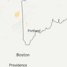
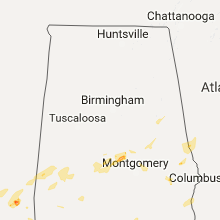
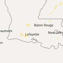
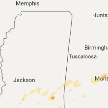
Hail Map for Sunday, September 11, 2016

Number of Impacted Households on 9/11/2016
0
Impacted by 1" or Larger Hail
0
Impacted by 1.75" or Larger Hail
0
Impacted by 2.5" or Larger Hail
Square Miles of Populated Area Impacted on 9/11/2016
0
Impacted by 1" or Larger Hail
0
Impacted by 1.75" or Larger Hail
0
Impacted by 2.5" or Larger Hail
Regions Impacted by Hail on 9/11/2016
Cities Most Affected by Hail Storms of 9/11/2016
| Hail Size | Demographics of Zip Codes Affected | ||||||
|---|---|---|---|---|---|---|---|
| City | Count | Average | Largest | Pop Density | House Value | Income | Age |
Hail and Wind Damage Spotted on 9/11/2016
Filter by Report Type:Hail ReportsWind Reports
States Impacted
New York, New Hampshire, Massachusetts, Connecticut, Maine, Mississippi, Alabama, Georgia, South Carolina, UtahNew York
| Local Time | Report Details |
|---|---|
| 8:00 AM EDT | 6 trees down in columbia county NY, 39.1 miles SSE of Schenectady, NY |
| 8:00 AM EDT | Trees down at columbia county airport in columbia county NY, 37.9 miles SSE of Schenectady, NY |
New Hampshire
| Local Time | Report Details |
|---|---|
| 8:04 AM EDT | Numerous trees and wires downed in coos county NH, 82.4 miles ENE of Burlington, VT |
| 8:04 AM EDT | Numerous trees and wires downed in coos county NH, 82.6 miles E of Burlington, VT |
| 8:10 AM EDT | Trees downed on main street in coos county NH, 81.2 miles E of Burlington, VT |
| 8:25 AM EDT | Trees and power lines down in cheshire county NH, 74.9 miles E of Schenectady, NY |
| 8:25 AM EDT | Trees down in sullivan county NH, 87.1 miles SSE of Burlington, VT |
| 8:30 AM EDT | Trees down in cheshire county NH, 83.8 miles E of Schenectady, NY |
| 8:35 AM EDT | Trees down in sullivan county NH, 91.3 miles ENE of Schenectady, NY |
| 8:40 AM EDT | Trees and power lines down in sullivan county NH, 96.7 miles ENE of Schenectady, NY |
| 8:45 AM EDT | Trees and power lines down in sullivan county NH, 92.5 miles ENE of Schenectady, NY |
| 8:45 AM EDT | Power lines down in grafton county NH, 75 miles WNW of Portland, ME |
| 8:50 AM EDT | Trees and power lines down in sullivan county NH, 96.7 miles ENE of Schenectady, NY |
| 8:52 AM EDT | Trees and power lines down in cheshire county NH, 93.8 miles NNW of Providence, RI |
| 8:52 AM EDT | Trees down in sullivan county NH, 87.1 miles SSE of Burlington, VT |
| 9:20 AM EDT | Multiple trees down through town and power outages in hillsborough county NH, 84 miles WSW of Portland, ME |
| 9:20 AM EDT | Large branches down in carroll county NH, 57.6 miles W of Portland, ME |
| 9:30 AM EDT | Trees down in hillsborough county NH, 64.6 miles N of Providence, RI |
| 9:32 AM EDT | Trees and power lines down in belknap county NH, 60.7 miles WSW of Portland, ME |
| 9:35 AM EDT | Trees and power lines down in hillsborough county NH, 77.9 miles N of Providence, RI |
| 9:40 AM EDT | *** 1 inj *** tree down on car. man brought to hospita in merrimack county NH, 61.9 miles WSW of Portland, ME |
| 9:45 AM EDT | Large branches down in belknap county NH, 50.5 miles WSW of Portland, ME |
| 9:50 AM EDT | Multiple trees and power lines down in carroll county NH, 41.3 miles W of Portland, ME |
| 9:55 AM EDT | Trees and power lines down in strafford county NH, 48.3 miles WSW of Portland, ME |
| 9:55 AM EDT | Multiple trees down in strafford county NH, 51.7 miles WSW of Portland, ME |
| 10:00 AM EDT | Trees and power lines down in rockingham county NH, 67.6 miles N of Providence, RI |
| 10:05 AM EDT | Multiple trees and power lines down in strafford county NH, 40.6 miles WSW of Portland, ME |
| 10:10 AM EDT | Trees down on homes in strafford county NH, 44 miles SW of Portland, ME |
| 10:30 AM EDT | Trees and power lines down in rockingham county NH, 47.9 miles SSW of Portland, ME |
| 10:31 AM EDT | Multiple trees down on pierce island. time estimated from rada in rockingham county NH, 47.4 miles SSW of Portland, ME |
Massachusetts
| Local Time | Report Details |
|---|---|
| 8:05 AM EDT | Multiple trees down on propert in berkshire county MA, 50.3 miles SSE of Schenectady, NY |
| 8:19 AM EDT | Tree down on wires with tree on fir in berkshire county MA, 58.3 miles SE of Schenectady, NY |
| 8:34 AM EDT | Tre down on wires in hampshire county MA, 63.9 miles ESE of Schenectady, NY |
| 8:40 AM EDT | Tree down on wires in franklin county MA, 66.2 miles ESE of Schenectady, NY |
| 8:43 AM EDT | Multiple trees down on old sunderland and taylor hills road in franklin county MA, 74.5 miles ESE of Schenectady, NY |
| 8:45 AM EDT | Tree down on wires on route 9 in hampshire county MA, 72.4 miles ESE of Schenectady, NY |
| 8:46 AM EDT | Tree down on route 9 by florence road in hampshire county MA, 68.5 miles ESE of Schenectady, NY |
| 8:48 AM EDT | Large tree on house at 33 school street in franklin county MA, 73.3 miles ESE of Schenectady, NY |
| 8:53 AM EDT | Wires down chestnut street in hampshire county MA, 72.2 miles WNW of Providence, RI |
| 8:55 AM EDT | Tree down in franklin county MA, 71.5 miles E of Schenectady, NY |
| 9:01 AM EDT | Tree down on route 20 in hampden county MA, 61.3 miles SE of Schenectady, NY |
| 9:03 AM EDT | Multiple trees down on huckle hill raod in franklin county MA, 71.5 miles E of Schenectady, NY |
| 9:05 AM EDT | Tree down on house on allen street in hampshire county MA, 68.7 miles NW of Providence, RI |
| 9:08 AM EDT | Tree down on moore ave in hampshire county MA, 72.2 miles WNW of Providence, RI |
| 9:09 AM EDT | Tree down on skyline trail in hampden county MA, 61.3 miles SE of Schenectady, NY |
| 9:09 AM EDT | Tree down plumtree road blocking road in franklin county MA, 73.3 miles ESE of Schenectady, NY |
| 9:11 AM EDT | Tree down on wires on stillwater road in franklin county MA, 70.7 miles ESE of Schenectady, NY |
| 9:14 AM EDT | Tree down on house on chestnut street in hampshire county MA, 68.7 miles NW of Providence, RI |
| 9:14 AM EDT | Tree down on route 9 in hampshire county MA, 59.4 miles WNW of Providence, RI |
| 9:21 AM EDT | Tree down on sunrise ave and wires down on high street near peach street in worcester county MA, 54.6 miles NW of Providence, RI |
| 9:22 AM EDT | Storm damage reported in worcester county MA, 47.6 miles NW of Providence, RI |
| 9:28 AM EDT | Trees down in the state forest in franklin county MA, 73.8 miles NW of Providence, RI |
| 9:30 AM EDT | Several trees down across the town in worcester county MA, 55.3 miles NNW of Providence, RI |
| 9:30 AM EDT | Trees down on multiple streets in worcester county MA, 48.9 miles NW of Providence, RI |
| 9:31 AM EDT | Trees and wires down on campbell street... pleasentdale road and lincoln road in worcester county MA, 46.2 miles NW of Providence, RI |
| 9:33 AM EDT | Large branches down in hampshire county MA, 64.9 miles WNW of Providence, RI |
| 9:35 AM EDT | Several trees down on riverbend road in middlesex county MA, 54.9 miles N of Providence, RI |
| 9:35 AM EDT | Wires down on several streets in worcester county MA, 55 miles NW of Providence, RI |
| 9:36 AM EDT | Tree down across pearl brook road as well as tree and wires down route 13 brookline road and meadow road in middlesex county MA, 60.2 miles NNW of Providence, RI |
| 9:39 AM EDT | Wires down on chestnut street in hampshire county MA, 72.2 miles WNW of Providence, RI |
| 9:40 AM EDT | Large limb down on river street in middlesex county MA, 59.1 miles N of Providence, RI |
| 9:45 AM EDT | Trees and wires down on jenkins road in middlesex county MA, 54.9 miles N of Providence, RI |
| 9:45 AM EDT | Large branch down on car blocking hope street in worcester county MA, 56.9 miles NNW of Providence, RI |
| 9:53 AM EDT | *** 1 inj *** tree down on man... transported by ambulance in worcester county MA, 51.4 miles NNW of Providence, RI |
| 9:55 AM EDT | Trees down on chelmsford street with other large limbs down in town in middlesex county MA, 53.6 miles N of Providence, RI |
| 10:00 AM EDT | Tree down on barre road in worcester county MA, 55 miles NW of Providence, RI |
| 10:00 AM EDT | Tree down in middlesex county MA, 29.6 miles N of Providence, RI |
| 10:15 AM EDT | Trees and wires down in the warrendale section of the city in middlesex county MA, 40.1 miles NNE of Providence, RI |
| 10:15 AM EDT | Tree down on car on washington street in middlesex county MA, 36.4 miles NNE of Providence, RI |
| 10:17 AM EDT | Tree down on wachusett by pleasant street in worcester county MA, 51.4 miles NNW of Providence, RI |
| 10:20 AM EDT | Tree down on house on orchard street in essex county MA, 64.8 miles SSW of Portland, ME |
| 10:25 AM EDT | Trees and wires down on powder mill and sudbury roads in middlesex county MA, 43.3 miles N of Providence, RI |
| 10:25 AM EDT | Tree down on house on rabitt road in essex county MA, 64.4 miles SSW of Portland, ME |
| 10:30 AM EDT | Tree down on waban ave blocking road in middlesex county MA, 36.4 miles NNE of Providence, RI |
| 10:30 AM EDT | Tree down on power lines in middlesex county MA, 54.9 miles N of Providence, RI |
| 10:32 AM EDT | Tree down on concord ave and tree down at concord ave and fresh pond parkway in middlesex county MA, 41.2 miles NNE of Providence, RI |
| 11:00 AM EDT | Large limb down in north end of city in plymouth county MA, 26.5 miles NE of Providence, RI |
Connecticut
| Local Time | Report Details |
|---|---|
| 8:34 AM EDT | Trees and wires dow in litchfield county CT, 63.3 miles SSE of Schenectady, NY |
| 8:46 AM EDT | Trees and wires dow in litchfield county CT, 78.9 miles SSE of Schenectady, NY |
| 9:22 AM EDT | Tree down across north street blocking road in hartford county CT, 64.8 miles W of Providence, RI |
Maine
| Local Time | Report Details |
|---|---|
| 9:45 AM EDT | Tree down in oxford county ME, 73 miles NNW of Portland, ME |
| 10:10 AM EDT | Trees down in oxford county ME, 41.1 miles NNW of Portland, ME |
| 10:12 AM EDT | Large oak branch down. time estimated from rada in oxford county ME, 32.6 miles NNW of Portland, ME |
| 10:20 AM EDT | Large braches down in sagadahoc county ME, 30.1 miles NE of Portland, ME |
| 10:25 AM EDT | Trees and power lines down in york county ME, 40.5 miles SW of Portland, ME |
| 10:30 AM EDT | Trees down in york county ME, 13.3 miles W of Portland, ME |
| 10:35 AM EDT | Trees and power lines down in york county ME, 40.9 miles SSW of Portland, ME |
| 10:40 AM EDT | Large tree down in york county ME, 15.2 miles SW of Portland, ME |
| 10:45 AM EDT | Multiple trees down on roads and wires in york county ME, 11.4 miles SSW of Portland, ME |
| 10:45 AM EDT | Trees down on roads in york county ME, 14.3 miles SW of Portland, ME |
| 10:45 AM EDT | Trees down on wires in cumberland county ME, 5.9 miles WNW of Portland, ME |
| 11:10 AM EDT | Large branches down with power outages in kennebec county ME, 41.8 miles NNE of Portland, ME |
| 11:20 AM EDT | Large braches down in sagadahoc county ME, 30.1 miles NE of Portland, ME |
Mississippi
| Local Time | Report Details |
|---|---|
| 2:30 PM CDT | Quarter sized hail reported near Heidelberg, MS, 75.3 miles ESE of Jackson, MS, public report of quarter size hail near heidelberg. |
| 3:45 PM CDT | Multiple trees down along king roa in copiah county MS, 38.6 miles S of Jackson, MS |
Alabama
| Local Time | Report Details |
|---|---|
| 2:42 PM CDT | Power line down about 20 miles west of prattville on u.s. highway 82. estimated 40 to 50 mph winds. time estimated by rada in autauga county AL, 53.7 miles NE of Camden, AL |
| 3:39 PM CDT | 1 rotten tree downed by thunderstorm winds near downtown ashland. estimated 30 to 40 mph winds. time estimated by rada in clay county AL, 50.2 miles NNW of Auburn, AL |
| 3:39 PM CDT | 1 rotten tree downed by thunderstorm winds near downtown ashland. estimated 30 to 40 mph winds. time estimated by rada in clay county AL, 50.2 miles NNW of Auburn, AL |
| 3:39 PM CDT | Tree down along clay county road 31. time estimated by rada in clay county AL, 50.6 miles NNW of Auburn, AL |
| 3:48 PM CDT | Report of 10 power poles damaged along jackson road with 2100 residents without electricity. time estimated by rada in elmore county AL, 37.4 miles WSW of Auburn, AL |
| 3:48 PM CDT | Power lines down across jackson rd. time estimated from radar. additional report of 7 power poles damaged with lines down near same location... likely microburs in elmore county AL, 37.6 miles WSW of Auburn, AL |
Georgia
| Local Time | Report Details |
|---|---|
| 4:45 PM EDT | Large limb or small pine tree fell on a home on belair rd causing roof damage. report from the public relayed by medi in richmond county GA, 6.8 miles WSW of Augusta, GA |
South Carolina
| Local Time | Report Details |
|---|---|
| 7:06 PM EDT | Tree down across power lines near intersection of grays highway and calf pen bay roa in jasper county SC, 32 miles N of Savannah, GA |
| 7:08 PM EDT | Sc highway patrol reports a tree down near intersection of cohen road and calf pen bay roa in jasper county SC, 35.2 miles N of Savannah, GA |
Utah
| Local Time | Report Details |
|---|---|
| 5:40 PM MDT | Dry micro-burst winds not associated with a thunderstorm knocked down several power lines on freedom blv in utah county UT, 36.9 miles SSE of Salt Lake City, UT |


Connect with Interactive Hail Maps