

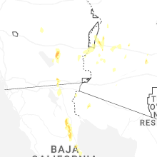
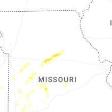
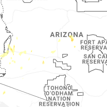
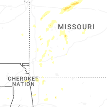
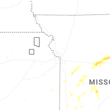
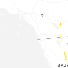
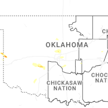
Hail Map for Thursday, September 18, 2025

Number of Impacted Households on 9/18/2025
0
Impacted by 1" or Larger Hail
0
Impacted by 1.75" or Larger Hail
0
Impacted by 2.5" or Larger Hail
Square Miles of Populated Area Impacted on 9/18/2025
0
Impacted by 1" or Larger Hail
0
Impacted by 1.75" or Larger Hail
0
Impacted by 2.5" or Larger Hail
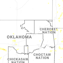
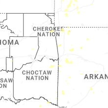
Cities Most Affected by Hail Storms of 9/18/2025
| Hail Size | Demographics of Zip Codes Affected | ||||||
|---|---|---|---|---|---|---|---|
| City | Count | Average | Largest | Pop Density | House Value | Income | Age |
| Sweetwater, OK | 1 | 1.75 | 1.75 | 5 | $29k | $21.9k | 42.0 |
Hail and Wind Damage Spotted on 9/18/2025
Filter by Report Type:Hail ReportsWind Reports
Missouri
| Local Time | Report Details |
|---|---|
| 3:20 PM CDT | A tree was down due to thunderstorm winds and was blocking the road on state highway mm near lawrencebur in lawrence county MO, 20.7 miles WNW of Springfield, MO |
| 3:27 PM CDT | Trees and power poles down in lama in barton county MO, 58 miles WNW of Springfield, MO |
| 4:06 PM CDT | Tree down on south side of pleasant hill. report via social medi in cass county MO, 27.9 miles SE of Kansas City, MO |
| 4:11 PM CDT | Power lines downe in jackson county MO, 23.8 miles SE of Kansas City, MO |
| 4:15 PM CDT | Tree limbs down in el dorado spring in cedar county MO, 61.2 miles NW of Springfield, MO |
| 4:28 PM CDT | Branches down... six foot fence dow in lafayette county MO, 28.3 miles ESE of Kansas City, MO |
| 4:38 PM CDT | Tree down on house. report via social medi in johnson county MO, 46.8 miles ESE of Kansas City, MO |
| 4:40 PM CDT | Tree downed. time estimated via rada in johnson county MO, 46.9 miles ESE of Kansas City, MO |
| 4:43 PM CDT | Storm damage reported in johnson county MO, 47.4 miles ESE of Kansas City, MO |
| 4:44 PM CDT | Large tree and powerline dow in johnson county MO, 49.6 miles ESE of Kansas City, MO |
| 4:45 PM CDT | Personal weather statio in johnson county MO, 45.7 miles SE of Kansas City, MO |
| 4:45 PM CDT | Powerline dow in johnson county MO, 50.4 miles ESE of Kansas City, MO |
| 4:50 PM CDT | Quarter sized hail reported near Sarcoxie, MO, 46.2 miles W of Springfield, MO, hail to the size of quarters fell three miles north of sarcoxie. |
| 4:54 PM CDT | Thunderstorm winds down a tree on old prospect roa in christian county MO, 16.4 miles SSE of Springfield, MO |
| 4:55 PM CDT | Thunderstorm winds downed a tree just north of windyville on state highway in dallas county MO, 39.9 miles NNE of Springfield, MO |
| 5:07 PM CDT | Quarter sized hail reported near Weaubleau, MO, 48.9 miles NNW of Springfield, MO |
| 5:12 PM CDT | Limbs down. power ou in christian county MO, 15.4 miles SW of Springfield, MO |
| 5:14 PM CDT | Tree down blocking the roa in christian county MO, 16.8 miles WSW of Springfield, MO |
| 5:32 PM CDT | Several reports of trees and tree limbs down in the macks creek area. electric company also reporting several outages in the are in camden county MO, 54.4 miles NNE of Springfield, MO |
| 6:45 PM CDT | Power pole knocked dow in cooper county MO, 24.6 miles WSW of Columbia, MO |
| 7:00 PM CDT | Power pole downed by stor in cooper county MO, 35.5 miles W of Columbia, MO |
| 7:13 PM CDT | Power pole downed by stor in howard county MO, 25.8 miles WNW of Columbia, MO |
California
| Local Time | Report Details |
|---|---|
| 1:40 PM PDT | Anza borrego desert state part observation station reported wind gust of 64 mp in san diego county CA, 58 miles NE of San Diego, CA |
| 4:32 PM PDT | Sce painted canyon rd observation station reported wind gust of 62 mp in riverside county CA, 29.9 miles S of Yucca Valley, CA |
| 6:00 PM PDT | Powerlines down and semi-truck flipped over onto vehicle along hwy 111 near east mccabe r in imperial county CA, 51.2 miles W of Yuma, AZ |
| 6:01 PM PDT | Asos station kipl imperia in imperial county CA, 56.5 miles W of Yuma, AZ |
| 6:02 PM PDT | Powerlines down at the intersection of bowker rd and e jasper r in imperial county CA, 49.3 miles W of Yuma, AZ |
| 6:07 PM PDT | Semi-truck blown over on interstate 8 near the intersection of hwy 11 in imperial county CA, 51.3 miles W of Yuma, AZ |
| 6:08 PM PDT | Semi-truck flipped over on interstate 8 just east of bowker r in imperial county CA, 49.6 miles W of Yuma, AZ |
| 6:13 PM PDT | Powerlines fell down and struck vehicles near the intersection of dogwood rd and e aten r in imperial county CA, 54.2 miles W of Yuma, AZ |
| 6:20 PM PDT | Semi-truck flipped over at the intersection of e evan hewes hwy and bowker r in imperial county CA, 49.8 miles W of Yuma, AZ |
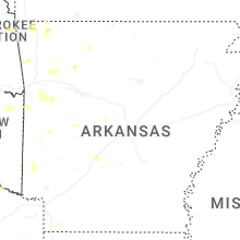
Arkansas
| Local Time | Report Details |
|---|---|
| 3:56 PM CDT | Downed powerlines on adams street reported via emergency manage in franklin county AR, 21.8 miles ESE of Fort Smith, AR |
| 3:59 PM CDT | Multiple utility and electric lines down in this are in franklin county AR, 21.8 miles E of Fort Smith, AR |
Oklahoma
| Local Time | Report Details |
|---|---|
| 6:05 PM CDT | Ping Pong Ball sized hail reported near Sweetwater, OK, 69.2 miles SSW of Woodward, OK |
| 6:05 PM CDT | Golf Ball sized hail reported near Sweetwater, OK, 71.1 miles SSW of Woodward, OK, delayed report. |
Arizona
| Local Time | Report Details |
|---|---|
| 5:23 PM MST | Raws station tt823 mohawk dune in yuma county AZ, 51 miles E of Yuma, AZ |
Connect with Interactive Hail Maps