

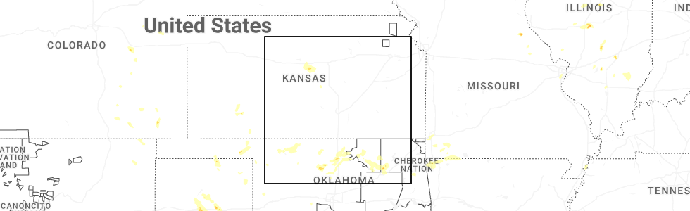
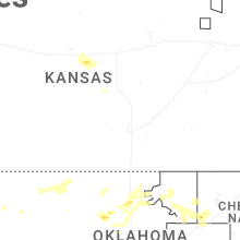
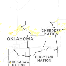
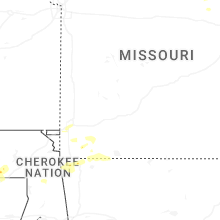
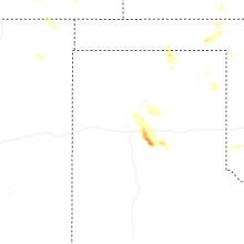
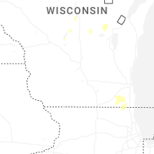
Hail Map for Saturday, September 20, 2025
Number of Impacted Households on 9/20/2025
0
Impacted by 1" or Larger Hail
0
Impacted by 1.75" or Larger Hail
0
Impacted by 2.5" or Larger Hail
Square Miles of Populated Area Impacted on 9/20/2025
0
Impacted by 1" or Larger Hail
0
Impacted by 1.75" or Larger Hail
0
Impacted by 2.5" or Larger Hail
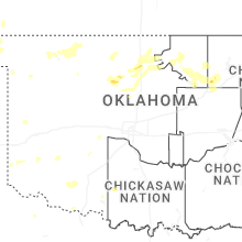
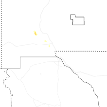
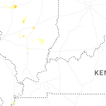
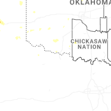
Cities Most Affected by Hail Storms of 9/20/2025
| Hail Size | Demographics of Zip Codes Affected | ||||||
|---|---|---|---|---|---|---|---|
| City | Count | Average | Largest | Pop Density | House Value | Income | Age |
| Sperry, OK | 1 | 1.75 | 1.75 | 87 | $72k | $36.2k | 39.3 |
Hail and Wind Damage Spotted on 9/20/2025
Filter by Report Type:Hail ReportsWind Reports
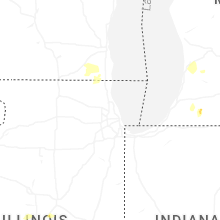
States Impacted
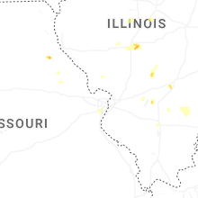
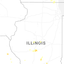
Illinois, Ohio, Indiana, Oklahoma, Texas, Michigan, Wisconsin, Utah, Missouri, ArkansasIllinois
| Local Time | Report Details |
|---|---|
| 1:15 PM CDT | Quarter sized hail reported near Atlanta, IL, 35.3 miles SSE of Peoria, IL, relayed by wcia tv media. |
| 2:00 PM CDT | Quarter sized hail reported near Altamont, IL, 35.9 miles SW of Mattoon, IL, relayed by wcia tv media. |
| 4:10 PM CDT | Estimated 60 mph wind gusts along hwy 161 a few miles west of mount eri in wayne county IL, 53.6 miles NW of Evansville, IN |
| 4:15 PM CDT | Report of a tree split and several large 6 to 8 inch branches down in pan in christian county IL, 38.2 miles W of Mattoon, IL |
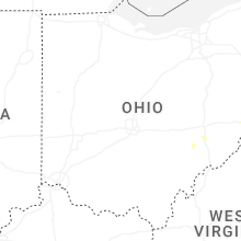
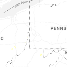
Ohio
| Local Time | Report Details |
|---|---|
| 4:16 PM EDT | Quarter sized hail reported near Saint Clairsville, OH, 51.3 miles WSW of Pittsburgh, PA |
Indiana
| Local Time | Report Details |
|---|---|
| 3:35 PM CDT | A few large trees and limbs snapped. powerline down as wel in starke county IN, 71.6 miles SE of Chicago, IL |
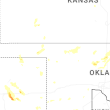
Oklahoma
| Local Time | Report Details |
|---|---|
| 5:05 PM CDT | Freedom mesonet sit in woodward county OK, 25.3 miles NE of Woodward, OK |
| 5:37 PM CDT | Quarter sized hail reported near Fairmont, OK, 58.1 miles N of Oklahoma City, OK |
| 6:20 PM CDT | Quarter sized hail reported near Billings, OK, 69.7 miles N of Oklahoma City, OK |
| 6:27 PM CDT | Measured by mobile mesonet. also power poles down on wood rd. between cleveland and oakwoo in garfield county OK, 58.4 miles NNW of Oklahoma City, OK |
| 7:01 PM CDT | Quarter sized hail reported near Waukomis, OK, 57.7 miles NNW of Oklahoma City, OK |
| 8:34 PM CDT | Half Dollar sized hail reported near Tulsa, OK, 7.8 miles NNE of Tulsa, OK, report from mping: half dollar (1.25 in.). |
| 8:35 PM CDT | Half Dollar sized hail reported near Owasso, OK, 14.2 miles NE of Tulsa, OK, half dollar size hail. |
| 8:48 PM CDT | Golf Ball sized hail reported near Sperry, OK, 9.3 miles NNE of Tulsa, OK, golf ball size hail. |
| 8:50 PM CDT | Quarter sized hail reported near Owasso, OK, 10.4 miles NNE of Tulsa, OK, report from mping: quarter (1.00 in.). |
| 9:03 PM CDT | Quarter sized hail reported near Owasso, OK, 10.7 miles NNE of Tulsa, OK, report from mping: quarter (1.00 in.). |
| 10:11 PM CDT | Storm damage reported in tulsa county OK, 10.8 miles E of Tulsa, OK |
Texas
| Local Time | Report Details |
|---|---|
| 5:15 PM CDT | Storm damage reported in carson county TX, 13.1 miles ENE of Amarillo, TX |
| 6:00 PM CDT | Local media reported truck and camper flipped over on us 287 a mile east of washbur in armstrong county TX, 15.7 miles E of Amarillo, TX |
| 7:58 PM CDT | Quarter sized hail reported near Amarillo, TX, 9.4 miles E of Amarillo, TX, public call for quarter sized hail that was accumulating. |
| 8:01 PM CDT | Quarter sized hail reported near Amarillo, TX, 9.3 miles E of Amarillo, TX, report from mping: quarter (1.00 in.). |
| 9:01 PM CDT | Peak wind gust of 64 mph measured at 9:01 pm. first severe gust of 60 mph at 8:58 pm and last severe gust of 59 mph measured at 9:03 p in armstrong county TX, 24.6 miles SE of Amarillo, TX |
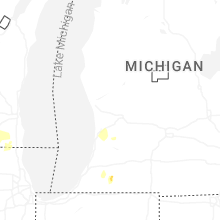
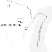
Michigan
| Local Time | Report Details |
|---|---|
| 7:00 PM EDT | Quarter sized hail reported near Marcellus, MI, 65.1 miles S of Grand Rapids, MI |
| 7:48 PM EDT | Much of the west half of fennville is without power. at least one line and several large tree branches witnessed down. a very large tree on the road at 118th ave near 4 in allegan county MI, 33.7 miles SW of Grand Rapids, MI |
Wisconsin
| Local Time | Report Details |
|---|---|
| 6:20 PM CDT | Tree down. time estimated by dispatc in outagamie county WI, 37.2 miles WSW of Green Bay, WI |
Utah
| Local Time | Report Details |
|---|---|
| 6:40 PM MDT | Measured at the causeway mesonet sit in tooele county UT, 94.4 miles NE of Ely, NV |
Missouri
| Local Time | Report Details |
|---|---|
| 10:15 PM CDT | A tree was down due to thunderstorm winds on highway 76 at farm road 215 in barry county MO, 38.9 miles SSW of Springfield, MO |
| 10:40 PM CDT | Quarter sized hail reported near Cassville, MO, 53.5 miles SW of Springfield, MO, hail to the size of quarters fell at highway 37 and farm road 2212. |
| 11:20 PM CDT | A tree down in the area of highway 97 and state highway b and highway in barry county MO, 49.8 miles WSW of Springfield, MO |
Arkansas
| Local Time | Report Details |
|---|---|
| 12:01 AM CDT | Half Dollar sized hail reported near Decatur, AR, 65.9 miles N of Fort Smith, AR |
Connect with Interactive Hail Maps