

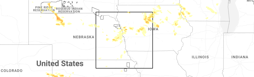
Hail Map for Monday, September 22, 2025
Number of Impacted Households on 9/22/2025
0
Impacted by 1" or Larger Hail
0
Impacted by 1.75" or Larger Hail
0
Impacted by 2.5" or Larger Hail
Square Miles of Populated Area Impacted on 9/22/2025
0
Impacted by 1" or Larger Hail
0
Impacted by 1.75" or Larger Hail
0
Impacted by 2.5" or Larger Hail


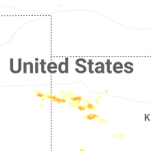
Cities Most Affected by Hail Storms of 9/22/2025
| Hail Size | Demographics of Zip Codes Affected | ||||||
|---|---|---|---|---|---|---|---|
| City | Count | Average | Largest | Pop Density | House Value | Income | Age |
| Sutherland, IA | 2 | 2.00 | 2.00 | 8 | $38k | $33.5k | 48.3 |
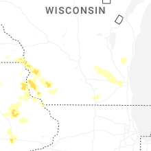
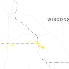
| Livingston, WI | 2 | 2.00 | 2.00 | 18 | $72k | $36.7k | 34.9 |
| Seymour, TX | 1 | 1.75 | 1.75 | 4 | $34k | $24.5k | 47.1 |
| Prague, NE | 1 | 1.75 | 1.75 | 7 | $53k | $30.8k | 45.0 |
| Fremont, NE | 1 | 1.75 | 1.75 | 246 | $90k | $38.3k | 39.5 |
Hail and Wind Damage Spotted on 9/22/2025
Filter by Report Type:Hail ReportsWind Reports
States Impacted
Wisconsin, Ohio, Kentucky, Mississippi, Alabama, New Mexico, Iowa, Kansas, Colorado, Texas, Nebraska, OklahomaWisconsin
| Local Time | Report Details |
|---|---|
| 7:11 AM CDT | Several trees and power lines down at the intersection of cth ww and oak lan in vernon county WI, 46.1 miles E of La Crosse, WI |
| 2:52 PM CDT | Quarter sized hail reported near De Soto, WI, 27.2 miles S of La Crosse, WI |
| 6:08 PM CDT | Hen Egg sized hail reported near Livingston, WI, 53.6 miles W of Madison, WI |
| 6:13 PM CDT | Hen Egg sized hail reported near Livingston, WI, 53.6 miles W of Madison, WI, estimated was hit by up to 2 inch hail while driving. |
| 6:29 PM CDT | Quarter sized hail reported near Montfort, WI, 53.2 miles W of Madison, WI, report relayed via nws chat. |
| 8:00 PM CDT | Law enforcement reports several trees down near ixonia w in jefferson county WI, 40.1 miles E of Madison, WI |
| 8:41 PM CDT | Several trees and wires down in the delafield area. wind gusts estimated at 55-60 mp in waukesha county WI, 49.9 miles E of Madison, WI |
Ohio
| Local Time | Report Details |
|---|---|
| 1:45 PM EDT | Tree dow in medina county OH, 32.7 miles SSW of Cleveland, OH |
| 1:50 PM EDT | Tree and utility wires dow in medina county OH, 34.6 miles SSW of Cleveland, OH |
| 5:28 PM EDT | Multiple trees down on us52 between higginsport and ripley. time estimated from rada in brown county OH, 40 miles SE of Cincinnati, OH |
| 6:13 PM EDT | Trees down on 52 near buena vista. time estimated from rada in scioto county OH, 74.7 miles ESE of Cincinnati, OH |
| 7:12 PM EDT | Tree down reported in jefferson stree in jackson county OH, 63.1 miles NW of Charleston, WV |
| 7:13 PM EDT | Several trees dow in jackson county OH, 62.4 miles SSE of Columbus, OH |
| 7:21 PM EDT | Tree down into power lines blocking the roa in lawrence county OH, 50.8 miles W of Charleston, WV |
| 7:42 PM EDT | Tree down blocking one lane of traffi in lawrence county OH, 51.2 miles W of Charleston, WV |
| 7:53 PM EDT | Rock run rd & us rt 35 closed due to a down tre in jackson county OH, 60.6 miles SSE of Columbus, OH |
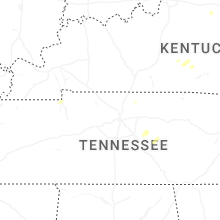
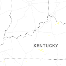
Kentucky
| Local Time | Report Details |
|---|---|
| 3:30 PM EDT | One tree reported across jarboe road in taylor count in taylor county KY, 40.4 miles SSE of Louisville, KY |
| 3:30 PM EDT | Two trees reported down on feather creek road in taylor count in taylor county KY, 41.7 miles SSE of Louisville, KY |
| 4:11 PM EDT | Large limb fell on a school bus on raikes hill road in eastern taylor county. no injuries were reporte in taylor county KY, 51.9 miles SE of Louisville, KY |
| 5:00 PM EDT | A tree and powerlines down blocking the right lane of ky-39 at petrey road. the event time is radar estimate in pulaski county KY, 43.1 miles SW of Irvine, KY |
| 5:05 PM EDT | At ky-70 and estill hackney road a tree was reported to be down blocking all lanes of the roadway. the event time is radar estimate in pulaski county KY, 43.7 miles SW of Irvine, KY |
| 5:07 PM EDT | Social media images showing damage to many trees... outbuildings... and minor damage to homes along west miami street south of cooper lane. possible tornad in bracken county KY, 37.1 miles SE of Cincinnati, OH |
| 5:19 PM EDT | A tree was blown down onto ky 1326 withing the city limits of mount vernon. the event time is radar estimate in rockcastle county KY, 31.1 miles SW of Irvine, KY |
| 5:30 PM EDT | A tree was reported down near 300 shady acre lane. the event time is estimate in powell county KY, 11.5 miles NNE of Irvine, KY |
| 5:30 PM EDT | Photos on social media of a large tree downed in the front yard of a house near the intersection of levee road and tonkin road south of mount sterling. time provided by in montgomery county KY, 21.4 miles N of Irvine, KY |
| 5:36 PM EDT | A tree was reported down onto ky 713 spencer pike at fortune cemetery lan in montgomery county KY, 23.6 miles NNE of Irvine, KY |
| 5:37 PM EDT | A tree was reported down near 100 pecks creek road near the intersection of pecks creek road and ky 11/15. the even time is radar estimate in powell county KY, 12.8 miles NE of Irvine, KY |
| 5:47 PM EDT | A utility line was blown down at 6540 e hwy 36. the event time is radar estimate in bath county KY, 31.1 miles NNE of Irvine, KY |
| 5:49 PM EDT | Fleming county dispatch received multiple calls of tree damage blocking ky-32/morehead road around 6pm. exact time estimated via rada in fleming county KY, 50.1 miles NNE of Irvine, KY |
| 5:50 PM EDT | Bath county em reported downed trees on mudlick road and slate lick road. time estimated via rada in bath county KY, 32 miles NE of Irvine, KY |
| 6:02 PM EDT | A tree was reported to have been blown down onto adams branch roa in menifee county KY, 25.1 miles NE of Irvine, KY |
| 6:08 PM EDT | A tree was blown down onto ky 52 blocking the roadway approximately 1 mile east from the ky 11 and ky 52 intersection. the event time is radar estimate in lee county KY, 17.7 miles ESE of Irvine, KY |
| 6:16 PM EDT | Tree down blocking east bound lane of kentucky 8. time estimated from rada in lewis county KY, 74.7 miles NNE of Irvine, KY |
| 6:19 PM EDT | A tree was reported to have been blown down onto little bloody creek road near the flat and mary communities. the even time is radar estimate in wolfe county KY, 24.5 miles E of Irvine, KY |
| 6:24 PM EDT | Tree down with wires. blocking driveways near kentucky drive. time estimated from rada in lewis county KY, 80.1 miles NE of Irvine, KY |
| 6:31 PM EDT | A tree was blown onto ky 772 about one quarter of a mile from us 46 in morgan county KY, 32.1 miles ENE of Irvine, KY |
| 6:33 PM EDT | A tree was reported to have been blown down onto ky 1812 very close to the breathitt county line. the event time is radar estimate in wolfe county KY, 31 miles E of Irvine, KY |
| 6:35 PM EDT | A tree was reported to have been blown down onto ky 7 about 0.5 miles from the sandy hook city limits. the event time is radar estimate in elliott county KY, 52.6 miles ENE of Irvine, KY |
| 6:40 PM EDT | Tree damage resulting in 571 customers without powe in boyd county KY, 59.2 miles W of Charleston, WV |
| 6:47 PM EDT | Several tree limbs and tree debris reported to have been blown down onto ky route 7 near the morgan county line. the event time is radar estimate in elliott county KY, 47.8 miles ENE of Irvine, KY |
| 7:10 PM EDT | Tree down on state route in boyd county KY, 58.5 miles W of Charleston, WV |
| 7:13 PM EDT | Tree branch and power lines dow in boyd county KY, 55.3 miles W of Charleston, WV |
| 7:52 PM EDT | Tree fell into a residence on clay street. powerlines involve in boyd county KY, 53.2 miles W of Charleston, WV |
| 7:55 PM EDT | Tree on school property fell onto roadway and on to both of rps vehicle in greenup county KY, 75.5 miles WNW of Charleston, WV |
Mississippi
| Local Time | Report Details |
|---|---|
| 3:11 PM CDT | Tree and power lines down. tree on old hwy 7 south... where a car struck the downed tree. power lines down on hwy 7 north and hwy 311. time estimated via rada in marshall county MS, 41.7 miles SE of Memphis, TN |
| 4:49 PM CDT | Tree down near the intersection of willis and new africa roa in coahoma county MS, 84 miles SSW of Memphis, TN |
Alabama
| Local Time | Report Details |
|---|---|
| 4:00 PM CDT | Multiple trees down along cain r in morgan county AL, 54 miles ESE of Florence, AL |
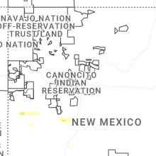
New Mexico
| Local Time | Report Details |
|---|---|
| 3:25 PM MDT | Trained spotter in magdalena reported an estimated wind gust of about 60 mph. no damage reporte in socorro county NM, 74.8 miles SSW of Albuquerque, NM |
| 4:50 PM MDT | Mesonet station wsm30 phillips hill (wsmr in lincoln county NM, 92.9 miles W of Roswell, NM |
| 7:05 PM MDT | Asos station krow roswell air cente in chaves county NM, 6.7 miles SSE of Roswell, NM |
| 7:14 PM MDT | Mesonet station mrrn5 tolar 13 se (melrose range in roosevelt county NM, 61.9 miles S of Tucumcari, NM |
| 7:36 PM MDT | Mesonet station 107 endee 2 s in quay county NM, 34.6 miles E of Tucumcari, NM |
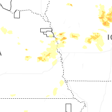
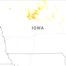
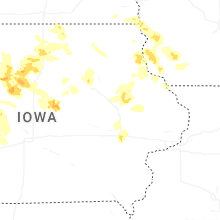
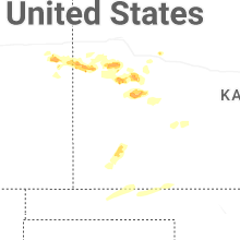
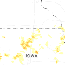
Iowa
| Local Time | Report Details |
|---|---|
| 4:35 PM CDT | Quarter sized hail reported near Saint Ansgar, IA, 21 miles NNE of Mason City, IA, photo relayed by media via nws chat. |
| 6:08 PM CDT | Quarter sized hail reported near Waucoma, IA, 59.5 miles E of Mason City, IA, photo relayed by media via nws chat. |
| 6:40 PM CDT | Hen Egg sized hail reported near Sutherland, IA, 30.2 miles NNW of Storm Lake, IA, ts reported 2 inch hail between 6:40 and 6:50 pm cdt. heavy rain and nickles to dimes ongoing at time of the call at 7:09 pm. |
| 7:00 PM CDT | Hen Egg sized hail reported near Sutherland, IA, 27.5 miles NNW of Storm Lake, IA, em reported 2 inch hail on the north side of southerland. pictures included confirm size. time was estimated by radar. |
| 7:20 PM CDT | Quarter sized hail reported near Primghar, IA, 37.5 miles NW of Storm Lake, IA, social media post with picture of a hailstone the size of a quarter. time confirmed with radar. |
| 7:22 PM CDT | Quarter sized hail reported near Denver, IA, 55.1 miles SE of Mason City, IA, social media image of quarter sized hail. relayed by kwwl. time estimated from radar. |
| 7:40 PM CDT | Quarter sized hail reported near Primghar, IA, 37.4 miles NW of Storm Lake, IA, ts reported quarter sized hail at approximately 7:40 pm cdt. he also reported that at the time of the call... 7:45 pm... that the hail had ended and it was just really |
| 8:02 PM CDT | Quarter sized hail reported near Humboldt, IA, 54.1 miles E of Storm Lake, IA |
| 8:20 PM CDT | Quarter sized hail reported near Eagle Grove, IA, 53 miles SW of Mason City, IA, received via social media. occurred at prestage foods of iowa. |
| 8:25 PM CDT | Quarter sized hail reported near Dike, IA, 57.4 miles SSE of Mason City, IA |
| 8:30 PM CDT | Measured by a personal weather statio in hamilton county IA, 56.8 miles SW of Mason City, IA |
| 9:20 PM CDT | Several large tree branches greater than 3 inches in diameter down around the cit in story county IA, 29.7 miles N of Des Moines, IA |
| 10:12 PM CDT | Quarter sized hail reported near Moorhead, IA, 41.9 miles N of Omaha, NE, report from mping: quarter (1.00 in.). |
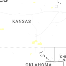
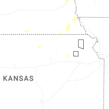
Kansas
| Local Time | Report Details |
|---|---|
| 5:14 PM CDT | Ambient weather site section 17 reported the wind gus in logan county KS, 34.8 miles SW of Colby, KS |
| 7:22 PM CDT | Storm damage reported in gove county KS, 31.8 miles SE of Colby, KS |
| 8:36 PM MDT | Weather link site delta do in sherman county KS, 47.9 miles WSW of Colby, KS |
| 9:00 PM MDT | Quarter sized hail reported near Sharon Springs, KS, 51.1 miles SW of Colby, KS, facebook photo. |
| 1:08 AM CDT | The awos reported a 61 mph wind gus in barber county KS, 72.4 miles WSW of Wichita, KS |
| 1:57 AM CDT | Wind gust measured from pw in harper county KS, 47.9 miles SSW of Wichita, KS |
Colorado
| Local Time | Report Details |
|---|---|
| 4:56 PM MDT | Mesonet station co098 139s034 douglas pas in garfield county CO, 39.1 miles NNW of Grand Junction, CO |
Texas
| Local Time | Report Details |
|---|---|
| 6:00 PM CDT | Golf Ball sized hail reported near Seymour, TX, 40.3 miles WSW of Wichita Falls, TX |
| 9:28 PM CDT | Storm damage reported in deaf smith county TX, 42.2 miles SW of Amarillo, TX |
| 9:35 PM CDT | Awos station khrx hereford (awos in deaf smith county TX, 36.5 miles SW of Amarillo, TX |
| 10:06 PM CDT | Mesonet station 106 happy 1 in swisher county TX, 32.2 miles S of Amarillo, TX |
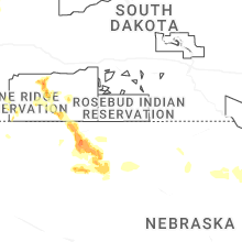
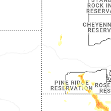
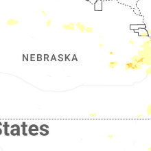
Nebraska
| Local Time | Report Details |
|---|---|
| 7:10 PM MDT | Half Dollar sized hail reported near Merriman, NE, 58.4 miles W of Valentine, NE, trained spotter reports hail ranging from pea to 1.25 inches in merriman. |
| 8:26 PM CDT | Golf Ball sized hail reported near Prague, NE, 47.5 miles W of Omaha, NE |
| 7:28 PM MDT | Trained spotter estimated 60 mph thunderstorms wind gusts with pea sized hai in cherry county NE, 58.4 miles W of Valentine, NE |
| 8:30 PM CDT | Quarter sized hail reported near Cedar Bluffs, NE, 36.1 miles WNW of Omaha, NE, quarter size hail in cedar bluffs. hail lasted about 7 minutes. |
| 8:36 PM CDT | Ping Pong Ball sized hail reported near Prague, NE, 44.3 miles W of Omaha, NE, ping pong ball size hail reported near prague. |
| 8:37 PM CDT | Ping Pong Ball sized hail reported near Cedar Bluffs, NE, 35.4 miles WNW of Omaha, NE, report from mping: ping pong ball (1.50 in.). |
| 8:45 PM CDT | Half Dollar sized hail reported near Fremont, NE, 31.4 miles WNW of Omaha, NE, report from mping: half dollar (1.25 in.). |
| 8:47 PM CDT | Quarter sized hail reported near Fremont, NE, 31.4 miles WNW of Omaha, NE, report from mping: quarter (1.00 in.). |
| 8:47 PM CDT | Ping Pong Ball sized hail reported near Fremont, NE, 28.4 miles WNW of Omaha, NE, report from mping: ping pong ball (1.50 in.). |
| 8:47 PM CDT | Golf Ball sized hail reported near Fremont, NE, 31.1 miles WNW of Omaha, NE, golf ball size hail reported covering the ground. |
| 8:48 PM CDT | Quarter sized hail reported near Fremont, NE, 32.6 miles WNW of Omaha, NE |
| 9:00 PM CDT | Ping Pong Ball sized hail reported near Fremont, NE, 32.1 miles WNW of Omaha, NE, social media report with photos of ping pong ball sized hail on the east side of fremont. time estimated based on radar. |
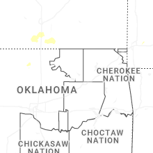
Oklahoma
| Local Time | Report Details |
|---|---|
| 11:32 PM CDT | Asos station kgag gag in ellis county OK, 22.6 miles WSW of Woodward, OK |
| 12:30 AM CDT | Storm damage reported in woodward county OK, 25.3 miles NE of Woodward, OK |
| 12:35 AM CDT | Storm damage reported in woodward county OK, 25.3 miles NE of Woodward, OK |
Connect with Interactive Hail Maps