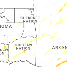
Hail Map for Wednesday, April 2, 2025

Number of Impacted Households on 4/2/2025
0
Impacted by 1" or Larger Hail
0
Impacted by 1.75" or Larger Hail
0
Impacted by 2.5" or Larger Hail
Square Miles of Populated Area Impacted on 4/2/2025
0
Impacted by 1" or Larger Hail
0
Impacted by 1.75" or Larger Hail
0
Impacted by 2.5" or Larger Hail
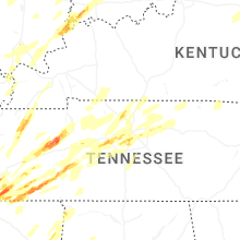
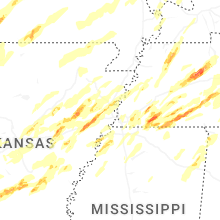
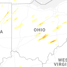
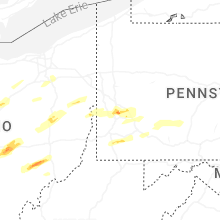
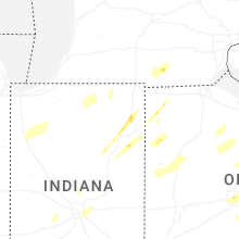
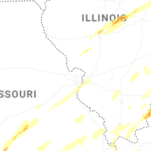
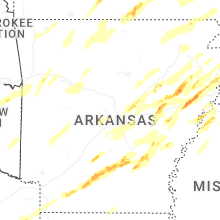
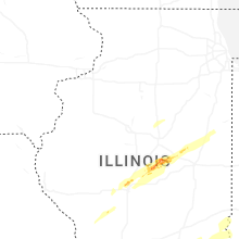
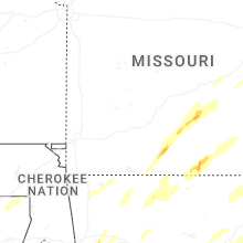
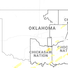
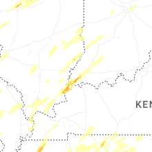
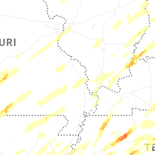
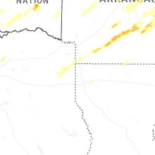
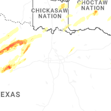
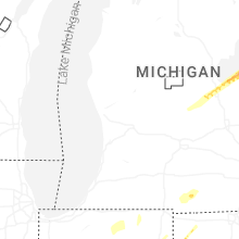
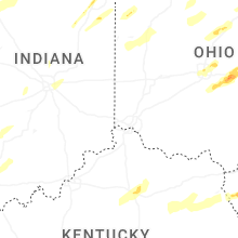
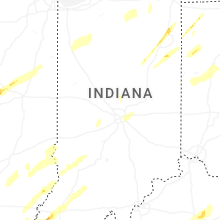
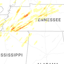
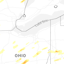
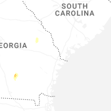
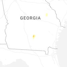
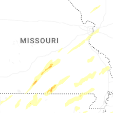
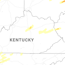
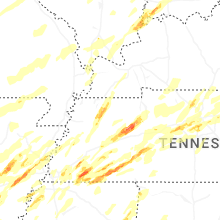
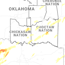
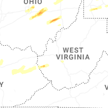
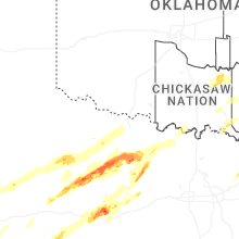
Regions Impacted by Hail on 4/2/2025
Cities Most Affected by Hail Storms of 4/2/2025
| Hail Size | Demographics of Zip Codes Affected | ||||||
|---|---|---|---|---|---|---|---|
| City | Count | Average | Largest | Pop Density | House Value | Income | Age |
| Forrest City, AR | 5 | 2.65 | 2.75 | 100 | $60k | $26.6k | 35.8 |
| Anson, TX | 4 | 2.00 | 2.75 | 17 | $31k | $26.5k | 39.9 |
| Ashland City, TN | 2 | 2.63 | 2.75 | 117 | $95k | $41.2k | 39.0 |
| Cedar Grove, TN | 2 | 2.50 | 2.50 | 29 | $51k | $29.6k | 43.5 |
| Fulton, MS | 2 | 2.38 | 2.75 | 54 | $61k | $30.8k | 38.2 |
| West Plains, MO | 2 | 2.25 | 2.50 | 54 | $73k | $27.3k | 39.0 |
| Memphis, TN | 2 | 2.13 | 2.50 | 1912 | $177k | $66.9k | 39.4 |
| Cisco, TX | 2 | 2.13 | 2.25 | 14 | $29k | $26.2k | 41.5 |
| Springfield, IL | 2 | 1.88 | 2.00 | 2547 | $85k | $16.5k | 40.1 |
| Martin, TN | 2 | 1.75 | 1.75 | 116 | $80k | $31.0k | 28.6 |
| Kenton, TN | 2 | 1.75 | 1.75 | 30 | $62k | $32.6k | 42.3 |
| Bald Knob, AR | 1 | 2.75 | 2.75 | 40 | $47k | $29.2k | 38.6 |
| Turrell, AR | 1 | 2.75 | 2.75 | 6 | $34k | $20.3k | 40.7 |
| Senatobia, MS | 1 | 2.50 | 2.50 | 86 | $93k | $39.3k | 33.2 |
| Pomona, MO | 1 | 2.50 | 2.50 | 24 | $64k | $26.3k | 41.1 |
| Fairview, TN | 1 | 2.50 | 2.50 | 165 | $117k | $44.4k | 37.8 |
| Lonoke, AR | 1 | 2.00 | 2.00 | 73 | $66k | $35.8k | 38.7 |
| Cabot, AR | 1 | 2.00 | 2.00 | 385 | $98k | $48.3k | 34.6 |
| Latham, IL | 1 | 2.00 | 2.00 | 10 | $64k | $48.1k | 41.6 |
| Buckeye Lake, OH | 1 | 2.00 | 2.00 | 0 | $68k | $27.7k | 40.0 |
| Thornville, OH | 1 | 1.75 | 1.75 | 121 | $110k | $47.1k | 43.4 |
| Clinton, IL | 1 | 1.75 | 1.75 | 81 | $77k | $39.9k | 40.9 |
| Austin, AR | 1 | 1.75 | 1.75 | 180 | $91k | $40.2k | 35.3 |
| Sardis, MS | 1 | 1.75 | 1.75 | 52 | $50k | $22.2k | 38.6 |
| Henning, TN | 1 | 1.75 | 1.75 | 19 | $49k | $26.2k | 35.9 |
| Camden, TN | 1 | 1.75 | 1.75 | 75 | $68k | $29.3k | 44.2 |
| Kenney, IL | 1 | 1.75 | 1.75 | 12 | $59k | $39.4k | 49.9 |
| Bluffton, IN | 1 | 1.75 | 1.75 | 115 | $85k | $39.9k | 39.6 |
| Oakland, TN | 1 | 1.75 | 1.75 | 222 | $112k | $44.8k | 36.2 |
| Nesbit, MS | 1 | 1.75 | 1.75 | 230 | $141k | $52.2k | 42.3 |
| Huntingdon, TN | 1 | 1.75 | 1.75 | 57 | $67k | $30.6k | 42.5 |
| Cordova, TN | 1 | 1.75 | 1.75 | 2414 | $0k | $0.0k | 34.2 |
| Throckmorton, TX | 1 | 1.75 | 1.75 | 1 | $37k | $29.9k | 45.5 |
| Olney, TX | 1 | 1.75 | 1.75 | 15 | $34k | $25.4k | 42.7 |
Hail and Wind Damage Spotted on 4/2/2025
Filter by Report Type:Hail ReportsWind Reports
States Impacted
Oklahoma, Ohio, Kansas, Indiana, Missouri, Arkansas, Illinois, West Virginia, Pennsylvania, Mississippi, Tennessee, Georgia, Alabama, Kentucky, Texas, MichiganOklahoma
| Local Time | Report Details |
|---|---|
| 7:10 AM CDT | Quarter sized hail reported near Ada, OK, 42.5 miles NW of Atoka, OK, time estimated by radar. |
Ohio
| Local Time | Report Details |
|---|---|
| 8:19 AM EDT | Quarter sized hail reported near Defiance, OH, 39.5 miles ENE of Fort Wayne, IN, report from mping: quarter (1.00 in.). |
| 9:12 AM EDT | Quarter sized hail reported near Van Wert, OH, 30 miles ESE of Fort Wayne, IN, report from mping: quarter (1.00 in.). |
| 9:16 AM EDT | Quarter sized hail reported near Van Wert, OH, 30.6 miles ESE of Fort Wayne, IN, quarter size hail fell in van wert at westwood drive and ervin rd. |
| 9:16 AM EDT | Quarter sized hail reported near Van Wert, OH, 31.1 miles ESE of Fort Wayne, IN, report from mping: quarter (1.00 in.). |
| 9:24 AM EDT | Quarter sized hail reported near Lima, OH, 57.7 miles ESE of Fort Wayne, IN |
| 9:47 AM EDT | Quarter sized hail reported near Delphos, OH, 37.3 miles ESE of Fort Wayne, IN, reported by trained spotter. |
| 10:19 AM EDT | Ping Pong Ball sized hail reported near Nevada, OH, 58.9 miles N of Columbus, OH, hail up to ping pong ball-size. time estimated via radar. |
| 10:49 AM EDT | Quarter sized hail reported near Columbus, OH, 3.3 miles NW of Columbus, OH |
| 11:00 AM EDT | Quarter sized hail reported near Mansfield, OH, 55.4 miles NNE of Columbus, OH |
| 11:00 AM EDT | Quarter sized hail reported near Mansfield, OH, 53.1 miles NNE of Columbus, OH, time estimated via radar. |
| 11:05 AM EDT | Quarter sized hail reported near New Albany, OH, 14 miles NE of Columbus, OH, report from mping: quarter (1.00 in.). |
| 11:09 AM EDT | Quarter sized hail reported near Carroll, OH, 20.8 miles SE of Columbus, OH, report from mping: quarter (1.00 in.). |
| 11:15 AM EDT | Half Dollar sized hail reported near Baltimore, OH, 23 miles ESE of Columbus, OH |
| 11:24 AM EDT | Hen Egg sized hail reported near Buckeye Lake, OH, 27.9 miles E of Columbus, OH |
| 11:26 AM EDT | Ping Pong Ball sized hail reported near Heath, OH, 32.2 miles E of Columbus, OH |
| 11:30 AM EDT | Golf Ball sized hail reported near Thornville, OH, 31.1 miles E of Columbus, OH, golf ball sized hail near shoreline drive. |
| 11:30 AM EDT | Ping Pong Ball sized hail reported near Thornville, OH, 31.3 miles E of Columbus, OH, ping pong ball sized hail in thornville. |
| 11:30 AM EDT | Ping Pong Ball sized hail reported near Thornville, OH, 29 miles E of Columbus, OH, picture of ping pong to golf ball sized hail on social media near buckeye lake. dented vehicles are also being mentioned. |
| 11:35 AM EDT | Quarter sized hail reported near Heath, OH, 38.1 miles E of Columbus, OH, report from mping: quarter (1.00 in.). |
| 11:50 AM EDT | Quarter sized hail reported near Bucyrus, OH, 59.2 miles N of Columbus, OH |
| 12:00 PM EDT | Ping Pong Ball sized hail reported near Mcconnelsville, OH, 64.5 miles ESE of Columbus, OH, picture of ping pong to golf ball size hail on social media. |
| 12:00 PM EDT | Ping Pong Ball sized hail reported near Mcconnelsville, OH, 65 miles ESE of Columbus, OH, picture of ping pong size hail in mcconnelsville. |
| 12:00 PM EDT | Quarter sized hail reported near Coshocton, OH, 62.9 miles ENE of Columbus, OH |
| 12:05 PM EDT | Ping Pong Ball sized hail reported near Malta, OH, 61 miles ESE of Columbus, OH, via mping report. |
| 12:33 PM EDT | Quarter sized hail reported near New Philadelphia, OH, 71.1 miles S of Cleveland, OH |
| 12:34 PM EDT | Quarter sized hail reported near New Philadelphia, OH, 71.1 miles S of Cleveland, OH |
| 12:42 PM EDT | Quarter sized hail reported near Barberton, OH, 33 miles S of Cleveland, OH, time estimated via radar. |
| 12:47 PM EDT | Quarter sized hail reported near Akron, OH, 31.9 miles SSE of Cleveland, OH |
| 12:49 PM EDT | Quarter sized hail reported near Carrollton, OH, 55.5 miles WNW of Pittsburgh, PA |
| 1:40 PM EDT | Ping Pong Ball sized hail reported near Toronto, OH, 38.1 miles W of Pittsburgh, PA, picture provided. |
| 10:50 PM EDT | Tree downed near intersection of mill and blake roads. time estimate in mercer county OH, 45.7 miles SE of Fort Wayne, IN |
| 10:51 PM EDT | Power poles down and trees down in several parts of the county including montezum in mercer county OH, 49.6 miles SE of Fort Wayne, IN |
| 11:00 PM EDT | Village of ohio city fire dept reporting some poles snapped and some trees down on west side of tow in van wert county OH, 32.8 miles SE of Fort Wayne, IN |
| 11:07 PM EDT | Emergency manager reports a 65 mph gust at the van wert fairgrounds measured on a davis station. time given by emergency manage in van wert county OH, 30.5 miles ESE of Fort Wayne, IN |
| 11:10 PM EDT | Photos on x of power poles and tree branches down. a home lost its roof at the corner of jennings rd and mendon rd. time estimated via rada in van wert county OH, 32.7 miles ESE of Fort Wayne, IN |
| 11:11 PM EDT | Tree branches reported dow in van wert county OH, 37.3 miles ESE of Fort Wayne, IN |
| 11:12 PM EDT | Report of several trees uprooted at mendon rd and middle point r in van wert county OH, 37.1 miles ESE of Fort Wayne, IN |
| 11:12 PM EDT | Several homes with extensive damage in dupont... o in putnam county OH, 41.7 miles E of Fort Wayne, IN |
| 3:12 AM UTC | Mobile home rolled several times in the 22000 block of county road i-22. 3 injuries reported. time estimated via rada in putnam county OH, 42.3 miles E of Fort Wayne, IN |
| 11:13 PM EDT | Large tree down on a house in dupont... oh. time estimated via rada in putnam county OH, 41.7 miles E of Fort Wayne, IN |
| 11:15 PM EDT | Part of a barn was reported in the roadway on sr 66 ... south of ottovill in putnam county OH, 41.1 miles ESE of Fort Wayne, IN |
| 11:22 PM EDT | Awos station kaoh 2 wnw westminste in allen county OH, 61.9 miles ESE of Fort Wayne, IN |
| 11:45 PM EDT | Large tree down on home. time estimated via rada in wood county OH, 78 miles E of Fort Wayne, IN |
| 11:45 PM EDT | Large tree fell onto a house resulting in structural damage. time estimated via rada in wood county OH, 74.4 miles E of Fort Wayne, IN |
| 11:50 PM EDT | Dispatch reports large tree across roadway with wires dow in wood county OH, 70.8 miles ENE of Fort Wayne, IN |
| 11:53 PM EDT | Asos station kfdy findla in hancock county OH, 74.8 miles E of Fort Wayne, IN |
| 11:55 PM EDT | Dispatch reports trees and power poles down across roadway. time estimated via rada in wood county OH, 78.5 miles ENE of Fort Wayne, IN |
| 11:56 PM EDT | Large tree down and blocking road at main/west mai in hancock county OH, 76.3 miles E of Fort Wayne, IN |
| 12:13 AM EDT | Tree down within 10000 block of lochard road. time estimated by rada in shelby county OH, 64.9 miles WNW of Columbus, OH |
| 12:15 AM EDT | Awos station ks24 3 nne green spring in sandusky county OH, 71 miles W of Cleveland, OH |
| 12:15 AM EDT | Semi truck blown on its side on sr 23 blocking all lanes. time estimated via rada in wood county OH, 89.8 miles W of Cleveland, OH |
| 12:17 AM EDT | Tree down on wires at 400 block of fremont s in ottawa county OH, 83 miles W of Cleveland, OH |
| 12:19 AM EDT | Roof blown off bar in sandusky county OH, 69.7 miles W of Cleveland, OH |
| 12:19 AM EDT | Semi truck blown on its side at us20/cr220 blocking intersectio in sandusky county OH, 69.7 miles W of Cleveland, OH |
| 12:20 AM EDT | Downed tree across roadway. time estimated via rada in ottawa county OH, 71 miles W of Cleveland, OH |
| 12:25 AM EDT | Mesonet station aw078 bowling gree in wood county OH, 82.8 miles ENE of Fort Wayne, IN |
| 12:28 AM EDT | Bardshar rd between bogart rd and miller rd closed due to a downed power pole and powerlines in roadway. time estimated via rada in erie county OH, 56.6 miles W of Cleveland, OH |
| 12:30 AM EDT | Power poles down in the road. time estimated via rada in ottawa county OH, 58.6 miles W of Cleveland, OH |
| 12:51 AM EDT | Large tree down house along foxboro court. time estimated by rada in warren county OH, 31.7 miles NNE of Cincinnati, OH |
| 12:52 AM EDT | Asos station kluk cincinnati lunken fiel in hamilton county OH, 4.6 miles E of Cincinnati, OH |
| 12:55 AM EDT | Pieces of roofing blown of in montgomery county OH, 43.9 miles NNE of Cincinnati, OH |
| 12:57 AM EDT | Power pole and lines downe in montgomery county OH, 43 miles NNE of Cincinnati, OH |
| 12:58 AM EDT | Large mature tree uproote in montgomery county OH, 44.9 miles NNE of Cincinnati, OH |
| 1:00 AM EDT | Asos station kmgy dayton wright brothers airpor in montgomery county OH, 36.4 miles NNE of Cincinnati, OH |
| 1:00 AM EDT | Asos station kluk cincinnati lunken fiel in hamilton county OH, 4.6 miles E of Cincinnati, OH |
| 1:03 AM EDT | Several mature trees uprooted or had large limbs split of in clermont county OH, 11.2 miles E of Cincinnati, OH |
| 1:21 AM EDT | Four power poles were downe in highland county OH, 41.9 miles ENE of Cincinnati, OH |
| 1:21 AM EDT | Multiple power poles snapped. wall collapse at bar in highland county OH, 42.4 miles ENE of Cincinnati, OH |
| 1:24 AM EDT | Corrects previous report. kiln aso in clinton county OH, 44.8 miles ENE of Cincinnati, OH |
| 1:26 AM EDT | Multiple trees were downe in highland county OH, 44.2 miles E of Cincinnati, OH |
| 1:28 AM EDT | Asos station kiln wilmington air par in clinton county OH, 44.8 miles ENE of Cincinnati, OH |
| 1:40 AM EDT | Large tree uprooted and downed onto hom in warren county OH, 31.6 miles NNE of Cincinnati, OH |
| 2:06 AM EDT | Multiple power poles were downe in adams county OH, 56.4 miles ESE of Cincinnati, OH |
| 2:15 AM EDT | Multiple power poles were downe in adams county OH, 60.5 miles ESE of Cincinnati, OH |
| 2:17 AM EDT | Tree downed across a parked vehicl in licking county OH, 19.4 miles E of Columbus, OH |
| 2:39 AM EDT | Multiple trees and power lines down around junction city. time estimated based on rada in perry county OH, 40.9 miles ESE of Columbus, OH |
| 2:43 AM EDT | Trees down on houses in the new lexington area. substantial power outages to much of perry count in perry county OH, 45.4 miles ESE of Columbus, OH |
| 2:51 AM EDT | Tree down on a car and partially onto a house roof. time estimate in muskingum county OH, 50.7 miles ESE of Columbus, OH |
| 3:12 AM EDT | Tree down. time is radar estimate in tuscarawas county OH, 68.6 miles SSE of Cleveland, OH |
| 3:12 AM EDT | Tree down near intersection of state route 800 and seven mile road. time estimate in guernsey county OH, 80.3 miles WSW of Pittsburgh, PA |
| 3:33 AM EDT | Downed powerlines. time estimated by rada in carroll county OH, 53.9 miles WNW of Pittsburgh, PA |
| 3:46 AM EDT | Trees down and uprooted. time estimated from rada in belmont county OH, 67.7 miles SW of Pittsburgh, PA |
| 3:48 AM EDT | Tree(s) down. time is radar estimate in belmont county OH, 54.1 miles WSW of Pittsburgh, PA |
Kansas
| Local Time | Report Details |
|---|---|
| 7:20 AM CDT | Some snapped trees... broken power poles to the sw and ne. video on slac in crawford county KS, 45.7 miles E of Chanute, KS |
| 7:27 AM CDT | Possible tornado. a semi-truck was overturned two miles north of arm in crawford county KS, 41.8 miles E of Chanute, KS |
Indiana
| Local Time | Report Details |
|---|---|
| 8:22 AM EDT | Quarter sized hail reported near Fort Wayne, IN, 2.2 miles W of Fort Wayne, IN |
| 8:25 AM EDT | Ping Pong Ball sized hail reported near Fort Wayne, IN, 8.5 miles WSW of Fort Wayne, IN, photo on facebook shows ping pong ball sized hail. time estimated via radar. |
| 8:26 AM EDT | Quarter sized hail reported near Fort Wayne, IN, 9.3 miles WSW of Fort Wayne, IN |
| 8:27 AM EDT | Half Dollar sized hail reported near Roanoke, IN, 12.7 miles WSW of Fort Wayne, IN, photo on facebook shows quarter to half dollar size hail that fell in aboite. time estimated via radar. |
| 8:28 AM EDT | Quarter sized hail reported near Fort Wayne, IN, 10.2 miles WNW of Fort Wayne, IN, nickel to quarter size hail fell for several minutes. |
| 8:30 AM EDT | Quarter sized hail reported near Fort Wayne, IN, 7.5 miles NNW of Fort Wayne, IN, quarter size hail fell at lima rd and till rd. |
| 8:30 AM EDT | Quarter sized hail reported near Fort Wayne, IN, 6.9 miles NNW of Fort Wayne, IN |
| 8:30 AM EDT | Quarter sized hail reported near Fort Wayne, IN, 10.2 miles NNW of Fort Wayne, IN, cocorahs observer measured up to 1 inch hail. |
| 8:32 AM EDT | Quarter sized hail reported near Fort Wayne, IN, 9.3 miles N of Fort Wayne, IN |
| 8:32 AM EDT | Quarter sized hail reported near Columbia City, IN, 14.7 miles W of Fort Wayne, IN, report from mping: quarter (1.00 in.). |
| 8:32 AM EDT | Quarter sized hail reported near Fort Wayne, IN, 8.7 miles N of Fort Wayne, IN, report from mping: quarter (1.00 in.). |
| 8:35 AM EDT | Quarter sized hail reported near Fort Wayne, IN, 8 miles N of Fort Wayne, IN, report from mping: quarter (1.00 in.). |
| 8:35 AM EDT | Quarter sized hail reported near Fort Wayne, IN, 5.9 miles N of Fort Wayne, IN |
| 8:36 AM EDT | Quarter sized hail reported near Fort Wayne, IN, 10.2 miles NNW of Fort Wayne, IN, report from mping: quarter (1.00 in.). |
| 8:36 AM EDT | Ping Pong Ball sized hail reported near Leo, IN, 12.1 miles N of Fort Wayne, IN, photo on facebook shows half dollar to ping pong ball at the intersection of garmen rd and tonkel rd. time estimated via radar. |
| 8:49 AM EDT | Golf Ball sized hail reported near Bluffton, IN, 19.4 miles S of Fort Wayne, IN, emergency manager reports golf ball size hail north of bluffton. |
| 8:49 AM EDT | Trees down and powerlines down on the road at the intersection of maplecrest rd and stellhorn r in allen county IN, 3.7 miles NNE of Fort Wayne, IN |
| 8:50 AM EDT | Quarter sized hail reported near Bluffton, IN, 23.4 miles S of Fort Wayne, IN, trained spotter reports quarter size hail on sr 1. no damage to homes or cars. |
| 8:55 AM EDT | Quarter sized hail reported near Decatur, IN, 19.1 miles SSE of Fort Wayne, IN, broadcast media reports quarter size hail in decatur. time estimated via radar. |
| 9:58 AM EDT | Utility lines down and sheet metal in roadway at n county rd 600 w & conner rd. time estimated from rada in delaware county IN, 48.4 miles NE of Indianapolis, IN |
| 5:57 PM CDT | Private weather station reported 58 mph gust near broo in newton county IN, 71 miles S of Chicago, IL |
| 7:56 PM EDT | Tree down onto a garage. time estimated via rada in cass county IN, 67 miles NNW of Indianapolis, IN |
| 8:00 PM EDT | Lots of damage reported east of argos... in on sr 10 including trees down onto powerlines and large trees limbs snappe in marshall county IN, 65.2 miles W of Fort Wayne, IN |
| 8:01 PM EDT | Emergency manager relayed a report of a tree down on hawthorne lane in logansport. time estimated via rada in cass county IN, 68.3 miles WSW of Fort Wayne, IN |
| 8:03 PM EDT | Photo relayed by wsbt in south bend of damage to the northern indiana manufacturing factory in bourbon. factory is at the intersection of w quad street and s ecker aven in marshall county IN, 55.2 miles WNW of Fort Wayne, IN |
| 8:04 PM EDT | Emergency manager confirms multiple houses with roofs off on rose ln and crocut ct in bourbon. time estimated via rada in marshall county IN, 55.4 miles WNW of Fort Wayne, IN |
| 8:04 PM EDT | Structural damage reported to a house on the east side of bourbon. time estimated via rada in marshall county IN, 53.4 miles WNW of Fort Wayne, IN |
| 8:04 PM EDT | Abc 57 in south bend relays report that 3 semis tipped over on us 30 in bourbon. parts of us 30 are closed. unknown if any injuries. time estimated via rada in marshall county IN, 55.6 miles WNW of Fort Wayne, IN |
| 8:05 PM EDT | News now warsaw relays report of a woman trapped in her car after a tree fell on it. unknown the extent of any injuries. time estimated via rada in marshall county IN, 55.4 miles WNW of Fort Wayne, IN |
| 8:05 PM EDT | Us 30 was closed for several hours on the evening of april 2nd after at least 3 semis flipped over at the intersection with cedar rd north of bourbon. unknown if there in marshall county IN, 55.6 miles WNW of Fort Wayne, IN |
| 8:09 PM EDT | Powerlines down on sr19 near 600 north. time estimated via rada in kosciusko county IN, 51.9 miles WNW of Fort Wayne, IN |
| 8:10 PM EDT | Three semi-trucks were overturned by thunderstorm winds near the indiana-illinois state borde in vigo county IN, 45.9 miles E of Mattoon, IL |
| 8:13 PM EDT | Report of structure damage. time estimated from rada in vigo county IN, 49.5 miles E of Mattoon, IL |
| 8:15 PM EDT | Home significantly damaged. reports of tree damage as well. power out across town from wind damag in vigo county IN, 49.4 miles E of Mattoon, IL |
| 8:23 PM EDT | Numerous tree damage in the are in parke county IN, 56.9 miles ENE of Mattoon, IL |
| 8:24 PM EDT | Goshen airport is without power. estimated 70+ mph wind in elkhart county IN, 48.1 miles NW of Fort Wayne, IN |
| 8:25 PM EDT | Tree and power lines down onto a vehicle across n. hillside drive. time estimated via rada in kosciusko county IN, 42.2 miles NW of Fort Wayne, IN |
| 8:30 PM EDT | Multiple trees down onto powerlines at the intersection of st rd 120 and 900 west. time estimated via rada in lagrange county IN, 52.1 miles NNW of Fort Wayne, IN |
| 8:30 PM EDT | Thunderstorm winds caused large oak tree to collapse on powerline... causing power outage. time estimated from rada in tippecanoe county IN, 55.1 miles NW of Indianapolis, IN |
| 8:48 PM EDT | Storm damage reported in carroll county IN, 59.7 miles NNW of Indianapolis, IN |
| 8:48 PM EDT | Trained spotter reports an estimated wind gust of 98.4 mph using an anemomete in steuben county IN, 45.3 miles N of Fort Wayne, IN |
| 8:48 PM EDT | Emergency manager reports a barn with structural damage to the roof at 7640 n 750 w ij orland. time estimated via rada in steuben county IN, 45.3 miles N of Fort Wayne, IN |
| 8:50 PM EDT | Cup anemometer at 33 fee in putnam county IN, 37.8 miles WSW of Indianapolis, IN |
| 9:10 PM EDT | Structure collapse with a few people unaccounted for. time estimated from radar.. in hendricks county IN, 13 miles WNW of Indianapolis, IN |
| 9:10 PM EDT | Damage to hession farms inc. time estimated from rada in hendricks county IN, 12.1 miles WNW of Indianapolis, IN |
| 9:11 PM EDT | Housing development damaged. time estimated from rada in hendricks county IN, 14 miles WNW of Indianapolis, IN |
| 9:13 PM EDT | Location described as northeast of danville. two reports of 70 mph thunderstorm wind in hendricks county IN, 18.7 miles W of Indianapolis, IN |
| 9:14 PM EDT | Damage in branches subdivision neighborhood in brownsbur in hendricks county IN, 12.4 miles WNW of Indianapolis, IN |
| 9:15 PM EDT | Report of tree on house nearby. time estimated from rada in hendricks county IN, 11.2 miles WNW of Indianapolis, IN |
| 9:15 PM EDT | At least a dozen trees down in the are in greene county IN, 70.7 miles SW of Indianapolis, IN |
| 9:15 PM EDT | Storm damage reported in morgan county IN, 21.8 miles SW of Indianapolis, IN |
| 9:15 PM EDT | Storm damage reported in hendricks county IN, 17.6 miles W of Indianapolis, IN |
| 9:15 PM EDT | Storm damage reported in knox county IN, 54.6 miles N of Evansville, IN |
| 9:18 PM EDT | Storm damage reported in marion county IN, 8.1 miles WSW of Indianapolis, IN |
| 9:18 PM EDT | Storm damage reported in knox county IN, 46.6 miles N of Evansville, IN |
| 9:18 PM EDT | Power poles snapped and along lafayette rd. one landed on a car. sheet metal in road and in powerlines. semi flipped on side nearby. time estimated from rada in marion county IN, 11.7 miles NW of Indianapolis, IN |
| 9:20 PM EDT | Large tree down into a street from thunderstorm winds. time estimated from rada in marion county IN, 5.6 miles WNW of Indianapolis, IN |
| 9:25 PM EDT | Per indianapolis dispatch center... we have at least 6 different incidents with trees into homes/buildings. locations in the indianapolis area are unknown at this tim in marion county IN, 0.9 miles N of Indianapolis, IN |
| 9:26 PM EDT | Reports of debris and damage within carmel. trees and powerlines down and roads floode in hamilton county IN, 14.1 miles N of Indianapolis, IN |
| 9:26 PM EDT | Building damage and large tree limbs broken. time estimated from rada in hamilton county IN, 13.3 miles N of Indianapolis, IN |
| 9:30 PM EDT | Tree down with power lines. time very roughly estimated from rada in knox county IN, 56.4 miles N of Evansville, IN |
| 9:30 PM EDT | Side of carmel old town antique mall building peeled off by thunderstorm winds. time estimated from rada in hamilton county IN, 14.1 miles N of Indianapolis, IN |
| 9:30 PM EDT | Quarter sized hail reported near Indianapolis, IN, 7.9 miles SE of Indianapolis, IN |
| 9:30 PM EDT | Furniture blown... large limbs and tree tops down from thunderstorm winds. time estimated from rada in marion county IN, 12.4 miles NE of Indianapolis, IN |
| 9:30 PM EDT | Traffic signal was blown down into the intersection at west 86th street and harcourt road. live electric line. time estimated from rada in marion county IN, 10.1 miles NNW of Indianapolis, IN |
| 9:30 PM EDT | Quarter sized hail reported near Westfield, IN, 19.6 miles N of Indianapolis, IN, report from mping: quarter (1.00 in.). time estimated from radar. |
| 9:30 PM EDT | Unknown number of tree branches down. winds shaking house considerably. time estimated from rada in marion county IN, 6.1 miles S of Indianapolis, IN |
| 9:30 PM EDT | Aluminum siding blown off a house and a 12-inch diameter tree was split in half...suspected lightning strike. time estimated from rada in marion county IN, 9.3 miles NNW of Indianapolis, IN |
| 9:34 PM EDT | Power lines taken down near 3rd/broadway in oaktow in knox county IN, 62 miles N of Evansville, IN |
| 9:35 PM EDT | Reports of downed powerlines in the area from storm in hamilton county IN, 16.6 miles NE of Indianapolis, IN |
| 9:35 PM EDT | Thunderstorm winds were measured at 87 mph north of lapel. time estimated from radar. location estimate in madison county IN, 26.8 miles NE of Indianapolis, IN |
| 9:38 PM EDT | Trees and power lines dow in knox county IN, 49.6 miles N of Evansville, IN |
| 9:42 PM EDT | Plethora of damage to homes and businesses... many roads impassable from large amounts of debri in madison county IN, 30.8 miles NE of Indianapolis, IN |
| 9:52 PM EDT | Storm damage reported in madison county IN, 33.9 miles NE of Indianapolis, IN |
| 9:58 PM EDT | Trees and powerlines down in are in delaware county IN, 45.6 miles NE of Indianapolis, IN |
| 9:58 PM EDT | Corrects previous tstm wnd dmg report from 4 s gaston. utility lines down and sheet metal in roadway at n county rd 600 w & conner rd. time estimated from rada in delaware county IN, 48.4 miles NE of Indianapolis, IN |
| 9:01 PM CDT | Transformer damage reporte in vanderburgh county IN, 5.6 miles ENE of Evansville, IN |
| 10:02 PM EDT | Tree and power lines dow in delaware county IN, 52.8 miles NE of Indianapolis, IN |
| 9:03 PM CDT | Storm damage reported in warrick county IN, 7.3 miles E of Evansville, IN |
| 9:03 PM CDT | Asos station kevv evansville i in vanderburgh county IN, 5.6 miles NNE of Evansville, IN |
| 9:05 PM CDT | Storm damage reported in warrick county IN, 10.2 miles E of Evansville, IN |
| 10:06 PM EDT | *** 1 inj *** corrects previous tstm wnd dmg report from 1 wsw mill grove. law enforcement reported a barn was blown into a house near mill grove in blackford county in in blackford county IN, 47.8 miles SSW of Fort Wayne, IN |
| 10:06 PM EDT | Asos station kmie munci in delaware county IN, 51 miles NE of Indianapolis, IN |
| 10:08 PM EDT | Law enforcement reports of a large tree downed near mill grove in blackford county in indiana. time is radar estimate in blackford county IN, 47.9 miles SSW of Fort Wayne, IN |
| 10:09 PM EDT | Trees across road near hindostan. time estimated from rada in martin county IN, 59.5 miles NE of Evansville, IN |
| 10:10 PM EDT | Tree down near 5th and broadway. time very roughly estimated from rada in knox county IN, 48.5 miles N of Evansville, IN |
| 9:10 PM CDT | Report of roof damage... with water entering the structure... on morre st. between 7th st and forrest ave. in boonville... i in warrick county IN, 16.6 miles ENE of Evansville, IN |
| 9:10 PM CDT | Part of roof blown off of a house and laying in the front yard near millersburg rd and n eskew rd... boonville... in. possible tornad in warrick county IN, 15.5 miles ENE of Evansville, IN |
| 10:13 PM EDT | Personal weather station kineaton8 1 mile south of eaton... indiana gusted to 100 mph from a thunderstorm at 10:13 pm ed in delaware county IN, 53.1 miles SSW of Fort Wayne, IN |
| 10:15 PM EDT | Storm damage reported in jay county IN, 49 miles S of Fort Wayne, IN |
| 10:15 PM EDT | Minor roof damage to homes. time estimated from rada in martin county IN, 63.3 miles NE of Evansville, IN |
| 10:23 PM EDT | Tree onto a house near 550 s and 200 w. no injuries reported. time estimated by rada in jay county IN, 49.5 miles S of Fort Wayne, IN |
| 10:24 PM EDT | Emergency manager reports powerlines down and trees down at 400 s and state road 1 north of redke in jay county IN, 48.1 miles S of Fort Wayne, IN |
| 10:33 PM EDT | Power lines and a tree dow in knox county IN, 67 miles NNE of Evansville, IN |
| 10:33 PM EDT | Corrects previous tstm wnd gst report from 3 n johnsburg. corrects previous tstm wnd gst report from 3 n johnsburg. huntingburg airport reporting 62.1 mph wind gus in dubois county IN, 38.4 miles ENE of Evansville, IN |
| 10:37 PM EDT | Large tree uprooted. time estimated from rada in lawrence county IN, 65.7 miles SSW of Indianapolis, IN |
| 10:39 PM EDT | Huntingburg airport reporting 62.1 mph wind gus in dubois county IN, 38.4 miles ENE of Evansville, IN |
| 10:42 PM EDT | Trained spotter reported a large tree downed in berne in adams county in indian in adams county IN, 29.6 miles SSE of Fort Wayne, IN |
| 10:49 PM EDT | Numerous reports of trees down... damage and debris from storms mainly across eastern part of lawrence co. time estimated from rada in lawrence county IN, 61.7 miles SSW of Indianapolis, IN |
| 10:50 PM EDT | Damage to barns and out buildings in the are in rush county IN, 33.8 miles ESE of Indianapolis, IN |
| 10:57 PM EDT | Corrects previous tstm wnd dmg report from duff. one main tree branch... 4in diameter... covering the eastbound lan in dubois county IN, 35.4 miles NE of Evansville, IN |
| 11:00 PM EDT | Tree down over roa in knox county IN, 57.8 miles N of Evansville, IN |
| 11:10 PM EDT | Tree on power line... 190n... just past sultans run... tree is completely blocking roadwa in dubois county IN, 46.9 miles NE of Evansville, IN |
| 11:16 PM EDT | Power line blocking both lane in dubois county IN, 50.4 miles ENE of Evansville, IN |
| 11:30 PM EDT | Home damaged on garrison hollow roa in washington county IN, 43.9 miles NNW of Louisville, KY |
| 11:38 PM EDT | Numerous trees snapped... substantial damage to a bar in washington county IN, 43.3 miles NNW of Louisville, KY |
| 11:49 PM EDT | Tree downed along state route 101. time estimated by rada in union county IN, 42.7 miles NNW of Cincinnati, OH |
Missouri
| Local Time | Report Details |
|---|---|
| 7:24 AM CDT | Home on f hwy at ulysses road damaged (sw of moundville). time based on radar. additional buildings... shops and businesses damage in vernon county MO, 51.8 miles E of Chanute, KS |
| 7:37 AM CDT | Large trees down. via social media picture in vernon county MO, 58.1 miles E of Chanute, KS |
| 1:23 PM CDT | Quarter sized hail reported near Ava, MO, 38.3 miles ESE of Springfield, MO, via slack message of 1 inch hail. mt zion area. |
| 1:55 PM CDT | Quarter sized hail reported near Ava, MO, 39.2 miles ESE of Springfield, MO, several reports in ava of quarter size hail. |
| 2:00 PM CDT | Half Dollar sized hail reported near Macomb, MO, 43.5 miles E of Springfield, MO, via social media. |
| 2:00 PM CDT | Outbuilding damaged and one was tipped ove in wright county MO, 43.5 miles E of Springfield, MO |
| 2:02 PM CDT | Quarter sized hail reported near Macomb, MO, 43.5 miles E of Springfield, MO, quarter size hail 10 mins ago north of macomb on spence school road 1 1/2 mile west of hwy y. |
| 2:03 PM CDT | Damage at the houston airport. two hangar doors damaged along with a couple of large trees dow in texas county MO, 31.9 miles SW of Salem, MO |
| 2:05 PM CDT | Large trees down. time estimated based on rada in texas county MO, 31.9 miles SW of Salem, MO |
| 2:55 PM CDT | Tennis Ball sized hail reported near Pomona, MO, 57.4 miles SSW of Salem, MO, public picture of 2.5 inch hail. time estimated based on radar. |
| 3:00 PM CDT | Hen Egg sized hail reported near West Plains, MO, 70 miles SSW of Salem, MO, picture via social media. |
| 3:01 PM CDT | Quarter sized hail reported near Caulfield, MO, 78.6 miles ESE of Springfield, MO, quarter size hail yy 1mile off 101 reported by caulfield fire. |
| 3:14 PM CDT | Tennis Ball sized hail reported near West Plains, MO, 73.3 miles SSW of Salem, MO, golf ball to tennis ball size hail at southfork... howell county. |
| 3:25 PM CDT | Quarter sized hail reported near West Plains, MO, 64.9 miles SSW of Salem, MO, west plains schools reported 1 inch hail. |
| 4:21 PM CDT | Quarter sized hail reported near Saint Louis, MO, 12.2 miles SSW of Saint Louis, MO, report from mping: quarter (1.00 in.). |
| 4:22 PM CDT | Quarter sized hail reported near Saint Louis, MO, 14.9 miles SSW of Saint Louis, MO, report from mping: quarter (1.00 in.). |
| 4:43 PM CDT | Storm damage reported in st. francois county MO, 58.2 miles NW of Cape Girardeau, MO |
| 7:17 PM CDT | Storm damage reported in cape girardeau county MO, 0.6 miles NNW of Cape Girardeau, MO |
| 7:45 PM CDT | Metal building destroye in scott county MO, 24.7 miles S of Cape Girardeau, MO |
| 7:53 PM CDT | Asos station kcgi cape girardeau m in scott county MO, 5.4 miles SSW of Cape Girardeau, MO |
Arkansas
| Local Time | Report Details |
|---|---|
| 7:29 AM CDT | Tennis Ball sized hail reported near Forrest City, AR, 43.1 miles WSW of Memphis, TN |
| 1:52 PM CDT | The roof of a mobile home was remove in boone county AR, 77.3 miles SSE of Springfield, MO |
| 2:13 PM CDT | Ping Pong Ball sized hail reported near Yellville, AR, 75.3 miles SSE of Springfield, MO, reported via mping. |
| 3:21 PM CDT | Measured via rooftop anemomete in crittenden county AR, 18.6 miles NW of Memphis, TN |
| 4:12 PM CDT | Trees reported to be blown dow in woodruff county AR, 60.9 miles ENE of Little Rock, AR |
| 4:45 PM CDT | Storm damage reported in conway county AR, 38 miles NW of Little Rock, AR |
| 5:19 PM CDT | Quarter sized hail reported near Jacksonville, AR, 12.6 miles NE of Little Rock, AR, report from mping: quarter (1.00 in.). |
| 5:28 PM CDT | Hen Egg sized hail reported near Lonoke, AR, 20.6 miles ENE of Little Rock, AR, pictures show hailstone against a tape measure. |
| 5:29 PM CDT | Hen Egg sized hail reported near Cabot, AR, 17.6 miles ENE of Little Rock, AR, report relayed by kark. |
| 5:30 PM CDT | Golf Ball sized hail reported near Austin, AR, 24.1 miles NE of Little Rock, AR, pictures via social media. |
| 5:30 PM CDT | Half Dollar sized hail reported near Cabot, AR, 18.2 miles NE of Little Rock, AR, report from mping: half dollar (1.25 in.). |
| 5:31 PM CDT | Quarter sized hail reported near Cabot, AR, 21 miles NE of Little Rock, AR |
| 6:11 PM CDT | Baseball sized hail reported near Bald Knob, AR, 55.9 miles NE of Little Rock, AR |
| 6:39 PM CDT | Major roof damage to westside school gymnasiu in craighead county AR, 65.1 miles NW of Memphis, TN |
| 6:50 PM CDT | Ar state hwy 160 near gin city is blocked by downed power lines and power poles. potential tornad in lafayette county AR, 41.1 miles N of Shreveport, LA |
| 7:19 PM CDT | Baseball sized hail reported near Forrest City, AR, 43.1 miles WSW of Memphis, TN, baseball sized hail in the 100 block of washington street. |
| 7:28 PM CDT | Baseball sized hail reported near Forrest City, AR, 42.5 miles WSW of Memphis, TN |
| 7:31 PM CDT | Baseball sized hail reported near Forrest City, AR, 43.1 miles WSW of Memphis, TN, several car windows smashed by large hail. |
| 7:32 PM CDT | Tennis Ball sized hail reported near Forrest City, AR, 43.3 miles WSW of Memphis, TN, near the fairgrounds. |
| 7:55 PM CDT | Baseball sized hail reported near Turrell, AR, 19.9 miles NW of Memphis, TN |
| 8:09 PM CDT | Structural damage to several homes in monette. report delayed from time of occurrence. possible tornad in craighead county AR, 53.6 miles NNW of Memphis, TN |
| 8:10 PM CDT | Overturned semi at mm 18 on interstate 5 in crittenden county AR, 16.7 miles NW of Memphis, TN |
| 8:17 PM CDT | Multiple trees down east of forrest city. sign damage also reporte in st. francis county AR, 40.2 miles WSW of Memphis, TN |
| 8:25 PM CDT | A tree was reported on a house along columbia ave in camde in ouachita county AR, 62.7 miles ESE of Nashville, AR |
Illinois
| Local Time | Report Details |
|---|---|
| 9:10 AM CDT | Quarter sized hail reported near El Paso, IL, 30.5 miles E of Peoria, IL |
| 10:16 AM CDT | Power pole snapped at 1400 350th av in logan county IL, 40.9 miles S of Peoria, IL |
| 10:21 AM CDT | *** 2 inj *** corrects previous tstm wnd dmg report from 1 w hartsburg. social media report of 2 semis flipped on highway 155 near hartsbur in logan county IL, 31.2 miles SSE of Peoria, IL |
| 10:25 AM CDT | Large tree branch down and in the roa in logan county IL, 38.2 miles SSE of Peoria, IL |
| 10:26 AM CDT | 2 powerlines down in lincol in logan county IL, 39.3 miles SSE of Peoria, IL |
| 10:26 AM CDT | Roof ripped off eaton manufacturing buildin in logan county IL, 37.8 miles SSE of Peoria, IL |
| 10:26 AM CDT | Corrects previous tstm wnd dmg report from hartsburg. photo of roof damage to shed in hartsburg. tree and power lines also dow in logan county IL, 31.5 miles SSE of Peoria, IL |
| 10:27 AM CDT | Semi blown over at exit 133 on i-5 in logan county IL, 38.3 miles SSE of Peoria, IL |
| 10:35 AM CDT | Power lines down... with some structure damage outside of tow in logan county IL, 35.3 miles SSE of Peoria, IL |
| 10:55 AM CDT | Mesonet station fw2710 towanda station elevation: 793 f in mclean county IL, 34.4 miles ESE of Peoria, IL |
| 12:10 PM CDT | 2 to 3 inch tree limbs snapped at 503 s marke in tazewell county IL, 9.4 miles E of Peoria, IL |
| 3:14 PM CDT | Quarter sized hail reported near Springfield, IL, 61.6 miles S of Peoria, IL, quarter size hail at 2801 n 5th street in springfield. |
| 3:15 PM CDT | Quarter sized hail reported near Springfield, IL, 61.6 miles S of Peoria, IL, quarter size hail at peoria rd and dirksen. |
| 3:15 PM CDT | Hen Egg sized hail reported near Springfield, IL, 61.6 miles S of Peoria, IL, egg size hail at 3100 block piper rd. |
| 3:19 PM CDT | Golf Ball sized hail reported near Springfield, IL, 61.6 miles S of Peoria, IL, golf ball size hail on north grand in springfield. |
| 3:23 PM CDT | Estimated 50 to 60 mph wind gust in logan county IL, 46.6 miles S of Peoria, IL |
| 3:24 PM CDT | 70 to 75 mph winds estimated in elkar in logan county IL, 46.7 miles S of Peoria, IL |
| 3:37 PM CDT | Half Dollar sized hail reported near Mount Pulaski, IL, 49.8 miles SSE of Peoria, IL, half dollar size hail in mount pulaski. |
| 3:45 PM CDT | Ping Pong Ball sized hail reported near Kenney, IL, 48.6 miles SSE of Peoria, IL |
| 3:45 PM CDT | Golf Ball sized hail reported near Kenney, IL, 48.6 miles SSE of Peoria, IL, golf ball size hail in kenney... photo from wcia. |
| 3:46 PM CDT | Quarter sized hail reported near Kenney, IL, 48.6 miles SSE of Peoria, IL, quarter size hail in kenney. |
| 3:46 PM CDT | Hen Egg sized hail reported near Latham, IL, 53.7 miles NW of Mattoon, IL, egg size hail at 2000 ave and highway 121 in latham. |
| 3:47 PM CDT | Semi truck blown over on nb i-55 at the sherman exit. time estimated by rada in sangamon county IL, 55.4 miles S of Peoria, IL |
| 3:50 PM CDT | Quarter sized hail reported near Clinton, IL, 51 miles NNW of Mattoon, IL, a few quarter size hail stones in lane. |
| 3:50 PM CDT | Golf Ball sized hail reported near Clinton, IL, 51.2 miles SE of Peoria, IL, report from mping: golf ball (1.75 in.). |
| 3:53 PM CDT | Quarter sized hail reported near Clinton, IL, 51 miles SE of Peoria, IL, report from mping: quarter (1.00 in.). |
| 4:00 PM CDT | Downed trees from high winds in downs. roughly 4 to 6 inch diamete in mclean county IL, 42.8 miles ESE of Peoria, IL |
| 4:03 PM CDT | Quarter sized hail reported near Clinton, IL, 52.2 miles SE of Peoria, IL, report from mping: quarter (1.00 in.). |
| 4:19 PM CDT | Half Dollar sized hail reported near Bellflower, IL, 59.8 miles N of Mattoon, IL |
| 4:20 PM CDT | Quarter sized hail reported near Bellflower, IL, 59.8 miles N of Mattoon, IL |
| 4:23 PM CDT | Power lines down from high winds with power out in bellflower. localized floodin in mclean county IL, 59.8 miles N of Mattoon, IL |
| 4:27 PM CDT | Latham fire estimating 60 to 70 mph wind gust in logan county IL, 53.7 miles NW of Mattoon, IL |
| 4:29 PM CDT | Latham fire estimating wind gusts to 90 mp in logan county IL, 53.7 miles NW of Mattoon, IL |
| 4:32 PM CDT | Reported at cp in st. clair county IL, 4.5 miles SSE of Saint Louis, MO |
| 4:38 PM CDT | Half Dollar sized hail reported near Fairview Heights, IL, 9.4 miles ESE of Saint Louis, MO, report from mping: half dollar (1.25 in.). |
| 4:40 PM CDT | Storm damage reported in st. clair county IL, 9.7 miles ESE of Saint Louis, MO |
| 4:45 PM CDT | Power poles snapped 2 miles sw of delan in piatt county IL, 44.6 miles NNW of Mattoon, IL |
| 4:56 PM CDT | Latham fire estimates wind gusts of 60 mp in logan county IL, 53.7 miles NW of Mattoon, IL |
| 4:59 PM CDT | Power lines damaged near 600n road and 300e (2100e) road southeast of loda. time estimated by rada in ford county IL, 71.6 miles NNE of Mattoon, IL |
| 5:00 PM CDT | Powerline down at e washington st and argenta rd between maroa and friends cree in macon county IL, 48.2 miles NW of Mattoon, IL |
| 5:00 PM CDT | Outbuildings damaged in mansfiel in piatt county IL, 50.8 miles N of Mattoon, IL |
| 5:00 PM CDT | Outbuilding damaged east of farmer cit in piatt county IL, 53.7 miles NNW of Mattoon, IL |
| 5:01 PM CDT | Photo shows damage to multiple buildings on a farm near 100n road and 500e road east of loda. time estimated by rada in iroquois county IL, 72.8 miles NNE of Mattoon, IL |
| 5:12 PM CDT | Measured 60 mph wind gust in seymour around i-7 in champaign county IL, 43.5 miles N of Mattoon, IL |
| 5:14 PM CDT | Power lines downed just east of cissna park. relayed by broadcast media... time estimated by rada in iroquois county IL, 79.9 miles NNE of Mattoon, IL |
| 5:19 PM CDT | Tree damage in mansfiel in piatt county IL, 50.8 miles N of Mattoon, IL |
| 5:26 PM CDT | Mesonet station cw2101 mahome in champaign county IL, 51 miles N of Mattoon, IL |
| 5:40 PM CDT | 3 inch tree limbs broken by high wind in shelby county IL, 34 miles W of Mattoon, IL |
| 6:00 PM CDT | Power pole snapped by high wind in effingham county IL, 29.6 miles SW of Mattoon, IL |
| 6:07 PM CDT | Two apartment buildings in altamont lost their roofs at the a frame apartment in effingham county IL, 35.3 miles SW of Mattoon, IL |
| 6:10 PM CDT | Outbuilding blown onto road. time estimated from rada in effingham county IL, 35.9 miles SSW of Mattoon, IL |
| 6:18 PM CDT | Hangar damage in effingham county IL, 29.6 miles SSW of Mattoon, IL |
| 6:20 PM CDT | Corrects previous tstm wnd gst report from 2 w louisville. between 60 and 70 mph wind gusts on kinmnudy road. corrected tim in clay county IL, 49.9 miles S of Mattoon, IL |
| 6:22 PM CDT | Large tree limbs blown dow in effingham county IL, 24.8 miles SSW of Mattoon, IL |
| 6:27 PM CDT | Spotter reporting 60 to 70 mph wind gusts west of louisvill in clay county IL, 49.9 miles S of Mattoon, IL |
| 6:29 PM CDT | Half Dollar sized hail reported near Goreville, IL, 37.2 miles ENE of Cape Girardeau, MO, report from mping: half dollar (1.25 in.). |
| 6:30 PM CDT | Outbuildings destroye in effingham county IL, 29.1 miles S of Mattoon, IL |
| 6:30 PM CDT | Tree and structure damage along i-7 in effingham county IL, 21.5 miles S of Mattoon, IL |
| 6:36 PM CDT | Tree limbs down... fence blown down... mature pine trees snapped in hal in cumberland county IL, 17.7 miles SSE of Mattoon, IL |
| 6:38 PM CDT | Outbuilding destroyed and porch damaged. time estimated from rada in cumberland county IL, 16.5 miles SE of Mattoon, IL |
| 6:38 PM CDT | Tree damage in greenu in cumberland county IL, 19.7 miles SE of Mattoon, IL |
| 6:45 PM CDT | Three inch tree limbs broken by high wind in clark county IL, 24.2 miles ESE of Mattoon, IL |
| 6:46 PM CDT | Front porch removed from house. barn and garage collapsed. two sheds destroyed. multiple trees down. time estimated from rada in cumberland county IL, 19 miles ESE of Mattoon, IL |
| 6:49 PM CDT | Storm damage reported in clark county IL, 31 miles ESE of Mattoon, IL |
| 6:59 PM CDT | Structure damage with barn damage in clark county IL, 28.7 miles E of Mattoon, IL |
| 7:03 PM CDT | Several buildings destroyed at a farm. time estimated from rada in clark county IL, 39.5 miles E of Mattoon, IL |
| 7:08 PM CDT | Storm damage reported in edgar county IL, 40.6 miles ENE of Mattoon, IL |
| 7:14 PM CDT | Tree blown onto a house. time estimated from rada in edgar county IL, 45.6 miles ENE of Mattoon, IL |
| 7:20 PM CDT | Between 60 and 70 mph wind gusts on kinmnudy roa in clay county IL, 49.9 miles S of Mattoon, IL |
| 7:36 PM CDT | Possible tornad in johnson county IL, 32.4 miles ENE of Cape Girardeau, MO |
West Virginia
| Local Time | Report Details |
|---|---|
| 1:43 PM EDT | Quarter sized hail reported near New Cumberland, WV, 32.6 miles W of Pittsburgh, PA |
| 1:47 PM EDT | Quarter sized hail reported near New Cumberland, WV, 32.6 miles W of Pittsburgh, PA |
| 1:48 PM EDT | Quarter sized hail reported near New Cumberland, WV, 32 miles W of Pittsburgh, PA |
| 1:50 PM EDT | Quarter sized hail reported near New Cumberland, WV, 31.9 miles WNW of Pittsburgh, PA, report from mping: quarter (1.00 in.). |
| 4:07 AM EDT | Corrected to thunderstorm wind gust in ohio county WV, 39.1 miles WSW of Pittsburgh, PA |
| 4:55 AM EDT | Trees dow in wetzel county WV, 56.4 miles NW of Elkins, WV |
| 5:06 AM EDT | 200 means rd - trees down on power line in putnam county WV, 24.3 miles NW of Charleston, WV |
| 5:25 AM EDT | Trees dow in monongalia county WV, 46.7 miles NNW of Elkins, WV |
| 5:25 AM EDT | Down trees and wire in monongalia county WV, 48.3 miles N of Elkins, WV |
| 5:27 AM EDT | Large tree fell taking down utility lines on volcano r in wood county WV, 58.9 miles NNE of Charleston, WV |
| 5:29 AM EDT | Trees and wires dow in marion county WV, 40.9 miles NNW of Elkins, WV |
| 5:30 AM EDT | Trees dow in monongalia county WV, 51.5 miles N of Elkins, WV |
| 6:32 AM EDT | Trees down on sago r in upshur county WV, 21.3 miles WNW of Elkins, WV |
Pennsylvania
| Local Time | Report Details |
|---|---|
| 2:10 PM EDT | Quarter sized hail reported near Coraopolis, PA, 14.9 miles WNW of Pittsburgh, PA, report from mping. |
| 2:12 PM EDT | Quarter sized hail reported near Ellwood City, PA, 31.7 miles NNW of Pittsburgh, PA, report from mping. |
| 2:14 PM EDT | Quarter sized hail reported near Coraopolis, PA, 11.1 miles WNW of Pittsburgh, PA, reported by allegheny county ema at the office off hookstown grade road. |
| 2:14 PM EDT | Quarter sized hail reported near Brownsville, PA, 27.3 miles S of Pittsburgh, PA |
| 2:16 PM EDT | Quarter sized hail reported near Sewickley, PA, 9.4 miles NW of Pittsburgh, PA |
| 2:17 PM EDT | Half Dollar sized hail reported near Pittsburgh, PA, 7.7 miles NW of Pittsburgh, PA |
| 2:17 PM EDT | Ping Pong Ball sized hail reported near Coraopolis, PA, 8.2 miles WNW of Pittsburgh, PA, hail size estimated based on picture comparison with quarter. |
| 2:18 PM EDT | Ping Pong Ball sized hail reported near Pittsburgh, PA, 7.3 miles NW of Pittsburgh, PA |
| 2:20 PM EDT | Quarter sized hail reported near Pittsburgh, PA, 7.1 miles NNW of Pittsburgh, PA |
| 2:20 PM EDT | Ping Pong Ball sized hail reported near Pittsburgh, PA, 5.7 miles NNW of Pittsburgh, PA |
| 2:20 PM EDT | Ping Pong Ball sized hail reported near Pittsburgh, PA, 5.7 miles NW of Pittsburgh, PA, report from mping. |
| 2:20 PM EDT | Half Dollar sized hail reported near Pittsburgh, PA, 5.4 miles NNW of Pittsburgh, PA |
| 2:20 PM EDT | Ping Pong Ball sized hail reported near Pittsburgh, PA, 6.3 miles NW of Pittsburgh, PA, pictured provided via social media. |
| 2:21 PM EDT | Quarter sized hail reported near Pittsburgh, PA, 7 miles N of Pittsburgh, PA |
| 2:21 PM EDT | Quarter sized hail reported near Pittsburgh, PA, 5.9 miles NNW of Pittsburgh, PA |
| 2:21 PM EDT | Ping Pong Ball sized hail reported near Pittsburgh, PA, 5.9 miles NNW of Pittsburgh, PA, picture provided. |
| 2:21 PM EDT | Quarter sized hail reported near Pittsburgh, PA, 6.4 miles N of Pittsburgh, PA |
| 2:22 PM EDT | Quarter sized hail reported near Pittsburgh, PA, 6.4 miles N of Pittsburgh, PA |
| 2:22 PM EDT | Half Dollar sized hail reported near Pittsburgh, PA, 7 miles N of Pittsburgh, PA, size estimated based on picture. |
| 2:22 PM EDT | Quarter sized hail reported near Pittsburgh, PA, 5.7 miles NW of Pittsburgh, PA, picture provided. |
| 2:22 PM EDT | Quarter sized hail reported near Pittsburgh, PA, 5.1 miles NNW of Pittsburgh, PA, picture provided. |
| 2:24 PM EDT | Quarter sized hail reported near Glenshaw, PA, 7 miles NNE of Pittsburgh, PA, near the intersection of laurelwood drive and middle road. |
| 2:24 PM EDT | Quarter sized hail reported near Glenshaw, PA, 6.5 miles NNE of Pittsburgh, PA |
| 2:34 PM EDT | Quarter sized hail reported near Pittsburgh, PA, 7.3 miles E of Pittsburgh, PA |
| 2:40 PM EDT | Half Dollar sized hail reported near Pittsburgh, PA, 7.9 miles NE of Pittsburgh, PA, picture provided via social media. |
Mississippi
| Local Time | Report Details |
|---|---|
| 2:50 PM CDT | Quarter sized hail reported near Olive Branch, MS, 18.5 miles SE of Memphis, TN, quarter size hail. |
| 3:45 PM CDT | Hen Egg sized hail reported near Fulton, MS, 55.7 miles SW of Florence, AL, large non-spherical hail. |
| 4:12 PM CDT | Baseball sized hail reported near Fulton, MS, 46.6 miles WSW of Florence, AL, ryans well in itawamba county baseball sized hail. |
| 4:18 PM CDT | Trees down across hwy 5 in tate county MS, 36.8 miles S of Memphis, TN |
| 4:40 PM CDT | Golf Ball sized hail reported near Sardis, MS, 50.2 miles S of Memphis, TN, golf ball size around the union area of panola county. |
| 4:52 PM CDT | Tennis Ball sized hail reported near Senatobia, MS, 39.7 miles SSE of Memphis, TN, spikey tennis ball sized hail. |
| 5:00 PM CDT | Golf Ball sized hail reported near Nesbit, MS, 18.7 miles S of Memphis, TN, golfball size hail near nesbitt at lauder and 269. |
| 5:00 PM CDT | Quarter sized hail reported near Holly Springs, MS, 43.3 miles SE of Memphis, TN, quarter size hail jaybird/hollysprings hernando... ms. |
| 5:05 PM CDT | Quarter sized hail reported near Olive Branch, MS, 16.4 miles SE of Memphis, TN, report from mping: quarter (1.00 in.). |
Tennessee
| Local Time | Report Details |
|---|---|
| 2:53 PM CDT | Golf Ball sized hail reported near Memphis, TN, 18.7 miles ESE of Memphis, TN, facebook report of golfball size hail near shelby drive and forest hill irene. |
| 3:18 PM CDT | Quarter sized hail reported near Oakland, TN, 30.9 miles E of Memphis, TN |
| 3:18 PM CDT | Quarter sized hail reported near Oakland, TN, 30.4 miles E of Memphis, TN, report from mping: quarter (1.00 in.). |
| 3:25 PM CDT | Golf Ball sized hail reported near Oakland, TN, 30.9 miles E of Memphis, TN, golfball size hail in oakland tn area from chaser. |
| 3:54 PM CDT | Quarter sized hail reported near Memphis, TN, 10.2 miles ENE of Memphis, TN, report from mping: quarter (1.00 in.). |
| 4:00 PM CDT | Golf Ball sized hail reported near Henning, TN, 44.6 miles NE of Memphis, TN, report of golf ball hail at west tennessee state penn. |
| 4:45 PM CDT | Quarter sized hail reported near Jackson, TN, 38.8 miles SSW of Mc Kenzie, TN, quarter size hail at jackson regional airport. |
| 4:50 PM CDT | Half Dollar sized hail reported near Jackson, TN, 35.2 miles SSW of Mc Kenzie, TN, half dollar size hail exit 83 n jackson. |
| 4:50 PM CDT | Half Dollar sized hail reported near Jackson, TN, 38.4 miles SSW of Mc Kenzie, TN, quarter size hail south of i 40 and the 45 bypass. |
| 5:00 PM CDT | Small outdoor shed destroyed in three wa in madison county TN, 31.1 miles SW of Mc Kenzie, TN |
| 5:14 PM CDT | Quarter sized hail reported near Jackson, TN, 35.4 miles SSW of Mc Kenzie, TN, report from mping: quarter (1.00 in.). |
| 5:23 PM CDT | Tennis Ball sized hail reported near Cedar Grove, TN, 18.9 miles S of Mc Kenzie, TN, public report of hail just under baseball size near clarksburg. time estimated via radar. |
| 5:23 PM CDT | Structure damage on jones hollow road near lobelville. time estimated from rada in perry county TN, 49.2 miles ESE of Mc Kenzie, TN |
| 5:28 PM CDT | Quarter sized hail reported near Germantown, TN, 13.8 miles ESE of Memphis, TN, report from mping: quarter (1.00 in.). |
| 5:30 PM CDT | Golf Ball sized hail reported near Huntingdon, TN, 10.5 miles SE of Mc Kenzie, TN |
| 5:30 PM CDT | Quarter sized hail reported near Memphis, TN, 14.2 miles E of Memphis, TN, corrects previous hail report from 3 nnw germantown. one inch hail at nws memphis lasted 2-3 minutes. |
| 5:30 PM CDT | Tennis Ball sized hail reported near Memphis, TN, 14.2 miles E of Memphis, TN, one inch hail at nws memphis lasted 2-3 minutes. |
| 5:35 PM CDT | Ping Pong Ball sized hail reported near Cordova, TN, 16.4 miles E of Memphis, TN |
| 5:39 PM CDT | Golf Ball sized hail reported near Cordova, TN, 17 miles E of Memphis, TN, report from mping: golf ball (1.75 in.). |
| 5:39 PM CDT | Half Dollar sized hail reported near Hollow Rock, TN, 15.4 miles ESE of Mc Kenzie, TN, 1/2 dollar sized hail. |
| 5:40 PM CDT | Tennis Ball sized hail reported near Cedar Grove, TN, 18.2 miles S of Mc Kenzie, TN |
| 5:40 PM CDT | Half Dollar sized hail reported near Arlington, TN, 20.6 miles ENE of Memphis, TN |
| 5:46 PM CDT | Quarter sized hail reported near Williston, TN, 37.9 miles E of Memphis, TN |
| 5:50 PM CDT | Quarter sized hail reported near Arlington, TN, 19.1 miles ENE of Memphis, TN |
| 5:57 PM CDT | Half Dollar sized hail reported near Camden, TN, 24 miles ESE of Mc Kenzie, TN |
| 6:06 PM CDT | Tennis Ball sized hail reported near Ashland City, TN, 17.1 miles NW of Nashville, TN |
| 6:08 PM CDT | Baseball sized hail reported near Ashland City, TN, 16.4 miles NW of Nashville, TN, close to baseball-size hail... windshields blown out... lots of damage. |
| 6:11 PM CDT | Quarter sized hail reported near Bolivar, TN, 60.4 miles E of Memphis, TN |
| 6:14 PM CDT | Quarter sized hail reported near Pinson, TN, 45.1 miles SSW of Mc Kenzie, TN, quarter hail in pinson relayed by amateur radio. |
| 6:16 PM CDT | Ping Pong Ball sized hail reported near Greenbrier, TN, 18.9 miles NNW of Nashville, TN |
| 6:27 PM CDT | Quarter sized hail reported near Springfield, TN, 23.6 miles NNW of Nashville, TN |
| 6:30 PM CDT | Golf Ball sized hail reported near Camden, TN, 23.5 miles ESE of Mc Kenzie, TN, golf ball hail about 1/4 mi east of the courthouse. |
| 6:46 PM CDT | Quarter sized hail reported near White House, TN, 21 miles NNE of Nashville, TN |
| 6:46 PM CDT | Quarter sized hail reported near Memphis, TN, 17.6 miles ENE of Memphis, TN, quarter hail observed at milemarker 93 on interstate 40. |
| 7:36 PM CDT | Golf Ball sized hail reported near Kenton, TN, 24.3 miles W of Mc Kenzie, TN |
| 7:38 PM CDT | Golf Ball sized hail reported near Kenton, TN, 27.9 miles W of Mc Kenzie, TN |
| 7:42 PM CDT | Golf Ball sized hail reported near Martin, TN, 23.3 miles NW of Mc Kenzie, TN |
| 8:15 PM CDT | Storm damage reported in dyer county TN, 47.5 miles W of Mc Kenzie, TN |
| 8:32 PM CDT | Trees and power lines down. possible tornad in dyer county TN, 37.8 miles W of Mc Kenzie, TN |
| 8:36 PM CDT | Barn and shop destroyed on morella roa in gibson county TN, 29.4 miles W of Mc Kenzie, TN |
| 8:41 PM CDT | Building destroyed on concord roa in obion county TN, 30.2 miles WNW of Mc Kenzie, TN |
| 8:52 PM CDT | Large tree down blocking highway 431 causing a vehicle acciden in weakley county TN, 29 miles NW of Mc Kenzie, TN |
| 9:17 PM CDT | Golf Ball sized hail reported near Martin, TN, 23.8 miles NW of Mc Kenzie, TN |
| 9:26 PM CDT | Quarter sized hail reported near Brighton, TN, 27.8 miles NE of Memphis, TN, quarter size hail reported between atoka and brighton. |
| 9:55 PM CDT | Quarter sized hail reported near Memphis, TN, 5.8 miles ESE of Memphis, TN, nickel and quarter sized hail at poplar and highland. |
| 11:43 PM CDT | Several trees down in erin. time estimated from rada in houston county TN, 47.6 miles ENE of Mc Kenzie, TN |
| 11:57 PM CDT | Several trees down. time estimated from rada in montgomery county TN, 34.1 miles NW of Nashville, TN |
| 12:09 AM CDT | Trees and power lines down across the city of clarksville. time provided by ham in montgomery county TN, 38 miles NW of Nashville, TN |
| 12:18 AM CDT | Homes damaged and trees down on neely roa in hardeman county TN, 67.3 miles E of Memphis, TN |
| 1:19 AM CDT | Quarter sized hail reported near Dickson, TN, 34.9 miles W of Nashville, TN, at fire station 2. |
| 2:33 AM CDT | Tennis Ball sized hail reported near Fairview, TN, 28.4 miles WSW of Nashville, TN, pinewood road and hwy 100. time estimated from radar. |
| 3:02 AM CDT | Tspotter report of a tree that fell on a house on old tusculum rd. time radar estimate in davidson county TN, 9.5 miles SSE of Nashville, TN |
| 3:19 AM CDT | Quarter sized hail reported near Mount Juliet, TN, 14.5 miles E of Nashville, TN, time estimated from radar. |
| 3:24 AM CDT | Half Dollar sized hail reported near Mount Juliet, TN, 16.5 miles ENE of Nashville, TN |
| 3:37 AM CDT | 60 mph wind gust measured at highway 100 and brush creek r in williamson county TN, 20.5 miles SW of Nashville, TN |
| 3:44 AM CDT | Quarter sized hail reported near Franklin, TN, 14 miles SW of Nashville, TN, quarter size hail reported at temple hills. time estimated by radar. |
| 3:46 AM CDT | Quarter sized hail reported near Nashville, TN, 10.4 miles SW of Nashville, TN, tspotter report of quarter size hail near kroger on highway 70. time radar estimated. |
| 4:24 AM CDT | Em for lewis county reports trees down and outbuilding destroyed in hohenwald. power lines down as well. time estimate in lewis county TN, 51.4 miles N of Florence, AL |
| 4:28 AM CDT | Tspotter report of a tree that fell on a house and car on pine crest cour in williamson county TN, 25 miles WSW of Nashville, TN |
| 4:28 AM CDT | Half Dollar sized hail reported near Franklin, TN, 18.5 miles SSW of Nashville, TN, tspotter report of half dollar size hail at west haven. time estimated by radar. |
| 4:30 AM CDT | Half Dollar sized hail reported near Brentwood, TN, 11.6 miles S of Nashville, TN, hafl dollar sized hail in brentwood from tspotter. time estimated. |
| 4:30 AM CDT | Trees down on pinecrest ct in fairview. no structural damag in williamson county TN, 25 miles WSW of Nashville, TN |
| 4:40 AM CDT | Quarter sized hail reported near Brentwood, TN, 10.5 miles SSW of Nashville, TN, quarter size hail reported in brentwood by public. ongoing at the time of the report. |
| 4:53 AM CDT | Downed trees in williamsport... tn reported by em. time estimate in maury county TN, 41.2 miles SW of Nashville, TN |
Georgia
| Local Time | Report Details |
|---|---|
| 5:58 PM EDT | Irwin county 911 dispatch reported a tree down along county line road. time estimated by rada in coffee county GA, 13 miles WNW of Douglas, GA |
| 6:00 PM EDT | Photo provided to local media of two large trees downed in twin city... g in emanuel county GA, 62.9 miles S of Augusta, GA |
| 6:01 PM EDT | Irwin county 911 reported a tree was down near hwy 32 in between ambrose and bushnell. time was estimated by rada in coffee county GA, 8.6 miles WNW of Douglas, GA |
| 6:36 PM EDT | 911 dispatch reported a tree down blocking one lane on highway 17 nort in jenkins county GA, 46.3 miles S of Augusta, GA |
Alabama
| Local Time | Report Details |
|---|---|
| 5:51 PM CDT | Quarter sized hail reported near Phil Campbell, AL, 35.2 miles S of Florence, AL, nickles with a few quarters mixed in. |
Kentucky
| Local Time | Report Details |
|---|---|
| 6:08 PM CDT | Quarter sized hail reported near Wickliffe, KY, 39.6 miles SE of Cape Girardeau, MO |
| 6:54 PM CDT | Tree down at davis crossroad in butler county KY, 60.9 miles N of Nashville, TN |
| 8:30 PM CDT | Mesonet station ew0626 gag in ballard county KY, 41.7 miles ESE of Cape Girardeau, MO |
| 8:49 PM CDT | Storm damage reported in henderson county KY, 16.2 miles SW of Evansville, IN |
| 9:01 PM CDT | Awos station kehr henderson k in henderson county KY, 12.3 miles SSW of Evansville, IN |
| 10:43 PM CDT | Storm damage reported in muhlenberg county KY, 55.4 miles SSE of Evansville, IN |
| 12:30 AM EDT | Partial building collapse on ampere driv in jefferson county KY, 17.8 miles NNE of Louisville, KY |
| 12:35 AM EDT | Multiple trees down... roof and window damage to homes in beckley hills subdivisio in jefferson county KY, 20.6 miles NE of Louisville, KY |
| 12:55 AM EDT | Large hardwood tree downed across the roa in campbell county KY, 12 miles SE of Cincinnati, OH |
| 1:35 AM EDT | Recorded at the kentucky mesonet sit in harrison county KY, 42.7 miles SSE of Cincinnati, OH |
| 1:52 AM EDT | Trees downed as well as some siding blown onto road along ky 435. time estimated by rada in mason county KY, 44.7 miles SE of Cincinnati, OH |
| 1:57 AM EDT | Tree down. time estimated from radar dat in mason county KY, 46.3 miles SE of Cincinnati, OH |
| 2:01 AM EDT | Tree down. time estimated from radar dat in mason county KY, 51.9 miles SE of Cincinnati, OH |
| 1:14 AM CDT | Tree down on a house in eastern valley estate in barren county KY, 71.4 miles S of Louisville, KY |
| 1:25 AM CDT | Kentucky mesone in metcalfe county KY, 68.8 miles S of Louisville, KY |
| 2:31 AM EDT | Several camping trailers blown over and roof blown off a business on lone valley roa in taylor county KY, 52.6 miles SSE of Louisville, KY |
| 2:36 AM EDT | Quarter sized hail reported near Lexington, KY, 38 miles NW of Irvine, KY |
| 1:45 AM CDT | Kentucky mesone in adair county KY, 63 miles SSE of Louisville, KY |
| 2:45 AM EDT | Tree down. time estimated from radar dat in lewis county KY, 70.2 miles NNE of Irvine, KY |
| 2:52 AM EDT | Tree down. time estimated from radar dat in lewis county KY, 73.6 miles NNE of Irvine, KY |
| 3:15 AM EDT | Kentucky mesone in lincoln county KY, 36.3 miles WSW of Irvine, KY |
| 3:35 AM EDT | Emergency manager reported a tree on a house at 905 furnace jct... northeast of ravenna. the home is badly damaged as a result. there are other reports of trees down on in estill county KY, 5.4 miles ENE of Irvine, KY |
| 3:37 AM EDT | A large tree was downed at the intersection of red lick road and coral avenue in the community of wisemantown. the tree took some power or phone lines down with it... w in estill county KY, 2.5 miles SSW of Irvine, KY |
| 3:45 AM EDT | A tree was reported downed on a house at 2375 cow creek road (house to the east of this address) in the willow creek community. time estimated by rada in estill county KY, 3.5 miles E of Irvine, KY |
| 7:58 AM UTC | Rowan county 911 center reported a tree down on the 500 block of crix ridge rd. time estimated from rada in rowan county KY, 46 miles NE of Irvine, KY |
| 4:25 AM EDT | Mesonet station wlbt west liberty 2 s in morgan county KY, 41 miles ENE of Irvine, KY |
Texas
| Local Time | Report Details |
|---|---|
| 6:15 PM CDT | Quarter sized hail reported near Kildare, TX, 41.4 miles NW of Shreveport, LA, quarter size hail reported in the kildare community. |
| 2:00 AM CDT | Golf Ball sized hail reported near Anson, TX, 25.9 miles NW of Abilene, TX |
| 2:05 AM CDT | Golf Ball sized hail reported near Anson, TX, 25.7 miles NNW of Abilene, TX |
| 2:07 AM CDT | Quarter sized hail reported near Anson, TX, 23.3 miles NNW of Abilene, TX |
| 2:15 AM CDT | Baseball sized hail reported near Anson, TX, 22.7 miles NNW of Abilene, TX |
| 2:15 AM CDT | Golf Ball sized hail reported near Anson, TX, 23.3 miles NNW of Abilene, TX |
| 3:02 AM CDT | Golf Ball sized hail reported near Throckmorton, TX, 60 miles NNE of Abilene, TX, golf ball or a little larger hail. |
| 3:44 AM CDT | Ping Pong Ball sized hail reported near Olney, TX, 39.4 miles SSW of Wichita Falls, TX, report from mping: ping pong ball (1.50 in.). |
| 3:45 AM CDT | Golf Ball sized hail reported near Olney, TX, 39.8 miles SSW of Wichita Falls, TX |
| 3:46 AM CDT | 71 mph wind gust measured by the graham municipal airport awo in young county TX, 55.1 miles S of Wichita Falls, TX |
| 4:05 AM CDT | Half Dollar sized hail reported near Windthorst, TX, 36.6 miles SSE of Wichita Falls, TX, report from mping: half dollar (1.25 in.). |
| 4:10 AM CDT | Large trees snapped and metal roor removed from a bar in jack county TX, 42 miles SE of Wichita Falls, TX |
| 4:15 AM CDT | 71 mph wind gust at the west texas mesonet site west of rota in fisher county TX, 55 miles WNW of Abilene, TX |
| 5:01 AM CDT | 66 mph wind gust at the west texas mesonet site northwest of haskel in haskell county TX, 50.4 miles N of Abilene, TX |
| 5:45 AM CDT | 54 kt gust at cisco awos - kgz in eastland county TX, 43.4 miles E of Abilene, TX |
| 5:49 AM CDT | Hen Egg sized hail reported near Cisco, TX, 44.7 miles E of Abilene, TX, report from mping. hen egg 2.00 in. |
| 6:01 AM CDT | Hen Egg sized hail reported near Cisco, TX, 43.9 miles E of Abilene, TX, report from mping. hen egg 2.25 in. |
| 6:27 AM CDT | Quarter sized hail reported near Holliday, TX, 12.8 miles WSW of Wichita Falls, TX, time estimated by radar. |
| 6:35 AM CDT | Half Dollar sized hail reported near Jacksboro, TX, 50.9 miles SSE of Wichita Falls, TX |
Michigan
| Local Time | Report Details |
|---|---|
| 8:42 PM EDT | Quarter sized hail reported near Pigeon, MI, 60.3 miles NNE of Flint, MI, photos sent on facebook. |
| 8:50 PM EDT | Ping Pong Ball sized hail reported near Caseville, MI, 68.8 miles NNE of Flint, MI, size estimated from photo on facebook. |
| 8:52 PM EDT | Half Dollar sized hail reported near Port Austin, MI, 73.3 miles NNE of Flint, MI, photo found on facebook |
| 8:56 PM EDT | Quarter sized hail reported near Port Austin, MI, 73.9 miles SSE of Alpena, MI |
| 9:20 PM EDT | 6 different power outages of 200-1000 each in far sw jackson count in jackson county MI, 73.5 miles NNE of Fort Wayne, IN |





Connect with Interactive Hail Maps