Hail Map for Thursday, April 3, 2025

Number of Impacted Households on 4/3/2025
0
Impacted by 1" or Larger Hail
0
Impacted by 1.75" or Larger Hail
0
Impacted by 2.5" or Larger Hail
Square Miles of Populated Area Impacted on 4/3/2025
0
Impacted by 1" or Larger Hail
0
Impacted by 1.75" or Larger Hail
0
Impacted by 2.5" or Larger Hail
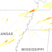
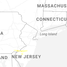
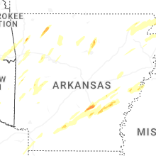
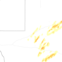
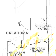
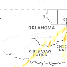
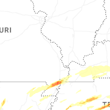
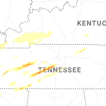
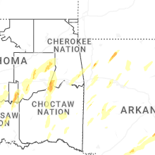
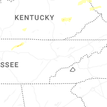
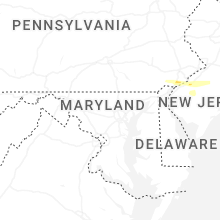
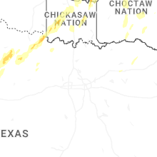
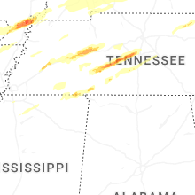
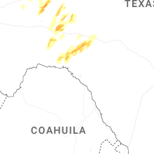
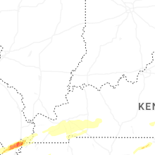
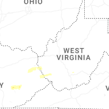
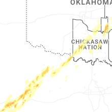
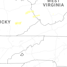
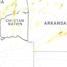
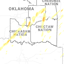
Regions Impacted by Hail on 4/3/2025
Cities Most Affected by Hail Storms of 4/3/2025
| Hail Size | Demographics of Zip Codes Affected | ||||||
|---|---|---|---|---|---|---|---|
| City | Count | Average | Largest | Pop Density | House Value | Income | Age |
| Pine Bluff, AR | 3 | 2.08 | 2.50 | 186 | $57k | $31.1k | 35.9 |
| Santa Fe, TN | 1 | 3.00 | 3.00 | 39 | $85k | $42.8k | 40.8 |
| Rison, AR | 1 | 3.00 | 3.00 | 19 | $53k | $34.1k | 39.5 |
| Williamsport, TN | 1 | 3.00 | 3.00 | 24 | $126k | $39.4k | 40.8 |
| Corinth, MS | 1 | 2.00 | 2.00 | 134 | $64k | $28.5k | 39.1 |
| Duck River, TN | 1 | 1.75 | 1.75 | 17 | $61k | $22.2k | 43.1 |
| Holdenville, OK | 1 | 1.75 | 1.75 | 25 | $33k | $21.7k | 37.8 |
| Jackson, TN | 1 | 1.75 | 1.75 | 393 | $102k | $47.1k | 35.9 |
| Grady, AR | 1 | 1.75 | 1.75 | 4 | $36k | $25.9k | 35.6 |
Hail and Wind Damage Spotted on 4/3/2025
Filter by Report Type:Hail ReportsWind Reports
States Impacted
West Virginia, Tennessee, Oklahoma, Texas, Arkansas, Kentucky, Mississippi, Missouri, Pennsylvania, New JerseyWest Virginia
| Local Time | Report Details |
|---|---|
| 8:00 AM EDT | Large tree down between po road and river church roa in upshur county WV, 13.7 miles WNW of Elkins, WV |
| 8:15 AM EDT | Tree down on power lines. time estimated by rada in pocahontas county WV, 28.6 miles S of Elkins, WV |
| 10:30 AM EDT | Tree down on power lines. time estimated by rada in fayette county WV, 40.6 miles SE of Charleston, WV |
| 11:00 AM EDT | Tree down on power lines. time estimated by rada in nicholas county WV, 55.4 miles E of Charleston, WV |
| 4:24 PM EDT | Power lines in the road between crystal block and hatfield cemetery. time estimated from rada in logan county WV, 48.1 miles SSW of Charleston, WV |
| 5:09 PM EDT | Tree and power lines down on coal river rd. near bolt rd. time estimated from rada in raleigh county WV, 42.6 miles SSE of Charleston, WV |
| 5:26 PM EDT | Tree down in 100 block of high school dr. near vo tech dr. time estimated from radar and nearby aso in raleigh county WV, 45.8 miles SE of Charleston, WV |
| 5:27 PM EDT | Lines down in 3000 block of robert c. byrd dr. time estimated from radar and nearby aso in raleigh county WV, 45.7 miles SSE of Charleston, WV |
| 5:27 PM EDT | Asos station kbkw beckley airpor in raleigh county WV, 47.3 miles SE of Charleston, WV |
| 5:33 PM EDT | Tree down blocking most of stone coal rd. between kiah creek rd. and twelvepole creek rd. time estimated from rada in wayne county WV, 53.1 miles SW of Charleston, WV |
| 6:08 PM EDT | Thunderstorm winds blew down one large tree at the intersection of bungers mill road and herns mill roa in greenbrier county WV, 48.9 miles NW of Roanoke, VA |
| 3:19 AM EDT | Storm damage reported in barbour county WV, 18.8 miles NW of Elkins, WV |
Tennessee
| Local Time | Report Details |
|---|---|
| 8:12 AM EDT | Trees dow in scott county TN, 55.9 miles NW of Knoxville, TN |
| 7:45 AM CDT | Ping Pong Ball sized hail reported near Primm Springs, TN, 27.8 miles SW of Nashville, TN, south harpeth rd between pinewood rd and i-840 closed because of high water. |
| 9:38 AM CDT | Thunderstorm wind damage report of trees down and roof damage along flatwoods road and cedars of lebanon state park (941 am). possible tornad in wilson county TN, 25.4 miles ESE of Nashville, TN |
| 2:12 PM CDT | Trees down on a power lin in perry county TN, 49.8 miles SE of Mc Kenzie, TN |
| 2:48 PM CDT | Half Dollar sized hail reported near Linden, TN, 52.4 miles N of Florence, AL, report of large hail on the perry/lewis county line on highway 412. time estimated via radar. |
| 2:54 PM CDT | Quarter sized hail reported near Hohenwald, TN, 52.1 miles N of Florence, AL |
| 3:24 PM CDT | Golf Ball sized hail reported near Duck River, TN, 41.3 miles SW of Nashville, TN, time estimated via radar. |
| 3:30 PM CDT | Half Dollar sized hail reported near Williamsport, TN, 41.2 miles SW of Nashville, TN |
| 3:30 PM CDT | Tea Cup sized hail reported near Santa Fe, TN, 35.5 miles SSW of Nashville, TN, water valley rd and highway 7 near santa fe. |
| 3:30 PM CDT | Tea Cup sized hail reported near Williamsport, TN, 37.4 miles SW of Nashville, TN, picture of larger than tea cup size hail. time estimated from radar. (this is the earlier storm.). |
| 3:35 PM CDT | Ping Pong Ball sized hail reported near Santa Fe, TN, 34.1 miles SW of Nashville, TN, report of hail at hilltown rd and fly road. |
| 3:36 PM CDT | Ping Pong Ball sized hail reported near Columbia, TN, 30.5 miles SSW of Nashville, TN, theta... tn chestnut ridge rd. time estimated via radar/. |
| 4:00 PM CDT | Half Dollar sized hail reported near Franklin, TN, 17.8 miles SSW of Nashville, TN, time estimated via radar. |
| 4:42 PM CDT | Half Dollar sized hail reported near Columbia, TN, 32.2 miles SSW of Nashville, TN, several reports of quarter to half dollar size hail. time and location estimated via radar. |
| 5:01 PM CDT | Multiple homes with roof damage on arnold lan in hardin county TN, 39 miles WNW of Florence, AL |
| 5:09 PM CDT | Multiple trees down on morris road in walnut grove. this area was under a tornado warning at this time as well so may need to further evaluat in hardin county TN, 27.4 miles NW of Florence, AL |
| 5:22 PM CDT | Possible tornado. multiple trees down along king branch road and jones hollow road south of lobelville. tree on king branch road fell onto a home... causing significant in perry county TN, 49.3 miles SE of Mc Kenzie, TN |
| 6:06 PM CDT | Possible tornado. em reports tree down across chief creek road. power flashes and power outages also reported. time estimated via rada in lawrence county TN, 42.8 miles NNE of Florence, AL |
| 8:40 PM CDT | Large trees down on riverside d in madison county TN, 42.1 miles SSW of Mc Kenzie, TN |
| 8:49 PM CDT | Golf Ball sized hail reported near Jackson, TN, 26.6 miles SSW of Mc Kenzie, TN |
| 9:25 PM CDT | Quarter sized hail reported near Holladay, TN, 31 miles SE of Mc Kenzie, TN, near interstate 40. |
Oklahoma
| Local Time | Report Details |
|---|---|
| 7:15 AM CDT | Semi blown over on i-35 at mile marker 1 in love county OK, 64.4 miles WSW of Atoka, OK |
| 8:04 AM CDT | Power pole down... wire on tree. time estimated from rada in love county OK, 64.5 miles WSW of Atoka, OK |
| 8:04 AM CDT | 30 inch tree blocking roadway on vinson r in love county OK, 54.6 miles WSW of Atoka, OK |
| 8:05 AM CDT | Power lines down blocking roadway at hwy 77 and indian trails. time estimated from rada in love county OK, 65.5 miles WSW of Atoka, OK |
| 8:05 AM CDT | Trees and power lines down in oaklan in marshall county OK, 42.7 miles WSW of Atoka, OK |
| 8:05 AM CDT | Several trees dow in johnston county OK, 45.1 miles WSW of Atoka, OK |
| 8:05 AM CDT | Tree down on melvin douglast... 1 mile north of enville-ran rd. picture in slac in love county OK, 56 miles WSW of Atoka, OK |
| 8:10 AM CDT | Storm damage reported in love county OK, 69 miles E of Wichita Falls, TX |
| 8:25 AM CDT | Storm damage reported in marshall county OK, 52 miles WSW of Atoka, OK |
| 8:29 AM CDT | Storm damage reported in carter county OK, 57.9 miles W of Atoka, OK |
| 8:35 AM CDT | 12 inch tree dow in johnston county OK, 37.5 miles WSW of Atoka, OK |
| 8:38 AM CDT | Several trees down. time estimated from rada in johnston county OK, 33.2 miles WSW of Atoka, OK |
| 5:13 AM CDT | Quarter sized hail reported near Ada, OK, 40.8 miles NW of Atoka, OK, report from mping: quarter (1.00 in.). |
| 5:24 AM CDT | Quarter sized hail reported near Ada, OK, 44.3 miles NW of Atoka, OK, report from mping: quarter (1.00 in.). |
| 5:26 AM CDT | Quarter sized hail reported near Sasakwa, OK, 44.6 miles NNW of Atoka, OK, report from mping: quarter (1.00 in.). |
| 5:45 AM CDT | Quarter sized hail reported near Wewoka, OK, 56.6 miles NNW of Atoka, OK, time estimated from radar. |
| 5:45 AM CDT | Golf Ball sized hail reported near Holdenville, OK, 56.5 miles NNW of Atoka, OK |
Texas
| Local Time | Report Details |
|---|---|
| 1:11 PM CDT | Quarter sized hail reported near Brashear, TX, 65.8 miles ENE of Dallas, TX, quarter size hail reported on cr 1157. |
| 2:32 AM CDT | Quarter sized hail reported near Odessa, TX, 1.6 miles SSW of Odessa, TX, received phone call from a spotter of quarter size hail on the west side of odessa. time and location are estimated. |
| 2:37 AM CDT | Quarter sized hail reported near Odessa, TX, 0.3 miles W of Odessa, TX, public phone call of nickel to quarter size hail near odessa high school. |
| 2:58 AM CDT | Quarter sized hail reported near Midland, TX, 19.5 miles NE of Odessa, TX, report from mping: quarter (1.00 in.). |
| 3:56 AM CDT | Storm damage reported in wichita county TX, 5.6 miles SW of Wichita Falls, TX |
Arkansas
| Local Time | Report Details |
|---|---|
| 2:38 PM CDT | Quarter sized hail reported near Dover, AR, 64.8 miles NW of Little Rock, AR, picture via social media. |
| 3:10 PM CDT | Quarter sized hail reported near Fort Smith, AR, 8.4 miles SSE of Fort Smith, AR, time estimated by radar. |
| 3:15 PM CDT | Numerous trees down in the kedron communit in cleveland county AR, 48.8 miles S of Little Rock, AR |
| 3:15 PM CDT | Multiple tress down in and around rison. reports of roof damage to buildings in tow in cleveland county AR, 54.6 miles S of Little Rock, AR |
| 3:23 PM CDT | Quarter sized hail reported near Alma, AR, 14.8 miles ENE of Fort Smith, AR, time estimated by radar. |
| 3:51 PM CDT | Tea Cup sized hail reported near Rison, AR, 47.5 miles S of Little Rock, AR, report via social media. |
| 4:02 PM CDT | Hen Egg sized hail reported near Pine Bluff, AR, 40.1 miles SSE of Little Rock, AR |
| 4:02 PM CDT | Tennis Ball sized hail reported near Pine Bluff, AR, 40.2 miles SSE of Little Rock, AR |
| 4:02 PM CDT | Golf Ball sized hail reported near Pine Bluff, AR, 40.5 miles SSE of Little Rock, AR, report via social media. |
| 4:04 PM CDT | Trees and powerlines blown dow in hot spring county AR, 45.9 miles SW of Little Rock, AR |
| 4:06 PM CDT | Quarter sized hail reported near Pine Bluff, AR, 42.3 miles SSE of Little Rock, AR |
| 4:08 PM CDT | Quarter sized hail reported near Pine Bluff, AR, 41.2 miles SSE of Little Rock, AR |
| 4:49 PM CDT | Storm damage reported in arkansas county AR, 46.4 miles ESE of Little Rock, AR |
| 4:53 PM CDT | Outbuilding destroyed and contents blown into an adjacent field. verified through pictures on social medi in arkansas county AR, 47.1 miles ESE of Little Rock, AR |
| 5:56 PM CDT | Highway 242 and hwy 44 area. shop blown over and trucks overturned in lo in phillips county AR, 57.2 miles SW of Memphis, TN |
| 6:16 PM CDT | Trees and powerlines reported blown down along calhoun 6 in calhoun county AR, 71.7 miles SSW of Little Rock, AR |
| 6:26 PM CDT | Tree blown onto a house in fordyc in dallas county AR, 64.5 miles S of Little Rock, AR |
| 7:04 PM CDT | Quarter sized hail reported near Star City, AR, 61 miles SSE of Little Rock, AR, quarter sized hail in star city. also some tin blown off the roof of a building near the courthouse. |
| 7:13 PM CDT | Golf Ball sized hail reported near Grady, AR, 56.6 miles SE of Little Rock, AR, storm verified from pictures on social media and radar estimates. |
Kentucky
| Local Time | Report Details |
|---|---|
| 4:22 PM EDT | Rockcastle 911 center reported several trees down on south wilderness road... 2 miles south of livingston near the laurel county line. time estimated from rada in rockcastle county KY, 31.9 miles SSW of Irvine, KY |
| 10:50 PM CDT | Trees down on hwy 280 near calloway county east elementary schoo in calloway county KY, 37 miles NNE of Mc Kenzie, TN |
| 12:13 AM CDT | Three power poles were damaged on canton pike between pyle lane and eagle way bypass in hopkinsville. the road remains closed. time estimated from rada in christian county KY, 63.8 miles NW of Nashville, TN |
Mississippi
| Local Time | Report Details |
|---|---|
| 4:20 PM CDT | Tree down blocking the teckville boat ram in lafayette county MS, 49.3 miles SSE of Memphis, TN |
| 4:51 PM CDT | Hen Egg sized hail reported near Corinth, MS, 40.6 miles WNW of Florence, AL, 2 inch hail reported east of corinth. |
| 7:06 PM CDT | Quarter sized hail reported near Hernando, MS, 21.4 miles SSE of Memphis, TN, jaybird road and byhalia road. |
Missouri
| Local Time | Report Details |
|---|---|
| 8:37 PM CDT | Ping Pong Ball sized hail reported near Portageville, MO, 60.8 miles S of Cape Girardeau, MO |
| 8:40 PM CDT | Ping Pong Ball sized hail reported near Portageville, MO, 62.2 miles S of Cape Girardeau, MO, ping pong ball sized hail near portageville. |
Pennsylvania
| Local Time | Report Details |
|---|---|
| 4:44 AM EDT | Tree down blocking a lane on 476 south bound. time estimated from rada in delaware county PA, 79.2 miles ENE of Baltimore, MD |
| 4:45 AM EDT | Multiple trees and wires down. time estimated from rada in delaware county PA, 78.7 miles NE of Baltimore, MD |
| 4:47 AM EDT | Half Dollar sized hail reported near Brookhaven, PA, 76.8 miles ENE of Baltimore, MD, also estimated 65 mph wind gusts. |
| 4:54 AM EDT | Multiple tree limbs dow in delaware county PA, 79.3 miles ENE of Baltimore, MD |
| 4:54 AM EDT | Quarter sized hail reported near Swarthmore, PA, 79.3 miles ENE of Baltimore, MD, quarter sized hail. |
| 5:00 AM EDT | Quarter sized hail reported near Swarthmore, PA, 79.4 miles ENE of Baltimore, MD, report from mping: quarter (1.00 in.). |
| 5:00 AM EDT | Quarter sized hail reported near Philadelphia, PA, 82.9 miles ENE of Baltimore, MD, weather observer at kphl reported 1 inch hail. |
New Jersey
| Local Time | Report Details |
|---|---|
| 5:05 AM EDT | Tree blown down on to a vehicle. time estimated from rada in gloucester county NJ, 82.8 miles SW of Brooklyn, NY |
| 5:10 AM EDT | Quarter sized hail reported near Blackwood, NJ, 84 miles SW of Brooklyn, NY |
| 6:04 AM EDT | Quarter sized hail reported near Williamstown, NJ, 87.2 miles SW of Brooklyn, NY, report from mping: quarter (1.00 in.). |




Connect with Interactive Hail Maps