Hail Map for Tuesday, April 21, 2020

Number of Impacted Households on 4/21/2020
0
Impacted by 1" or Larger Hail
0
Impacted by 1.75" or Larger Hail
0
Impacted by 2.5" or Larger Hail
Square Miles of Populated Area Impacted on 4/21/2020
0
Impacted by 1" or Larger Hail
0
Impacted by 1.75" or Larger Hail
0
Impacted by 2.5" or Larger Hail
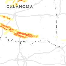
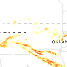
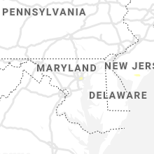
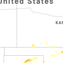
Regions Impacted by Hail on 4/21/2020
Cities Most Affected by Hail Storms of 4/21/2020
| Hail Size | Demographics of Zip Codes Affected | ||||||
|---|---|---|---|---|---|---|---|
| City | Count | Average | Largest | Pop Density | House Value | Income | Age |
| Elk City, OK | 4 | 2.25 | 2.50 | 77 | $64k | $29.0k | 34.9 |
| Elgin, OK | 2 | 2.38 | 3.00 | 56 | $75k | $38.4k | 36.9 |
| Sayre, OK | 2 | 2.25 | 2.75 | 11 | $33k | $25.8k | 35.6 |
| Pocasset, OK | 2 | 2.13 | 2.50 | 7 | $53k | $30.0k | 37.9 |
| Gotebo, OK | 2 | 1.88 | 2.00 | 2 | $22k | $28.8k | 44.4 |
| Ardmore, OK | 2 | 1.75 | 1.75 | 111 | $66k | $30.4k | 38.2 |
| Duncan, OK | 2 | 1.75 | 1.75 | 88 | $61k | $31.6k | 40.0 |
| Devol, OK | 1 | 2.75 | 2.75 | 4 | $48k | $36.6k | 43.5 |
| Reydon, OK | 1 | 2.50 | 2.50 | 3 | $31k | $29.8k | 40.0 |
| Dill City, OK | 1 | 2.50 | 2.50 | 12 | $25k | $26.7k | 43.3 |
| Sterling, OK | 1 | 2.00 | 2.00 | 0 | $48k | $27.8k | 32.1 |
| Amber, OK | 1 | 2.00 | 2.00 | 12 | $53k | $33.4k | 35.8 |
| Caddo, OK | 1 | 2.00 | 2.00 | 14 | $41k | $32.0k | 40.2 |
| Haskell, TX | 1 | 1.75 | 1.75 | 11 | $36k | $23.6k | 42.6 |
| Fletcher, OK | 1 | 1.75 | 1.75 | 26 | $62k | $35.7k | 39.4 |
| Cheyenne, OK | 1 | 1.75 | 1.75 | 3 | $52k | $28.7k | 39.7 |
| Crawford, OK | 1 | 1.75 | 1.75 | 1 | $48k | $46.3k | 52.7 |
| Electra, TX | 1 | 1.75 | 1.75 | 11 | $30k | $26.5k | 41.9 |
| Canadian, TX | 1 | 1.75 | 1.75 | 3 | $57k | $35.4k | 35.6 |
| Shattuck, OK | 1 | 1.75 | 1.75 | 4 | $37k | $27.6k | 43.2 |
Hail and Wind Damage Spotted on 4/21/2020
Filter by Report Type:Hail ReportsWind Reports
States Impacted
Pennsylvania, Delaware, New Jersey, Maryland, New York, Connecticut, Texas, Oklahoma, KansasPennsylvania
| Local Time | Report Details |
|---|---|
| 1:04 PM EDT | 1 inch tree limbs broken and shingles blown off of roof. report from mpin in montgomery county PA, 80.1 miles S of Scranton, PA |
| 1:15 PM EDT | Downed tree near the intersection of reeceville road and swinehart road. time estimated from rada in chester county PA, 66.8 miles NE of Baltimore, MD |
| 1:18 PM EDT | Downed tree near the intersection of reeceville road and swinehart road. time estimated from rada in chester county PA, 66.8 miles NE of Baltimore, MD |
| 1:26 PM EDT | Downed trees and wires. time estimated from rada in chester county PA, 77.8 miles NE of Baltimore, MD |
| 1:58 PM EDT | Downed wires near kemble park. time estimated from rada in philadelphia county PA, 76 miles SW of Brooklyn, NY |
| 2:05 PM EDT | Phl itws measured 61 mph at 2:05 p in delaware county PA, 81.6 miles ENE of Baltimore, MD |
| 2:05 PM EDT | 61 mph measured wind gust at kphl itw in delaware county PA, 82.4 miles ENE of Baltimore, MD |
| 2:07 PM EDT | 59 mph wind gust measured at kphl. this corrects a previous ls in philadelphia county PA, 84.6 miles ENE of Baltimore, MD |
| 2:07 PM EDT | 59 mph wind gust measured at kph in delaware county PA, 82.9 miles ENE of Baltimore, MD |
Delaware
| Local Time | Report Details |
|---|---|
| 1:54 PM EDT | A couple of reports of downed wires. time estimated from rada in new castle county DE, 69.6 miles ENE of Baltimore, MD |
| 2:08 PM EDT | A couple of reports of tree limbs and wires down in the area. time estimated from rada in new castle county DE, 65 miles ENE of Baltimore, MD |
| 2:50 PM EDT | Damaged utility pole from strong winds. time estimated from rada in kent county DE, 51.4 miles ESE of Baltimore, MD |
| 3:30 PM EDT | Storm damage reported in sussex county DE, 30.8 miles N of Ocean City, MD |
New Jersey
| Local Time | Report Details |
|---|---|
| 2:00 PM EDT | Nj mesonet site reported 66 mph wind gus in gloucester county NJ, 75 miles ENE of Baltimore, MD |
| 2:02 PM EDT | Several trees down near quakerbridge mall. time estimated from rada in mercer county NJ, 45.7 miles SW of Brooklyn, NY |
| 2:07 PM EDT | Trained spotter reports trees and power lines down in brooklawn... n in camden county NJ, 81.9 miles SW of Brooklyn, NY |
| 2:10 PM EDT | A swath of wind damage was reported from brooklawn to east of haddonfield. numerous power outages in the area... with several trees and power lines downed. time estimat in camden county NJ, 77.5 miles SW of Brooklyn, NY |
| 2:13 PM EDT | Nj 511 reports a tree down on the garden state parkway southbound... south of exit 14 in essex county NJ, 12.9 miles WNW of Brooklyn, NY |
| 2:14 PM EDT | Mping report of trees uprooted at this location. time estimated from rada in camden county NJ, 81.1 miles SW of Brooklyn, NY |
| 2:15 PM EDT | Multiple trees down in haddon heights... nj. time estimated from rada in camden county NJ, 79.6 miles SW of Brooklyn, NY |
| 2:16 PM EDT | Downed pole and wires on state highway 41 near clements bridge roa in gloucester county NJ, 82.7 miles SW of Brooklyn, NY |
| 2:16 PM EDT | Downed wires from strong winds. time estimated from rada in mercer county NJ, 52.9 miles SW of Brooklyn, NY |
| 2:20 PM EDT | Reports of power lines dow in gloucester county NJ, 77.1 miles ENE of Baltimore, MD |
| 2:20 PM EDT | Downed tree on interstate 295 southbound ramp from haddonfield berlin road. time estimated from rada in camden county NJ, 77.7 miles SW of Brooklyn, NY |
| 2:20 PM EDT | Large tree uprooted and fell on suv on laurel aven in bergen county NJ, 10.6 miles NW of Brooklyn, NY |
| 2:20 PM EDT | Downed tree on wires near neptune lane. time estimated from rada in burlington county NJ, 64.3 miles SW of Brooklyn, NY |
| 2:20 PM EDT | Tree down on hous in bergen county NJ, 10.9 miles NW of Brooklyn, NY |
| 2:21 PM EDT | Several photos of trees down in the area. time estimated from rada in camden county NJ, 79.6 miles SW of Brooklyn, NY |
| 2:23 PM EDT | Downed tree on wires near neptune lan in burlington county NJ, 64.3 miles SW of Brooklyn, NY |
| 2:24 PM EDT | 1-inch tree limbs broken and shingles blown of in burlington county NJ, 70.1 miles SW of Brooklyn, NY |
| 2:25 PM EDT | Dozens of reports of power lines and trees down in a swath from brooklawn to haddonfiel in camden county NJ, 77.5 miles SW of Brooklyn, NY |
| 2:30 PM EDT | Several tree limbs downe in ocean county NJ, 41.7 miles SSW of Brooklyn, NY |
| 2:31 PM EDT | Nj 511 reports a tree down on the garden state parkway southbound... south of exit 14 in essex county NJ, 12.9 miles WNW of Brooklyn, NY |
| 2:35 PM EDT | Trees down in medford... nj. time estimated from rada in burlington county NJ, 71.8 miles SW of Brooklyn, NY |
| 2:36 PM EDT | Several reports of trees and power lines down between pemberton and browns mills. time estimated from rada in burlington county NJ, 61.7 miles SW of Brooklyn, NY |
| 2:38 PM EDT | Downed tree and wires. time estimated from rada in monmouth county NJ, 36.8 miles SW of Brooklyn, NY |
| 2:40 PM EDT | Several reports of tree limbs and power lines down in the browns mills area. time estimated from rada in burlington county NJ, 58.8 miles SSW of Brooklyn, NY |
| 2:48 PM EDT | Downed utility pole on business state highway 33 near west main street. time estimated from rada in monmouth county NJ, 34.1 miles SSW of Brooklyn, NY |
| 2:50 PM EDT | Several reports of tree limbs and power lines dow in monmouth county NJ, 33.3 miles SSW of Brooklyn, NY |
| 2:51 PM EDT | Downed wires on nj70 in cherry hil in camden county NJ, 74.6 miles SW of Brooklyn, NY |
| 2:56 PM EDT | Downed tree and wires. time estimated from rada in cumberland county NJ, 68.3 miles N of Ocean City, MD |
| 2:58 PM EDT | Damage to trailers and sheds at sea girt training center... time estimated from rada in monmouth county NJ, 38.9 miles S of Brooklyn, NY |
| 3:00 PM EDT | Hooper ave & cedar bridge ave are closed due to wires dow in ocean county NJ, 44.9 miles S of Brooklyn, NY |
| 3:00 PM EDT | Trees and wires into homes near brick nj... time estimated from rada in ocean county NJ, 42.8 miles S of Brooklyn, NY |
| 3:00 PM EDT | Fortescue... nj reports a 58 mph wind gus in cumberland county NJ, 62.6 miles N of Ocean City, MD |
| 3:02 PM EDT | Storm damage reported in monmouth county NJ, 39.6 miles S of Brooklyn, NY |
| 3:03 PM EDT | Multiple trees uprooted in toms river near vaughn ave and n tunesbrook dr. time estimated from rada in ocean county NJ, 50.6 miles S of Brooklyn, NY |
| 3:04 PM EDT | Tree down on standish dr. in bellcrest area of toms river. time estimated from rada in ocean county NJ, 50.4 miles S of Brooklyn, NY |
| 3:04 PM EDT | Downed utility pole on state highway 35 south of lakewood road. time estimated from rada in monmouth county NJ, 39.7 miles S of Brooklyn, NY |
| 3:04 PM EDT | Several reports of trees and wires down near and west of manasquan. time estimated from rada in monmouth county NJ, 39.6 miles S of Brooklyn, NY |
| 3:08 PM EDT | Several reports of power lines and tree limbs down in the toms river area. time estimated from rada in ocean county NJ, 52.4 miles SSW of Brooklyn, NY |
| 3:08 PM EDT | Several reports of downed trees and wires. time estimated from rada in cumberland county NJ, 63.2 miles N of Ocean City, MD |
| 3:18 PM EDT | Brandywine shoal lighthouse measures a 61 mph wind gus in anz431 county NJ, 45.2 miles N of Ocean City, MD |
| 3:18 PM EDT | Corrects previous tstm wnd gst report from atlantic city international airport (kacy). kacy measures 60 mph wind gus in atlantic county NJ, 82.2 miles NNE of Ocean City, MD |
| 3:21 PM EDT | Kacy measures 60 mph wind gus in atlantic county NJ, 82.2 miles NNE of Ocean City, MD |
| 3:25 PM EDT | Tree down... transformers blow in cape may county NJ, 64.5 miles NNE of Ocean City, MD |
| 3:26 PM EDT | Several reports of power lines down in the area. time estimated from rada in atlantic county NJ, 72.2 miles NNE of Ocean City, MD |
| 3:27 PM EDT | Storm damage reported in cape may county NJ, 42.5 miles N of Ocean City, MD |
| 3:29 PM EDT | Beach haven mesonet measures 58 mph wind gus in ocean county NJ, 80.8 miles S of Brooklyn, NY |
| 3:30 PM EDT | Several reports of structural damage in little egg harbor. time estimated from rada in ocean county NJ, 79.2 miles SSW of Brooklyn, NY |
| 3:35 PM EDT | Several reports of downed power lines. time estimated from rada in cape may county NJ, 42.7 miles NNE of Ocean City, MD |
Maryland
| Local Time | Report Details |
|---|---|
| 2:08 PM EDT | Several trees down near state highway 298. time estimated from rada in kent county MD, 25.2 miles E of Baltimore, MD |
| 2:08 PM EDT | Tree uprooted. time based on rada in kent county MD, 23.4 miles E of Baltimore, MD |
| 2:22 PM EDT | Downed wires reported. time estimated from rada in queen annes county MD, 37.3 miles SE of Baltimore, MD |
| 2:23 PM EDT | A few reports of power lines down in the area. time estimated from rada in queen anne's county MD, 39.1 miles ESE of Baltimore, MD |
| 3:10 PM EDT | Power lines knocked down. time estimated from rada in dorchester county MD, 41.9 miles WNW of Ocean City, MD |
| 4:01 PM EDT | Power lines knocked down. time estimated from rada in worcester county MD, 9.3 miles WNW of Ocean City, MD |
| 4:03 PM EDT | Tree down on a house in ocean pine in worcester county MD, 6 miles NW of Ocean City, MD |
New York
| Local Time | Report Details |
|---|---|
| 2:35 PM EDT | Storm damage reported in bronx county NY, 13.3 miles NNE of Brooklyn, NY |
| 4:20 PM EDT | Storm damage reported in suffolk county NY, 65.6 miles SW of Providence, RI |
| 4:25 PM EDT | Storm damage reported in suffolk county NY, 65.6 miles SW of Providence, RI |
| 4:40 PM EDT | 50 kt gus in suffolk county NY, 50.9 miles SW of Providence, RI |
| 4:40 PM EDT | 50 kt gus in suffolk county NY, 50.9 miles SW of Providence, RI |
Connecticut
| Local Time | Report Details |
|---|---|
| 4:40 PM EDT | 50 kt gust measured at new london ledge station in anz330 county CT, 49.6 miles SW of Providence, RI |
Texas
| Local Time | Report Details |
|---|---|
| 6:48 PM CDT | Half Dollar sized hail reported near Canadian, TX, 68.9 miles SW of Woodward, OK, copious amounts of half dollar size hail reported by a storm chaser on highway 60 south of canadian. |
| 6:55 PM CDT | Quarter sized hail reported near Canadian, TX, 69.4 miles SW of Woodward, OK |
| 7:31 PM CDT | Quarter sized hail reported near Canadian, TX, 63.1 miles SW of Woodward, OK |
| 7:35 PM CDT | Quarter sized hail reported near Canadian, TX, 63.9 miles SW of Woodward, OK |
| 7:49 PM CDT | Golf Ball sized hail reported near Canadian, TX, 63.5 miles SW of Woodward, OK |
| 8:03 PM CDT | Quarter sized hail reported near Canadian, TX, 71.9 miles SW of Woodward, OK |
| 9:38 PM CDT | Golf Ball sized hail reported near Haskell, TX, 51.2 miles N of Abilene, TX, estimated time based on radar. |
| 10:45 PM CDT | Ping Pong Ball sized hail reported near Seymour, TX, 41.5 miles WSW of Wichita Falls, TX |
| 11:12 PM CDT | Golf Ball sized hail reported near Electra, TX, 25.5 miles WNW of Wichita Falls, TX |
| 11:29 PM CDT | Quarter sized hail reported near Burkburnett, TX, 13.8 miles NNW of Wichita Falls, TX |
| 3:29 AM CDT | Ping Pong Ball sized hail reported near Fritch, TX, 34.5 miles NNE of Amarillo, TX |
| 3:29 AM CDT | Quarter sized hail reported near , , 43.9 miles NNE of Amarillo, TX |
| 3:35 AM CDT | Quarter sized hail reported near Stinnett, TX, 47.7 miles NNE of Amarillo, TX |
| 3:35 AM CDT | Quarter sized hail reported near , , 43.9 miles NNE of Amarillo, TX |
| 3:35 AM CDT | Ping Pong Ball sized hail reported near Borger, TX, 39.7 miles NE of Amarillo, TX |
Oklahoma
| Local Time | Report Details |
|---|---|
| 7:42 PM CDT | Quarter sized hail reported near Anadarko, OK, 48.8 miles WSW of Oklahoma City, OK |
| 7:50 PM CDT | Quarter sized hail reported near Sayre, OK, 72.1 miles SSW of Woodward, OK |
| 8:02 PM CDT | Golf Ball sized hail reported near Cheyenne, OK, 56 miles SSW of Woodward, OK |
| 8:18 PM CDT | Golf Ball sized hail reported near Crawford, OK, 55.1 miles SSW of Woodward, OK |
| 8:30 PM CDT | Tennis Ball sized hail reported near Reydon, OK, 61.7 miles SSW of Woodward, OK, twitter pic. |
| 8:34 PM CDT | Hen Egg sized hail reported near Elk City, OK, 69.2 miles S of Woodward, OK |
| 8:35 PM CDT | Hen Egg sized hail reported near Elk City, OK, 70.6 miles S of Woodward, OK |
| 8:35 PM CDT | Tennis Ball sized hail reported near Elk City, OK, 70.6 miles S of Woodward, OK, twitter pic. |
| 9:05 PM CDT | Half Dollar sized hail reported near Elk City, OK, 72.8 miles S of Woodward, OK |
| 9:05 PM CDT | Tennis Ball sized hail reported near Elk City, OK, 69.2 miles S of Woodward, OK |
| 9:06 PM CDT | Quarter sized hail reported near Lookeba, OK, 53.6 miles W of Oklahoma City, OK, report from mping. |
| 9:16 PM CDT | Storm damage reported in washita county OK, 75.5 miles S of Woodward, OK |
| 9:24 PM CDT | Storm damage reported in washita county OK, 76.1 miles S of Woodward, OK |
| 9:31 PM CDT | Ping Pong Ball sized hail reported near Lookeba, OK, 47.1 miles W of Oklahoma City, OK |
| 9:36 PM CDT | Tennis Ball sized hail reported near Dill City, OK, 81 miles S of Woodward, OK, twitter pic. |
| 9:39 PM CDT | Half Dollar sized hail reported near Sayre, OK, 66.4 miles NNE of Childress, TX |
| 9:40 PM CDT | Golf Ball sized hail reported near Sayre, OK, 67.9 miles NNE of Childress, TX, report from mping. |
| 9:49 PM CDT | Baseball sized hail reported near Sayre, OK, 68.8 miles NNE of Childress, TX |
| 9:59 PM CDT | Storm damage reported in washita county OK, 76.1 miles S of Woodward, OK |
| 10:00 PM CDT | Quarter sized hail reported near Cordell, OK, 82.4 miles WSW of Oklahoma City, OK, time estimated from radar. |
| 10:08 PM CDT | Golf Ball sized hail reported near Gotebo, OK, 79.2 miles WSW of Oklahoma City, OK |
| 10:32 PM CDT | Golf Ball sized hail reported near Pocasset, OK, 31.1 miles SW of Oklahoma City, OK |
| 10:33 PM CDT | Quarter sized hail reported near Minco, OK, 26.5 miles WSW of Oklahoma City, OK |
| 10:44 PM CDT | Quarter sized hail reported near Hobart, OK, 76.1 miles ENE of Childress, TX, report from mping. |
| 10:47 PM CDT | Hen Egg sized hail reported near Amber, OK, 28.1 miles SW of Oklahoma City, OK, report from mping. |
| 10:47 PM CDT | Tennis Ball sized hail reported near Pocasset, OK, 31.5 miles SW of Oklahoma City, OK |
| 10:57 PM CDT | Storm damage reported in kiowa county OK, 76.3 miles ENE of Childress, TX |
| 11:00 PM CDT | Storm damage reported in grady county OK, 26.8 miles SW of Oklahoma City, OK |
| 11:11 PM CDT | Tea Cup sized hail reported near Elgin, OK, 61.3 miles N of Wichita Falls, TX |
| 11:12 PM CDT | Storm damage reported in comanche county OK, 61.6 miles N of Wichita Falls, TX |
| 11:15 PM CDT | Golf Ball sized hail reported near Elgin, OK, 61.6 miles NNE of Wichita Falls, TX |
| 11:19 PM CDT | Golf Ball sized hail reported near Fletcher, OK, 60.3 miles SW of Oklahoma City, OK |
| 11:22 PM CDT | Hen Egg sized hail reported near Gotebo, OK, 70.7 miles NNW of Wichita Falls, TX |
| 11:25 PM CDT | Hen Egg sized hail reported near Sterling, OK, 61 miles NNE of Wichita Falls, TX |
| 11:40 PM CDT | Large trees down and power lines down. time based on rada in stephens county OK, 59.8 miles NNE of Wichita Falls, TX |
| 11:45 PM CDT | Baseball sized hail reported near Devol, OK, 20.1 miles NNW of Wichita Falls, TX |
| 11:47 PM CDT | Ping Pong Ball sized hail reported near Lawton, OK, 60.2 miles N of Wichita Falls, TX |
| 11:57 PM CDT | Quarter sized hail reported near Walters, OK, 34.1 miles NNE of Wichita Falls, TX |
| 12:04 AM CDT | Quarter sized hail reported near Lawton, OK, 55.2 miles NNE of Wichita Falls, TX |
| 12:10 AM CDT | Quarter sized hail reported near Medicine Park, OK, 56.6 miles N of Wichita Falls, TX |
| 12:10 AM CDT | Storm damage reported in stephens county OK, 60.7 miles NE of Wichita Falls, TX |
| 12:15 AM CDT | Half Dollar sized hail reported near Duncan, OK, 51.2 miles NE of Wichita Falls, TX |
| 12:17 AM CDT | Golf Ball sized hail reported near Duncan, OK, 51.2 miles NE of Wichita Falls, TX |
| 12:18 AM CDT | Half Dollar sized hail reported near Duncan, OK, 51.2 miles NE of Wichita Falls, TX |
| 12:55 AM CDT | Quarter sized hail reported near Davis, OK, 57.9 miles W of Atoka, OK |
| 1:12 AM CDT | Golf Ball sized hail reported near Ardmore, OK, 50.1 miles W of Atoka, OK |
| 1:20 AM CDT | Golf Ball sized hail reported near Duncan, OK, 51.2 miles NE of Wichita Falls, TX, relayed via twitter |
| 1:30 AM CDT | Quarter sized hail reported near Mill Creek, OK, 36.3 miles W of Atoka, OK |
| 1:48 AM CDT | Quarter sized hail reported near Milburn, OK, 28.3 miles WSW of Atoka, OK |
| 2:02 AM CDT | Quarter sized hail reported near Coleman, OK, 22.7 miles WSW of Atoka, OK |
| 2:12 AM CDT | Quarter sized hail reported near Healdton, OK, 62.1 miles ENE of Wichita Falls, TX, also had 45 mph wind gusts reported. |
| 2:20 AM CDT | Transformer damaged and power out in tishoming in johnston county OK, 33.2 miles WSW of Atoka, OK |
| 2:20 AM CDT | Hen Egg sized hail reported near Caddo, OK, 19.4 miles SSW of Atoka, OK, relayed by media via twitter. |
| 2:35 AM CDT | Storm damage reported in carter county OK, 65.3 miles W of Atoka, OK |
| 2:35 AM CDT | Golf Ball sized hail reported near Ardmore, OK, 62.3 miles W of Atoka, OK |
| 2:50 AM CDT | Quarter sized hail reported near Kenefic, OK, 18.5 miles SW of Atoka, OK |
| 4:38 AM CDT | Golf Ball sized hail reported near Shattuck, OK, 39.5 miles WSW of Woodward, OK, mostly quarter size hail with a few golf ball size hailstones. |
| 5:33 AM CDT | Quarter sized hail reported near Enid, OK, 67.1 miles NNW of Oklahoma City, OK, on the west side of enid. |
| 5:35 AM CDT | Quarter sized hail reported near Enid, OK, 63.5 miles NNW of Oklahoma City, OK, from the vance airforce base weather observer via the kend metar. |
Kansas
| Local Time | Report Details |
|---|---|
| 2:27 AM CDT | Quarter sized hail reported near Liberal, KS, 64.1 miles S of Garden City, KS |






Connect with Interactive Hail Maps