

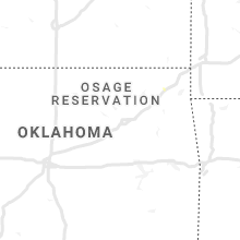
Hail Map for Friday, August 14, 2020

Number of Impacted Households on 8/14/2020
0
Impacted by 1" or Larger Hail
0
Impacted by 1.75" or Larger Hail
0
Impacted by 2.5" or Larger Hail
Square Miles of Populated Area Impacted on 8/14/2020
0
Impacted by 1" or Larger Hail
0
Impacted by 1.75" or Larger Hail
0
Impacted by 2.5" or Larger Hail


Cities Most Affected by Hail Storms of 8/14/2020
| Hail Size | Demographics of Zip Codes Affected | ||||||
|---|---|---|---|---|---|---|---|
| City | Count | Average | Largest | Pop Density | House Value | Income | Age |
| Jewell, KS | 5 | 3.00 | 4.00 | 3 | $23k | $32.0k | 48.3 |
| Mankato, KS | 5 | 2.85 | 4.00 | 5 | $32k | $30.9k | 53.1 |
| Manter, KS | 3 | 3.17 | 4.00 | 0 | $75k | $43.8k | 43.6 |
| Nelson, NE | 3 | 2.08 | 2.50 | 4 | $34k | $32.3k | 50.6 |
| Clay Center, NE | 3 | 2.08 | 2.50 | 16 | $61k | $37.3k | 45.0 |
| Sutton, NE | 2 | 2.38 | 2.75 | 8 | $62k | $35.2k | 43.4 |
| Lawrence, NE | 2 | 2.00 | 2.00 | 3 | $31k | $28.6k | 46.0 |
| Harvard, NE | 1 | 3.00 | 3.00 | 6 | $38k | $29.6k | 38.8 |
| Fairfield, NE | 1 | 2.75 | 2.75 | 7 | $47k | $32.3k | 45.0 |
| Granada, CO | 1 | 2.00 | 2.00 | 0 | $59k | $27.4k | 34.0 |
| Merrill, IA | 1 | 1.75 | 1.75 | 10 | $83k | $44.7k | 41.8 |
| Argusville, ND | 1 | 1.75 | 1.75 | 8 | $93k | $48.3k | 35.1 |
| Osborne, KS | 1 | 1.75 | 1.75 | 6 | $37k | $29.6k | 48.3 |
| Glencoe, MN | 1 | 1.75 | 1.75 | 66 | $100k | $48.8k | 39.6 |
| Minot, ND | 1 | 1.75 | 1.75 | 122 | $80k | $36.5k | 32.4 |
Hail and Wind Damage Spotted on 8/14/2020
Filter by Report Type:Hail ReportsWind Reports
States Impacted
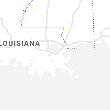
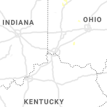
North Dakota, Minnesota, Michigan, Florida, Iowa, Ohio, Nebraska, South Carolina, Kansas, Texas, Colorado, Kentucky, Wisconsin, Georgia, Oklahoma, ArizonaNorth Dakota
| Local Time | Report Details |
|---|---|
| 7:10 AM CDT | Golf Ball sized hail reported near Argusville, ND, 19.6 miles NW of Fargo, ND, report and photo posted via social media. time estimated based on radar. |
| 7:25 AM CDT | Half Dollar sized hail reported near Hunter, ND, 23.1 miles NW of Fargo, ND |
| 9:14 AM CDT | Quarter sized hail reported near Lisbon, ND, 48.6 miles WSW of Fargo, ND |
| 9:15 AM CDT | Large 3 to 5 inch tree branches downed along with pea size hai in ransom county ND, 52.3 miles SW of Fargo, ND |
| 9:30 AM CDT | Near intersection of cass co. 16 and u.s. 81 in the vicinity of oxbow nd - large trees and a light pole downed... power lines from 112 av s to 124 av s all snapped off in cass county ND, 15 miles S of Fargo, ND |
| 9:35 AM CDT | 3 inch treen branches downed along with pea size hai in ransom county ND, 52.3 miles SW of Fargo, ND |
| 9:45 AM CDT | Peak wind measured at the sheyenne raws statio in ransom county ND, 39.1 miles SW of Fargo, ND |
| 9:50 AM CDT | Near intersection of cass co. 16 and u.s. 81 south of wild rice. large trees and several power poles were snapped at the base. a pole shed was also blown down. report a in cass county ND, 10.9 miles S of Fargo, ND |
| 9:54 AM CDT | Ndawn site measured a 61 mph wind gus in cass county ND, 2.5 miles WNW of Fargo, ND |
| 6:23 PM CDT | Golf Ball sized hail reported near Minot, ND, 13 miles NNW of Minot, ND, reported at minot air force base. relayed through broadcast media. |
Minnesota
| Local Time | Report Details |
|---|---|
| 9:55 AM CDT | Pictures of 2 and 6 inch diameter tree branches blown down on east side of town. time estimated by rada in clay county MN, 3.9 miles E of Fargo, ND |
| 10:04 AM CDT | Large grain bins crushed at the grain elevator complex. numerous trees snapped or uprooted. time estimated based on radar. reports and photos posted via social medi in clay county MN, 19.4 miles NE of Fargo, ND |
| 10:20 AM CDT | Trees blown down in a shelter bel in clay county MN, 29.5 miles ENE of Fargo, ND |
| 10:55 AM CDT | Peak wind measured at a raws station. time estimated based on rada in becker county MN, 44.7 miles E of Fargo, ND |
| 4:30 PM CDT | Four power poles down as well as numerous tree branches up to 8 inches in diamete in pope county MN, 56 miles N of Montevideo, MN |
| 5:00 PM CDT | Trees dow in todd county MN, 93.7 miles S of Bemidji, MN |
| 5:02 PM CDT | Report of roof damag in morrison county MN, 87.2 miles S of Bemidji, MN |
| 5:10 PM CDT | Mesonet station mn016 sauk centre 2s in stearns county MN, 64.9 miles NE of Montevideo, MN |
| 5:15 PM CDT | Trailer overturned and some roof damag in morrison county MN, 93.2 miles S of Bemidji, MN |
| 5:25 PM CDT | Large branches down blocking road on county road 2. time estimated based on rada in mcleod county MN, 46.3 miles W of Minneapolis, MN |
| 5:33 PM CDT | Several downed tree in crow wing county MN, 64 miles SE of Bemidji, MN |
| 5:35 PM CDT | Measured with personal weather senso in morrison county MN, 88.7 miles NW of Minneapolis, MN |
| 5:40 PM CDT | Quarter sized hail reported near Gaylord, MN, 55.5 miles WSW of Minneapolis, MN |
| 5:43 PM CDT | Golf Ball sized hail reported near Glencoe, MN, 50.4 miles WSW of Minneapolis, MN, time estimated based on radar. |
| 6:15 PM CDT | 4-6 inch tree limbs down around town. time estimated from rada in stearns county MN, 63.9 miles NW of Minneapolis, MN |
| 6:34 PM CDT | Several trees reported down at the trout lake campground near grand rapid in itasca county MN, 68.4 miles WNW of Duluth, MN |
| 6:35 PM CDT | Over 100 trees down at the location with the trees stacked up on each other. damage may be from a tornado. time estimated by rada in carlton county MN, 21.9 miles SW of Duluth, MN |
| 6:58 PM CDT | Multiple trees and power lines down. time estimated by rada in aitkin county MN, 54.6 miles WSW of Duluth, MN |
| 7:00 PM CDT | Multiple trees and power lines down. time estimated by rada in aitkin county MN, 53.7 miles WSW of Duluth, MN |
| 7:00 PM CDT | Trees were down in finlayson. mostly dead birch and dead tamarack but a few live popple trees were uprooted as wel in pine county MN, 56.1 miles SW of Duluth, MN |
| 7:04 PM CDT | Trees were falling along mn-61 as spotter was driving south between willow river and rutledge. time estimated by rada in pine county MN, 49.6 miles SW of Duluth, MN |
| 7:04 PM CDT | A few trees were down in hibbing with at least one partially blocking a stree in st. louis county MN, 58.5 miles NW of Duluth, MN |
| 7:05 PM CDT | A power line was down and laying across part of townline road. time estimated by rada in st. louis county MN, 56.1 miles NW of Duluth, MN |
| 7:10 PM CDT | Multiple trees down within the city of sturgeon lake. time estimated by rada in pine county MN, 44 miles SW of Duluth, MN |
| 7:16 PM CDT | Power lines were in the trees with smoldering limbs. time estimated from rada in st. louis county MN, 60.9 miles NW of Duluth, MN |
| 7:20 PM CDT | Tree down on power line reported via law enforcement. time estimated from rada in pine county MN, 34.7 miles SW of Duluth, MN |
| 7:25 PM CDT | Power line down in ditch reported via law enforcement. time estimated from rada in carlton county MN, 38.1 miles SW of Duluth, MN |
| 7:35 PM CDT | Video sent in via social media of multiple trees uprooted. time estimated from rada in carlton county MN, 26.9 miles SW of Duluth, MN |
| 7:41 PM CDT | A tree was down over the roadway in jay cooke state park. time estimated by rada in carlton county MN, 14.1 miles SW of Duluth, MN |
| 7:42 PM CDT | Power line down and going across the highway reported via law enforcement. time estimated from rada in carlton county MN, 22.3 miles SW of Duluth, MN |
| 7:45 PM CDT | Pine tree down across highway 210 reported via law enforcement. time estimated from rada in carlton county MN, 16.8 miles WSW of Duluth, MN |
| 7:45 PM CDT | Power line down reported via law enforcemen in carlton county MN, 19.9 miles WSW of Duluth, MN |
| 7:45 PM CDT | Report of a a tree down across the road via law enforcement. time estimated from rada in carlton county MN, 25.8 miles SW of Duluth, MN |
| 7:55 PM CDT | Numerous trees and power lines down throughout the city of crysta in hennepin county MN, 5.8 miles NW of Minneapolis, MN |
| 7:58 PM CDT | A tree was down on a power line in solway township. time estimated by rada in st. louis county MN, 12 miles W of Duluth, MN |
| 8:00 PM CDT | A large tree was down on a power line on tioga street and was on fire. time estimated by rada in st. louis county MN, 5.2 miles NE of Duluth, MN |
| 8:00 PM CDT | A tree was down on a power line on east 1st street and the tree was on fire. time estimated by rada in st. louis county MN, 2.1 miles NE of Duluth, MN |
| 8:00 PM CDT | Numerous 8 to 10 inch branches down over several blocks just west of 41st and penn avenue in north minneapoli in hennepin county MN, 4.2 miles NNW of Minneapolis, MN |
| 8:02 PM CDT | Report of metal sheeting dangling from a building that could pose a threat to power line in st. louis county MN, 2.3 miles NNE of Duluth, MN |
| 8:05 PM CDT | 8 inch tree down... time estimated from rada in hennepin county MN, 2.7 miles NW of Minneapolis, MN |
| 8:05 PM CDT | Several large trees dow in hennepin county MN, 3.9 miles NW of Minneapolis, MN |
| 8:08 PM CDT | Quarter sized hail reported near Minneapolis, MN, 16.4 miles NNW of Minneapolis, MN, hail slightly larger than quarters. |
| 8:13 PM CDT | A tree was leaning on a power line along lismore road in normanna township. time estimated by rada in st. louis county MN, 12.9 miles NE of Duluth, MN |
| 8:17 PM CDT | Asos station kmsp minneapolis-st. paul a in hennepin county MN, 7 miles SSE of Minneapolis, MN |
| 8:22 PM CDT | A tree was downed onto a power line along homestead road in clifton township. time estimated by rada in st. louis county MN, 15.8 miles NE of Duluth, MN |
| 8:27 PM CDT | Quarter sized hail reported near Minneapolis, MN, 6.9 miles S of Minneapolis, MN |
| 8:57 PM CDT | A string of loaded double stack container railroad cars were blown over on the south side of the duluth port termina in st. louis county MN, 2.6 miles S of Duluth, MN |
Michigan
| Local Time | Report Details |
|---|---|
| 3:07 PM EDT | Tree downed partially blocking road near the intersection of ridge rd and cavanaugh lake r in washtenaw county MI, 53.2 miles SSW of Flint, MI |
| 3:10 PM EDT | Tree downed near 15000 block of cavanaugh lake r in washtenaw county MI, 53.4 miles SSW of Flint, MI |
| 4:00 PM EDT | Several trees down in the area. some on roads... at least one on a house. power outage in the are in jackson county MI, 68.5 miles SSW of Flint, MI |
| 4:15 PM EDT | The hudson fire department reported that thunderstorm winds blew trees and power lines down throughout the town of hudso in lenawee county MI, 66.7 miles NE of Fort Wayne, IN |
Florida
| Local Time | Report Details |
|---|---|
| 3:20 PM EDT | Trees were blown down onto power lines at the intersection of arlington road and whitlock ave. the time of damage was based on radar. observations just west of this loc in duval county FL, 3.3 miles E of Jacksonville, FL |
| 4:17 PM EDT | Tree debris was blown down onto power lines that damaged fpl equipment. the time of damage was based on rada in st. johns county FL, 33.7 miles SSE of Jacksonville, FL |
Iowa
| Local Time | Report Details |
|---|---|
| 2:54 PM CDT | Quarter sized hail reported near Westfield, IA, 57.6 miles S of Sioux Falls, SD, mostly dime to nickel sized hail... but some as big as quarters. not much wind... as heavy rain is coming almost straight down. |
| 3:05 PM CDT | Quarter sized hail reported near Westfield, IA, 60.2 miles S of Sioux Falls, SD, quarter hail near k18/c43 intersection. |
| 3:25 PM CDT | Golf Ball sized hail reported near Merrill, IA, 58.6 miles W of Storm Lake, IA, report via social media. |
Ohio
| Local Time | Report Details |
|---|---|
| 4:32 PM EDT | Several large limbs downed. 6 inch diameter and large in fulton county OH, 57.3 miles NE of Fort Wayne, IN |
| 4:32 PM EDT | Quarter sized hail reported near Fayette, OH, 57.3 miles NE of Fort Wayne, IN |
| 5:08 PM EDT | Quarter sized hail reported near Fayette, OH, 54.9 miles NE of Fort Wayne, IN |
| 5:15 PM EDT | Tree downed and blocking road. size and health of tree unknow in fulton county OH, 68.4 miles ENE of Fort Wayne, IN |
Nebraska
| Local Time | Report Details |
|---|---|
| 4:23 PM CDT | Quarter sized hail reported near Osceola, NE, 43.8 miles ENE of Grand Island, NE |
| 4:37 PM CDT | Quarter sized hail reported near Osceola, NE, 44.9 miles ENE of Grand Island, NE |
| 4:50 PM CDT | Quarter sized hail reported near Emerson, NE, 80.6 miles NNW of Omaha, NE, corrects previous hail report from 7 n thurston. nickel to quarter size hail fell near emerson. time estimated. |
| 5:50 PM CDT | Hen Egg sized hail reported near Sutton, NE, 33.2 miles SE of Grand Island, NE, report and pic via facebook. |
| 5:51 PM CDT | Half Dollar sized hail reported near Sutton, NE, 33.2 miles SE of Grand Island, NE |
| 5:52 PM CDT | Half Dollar sized hail reported near Harvard, NE, 29.7 miles SE of Grand Island, NE |
| 5:52 PM CDT | Baseball sized hail reported near Sutton, NE, 33.2 miles SE of Grand Island, NE |
| 5:57 PM CDT | Tennis Ball sized hail reported near Clay Center, NE, 32.9 miles SSE of Grand Island, NE |
| 6:00 PM CDT | Tennis Ball sized hail reported near , , 31.7 miles SSE of Grand Island, NE, report and pic via facebook. |
| 6:10 PM CDT | Baseball sized hail reported near Fairfield, NE, 34.6 miles SSE of Grand Island, NE, picture of cracked windshied and hail stones via facebook. 6se clay center. |
| 6:10 PM CDT | Tea Cup sized hail reported near Harvard, NE, 28.2 miles SSE of Grand Island, NE, report and pic via facebook. (10 west of sutton). |
| 6:11 PM CDT | Golf Ball sized hail reported near Clay Center, NE, 36.1 miles SE of Grand Island, NE |
| 6:13 PM CDT | Hen Egg sized hail reported near Clay Center, NE, 35.5 miles SE of Grand Island, NE, 2 to 2 1/4 inch hail. |
| 6:15 PM CDT | 50-60 mph wind gust in clay county NE, 35.5 miles SE of Grand Island, NE |
| 6:35 PM CDT | Hen Egg sized hail reported near Lawrence, NE, 44.8 miles SSE of Grand Island, NE, corrects time of previous hail report from 4 ssw deweese. report and pic via facebook. 5 e of lawrence. |
| 6:37 PM CDT | Golf Ball sized hail reported near Nelson, NE, 47.4 miles SSE of Grand Island, NE, picture on twitter. |
| 6:49 PM CDT | Hen Egg sized hail reported near Nelson, NE, 52 miles SSE of Grand Island, NE, picture and time via facebook. |
| 6:58 PM CDT | Quarter sized hail reported near Nelson, NE, 50.7 miles SSE of Grand Island, NE |
| 7:00 PM CDT | Tennis Ball sized hail reported near Nelson, NE, 52 miles SSE of Grand Island, NE, broadcast media relayed public picture of large hail. |
| 7:41 PM CDT | Quarter sized hail reported near Superior, NE, 64.1 miles SSE of Grand Island, NE |
| 9:43 PM CDT | Hen Egg sized hail reported near Lawrence, NE, 44.8 miles SSE of Grand Island, NE, report and pic via facebook. 5 e of lawrence. |
South Carolina
| Local Time | Report Details |
|---|---|
| 5:45 PM EDT | Numerous trees blown down along interstate 95 near mile marker 16. hail of unknown size also reporte in jasper county SC, 24.5 miles N of Savannah, GA |
| 5:50 PM EDT | Tree in roadway on haphazard rd at smiths crossing. time estimated from rada in jasper county SC, 27.3 miles N of Savannah, GA |
| 5:50 PM EDT | Tree in roadway on mitchellville rd. time estimated from rada in jasper county SC, 26.9 miles NNE of Savannah, GA |
| 5:54 PM EDT | Tree in roadway on lakeview drive at lucas drive. time estimated from rada in jasper county SC, 30.2 miles N of Savannah, GA |
| 6:26 PM EDT | Hampton county 911 reported a tree down on ridgecut r in hampton county SC, 46.2 miles NNE of Savannah, GA |
| 7:00 PM EDT | Schp reported a tree down on bells hwy at tabor r in colleton county SC, 47.7 miles WSW of Charleston, SC |
Kansas
| Local Time | Report Details |
|---|---|
| 4:20 PM MDT | Half Dollar sized hail reported near Syracuse, KS, 64.6 miles WNW of Garden City, KS |
| 4:26 PM MDT | Quarter sized hail reported near Syracuse, KS, 64.3 miles WNW of Garden City, KS |
| 5:45 PM CDT | Ping Pong Ball sized hail reported near Johnson, KS, 58.6 miles WSW of Garden City, KS, pea to ping pong. |
| 6:25 PM CDT | Tea Cup sized hail reported near Manter, KS, 63.7 miles WSW of Garden City, KS, pic and measurement from fb. |
| 6:25 PM CDT | Tennis Ball sized hail reported near Manter, KS, 63.7 miles WSW of Garden City, KS, pic from tw. |
| 6:25 PM CDT | Grapefruit sized hail reported near Manter, KS, 63.3 miles WSW of Garden City, KS, baseball to softball size from fb. |
| 6:29 PM CDT | Quarter sized hail reported near Manter, KS, 64.2 miles WSW of Garden City, KS |
| 7:25 PM CDT | Ping Pong Ball sized hail reported near Richfield, KS, 84.2 miles SW of Garden City, KS |
| 7:32 PM CDT | Mesonet station cw8810 elkhar in morton county KS, 88 miles SW of Garden City, KS |
| 7:45 PM CDT | Golf Ball sized hail reported near Mankato, KS, 78.6 miles S of Grand Island, NE, picture and report via facebook. |
| 7:50 PM CDT | Grapefruit sized hail reported near Mankato, KS, 78.6 miles S of Grand Island, NE, report and pic (with a ruler next to hailstone) received via facebook. |
| 7:50 PM CDT | Hen Egg sized hail reported near Mankato, KS, 78.6 miles S of Grand Island, NE |
| 8:00 PM CDT | Grapefruit sized hail reported near Mankato, KS, 81.7 miles S of Grand Island, NE, 3 east and 2.5 south of mankato. photo and report received via facebook. |
| 8:10 PM CDT | Tennis Ball sized hail reported near Mankato, KS, 78.6 miles S of Grand Island, NE, picture and report via facebook. |
| 8:10 PM CDT | K-state mesone in jewell county KS, 82.1 miles NE of Hays, KS |
| 8:13 PM CDT | Golf Ball sized hail reported near Jewell, KS, 86.5 miles NE of Hays, KS |
| 8:15 PM CDT | Grapefruit sized hail reported near Jewell, KS, 84.3 miles S of Grand Island, NE, report and pics via facebook. |
| 8:15 PM CDT | Baseball sized hail reported near Jewell, KS, 83.6 miles NE of Hays, KS, report and pic via facebook. |
| 8:15 PM CDT | Grapefruit sized hail reported near Jewell, KS, 85 miles NE of Hays, KS, report and pic via facebook. |
| 8:20 PM CDT | Tennis Ball sized hail reported near Jewell, KS, 83.6 miles NE of Hays, KS, relayed through kake media. |
| 8:31 PM CDT | Quarter sized hail reported near Alton, KS, 38.6 miles NNE of Hays, KS, ongoing. |
| 8:31 PM CDT | Quarter sized hail reported near Waldo, KS, 38.9 miles NE of Hays, KS, corrects previous hail report from 8 s alton. reported as 3 ne of covert. |
| 8:50 PM CDT | Ping Pong Ball sized hail reported near Cawker City, KS, 65.5 miles NE of Hays, KS, picture via facebook. |
| 9:17 PM CDT | Golf Ball sized hail reported near Osborne, KS, 45.9 miles NE of Hays, KS |
| 10:15 PM CDT | Storm damage reported in lincoln county KS, 46.1 miles E of Hays, KS |
| 10:21 PM CDT | Asos station krsl russell municipal airpor in russell county KS, 27.6 miles E of Hays, KS |
| 10:34 PM CDT | Measured at the russell airport aso in russell county KS, 28.2 miles E of Hays, KS |
| 10:35 PM CDT | Large tree branch dow in ellsworth county KS, 46.6 miles E of Hays, KS |
| 10:37 PM CDT | Quarter sized hail reported near Bunker Hill, KS, 33.6 miles E of Hays, KS |
| 10:41 PM CDT | Asos station krsl russell municipal airpor in russell county KS, 27.6 miles E of Hays, KS |
| 10:55 PM CDT | Quarter sized hail reported near Bunker Hill, KS, 36.3 miles E of Hays, KS |
| 11:15 PM CDT | Half Dollar sized hail reported near Claflin, KS, 40.7 miles ESE of Hays, KS |
Texas
| Local Time | Report Details |
|---|---|
| 5:54 PM CDT | Quarter sized hail reported near White Deer, TX, 44.4 miles ENE of Amarillo, TX, a lot of nickel sized hail... but a few quarter sized hailstones noted... just south of skellytown on fm 294. |
| 5:55 PM CDT | Ping Pong Ball sized hail reported near Skellytown, TX, 44.7 miles ENE of Amarillo, TX |
| 6:57 PM CDT | Storm damage reported in lamb county TX, 57.7 miles NW of Lubbock, TX |
| 9:23 PM CDT | Storm damage reported in hansford county TX, 87.6 miles NNE of Amarillo, TX |
| 9:49 PM CDT | Gust of 58 mph measure one minute before this 67 mph gus in hansford county TX, 87.6 miles NNE of Amarillo, TX |
| 10:54 PM CDT | Storm damage reported in roberts county TX, 71.1 miles NE of Amarillo, TX |
Colorado
| Local Time | Report Details |
|---|---|
| 5:00 PM MDT | Hen Egg sized hail reported near Granada, CO, 76.4 miles W of Garden City, KS |
Kentucky
| Local Time | Report Details |
|---|---|
| 6:36 PM CDT | Observer called to say a big tree had fallen on power lines and was burnin in allen county KY, 50.4 miles NE of Nashville, TN |
| 6:37 PM CDT | Trees down on side streets around hwy 100. specifically walker way and lone oak dr. in allen county KY, 50.2 miles NE of Nashville, TN |
Wisconsin
| Local Time | Report Details |
|---|---|
| 7:47 PM CDT | A large tree was uprooted near duluth city hall. a few other reports of downed trees and branches were received from the central part of superior as well. time estimate in douglas county WI, 4.7 miles S of Duluth, MN |
| 7:52 PM CDT | Large tree down in superior. report with picture received via facebook. time estimated by rada in douglas county WI, 4.7 miles S of Duluth, MN |
| 8:04 PM CDT | A tree was down over a roadway in solon springs. time estimated by rada in douglas county WI, 33.1 miles SSE of Duluth, MN |
| 12:11 AM CDT | Asos station klse la crosse regional airpor in la crosse county WI, 4.7 miles N of La Crosse, WI |
Georgia
| Local Time | Report Details |
|---|---|
| 9:09 PM EDT | Report of an uprooted tree east of conyers from strong wind gust in rockdale county GA, 24.8 miles ESE of Atlanta, GA |
Oklahoma
| Local Time | Report Details |
|---|---|
| 8:13 PM CDT | Tree limbs 2 to 3 inches in diameter broken of in cimarron county OK, 107.7 miles SW of Garden City, KS |
| 8:15 PM CDT | Storm damage reported in texas county OK, 79 miles SSW of Garden City, KS |
| 8:55 PM CDT | Ping Pong Ball sized hail reported near Goodwell, OK, 96.1 miles N of Amarillo, TX, spotter said hail was mostly pea with a few ping pong ball size stones mixed in. also... said the hail was short lived. |
| 9:25 PM CDT | Storm damage reported in texas county OK, 96.9 miles N of Amarillo, TX |
| 9:35 PM CDT | Mesonet was measuring gust above 60 mph for about 10 mins. see previous report at 925 pm for the highest windgust of 65 mp in texas county OK, 96.9 miles N of Amarillo, TX |
Arizona
| Local Time | Report Details |
|---|---|
| 6:51 PM MST | Storm damage reported in santa cruz county AZ, 55.7 miles S of Tucson, AZ |
Connect with Interactive Hail Maps