

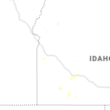
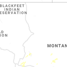
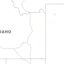
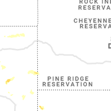
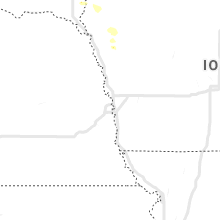
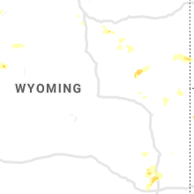
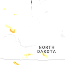
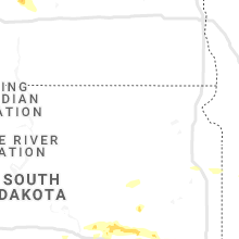
Hail Map for Friday, July 12, 2019

Number of Impacted Households on 7/12/2019
0
Impacted by 1" or Larger Hail
0
Impacted by 1.75" or Larger Hail
0
Impacted by 2.5" or Larger Hail
Square Miles of Populated Area Impacted on 7/12/2019
0
Impacted by 1" or Larger Hail
0
Impacted by 1.75" or Larger Hail
0
Impacted by 2.5" or Larger Hail


Cities Most Affected by Hail Storms of 7/12/2019
| Hail Size | Demographics of Zip Codes Affected | ||||||
|---|---|---|---|---|---|---|---|
| City | Count | Average | Largest | Pop Density | House Value | Income | Age |
| Homestead, MT | 1 | 1.75 | 1.75 | 3 | $95k | $18.1k | 53.5 |
| Lodgepole, NE | 1 | 1.75 | 1.75 | 1 | $41k | $30.4k | 50.0 |
| Lefor, ND | 1 | 1.75 | 1.75 | 1 | $51k | $26.3k | 51.8 |
Hail and Wind Damage Spotted on 7/12/2019
Filter by Report Type:Hail ReportsWind Reports
States Impacted
South Dakota, Minnesota, Michigan, North Carolina, Iowa, Colorado, Wyoming, Idaho, North Dakota, Montana, NebraskaSouth Dakota
| Local Time | Report Details |
|---|---|
| 9:50 AM CDT | Quarter sized hail reported near Wessington Springs, SD, 93.5 miles ESE of Pierre, SD |
| 10:19 AM CDT | Quarter sized hail reported near Mitchell, SD, 72.9 miles WNW of Sioux Falls, SD |
| 10:51 AM CDT | Half Dollar sized hail reported near , , 57.3 miles WNW of Sioux Falls, SD, quarter to half dollar sized hail. |
| 8:56 PM MDT | Wind gust from outflow boundary well ahead of thunderstorms in fall river county SD, 66.9 miles SW of Rapid City, SD |
Minnesota
| Local Time | Report Details |
|---|---|
| 11:35 AM CDT | Trees and power lines down... blocking traffic in belview. relayed to nws by wcco-t in redwood county MN, 30.9 miles SE of Montevideo, MN |
| 12:30 PM CDT | A few small tree branches down. picture via twitte in renville county MN, 37.2 miles ESE of Montevideo, MN |
| 12:45 PM CDT | Corrects time on previous tstm wnd dmg report from gaylord. 20 foot tall tree snapped... fell and crushed minivan in parking lo in sibley county MN, 55.5 miles WSW of Minneapolis, MN |
| 12:53 PM CDT | Tree was blown over and fell on to an apartment building... causing some structural damag in carver county MN, 35.7 miles WSW of Minneapolis, MN |
| 1:00 PM CDT | Large tree branch broke onto a vehicle. pictures shared via twitte in scott county MN, 27.9 miles SW of Minneapolis, MN |
| 1:00 PM CDT | Several larger tree branches down (4+ inch in diameter) time is estimated from rada in scott county MN, 35.1 miles SW of Minneapolis, MN |
| 1:05 PM CDT | Tree down on main street in arlingto in sibley county MN, 47.5 miles WSW of Minneapolis, MN |
| 1:06 PM CDT | 1 foot diameter tree snapped off on 80th st. and babcock av in mcleod county MN, 41.5 miles WSW of Minneapolis, MN |
| 1:09 PM CDT | Multiple large branches down... some blocking road. via spotternetwork.or in scott county MN, 18.8 miles SW of Minneapolis, MN |
| 1:12 PM CDT | Numerous branches and trees up to one foot in diameter dow in scott county MN, 34.1 miles SW of Minneapolis, MN |
| 1:15 PM CDT | 20 foot tall tree snapped... fell and crushed minivan in parking lo in sibley county MN, 55.5 miles WSW of Minneapolis, MN |
| 1:16 PM CDT | Trained spotter measured gust of 59 mph... via spotternetwork.or in scott county MN, 24.7 miles SSW of Minneapolis, MN |
| 1:20 PM CDT | A few larger branches (6 in. + diameter) down via pictures shared on social media. time estimated from rada in scott county MN, 15.6 miles SSW of Minneapolis, MN |
| 1:22 PM CDT | Measured 58 mph wind gust by emergency manage in scott county MN, 15.8 miles SSW of Minneapolis, MN |
| 1:35 PM CDT | Multiple small and big branches dow in dakota county MN, 17.9 miles S of Minneapolis, MN |
| 1:45 PM CDT | Two 4-6 inch branches down... one on home... at normandale and old shakopee roa in hennepin county MN, 12.4 miles SSW of Minneapolis, MN |
Michigan
| Local Time | Report Details |
|---|---|
| 1:16 PM EDT | Aspen trees reported down in the area; spotter measured 37mph winds (height unknown) with pea size hail and 0.45 inches of rain within about a 10 minute perio in baraga county MI, 57 miles W of Marquette, MI |
North Carolina
| Local Time | Report Details |
|---|---|
| 2:55 PM EDT | Emergency mngr reported trees blown down on mud cut r in mcdowell county NC, 60.9 miles NNE of Greenville, SC |
Iowa
| Local Time | Report Details |
|---|---|
| 2:46 PM CDT | Quarter sized hail reported near Maurice, IA, 49.6 miles SE of Sioux Falls, SD, mostly pea size... one or two quarters. |
| 3:20 PM CDT | Quarter sized hail reported near Hawarden, IA, 38.9 miles SSE of Sioux Falls, SD, pea sized with a couple quarters. |
Colorado
| Local Time | Report Details |
|---|---|
| 2:04 PM MDT | Asos station kcos colorado springs airpor in el paso county CO, 38.5 miles N of Pueblo, CO |
| 7:30 PM MDT | Quarter sized hail reported near Ovid, CO, 60.7 miles NNE of Yuma, CO |
Wyoming
| Local Time | Report Details |
|---|---|
| 3:45 PM MDT | Kwrl worland asos in washakie county WY, 67.9 miles NNE of Riverton, WY |
| 5:15 PM MDT | Spotter reported a wind gust of 67 mph. spotter lives on a ridge. small -little green blob- shower went over the area at the time and likely collapsed over the spotters in hot springs county WY, 44.5 miles N of Riverton, WY |
| 5:45 PM MDT | Storm damage reported in campbell county WY, 29.4 miles SSW of Gillette, WY |
| 7:05 PM MDT | Quarter sized hail reported near Hulett, WY, 41.4 miles NE of Gillette, WY |
Idaho
| Local Time | Report Details |
|---|---|
| 5:49 PM MDT | 72 mph wind gust measured 1 mile west of glenns ferry. home weather statio in elmore county ID, 51.1 miles WNW of Twin Falls, ID |
| 7:35 PM MDT | Thunderstorm wind gust partially broke 1 power pole near the base along n holmes ave. pole leaning over the road. photo submitted by the public to kifi local news 8 fac in bonneville county ID, 2.2 miles NNE of Idaho Falls, ID |
| 8:15 PM MDT | Mesonet station dw9069. strong outflow winds from showers and thunderstorm in jefferson county ID, 11 miles NNE of Idaho Falls, ID |
| 8:38 PM MDT | Top half of a pine tree snapped off in the parking lot of nws pocatello. trunk was approximately 10 inches in diameter at the point where it broke. plastic recycling en in power county ID, 49.4 miles SW of Idaho Falls, ID |
| 8:39 PM MDT | Pocatello regional airport. thunderstorm outflow wind in power county ID, 47.6 miles SW of Idaho Falls, ID |
| 8:45 PM MDT | Idaho state journal reports that a large electrical road sign for construction was blown onto i-15 and slammed into a pair of vehicle in bannock county ID, 45.6 miles SSW of Idaho Falls, ID |
| 8:45 PM MDT | Small to medium size tree blown down in front of kpvi channel in bannock county ID, 47.6 miles SSW of Idaho Falls, ID |
North Dakota
| Local Time | Report Details |
|---|---|
| 7:07 PM CDT | Ndawn mesonet sit in divide county ND, 42.9 miles NNW of Williston, ND |
| 8:35 PM CDT | Storm damage reported in williams county ND, 37 miles ENE of Williston, ND |
| 8:40 PM CDT | Large 8 inch tree branch broken. time estimated via rada in williams county ND, 34.2 miles ENE of Williston, ND |
| 9:32 PM CDT | Storm damage reported in mountrail county ND, 51.6 miles W of Minot, ND |
| 8:35 PM MDT | Golf Ball sized hail reported near Lefor, ND, 85.6 miles W of Bismarck, ND, small tree branches also broken. time estimated from radar. |
| 9:24 PM MDT | North dakota agricultural weather network (ndawn) statio in hettinger county ND, 79.2 miles WSW of Bismarck, ND |
| 9:25 PM MDT | North dakota agricultural weather network (ndawn) statio in hettinger county ND, 79.2 miles WSW of Bismarck, ND |
| 9:30 PM MDT | 12 inch diameter tree branch snapped off. reports of broken windows in mot in hettinger county ND, 79.3 miles WSW of Bismarck, ND |
Montana
| Local Time | Report Details |
|---|---|
| 6:15 PM MDT | Ping Pong Ball sized hail reported near Whitehall, MT, 52.8 miles WNW of Bozeman, MT |
| 6:30 PM MDT | Time estimated from rada in sheridan county MT, 47.2 miles WNW of Williston, ND |
| 6:38 PM MDT | Quarter sized hail reported near Homestead, MT, 43.6 miles WNW of Williston, ND, nickel-sized hail with gusty winds... followed by a quick hit of quarter-sized hail. time estimated from radar. |
| 6:40 PM MDT | Measured 84 mph wind gust along with hail to golf-ball siz in sheridan county MT, 39.2 miles WNW of Williston, ND |
| 6:40 PM MDT | Golf Ball sized hail reported near Homestead, MT, 39.7 miles WNW of Williston, ND, wind-blown golf ball sized hail broke out windows on the north side of a house. time esitmated from radar. |
| 6:50 PM MDT | Quarter sized hail reported near Dagmar, MT, 33.9 miles WNW of Williston, ND, quarter-sized hail... with some slightly larger. also had 0.67 inches of rain in 15 minutes. time estimated from radar. |
| 8:00 PM MDT | Ping Pong Ball sized hail reported near Winston, MT, 64 miles NNW of Bozeman, MT, picture and video show multiple hailstones over an inch in diameter. |
Nebraska
| Local Time | Report Details |
|---|---|
| 6:46 PM MDT | Golf Ball sized hail reported near Lodgepole, NE, 67.4 miles SE of Scottsbluff, NE |
| 8:29 PM MDT | Winds recorded from automated weather statio in keith county NE, 47 miles W of North Platte, NE |
| 8:35 PM MDT | Measured at the ogallala airpor in keith county NE, 51 miles W of North Platte, NE |
| 8:49 PM MDT | Report via automated weather statio in perkins county NE, 39.1 miles WSW of North Platte, NE |
| 10:13 PM CDT | Wind gust recorded on automated weather statio in lincoln county NE, 18.4 miles WSW of North Platte, NE |
| 10:55 PM CDT | Multiple power lines down around east d and east e streets. fire department reports tree limbs have knocked lines down. also power transformer on east d street is on fi in lincoln county NE, 0.6 miles SW of North Platte, NE |
| 11:09 PM CDT | Reports of tree limbs down from high winds and some power outage in lincoln county NE, 19.2 miles W of North Platte, NE |
| 11:34 PM CDT | Storm damage reported in thomas county NE, 59.1 miles N of North Platte, NE |
| 11:45 PM CDT | Quarter sized hail reported near Gothenburg, NE, 32.4 miles E of North Platte, NE, estimated a little larger than quarter size but not as large as half dollar. |
| 11:45 PM CDT | Quarter sized hail reported near Gothenburg, NE, 32 miles E of North Platte, NE |
| 1:00 AM CDT | Quarter sized hail reported near Miller, NE, 55 miles W of Grand Island, NE |
| 2:55 AM CDT | Quarter sized hail reported near Norfolk, NE, 67.1 miles ESE of Oneill, NE, mostly nickels... but a few as large as quarters. |
Connect with Interactive Hail Maps