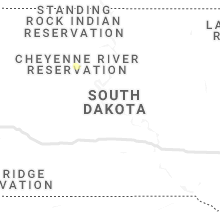
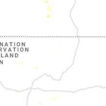
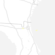
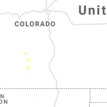
Hail Map for Thursday, July 22, 2021

Number of Impacted Households on 7/22/2021
0
Impacted by 1" or Larger Hail
0
Impacted by 1.75" or Larger Hail
0
Impacted by 2.5" or Larger Hail
Square Miles of Populated Area Impacted on 7/22/2021
0
Impacted by 1" or Larger Hail
0
Impacted by 1.75" or Larger Hail
0
Impacted by 2.5" or Larger Hail
Regions Impacted by Hail on 7/22/2021
Cities Most Affected by Hail Storms of 7/22/2021
| Hail Size | Demographics of Zip Codes Affected | ||||||
|---|---|---|---|---|---|---|---|
| City | Count | Average | Largest | Pop Density | House Value | Income | Age |
Hail and Wind Damage Spotted on 7/22/2021
Filter by Report Type:Hail ReportsWind Reports
Utah
| Local Time | Report Details |
|---|---|
| 1:20 PM MDT | Ping Pong Ball sized hail reported near Bryce, UT, 66.3 miles S of Monroe, UT |
| 7:30 PM MDT | Multiple downed trees on homes in the midvale area... snapped full sized trees... power outage in salt lake county UT, 10.3 miles S of Salt Lake City, UT |
| 7:30 PM MDT | 60 mph wind gust at home sensor in daybreak... storm drains overwhelemed by heavy rainfal in salt lake county UT, 17.5 miles SSW of Salt Lake City, UT |
| 7:30 PM MDT | Storm damage reported in davis county UT, 8.6 miles NNE of Salt Lake City, UT |
| 8:30 PM MDT | Damage to homes... roofing on shed... downed full-sized trees in salt lake county UT, 9 miles S of Salt Lake City, UT |
Montana
| Local Time | Report Details |
|---|---|
| 1:39 PM MDT | 6 inch diameter tree limbs blown down in custer county MT, 0.5 miles S of Miles City, MT |
| 1:41 PM MDT | Mesonet station mtbvr 3.8 ne hodges (mt dot in dawson county MT, 83.7 miles ENE of Miles City, MT |
| 1:53 PM MDT | Higher wind gust of 73 updates the previous report for mesonet station mtbvr 3.8 ne hodges (mt dot in dawson county MT, 83.7 miles ENE of Miles City, MT |
| 2:12 PM MDT | Corrects previous tstm wnd gst report from belgrade. asos station kbzn bozeman yellowstone airpor in gallatin county MT, 9.6 miles NW of Bozeman, MT |
| 2:16 PM MDT | Pictures submitted on social media of medium sized out building flipped upside down from strong wind. tree damage also reporte in gallatin county MT, 14 miles N of Bozeman, MT |
| 2:27 PM MDT | Asos station kbzn bozeman yellowstone airpor in gallatin county MT, 9.6 miles NW of Bozeman, MT |
| 3:21 PM MDT | Storm damage reported in carter county MT, 74.2 miles NE of Gillette, WY |
| 3:51 PM MDT | Storm damage reported in carter county MT, 74.2 miles NE of Gillette, WY |
| 6:35 PM MDT | Mesonet station ggwfp 2.4 e fort peck (ggwwfo). time estimated by rada in mccone county MT, 16.8 miles SE of Glasgow, MT |
| 6:40 PM MDT | Report through social media. sustained shingles off the roo in valley county MT, 3.9 miles SE of Glasgow, MT |
| 6:41 PM MDT | Asos station kggw glasgow airport (asos in valley county MT, 1.9 miles NNE of Glasgow, MT |
| 6:45 PM MDT | Tree damage reported by nws employee. time estimate in valley county MT, 0.5 miles NE of Glasgow, MT |
| 6:45 PM MDT | Twenty year old pine tree down. reported via social media. time estimate in valley county MT, 2.5 miles NNW of Glasgow, MT |
| 7:32 PM MDT | Asos station kolf wolf point airpor in roosevelt county MT, 49.3 miles E of Glasgow, MT |
| 7:48 PM MDT | Mesonet station mtmcd 8.5 sw bredette (mt dot in roosevelt county MT, 57.5 miles ENE of Glasgow, MT |
| 7:55 PM MDT | Corrects previous tstm wnd gst report from 7 s scobey. public report via social media... 65 mph winds and 0.3 inches of rain. time estimated by rada in daniels county MT, 65.6 miles ENE of Glasgow, MT |
| 8:00 PM MDT | Awos station kpo1 popla in roosevelt county MT, 68 miles E of Glasgow, MT |
| 8:19 PM MDT | Navajo mdt site on mt 5 at mp 16. in daniels county MT, 80.4 miles NW of Williston, ND |
Nevada
| Local Time | Report Details |
|---|---|
| 1:51 PM PDT | Large tree down near paso verde and calle verd in clark county NV, 11.4 miles SSE of Las Vegas, NV |
| 1:52 PM PDT | Roof partially torn off a parking structur in clark county NV, 12.6 miles S of Las Vegas, NV |
| 1:55 PM PDT | Large tree dow in clark county NV, 10.8 miles SSE of Las Vegas, NV |
| 1:55 PM PDT | Large tree dow in clark county NV, 11.6 miles SSE of Las Vegas, NV |
| 1:56 PM PDT | Large tree dow in clark county NV, 10.4 miles SSE of Las Vegas, NV |
| 1:56 PM PDT | Several trees down at the arroyo grande sports comple in clark county NV, 9.8 miles SSE of Las Vegas, NV |
| 1:56 PM PDT | Large tree dow in clark county NV, 11.8 miles SSE of Las Vegas, NV |
| 1:57 PM PDT | Large tree down along auto mall driv in clark county NV, 10.4 miles SE of Las Vegas, NV |
| 1:59 PM PDT | Wind measured near cowabunga bay water park. data courtesy earth network in clark county NV, 9.7 miles SE of Las Vegas, NV |
| 2:00 PM PDT | Wind measured near the intersection of green valley place and paseo verde parkway. data courtesy earth network in clark county NV, 11 miles SSE of Las Vegas, NV |
| 2:00 PM PDT | Utility pole dow in clark county NV, 8.4 miles SE of Las Vegas, NV |
| 2:01 PM PDT | 6 to 8 power poles down along boulder highway near tropican in clark county NV, 7.1 miles SE of Las Vegas, NV |
| 2:03 PM PDT | Wind measured near the intersection of reunion drive and anthem parkway. data courtesy earth network in clark county NV, 13.7 miles SSE of Las Vegas, NV |
| 2:04 PM PDT | Wind measured near wetlands park lane and hollywood drive. data courtesy earth network in clark county NV, 7.9 miles SE of Las Vegas, NV |
| 3:10 PM PDT | Wind measured at creech air force bas in clark county NV, 40.8 miles NW of Las Vegas, NV |
| 3:18 PM PDT | Large tree down on ca in clark county NV, 14.1 miles S of Las Vegas, NV |
South Carolina
| Local Time | Report Details |
|---|---|
| 5:11 PM EDT | A picture of a fallen tree due to outflow was shared on social media. the tree fell on a powerline on thomas hamilton roa in hampton county SC, 54.8 miles N of Savannah, GA |
South Dakota
| Local Time | Report Details |
|---|---|
| 3:30 PM MDT | Storm damage reported in harding county SD, 95.4 miles ESE of Miles City, MT |
| 3:40 PM MDT | Storm damage reported in harding county SD, 105.3 miles ESE of Miles City, MT |
| 3:55 PM MDT | Storm damage reported in harding county SD, 106 miles N of Rapid City, SD |
| 3:59 PM MDT | Storm damage reported in harding county SD, 124 miles ESE of Miles City, MT |
| 4:04 PM MDT | Storm damage reported in harding county SD, 106 miles N of Rapid City, SD |
| 4:09 PM MDT | Storm damage reported in harding county SD, 124 miles ESE of Miles City, MT |
| 4:40 PM MDT | Storm damage reported in butte county SD, 71.1 miles N of Rapid City, SD |
| 4:59 PM MDT | Storm damage reported in perkins county SD, 113.3 miles SW of Bismarck, ND |
| 5:15 PM MDT | Storm damage reported in meade county SD, 66.7 miles NNE of Rapid City, SD |
| 5:48 PM MDT | Storm damage reported in ziebach county SD, 103.8 miles NW of Pierre, SD |
| 6:25 PM MDT | Storm damage reported in ziebach county SD, 85.5 miles NW of Pierre, SD |
North Dakota
| Local Time | Report Details |
|---|---|
| 3:55 PM MDT | Awos station kbww bowman airpor in bowman county ND, 123.1 miles E of Miles City, MT |
| 4:24 PM MDT | Storm damage reported in harding county SD, 123.4 miles N of Rapid City, SD |
| 4:30 PM MDT | Storm damage reported in harding county SD, 123.4 miles N of Rapid City, SD |
| 4:45 PM MDT | Storm damage reported in harding county SD, 123.4 miles N of Rapid City, SD |
| 4:53 PM MDT | Asos station khei hettinger airpor in adams county ND, 104.6 miles WSW of Bismarck, ND |
| 5:37 PM MDT | Mesonet station tt584 12 e mot in hettinger county ND, 68.3 miles WSW of Bismarck, ND |
Florida
| Local Time | Report Details |
|---|---|
| 7:15 PM EDT | Pine tree down near the intersection of state road 121 and southern state nursery road. tree estimated 6 inches in diameter. radar estimated tim in baker county FL, 29 miles WSW of Jacksonville, FL |
| 7:20 PM EDT | Report from mping: trees uprooted or snapped near state road 121 and jeff starling roa in baker county FL, 28.3 miles WSW of Jacksonville, FL |
| 8:05 PM EDT | Tree down on jammes road just south of 103rd st. radar estimated tim in duval county FL, 7.9 miles SW of Jacksonville, FL |
Arizona
| Local Time | Report Details |
|---|---|
| 5:30 PM MST | Power outage affecting chui chu and white horse pass. reports of a power pole down on the highway on rt 15 near white horse pass turn off. sourced from power utility co in pinal county AZ, 53.7 miles SSE of Phoenix, AZ |


Connect with Interactive Hail Maps