Hail Map for Thursday, July 29, 2021

Number of Impacted Households on 7/29/2021
0
Impacted by 1" or Larger Hail
0
Impacted by 1.75" or Larger Hail
0
Impacted by 2.5" or Larger Hail
Square Miles of Populated Area Impacted on 7/29/2021
0
Impacted by 1" or Larger Hail
0
Impacted by 1.75" or Larger Hail
0
Impacted by 2.5" or Larger Hail
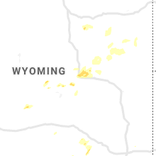
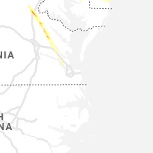
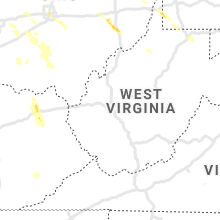
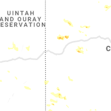
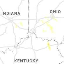
Regions Impacted by Hail on 7/29/2021
Cities Most Affected by Hail Storms of 7/29/2021
| Hail Size | Demographics of Zip Codes Affected | ||||||
|---|---|---|---|---|---|---|---|
| City | Count | Average | Largest | Pop Density | House Value | Income | Age |
| Fredericksburg, VA | 3 | 1.92 | 2.25 | 315 | $160k | $65.0k | 36.6 |
| Jamestown, OH | 1 | 1.75 | 1.75 | 83 | $103k | $47.2k | 40.4 |
Hail and Wind Damage Spotted on 7/29/2021
Filter by Report Type:Hail ReportsWind Reports
States Impacted
Ohio, New York, Pennsylvania, Delaware, Maryland, Utah, Virginia, New Jersey, Florida, Colorado, Indiana, Kentucky, Nevada, Massachusetts, MissouriOhio
| Local Time | Report Details |
|---|---|
| 9:00 AM EDT | 50 knot peak wind. mesonet station loro1 2 nnw lorai in lez145 county OH, 26 miles W of Cleveland, OH |
| 11:36 AM EDT | Storm damage reported in ashtabula county OH, 49.7 miles ENE of Cleveland, OH |
| 11:47 AM EDT | Tree and wires dow in ashtabula county OH, 58 miles ENE of Cleveland, OH |
| 3:09 PM EDT | Quarter sized hail reported near Columbus, OH, 2 miles N of Columbus, OH, multiple reports of quarter sized hai near short north and downtown columbus. |
| 3:13 PM EDT | Wires reported down and large tree branches reported down across the city. time estimated from rada in franklin county OH, 0.2 miles SE of Columbus, OH |
| 3:49 PM EDT | Large tree limb down in franklin county OH, 14.8 miles NW of Columbus, OH |
| 4:01 PM EDT | Multiple trees downed on dyer rd in mt. sterling. garage door was also blown in and damage in madison county OH, 21.9 miles SW of Columbus, OH |
| 4:59 PM EDT | Multiple reports of trees and power lines reported down. time estimated from rada in madison county OH, 21.9 miles SW of Columbus, OH |
| 5:04 PM EDT | 20x30ft shed destroyed and chimney blown off house near 3100 channel roa in carroll county OH, 53.7 miles WNW of Pittsburgh, PA |
| 5:05 PM EDT | Report of trees down and a neighbor's machinery shed destroyed in washingtown townshi in carroll county OH, 53.1 miles WNW of Pittsburgh, PA |
| 5:06 PM EDT | Trees and utility poles down along state route 39 in carroll county OH, 53.6 miles WNW of Pittsburgh, PA |
| 5:08 PM EDT | Ping Pong Ball sized hail reported near Caldwell, OH, 82.8 miles ESE of Columbus, OH |
| 5:17 PM EDT | Multiple trees down on us-62n. time est from rada in fayette county OH, 30.3 miles SW of Columbus, OH |
| 5:40 PM EDT | Widespread damage with utility lines and trees down being reported across jefferson county... o in jefferson county OH, 37.6 miles W of Pittsburgh, PA |
| 5:42 PM EDT | A barn is destroyed and a number of trees are down across the villag in pickaway county OH, 30 miles SSW of Columbus, OH |
| 5:46 PM EDT | Tree down in greene county OH, 45.6 miles WSW of Columbus, OH |
| 5:48 PM EDT | Large tree limb down on garage in greene county OH, 44.3 miles WSW of Columbus, OH |
| 5:50 PM EDT | Report of numerous trees down... windows broken... collapsed roof and home on bantam ridge in wintersvill in jefferson county OH, 37.8 miles W of Pittsburgh, PA |
| 6:00 PM EDT | Trees snapped and a tree uproote in greene county OH, 43.5 miles WSW of Columbus, OH |
| 6:08 PM EDT | Golf Ball sized hail reported near Jamestown, OH, 45.2 miles WSW of Columbus, OH, waynesville jamestown rd |
| 6:14 PM EDT | Trees and power lines reported dow in pike county OH, 55.6 miles S of Columbus, OH |
| 6:46 PM EDT | Trees reported down. time estimated from rada in pike county OH, 69.5 miles S of Columbus, OH |
| 8:21 PM EDT | Multiple trees and power lines down in the northern part of the county including otway. time estimated from rada in scioto county OH, 72.6 miles ESE of Cincinnati, OH |
New York
| Local Time | Report Details |
|---|---|
| 10:47 AM EDT | Report of a downed tree on route 62 between abbey hill rd and little r in chautauqua county NY, 48.6 miles SSW of Buffalo, NY |
| 7:45 PM EDT | A few trees down in saratoga spring in saratoga county NY, 19.6 miles NNE of Schenectady, NY |
| 8:10 PM EDT | A few trees down in halfmoon townshi in saratoga county NY, 10.7 miles ENE of Schenectady, NY |
| 8:20 PM EDT | Tree on wire in rensselaer county NY, 30.6 miles ENE of Schenectady, NY |
| 9:30 PM EDT | Road closure between route 22 and county route 5 due to tree and wires down. time estimated by rada in columbia county NY, 37.4 miles SE of Schenectady, NY |
Pennsylvania
| Local Time | Report Details |
|---|---|
| 1:06 PM EDT | Numerous trees uprooted closing barkeyville rd. corrected for road nam in venango county PA, 51.2 miles N of Pittsburgh, PA |
| 1:53 PM EDT | Trees on wire in clearfield county PA, 31 miles W of State College, PA |
| 2:05 PM EDT | Mutliple trees down and structural damage in saltlick twp in fayette county PA, 38.4 miles SE of Pittsburgh, PA |
| 2:06 PM EDT | Report from mping: homes/buildings completely destroye in fayette county PA, 38.4 miles SE of Pittsburgh, PA |
| 2:08 PM EDT | Report from mping: trees uprooted or snapped; roof blown of in fayette county PA, 38 miles SE of Pittsburgh, PA |
| 2:08 PM EDT | Multiple trees down in westmoreland county PA, 41 miles SE of Pittsburgh, PA |
| 2:08 PM EDT | Report from mping: trees uprooted or snapped; roof blown of in fayette county PA, 38.8 miles SE of Pittsburgh, PA |
| 2:22 PM EDT | Widespread trees down in laurel hill state par in somerset county PA, 49.4 miles SE of Pittsburgh, PA |
| 3:50 PM EDT | Several trees down in kempton. time estimated from rada in berks county PA, 54.7 miles S of Scranton, PA |
| 4:05 PM EDT | Downed trees and power lines in the new tripoli area. some structural damage to an outside barn as well with pieces of roofing off. time estimated from rada in lehigh county PA, 50.6 miles S of Scranton, PA |
| 4:05 PM EDT | Utility poles dow in lehigh county PA, 54.7 miles S of Scranton, PA |
| 4:08 PM EDT | Trees and wires down. time estimated by rada in lehigh county PA, 51 miles S of Scranton, PA |
| 4:15 PM EDT | Trees and wires down with partially torn off roof of a building. possible tornado damage. time estimated by rada in lehigh county PA, 54.8 miles S of Scranton, PA |
| 4:27 PM EDT | Tree down and uprooted. time estimated by rada in lehigh county PA, 45.7 miles S of Scranton, PA |
| 4:28 PM EDT | Corrects previous tstm wnd dmg report from 1 nnw slatington to 428 pm. downed tree on power lines on shadow oaks lane. possible tornad in lehigh county PA, 44.9 miles S of Scranton, PA |
| 4:28 PM EDT | Planes damaged at slatington airpor in lehigh county PA, 45 miles S of Scranton, PA |
| 4:31 PM EDT | Multiple trees down on timberline rd. possible tornado. time estimated from rada in northampton county PA, 43.6 miles S of Scranton, PA |
| 4:31 PM EDT | Multiple trees down on timberline rd. possible tornado. time estimated from rada in northampton county PA, 43.6 miles S of Scranton, PA |
| 4:57 PM EDT | Downed trees and power lines on hafler road off apples church road in lower saucon township. time estimated from radar. possible tornad in northampton county PA, 61.5 miles SSE of Scranton, PA |
| 4:58 PM EDT | 3 to 4 buildings damaged at the intersection of leithsville rd and weavers ln. also some tree damage in the area. possible tornado. time estimated from rada in northampton county PA, 61.7 miles SSE of Scranton, PA |
| 5:00 PM EDT | Three buildings damaged near the intersection of leithsville road and weavers lan in northampton county PA, 61.7 miles SSE of Scranton, PA |
| 5:11 PM EDT | Several trees down... also have reports from buckingham and upper makefield. time estimated from rada in bucks county PA, 69 miles SSE of Scranton, PA |
| 5:17 PM EDT | Barn roof blown off structure; time estimate based on radar in indiana county PA, 49.2 miles ENE of Pittsburgh, PA |
| 5:30 PM EDT | Utility lines down along dilltown heights road in buffington township in indiana county PA, 52.7 miles E of Pittsburgh, PA |
| 5:30 PM EDT | Debris blocking fretz valley road... geigel hill road and creamery roa in bucks county PA, 63.8 miles WSW of Brooklyn, NY |
| 5:50 PM EDT | Widespread tree damage along with some damage to structures in buckingham townshi in bucks county PA, 60.1 miles WSW of Brooklyn, NY |
| 6:00 PM EDT | Numerous trees reported down in richhill twp. along day roa in greene county PA, 42.8 miles SW of Pittsburgh, PA |
| 6:10 PM EDT | Debris blocking pa route 3 in bucks county PA, 54 miles WSW of Brooklyn, NY |
| 6:12 PM EDT | Bleachers and a portable toilet where knocked over at blacklick valley high schoo in cambria county PA, 55.8 miles WSW of State College, PA |
| 6:23 PM EDT | Numerous trees reported down along crabapple drive on the north end of waynesbur in greene county PA, 38.5 miles SSW of Pittsburgh, PA |
| 7:05 PM EDT | Wind damage reported in the vicinity of grant ave and roosevelt blvd. branches down... roof covering blown off a building. time estimated from rada in philadelphia county PA, 69.2 miles SW of Brooklyn, NY |
| 7:07 PM EDT | Reports of damage to the lowes outdoor garden center just west of neshaminy mall. multiple trees down as well as windows blown out of vehicles. possible tornado. time e in bucks county PA, 64.6 miles SW of Brooklyn, NY |
| 7:10 PM EDT | Building damage and trees down in bensalem township near street road and the turnpik in bucks county PA, 65 miles SW of Brooklyn, NY |
Delaware
| Local Time | Report Details |
|---|---|
| 2:48 PM EDT | Trees down near hollymount... d in sussex county DE, 24.9 miles NNW of Ocean City, MD |
| 2:59 PM EDT | Quarter sized hail reported near Millsboro, DE, 23.1 miles NNW of Ocean City, MD, one inch hail reported north of long neck... de. |
Maryland
| Local Time | Report Details |
|---|---|
| 4:35 PM EDT | Tree damage was reported near gaither... including near the intersection of gaither road and forsythe roa in howard county MD, 20.3 miles WNW of Baltimore, MD |
| 4:52 PM EDT | Trees blew down on westbound us-40 baltimore national pike at bethany lan in howard county MD, 13.4 miles W of Baltimore, MD |
| 4:54 PM EDT | Tree down on i-695 baltimore beltway outer loop at exit 16a/westbound i-7 in baltimore county MD, 7 miles W of Baltimore, MD |
| 4:59 PM EDT | A tree blew down near the intersection of green mountain circle and painted cup. a tree blew down near the intersection of governor warfield parkway and little patuxent in howard county MD, 14.8 miles WSW of Baltimore, MD |
| 5:03 PM EDT | A tree blew down onto wires snapping a telephone pole in the 12000 block of bluhill roa in montgomery county MD, 29.8 miles SW of Baltimore, MD |
| 5:03 PM EDT | Large tree branches blew down onto wires in the 13000 block of turkey branch parkwa in montgomery county MD, 29.5 miles WSW of Baltimore, MD |
| 5:10 PM EDT | Large tree... telephone pole and wires down near the 12000 block of bluhill road in montgomery county MD, 29.8 miles SW of Baltimore, MD |
| 5:10 PM EDT | Large tree branches down onto wires on the 13000 block of turkey branch pkwy in montgomery county MD, 29.5 miles WSW of Baltimore, MD |
| 5:18 PM EDT | A few tree reported down along with heavy metal barrels flipped over near dorsey road and arundel av in anne arundel county MD, 9.6 miles SSW of Baltimore, MD |
| 5:21 PM EDT | 54 knot wind gust at bwi asos in anne arundel county MD, 9.1 miles SSW of Baltimore, MD |
| 5:27 PM EDT | Tree down on us 40 west in howard county MD, 13.4 miles W of Baltimore, MD |
| 5:36 PM EDT | Numerous trees... branches and wires blew down in the landover are in prince georges county MD, 28.8 miles SSW of Baltimore, MD |
| 5:42 PM EDT | Trees blew down near the intersection of md-214 central avenue and hill road/shady glen driv in prince georges county MD, 31.2 miles SSW of Baltimore, MD |
Utah
| Local Time | Report Details |
|---|---|
| 2:38 PM MDT | Half Dollar sized hail reported near Beaver, UT, 35.5 miles SW of Monroe, UT, reported at canyon breeze golf course. large mature pine tree also blown over. time estimated by radar. |
Virginia
| Local Time | Report Details |
|---|---|
| 5:15 PM EDT | Trees blew down in the area of stony hill road between cannon knolls drive and va-662 poplar roa in stafford county VA, 64.8 miles N of Richmond, VA |
| 5:15 PM EDT | Numerous trees down on the property of gauntlet golf club in stafford county VA, 64 miles N of Richmond, VA |
| 5:21 PM EDT | Tree down near the intersection of harmlin drive and sherwood drive in stafford county VA, 67.3 miles N of Richmond, VA |
| 5:23 PM EDT | Numerous trees down along va-655 holly corner roa in stafford county VA, 59.2 miles N of Richmond, VA |
| 5:25 PM EDT | Golf Ball sized hail reported near Fredericksburg, VA, 59.6 miles N of Richmond, VA |
| 5:25 PM EDT | 5 trees down along merlin way in stafford county VA, 59.6 miles N of Richmond, VA |
| 5:25 PM EDT | Golf Ball sized hail reported near Fredericksburg, VA, 60.1 miles N of Richmond, VA |
| 5:27 PM EDT | Hen Egg sized hail reported near Fredericksburg, VA, 59 miles N of Richmond, VA |
| 5:28 PM EDT | Tree debris blocks the ramp of i-95 to us-1 in stafford county VA, 58.4 miles N of Richmond, VA |
| 5:28 PM EDT | Several trees snapped along truslow roa in stafford county VA, 59.8 miles N of Richmond, VA |
| 5:28 PM EDT | Quarter sized hail reported near Fredericksburg, VA, 59.5 miles N of Richmond, VA |
| 5:28 PM EDT | 5-10 trees down along route 1 near the crossing of the rappahannock rive in stafford county VA, 57.9 miles N of Richmond, VA |
| 5:28 PM EDT | Quarter sized hail reported near Fredericksburg, VA, 57.7 miles NNE of Richmond, VA, numerous reports of quarter size hail in the falmouth area |
| 5:28 PM EDT | A tree blew down in the 100 block of west river bend roa in spotsylvania county VA, 57.8 miles N of Richmond, VA |
| 5:31 PM EDT | Tree down on cannon knolls drive in stafford county VA, 64.8 miles N of Richmond, VA |
| 5:31 PM EDT | Tree down near the intersection of route 1050 north at mt. pleasant blvd in stafford county VA, 58.7 miles N of Richmond, VA |
| 5:31 PM EDT | Tree down near the intersection of harmlin drive and sherwood drive in stafford county VA, 67.3 miles N of Richmond, VA |
| 5:31 PM EDT | 3 trees down on homes on the 800 block of spring valley driv in stafford county VA, 58.6 miles N of Richmond, VA |
| 5:31 PM EDT | Trees blew down near the intersection of us-1 cambridge street and carter stree in stafford county VA, 57.2 miles N of Richmond, VA |
| 5:35 PM EDT | 5 trees down within the city limits. about 1 foot diamete in city of fredericks county VA, 55.6 miles N of Richmond, VA |
| 5:38 PM EDT | A tree blew down on va-636 mine road near first iron boulevar in spotsylvania county VA, 52.4 miles N of Richmond, VA |
| 6:15 PM EDT | Numerous trees and powerlines down across caroline county. time approximated from rada in caroline county VA, 39.5 miles NNE of Richmond, VA |
| 6:17 PM EDT | Report of roof lifted off of a house along alps dr. time estimated via rada in caroline county VA, 42.3 miles NE of Richmond, VA |
| 6:19 PM EDT | Rv destroyed along alps driv in caroline county VA, 41.6 miles NE of Richmond, VA |
| 6:44 PM EDT | Quarter sized hail reported near Saint Stephens Church, VA, 39.5 miles NE of Richmond, VA, barn and tree damage along with 1 inch hail off route 721 approx 4 miles north of st stephens church. |
| 6:46 PM EDT | Half Dollar sized hail reported near Saint Stephens Church, VA, 37.5 miles ENE of Richmond, VA |
| 6:46 PM EDT | Numerous trees down along chatham hill roa in king and queen county VA, 37.5 miles ENE of Richmond, VA |
| 6:58 PM EDT | Corrects previous tstm wnd dmg report from 1 ene rumford. widespread tree damage northeast of va-30 and between us-360 and walkerton rd in king william county. time est in king william county VA, 35.5 miles ENE of Richmond, VA |
| 7:02 PM EDT | Tree through house on little woodberry rd. time estimated from rada in king william county VA, 37.7 miles ENE of Richmond, VA |
| 7:04 PM EDT | Report from mping: trees uprooted or snapped; roof blown of in king william county VA, 38.8 miles ENE of Richmond, VA |
| 7:15 PM EDT | Numerous trees down across eastern king william count in king william county VA, 41.4 miles E of Richmond, VA |
| 7:55 PM EDT | Large branches reported down in town of norge. time radar estimate in james city county VA, 48.8 miles E of Richmond, VA |
| 8:00 PM EDT | Multiple areas of trees and powerlines down across the northern portion of james city county. time estimated from rada in james city county VA, 47.6 miles E of Richmond, VA |
| 8:00 PM EDT | Numerous reports of trees and large tree limbs downed on us-60. time is radar estimate in james city county VA, 49.3 miles E of Richmond, VA |
| 8:06 PM EDT | Widespread tree damage northeast of va-30 and between us-360 and walkerton rd in king william count in king william county VA, 35.5 miles ENE of Richmond, VA |
New Jersey
| Local Time | Report Details |
|---|---|
| 5:54 PM EDT | Large tree down on house on sylvan r in essex county NJ, 16.2 miles WNW of Brooklyn, NY |
| 5:54 PM EDT | Tree down on house on park av in essex county NJ, 16.6 miles NW of Brooklyn, NY |
| 5:54 PM EDT | Tree down on power lines and roa in essex county NJ, 16.2 miles NW of Brooklyn, NY |
| 5:57 PM EDT | Numerous reports of trees and lines down in new hope. possible tornado. time estimated from rada in bucks county PA, 55.2 miles WSW of Brooklyn, NY |
| 6:02 PM EDT | Few small trees blown down on timothy lane in bedminster. time estimated from rada in somerset county NJ, 34.3 miles W of Brooklyn, NY |
| 6:10 PM EDT | Trees down on nj route 29 with the highway close in mercer county NJ, 53.7 miles WSW of Brooklyn, NY |
| 6:10 PM EDT | Multiple trees down in titusville... nj. possible tornado. time estimated from rada in mercer county NJ, 53.8 miles WSW of Brooklyn, NY |
| 6:11 PM EDT | Trees and wires down on pleasant valley road in hopewel in mercer county NJ, 53.3 miles WSW of Brooklyn, NY |
| 6:19 PM EDT | Multiple trees snapped and uprooted near pennington... nj. possible tornado. time estimated from rada in mercer county NJ, 49.3 miles WSW of Brooklyn, NY |
| 6:25 PM EDT | Wires down along west church roa in mercer county NJ, 48.7 miles SW of Brooklyn, NY |
| 6:48 PM EDT | Lots of tree branches down and power is out in robbinsville north of 130. time estimated from rada in mercer county NJ, 46.9 miles SW of Brooklyn, NY |
| 7:05 PM EDT | Numerous trees down on voelbel road and perrineville road. possible tornado. times estimated from rada in mercer county NJ, 43.3 miles SW of Brooklyn, NY |
| 7:10 PM EDT | Trees and wires down along neck roa in burlington county NJ, 60.4 miles SW of Brooklyn, NY |
| 7:19 PM EDT | Ping Pong Ball sized hail reported near Willingboro, NJ, 65.9 miles SW of Brooklyn, NY, picture shared on social media of 1.5 inch hail in willingboro. time estimated from radar. |
| 7:19 PM EDT | Quarter sized hail reported near Beverly, NJ, 66.1 miles SW of Brooklyn, NY |
| 7:26 PM EDT | Quarter sized hail reported near Mount Holly, NJ, 64.3 miles SW of Brooklyn, NY |
| 7:29 PM EDT | Half Dollar sized hail reported near Mount Holly, NJ, 63.8 miles SW of Brooklyn, NY |
| 7:31 PM EDT | Half Dollar sized hail reported near Mount Holly, NJ, 64.1 miles SW of Brooklyn, NY, picture of hail near mount holly... nj. time estimated from radar. |
| 8:30 PM EDT | Several trees down in the silverton area of toms river. time estimated from rada in ocean county NJ, 47.1 miles S of Brooklyn, NY |
| 9:00 PM EDT | Downed utility pole and wires blocking nj route 72 eastbound near warren grove road in barnegat townshi in ocean county NJ, 65.6 miles SSW of Brooklyn, NY |
| 9:00 PM EDT | Utility pole and wires down blocking nj route 72 near whiting road in barnegat townshi in ocean county NJ, 64.9 miles SSW of Brooklyn, NY |
| 9:12 PM EDT | Widespread wind damage in high bar harbor. a roof was torn off a building... boats were overturned... utility poles were toppled and there was much debris on local road in ocean county NJ, 65.4 miles S of Brooklyn, NY |
Florida
| Local Time | Report Details |
|---|---|
| 5:15 PM CDT | Northwest beaches international airport measured a thunderstorm wind gust of 59 mp in bay county FL, 33.5 miles E of Miramar Beach, FL |
Colorado
| Local Time | Report Details |
|---|---|
| 5:30 PM MDT | Quarter sized hail reported near Walden, CO, 59.4 miles SW of Laramie, WY |
Indiana
| Local Time | Report Details |
|---|---|
| 8:00 PM EDT | Roofing material removed from a building at the intersection of pike and howar in shelby county IN, 26.1 miles SE of Indianapolis, IN |
| 8:07 PM EDT | Trees down. time estimated from rada in shelby county IN, 34.1 miles SE of Indianapolis, IN |
| 9:04 PM EDT | 2-3 inch diameter tree reported down on us 41 at camp arthur r in knox county IN, 52.1 miles N of Evansville, IN |
Kentucky
| Local Time | Report Details |
|---|---|
| 8:49 PM EDT | Multiple trees downed in garrison ky. corrected time of event based on rada in lewis county KY, 76.5 miles NE of Irvine, KY |
| 10:15 PM EDT | Multiple trees downed in garrison k in lewis county KY, 76.5 miles NE of Irvine, KY |
| 12:35 AM EDT | Breathitt county dispatch reported that a tree had been blown down onto ky-30 at round bottom and was blocking both lane in breathitt county KY, 36.7 miles ESE of Irvine, KY |
| 1:22 AM EDT | Breathitt and perry county dispatch reported that a tree was blown down on to ky-15 near the county line community church... blocking one of the lane in perry county KY, 43.9 miles ESE of Irvine, KY |
| 1:39 AM EDT | A few trees down in the county including one on a house in bere in madison county KY, 18.9 miles WSW of Irvine, KY |
| 3:45 AM CDT | One tree was reported down across a hous in green county KY, 52.3 miles SSE of Louisville, KY |
Nevada
| Local Time | Report Details |
|---|---|
| 5:56 PM PDT | Nv dot weather station in the eldorado valley along highway 95... southwest of boulder city reported a peak wind gust of 62 mp in clark county NV, 22.7 miles SSE of Las Vegas, NV |
| 7:08 PM PDT | 59 mph wind gust near south valley view blvd and meadows ln. data courtesy of earth network in clark county NV, 2.8 miles W of Las Vegas, NV |
Massachusetts
| Local Time | Report Details |
|---|---|
| 9:25 PM EDT | Trees and wires down. time estimated by rada in berkshire county MA, 43.9 miles ESE of Schenectady, NY |
| 10:26 PM EDT | Trees down on road. time estimated by rada in berkshire county MA, 62.4 miles SE of Schenectady, NY |
Missouri
| Local Time | Report Details |
|---|---|
| 8:30 PM CDT | Krcg tv relayed public report of tree limb damage at moberly community college campus. estimated 6 to 8 inch diameter limb fel in randolph county MO, 33 miles NNW of Columbia, MO |








Connect with Interactive Hail Maps