

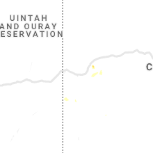
Hail Map for Wednesday, July 28, 2021

Number of Impacted Households on 7/28/2021
0
Impacted by 1" or Larger Hail
0
Impacted by 1.75" or Larger Hail
0
Impacted by 2.5" or Larger Hail
Square Miles of Populated Area Impacted on 7/28/2021
0
Impacted by 1" or Larger Hail
0
Impacted by 1.75" or Larger Hail
0
Impacted by 2.5" or Larger Hail


Cities Most Affected by Hail Storms of 7/28/2021
| Hail Size | Demographics of Zip Codes Affected | ||||||
|---|---|---|---|---|---|---|---|
| City | Count | Average | Largest | Pop Density | House Value | Income | Age |
| Scottsville, VA | 1 | 2.00 | 2.00 | 45 | $102k | $39.0k | 41.0 |
| Kelliher, MN | 1 | 1.75 | 1.75 | 3 | $32k | $21.4k | 48.3 |
| Great Mills, MD | 1 | 1.75 | 1.75 | 1050 | $133k | $59.7k | 33.4 |
Hail and Wind Damage Spotted on 7/28/2021
Filter by Report Type:Hail ReportsWind Reports
States Impacted
Minnesota, Virginia, North Carolina, Pennsylvania, Texas, Maryland, South Carolina, Utah, Georgia, Arizona, Colorado, California, Wisconsin, Iowa, Illinois, Michigan, IndianaMinnesota
| Local Time | Report Details |
|---|---|
| 7:15 AM CDT | Quarter sized hail reported near Bemidji, MN, 0.5 miles N of Bemidji, MN, reported via social media. time estimated by radar. |
| 7:15 AM CDT | Half Dollar sized hail reported near Bemidji, MN, 5.1 miles NW of Bemidji, MN, report relayed via social media. time estimated from radar. |
| 10:23 AM CDT | Quarter sized hail reported near Deer River, MN, 39.4 miles E of Bemidji, MN, observation at cut foot sioux resort. |
| 11:40 AM CDT | Quarter sized hail reported near Angle Inlet, MN, 50.3 miles NE of Roseau, MN, hail brushed the northwest angle of minnesota across to oak islandbetwen 1130 and 1150 am. most hail ranged from pea to dime sized. some up to quarter sized fell near t |
| 11:40 AM CDT | Quarter sized hail reported near Angle Inlet, MN, 50 miles NE of Roseau, MN, hail brushed the northwest angle of minnesota across to oak islandbetwen 1130 and 1150 am. most hail ranged from pea to dime sized. some up to quarter sized fell near t |
| 7:00 PM CDT | Golf Ball sized hail reported near Kelliher, MN, 38 miles NNE of Bemidji, MN |
| 8:25 PM CDT | Quarter sized hail reported near Federal Dam, MN, 34.9 miles ESE of Bemidji, MN |
| 8:48 PM CDT | Quarter sized hail reported near Remer, MN, 53.8 miles ESE of Bemidji, MN |
Virginia
| Local Time | Report Details |
|---|---|
| 12:45 PM EDT | Tree down on a garage. some other trees down across the area with power outage in city of hampton county VA, 28.4 miles NW of Virginia Beach, VA |
| 1:45 PM EDT | Trees down along kings highway. lots of debris in the road from high win in city of suffolk county VA, 28 miles WNW of Virginia Beach, VA |
| 2:25 PM EDT | Tree on a home in the hickory are in city of chesapeake county VA, 11.5 miles SW of Virginia Beach, VA |
| 9:00 PM EDT | Trees downed along us-33 (jefferson highway) at paynes mill. numerous power outages reported in the area. time is radar-estimate in louisa county VA, 26.9 miles NNW of Richmond, VA |
| 9:40 PM EDT | Trees down across broad street near the intersection of oilville roa in goochland county VA, 15.5 miles NNW of Richmond, VA |
| 9:40 PM EDT | Tree down on i-64 exit ramp at oilvill in goochland county VA, 15.9 miles NNW of Richmond, VA |
| 9:40 PM EDT | Tree down at the intersection of broad street and pony farm roa in goochland county VA, 19.6 miles NNW of Richmond, VA |
| 9:50 PM EDT | Multiple trees downed along va-6 near state farm prison. time is radar estimate in goochland county VA, 13.7 miles NW of Richmond, VA |
| 10:05 PM EDT | Tree down on jefferson park ave near fry's spring beach clu in albemarle county VA, 59 miles NW of Richmond, VA |
| 10:06 PM EDT | Branches down on old lynchburg roa in albemarle county VA, 59 miles NW of Richmond, VA |
| 10:06 PM EDT | A tree blew down near the i-495 capital beltway/george washington memorial parkway interchange just south of the american legion bridg in fairfax county VA, 38.2 miles SW of Baltimore, MD |
| 10:08 PM EDT | Tree down on riva ridge drive at the intersection of schindel court and lockmeade cour in fairfax county VA, 43.4 miles WSW of Baltimore, MD |
| 10:19 PM EDT | Tree and wires down in the 1400 block of mayflower driv in fairfax county VA, 39.9 miles SW of Baltimore, MD |
| 10:20 PM EDT | Numerous trees down across central and eastern portions of powhatan count in powhatan county VA, 10.8 miles WNW of Richmond, VA |
| 10:23 PM EDT | Tree down on old dominion drive at linway terrac in fairfax county VA, 39.1 miles SW of Baltimore, MD |
| 10:24 PM EDT | Trees and branches blew down in east falls church... including along us-29 near north sycamore street and the east falls church metro. lawn furniture was blown into the in arlington county VA, 40.5 miles SW of Baltimore, MD |
| 10:32 PM EDT | Trees down on us-29 southbound before sycamore street. lawn furniture also blown into the roa in city of falls chur county VA, 41.4 miles SW of Baltimore, MD |
| 10:34 PM EDT | Several trees and branches were blown down near falls church... including on westmoreland street near beacon lan in fairfax county VA, 40.4 miles SW of Baltimore, MD |
| 11:01 PM EDT | Tree down on pole roa in fairfax county VA, 47.4 miles SW of Baltimore, MD |
| 11:03 PM EDT | Tree down on cunningham drive near mt vernon highwa in fairfax county VA, 47.1 miles SSW of Baltimore, MD |
| 11:13 PM EDT | Widespread tree and power line damage in scottsville. power poles snapped. several cars damaged by falling trees and/or wind driven hail. gas station awning blown ove in albemarle county VA, 50.3 miles WNW of Richmond, VA |
| 11:15 PM EDT | Report of a dozen large trees down across highway 20... about 2 miles south of james river. lots of debris in the roadwa in buckingham county VA, 49.3 miles WNW of Richmond, VA |
| 11:18 PM EDT | Hen Egg sized hail reported near Scottsville, VA, 51.1 miles WNW of Richmond, VA |
| 11:19 PM EDT | Pieces of roofing and siding torn off buildings in scottsvil in albemarle county VA, 50.3 miles WNW of Richmond, VA |
| 11:19 PM EDT | Half Dollar sized hail reported near Scottsville, VA, 50.3 miles WNW of Richmond, VA |
North Carolina
| Local Time | Report Details |
|---|---|
| 2:30 PM EDT | Media reports trees and power lines down near oak ridge duncan roa in harnett county NC, 19.8 miles SW of Raleigh, NC |
| 2:58 PM EDT | Fire department reports power lines down at oakridge river road and avery spence roa in harnett county NC, 21.2 miles SW of Raleigh, NC |
| 3:50 PM EDT | Large tree limbs downed on us-17 south...south of ballahack r in perquimans county NC, 46.7 miles SSW of Virginia Beach, VA |
| 4:03 PM EDT | Report from mping: 3-inch tree limbs broken; power poles broke in tyrrell county NC, 57.1 miles SSW of Virginia Beach, VA |
| 4:29 PM EDT | Multiple trees down in pittigrew state park. some trees had their tops snapped of in washington county NC, 69.4 miles SSW of Virginia Beach, VA |
| 4:51 PM EDT | Multiple trees dow in beaufort county NC, 88.7 miles ESE of Raleigh, NC |
| 5:00 PM EDT | Multiple trees down and powerlines dow in johnston county NC, 22.5 miles ESE of Raleigh, NC |
| 5:05 PM EDT | Multiple trees reported down on route 22 in kenl in johnston county NC, 30.5 miles ESE of Raleigh, NC |
| 5:48 PM EDT | Multiple trees reported down at nc 43 and bulluck roa in edgecombe county NC, 51.1 miles E of Raleigh, NC |
| 6:00 PM EDT | Multiple trees down at davistown-mercer roa in edgecombe county NC, 54.7 miles E of Raleigh, NC |
| 6:01 PM EDT | Trees reported down at rayconda and fairforest roa in cumberland county NC, 56.3 miles SSW of Raleigh, NC |
| 6:41 PM EDT | Corrects previous tstm wnd dmg report from 3 ssw kinston. multiple trees down across the county. at one time around 15...000 customers were without power in the count in lenoir county NC, 69.8 miles ESE of Raleigh, NC |
| 6:51 PM EDT | Multiple trees down across the county. at one time around 15...000 customers were without power in the county. time estimated by rada in lenoir county NC, 69.8 miles ESE of Raleigh, NC |
| 7:25 PM EDT | Trees down across the county including in beaulaville and magnolia. time estimated by rada in duplin county NC, 48.2 miles N of Wilmington, NC |
Pennsylvania
| Local Time | Report Details |
|---|---|
| 3:18 PM EDT | Intersection of state route 18 and halltown road... the roof of building partially torn off... trees down and large branches tossed aroun in lawrence county PA, 36 miles NNW of Pittsburgh, PA |
| 3:22 PM EDT | Multiple trees down across north beaver township in lawrence county PA, 38.8 miles NNW of Pittsburgh, PA |
| 3:26 PM EDT | State route 18 closed due to utility lines and poles down across roadwa in lawrence county PA, 38 miles NNW of Pittsburgh, PA |
| 4:08 PM EDT | Utility lines down along strong road in black lick townshi in indiana county PA, 38.7 miles E of Pittsburgh, PA |
| 4:18 PM EDT | Utility lines down along pine ridge road in burell townshi in indiana county PA, 41.5 miles E of Pittsburgh, PA |
| 4:50 PM EDT | Roof blown off of structure and multiple wires dow in york county PA, 46.2 miles N of Baltimore, MD |
| 4:55 PM EDT | Intersection of state route 18 and halltown road... the roof of building partially torn off... trees down and large branches tossed aroun in lawrence county PA, 36 miles NNW of Pittsburgh, PA |
| 5:00 PM EDT | Roof blown off of structure and multiple wires dow in york county PA, 46.2 miles N of Baltimore, MD |
Texas
| Local Time | Report Details |
|---|---|
| 3:45 PM CDT | Also reported pea to dime size hai in hidalgo county TX, 64.6 miles NW of Brownsville, TX |
| 4:08 PM CDT | Quarter sized hail reported near Fairfield, TX, 69.7 miles SE of Dallas, TX, report from mping: quarter (1.00 in.). |
| 4:30 PM CDT | Video on social media showed a strong microburst. delayed reports of an overturned camper... minor tree damage... and door damage to a busines in williamson county TX, 32.9 miles S of Killeen, TX |
Maryland
| Local Time | Report Details |
|---|---|
| 4:56 PM EDT | Quarter sized hail reported near Hollywood, MD, 64.9 miles S of Baltimore, MD |
| 5:00 PM EDT | Ping Pong Ball sized hail reported near Hollywood, MD, 66.3 miles S of Baltimore, MD, hail covering the ground |
| 5:04 PM EDT | Quarter sized hail reported near California, MD, 68.4 miles S of Baltimore, MD |
| 5:06 PM EDT | Quarter sized hail reported near California, MD, 68.4 miles S of Baltimore, MD |
| 5:07 PM EDT | Quarter sized hail reported near California, MD, 68.4 miles S of Baltimore, MD |
| 5:08 PM EDT | Golf Ball sized hail reported near Great Mills, MD, 70 miles S of Baltimore, MD |
| 5:10 PM EDT | Quarter sized hail reported near Lexington Park, MD, 73.5 miles S of Baltimore, MD |
| 5:15 PM EDT | Quarter sized hail reported near California, MD, 68.5 miles S of Baltimore, MD |
| 9:31 PM EDT | Quarter sized hail reported near Gaithersburg, MD, 31.6 miles WSW of Baltimore, MD |
| 9:53 PM EDT | Wires down in the 9800 block of tibron cour in montgomery county MD, 36.8 miles WSW of Baltimore, MD |
| 9:58 PM EDT | Branches down on wires on savannah cour in montgomery county MD, 35 miles WSW of Baltimore, MD |
| 10:04 PM EDT | Trees down on clara barton parkway near i-49 in montgomery county MD, 37.8 miles SW of Baltimore, MD |
| 10:08 PM EDT | Wires down in the 5300 block of ventnor roa in montgomery county MD, 34.8 miles SW of Baltimore, MD |
South Carolina
| Local Time | Report Details |
|---|---|
| 5:51 PM EDT | Power lines down on us hwy 52 near cheraw... exact location not given. time estimate in chesterfield county SC, 61.3 miles ESE of Charlotte, NC |
| 5:52 PM EDT | Awos unit at cheraw municipal airport measured a wind gust of 59 knots or 68 mp in chesterfield county SC, 61.1 miles SE of Charlotte, NC |
| 5:53 PM EDT | Two power lines downed on four mile loop rd. time estimate in chesterfield county SC, 61.6 miles SE of Charlotte, NC |
| 5:58 PM EDT | A tree fell onto an apartment complex on basin st in cheraw. extent of damage unknown at this time. time estimate in chesterfield county SC, 61.9 miles SE of Charlotte, NC |
| 6:24 PM EDT | Kershaw co dispatch reported trees down at porter rd and newman rd north of bethune. time estimate in kershaw county SC, 55 miles SSE of Charlotte, NC |
| 6:30 PM EDT | Kershaw co dispatch reported trees down on mill creek rd in bethune... exact location not given. time estimate in kershaw county SC, 58.7 miles SSE of Charlotte, NC |
| 7:15 PM EDT | Schp reported tree in roadway at us hwy 601 and us hwy 1 in lugoff. time estimate in kershaw county SC, 69 miles S of Charlotte, NC |
| 7:15 PM EDT | County dispatch reported a large tree was downed on burdell rd in lugoff. time estimate in kershaw county SC, 68.4 miles S of Charlotte, NC |
| 7:23 PM EDT | Trained spotter with buford fd reported a tree down on wadell stinson rd. time estimate in lancaster county SC, 34.3 miles SSE of Charlotte, NC |
| 7:24 PM EDT | Trained spotter with buford fd reported a tree down on cimmeron rd. time estimate in lancaster county SC, 36.2 miles SSE of Charlotte, NC |
| 7:30 PM EDT | Kershaw co dispatch reported a large tree down on white pond rd near interstate 20 near the truck stop. time estimate in kershaw county SC, 74.8 miles S of Charlotte, NC |
| 7:30 PM EDT | Trained spotter with buford fd reported a tree down on a house at 3396 cimmeron rd. extensive damage to the home. no injuries. time estimate in lancaster county SC, 36.2 miles SSE of Charlotte, NC |
| 9:06 PM EDT | Schp reported tree in roadway at three dog rd and back acres rd. time estimate in richland county SC, 61.7 miles NE of Augusta, GA |
| 9:09 PM EDT | Schp reported tree in roadway at old rd and richard franklin rd near lake murray south of white rock. time estimate in richland county SC, 60.5 miles NE of Augusta, GA |
Utah
| Local Time | Report Details |
|---|---|
| 4:14 PM MDT | Social media video shows strong winds and small hail with heavy rain... damaged garage door... trash cans blown around in win in box elder county UT, 65.1 miles NNW of Salt Lake City, UT |
| 9:28 PM MDT | Five mile raws reported a peak wind gust of 67 mph appears to be a downburst from a decaying weak thunderstorm in duchesne county UT, 35 miles NE of Price, UT |
Georgia
| Local Time | Report Details |
|---|---|
| 6:53 PM EDT | Tree down on daisy road. time estimated by rada in irwin county GA, 20.7 miles W of Douglas, GA |
| 7:00 PM EDT | Numerous trees and powerlines down across berrien count in berrien county GA, 31.2 miles SW of Douglas, GA |
| 7:41 PM EDT | Tree down on fellowship road. time estimated by rada in cook county GA, 44.1 miles SW of Douglas, GA |
| 7:51 PM EDT | Tree down west of adel. time estimated by rada in cook county GA, 44.1 miles WSW of Douglas, GA |
| 7:58 PM EDT | Tree down on adel highway north of morven. time estimated by rada in brooks county GA, 52.8 miles SW of Douglas, GA |
| 8:24 PM EDT | Tree down on pioneer trail. time estimated by rada in colquitt county GA, 57.3 miles NNE of Tallahassee, FL |
| 8:26 PM EDT | Tree down on tallokas road. time reported by dispatc in colquitt county GA, 57.3 miles NNE of Tallahassee, FL |
| 8:26 PM EDT | Report of some damage to homes on tallokas circle and tallokas r in colquitt county GA, 57 miles NNE of Tallahassee, FL |
| 8:31 PM EDT | Tree and powerline down at harts mill and parrish road in pavo. time estimated by rada in thomas county GA, 47.4 miles NE of Tallahassee, FL |
| 8:48 PM EDT | Tree down on highway 112 north of jerusalem church road. time estimated by rada in mitchell county GA, 60.1 miles N of Tallahassee, FL |
Arizona
| Local Time | Report Details |
|---|---|
| 4:07 PM MST | Quarter sized hail reported near Sierra Vista, AZ, 43 miles WNW of Douglas, AZ |
Colorado
| Local Time | Report Details |
|---|---|
| 5:42 PM MDT | Quarter sized hail reported near Mesa, CO, 26.6 miles E of Grand Junction, CO, hail accumulating estimated 6 inches deep near skyway on the grand mesa. |
| 6:21 PM MDT | Spotter estimated strong winds in palisad in mesa county CO, 11.3 miles ENE of Grand Junction, CO |
| 7:20 PM MDT | Large branch down in cliffto in mesa county CO, 5.6 miles E of Grand Junction, CO |
California
| Local Time | Report Details |
|---|---|
| 5:00 PM PDT | Tree blew down in gusty thunderstorm winds and crushed 3 unoccupied tent cabins at curry villag in mariposa county CA, 67.9 miles N of Fresno, CA |
Wisconsin
| Local Time | Report Details |
|---|---|
| 8:07 PM CDT | Multiple trees and powerlines down in city in lincoln county WI, 19.8 miles SW of Rhinelander, WI |
| 8:20 PM CDT | Trees and power lines down. time estimated based on rada in rusk county WI, 91.6 miles W of Rhinelander, WI |
| 8:23 PM CDT | Multiple trees and powerlines down in city...via social medi in lincoln county WI, 23.9 miles SSW of Rhinelander, WI |
| 8:25 PM CDT | Quarter sized hail reported near Rice Lake, WI, 82.9 miles ENE of Minneapolis, MN, small branches also down. |
| 8:39 PM CDT | Numerous trees and power lines down in the cit in lincoln county WI, 34.2 miles SSW of Rhinelander, WI |
| 8:40 PM CDT | There are reports of numerous trees and power lines down in the cit in lincoln county WI, 34.2 miles SSW of Rhinelander, WI |
| 8:45 PM CDT | Half Dollar sized hail reported near Rice Lake, WI, 81.8 miles ENE of Minneapolis, MN, spotter called in half dollar hail... violent wind... power out... trees snapped. |
| 8:50 PM CDT | Numerous trees down... at least 7 plus additional trees further down the road in marathon county WI, 40 miles S of Rhinelander, WI |
| 8:58 PM CDT | Storm damage reported in marathon county WI, 51.7 miles S of Rhinelander, WI |
| 9:00 PM CDT | At the airpor in marathon county WI, 48 miles SSW of Rhinelander, WI |
| 9:00 PM CDT | Multiple pine trees snapped off at 15 feet. house damag in marathon county WI, 52 miles SSW of Rhinelander, WI |
| 9:02 PM CDT | At the airpor in marathon county WI, 48 miles SSW of Rhinelander, WI |
| 9:04 PM CDT | Via social media from wsaw tv- in marathon county WI, 51.6 miles S of Rhinelander, WI |
| 9:05 PM CDT | Numerous trees and power lines down in the city of wausa in marathon county WI, 48 miles SSW of Rhinelander, WI |
| 9:05 PM CDT | Small trees/ large branches down on the road between cameron and chetek at 9:05pm. heavy rain... lots of lightnin in barron county WI, 79.9 miles ENE of Minneapolis, MN |
| 9:15 PM CDT | Trees and power lines dow in marathon county WI, 52.5 miles S of Rhinelander, WI |
| 9:40 PM CDT | 8-10 inch diamater trees down in town of wilson... relayed to nws through eau co comms. time estimated by rada in eau claire county WI, 71.2 miles N of La Crosse, WI |
| 9:50 PM CDT | Barn and garage taken down... corn flattened at county road e and 160th st. time estimated by rada in st. croix county WI, 38.7 miles E of Minneapolis, MN |
| 9:55 PM CDT | Report from mping: 3-inch tree limbs broken; power poles broke in st. croix county WI, 42.4 miles ENE of Minneapolis, MN |
| 9:55 PM CDT | Ping Pong Ball sized hail reported near New Richmond, WI, 36.8 miles ENE of Minneapolis, MN, picture via twitter... time estimated via radar. |
| 9:55 PM CDT | Reported at brewsters bar. still raining too hard to know the extent of damage outside. roared inside the building... thought windows were going to blow ou in clark county WI, 76.4 miles NNE of La Crosse, WI |
| 9:57 PM CDT | Several trees down. winds estimated at 60 to 65 mp in waupaca county WI, 54.4 miles W of Green Bay, WI |
| 10:00 PM CDT | Power lines and poles down in area. roughly 390 residents without power. time estimate in clark county WI, 61.2 miles NNE of La Crosse, WI |
| 10:05 PM CDT | 8-10 inch diameter trees down in fairchild. relayed to nws through eau county comms. time estimated by rada in eau claire county WI, 56.1 miles NNE of La Crosse, WI |
| 10:20 PM CDT | A couple trees dow in eau claire county WI, 70.6 miles N of La Crosse, WI |
| 10:20 PM CDT | Multiple snapped pine trees. picture via social media in waupaca county WI, 58.8 miles WSW of Green Bay, WI |
| 10:35 PM CDT | Large tree dow in eau claire county WI, 57.8 miles N of La Crosse, WI |
| 10:36 PM CDT | Trempealeau sheriff reports parts of roof off sign along with power lines reported at family dolla in trempealeau county WI, 53 miles N of La Crosse, WI |
| 10:50 PM CDT | Trained spotter reports 50-60 mph wind gusts with signs blown off of gas statio in buffalo county WI, 56.9 miles NW of La Crosse, WI |
| 11:07 PM CDT | Mesonet station tt569 ganoe hil in pepin county WI, 64.9 miles ESE of Minneapolis, MN |
| 11:25 PM CDT | Storm damage reported in waushara county WI, 62 miles WSW of Green Bay, WI |
| 11:25 PM CDT | Semi flipped on highway 21 and edgewater ridge in omr in winnebago county WI, 50.6 miles SW of Green Bay, WI |
| 11:32 PM CDT | Tree branches down on highway 21. winds estimated at 60 to 70 mp in winnebago county WI, 52.9 miles SW of Green Bay, WI |
| 11:33 PM CDT | Numerous trees and power lines dow in winnebago county WI, 49.6 miles SW of Green Bay, WI |
| 11:35 PM CDT | Numerous trees blocking road on county k and county e in eurek in winnebago county WI, 54.3 miles SW of Green Bay, WI |
| 11:43 PM CDT | Report of multiple trees down in ripon. time estimated from rada in fond du lac county WI, 60.5 miles NNE of Madison, WI |
| 11:45 PM CDT | City of ripon police department reports numerous downed trees and road closures city wide. power out city wid in fond du lac county WI, 59.7 miles NNE of Madison, WI |
| 11:45 PM CDT | Relayed from tmj4 multiple power lines and poles down across ripon. time estimated from rada in fond du lac county WI, 60.3 miles NNE of Madison, WI |
| 12:02 AM CDT | Storm damage reported in columbia county WI, 43 miles NNW of Madison, WI |
| 12:45 AM CDT | The lone rock asos reported a 59 kt gus in sauk county WI, 41.7 miles WNW of Madison, WI |
| 12:47 AM CDT | Multiple trees down on power lines. relayed from social medi in dane county WI, 13.6 miles W of Madison, WI |
| 12:50 AM CDT | Reports of multiple trees snapped and uprooted across middleton. trees on powerlines and trees on houses and other structures. time estimated from rada in dane county WI, 6.5 miles WNW of Madison, WI |
| 1:00 AM CDT | Multiple trees down in clyman. time estimated from rada in dodge county WI, 37.4 miles ENE of Madison, WI |
| 1:03 AM CDT | Relayed from wisn large tree down in watertown. time estimated from rada in jefferson county WI, 34.2 miles ENE of Madison, WI |
| 1:07 AM CDT | Barn damage near intersection of west rd and in jefferson county WI, 30.7 miles ENE of Madison, WI |
| 1:10 AM CDT | Trees damage and trees down on highway f and e from sullivan to concord. time estimated from rada in jefferson county WI, 40.9 miles E of Madison, WI |
| 1:12 AM CDT | Nws employee estimated wind gust of 70 mp in jefferson county WI, 31.2 miles E of Madison, WI |
| 1:13 AM CDT | Large trees down along highway 167 near holy hill. time estimated from rada in washington county WI, 54.3 miles ENE of Madison, WI |
| 1:13 AM CDT | Power poles down across highway f. debris from houses and other structures covering roadway. time estimated from rada in jefferson county WI, 39.8 miles E of Madison, WI |
| 1:15 AM CDT | Report of multiple homes and buildings damaged along county rd e just north of i-94 in concor in jefferson county WI, 39.3 miles E of Madison, WI |
| 1:16 AM CDT | Trees snapped near their base in downtown oconomowoc. time estimated from rada in waukesha county WI, 45 miles E of Madison, WI |
| 1:18 AM CDT | Business building damag in jefferson county WI, 39.8 miles E of Madison, WI |
| 1:24 AM CDT | Multiple very large trees broken and downe in jefferson county WI, 42.6 miles E of Madison, WI |
| 1:28 AM CDT | Report from mping: 1-inch tree limbs broken; shingles blown of in grant county WI, 68.4 miles NE of Cedar Rapids, IA |
| 1:30 AM CDT | Nws employee estimated winds to 60 mp in waukesha county WI, 45.5 miles E of Madison, WI |
| 1:32 AM CDT | Reports of multiple trees snapped and laying in the roadway off road dt and highway 18. time estimated from rada in waukesha county WI, 54.2 miles E of Madison, WI |
| 1:40 AM CDT | Tree limbs down... transformer exploded behind village of mukwonago police departmen in waukesha county WI, 55.5 miles ESE of Madison, WI |
| 1:41 AM CDT | Storm damage reported in rock county WI, 31.6 miles SSE of Madison, WI |
| 2:14 AM CDT | Corrects previous tstm wnd dmg report from 1 ssw kenosha. large branches down in southern kenosha. time estimated from rada in kenosha county WI, 48.3 miles NNW of Chicago, IL |
Iowa
| Local Time | Report Details |
|---|---|
| 1:43 AM CDT | 2 trees down from thunderstorm outflow winds. trees were about 2 feet in diamete in dubuque county IA, 63.3 miles NE of Cedar Rapids, IA |
Illinois
| Local Time | Report Details |
|---|---|
| 2:10 AM CDT | Wires blown dow in mchenry county IL, 50.8 miles NW of Chicago, IL |
| 2:10 AM CDT | Wires were blown down and a vehicle was damaged along forest driv in lake county IL, 49 miles NNW of Chicago, IL |
| 2:12 AM CDT | Estimated 60 mph winds just south of hebro in mchenry county IL, 58 miles NW of Chicago, IL |
| 2:14 AM CDT | Wires blown down on park avenu in lake county IL, 45.8 miles NNW of Chicago, IL |
| 2:14 AM CDT | Wires blow dow in mchenry county IL, 45 miles NW of Chicago, IL |
| 2:22 AM CDT | Measured gust to 60 mph at mchenry county colleg in mchenry county IL, 46 miles NW of Chicago, IL |
| 2:24 AM CDT | Wires down on evergreen avenu in lake county IL, 39.6 miles NNW of Chicago, IL |
| 2:24 AM CDT | Tree limb blown down on a high voltage line at 27th street and bethel blv in lake county IL, 40.4 miles NNW of Chicago, IL |
| 2:24 AM CDT | Wires down on 11th stree in lake county IL, 42.6 miles NNW of Chicago, IL |
| 2:32 AM CDT | Large tree limbs blown down near shaddle avenue and french driv in lake county IL, 31.8 miles NW of Chicago, IL |
| 2:33 AM CDT | A tree was blown down completely blocking old barrington roa in lake county IL, 35.2 miles NW of Chicago, IL |
| 2:45 AM CDT | Trees down completely across the road near route 25 and sunset park driv in kane county IL, 35 miles WNW of Chicago, IL |
| 2:46 AM CDT | Wires down and trees on fire at route 38 and schrader roa in kane county IL, 49.4 miles W of Chicago, IL |
| 2:50 AM CDT | Large tree limb in the roadway at liberty street and sherman avenu in kane county IL, 34.4 miles WNW of Chicago, IL |
| 2:50 AM CDT | Measured gust to 58 mph on a personal weather statio in kane county IL, 35.1 miles WNW of Chicago, IL |
| 2:52 AM CDT | Wires blown down in hanover townshi in cook county IL, 29.5 miles WNW of Chicago, IL |
| 2:53 AM CDT | Large tree down blocking spring valley cour in cook county IL, 24.2 miles WNW of Chicago, IL |
| 2:55 AM CDT | Large tree down blocking wolf road. photo shared on social medi in cook county IL, 19.7 miles NW of Chicago, IL |
| 2:57 AM CDT | Storm damage reported in cook county IL, 16 miles NNW of Chicago, IL |
| 2:59 AM CDT | Storm damage reported in dupage county IL, 32.4 miles W of Chicago, IL |
| 3:02 AM CDT | Six inch diameter tree limb blown down near intersection of millview drive and town avenu in kane county IL, 36.1 miles W of Chicago, IL |
| 3:14 AM CDT | Several tree limbs blown dow in cook county IL, 10.4 miles WSW of Chicago, IL |
| 3:21 AM CDT | Storm damage reported in cook county IL, 12.5 miles SW of Chicago, IL |
Michigan
| Local Time | Report Details |
|---|---|
| 4:07 AM EDT | Measured at personal weather statio in ottawa county MI, 29.4 miles WSW of Grand Rapids, MI |
| 4:12 AM EDT | Buoy station hlnm4 holland harbo in ottawa county MI, 30.1 miles WSW of Grand Rapids, MI |
| 4:20 AM EDT | Light pole blown dow in ottawa county MI, 24.3 miles WSW of Grand Rapids, MI |
| 4:45 AM EDT | Trees across roadway. time estimated from rada in allegan county MI, 36.3 miles S of Grand Rapids, MI |
| 4:58 AM EDT | Trees and power lines dow in allegan county MI, 31.6 miles SSW of Grand Rapids, MI |
| 5:03 AM EDT | Trees and wires down. time estimated from rada in kalamazoo county MI, 38.5 miles S of Grand Rapids, MI |
| 5:04 AM EDT | Wires dow in allegan county MI, 33.7 miles S of Grand Rapids, MI |
| 5:04 AM EDT | Wires dow in kalamazoo county MI, 40.6 miles S of Grand Rapids, MI |
| 5:05 AM EDT | Trees in roadwa in kalamazoo county MI, 40.9 miles S of Grand Rapids, MI |
| 5:06 AM EDT | Wires dow in kalamazoo county MI, 43.4 miles S of Grand Rapids, MI |
| 5:14 AM EDT | Trees blocking road. time estimated by rada in kalamazoo county MI, 61.4 miles S of Grand Rapids, MI |
| 5:14 AM EDT | Tree down on roa in kalamazoo county MI, 60.7 miles S of Grand Rapids, MI |
| 5:15 AM EDT | Trees down on roa in kalamazoo county MI, 60.9 miles S of Grand Rapids, MI |
Indiana
| Local Time | Report Details |
|---|---|
| 3:23 AM CDT | Several trees downed along 5th stree in la porte county IN, 50.6 miles ESE of Chicago, IL |
| 4:40 AM EDT | Limb down. size unknow in st. joseph county IN, 66.8 miles ESE of Chicago, IL |
| 5:15 AM EDT | Goshen airport wind gus in elkhart county IN, 47.7 miles NW of Fort Wayne, IN |
| 5:25 AM EDT | Numerous trees down around tippecanoe lak in kosciusko county IN, 38.2 miles WNW of Fort Wayne, IN |
| 5:27 AM EDT | Numerous trees down around big barbee lak in kosciusko county IN, 34.6 miles WNW of Fort Wayne, IN |
| 5:58 AM EDT | Report from mping: 3-inch tree limbs broken; power poles broke in de kalb county IN, 20.4 miles N of Fort Wayne, IN |
| 5:58 AM EDT | Report from mping: 3-inch tree limbs broken; power poles broke in de kalb county IN, 20.4 miles N of Fort Wayne, IN |
Connect with Interactive Hail Maps