

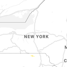
Hail Map for Thursday, July 30, 2020

Number of Impacted Households on 7/30/2020
0
Impacted by 1" or Larger Hail
0
Impacted by 1.75" or Larger Hail
0
Impacted by 2.5" or Larger Hail
Square Miles of Populated Area Impacted on 7/30/2020
0
Impacted by 1" or Larger Hail
0
Impacted by 1.75" or Larger Hail
0
Impacted by 2.5" or Larger Hail


Cities Most Affected by Hail Storms of 7/30/2020
| Hail Size | Demographics of Zip Codes Affected | ||||||
|---|---|---|---|---|---|---|---|
| City | Count | Average | Largest | Pop Density | House Value | Income | Age |
| Florence, CO | 1 | 1.75 | 1.75 | 72 | $89k | $30.5k | 39.6 |
| Rome, PA | 1 | 1.75 | 1.75 | 33 | $70k | $35.5k | 41.1 |
Hail and Wind Damage Spotted on 7/30/2020
Filter by Report Type:Hail ReportsWind Reports
States Impacted
Georgia, New York, Connecticut, Maine, Massachusetts, Virginia, Maryland, Texas, Pennsylvania, Oklahoma, South Dakota, Montana, Colorado, New Jersey, Arkansas, New MexicoGeorgia
| Local Time | Report Details |
|---|---|
| 3:45 PM EDT | A few trees dow in lowndes county GA, 47 miles SW of Douglas, GA |
| 4:12 PM EDT | Power lines down on val tech road in front wiregrass technical colleg in lowndes county GA, 52.1 miles SW of Douglas, GA |
| 4:13 PM EDT | Power lines down on i-75 just south of exit 2 in lowndes county GA, 51.7 miles SW of Douglas, GA |
New York
| Local Time | Report Details |
|---|---|
| 4:10 PM EDT | Downed tree on ny 22 in both directions south of bedford road. all lanes are blocke in westchester county NY, 35.5 miles NNE of Brooklyn, NY |
| 4:10 PM EDT | Fire department is responding to a tree down on wires on bedford banksville roa in westchester county NY, 36.3 miles NNE of Brooklyn, NY |
| 4:16 PM EDT | Tree and power pole down on ny 137 between ny 124 and upper shad roa in westchester county NY, 40.8 miles NNE of Brooklyn, NY |
| 2:43 AM EDT | Power lines down across main street in sayville... ny time estimated by rada in suffolk county NY, 47.9 miles E of Brooklyn, NY |
Connecticut
| Local Time | Report Details |
|---|---|
| 4:20 PM EDT | Trees were reported down on silvermine road... mill road... and valley roa in fairfield county CT, 42.6 miles NE of Brooklyn, NY |
| 4:33 PM EDT | Tree down near the merrit 7 metro north station reported by metro north railroa in fairfield county CT, 43.1 miles NE of Brooklyn, NY |
| 4:35 PM EDT | Several large tree branch downed at the va medical center. one fell onto a vehicl in new haven county CT, 67 miles NE of Brooklyn, NY |
Maine
| Local Time | Report Details |
|---|---|
| 4:30 PM EDT | Multiple trees down across the bridgton are in cumberland county ME, 37.6 miles NW of Portland, ME |
| 5:05 PM EDT | Large tree split in half landing on a parked car. reported at turner street auburn m in androscoggin county ME, 31.8 miles N of Portland, ME |
| 5:06 PM EDT | Trees down across the road. reported at beech road auburn m in androscoggin county ME, 29.1 miles N of Portland, ME |
Massachusetts
| Local Time | Report Details |
|---|---|
| 4:49 PM EDT | Multiple trees and power lines down on upper road and lower rd in franklin county MA, 70.7 miles ESE of Schenectady, NY |
| 4:49 PM EDT | Multiple trees and power lines down on upper road and lower rd in franklin county MA, 70.7 miles ESE of Schenectady, NY |
| 4:50 PM EDT | Multiple trees down on mill village rd in franklin county MA, 70.7 miles ESE of Schenectady, NY |
| 5:00 PM EDT | Trees and power lines down on west st in franklin county MA, 71.3 miles NW of Providence, RI |
| 5:05 PM EDT | Multiple trees down on mill village rd in franklin county MA, 70.7 miles ESE of Schenectady, NY |
| 5:25 PM EDT | Large tree down blocking road on farmers row in middlesex county MA, 54.9 miles N of Providence, RI |
| 5:25 PM EDT | Large tree down blocking road on farmers row in middlesex county MA, 54.9 miles N of Providence, RI |
| 5:45 PM EDT | Tree down on littleton rd in middlesex county MA, 52.2 miles N of Providence, RI |
| 5:55 PM EDT | Trees and wires down on robin hill rd in middlesex county MA, 53.6 miles N of Providence, RI |
| 6:05 PM EDT | Large tree and wires down on birchwood rd in middlesex county MA, 50.6 miles N of Providence, RI |
| 6:35 PM EDT | Tree down on bresnahan stree in essex county MA, 53.8 miles NNE of Providence, RI |
| 6:35 PM EDT | Multiple trees down on wire in essex county MA, 50.3 miles NNE of Providence, RI |
| 6:35 PM EDT | Multiple trees down on wire in essex county MA, 50.3 miles NNE of Providence, RI |
| 6:40 PM EDT | Several trees dow in essex county MA, 56.1 miles NNE of Providence, RI |
| 6:43 PM EDT | Storm damage reported in anz230 county MA, 51.4 miles NNE of Providence, RI |
| 6:43 PM EDT | Photos of downed trees on highland ave at proctor st from social media in essex county MA, 56.1 miles NNE of Providence, RI |
| 6:45 PM EDT | Tree down on pleasant stree in essex county MA, 48.9 miles NNE of Providence, RI |
| 6:46 PM EDT | Large tree branch down on wire in essex county MA, 52 miles NNE of Providence, RI |
Virginia
| Local Time | Report Details |
|---|---|
| 4:55 PM EDT | Downed trees on calendon rd between cottonwood ct and persimmon ln in king george county VA, 60 miles NNE of Richmond, VA |
| 4:57 PM EDT | Downed tree on calendon rd near potomac forest drive in king george county VA, 61.9 miles NNE of Richmond, VA |
| 5:25 PM EDT | Several trees reported down in the leaksville road are in page county VA, 74.3 miles ESE of Elkins, WV |
| 5:25 PM EDT | Tree reported down on aylor gurbbs ave near gray driv in page county VA, 76.9 miles ESE of Elkins, WV |
| 6:38 PM EDT | Downed tree on va 3 (blue and gray parkway) just west of kings hwy in stafford county VA, 55.3 miles NNE of Richmond, VA |
| 6:57 PM EDT | Downed tree near the intersection of va 206 (dahlgren rd) and va 610 (indiantown rd) in king george county VA, 60 miles NNE of Richmond, VA |
| 7:30 PM EDT | Tree reported down on the 5000 block of hannora lan in fairfax county VA, 51.4 miles SW of Baltimore, MD |
| 7:46 PM EDT | Downed tree on richland valley dr at rich meadow drive in fairfax county VA, 43 miles WSW of Baltimore, MD |
| 7:55 PM EDT | Downed tree on belle plains rd in stafford county VA, 59.2 miles NNE of Richmond, VA |
Maryland
| Local Time | Report Details |
|---|---|
| 5:14 PM EDT | Tree down on port tobacco road at maryland point road in charles county MD, 67.8 miles NNE of Richmond, VA |
| 7:10 PM EDT | Multiple trees down around nanjemoy in charles county MD, 66.7 miles SSW of Baltimore, MD |
| 7:25 PM EDT | Multiple trees down around la plata in charles county MD, 55.9 miles SSW of Baltimore, MD |
| 7:25 PM EDT | Multiple trees down around marbury in charles county MD, 58.5 miles SSW of Baltimore, MD |
| 7:25 PM EDT | Mulitple trees down around bryans road in charles county MD, 54.4 miles SSW of Baltimore, MD |
| 7:53 PM EDT | Downed tree on md 190 river rd between maidens bower dr and pettit way in montgomery county MD, 40.3 miles WSW of Baltimore, MD |
| 8:01 PM EDT | Downed tree on md 769c 52nd ave at newton st in prince georges county MD, 29.7 miles SW of Baltimore, MD |
| 8:03 PM EDT | Tree down on westbound md 202 largo rd and md 214 central ave in prince georges county MD, 29.4 miles SSW of Baltimore, MD |
| 8:07 PM EDT | Downed tree near md 953 glenn dale rd and old pond dr in anne arundel county MD, 8.9 miles SSW of Baltimore, MD |
| 8:17 PM EDT | Downed tree near md 424 davidsonville rd and gernster rd in anne arundel county MD, 8.9 miles SSW of Baltimore, MD |
| 8:59 PM EDT | Tree reported down on the 5600 block of cryslar ave in baltimore city county MD, 5.9 miles NW of Baltimore, MD |
| 8:59 PM EDT | Tree reported down on wabash av in baltimore city county MD, 4.2 miles NW of Baltimore, MD |
| 9:02 PM EDT | Trees down blocking hainesville road near worton. time estimated from rada in kent county MD, 25.8 miles E of Baltimore, MD |
| 9:25 PM EDT | Tree down on shore drive in harford county MD, 15.7 miles ENE of Baltimore, MD |
| 9:30 PM EDT | Tree down on nuttal avenue in harford county MD, 18.8 miles ENE of Baltimore, MD |
| 9:35 PM EDT | Tree down on wires in harford county MD, 24.4 miles ENE of Baltimore, MD |
| 9:35 PM EDT | Tree down on route 7 at brass mill road in harford county MD, 24.5 miles NE of Baltimore, MD |
| 9:40 PM EDT | Tree down on blue silver road in harford county MD, 21.6 miles NE of Baltimore, MD |
| 9:40 PM EDT | Tree down on route 152 and old joppa road in harford county MD, 17.9 miles NE of Baltimore, MD |
| 9:40 PM EDT | Tree down on whitaker mill road at west ring factory road in harford county MD, 20 miles NE of Baltimore, MD |
| 9:40 PM EDT | Tree down on stockton road at mountain road in harford county MD, 17.8 miles NE of Baltimore, MD |
| 9:40 PM EDT | Tree branches down on wires along shelburne road in harford county MD, 22.4 miles NE of Baltimore, MD |
| 9:42 PM EDT | Tree down on thomas run road in harford county MD, 25.8 miles NE of Baltimore, MD |
| 9:42 PM EDT | Tree down on mooores mill road in harford county MD, 22.7 miles NE of Baltimore, MD |
| 9:42 PM EDT | Tree branch on stepney road at bush chapel road in harford county MD, 26.2 miles NE of Baltimore, MD |
| 9:45 PM EDT | Tree down on sandy hoook road at kalmia road in harford county MD, 26.9 miles NE of Baltimore, MD |
| 9:48 PM EDT | Wind-blown debris closed randalia road at the intersection of state highway 213. time estimated from rada in cecil county MD, 44.9 miles ENE of Baltimore, MD |
Texas
| Local Time | Report Details |
|---|---|
| 4:30 PM CDT | Rv trailers flipped in wilbarger county TX, 48.8 miles WNW of Wichita Falls, TX |
| 4:32 PM CDT | Semi blown over near the hardeman/wilbarger county line in wilbarger county TX, 46.3 miles ESE of Childress, TX |
| 4:35 PM CDT | Near the wilbarger/foard county line in wilbarger county TX, 51.3 miles ESE of Childress, TX |
| 5:07 PM CDT | Storm damage reported in foard county TX, 42.2 miles SE of Childress, TX |
| 6:38 PM CDT | Spotter estimates 60 mph winds in rocheste in haskell county TX, 60.3 miles N of Abilene, TX |
| 6:50 PM CDT | Haskell sheriffs office reported a sign at the kent kwik convenience store being blown into a power line... knocking the power out. haskell mesonet reported a max wind in haskell county TX, 49 miles N of Abilene, TX |
| 7:25 PM CDT | Storm damage reported in garza county TX, 40.3 miles SSE of Lubbock, TX |
| 9:55 PM CDT | North texas regional airport reported a 61 mph wind gus in grayson county TX, 55.8 miles SW of Atoka, OK |
| 3:10 AM CDT | First severe gust (59 mph) observation at 3:05 am cd in yoakum county TX, 75.2 miles WSW of Lubbock, TX |
Pennsylvania
| Local Time | Report Details |
|---|---|
| 5:30 PM EDT | Quarter sized hail reported near Rome, PA, 46.9 miles NW of Scranton, PA, hail size estimated from twitter photo |
| 5:37 PM EDT | Golf Ball sized hail reported near Rome, PA, 45.2 miles NW of Scranton, PA, large hail just south of orwell |
| 5:55 PM EDT | Tree down blocking rte 267... time estimated from radar in susquehanna county PA, 36.6 miles NW of Scranton, PA |
| 11:06 PM EDT | Tree down near the intersection of poplar street and astor street in norristown. time estimated from rada in montgomery county PA, 81.1 miles WSW of Brooklyn, NY |
| 11:18 PM EDT | Downed tree in wires on willow park road near first street in bethlehem. time estimated from rada in northampton county PA, 55.9 miles SSE of Scranton, PA |
| 11:27 PM EDT | Downed tree near the intersection of school house lane and dekalb pike. time estimated from rada in montgomery county PA, 75.4 miles WSW of Brooklyn, NY |
| 11:27 PM EDT | Downed power pole and wires near the intersection of latchstring lane and plymouth road. time estimated from rada in montgomery county PA, 75.1 miles WSW of Brooklyn, NY |
| 11:27 PM EDT | Downed utility on state highway 248 near nazareth-bethlehem pike. time estimated from rada in northampton county PA, 50.2 miles SSE of Scranton, PA |
| 11:28 PM EDT | Several reports of power lines down near lansdale and north wales. time estimated from rada in montgomery county PA, 74.6 miles WSW of Brooklyn, NY |
| 11:53 PM EDT | Tree down on wires causing a power outage near the intersection of sandy hill rd and power mill hollow rd. time estimated from rada in berks county PA, 73.8 miles S of Scranton, PA |
| 12:04 AM EDT | Trees and wires down near tabor road in ottsville. time estimated from rada in bucks county PA, 63.1 miles WSW of Brooklyn, NY |
| 12:09 AM EDT | Trees and wires down near kintner hill road in nockamixon township. time estimated from rada in bucks county PA, 62.8 miles W of Brooklyn, NY |
| 12:13 AM EDT | Reports of wires down near zieglersville. time estimated from rada in montgomery county PA, 77.1 miles S of Scranton, PA |
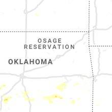
Oklahoma
| Local Time | Report Details |
|---|---|
| 5:20 PM CDT | Ping Pong Ball sized hail reported near Lawton, OK, 50.1 miles N of Wichita Falls, TX |
| 5:55 PM CDT | Damage to trees in stephens county OK, 52 miles NE of Wichita Falls, TX |
| 6:05 PM CDT | Storm damage reported in cotton county OK, 29.4 miles NNE of Wichita Falls, TX |
| 6:18 PM CDT | Quarter sized hail reported near Kiowa, OK, 25.8 miles NNE of Atoka, OK, report relayed by media. |
| 6:35 PM CDT | Asos station kpvj pauls valle in garvin county OK, 54.6 miles SSE of Oklahoma City, OK |
| 6:36 PM CDT | Power pole and powerline damage on hwy 7 in murray county OK, 57.6 miles W of Atoka, OK |
| 6:40 PM CDT | Sporadic 2-3 inch tree limbs damage along with minor flooding of some city street in garvin county OK, 53.9 miles SSE of Oklahoma City, OK |
| 6:41 PM CDT | Quarter sized hail reported near Konawa, OK, 53.1 miles NW of Atoka, OK |
| 6:45 PM CDT | Quarter sized hail reported near Lawton, OK, 47.9 miles N of Wichita Falls, TX |
| 6:50 PM CDT | Damage to metal buildings and barn roof damage in murray county OK, 48.5 miles WNW of Atoka, OK |
| 6:50 PM CDT | Corrects previous tstm wnd dmg report from 1 n sulphur. moderate sized tree snapped in hal in murray county OK, 49 miles W of Atoka, OK |
| 6:50 PM CDT | Corrects previous tstm wnd dmg report from 1 n sulphur. moderate sized tree snapped in hal in murray county OK, 49 miles W of Atoka, OK |
| 6:50 PM CDT | Telephone poles blown ove in murray county OK, 47.2 miles W of Atoka, OK |
| 6:55 PM CDT | Road sign damage near chickasaw turnpike and hwy in pontotoc county OK, 42.2 miles WNW of Atoka, OK |
| 6:55 PM CDT | Mesonet station sulp sulphur. also... was 66mph at 6:45p in murray county OK, 48.6 miles WNW of Atoka, OK |
| 6:55 PM CDT | 5-6 inch diameter tree limbs down in murray county OK, 48.2 miles W of Atoka, OK |
| 7:00 PM CDT | Quarter sized hail reported near Stonewall, OK, 30.6 miles NW of Atoka, OK |
| 7:00 PM CDT | A horse barn was blown about 150 yards across hwy 377. pipe fence attached to barn was raised about 3 fee in pontotoc county OK, 34 miles WNW of Atoka, OK |
| 7:05 PM CDT | Mesonet station fitt fittstow in pontotoc county OK, 35.7 miles WNW of Atoka, OK |
| 7:15 PM CDT | Storm damage reported in pontotoc county OK, 41.1 miles NW of Atoka, OK |
| 7:15 PM CDT | Mesonet repor in pontotoc county OK, 35.1 miles WNW of Atoka, OK |
| 7:17 PM CDT | Powerlines down at 7th and neshoba in johnston county OK, 33.2 miles WSW of Atoka, OK |
| 7:23 PM CDT | Multiple powerlines down in mill cree in johnston county OK, 39.6 miles W of Atoka, OK |
| 8:27 PM CDT | Gas station awning blown off... vinyl fencing blown down and billboard blown over. report received via social medi in pushmataha county OK, 31 miles ESE of Atoka, OK |
| 8:55 PM CDT | Large branches blown down in hugo. report received via social medi in choctaw county OK, 43.8 miles SE of Atoka, OK |
| 9:08 PM CDT | Quarter sized hail reported near Lawton, OK, 62.2 miles N of Wichita Falls, TX |
| 9:19 PM CDT | Measured wind gust on west side of pocola. report received via social medi in le flore county OK, 11.5 miles SSW of Fort Smith, AR |
South Dakota
| Local Time | Report Details |
|---|---|
| 6:26 PM MDT | Storm damage reported in harding county SD, 106 miles N of Rapid City, SD |
Montana
| Local Time | Report Details |
|---|---|
| 7:34 PM MDT | Storm damage reported in custer county MT, 2.5 miles NW of Miles City, MT |
| 7:44 PM MDT | Storm damage reported in custer county MT, 2.5 miles NW of Miles City, MT |
Colorado
| Local Time | Report Details |
|---|---|
| 8:12 PM MDT | Quarter sized hail reported near Canon City, CO, 34.9 miles WNW of Pueblo, CO, delayed report. |
| 8:17 PM MDT | Quarter sized hail reported near Florence, CO, 30.3 miles WNW of Pueblo, CO, corrects previous hail report from 2 w florence. delayed report. 1 to 1.25 inch hail estimated from picture posted on social media. windows were also broken out. time e |
| 8:20 PM MDT | Golf Ball sized hail reported near Florence, CO, 28.6 miles WNW of Pueblo, CO |
| 8:30 PM MDT | Quarter sized hail reported near Florence, CO, 30.3 miles WNW of Pueblo, CO, delayed report. 1 to 1.25 inch hail estimated from picture posted on social media. windows were also broken out. |
New Jersey
| Local Time | Report Details |
|---|---|
| 10:22 PM EDT | Power lines down near salem high school. time estimated from rada in salem county NJ, 63.2 miles ENE of Baltimore, MD |
| 11:07 PM EDT | Several reports of power lines down in the fairview and jericho area. time estimated from rada in gloucester county NJ, 86.3 miles SW of Brooklyn, NY |
| 11:11 PM EDT | Wires down near pennsylvania avenue in glassboro. time estimated from rada in gloucester county NJ, 84 miles ENE of Baltimore, MD |
| 11:14 PM EDT | Downed wires on signey lane. time estimated from rada in camden county NJ, 81 miles SW of Brooklyn, NY |
| 11:16 PM EDT | Downed wires near whitman drive. time estimated from rada in camden county NJ, 78.9 miles SW of Brooklyn, NY |
| 11:37 PM EDT | Wires down near creek road. time estimated from rada in burlington county NJ, 67.9 miles SW of Brooklyn, NY |
| 11:46 PM EDT | Wires down near wood street in burlington. time estimated from rada in burlington county NJ, 62.4 miles SW of Brooklyn, NY |
| 11:46 PM EDT | Observed on the bristol bridg in burlington county NJ, 62.8 miles SW of Brooklyn, NY |
| 11:50 PM EDT | Wires down on hamilton street. time estimated from rada in burlington county NJ, 58.3 miles SW of Brooklyn, NY |
| 11:51 PM EDT | Wires down near jacksonville road and mill lane. time estimated from rada in burlington county NJ, 56.9 miles SW of Brooklyn, NY |
| 11:58 PM EDT | Wires down on stanton avenue in bordentown. time estimated from rada in burlington county NJ, 52.4 miles SW of Brooklyn, NY |
| 12:43 AM EDT | Corrects previous tstm wnd dmg report from 2 ssw north brunswick. several reports of wires down near adams lane in north brunswick. time estimated from rada in middlesex county NJ, 31.2 miles WSW of Brooklyn, NY |
| 12:48 AM EDT | Corrects previous report from new brunswick. several reports of tree limbs and wires down in the new brunswick area. time estimated from rada in middlesex county NJ, 27.5 miles WSW of Brooklyn, NY |
| 12:50 AM EDT | Downed power lines near hoover avenue in metuchen. time estimated from rada in middlesex county NJ, 21.1 miles WSW of Brooklyn, NY |
| 12:50 AM EDT | Downed trees and power outages reported in somerville. time estimated from rada in somerset county NJ, 34.2 miles WSW of Brooklyn, NY |
| 12:51 AM EDT | Several reports of power lines down near manville. time estimated from rada in somerset county NJ, 32.5 miles WSW of Brooklyn, NY |
| 12:57 AM EDT | Downed trees and wires near tina place in matawan. time estimated from rada in monmouth county NJ, 24.1 miles SSW of Brooklyn, NY |
| 12:59 AM EDT | Storm damage reported in monmouth county NJ, 20.6 miles SSW of Brooklyn, NY |
| 1:00 AM EDT | Several reports of power lines down in keyport. time estimated from rada in monmouth county NJ, 20.6 miles SSW of Brooklyn, NY |
| 1:00 AM EDT | Tree down on wires on atlantic st. time estimated from rada in monmouth county NJ, 21.2 miles SSW of Brooklyn, NY |
| 1:22 AM EDT | Downed wires on woodbridge center drive. time estimated from rada in middlesex county NJ, 19.1 miles WSW of Brooklyn, NY |
| 1:23 AM EDT | Several reports of downed power lines between fords and colonia. time estimated from rada in middlesex county NJ, 17.8 miles WSW of Brooklyn, NY |
| 1:30 AM EDT | Storm damage reported in middlesex county NJ, 15.6 miles WSW of Brooklyn, NY |
Arkansas
| Local Time | Report Details |
|---|---|
| 10:25 PM CDT | Power lines reported down in de quee in sevier county AR, 29 miles WNW of Nashville, AR |
| 1:34 AM CDT | Entergy reported that a tree blew down on powerlines in the are in pulaski county AR, 24.3 miles WNW of Little Rock, AR |
New Mexico
| Local Time | Report Details |
|---|---|
| 1:40 AM MDT | Storm damage reported in lea county NM, 70.2 miles E of Roswell, NM |
Connect with Interactive Hail Maps