Hail Map for Thursday, June 13, 2019

Number of Impacted Households on 6/13/2019
0
Impacted by 1" or Larger Hail
0
Impacted by 1.75" or Larger Hail
0
Impacted by 2.5" or Larger Hail
Square Miles of Populated Area Impacted on 6/13/2019
0
Impacted by 1" or Larger Hail
0
Impacted by 1.75" or Larger Hail
0
Impacted by 2.5" or Larger Hail
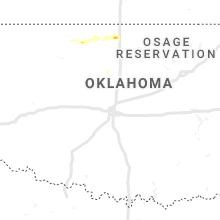
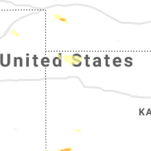
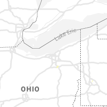
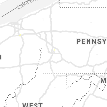
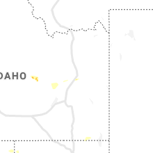
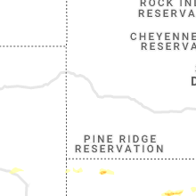
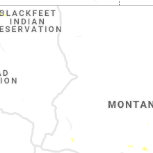
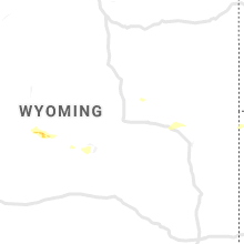
Regions Impacted by Hail on 6/13/2019
Cities Most Affected by Hail Storms of 6/13/2019
| Hail Size | Demographics of Zip Codes Affected | ||||||
|---|---|---|---|---|---|---|---|
| City | Count | Average | Largest | Pop Density | House Value | Income | Age |
| Amistad, NM | 2 | 1.88 | 2.00 | 0 | $54k | $41.9k | 47.2 |
| Hope, NM | 1 | 1.75 | 1.75 | 0 | $55k | $36.7k | 44.0 |
Hail and Wind Damage Spotted on 6/13/2019
Filter by Report Type:Hail ReportsWind Reports
States Impacted
Florida, Ohio, Montana, Virginia, Idaho, Maryland, Oregon, Utah, West Virginia, New Mexico, Wyoming, Delaware, New Jersey, Nebraska, North Dakota, Kansas, ColoradoFlorida
| Local Time | Report Details |
|---|---|
| 1:37 PM EDT | Palm tree down on australian ave in west palm beach. reported by wptv via twitte in palm beach county FL, 42.2 miles SSE of Port Saint Lucie, FL |
| 2:38 PM EDT | Palm bay police department relayed report of trees down and a boat blown off a trailer near the intersection of lipscomb street and florida avenue in northeast palm bay in brevard county FL, 56 miles NNW of Port Saint Lucie, FL |
| 3:34 PM EDT | Weatherflow site xstl measured a wind gust of 62 mph/54 from the s in st. lucie county FL, 9.2 miles NE of Port Saint Lucie, FL |
Ohio
| Local Time | Report Details |
|---|---|
| 3:04 PM EDT | Barn blown over and damage to the roof of a home on chardon-windsor road. possible tornado damag in geauga county OH, 31.4 miles E of Cleveland, OH |
Montana
| Local Time | Report Details |
|---|---|
| 1:45 PM MDT | Quarter sized hail reported near Toston, MT, 39.2 miles NNW of Bozeman, MT, pea-size to quarter-size hail covered the ground. |
| 5:45 PM MDT | Tree damage from social media pictures in yellowstone county MT, 1.2 miles WSW of Billings, MT |
| 5:47 PM MDT | Storm damage reported in yellowstone county MT, 2.8 miles NW of Billings, MT |
Virginia
| Local Time | Report Details |
|---|---|
| 4:01 PM EDT | Tree down near intersection of drogheda mountain road and eggbornsville r in culpeper county VA, 74.6 miles NNW of Richmond, VA |
| 4:10 PM EDT | Tree down 8600 block of rixeyville r in culpeper county VA, 76.4 miles NNW of Richmond, VA |
| 4:40 PM EDT | Tree down on kennedy roa in fauquier county VA, 68.6 miles WSW of Baltimore, MD |
| 4:41 PM EDT | Tree down on greenwich roa in fauquier county VA, 68.9 miles SW of Baltimore, MD |
| 4:47 PM EDT | Tree down near the intersection of vint hill and greenwich roads in prince william county VA, 67.3 miles WSW of Baltimore, MD |
| 4:50 PM EDT | Tree down on bollington road near berlin turnpik in loudoun county VA, 55.9 miles W of Baltimore, MD |
| 4:56 PM EDT | Tree down on lovettsville road and taylors town roa in loudoun county VA, 52.6 miles W of Baltimore, MD |
| 4:56 PM EDT | Tree down on the 9200 block of plank roa in spotsylvania county VA, 55.6 miles N of Richmond, VA |
| 5:01 PM EDT | Tree down on prescott ave near center stree in city of manassas county VA, 59 miles SW of Baltimore, MD |
| 5:04 PM EDT | Tree down on catharpin road in spotsylvania county VA, 52.2 miles N of Richmond, VA |
| 5:05 PM EDT | Tree down in the 17000 block of joplin road in prince william county VA, 65.5 miles SW of Baltimore, MD |
| 5:07 PM EDT | Trees down on the 200 block of sanford driv in stafford county VA, 58.2 miles N of Richmond, VA |
| 5:12 PM EDT | Tree down at intersection of greenmount and cardinal drives in prince william county VA, 60.7 miles SW of Baltimore, MD |
| 5:12 PM EDT | Tree down at intersection of spriggs road and gwendolyn drive in prince william county VA, 61 miles SW of Baltimore, MD |
| 5:13 PM EDT | Tree down on beaver pond road near misty lan in prince william county VA, 57.4 miles SW of Baltimore, MD |
| 5:15 PM EDT | Tree down on the 400 block of eskimo hill roa in stafford county VA, 61.9 miles NNE of Richmond, VA |
| 5:19 PM EDT | Tree down on jason lane and greenridge driv in stafford county VA, 65.5 miles NNE of Richmond, VA |
| 5:25 PM EDT | Tree down on mills drive near massaponax church roa in spotsylvania county VA, 50.6 miles NNE of Richmond, VA |
Idaho
| Local Time | Report Details |
|---|---|
| 2:13 PM MDT | Quarter sized hail reported near Idaho Falls, ID, 5.2 miles SSW of Idaho Falls, ID, hail picture submitted to east idaho news.com with a few stones 1 inch or slightly larger in diameter. time estimated using radar. |
Maryland
| Local Time | Report Details |
|---|---|
| 4:15 PM EDT | Tree down on slotler roa in washington county MD, 66.8 miles WNW of Baltimore, MD |
| 4:20 PM EDT | Tree down on sharpsburg pike near lappans roa in washington county MD, 63.1 miles WNW of Baltimore, MD |
| 5:07 PM EDT | Tree down on md 550 at md 2 in frederick county MD, 36.7 miles WNW of Baltimore, MD |
| 5:14 PM EDT | Tree down on baker valley road near fingerboard roa in frederick county MD, 42.4 miles W of Baltimore, MD |
| 5:19 PM EDT | Tree down on bessie clemson road and new windsor roa in frederick county MD, 34.5 miles WNW of Baltimore, MD |
| 5:19 PM EDT | Tree down near the intersection of medford road and new windsor roa in carroll county MD, 30 miles NW of Baltimore, MD |
| 5:34 PM EDT | Tree down at intersection of holly springs road and port tobacco road in charles county MD, 67.7 miles SSW of Baltimore, MD |
| 5:34 PM EDT | Trees down near intersection of raintree avenue and neudecker road... closing roadwa in carroll county MD, 25.1 miles NW of Baltimore, MD |
| 5:36 PM EDT | Three trees down along fenwick road in charles county MD, 51.2 miles SSW of Baltimore, MD |
| 5:38 PM EDT | Tree down at marshall hall and lantana road in charles county MD, 50.9 miles SSW of Baltimore, MD |
| 5:38 PM EDT | Tree down in the 2600 block of dakota street in charles county MD, 52.1 miles SSW of Baltimore, MD |
| 5:38 PM EDT | Tree down at carrollton road and houcksville road in carroll county MD, 23.6 miles NW of Baltimore, MD |
| 5:43 PM EDT | Eight inch diameter trees snappe in carroll county MD, 23.2 miles NNW of Baltimore, MD |
| 5:52 PM EDT | Tree down at intersection of bel alton-newtown road and mudd road in charles county MD, 59.8 miles SSW of Baltimore, MD |
| 6:14 PM EDT | Downed tree and wires with people trapped in a home. no injuries reported. time estimated from rada in cecil county MD, 45.9 miles ENE of Baltimore, MD |
| 6:15 PM EDT | Numerous trees down. several outbuildings damaged. roof and window damage to a house. time estimated from rada in cecil county MD, 43.7 miles ENE of Baltimore, MD |
| 6:22 PM EDT | Tree down on wires in the 4300 block of federal hill road in harford county MD, 26.9 miles NNE of Baltimore, MD |
| 6:22 PM EDT | Tree down on fawn grove road in harford county MD, 27.5 miles NNE of Baltimore, MD |
| 6:28 PM EDT | Numerous trees down along hunters run drive in harford county MD, 21.2 miles NE of Baltimore, MD |
| 6:28 PM EDT | Tree down at intersection of laurel bush and point to point roads in harford county MD, 21.2 miles NE of Baltimore, MD |
| 6:35 PM EDT | Tree down in the 400 block of glenville road in harford county MD, 27.6 miles NE of Baltimore, MD |
| 6:42 PM EDT | Tree down in the 4400 block of webster lapidum road in harford county MD, 32.5 miles NE of Baltimore, MD |
| 6:42 PM EDT | Tree down on perryman road near spesutia road in harford county MD, 25.2 miles ENE of Baltimore, MD |
| 6:46 PM EDT | Tree down along aldino stepney road off of route 22 in harford county MD, 27.4 miles NE of Baltimore, MD |
| 6:48 PM EDT | Wind damage closed u.s. highway 1 northbound at state highway 222. time estimated from rada in cecil county MD, 35.2 miles NE of Baltimore, MD |
| 10:54 PM UTC | Several reports of trees down in port deposit... including one across canal road... forcing its closure. time estimated from rada in cecil county MD, 35 miles NE of Baltimore, MD |
| 7:04 PM EDT | State highway 272 closed at campground road from wind damage. time estimated from rada in cecil county MD, 35.7 miles ENE of Baltimore, MD |
| 7:15 PM EDT | Wind damage closed u.s. highway 40 westbound near nottingham road. time estimated from rada in cecil county MD, 45.7 miles ENE of Baltimore, MD |
| 7:20 PM EDT | Several reports of wind damage near state highway 213 and biddle street. time estimated from rada in cecil county MD, 46.1 miles ENE of Baltimore, MD |
Oregon
| Local Time | Report Details |
|---|---|
| 1:18 PM PDT | Half Dollar sized hail reported near Baker City, OR, 94.4 miles NE of Burns, OR, hail covered the ground along highway 245 near stices gulch. hail sizes were up to 1.25 inches. |
Utah
| Local Time | Report Details |
|---|---|
| 3:00 PM MDT | Sr-12 at boulder summit in garfield county UT, 59.2 miles SE of Monroe, UT |
| 4:17 PM MDT | Quarter sized hail reported near Ibapah, UT, 72.8 miles NE of Ely, NV, hail damage reported to vehicles in ibapah. hail size estimated. |
| 5:00 PM MDT | Scipio summit on i-15 in millard county UT, 38.6 miles N of Monroe, UT |
| 5:40 PM MDT | Mp 2 on i-80 in tooele county UT, 94 miles E of Elko, NV |
| 5:40 PM MDT | Sevier river bridge on i-1 in juab county UT, 51.9 miles N of Monroe, UT |
| 6:00 PM MDT | Mp 31 on i-80 in tooele county UT, 82 miles W of Salt Lake City, UT |
| 6:20 PM MDT | I-80 at grassey in tooele county UT, 58.9 miles W of Salt Lake City, UT |
| 7:10 PM MDT | Sr 10 at mp 54 in emery county UT, 14.5 miles SSW of Price, UT |
| 7:28 PM MDT | Storm damage reported in salt lake county UT, 8 miles W of Salt Lake City, UT |
| 7:35 PM MDT | Storm damage reported in weber county UT, 35.5 miles NW of Salt Lake City, UT |
| 10:25 PM MDT | Fremont island sensor in weber county UT, 35.5 miles NW of Salt Lake City, UT |
West Virginia
| Local Time | Report Details |
|---|---|
| 5:24 PM EDT | Tree down on fort ashby bridge roa in mineral county WV, 70.4 miles NE of Elkins, WV |
New Mexico
| Local Time | Report Details |
|---|---|
| 3:53 PM MDT | Quarter sized hail reported near Truth Or Consequences, NM, 64.8 miles ENE of Silver City, NM |
| 3:55 PM MDT | Half Dollar sized hail reported near Truth Or Consequences, NM, 65.1 miles ENE of Silver City, NM |
| 4:14 PM MDT | Ping Pong Ball sized hail reported near Truth Or Consequences, NM, 64.5 miles ENE of Silver City, NM, picture of ping pong sized hail forwared to nws by em |
| 5:45 PM MDT | Quarter sized hail reported near Mosquero, NM, 45.7 miles N of Tucumcari, NM |
| 6:10 PM MDT | Golf Ball sized hail reported near Hope, NM, 41.6 miles SSW of Roswell, NM |
| 6:35 PM MDT | Golf Ball sized hail reported near Amistad, NM, 46.9 miles NNE of Tucumcari, NM |
| 6:56 PM MDT | Ping Pong Ball sized hail reported near Amistad, NM, 43.8 miles NNE of Tucumcari, NM |
| 6:58 PM MDT | Ping Pong Ball sized hail reported near Amistad, NM, 46.8 miles NNE of Tucumcari, NM |
| 7:00 PM MDT | Hen Egg sized hail reported near Amistad, NM, 45.7 miles NNE of Tucumcari, NM |
| 7:57 PM MDT | Quarter sized hail reported near Clayton, NM, 93.1 miles NNE of Tucumcari, NM |
| 8:00 PM MDT | Quarter sized hail reported near Clayton, NM, 92.7 miles NNE of Tucumcari, NM |
| 8:30 PM MDT | Quarter sized hail reported near Amistad, NM, 52.9 miles NE of Tucumcari, NM |
| 12:07 AM MDT | Storm damage reported in eddy county NM, 73.2 miles S of Roswell, NM |
Wyoming
| Local Time | Report Details |
|---|---|
| 4:38 PM MDT | Asos station krwl rawlins airport - rw in carbon county WY, 86.3 miles SSW of Casper, WY |
Delaware
| Local Time | Report Details |
|---|---|
| 7:28 PM EDT | Wind gusts blew over a tractor trailer near the intersection of cedar lane road and boyds corner road. time estimated from rada in new castle county DE, 51.8 miles ENE of Baltimore, MD |
| 7:33 PM EDT | Downed trees and partial roof damage near the intersection of port penn road and dutch neck road. time estimated from rada in new castle county DE, 54.8 miles ENE of Baltimore, MD |
| 7:40 PM EDT | Downed treee damaging a house. time estimated from rada in new castle county DE, 61.1 miles ENE of Baltimore, MD |
New Jersey
| Local Time | Report Details |
|---|---|
| 7:43 PM EDT | Several trees downed and uprooted. time estimated from rada in salem county NJ, 62.9 miles ENE of Baltimore, MD |
| 7:46 PM EDT | Downed trees and partial roof damage near the intersection of front street and broadway. time estimated from rada in salem county NJ, 63.6 miles ENE of Baltimore, MD |
| 8:00 PM EDT | Multiple reports of trees down. time estimated from rada in salem county NJ, 72.8 miles ENE of Baltimore, MD |
| 8:30 PM EDT | Downed road sign and numerous tree branches down near the intersection of state highways 55 and 47. time estimated from rada in gloucester county NJ, 85.9 miles SW of Brooklyn, NY |
| 8:34 PM EDT | Numerous trees down between church street and black horse pike along erial road. time estimated from rada in camden county NJ, 83.1 miles SW of Brooklyn, NY |
Nebraska
| Local Time | Report Details |
|---|---|
| 5:52 PM MDT | Storm damage reported in dawes county NE, 69.8 miles NNE of Scottsbluff, NE |
North Dakota
| Local Time | Report Details |
|---|---|
| 7:10 PM CDT | Quarter sized hail reported near Binford, ND, 46.9 miles SSE of Devils Lake, ND |
Kansas
| Local Time | Report Details |
|---|---|
| 7:49 PM CDT | Ping Pong Ball sized hail reported near Manter, KS, 72.9 miles WSW of Garden City, KS, report relayed from ddc. |
| 7:55 PM CDT | Ping Pong Ball sized hail reported near Manter, KS, 72.9 miles WSW of Garden City, KS, spotter report of ping pong size hail hear the saunders elevator along colorado state line. |
| 8:45 PM CDT | Quarter sized hail reported near Johnson, KS, 50 miles SW of Garden City, KS, spotter report of quarter size hail south of big bow. |
| 8:58 PM CDT | Ping Pong Ball sized hail reported near Ulysses, KS, 38.2 miles SW of Garden City, KS, social media report of ping pong size hail on west side of ulysses. |
| 9:00 PM CDT | Quarter sized hail reported near Ulysses, KS, 39.3 miles SW of Garden City, KS, emergency reported quarter size hail covering the highway 25 at road 14. |
Colorado
| Local Time | Report Details |
|---|---|
| 6:58 PM MDT | Mesonet station stoc2 strm king mt... glnwood 4n in garfield county CO, 64.2 miles S of Craig, CO |








Connect with Interactive Hail Maps