Hail Map for Saturday, June 29, 2019

Number of Impacted Households on 6/29/2019
0
Impacted by 1" or Larger Hail
0
Impacted by 1.75" or Larger Hail
0
Impacted by 2.5" or Larger Hail
Square Miles of Populated Area Impacted on 6/29/2019
0
Impacted by 1" or Larger Hail
0
Impacted by 1.75" or Larger Hail
0
Impacted by 2.5" or Larger Hail
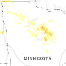
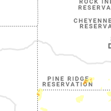
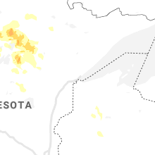
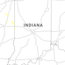
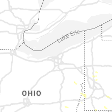
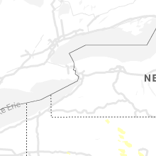
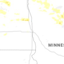
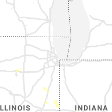
Regions Impacted by Hail on 6/29/2019
Cities Most Affected by Hail Storms of 6/29/2019
| Hail Size | Demographics of Zip Codes Affected | ||||||
|---|---|---|---|---|---|---|---|
| City | Count | Average | Largest | Pop Density | House Value | Income | Age |
| Carson, ND | 2 | 2.00 | 2.00 | 1 | $21k | $21.0k | 44.4 |
| Kirkwood, NY | 1 | 2.00 | 2.00 | 189 | $72k | $37.0k | 41.2 |
| West Long Branch, NJ | 1 | 1.75 | 1.75 | 2607 | $203k | $71.9k | 32.4 |
| Cumberland, RI | 1 | 1.75 | 1.75 | 1318 | $145k | $54.7k | 42.6 |
| Conklin, NY | 1 | 1.75 | 1.75 | 266 | $73k | $35.4k | 45.0 |
| Lincoln, RI | 1 | 1.75 | 1.75 | 1032 | $161k | $52.5k | 43.9 |
Hail and Wind Damage Spotted on 6/29/2019
Filter by Report Type:Hail ReportsWind Reports
States Impacted
North Dakota, Ohio, Texas, Pennsylvania, Georgia, Virginia, Minnesota, Maryland, New York, Montana, New Jersey, Rhode Island, Massachusetts, Delaware, West Virginia, Mississippi, Vermont, New Hampshire, Connecticut, Illinois, Maine, IndianaNorth Dakota
| Local Time | Report Details |
|---|---|
| 7:34 AM CDT | Quarter sized hail reported near Rolette, ND, 59 miles NW of Devils Lake, ND, reports of dime to quarter sized hail and very heavy rain. |
| 7:50 AM CDT | Half Dollar sized hail reported near York, ND, 38.7 miles WNW of Devils Lake, ND, strong winds and torrential rains occurred with the hail. |
| 8:02 AM CDT | Large tree branches and limbs broken down. winds estimated to 60 mph or greate in benson county ND, 29.6 miles WNW of Devils Lake, ND |
| 8:50 AM CDT | A few large tree 3 to 5 inch diameter branches broken down... along with some dime to nickel sized hail and very heavy rains. wind was very strong between 845 and 9 am in benson county ND, 19.3 miles SW of Devils Lake, ND |
| 9:25 AM CDT | Several large branches were broken down along with torrential rains and some pea to penny sized hail across northern freeborn township... from about 920 through 930 am in eddy county ND, 22.6 miles SSE of Devils Lake, ND |
| 10:33 AM CDT | Peak winds measured. noted that four 9 inch diameter pine trees were snapped at the base around 1033 am cd in grand forks county ND, 51.9 miles ESE of Devils Lake, ND |
| 10:40 AM CDT | Peak winds measured. noted that four 9 inch diameter pine trees were snapped at the base around 1033 am cd in grand forks county ND, 51.9 miles ESE of Devils Lake, ND |
| 10:45 AM CDT | Severe winds... torrential rains... and marble sized hail were reporte in grand forks county ND, 46.3 miles E of Devils Lake, ND |
| 12:00 PM CDT | Peak winds measured by a mobile mesonet statio in traill county ND, 36.9 miles NNW of Fargo, ND |
| 12:03 PM CDT | Storm damage reported in cass county ND, 17.3 miles WNW of Fargo, ND |
| 12:25 PM CDT | Several 3 to 5 inch diameter tree branches broken dow in cass county ND, 17.8 miles SW of Fargo, ND |
| 12:28 PM CDT | Shingles and construction materials flying in the winds. multiple spotter report winds gusting to 60 mph or highe in cass county ND, 2.9 miles SW of Fargo, ND |
| 12:34 PM CDT | Power poles broken and small trees snapped in south farg in cass county ND, 3.7 miles SSW of Fargo, ND |
| 12:35 PM CDT | Peak winds measured at the fargo airport /kfar in cass county ND, 2.8 miles NW of Fargo, ND |
| 12:35 PM CDT | Winds at 40 mph gusting to 65 mph reported on the rwis station on the red river bridg in cass county ND, 2.5 miles SW of Fargo, ND |
| 12:45 PM CDT | Numerous large trees snapped around the city. a few garage doors were blown in and garage sidewalls blown out in at least two apartment complexes. a semi was tumbled on in cass county ND, 3.7 miles W of Fargo, ND |
| 12:46 PM CDT | Peak winds measured at the fargo airport /kfar in cass county ND, 2.8 miles NW of Fargo, ND |
| 12:49 PM CDT | Tree branches up to baseball bat thickness /maximum 3 to 5 inch diamter/ were broken down by wind in griggs county ND, 52.9 miles SE of Devils Lake, ND |
| 12:55 PM CDT | A pickup truck and trailer were blownover and blocking the northbound lane of interstate 28. time estimated based on radar. a semi truck an trailer were also blown over in cass county ND, 6.3 miles NW of Fargo, ND |
| 12:55 PM CDT | A pickup truck and trailer were blownover and blocking the northbound lane of interstate 28. time estimated based on rada in cass county ND, 4.9 miles NW of Fargo, ND |
| 1:02 PM CDT | Peak winds ...easured at the fargo airport /kfar in cass county ND, 2.8 miles NW of Fargo, ND |
| 1:02 PM CDT | Peak winds measured at the fargo airport /kfar in cass county ND, 2.8 miles NW of Fargo, ND |
| 1:30 PM CDT | Quarter sized hail reported near Portland, ND, 51.2 miles NNW of Fargo, ND, report and photo posted via social media. time estimated based on radar. |
| 1:35 PM CDT | Ping Pong Ball sized hail reported near Mayville, ND, 50.3 miles NNW of Fargo, ND, report and photo posted via social media. time estimated based on radar. |
| 1:35 PM CDT | Quarter sized hail reported near Portland, ND, 51.2 miles NNW of Fargo, ND, report and photo posted via social media. time estimated based on radar. |
| 7:13 PM MDT | Hen Egg sized hail reported near Carson, ND, 42.2 miles WSW of Bismarck, ND, via nws chat. |
| 7:20 PM MDT | Hen Egg sized hail reported near Carson, ND, 37.7 miles WSW of Bismarck, ND, estimated distance north of carson with radar. estimated hail size by picture. report relayed by broadcast media. |
| 7:41 PM MDT | Ping Pong Ball sized hail reported near Flasher, ND, 33.7 miles WSW of Bismarck, ND |
Ohio
| Local Time | Report Details |
|---|---|
| 9:00 AM EDT | Several trees and branches down in saybrook townshi in ashtabula county OH, 48.5 miles ENE of Cleveland, OH |
| 5:06 PM EDT | Large tree down on hous in mahoning county OH, 52.3 miles NW of Pittsburgh, PA |
Texas
| Local Time | Report Details |
|---|---|
| 9:05 AM CDT | Quarter sized hail reported near Maud, TX, 48.8 miles SSW of Nashville, AR, hail mostly nickels few quarter size off hwy 67 between redwater and maud. |
| 2:42 PM CDT | Wind gust 61 mph measured at north jett in gmz335 county TX, 37.4 miles E of Houston, TX |
| 5:38 PM CDT | Em reports some trees down in central sherma in grayson county TX, 58 miles SSW of Atoka, OK |
| 6:05 PM CDT | Quarter sized hail reported near Dallas, TX, 2.7 miles ESE of Dallas, TX, quarter-size hail near i-30 at loop 12 |
| 7:07 PM CDT | Quarter sized hail reported near Keller, TX, 28.4 miles WNW of Dallas, TX, quarter sized hail reported in keller (anita and keller parkway) |
Pennsylvania
| Local Time | Report Details |
|---|---|
| 11:42 AM EDT | Trees down... time estimated from radar in clearfield county PA, 23.9 miles WNW of State College, PA |
| 12:17 PM EDT | Two trees down near prison in centre county PA, 6.2 miles NE of State College, PA |
| 12:20 PM EDT | Numerous trres and wires down in centre county PA, 9.1 miles ENE of State College, PA |
| 12:20 PM EDT | Two trees down near rockview prison in centre county PA, 6.1 miles NE of State College, PA |
| 12:38 PM EDT | Quarter sized hail reported near Mars, PA, 19.4 miles N of Pittsburgh, PA, mix of dime and quarter size hail. |
| 12:45 PM EDT | Multiple trees and wires down in mifflin county PA, 16.5 miles SE of State College, PA |
| 1:05 PM EDT | Numerous trees down in huntingdon county PA, 35.9 miles SSW of State College, PA |
| 1:20 PM EDT | *** 20 inj *** over a dozen trees down. multiple camping tents blown over... one large party tent knocked over. numerous injuries reported... most mino in huntingdon county PA, 35.5 miles S of State College, PA |
| 1:22 PM EDT | Multiple trees and wires down in juniata county PA, 32.3 miles SSE of State College, PA |
| 1:25 PM EDT | Numerous trees down in huntingdon county PA, 38.2 miles S of State College, PA |
| 1:35 PM EDT | Multiple trees down in perry county PA, 44.1 miles ESE of State College, PA |
| 1:50 PM EDT | Numerous trees down in perry county PA, 45.8 miles SE of State College, PA |
| 2:15 PM EDT | Multiple trees down in schuylkill county PA, 70.3 miles E of State College, PA |
| 2:44 PM EDT | Multiple trees down in adams county PA, 46.1 miles NNW of Baltimore, MD |
| 2:50 PM EDT | Multiple trees down on water street in adams county PA, 53.3 miles NW of Baltimore, MD |
| 2:55 PM EDT | Trees and wires down in lebanon county PA, 72.6 miles N of Baltimore, MD |
| 2:57 PM EDT | Trees and wires down in lebanon county PA, 69.7 miles N of Baltimore, MD |
| 3:00 PM EDT | Several large trees dow in adams county PA, 53.7 miles NW of Baltimore, MD |
| 3:08 PM EDT | Downed tree on gradyville road near valley road. all lanes closed. time estimated from rada in delaware county PA, 75.1 miles NE of Baltimore, MD |
| 3:16 PM EDT | Downed tree on hoch road. time estimated from rada in berks county PA, 67.7 miles S of Scranton, PA |
| 3:20 PM EDT | Multiple trees down in east cocalico tw in lancaster county PA, 69.9 miles NNE of Baltimore, MD |
| 3:20 PM EDT | Multiple trees down in manheim tw in lancaster county PA, 57.4 miles NNE of Baltimore, MD |
| 3:21 PM EDT | Multiple reports of trees down in the area of intersection of warner road and chestnut ridge road. time estimated from rada in susquehanna county PA, 34.8 miles NNW of Scranton, PA |
| 3:22 PM EDT | Downed tree onto a house on commonwealth blvd in kenhorst boro. time estimated from rada in berks county PA, 77.3 miles S of Scranton, PA |
| 3:22 PM EDT | Downed tree on wires on welsh road in cumru twp. time estimated from rada in berks county PA, 76.9 miles NNE of Baltimore, MD |
| 3:24 PM EDT | Downed tree blocking the roadway at the intersection of sandy hill road and tyler drive. time estimated from rada in chester county PA, 62.1 miles NE of Baltimore, MD |
| 3:26 PM EDT | Downed tree on cedar knoll road in west caln twp. time estimated from rada in chester county PA, 65.5 miles NE of Baltimore, MD |
| 3:26 PM EDT | Downed tree blocking the roadway at the intersection of kings highway and ash road. time estimated from rada in chester county PA, 62.7 miles NE of Baltimore, MD |
| 3:28 PM EDT | Wires down blocking entire roadway (wagner road). time estimated from rada in susquehanna county PA, 32.8 miles N of Scranton, PA |
| 3:29 PM EDT | Wires down along route 706. time estimated from rada in susquehanna county PA, 31.4 miles N of Scranton, PA |
| 3:29 PM EDT | Downed tree at the intersection of christy court and white bear road. time estimated from rada in berks county PA, 77.3 miles NNE of Baltimore, MD |
| 3:31 PM EDT | Downed trees and power lines on and near fallowfield road. time estimated from rada in chester county PA, 56.3 miles NE of Baltimore, MD |
| 3:32 PM EDT | Numerous trees and powerlines down in the area south of susquehanna st. a few roads blocked. time estimated from rada in lehigh county PA, 57.5 miles S of Scranton, PA |
| 3:33 PM EDT | Downed tree blocking monacy road near manor road. time estimated from rada in chester county PA, 65.6 miles NE of Baltimore, MD |
| 3:33 PM EDT | Quarter sized hail reported near Coatesville, PA, 63.5 miles NE of Baltimore, MD, time estimated from radar. |
| 3:35 PM EDT | Downed tree in wires at the intersection of chestnut street and kings highway. lane closures in place. time estimated from rada in lehigh county PA, 63.2 miles S of Scranton, PA |
| 3:37 PM EDT | Tree down on harford road. time estimated from rada in susquehanna county PA, 31.3 miles N of Scranton, PA |
| 3:37 PM EDT | Downed tree on gap newport pike near glen run road. time estimated from rada in chester county PA, 56.6 miles NE of Baltimore, MD |
| 3:39 PM EDT | Social media video footage of numerous trees down and property damage in the potter street and tioga street sections of allentown. time estimated from rada in lehigh county PA, 57.8 miles SSE of Scranton, PA |
| 3:41 PM EDT | Downed tree blocking limestone road near highland road. time estimated from rada in chester county PA, 58 miles NE of Baltimore, MD |
| 3:48 PM EDT | Tree down across roadwa in susquehanna county PA, 25.6 miles N of Scranton, PA |
| 3:51 PM EDT | Corrects previous tstm wnd dmg report from coatesville. photo of a large tree down. time estimated from rada in chester county PA, 63.2 miles NE of Baltimore, MD |
| 3:52 PM EDT | Photo shows a large tree down on a fence and power lines. time estimated from rada in lehigh county PA, 57.4 miles S of Scranton, PA |
| 3:54 PM EDT | Downed tree blocking dorian mill road near robert dean drive. time estimated from rada in chester county PA, 71.5 miles NE of Baltimore, MD |
| 3:57 PM EDT | Quarter sized hail reported near Hop Bottom, PA, 19.6 miles N of Scranton, PA |
| 3:58 PM EDT | Downed tree on stony run road near schuylkill road in east vincent twp. time estimated from rada in chester county PA, 82.5 miles NE of Baltimore, MD |
| 3:58 PM EDT | Downed tree in wires at the intersection of bethel church road and kolb road. lane closures required. time estimated from rada in chester county PA, 82.5 miles NE of Baltimore, MD |
| 4:02 PM EDT | Downed tree near stellas way and level road. time estimated from rada in montgomery county PA, 85.7 miles NE of Baltimore, MD |
| 4:02 PM EDT | Downed tree blocking boot road near king road in west whiteland twp. time estimated from rada in chester county PA, 72.8 miles NE of Baltimore, MD |
| 4:03 PM EDT | Large tree limbs downed. time estimated from rada in northampton county PA, 59.3 miles SSE of Scranton, PA |
| 4:05 PM EDT | Tree down across roadway in benton township. time estimated from rada in lackawanna county PA, 13.5 miles NNW of Scranton, PA |
| 4:05 PM EDT | Trees down. time estimated from rada in chester county PA, 56.1 miles NE of Baltimore, MD |
| 4:06 PM EDT | Downed tree on state highway 352 near valley road. all lanes closed. time estimated from rada in delaware county PA, 75.1 miles NE of Baltimore, MD |
| 4:08 PM EDT | Corrects previous tstm wnd dmg report from 1 wsw gradyville. downed tree on gradyville road near valley road. all lanes closed. time estimated from rada in delaware county PA, 75.1 miles NE of Baltimore, MD |
| 4:08 PM EDT | Power lines down in butler county PA, 39.8 miles N of Pittsburgh, PA |
| 4:14 PM EDT | Downed tree on state highway 352 near middletown road. all lanes closed. time estimated from rada in delaware county PA, 76.7 miles ENE of Baltimore, MD |
| 4:14 PM EDT | Downed tree blocking interstate 76 exit ramp to balligomingo road. time estimated from rada in montgomery county PA, 83.2 miles WSW of Brooklyn, NY |
| 4:15 PM EDT | Power lines down in butler county PA, 25.4 miles NNW of Pittsburgh, PA |
| 4:16 PM EDT | Downed tree at barren hill road and river road. time estimated from rada in montgomery county PA, 80.1 miles WSW of Brooklyn, NY |
| 4:18 PM EDT | Downed tree and wires near the intersection of dove lake road and black rock road. time estimated from rada in montgomery county PA, 82.4 miles WSW of Brooklyn, NY |
| 4:22 PM EDT | Downed tree on tennis avenue near limekiln pike. time estimated from rada in montgomery county PA, 74.1 miles WSW of Brooklyn, NY |
| 4:24 PM EDT | Downed tree on oak lane road near coventry road. time estimated from rada in montgomery county PA, 73.4 miles SW of Brooklyn, NY |
| 4:26 PM EDT | Downed tree on ashmead road near tookany creek parkway. time estimated from rada in montgomery county PA, 73.4 miles SW of Brooklyn, NY |
| 4:28 PM EDT | Quarter sized hail reported near Clarks Summit, PA, 6.4 miles NNW of Scranton, PA |
| 4:30 PM EDT | Reports of downed trees in the area. time estimated from rada in philadelphia county PA, 72.2 miles SW of Brooklyn, NY |
| 4:30 PM EDT | Downed tree near the intersection of chancellor avenue and northwood avenue. time estimated from rada in montgomery county PA, 72.2 miles SW of Brooklyn, NY |
| 4:32 PM EDT | Social media photos of several trees down in the northeast philadelphia area. time estimated from rada in philadelphia county PA, 68.4 miles SW of Brooklyn, NY |
| 4:40 PM EDT | Downed tree severely damaged an apartment building. time estimated from rada in bucks county PA, 55 miles SW of Brooklyn, NY |
| 4:43 PM EDT | Tree down near roosevelt street in lackawanna county PA, 1.7 miles ENE of Scranton, PA |
| 4:43 PM EDT | Mping report of tree limbs down and property damage from thunderstorm winds. time estimated from rada in bucks county PA, 63.8 miles SW of Brooklyn, NY |
| 4:45 PM EDT | Trees and power lines down between washington and christian streets. time estimated from rada in philadelphia county PA, 80.7 miles SW of Brooklyn, NY |
| 4:48 PM EDT | Trees down. time estimated from rada in bucks county PA, 52.9 miles SW of Brooklyn, NY |
| 4:51 PM EDT | Tree and wires down near 618 fern street. time estimated from rada in wayne county PA, 25.3 miles E of Scranton, PA |
| 4:51 PM EDT | Photo of a large tree down. time estimated from rada in chester county PA, 63.2 miles NE of Baltimore, MD |
| 5:10 PM EDT | Numerous trees down in clinton county PA, 33.7 miles NNE of State College, PA |
| 5:20 PM EDT | Trees down in allegheny county PA, 14.4 miles NW of Pittsburgh, PA |
| 5:20 PM EDT | Several trees down in walter panek park in allegheny county PA, 14.6 miles NW of Pittsburgh, PA |
| 5:20 PM EDT | Numerous trees down in lycoming county PA, 53.7 miles NE of State College, PA |
| 5:21 PM EDT | Several trees down in allegheny county PA, 14.2 miles NW of Pittsburgh, PA |
| 5:25 PM EDT | Tree partially blocking state route 65 in allegheny county PA, 11.1 miles NW of Pittsburgh, PA |
| 5:35 PM EDT | Numerous trees down in clinton county PA, 32.1 miles NE of State College, PA |
| 5:40 PM EDT | 2 trees down on buildings in clinton county PA, 32.1 miles NE of State College, PA |
| 5:40 PM EDT | Multiple power poles down in clinton county PA, 28.7 miles NE of State College, PA |
| 6:16 PM EDT | Multiple trees down in shamokin townshi in northumberland county PA, 62 miles E of State College, PA |
| 6:25 PM EDT | Trees and wires down in snyder county PA, 52 miles E of State College, PA |
| 6:30 PM EDT | Multiple trees down in lower augusta townshi in northumberland county PA, 53.5 miles E of State College, PA |
| 6:50 PM EDT | Numerous trees down in northumberland county PA, 51.4 miles E of State College, PA |
| 6:50 PM EDT | Numerous trees down in schuylkill county PA, 66 miles SW of Scranton, PA |
| 7:05 PM EDT | Multiple trees down in pine grove townshi in schuylkill county PA, 71.4 miles SW of Scranton, PA |
| 7:42 PM EDT | Multiple trees and powerlines down in heidelberg townshi in lebanon county PA, 71.7 miles NNE of Baltimore, MD |
| 7:46 PM EDT | Trees down between stahlstown and ligonier in westmoreland county PA, 41.1 miles ESE of Pittsburgh, PA |
| 8:09 PM EDT | Trees and wires down blocking road in washington county PA, 19.3 miles S of Pittsburgh, PA |
| 8:14 PM EDT | Trees down on 400 block of rankin rd in washington county PA, 20.8 miles SSW of Pittsburgh, PA |
| 8:14 PM EDT | Trees down on washington pike in washington county PA, 28.6 miles WSW of Pittsburgh, PA |
| 8:15 PM EDT | Trees down at old 71 and brewer st in washington county PA, 20.9 miles S of Pittsburgh, PA |
| 8:23 PM EDT | Trees down at intersection of sugar run road and washington pik in washington county PA, 28.1 miles WSW of Pittsburgh, PA |
| 8:44 PM EDT | Roof blown off house on dry ridge rd in washington county PA, 32.4 miles SW of Pittsburgh, PA |
| 9:00 PM EDT | Trees down on gashel road in donegal tw in washington county PA, 30.5 miles SW of Pittsburgh, PA |
| 9:06 PM EDT | Roof damage to a hom in washington county PA, 30.9 miles SW of Pittsburgh, PA |
| 9:32 PM EDT | Trees and power lines down in fayette county PA, 30.3 miles S of Pittsburgh, PA |
Georgia
| Local Time | Report Details |
|---|---|
| 12:23 PM EDT | Several lines down near the intersection of rosemont rd and rosemont school r in troup county GA, 39.3 miles NE of Auburn, AL |
Virginia
| Local Time | Report Details |
|---|---|
| 1:24 PM EDT | Few trees down. time estimated by rada in alleghany county VA, 43.4 miles N of Roanoke, VA |
| 2:37 PM EDT | About a dozen reports of trees down across the city of fredericksbur in city of fredericks county VA, 55.6 miles N of Richmond, VA |
| 2:52 PM EDT | Tree down blocking the roadway in the 9400 block of thorton rolling roa in spotsylvania county VA, 50.9 miles NNE of Richmond, VA |
| 3:47 PM EDT | Scanner report of a tree down on a house in the 5000 block of lynchburg salem turnpike in thaxton. no injuries. relayed by wset and a trained spotte in bedford county VA, 17.9 miles ENE of Roanoke, VA |
| 3:56 PM EDT | Tree down at the intersection of seminole trail and lewis and clark d in albemarle county VA, 61.3 miles NW of Richmond, VA |
| 3:57 PM EDT | One large tree blown dow in bedford county VA, 36.5 miles E of Roanoke, VA |
| 3:57 PM EDT | Outside wall of building under construction was blown over. time estimated by rada in bedford county VA, 36.3 miles E of Roanoke, VA |
| 4:10 PM EDT | Quarter sized hail reported near Alexandria, VA, 43.1 miles SW of Baltimore, MD, quarter zize hail at intersection of route 1 and quander rd. |
| 4:12 PM EDT | Quarter sized hail reported near Alexandria, VA, 44.2 miles SW of Baltimore, MD |
| 4:30 PM EDT | One large limb down... plus smaller branches... and pea sized hai in franklin county VA, 16 miles S of Roanoke, VA |
| 4:35 PM EDT | Tree down at the intersection of rosebrook rd. and haneytown r in greene county VA, 69.8 miles NW of Richmond, VA |
| 4:38 PM EDT | Thunderstorm winds blew a tree down blocking and closing route 641 near intersection of calloway rd and antioch r in franklin county VA, 16 miles S of Roanoke, VA |
| 4:42 PM EDT | Tree down on red house road near intersection with mollies creek road. time estimated by rada in campbell county VA, 49.8 miles E of Roanoke, VA |
| 4:50 PM EDT | Tree down at the intersection of w main st. and twyman st. in the city of orange in orange county VA, 57.3 miles NNW of Richmond, VA |
| 4:50 PM EDT | Power lines down along the 11300 block of lucasville r in prince william county VA, 62 miles SW of Baltimore, MD |
| 5:03 PM EDT | Numerous trees down in the lake jackson area northwest of independent hil in prince william county VA, 61.5 miles SW of Baltimore, MD |
| 5:18 PM EDT | Tree down along red house road. road closed. time based on rada in charlotte county VA, 66.3 miles WSW of Richmond, VA |
| 5:27 PM EDT | Tree down blocking scuffletown road. time estimated by rada in charlotte county VA, 66 miles WSW of Richmond, VA |
| 5:35 PM EDT | Tree down on power lines on west catharpin road near danielville driv in spotsylvania county VA, 49.9 miles N of Richmond, VA |
| 10:14 PM EDT | Power lines down in clear broo in frederick county VA, 79.9 miles W of Baltimore, MD |
Minnesota
| Local Time | Report Details |
|---|---|
| 12:40 PM CDT | Trees snapped in south moorhead. time estimated based on radar and nearby wind sensor report in clay county MN, 2.7 miles SSE of Fargo, ND |
| 12:56 PM CDT | Peak winds measured at the moorhead airport /kjkl in clay county MN, 6.6 miles SE of Fargo, ND |
| 1:00 PM CDT | A semi truck and trailer were blown off of highway 10. time estimated based on rada in clay county MN, 11.5 miles E of Fargo, ND |
| 1:09 PM CDT | Winds persisting at 43 mph gusting to 61 mph at the moorhead airport /kjkl in clay county MN, 6.6 miles SE of Fargo, ND |
| 1:13 PM CDT | Several large branches broken down in farmsteads across northern humboldt township. time estimated based on nearby wind sensor report in clay county MN, 21.9 miles ESE of Fargo, ND |
Maryland
| Local Time | Report Details |
|---|---|
| 2:23 PM EDT | Trees down in the clinton are in prince georges county MD, 39.8 miles SSW of Baltimore, MD |
| 3:12 PM EDT | Storm damage reported in anz533 county MD, 60.5 miles SSE of Baltimore, MD |
| 3:25 PM EDT | Tree down near the intersection of chapel point road and old warehouse road. tree down in the 9700 block of poorhouse roa in charles county MD, 58.9 miles SSW of Baltimore, MD |
| 3:39 PM EDT | Quarter sized hail reported near Chesapeake Beach, MD, 46.5 miles S of Baltimore, MD |
| 3:40 PM EDT | Several trees and power lines reported down near 1100 dares beach road east of prince frederick... blocking the roadwa in calvert county MD, 51.1 miles S of Baltimore, MD |
| 3:51 PM EDT | Thunderstorm outflow resulted in a downed tree and wires on conowingo road. time estimated from rada in cecil county MD, 35 miles NE of Baltimore, MD |
| 3:52 PM EDT | Tree down on us-1 conowingo road near forge hill road... blocking all lane in harford county MD, 26.7 miles NE of Baltimore, MD |
| 3:52 PM EDT | Tree down on a car in the 3200 block of us-1 conowingo roa in harford county MD, 29.3 miles NE of Baltimore, MD |
| 4:10 PM EDT | Several pictures of trees down around damascus... m in montgomery county MD, 31.6 miles W of Baltimore, MD |
| 4:18 PM EDT | Tree down on annapolis rock road between hipsley mill road and the montgomery county lin in howard county MD, 26.8 miles W of Baltimore, MD |
| 4:28 PM EDT | Several trees down along cayots corner road between md 213 and st augustine road. time estimated from rada in cecil county MD, 43.9 miles ENE of Baltimore, MD |
| 4:30 PM EDT | Trees down in the area. time estimated from rada in cecil county MD, 45.6 miles ENE of Baltimore, MD |
| 4:33 PM EDT | Large tree down near the intersection of race road and furnace roa in baltimore county MD, 7.4 miles SW of Baltimore, MD |
| 4:37 PM EDT | Tree down on bucks haven lane near bucks haven cour in howard county MD, 20.1 miles WSW of Baltimore, MD |
| 4:45 PM EDT | Half a dozen calls for trees down (some on wires) in the pasadena are in anne arundel county MD, 12.9 miles SSE of Baltimore, MD |
| 4:55 PM EDT | A few tree limbs snapped and landed on power lines in the laurel are in prince georges county MD, 18.8 miles SW of Baltimore, MD |
| 5:00 PM EDT | A few tree limbs snapped and fell on power lines in the riverdale are in prince georges county MD, 28.6 miles SW of Baltimore, MD |
| 5:45 PM EDT | Mddot gaug in talbot county MD, 42.1 miles SSE of Baltimore, MD |
| 8:15 PM EDT | Multiple trees down in the dunkirk are in calvert county MD, 39.5 miles S of Baltimore, MD |
| 8:23 PM EDT | Multiple trees down in the owings are in calvert county MD, 39.4 miles S of Baltimore, MD |
| 8:26 PM EDT | Quarter sized hail reported near Sunderland, MD, 42.1 miles S of Baltimore, MD |
| 8:29 PM EDT | Quarter sized hail reported near Chesapeake Beach, MD, 40.9 miles S of Baltimore, MD, quarter size hail at chesapeake beach |
| 8:30 PM EDT | Multiple trees down in the north beach are in calvert county MD, 40.3 miles S of Baltimore, MD |
| 9:05 PM EDT | Tree down near intersection of e. industrial blvd. and winston s in allegany county MD, 76.7 miles NE of Elkins, WV |
| 9:40 PM EDT | Tree down on mapleville rd. south of national pik in washington county MD, 58.7 miles WNW of Baltimore, MD |
| 10:36 PM EDT | Large tree limbs down in the taneytown are in carroll county MD, 39.3 miles NW of Baltimore, MD |
| 10:49 PM EDT | Over a dozen trees down along savage river roa in garrett county MD, 55 miles NE of Elkins, WV |
New York
| Local Time | Report Details |
|---|---|
| 2:38 PM EDT | Multiple reports of trees down in owego area. time estimated from rada in tioga county NY, 56.8 miles NNW of Scranton, PA |
| 2:40 PM EDT | Multiple reports of trees down in apalachin area. time estimated from rada in tioga county NY, 52.6 miles NNW of Scranton, PA |
| 2:42 PM EDT | Wires down on pennsylvania avenue in tioga county NY, 52.3 miles NNW of Scranton, PA |
| 3:52 PM EDT | Half Dollar sized hail reported near Farmingdale, NY, 28.5 miles E of Brooklyn, NY, hail with size larger than a quarter reported with time estimated by radar |
| 3:56 PM EDT | Large tree branches down between porch and fence with time estimated by radar in suffolk county NY, 32.6 miles E of Brooklyn, NY |
| 5:18 PM EDT | Trees down on power lines around grand plaza with time estimated by radar in richmond county NY, 12.9 miles SW of Brooklyn, NY |
| 5:19 PM EDT | A tree fell on a house on windham loo in richmond county NY, 11.4 miles SW of Brooklyn, NY |
| 5:20 PM EDT | A large tree was brought down and blocking maine avenu in richmond county NY, 8.9 miles SW of Brooklyn, NY |
| 5:20 PM EDT | A tree fell onto a car at caswell avenue and livermore avenue. the road is also blocked by the downed tre in richmond county NY, 8.9 miles SW of Brooklyn, NY |
| 5:35 PM EDT | Large tree uprooted and laying across bavyiew street near the intersection of east blvd and bavyiew street with time estimated by radar in nassau county NY, 17.4 miles ESE of Brooklyn, NY |
| 5:35 PM EDT | Large tree down on a home on east 5th stree in kings county NY, 3.1 miles SSE of Brooklyn, NY |
| 5:42 PM EDT | Large branch down on shore parkway at coney island hospital with time estimated by radar in kings county NY, 7.9 miles SSE of Brooklyn, NY |
| 6:48 PM EDT | Tree and wire dow in jefferson county NY, 32.4 miles SW of Ogdensburg, NY |
| 6:54 PM EDT | Tree/power line down in st. lawrence county NY, 23.7 miles SW of Ogdensburg, NY |
| 7:12 PM EDT | Tree dow in jefferson county NY, 43.2 miles SW of Ogdensburg, NY |
| 7:39 PM EDT | Trees down in franklin county NY, 53.9 miles ENE of Ogdensburg, NY |
| 8:29 PM EDT | Half Dollar sized hail reported near Conklin, NY, 41.3 miles N of Scranton, PA |
| 8:30 PM EDT | Golf Ball sized hail reported near Conklin, NY, 41.2 miles N of Scranton, PA |
| 8:34 PM EDT | Hen Egg sized hail reported near Kirkwood, NY, 41 miles N of Scranton, PA |
| 9:39 PM EDT | Tree dow in lewis county NY, 54.6 miles NE of Syracuse, NY |
| 5:38 AM EDT | Several reports of trees down in oneida county NY, 50.7 miles ENE of Syracuse, NY |
| 6:53 AM EDT | Several reports of wires down. time estimated from rada in oneida county NY, 46.6 miles E of Syracuse, NY |
Montana
| Local Time | Report Details |
|---|---|
| 12:59 PM MDT | Quarter sized hail reported near Plentywood, MT, 60.9 miles NW of Williston, ND, quarter size hail falling in town of plentywood. still falling. |
| 1:07 PM MDT | Half Dollar sized hail reported near Plentywood, MT, 60.9 miles NW of Williston, ND, some reports of hail included half dollar sized hail. reported on social media. |
New Jersey
| Local Time | Report Details |
|---|---|
| 3:17 PM EDT | Quarter sized hail reported near Sicklerville, NJ, 84.5 miles SW of Brooklyn, NY, photo showing nickel to quarter size hail. |
| 3:40 PM EDT | Two trees blown dow in gloucester county NJ, 78.5 miles ENE of Baltimore, MD |
| 3:40 PM EDT | Quarter sized hail reported near Mullica Hill, NJ, 78.5 miles ENE of Baltimore, MD |
| 3:42 PM EDT | Numerous trees reported down in the area. time estimated from rada in sussex county NJ, 43.4 miles WNW of Brooklyn, NY |
| 4:00 PM EDT | Downed tree near the intersection of hudson street and washington street. time estimated from rada in warren county NJ, 55.2 miles SSE of Scranton, PA |
| 4:06 PM EDT | Downed tree on u.s. highway 22 near memorial parkway. time estimated from rada in warren county NJ, 55.3 miles SSE of Scranton, PA |
| 4:20 PM EDT | Telephone poles and wires dow in sussex county NJ, 41.4 miles WNW of Brooklyn, NY |
| 4:22 PM EDT | Photo of a large tree down. time estimated from rada in hunterdon county NJ, 57.4 miles W of Brooklyn, NY |
| 4:28 PM EDT | Downed tree near the intersection of pleasant grove road and stephenburg road. time estimated from rada in morris county NJ, 45.5 miles W of Brooklyn, NY |
| 4:30 PM EDT | Downed tree on u.s. highway 206 north of interstate 80. all lanes closed. time estimated from rada in sussex county NJ, 41.1 miles WNW of Brooklyn, NY |
| 4:32 PM EDT | Mping report of tree limbs down and property damage from thunderstorm winds at this location. time estimated from rada in salem county NJ, 71.3 miles ENE of Baltimore, MD |
| 4:34 PM EDT | Downed tree on state highway 10 eastbound near main street. all lanes closed. time estimated from rada in morris county NJ, 36.7 miles WNW of Brooklyn, NY |
| 4:34 PM EDT | Multiple photos and reports of power lines down. time estimated from rada in burlington county NJ, 64.1 miles SW of Brooklyn, NY |
| 4:34 PM EDT | Trees and large tree limbs down. time estimated from rada in burlington county NJ, 64.3 miles SW of Brooklyn, NY |
| 4:36 PM EDT | Downed tree on u.s. highway 46 eastbound near main street. all lanes closed. time estimated from rada in morris county NJ, 37.7 miles WNW of Brooklyn, NY |
| 4:42 PM EDT | A large tree uprooted and brought down on top of power lines with time estimated by radar in bergen county NJ, 10.8 miles NW of Brooklyn, NY |
| 4:46 PM EDT | Downed tree at a residence. time estimated from rada in cumberland county NJ, 71.1 miles E of Baltimore, MD |
| 4:47 PM EDT | Photo of a large tree down over a roadway and limb down on a car. time estimated from rada in mercer county NJ, 45.6 miles WSW of Brooklyn, NY |
| 4:54 PM EDT | Mping report of tree limbs down and property damage from thunderstorm damage at this location. time estimated from rada in somerset county NJ, 29.4 miles W of Brooklyn, NY |
| 4:55 PM EDT | Photos of several trees down in the area. time estimated from rada in somerset county NJ, 29.4 miles W of Brooklyn, NY |
| 4:56 PM EDT | A tree and a few large limbs down. time estimated from rada in somerset county NJ, 29.4 miles W of Brooklyn, NY |
| 4:56 PM EDT | Downed tree on interstate 287 northbound ramp to exit 36. time estimated from rada in morris county NJ, 26.1 miles WNW of Brooklyn, NY |
| 4:57 PM EDT | A few trees and branches taking power lines and a fence down on grand street in bergen county NJ, 11.2 miles NNW of Brooklyn, NY |
| 4:57 PM EDT | A tree fell onto a house in mount holly. time estimated from rada in burlington county NJ, 63.4 miles SW of Brooklyn, NY |
| 5:00 PM EDT | Mping report of trees and power lines down at this location. time estimated from rada in gloucester county NJ, 89.5 miles SW of Brooklyn, NY |
| 5:05 PM EDT | Photo of several hardwood trees down in country lakes. time estimated from rada in burlington county NJ, 59.4 miles SSW of Brooklyn, NY |
| 5:06 PM EDT | Downed tree on state highway 68 near monmouth road. all lanes closed. time estimated from rada in burlington county NJ, 55.8 miles SW of Brooklyn, NY |
| 5:07 PM EDT | Photos of multiple trees down. time estimated from rada in somerset county NJ, 24.2 miles WSW of Brooklyn, NY |
| 5:09 PM EDT | Reports of trees down near and west of estell manor. time estimated from rada in cumberland county NJ, 73.1 miles N of Ocean City, MD |
| 5:10 PM EDT | Trees and branches reported down around town... time estimated by radar in union county NJ, 23.1 miles WSW of Brooklyn, NY |
| 5:11 PM EDT | Trees split. time estimated from rada in middlesex county NJ, 23 miles WSW of Brooklyn, NY |
| 5:12 PM EDT | Trees reported down in westfield in union county NJ, 18.6 miles W of Brooklyn, NY |
| 5:12 PM EDT | A couple of trees down and branches down in backyard of home along raritan road in union county NJ, 20.6 miles WSW of Brooklyn, NY |
| 5:12 PM EDT | Large tree limbs and branches reported down with time estimated by radar in union county NJ, 17.6 miles W of Brooklyn, NY |
| 5:13 PM EDT | Report of a large tree down blocking both direction of middlesex avenue in metuchen. time estimated from rada in middlesex county NJ, 22.1 miles WSW of Brooklyn, NY |
| 5:15 PM EDT | Downed tree on state highway 27 near new dover road. time estimated from rada in middlesex county NJ, 18.5 miles WSW of Brooklyn, NY |
| 5:16 PM EDT | Large tree branches down at the intersection of west inman avenue and cornell avenue blocking the road with time estimated by radar in union county NJ, 17.5 miles WSW of Brooklyn, NY |
| 5:18 PM EDT | Large branch off a magnolia tree broken and down in union in union county NJ, 14.7 miles W of Brooklyn, NY |
| 5:18 PM EDT | Numerous trees and wires down throughout cranford with time estimated by radar in union county NJ, 16.4 miles W of Brooklyn, NY |
| 5:18 PM EDT | Large tree uprooted and blow down in street in union county NJ, 17.5 miles WSW of Brooklyn, NY |
| 5:21 PM EDT | Storm damage reported in middlesex county NJ, 15.6 miles WSW of Brooklyn, NY |
| 5:24 PM EDT | Tree down on john f kennedy boulevard with time estimated by radar in hudson county NJ, 7 miles WSW of Brooklyn, NY |
| 5:36 PM EDT | 60 mph observed at sandy hook mesonet in anz338 county NY, 15.4 miles S of Brooklyn, NY |
| 5:37 PM EDT | Golf Ball sized hail reported near West Long Branch, NJ, 27.8 miles S of Brooklyn, NY, golf ball size hail in west long branch. time estimated from radar. |
| 5:38 PM EDT | Damage to an outdoor stage and equipment owing to thunderstorm winds. time estimated from rada in monmouth county NJ, 32.6 miles S of Brooklyn, NY |
| 6:02 PM EDT | Weatherflow gaug in cape may county NJ, 44.3 miles N of Ocean City, MD |
Rhode Island
| Local Time | Report Details |
|---|---|
| 3:51 PM EDT | Quarter sized hail reported near North Scituate, RI, 10.9 miles W of Providence, RI |
| 4:00 PM EDT | Golf Ball sized hail reported near Lincoln, RI, 7.3 miles NNW of Providence, RI |
| 4:04 PM EDT | Golf Ball sized hail reported near Cumberland, RI, 10.4 miles NNW of Providence, RI |
| 5:17 PM EDT | Storm damage reported in anz236 county RI, 18.7 miles SSE of Providence, RI |
Massachusetts
| Local Time | Report Details |
|---|---|
| 4:05 PM EDT | Quarter sized hail reported near North Attleboro, MA, 11.6 miles NNE of Providence, RI |
| 4:10 PM EDT | Ping Pong Ball sized hail reported near North Attleboro, MA, 11.6 miles NNE of Providence, RI |
| 4:19 PM EDT | Quarter sized hail reported near Attleboro, MA, 10.2 miles NE of Providence, RI |
| 4:24 PM EDT | Storm damage reported in anz230 county MA, 42.8 miles NNE of Providence, RI |
| 4:40 PM EDT | Storm damage reported in plymouth county MA, 43 miles NE of Providence, RI |
| 5:01 PM EDT | Tree and wires down across road on pleasant street in plymouth county MA, 35.8 miles ENE of Providence, RI |
| 5:05 PM EDT | Trees and wires down on keene street in plymouth county MA, 41 miles ENE of Providence, RI |
| 5:12 PM EDT | Large tree down on pond and norfolk road in norfolk county MA, 42.2 miles NE of Providence, RI |
Delaware
| Local Time | Report Details |
|---|---|
| 4:13 PM EDT | Large tree limbs down in bear. time estimated from rada in new castle county DE, 55.9 miles ENE of Baltimore, MD |
| 4:15 PM EDT | Tree damage and winds estimated to be 60-65 mph. time estimated from rada in new castle county DE, 52.8 miles ENE of Baltimore, MD |
| 4:24 PM EDT | Quarter sized hail reported near Magnolia, DE, 56.1 miles NNW of Ocean City, MD, a tin roof was dented from the hail. time estimated from radar. |
| 4:40 PM EDT | Several reports of tree damage in the middletown area. time estimated from rada in new castle county DE, 48.4 miles ENE of Baltimore, MD |
| 4:42 PM EDT | Mping report of tree limbs down and property damage from thunderstorm winds at this location. time estimated from rada in new castle county DE, 52.2 miles ENE of Baltimore, MD |
| 5:14 PM EDT | Quarter sized hail reported near Dover, DE, 58.6 miles E of Baltimore, MD, pea to quarter size hail fell from 5:14 to 5:22 pm. |
West Virginia
| Local Time | Report Details |
|---|---|
| 4:43 PM EDT | Tree down on the 4500 block of johnson's mill r in morgan county WV, 86.3 miles SSW of State College, PA |
| 5:00 PM EDT | Multiple trees down along south mill creek roa in grant county WV, 37.5 miles E of Elkins, WV |
| 5:23 PM EDT | Tree down near the intersection of oak lee dr. and jack rabbit l in jefferson county WV, 66 miles W of Baltimore, MD |
| 5:24 PM EDT | Power lines down at the 1500 block of flowing springs r in jefferson county WV, 66 miles W of Baltimore, MD |
| 9:39 PM EDT | Tree down at the 1500 block of opequon l in berkeley county WV, 71.2 miles W of Baltimore, MD |
| 9:40 PM EDT | Tree down on the 900 block of madenbousch l in berkeley county WV, 73.6 miles W of Baltimore, MD |
| 9:40 PM EDT | Multiple trees down in the shepherdstown are in jefferson county WV, 65 miles W of Baltimore, MD |
| 9:45 PM EDT | Multiple trees down in the kearneysville are in jefferson county WV, 68.9 miles W of Baltimore, MD |
| 10:00 PM EDT | Numerous trees down in the ranson are in jefferson county WV, 67 miles W of Baltimore, MD |
| 10:40 PM EDT | Multiple trees down in the burlington are in mineral county WV, 57.4 miles ENE of Elkins, WV |
| 11:15 PM EDT | Tree down in the 1000 block of j c markwood roa in hardy county WV, 51.5 miles ENE of Elkins, WV |
| 11:20 PM EDT | Numerous trees down along patterson creek roa in grant county WV, 47.8 miles ENE of Elkins, WV |
Mississippi
| Local Time | Report Details |
|---|---|
| 5:50 PM CDT | Aproximately 12 utility poles down near highway 51 and stateline rd on west side of southave in desoto county MS, 11.1 miles S of Memphis, TN |
Vermont
| Local Time | Report Details |
|---|---|
| 6:55 PM EDT | Trees down in orleans county VT, 62.9 miles ENE of Burlington, VT |
| 7:03 PM EDT | Trees down in orleans county VT, 58.9 miles ENE of Burlington, VT |
| 7:10 PM EDT | Trees down in essex county VT, 69.6 miles ENE of Burlington, VT |
| 7:45 PM EDT | Trees down in orange county VT, 67 miles SE of Burlington, VT |
| 8:06 PM EDT | Trees down in orange county VT, 63.4 miles ESE of Burlington, VT |
| 8:08 PM EDT | Multiple trees down in washington county VT, 24.8 miles ESE of Burlington, VT |
New Hampshire
| Local Time | Report Details |
|---|---|
| 7:26 PM EDT | Trees on wires in coos county NH, 86.7 miles NW of Portland, ME |
| 11:45 PM EDT | Several reports of trees down in rockingham county NH, 69.9 miles SW of Portland, ME |
| 11:55 PM EDT | Trees down in rockingham county NH, 64.2 miles SW of Portland, ME |
| 11:55 PM EDT | Quarter sized hail reported near Exeter, NH, 61.7 miles SW of Portland, ME |
Connecticut
| Local Time | Report Details |
|---|---|
| 7:54 PM EDT | Large branches down off of interstate 95 between exits 17 and 18 with time estimated by radar in fairfield county CT, 44.7 miles NE of Brooklyn, NY |
| 8:00 PM EDT | Large branches down on island lane near the west haven and milford border in new haven county CT, 65.8 miles NE of Brooklyn, NY |
| 8:07 PM EDT | 60 mph measured at lighthouse point at 25 f in new haven county CT, 68.8 miles NE of Brooklyn, NY |
| 8:07 PM EDT | Storm damage reported in new haven county CT, 68.8 miles NE of Brooklyn, NY |
| 8:12 PM EDT | Tree split with half of the tree down off of minor street with time estimated by radar in new haven county CT, 69.5 miles NE of Brooklyn, NY |
Illinois
| Local Time | Report Details |
|---|---|
| 7:05 PM CDT | Storm damage reported in vermilion county IL, 72.4 miles NNE of Mattoon, IL |
| 7:15 PM CDT | Power lines reported dow in vermilion county IL, 70.2 miles NE of Mattoon, IL |
| 7:15 PM CDT | Power lines reported dow in vermilion county IL, 72.4 miles NNE of Mattoon, IL |
| 7:25 PM CDT | Quarter sized hail reported near Alvin, IL, 69.1 miles NE of Mattoon, IL |
| 7:35 PM CDT | Storm damage reported in vermilion county IL, 64.5 miles NE of Mattoon, IL |
| 7:55 PM CDT | Tree reported down across shake rag road near 2350n roa in vermilion county IL, 63.8 miles NE of Mattoon, IL |
Maine
| Local Time | Report Details |
|---|---|
| 8:35 PM EDT | A few trees down around yarmout in cumberland county ME, 10.3 miles NNE of Portland, ME |
| 12:05 AM EDT | Kittery police report trees/limbs down in vicinity of route 103 in york county ME, 46.2 miles SSW of Portland, ME |
Indiana
| Local Time | Report Details |
|---|---|
| 8:50 PM EDT | Large tree blown down onto road at west baltimore hill road and state road 263 requiring detour of traffi in warren county IN, 68.8 miles NE of Mattoon, IL |

















Connect with Interactive Hail Maps