

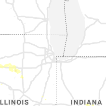
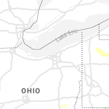
Hail Map for Wednesday, June 3, 2020

Number of Impacted Households on 6/3/2020
0
Impacted by 1" or Larger Hail
0
Impacted by 1.75" or Larger Hail
0
Impacted by 2.5" or Larger Hail
Square Miles of Populated Area Impacted on 6/3/2020
0
Impacted by 1" or Larger Hail
0
Impacted by 1.75" or Larger Hail
0
Impacted by 2.5" or Larger Hail


Cities Most Affected by Hail Storms of 6/3/2020
| Hail Size | Demographics of Zip Codes Affected | ||||||
|---|---|---|---|---|---|---|---|
| City | Count | Average | Largest | Pop Density | House Value | Income | Age |
| Idalia, CO | 3 | 1.75 | 1.75 | 1 | $119k | $36.3k | 34.9 |
| Thedford, NE | 1 | 2.00 | 2.00 | 0 | $39k | $31.7k | 46.4 |
| Blue Grass, IA | 1 | 1.75 | 1.75 | 122 | $125k | $62.4k | 44.9 |
| Brady, NE | 1 | 1.75 | 1.75 | 3 | $79k | $33.5k | 41.1 |
| Benton City, MO | 1 | 1.75 | 1.75 | 7 | $55k | $41.0k | 48.6 |
| North Loup, NE | 1 | 1.75 | 1.75 | 4 | $19k | $23.8k | 50.9 |
Hail and Wind Damage Spotted on 6/3/2020
Filter by Report Type:Hail ReportsWind Reports
States Impacted
Iowa, Pennsylvania, Illinois, New Jersey, Ohio, South Dakota, Mississippi, Colorado, Tennessee, Alabama, Nebraska, Missouri, West Virginia, Wyoming, Arkansas, Indiana, Louisiana, New York, Kansas, TexasIowa
| Local Time | Report Details |
|---|---|
| 7:00 AM CDT | Half Dollar sized hail reported near Princeton, IA, 71.8 miles ESE of Cedar Rapids, IA, delayed report. |
| 7:05 AM CDT | Quarter sized hail reported near Princeton, IA, 72 miles ESE of Cedar Rapids, IA, occurring right now. |
| 7:12 PM CDT | Golf Ball sized hail reported near Blue Grass, IA, 57.2 miles SE of Cedar Rapids, IA, quarter to golf ball size hail. |
Pennsylvania
| Local Time | Report Details |
|---|---|
| 8:50 AM EDT | Tree down on arnold avenue near route 66. time estimated from rada in clarion county PA, 75.1 miles NNE of Pittsburgh, PA |
| 9:12 AM EDT | Tree down on tippecanoe road near huckleberry ridge. time estimated from rada in clarion county PA, 57.7 miles NNE of Pittsburgh, PA |
| 9:58 AM EDT | Large tree down on wire in clearfield county PA, 33.3 miles WNW of State College, PA |
| 10:00 AM EDT | Tree down on wire in clearfield county PA, 38.4 miles W of State College, PA |
| 10:17 AM EDT | Trees down along marengo road in halfmoon tw in centre county PA, 9.4 miles WSW of State College, PA |
| 10:18 AM EDT | Trees and telephone pole down on short st in tyron in blair county PA, 22.1 miles WSW of State College, PA |
| 10:20 AM EDT | Tree blocking road. 600 block of west nittany av in centre county PA, 0.3 miles S of State College, PA |
| 10:20 AM EDT | Tree blocking roadwa in centre county PA, 12.5 miles NE of State College, PA |
| 10:22 AM EDT | A few trees down on se side of whitehall rd about 0.3 miles west of fairbroo in centre county PA, 6.9 miles SW of State College, PA |
| 10:30 AM EDT | Tree blocking roadwa in centre county PA, 10.2 miles NNE of State College, PA |
| 10:38 AM EDT | Trees down on wires along ferguson valley roa in mifflin county PA, 18.2 miles SE of State College, PA |
| 10:47 AM EDT | Trees down on wires muddy run road at green acres lan in juniata county PA, 27 miles ESE of State College, PA |
| 10:50 AM EDT | Downed tree in wires near the intersection of palm road and kings highway south. time estimate in lehigh county PA, 66.1 miles S of Scranton, PA |
| 10:51 AM EDT | Downed tree in wires near the intersection of powder valley road and palm road. time estimate in lehigh county PA, 66.7 miles S of Scranton, PA |
| 10:51 AM EDT | Trees down on wires on jericho roa in juniata county PA, 30.1 miles ESE of State College, PA |
| 10:53 AM EDT | Downed tree in wires near the intersection of state highway 23 and coventryville road. time estimate in chester county PA, 78 miles NE of Baltimore, MD |
| 10:58 AM EDT | Trees down on wire in northumberland county PA, 64.2 miles SW of Scranton, PA |
| 11:25 AM EDT | Several trees downed on a property on river rd. report via social media with photos. time estimated from rada in berks county PA, 72.2 miles SSW of Scranton, PA |
| 11:26 AM EDT | Mesonet station av372 hummelstow in dauphin county PA, 69.7 miles ESE of State College, PA |
| 11:30 AM EDT | Numerous reports of trees and wires down in north heidelberg. time estimated from rada in berks county PA, 73.9 miles SSW of Scranton, PA |
| 11:30 AM EDT | Tree down on wires on christmas village roa in berks county PA, 72.8 miles SSW of Scranton, PA |
| 11:32 AM EDT | Tree down on wires on mount pleasant roa in berks county PA, 72.3 miles SSW of Scranton, PA |
| 11:34 AM EDT | Storm damage reported in berks county PA, 72.9 miles SSW of Scranton, PA |
| 11:35 AM EDT | Several reports of tree and power line damage in the are in berks county PA, 72.9 miles SSW of Scranton, PA |
| 11:35 AM EDT | Power pole down onto a hous in berks county PA, 72.6 miles SSW of Scranton, PA |
| 11:35 AM EDT | Several tree limbs and power lines down in the area. estimated wind gusts up to 60 mp in berks county PA, 77 miles NNE of Baltimore, MD |
| 11:35 AM EDT | Multiple trees and limbs snapped or downed. time estimated from rada in berks county PA, 75.3 miles NNE of Baltimore, MD |
| 11:38 AM EDT | Downed tree in wires on state highway 12 near the 11th street interchange. time estimate in berks county PA, 73 miles S of Scranton, PA |
| 11:38 AM EDT | Downed tree in wires on state highway 12 near spring valley road. time estimate in berks county PA, 72.2 miles S of Scranton, PA |
| 11:39 AM EDT | Downed tree in wires. time estimate in berks county PA, 73.6 miles NNE of Baltimore, MD |
| 11:40 AM EDT | Large tree downed in wyomissing. report via social media with video. time estimated from rada in berks county PA, 76.2 miles SSW of Scranton, PA |
| 11:40 AM EDT | Downed tree and wires on cleveland avenu in berks county PA, 77.3 miles SSW of Scranton, PA |
| 11:40 AM EDT | Several reports of trees and wires down in spring ridge and west law in berks county PA, 75.2 miles SSW of Scranton, PA |
| 11:40 AM EDT | Tree down onto a house on east court boulevard. time estimate in berks county PA, 76.7 miles SSW of Scranton, PA |
| 11:42 AM EDT | Widespread power outages with numerous reports of power lines and trees dow in berks county PA, 71.8 miles SSW of Scranton, PA |
| 11:42 AM EDT | Several reports of trees and power lines dow in berks county PA, 77.2 miles SSW of Scranton, PA |
| 11:43 AM EDT | Trees and wires down mill rd at bensing r in lancaster county PA, 73.5 miles NNE of Baltimore, MD |
| 11:45 AM EDT | Storm damage reported in berks county PA, 69.6 miles S of Scranton, PA |
| 11:45 AM EDT | Building collapse caused by tree falling into a hous in berks county PA, 71.3 miles SSW of Scranton, PA |
| 11:50 AM EDT | Several reports of trees and power lines dow in lehigh county PA, 62.2 miles S of Scranton, PA |
| 11:50 AM EDT | Several reports of tree and power line damag in berks county PA, 77.3 miles S of Scranton, PA |
| 11:50 AM EDT | Several reports of trees and power lines dow in berks county PA, 74 miles S of Scranton, PA |
| 11:50 AM EDT | Trees and wires down north broad st at east walnut s in lancaster county PA, 54.4 miles NNE of Baltimore, MD |
| 11:50 AM EDT | Large tree down near yellow house hotel. time estimate in berks county PA, 79.4 miles S of Scranton, PA |
| 11:50 AM EDT | Corrects previous tstm wnd dmg report from 2 sse zionsville. downed tree in wires near the intersection of palm road and kings highway south. time estimate in lehigh county PA, 66.1 miles S of Scranton, PA |
| 11:51 AM EDT | Corrects previous tstm wnd dmg report from 2 ene hereford twp. downed tree in wires near the intersection of powder valley road and palm road. time estimate in lehigh county PA, 66.7 miles S of Scranton, PA |
| 11:52 AM EDT | Downed tree on schoolhouse road. time estimate in chester county PA, 82.1 miles NE of Baltimore, MD |
| 11:53 AM EDT | Corrects previous tstm wnd dmg report from 1 wnw pughtown. downed tree in wires near the intersection of state highway 23 and coventryville road. time estimate in chester county PA, 78 miles NE of Baltimore, MD |
| 11:53 AM EDT | Downed tree in wires. time estimate in lehigh county PA, 66.4 miles S of Scranton, PA |
| 11:53 AM EDT | Downed tree in wires. time estimate in montgomery county PA, 69.6 miles S of Scranton, PA |
| 11:55 AM EDT | Downed tree on pughtown road. time estimate in chester county PA, 78.8 miles NE of Baltimore, MD |
| 11:55 AM EDT | Several reports of trees and power lines dow in berks county PA, 75.9 miles NNE of Baltimore, MD |
| 11:56 AM EDT | Storm damage reported in chester county PA, 81.4 miles S of Scranton, PA |
| 11:56 AM EDT | Downed tree in wires. time estimate in bucks county PA, 71.6 miles SSE of Scranton, PA |
| 11:59 AM EDT | Multiple large trees snapped; one fell onto and destroyed a shed. report via social media with photos. time estimated from rada in chester county PA, 83.4 miles NE of Baltimore, MD |
| 11:59 AM EDT | Storm damage reported in montgomery county PA, 80.1 miles S of Scranton, PA |
| 12:00 PM EDT | Trees and power lines dow in berks county PA, 74.1 miles NNE of Baltimore, MD |
| 12:00 PM EDT | Downed limbs and power line in chester county PA, 81.9 miles NE of Baltimore, MD |
| 12:00 PM EDT | Downed tree caused an accident on county line roa in berks county PA, 74.6 miles S of Scranton, PA |
| 12:00 PM EDT | Numerous trees down in spring city. report via social media with photos. time estimated from rada in chester county PA, 83.4 miles NE of Baltimore, MD |
| 12:00 PM EDT | Downed tree in wires. time estimate in montgomery county PA, 78.6 miles S of Scranton, PA |
| 12:00 PM EDT | Downed tree in wires. time estimate in bucks county PA, 73.4 miles WSW of Brooklyn, NY |
| 12:02 PM EDT | Several reports of trees and power lines down in the area. time estimate in montgomery county PA, 84.4 miles WSW of Brooklyn, NY |
| 12:02 PM EDT | Downed trees and power lines on sycamore roa in berks county PA, 69.8 miles S of Scranton, PA |
| 12:04 PM EDT | Downed tree in wires. time estimate in bucks county PA, 72.6 miles WSW of Brooklyn, NY |
| 12:04 PM EDT | Multiple trees snapped. report via social media with photos. time estimated from rada in montgomery county PA, 81.3 miles WSW of Brooklyn, NY |
| 12:05 PM EDT | Large tree down on a building at the knollwood apartments. photo shows considerable structural damage. time estimated from rada in chester county PA, 82.4 miles NE of Baltimore, MD |
| 12:05 PM EDT | Large tree down in the 400 block of s park ave. time estimated from rada in montgomery county PA, 83.2 miles WSW of Brooklyn, NY |
| 12:07 PM EDT | Portion of a roof blown off of an apartment building. time estimated from rada in montgomery county PA, 74.5 miles WSW of Brooklyn, NY |
| 12:07 PM EDT | Numerous reports of power lines down in the area. time estimate in chester county PA, 82.5 miles NE of Baltimore, MD |
| 12:10 PM EDT | Multiple large tree branches down and two trees snapped on golf cours in chester county PA, 83.9 miles NE of Baltimore, MD |
| 12:10 PM EDT | Trees and power lines down all across central bucks county including chalfont. time estimated from rada in bucks county PA, 70 miles WSW of Brooklyn, NY |
| 12:10 PM EDT | Tree on wires at intersection of routes 29 and 663. time estimate in montgomery county PA, 70.9 miles S of Scranton, PA |
| 12:11 PM EDT | Large tree down on wall stree in chester county PA, 82.9 miles NE of Baltimore, MD |
| 12:11 PM EDT | Downed tree in wires near interstate 476 and exit 18. time estimate in montgomery county PA, 80.3 miles WSW of Brooklyn, NY |
| 12:11 PM EDT | Numerous reports of trees and power lines down. time estimate in montgomery county PA, 81.8 miles WSW of Brooklyn, NY |
| 12:11 PM EDT | Multiple trees down near the intersection of spring rd and n warren ave. time estimated from rada in chester county PA, 77.8 miles NE of Baltimore, MD |
| 12:11 PM EDT | Numerous reports of trees and power lines down. time estimate in bucks county PA, 67.8 miles WSW of Brooklyn, NY |
| 12:12 PM EDT | Video via social media of transformers blowing during thunderstorm winds. time estimated from rada in montgomery county PA, 82.2 miles WSW of Brooklyn, NY |
| 12:12 PM EDT | Tree down on conestoga roa in chester county PA, 75.3 miles NE of Baltimore, MD |
| 12:12 PM EDT | Tree down on saint matthews roa in chester county PA, 78.3 miles NE of Baltimore, MD |
| 12:12 PM EDT | Tree and wires down on west main stree in montgomery county PA, 83.1 miles WSW of Brooklyn, NY |
| 12:13 PM EDT | Several reports of trees and power lines down in the area. time estimate in bucks county PA, 67.3 miles WSW of Brooklyn, NY |
| 12:15 PM EDT | Downed tree on interstate 476 near the i-76 interchange. time estimate in montgomery county PA, 82.3 miles WSW of Brooklyn, NY |
| 12:15 PM EDT | Storm damage reported in chester county PA, 78.2 miles NE of Baltimore, MD |
| 12:15 PM EDT | Trees and power poles down. time estimated from rada in delaware county PA, 80.6 miles NE of Baltimore, MD |
| 12:15 PM EDT | Multiple trees down with the largest diameter around 1 foo in bucks county PA, 67.3 miles WSW of Brooklyn, NY |
| 12:17 PM EDT | Numerous reports of power lines down throughout the area. time estimate in delaware county PA, 73.8 miles NE of Baltimore, MD |
| 12:19 PM EDT | Tree down alongside road. time estimated from rada in delaware county PA, 83.6 miles NE of Baltimore, MD |
| 12:20 PM EDT | *** 1 fatal *** a tree crashed through the roof of a building at the philmont country club in lower moreland twp killling one perso in montgomery county PA, 67.6 miles SW of Brooklyn, NY |
| 12:22 PM EDT | Several trees and power poles down. time estimated from rada in delaware county PA, 81.3 miles ENE of Baltimore, MD |
| 12:23 PM EDT | *** 1 fatal *** a tree fell on to the roof of a car killing one person near the intersection of belmont avenue and rock hill roa in montgomery county PA, 80.2 miles SW of Brooklyn, NY |
| 12:23 PM EDT | Numerous reports of power lines down across the area. time estimate in delaware county PA, 74.6 miles ENE of Baltimore, MD |
| 12:23 PM EDT | Downed power lines throughout the area. time estimate in philadelphia county PA, 79 miles SW of Brooklyn, NY |
| 12:24 PM EDT | *** 1 fatal *** a tree fell on to the roof of a car killing one person in lower merion along medford roa in montgomery county PA, 83.6 miles SW of Brooklyn, NY |
| 12:25 PM EDT | Several large tree limbs snapped off with some onto cars. this was on whitby ave approaching cobbs creek parkway in southwest philadelphia. time estimated from rada in philadelphia county PA, 84 miles SW of Brooklyn, NY |
| 12:25 PM EDT | Section of roof removed at the park circle apartments. time estimated from rada in philadelphia county PA, 70.5 miles SW of Brooklyn, NY |
| 12:25 PM EDT | Multiple trees and power poles down on bellevue ave. report via social media with photos. county emergency management also reports widespread damage in bensalem. time e in bucks county PA, 64.2 miles SW of Brooklyn, NY |
| 12:25 PM EDT | Trees down. time estimated from rada in philadelphia county PA, 81.4 miles SW of Brooklyn, NY |
| 12:25 PM EDT | Several downed trees in the area. time estimate in bucks county PA, 63.8 miles SW of Brooklyn, NY |
| 12:25 PM EDT | Several downed trees in northeast philadelphia near the bucks county line. time estimate in philadelphia county PA, 65.9 miles SW of Brooklyn, NY |
| 12:25 PM EDT | Storm damage reported in philadelphia county PA, 68.4 miles SW of Brooklyn, NY |
| 12:25 PM EDT | Storm damage reported in montgomery county PA, 74.7 miles WSW of Brooklyn, NY |
| 12:26 PM EDT | Larges trees down in neighbors yar in montgomery county PA, 74.8 miles WSW of Brooklyn, NY |
| 12:28 PM EDT | Storm damage reported in philadelphia county PA, 84.6 miles ENE of Baltimore, MD |
| 12:29 PM EDT | Itws senso in delaware county PA, 82.4 miles ENE of Baltimore, MD |
| 12:30 PM EDT | Several large tree limbs snapped off destroying a fence. time estimated from rada in bucks county PA, 64.6 miles SW of Brooklyn, NY |
| 12:30 PM EDT | Storm damage reported in philadelphia county PA, 70.6 miles SW of Brooklyn, NY |
| 12:30 PM EDT | *** 1 fatal *** a tree fell on to a power line that fell on a house causing a house fire that killed one individual. time estimated from rada in delaware county PA, 77.7 miles ENE of Baltimore, MD |
| 1:43 PM EDT | Multiple tree branches covering the streets. larges branches between 1-2 inches thick. estimated wind speeds 70mp in montgomery county PA, 77.8 miles WSW of Brooklyn, NY |
| 3:35 PM EDT | Trees down across wykoff run r in cameron county PA, 37.1 miles NNW of State College, PA |
| 4:27 PM EDT | Trees down on wires near lama in clinton county PA, 23.3 miles NE of State College, PA |
| 4:34 PM EDT | Trees down on wires east of rebersbur in centre county PA, 26 miles ENE of State College, PA |
| 4:50 PM EDT | Multiple trees down on route 10 in snyder county PA, 42.7 miles E of State College, PA |
| 4:50 PM EDT | Multiple trees down on scholl r in snyder county PA, 43.7 miles E of State College, PA |
| 4:58 PM EDT | Quarter sized hail reported near Beavertown, PA, 34.7 miles E of State College, PA, quarter size hail in troxelville. |
| 5:07 PM EDT | Trees down on wires near rebuc in northumberland county PA, 59.5 miles E of State College, PA |
| 5:07 PM EDT | Campground destroyed at 275 campground ln in beaver tw in snyder county PA, 38.4 miles E of State College, PA |
| 5:15 PM EDT | Trees down on wire in tioga county PA, 69.4 miles WNW of Scranton, PA |
| 5:20 PM EDT | Multiple trees snapped along route 1 in snyder county PA, 49.3 miles ESE of State College, PA |
| 5:35 PM EDT | Quarter sized hail reported near Berrysburg, PA, 56.8 miles ESE of State College, PA |
| 5:36 PM EDT | Trees down on wire in dauphin county PA, 58.4 miles E of State College, PA |
| 5:36 PM EDT | Quarter sized hail reported near Berrysburg, PA, 56.8 miles ESE of State College, PA |
| 5:38 PM EDT | Tree dow in dauphin county PA, 59 miles ESE of State College, PA |
| 5:42 PM EDT | Trees and powerlines dow in dauphin county PA, 59.3 miles ESE of State College, PA |
| 5:59 PM EDT | Barn destroyed at oriental rd and sawmill rd in chapman tw in snyder county PA, 49.2 miles E of State College, PA |
| 6:02 PM EDT | 12 trees dow in lebanon county PA, 70.9 miles ESE of State College, PA |
| 6:12 PM EDT | Downed power lines on cleveland avenue. time estimate in berks county PA, 76.5 miles SSW of Scranton, PA |
| 6:13 PM EDT | Trees and wires dow in susquehanna county PA, 31.1 miles NNW of Scranton, PA |
| 6:14 PM EDT | Trees down on wire in lebanon county PA, 76.1 miles NNE of Baltimore, MD |
| 6:15 PM EDT | Downed power lines near texter mountain road. time estimate in berks county PA, 76.3 miles NNE of Baltimore, MD |
| 6:15 PM EDT | Downed tree damaged a property on garfield avenu in berks county PA, 77.3 miles SSW of Scranton, PA |
| 6:15 PM EDT | Downed tree onto a hous in berks county PA, 76.6 miles SSW of Scranton, PA |
| 6:19 PM EDT | Roof blown off a 40 by 100 foot warehouse and dropped in the road. building collapse in susquehanna county PA, 26.5 miles NNW of Scranton, PA |
| 6:20 PM EDT | Downed tree on wires near octagon avenu in berks county PA, 76.7 miles SSW of Scranton, PA |
| 6:20 PM EDT | Tree on wires on woodward driv in berks county PA, 73.4 miles SSW of Scranton, PA |
| 6:22 PM EDT | Trees and wires across road on rt 29 in susquehanna county PA, 31.1 miles NNW of Scranton, PA |
| 6:22 PM EDT | Mping report of trees down. time estimate in berks county PA, 77 miles NNE of Baltimore, MD |
| 6:26 PM EDT | Numerous large trees dow in susquehanna county PA, 21.5 miles NNW of Scranton, PA |
| 6:27 PM EDT | Multiple trees and wires down in susquehanna county PA, 24.4 miles NW of Scranton, PA |
| 6:27 PM EDT | Multiple large trees down. wires across roa in susquehanna county PA, 33.2 miles NW of Scranton, PA |
| 6:29 PM EDT | Numerous larges trees dow in wyoming county PA, 16.6 miles NNW of Scranton, PA |
| 6:32 PM EDT | Numerous large trees dow in susquehanna county PA, 20.7 miles N of Scranton, PA |
| 6:32 PM EDT | Trees down on wire in lancaster county PA, 67.7 miles NNE of Baltimore, MD |
| 6:33 PM EDT | Downed power lines on east main street and chestnut street. time estimate in berks county PA, 79.6 miles NNE of Baltimore, MD |
| 6:34 PM EDT | Trees down on homes... extent of damage unknown. no injuries or death in susquehanna county PA, 16.9 miles N of Scranton, PA |
| 6:34 PM EDT | Numerous large trees dow in lackawanna county PA, 13.5 miles NNW of Scranton, PA |
| 6:35 PM EDT | Downed trees and wires reporte in berks county PA, 79.1 miles S of Scranton, PA |
| 6:36 PM EDT | Numerous large trees dow in wyoming county PA, 12.1 miles NNW of Scranton, PA |
| 6:37 PM EDT | Power lines blocking the road in susquehanna county PA, 32.5 miles NW of Scranton, PA |
| 6:39 PM EDT | Trees down on wire in lancaster county PA, 65.2 miles NNE of Baltimore, MD |
| 6:40 PM EDT | High tension lines down in susquehanna county PA, 24.4 miles NW of Scranton, PA |
| 6:42 PM EDT | Trees down and blocking roadways in susquehanna county PA, 27.8 miles NNW of Scranton, PA |
| 6:54 PM EDT | Trees down on wire in lancaster county PA, 63.7 miles NNE of Baltimore, MD |
| 6:55 PM EDT | Large tree down near the intersection of fairview road and peters lan in chester county PA, 71.9 miles NE of Baltimore, MD |
| 7:00 PM EDT | Several large trees down near the intersection of horseshoe trail road and haverhill roa in chester county PA, 75.6 miles NE of Baltimore, MD |
| 7:00 PM EDT | Downed tree blocking hillcrest avenue near forrest avenu in chester county PA, 79.8 miles NE of Baltimore, MD |
| 7:02 PM EDT | Downed wires on a vehicle on coldstream roa in chester county PA, 80 miles NE of Baltimore, MD |
| 7:04 PM EDT | Downed tree and traffic light on moores avenue and kelmar avenu in chester county PA, 76.3 miles NE of Baltimore, MD |
| 7:04 PM EDT | Downed wires on conestoga road near lancaster avenu in chester county PA, 77.4 miles NE of Baltimore, MD |
| 7:07 PM EDT | Downed tree and wires on monument avenu in chester county PA, 77.3 miles NE of Baltimore, MD |
| 7:08 PM EDT | Trees down across rt 407 in lackawanna county PA, 6.1 miles NNW of Scranton, PA |
| 7:09 PM EDT | Trees blocking road on hamlin highway in wayne county PA, 14.8 miles E of Scranton, PA |
| 7:09 PM EDT | Tree down on lloyd avenu in chester county PA, 78.1 miles NE of Baltimore, MD |
| 7:10 PM EDT | Downed tree on kings highway near bailey road. time estimate in chester county PA, 67.2 miles NE of Baltimore, MD |
| 7:10 PM EDT | Trees down blocking road in pike county PA, 24 miles E of Scranton, PA |
| 7:11 PM EDT | Downed tree on hibernia road near lafayette roa in chester county PA, 66.7 miles NE of Baltimore, MD |
| 7:11 PM EDT | Several reports of power lines down in the area. time estimate in delaware county PA, 80.6 miles NE of Baltimore, MD |
| 7:12 PM EDT | Downed tree on country club road near beacon hill lan in chester county PA, 81.3 miles NE of Baltimore, MD |
| 7:13 PM EDT | Tree into a house on hilltop roa in chester county PA, 80.2 miles NE of Baltimore, MD |
| 7:14 PM EDT | Multiple downed trees and limbs. time estimate in delaware county PA, 82.3 miles NE of Baltimore, MD |
| 7:15 PM EDT | Downed wire on paoli pike near rustic lan in chester county PA, 78.1 miles NE of Baltimore, MD |
| 7:17 PM EDT | Tree into a house on mill road. time estimate in delaware county PA, 71.3 miles NE of Baltimore, MD |
| 7:17 PM EDT | Widespread reports of power lines down in brookhaven and springfield. time estimate in delaware county PA, 81.7 miles ENE of Baltimore, MD |
| 7:20 PM EDT | Downed tree blocking old eagle school roa in chester county PA, 83.1 miles NE of Baltimore, MD |
| 7:20 PM EDT | Downed trees on leopard road near edgewood avenu in chester county PA, 80.6 miles NE of Baltimore, MD |
| 7:21 PM EDT | Downed tree blocking grubb road near treble lan in chester county PA, 78.5 miles NE of Baltimore, MD |
| 7:23 PM EDT | Several reports of trees and wires down in the area. time estimate in delaware county PA, 82.8 miles ENE of Baltimore, MD |
| 7:27 PM EDT | Storm damage reported in delaware county PA, 82.4 miles ENE of Baltimore, MD |
| 7:28 PM EDT | Tree dow in cumberland county PA, 54.1 miles SE of State College, PA |
| 7:28 PM EDT | Downed tree and wires on laurel road. time estimate in delaware county PA, 83.7 miles ENE of Baltimore, MD |
| 7:30 PM EDT | Downed tree and wires near alfred avenue. time estimate in delaware county PA, 84.1 miles ENE of Baltimore, MD |
| 7:30 PM EDT | Downed trees and wires in the area. time estimate in delaware county PA, 83.7 miles ENE of Baltimore, MD |
| 7:30 PM EDT | Tree down on wires on south spring garden s in cumberland county PA, 54.4 miles SE of State College, PA |
| 7:30 PM EDT | Multiple trees dow in cumberland county PA, 54.8 miles SE of State College, PA |
| 7:30 PM EDT | Multiple trees dow in cumberland county PA, 54.8 miles SE of State College, PA |
| 7:32 PM EDT | Storm damage reported in philadelphia county PA, 84.6 miles ENE of Baltimore, MD |
| 8:02 PM EDT | Tree dow in york county PA, 54.3 miles NNW of Baltimore, MD |
| 8:15 PM EDT | Tree dow in york county PA, 47.1 miles N of Baltimore, MD |
| 8:15 PM EDT | Tree down on hous in york county PA, 47 miles N of Baltimore, MD |
| 8:17 PM EDT | Tree down on wire in york county PA, 46.5 miles N of Baltimore, MD |
| 8:27 PM EDT | Tree dow in york county PA, 42 miles N of Baltimore, MD |
| 8:27 PM EDT | Tree down on wire in york county PA, 42 miles N of Baltimore, MD |
| 8:27 PM EDT | Tree dow in york county PA, 42.7 miles N of Baltimore, MD |
| 8:30 PM EDT | Tree dow in york county PA, 43.4 miles N of Baltimore, MD |
| 8:30 PM EDT | Tree and wires down across jefferson lan in york county PA, 42.1 miles N of Baltimore, MD |
Illinois
| Local Time | Report Details |
|---|---|
| 7:59 AM CDT | Social media report with pictures of two destroyed grain bins... and a toppled elevator at this location. time is based on rada in bureau county IL, 50.9 miles N of Peoria, IL |
| 8:11 AM CDT | Corrects the time from the previous tstm wnd dmg report from nw princeton. reported power out on the northwest side of town. there was a 2 inch tree diameter tree limb in bureau county IL, 47.9 miles N of Peoria, IL |
| 8:15 AM CDT | Tree down over the street and several smaller branches also dow in bureau county IL, 47.3 miles N of Peoria, IL |
| 8:15 AM CDT | Numerous trees down in town with power outages reporte in bureau county IL, 47.9 miles N of Peoria, IL |
| 8:26 AM CDT | Quarter sized hail reported near Bureau, IL, 42.8 miles NNE of Peoria, IL, occurring right now. |
| 8:29 AM CDT | Tree down on garage and several large tree limbs down on the garage. wind gauge over the door measured 60 mph. also reported golf ball size hai in putnam county IL, 40.6 miles NNE of Peoria, IL |
| 8:50 AM CDT | Reported power out on the northwest side of town. there was a 2 inch tree diameter tree limb down in the driveway. also... heavy rain and pea size hai in bureau county IL, 47.9 miles N of Peoria, IL |
| 9:50 AM CDT | 911 operator reported powerlines down in cameron due to thunderstorm wind in warren county IL, 50.8 miles WNW of Peoria, IL |
| 3:35 PM CDT | Emergency management reported a gust of 62 mph at the leading edge of the storm. hail began falling shortly after the storm moved overhead. hail size ranged from penny in pike county IL, 74.2 miles SE of Kahoka, MO |
| 7:58 PM CDT | Reported a 5 to 6 inch diameter branch across the road. time was estimated using rada in rock island county IL, 56.3 miles SE of Cedar Rapids, IA |
| 8:50 PM CDT | Tree blown down onto power line in edgar township. time estimated from rada in edgar county IL, 42.4 miles ENE of Mattoon, IL |
| 9:00 PM CDT | Quarter sized hail reported near Smithfield, IL, 40 miles WSW of Peoria, IL, time estimated from radar. |
| 1:04 AM CDT | Storm damage reported in coles county IL, 5.1 miles E of Mattoon, IL |
New Jersey
| Local Time | Report Details |
|---|---|
| 12:19 PM EDT | Photo shows a large tree split in half and downed onto a fence. time estimated from rada in camden county NJ, 79.7 miles SW of Brooklyn, NY |
| 12:23 PM EDT | Downed power poles and wires on state highway 29 north of pleasant valley road. time estimate in mercer county NJ, 55 miles WSW of Brooklyn, NY |
| 12:23 PM EDT | Downed tree on interstate 295 south of exit 15. time estimate in gloucester county NJ, 78.6 miles ENE of Baltimore, MD |
| 12:25 PM EDT | Downed tree on state highway 47 near broadway avenue. time estimate in gloucester county NJ, 82.7 miles SW of Brooklyn, NY |
| 12:25 PM EDT | Downed tree on interstate 76 westbound ramp to exit 1c. time estimate in camden county NJ, 81.1 miles SW of Brooklyn, NY |
| 12:25 PM EDT | Downed tree on u.s. highway 130 southbound south of browning road. time estimate in camden county NJ, 76.3 miles SW of Brooklyn, NY |
| 12:27 PM EDT | Downed tree on new jersey turnpike southbound south of exit 3. time estimate in gloucester county NJ, 82.6 miles SW of Brooklyn, NY |
| 12:27 PM EDT | Downed traffic light on state highway 168 at browning road. time estimate in camden county NJ, 80.8 miles SW of Brooklyn, NY |
| 12:27 PM EDT | Multiple large trees and at least one power pole snapped. report via social media with photos. time estimated from rada in burlington county NJ, 71.2 miles SW of Brooklyn, NY |
| 12:27 PM EDT | Several trees down with winds estimated to be at least 50 mph. time estimated from rada in hunterdon county NJ, 45.3 miles WSW of Brooklyn, NY |
| 12:29 PM EDT | Downed tree on new jersey turnpike north of state highway 73. time estimate in burlington county NJ, 70.1 miles SW of Brooklyn, NY |
| 12:29 PM EDT | Time estimated from rada in burlington county NJ, 67.7 miles SW of Brooklyn, NY |
| 12:30 PM EDT | Gust measured at delran high school. last reading before instrument failed. time estimated from rada in burlington county NJ, 68.8 miles SW of Brooklyn, NY |
| 12:30 PM EDT | Several trees down blocking roadways. time estimated from rada in camden county NJ, 77.5 miles SW of Brooklyn, NY |
| 12:30 PM EDT | Large tree damaged propert in mercer county NJ, 49.5 miles WSW of Brooklyn, NY |
| 12:30 PM EDT | Solar panels damaged and blown off of cold spring elementary school. report via social media with photos. time estimated from rada in camden county NJ, 81 miles SW of Brooklyn, NY |
| 12:30 PM EDT | Numerous trees down blocking roadways. time estimated from rada in burlington county NJ, 65.4 miles SW of Brooklyn, NY |
| 12:30 PM EDT | Large branches dow in burlington county NJ, 66 miles SW of Brooklyn, NY |
| 12:30 PM EDT | Njwxnet senso in camden county NJ, 73.6 miles SW of Brooklyn, NY |
| 12:30 PM EDT | Bdrn4 nos gaug in bucks county PA, 62.8 miles SW of Brooklyn, NY |
| 12:31 PM EDT | Downed tree on new jersey turnpike north of state highway 168. time estimated from rada in camden county NJ, 78.6 miles SW of Brooklyn, NY |
| 12:31 PM EDT | Downed tree on interstate 295 at exit 15. time estimated from rada in gloucester county NJ, 79.1 miles ENE of Baltimore, MD |
| 12:31 PM EDT | Downed power lines on u.s. highway 30 east of graisbury avenue. time estimate in camden county NJ, 79.1 miles SW of Brooklyn, NY |
| 12:31 PM EDT | Downed tree on interstate 295 southbound at exit 43. time estimate in burlington county NJ, 67.5 miles SW of Brooklyn, NY |
| 12:31 PM EDT | Downed tree and wires on u.s. highway 30 west of state highway 41. time estimate in camden county NJ, 79.2 miles SW of Brooklyn, NY |
| 12:32 PM EDT | Several trees snapped on pioneer boulevard off of woodlane road in westampton. time estimated from rada in burlington county NJ, 64.3 miles SW of Brooklyn, NY |
| 12:32 PM EDT | Storm damage reported in mercer county NJ, 51.7 miles WSW of Brooklyn, NY |
| 12:32 PM EDT | Trees down in delran with some on power lines and some blocking roads... including on haines mill road. times estimated from rada in burlington county NJ, 69.6 miles SW of Brooklyn, NY |
| 12:32 PM EDT | Tree uprooted and blocking most of bridgeboro road near echo ave. time estimated from rada in burlington county NJ, 68.8 miles SW of Brooklyn, NY |
| 12:32 PM EDT | Numerous trees snapped and uprooted with some onto houses. time estimated from rada in camden county NJ, 76 miles SW of Brooklyn, NY |
| 12:33 PM EDT | Downed tree on new jersey turnpike south of exit 5. time estimate in burlington county NJ, 64.7 miles SW of Brooklyn, NY |
| 12:33 PM EDT | Trees down. time estimated from rada in mercer county NJ, 47.4 miles SW of Brooklyn, NY |
| 12:33 PM EDT | Downed tree near the bridle club on ridgewood way. report via social media with photo. time estimated from rada in burlington county NJ, 62.3 miles SW of Brooklyn, NY |
| 12:33 PM EDT | Downed power poles and wires on u.s. highway 130 southbound near neck road. time estimate in burlington county NJ, 59.1 miles SW of Brooklyn, NY |
| 12:35 PM EDT | Downed trees and power lines on hainesport road between state highway 38 and marne highway. time estimate in burlington county NJ, 66.6 miles SW of Brooklyn, NY |
| 12:35 PM EDT | Measured gust. time estimated from rada in burlington county NJ, 70.7 miles SW of Brooklyn, NY |
| 12:35 PM EDT | Measured gust. time estimated from rada in burlington county NJ, 70.7 miles SW of Brooklyn, NY |
| 12:35 PM EDT | Trees down on memorial lan in burlington county NJ, 67.1 miles SW of Brooklyn, NY |
| 12:35 PM EDT | Several trees and limbs down in marlton and voorhee in camden county NJ, 77.3 miles SW of Brooklyn, NY |
| 12:35 PM EDT | Tree down on larchmont blvd towards union mil in burlington county NJ, 68.5 miles SW of Brooklyn, NY |
| 12:35 PM EDT | Trees down in essex place on home in burlington county NJ, 67.6 miles SW of Brooklyn, NY |
| 12:35 PM EDT | Several trees onto power lines on borton landing road between creek road and hartford road. some power poles leaning over the road. time estimated from rada in burlington county NJ, 68.6 miles SW of Brooklyn, NY |
| 12:35 PM EDT | Njwxnet senso in burlington county NJ, 68.7 miles SW of Brooklyn, NY |
| 12:37 PM EDT | Tree snapped near the intersection of state highway 70 and medford leas road. time estimate in burlington county NJ, 69.5 miles SW of Brooklyn, NY |
| 12:37 PM EDT | Downed tree on high stree in burlington county NJ, 63.8 miles SW of Brooklyn, NY |
| 12:37 PM EDT | Downed tree and wires on u.s. highway 130 southbound south of state highway 156. time estimate in burlington county NJ, 51.6 miles SW of Brooklyn, NY |
| 12:37 PM EDT | Several large trees snapped in lumberton. report via social media with photo. time estimated from rada in burlington county NJ, 65.1 miles SW of Brooklyn, NY |
| 12:38 PM EDT | Several power poles toppled on eayrestown rd. time estimated from rada in burlington county NJ, 66.4 miles SW of Brooklyn, NY |
| 12:38 PM EDT | Large parts of trees blown down. spotter estimated wind gust of 55 mph. time estimated from rada in mercer county NJ, 47.6 miles SW of Brooklyn, NY |
| 12:39 PM EDT | Downed tree on state highway 68 near monmouth road. time estimate in burlington county NJ, 56.9 miles SW of Brooklyn, NY |
| 12:39 PM EDT | Downed trees and power poles on u.s. highway 206 south of vincentown-buddtown road. time estimate in burlington county NJ, 65.8 miles SW of Brooklyn, NY |
| 12:39 PM EDT | Multiple trees down near the intersection of state highway 70 and old red lion road. time estimate in burlington county NJ, 69 miles SW of Brooklyn, NY |
| 12:39 PM EDT | Tree down near a house. no damage reported to house. time estimated from rada in burlington county NJ, 67.2 miles SSW of Brooklyn, NY |
| 12:40 PM EDT | Large trees snappe in camden county NJ, 76 miles SW of Brooklyn, NY |
| 12:40 PM EDT | Multiple large trees down near and along fish pond rd. time estimated from rada in gloucester county NJ, 87.4 miles ENE of Baltimore, MD |
| 12:40 PM EDT | Trees down. time estimated from rada in burlington county NJ, 64.3 miles SW of Brooklyn, NY |
| 12:40 PM EDT | Storm damage reported in burlington county NJ, 65.9 miles SW of Brooklyn, NY |
| 12:40 PM EDT | Njwxnet senso in burlington county NJ, 60.1 miles SW of Brooklyn, NY |
| 12:40 PM EDT | Storm damage reported in burlington county NJ, 65 miles SW of Brooklyn, NY |
| 12:42 PM EDT | Trees uprooted near state highway 70 and huntington drive. time estimate in burlington county NJ, 66.9 miles SW of Brooklyn, NY |
| 12:43 PM EDT | Several reports of trees and power lines down in the area. time estimate in burlington county NJ, 61.7 miles SW of Brooklyn, NY |
| 12:45 PM EDT | Downed trees throughout the area. winds estimated at 60+ mp in burlington county NJ, 50.1 miles SW of Brooklyn, NY |
| 12:45 PM EDT | Numerous trees down. time estimated from rada in burlington county NJ, 69.5 miles SSW of Brooklyn, NY |
| 12:46 PM EDT | Tree downed near the intersection of powell place rd and eldorado dr. report via social media with photo. time estimated from rada in burlington county NJ, 67.2 miles SSW of Brooklyn, NY |
| 12:48 PM EDT | Several reports of trees and power lines down. time estimate in burlington county NJ, 58.9 miles SSW of Brooklyn, NY |
| 12:48 PM EDT | Route 537 by upper elementary school blocked by downed trees. spotter estimated gusts in excess of 60 mph. time estimated from rada in burlington county NJ, 53.3 miles SW of Brooklyn, NY |
| 12:50 PM EDT | Downed tree limbs and damage to shed and fenc in gloucester county NJ, 85.4 miles ENE of Baltimore, MD |
| 12:50 PM EDT | Several reports of power lines down in the area. time estimate in burlington county NJ, 73.7 miles SSW of Brooklyn, NY |
| 12:51 PM EDT | Large... healthy tree snapped. report via social media with a photo. time estimated from rada in burlington county NJ, 73.6 miles SSW of Brooklyn, NY |
| 12:54 PM EDT | Several reports of power lines down in the area. time estimate in atlantic county NJ, 84.3 miles SSW of Brooklyn, NY |
| 12:54 PM EDT | Several reports of downed trees and power lines. time estimate in ocean county NJ, 54.8 miles SSW of Brooklyn, NY |
| 12:55 PM EDT | Several trees downed or damaged in whiting. report via social media with photos. time estimated from rada in ocean county NJ, 54.6 miles SSW of Brooklyn, NY |
| 12:58 PM EDT | Numerous trees down. time estimated from rada in ocean county NJ, 49.2 miles SSW of Brooklyn, NY |
| 12:58 PM EDT | A number of large trees downed or damaged in lakehurst. time estimated from rada in ocean county NJ, 49.8 miles SSW of Brooklyn, NY |
| 12:58 PM EDT | Storm damage reported in ocean county NJ, 49.5 miles SSW of Brooklyn, NY |
| 1:00 PM EDT | Storm damage reported in ocean county NJ, 43.4 miles SSW of Brooklyn, NY |
| 1:00 PM EDT | Several trees down. time estimated from rada in ocean county NJ, 54.5 miles SSW of Brooklyn, NY |
| 1:00 PM EDT | Downed tree on state highway 72 east of barnegat road. time estimate in ocean county NJ, 65.5 miles SSW of Brooklyn, NY |
| 1:00 PM EDT | Several reports of downed trees and power lines in the area. time estimate in monmouth county NJ, 38.7 miles SSW of Brooklyn, NY |
| 1:00 PM EDT | Several reports of downed trees and wires in the area. time estimate in ocean county NJ, 43.3 miles SSW of Brooklyn, NY |
| 1:02 PM EDT | Storm damage reported in ocean county NJ, 54.9 miles SSW of Brooklyn, NY |
| 1:03 PM EDT | Trees and wires down in forked river. time estimated from rada in ocean county NJ, 59.1 miles S of Brooklyn, NY |
| 1:05 PM EDT | Downed tree on garden state parkway southbound north of state highway 72. time estimate in ocean county NJ, 68 miles SSW of Brooklyn, NY |
| 1:05 PM EDT | Njwxnet senso in ocean county NJ, 55.1 miles SSW of Brooklyn, NY |
| 1:05 PM EDT | Downed trees and power lines in the area. time estimate in monmouth county NJ, 37.6 miles S of Brooklyn, NY |
| 1:05 PM EDT | Numerous reports of trees and power lines down. time estimate in ocean county NJ, 52.3 miles SSW of Brooklyn, NY |
| 1:05 PM EDT | Downed trees onto power lines and minor property damage reported on turtle creek rd. time estimated from rada in burlington county NJ, 79.4 miles SSW of Brooklyn, NY |
| 1:05 PM EDT | Several reports of power lines down in the area. time estimate in ocean county NJ, 65.8 miles SSW of Brooklyn, NY |
| 1:08 PM EDT | Wxflow senso in ocean county NJ, 52.1 miles S of Brooklyn, NY |
| 1:10 PM EDT | Wxflow senso in ocean county NJ, 82.8 miles SSW of Brooklyn, NY |
| 1:10 PM EDT | Large tree down on a house in manasquan. time estimated from rada in monmouth county NJ, 38.9 miles S of Brooklyn, NY |
| 1:10 PM EDT | Several trees down. time estimated from rada in ocean county NJ, 79.2 miles SSW of Brooklyn, NY |
| 1:12 PM EDT | Wxflow senso in ocean county NJ, 57.3 miles S of Brooklyn, NY |
| 1:13 PM EDT | Storm damage reported in anz451 county NJ, 54.2 miles S of Brooklyn, NY |
| 1:13 PM EDT | Wxflow senso in anz451 county NJ, 63 miles S of Brooklyn, NY |
| 1:14 PM EDT | Wxflow senso in anz451 county NJ, 64.6 miles S of Brooklyn, NY |
| 1:14 PM EDT | Wxflow senso in ocean county NJ, 47.2 miles S of Brooklyn, NY |
| 1:14 PM EDT | Personal weather station knjwaret in monmouth county NJ, 40.3 miles S of Brooklyn, NY |
| 1:14 PM EDT | Measured 72mph wind gust from wxunderground knjlongb4 in ocean county NJ, 77.8 miles S of Brooklyn, NY |
| 1:15 PM EDT | Photo of a large tree down in a residential neighborhood. time estimated from rada in ocean county NJ, 76.8 miles SSW of Brooklyn, NY |
| 1:15 PM EDT | Storm damage reported in ocean county NJ, 71.1 miles S of Brooklyn, NY |
| 1:15 PM EDT | Njwxnet senso in ocean county NJ, 68.9 miles S of Brooklyn, NY |
| 1:15 PM EDT | Wxflow senso in anz451 county NJ, 73.5 miles S of Brooklyn, NY |
| 1:15 PM EDT | Storm damage reported in ocean county NJ, 54.2 miles S of Brooklyn, NY |
| 1:15 PM EDT | Storm damage reported in ocean county NJ, 80.8 miles S of Brooklyn, NY |
| 1:17 PM EDT | Downed tree on u.s. highway 9 southbound at ohio avenue. time estimate in atlantic county NJ, 81.6 miles NNE of Ocean City, MD |
| 1:18 PM EDT | Hads gaug in anz451 county NJ, 64.6 miles S of Brooklyn, NY |
| 1:18 PM EDT | Wxflow senso in ocean county NJ, 82.8 miles SSW of Brooklyn, NY |
| 1:18 PM EDT | Hads senso in ocean county NJ, 83.4 miles SSW of Brooklyn, NY |
| 1:19 PM EDT | Measured 93 mph wind gust from wxunderground knjlongb4 in ocean county NJ, 79.3 miles S of Brooklyn, NY |
| 1:20 PM EDT | Several reports of downed trees and wires in egg harbor cit in atlantic county NJ, 85.7 miles NNE of Ocean City, MD |
| 1:30 PM EDT | Downed trees in egg harbor city and brigantin in atlantic county NJ, 85.8 miles NNE of Ocean City, MD |
| 1:30 PM EDT | Downed tree on wrangleboro road. time estimate in atlantic county NJ, 85.9 miles SSW of Brooklyn, NY |
| 2:00 PM EDT | Tree uprooted on cuthbert blvd in haddon townshi in camden county NJ, 78.2 miles SW of Brooklyn, NY |
| 4:40 PM EDT | Storm damage reported in ocean county NJ, 72.6 miles S of Brooklyn, NY |
| 7:35 PM EDT | Downed trees and power lines in the area. estimated gusts up to 70 mp in camden county NJ, 81.9 miles SW of Brooklyn, NY |
| 7:38 PM EDT | Several reports of trees and power lines down. time estimate in camden county NJ, 84 miles SW of Brooklyn, NY |
| 7:40 PM EDT | Numerous trees and limbs down in the area. time estimate in camden county NJ, 80.1 miles SW of Brooklyn, NY |
| 7:40 PM EDT | Downed tree limbs and fencing at a residence. time estimate in camden county NJ, 84 miles SW of Brooklyn, NY |
| 7:41 PM EDT | Downed trees on new jersey turnpike near exit 3. time estimated from rada in camden county NJ, 79 miles SW of Brooklyn, NY |
| 7:45 PM EDT | Several downed trees and limbs in the are in camden county NJ, 80.3 miles SW of Brooklyn, NY |
| 7:46 PM EDT | Corrects previous tstm wnd dmg report from 1 wsw somerdale. debris down on the railroad tracks along atlantic av in camden county NJ, 80 miles SW of Brooklyn, NY |
| 7:47 PM EDT | Corrects previous tstm wnd dmg report from 1 ssw somerdale. large tree down with multiple parked cars underneat in camden county NJ, 80.1 miles SW of Brooklyn, NY |
| 7:53 PM EDT | Several reports of power lines down in the area. time estimate in camden county NJ, 81.4 miles SW of Brooklyn, NY |
| 7:55 PM EDT | Large tree snapped from its bas in camden county NJ, 76 miles SW of Brooklyn, NY |
| 7:58 PM EDT | Tree down in neighbors yard and dime sized hai in camden county NJ, 81.8 miles SW of Brooklyn, NY |
| 8:02 PM EDT | Power lines reported down in the area. time estimate in atlantic county NJ, 87.8 miles SSW of Brooklyn, NY |
| 8:05 PM EDT | Several reports of trees and wires down. time estimate in atlantic county NJ, 84.1 miles SSW of Brooklyn, NY |
| 8:07 PM EDT | Debris down on the railroad tracks along atlantic av in camden county NJ, 80 miles SW of Brooklyn, NY |
| 8:08 PM EDT | Several reports of trees down on elwood road. time estimate in atlantic county NJ, 85.9 miles SSW of Brooklyn, NY |
| 8:11 PM EDT | Downed tree and wires near the intersection of elwood road and pleasant mills road. time estimate in atlantic county NJ, 81.4 miles SSW of Brooklyn, NY |
| 8:13 PM EDT | Large tree down with multiple parked cars underneat in camden county NJ, 80.1 miles SW of Brooklyn, NY |
| 8:22 PM EDT | Several reports of power lines down in the area. time estimate in atlantic county NJ, 84.5 miles SSW of Brooklyn, NY |
| 8:37 PM EDT | Downed power lines reporte in ocean county NJ, 79.2 miles S of Brooklyn, NY |
Ohio
| Local Time | Report Details |
|---|---|
| 2:54 PM EDT | Trees were blown down along route 285 south of sarahsvill in noble county OH, 80.8 miles E of Columbus, OH |
| 7:30 PM EDT | Tree down near 38 and 734. time estimated from rada in fayette county OH, 31.3 miles SW of Columbus, OH |
| 7:38 PM EDT | Tree down. time estimated from rada in butler county OH, 25.9 miles N of Cincinnati, OH |
| 7:38 PM EDT | Tree fell into power lines 3900 block of north first street. time estimated from rada in butler county OH, 26.6 miles N of Cincinnati, OH |
| 8:30 PM EDT | 3-5 inch tree branches across 380. time estimated from rada in clinton county OH, 41.6 miles NE of Cincinnati, OH |
| 8:32 PM EDT | Large tree down. photo posted on social media. time estimated from rada in fayette county OH, 44.2 miles SW of Columbus, OH |
| 8:32 PM EDT | Trees down reported between miami trace and palmer roads. time estimated from rada in fayette county OH, 41.4 miles SW of Columbus, OH |
| 8:56 PM EDT | Storm damage reported in butler county OH, 30.9 miles NNW of Cincinnati, OH |
| 9:07 PM EDT | 2 pine trees uprooted. power lines down on gibson road. time estimated from rada in clinton county OH, 40.1 miles ENE of Cincinnati, OH |
| 9:24 PM EDT | Multiple trees down. time estimated from rada in butler county OH, 24.3 miles NNE of Cincinnati, OH |
South Dakota
| Local Time | Report Details |
|---|---|
| 1:11 PM MDT | Quarter sized hail reported near Rapid City, SD, 6 miles SW of Rapid City, SD |
| 1:12 PM MDT | Quarter sized hail reported near Rapid City, SD, 6.8 miles SW of Rapid City, SD |
| 3:33 PM MDT | Quarter sized hail reported near Rapid City, SD, 1.3 miles SE of Rapid City, SD |
| 1:13 AM MDT | Storm damage reported in pennington county SD, 36.4 miles E of Rapid City, SD |
Mississippi
| Local Time | Report Details |
|---|---|
| 2:30 PM CDT | Quarter sized hail reported near Hazlehurst, MS, 32.5 miles SSW of Jackson, MS, a few stones to quarter size. |
Colorado
| Local Time | Report Details |
|---|---|
| 1:40 PM MDT | Awos station k1v6 fremont county arp in fremont county CO, 28.6 miles WNW of Pueblo, CO |
| 2:50 PM MDT | Awos station kpub pueblo airpor in pueblo county CO, 6.2 miles E of Pueblo, CO |
| 3:03 PM MDT | Quarter sized hail reported near Idalia, CO, 36.8 miles SE of Yuma, CO, spotter reported quarter-sized hail ongoing at time of call. |
| 3:03 PM MDT | Golf Ball sized hail reported near Idalia, CO, 36.8 miles SE of Yuma, CO, corrects previous hail report from 1 sw idalia. spotter called back to say hail reached golf ball size. |
| 3:08 PM MDT | Ping Pong Ball sized hail reported near Idalia, CO, 37.3 miles SE of Yuma, CO, corrects previous hail report from 1 e idalia. relayed via social media. time is radar-estimated. |
| 3:09 PM MDT | Ping Pong Ball sized hail reported near Idalia, CO, 36.6 miles SE of Yuma, CO, relayed via social media. |
| 3:10 PM MDT | Quarter sized hail reported near Idalia, CO, 38.5 miles SE of Yuma, CO |
| 3:18 PM MDT | Ping Pong Ball sized hail reported near Idalia, CO, 39.7 miles SE of Yuma, CO |
| 3:18 PM MDT | Golf Ball sized hail reported near Idalia, CO, 36.8 miles SE of Yuma, CO, twitter report storm sw of idalia... co hail to 1â€... occasional golfballs. |
| 3:20 PM MDT | Golf Ball sized hail reported near Idalia, CO, 36.5 miles SE of Yuma, CO |
| 4:45 PM MDT | Quarter sized hail reported near Arapahoe, CO, 71.3 miles WSW of Colby, KS |
Tennessee
| Local Time | Report Details |
|---|---|
| 3:00 PM CDT | Tree reported down in woodbury. also hail from pea up to just under dime siz in cannon county TN, 46.4 miles ESE of Nashville, TN |
| 3:25 PM CDT | Tin blown off roof and 4 inch limbs down at buffalo road and ethridge redhill road in lawrence county TN, 40.3 miles NNE of Florence, AL |
Alabama
| Local Time | Report Details |
|---|---|
| 3:02 PM CDT | Large tree down near research park. report relayed via social media... and time estimated based on rada in madison county AL, 56.2 miles E of Florence, AL |
| 4:24 PM CDT | Quarter sized hail reported near Pinson, AL, 18.4 miles NE of Birmingham, AL, some hail stones up to quarter size. |
| 6:05 PM CDT | Tree downed near mm 201 on northbound side of i-5 in dekalb county AL, 66.2 miles SSW of Chattanooga, TN |
Nebraska
| Local Time | Report Details |
|---|---|
| 3:25 PM CDT | 8 to 10 inch diameter tree branches dow in rock county NE, 36.1 miles WNW of Oneill, NE |
| 3:25 PM CDT | 8 to 10 inch diameter tree branches dow in keya paha county NE, 42.8 miles NW of Oneill, NE |
| 4:20 PM CDT | Ping Pong Ball sized hail reported near Atkinson, NE, 21.3 miles NNW of Oneill, NE, ping pong ball sized hail. |
| 4:35 PM CDT | Quarter sized hail reported near Atkinson, NE, 17.6 miles WNW of Oneill, NE, dime to quarter size hail covering the ground |
| 4:35 PM CDT | Quarter sized hail reported near Atkinson, NE, 15.3 miles NW of Oneill, NE, dime to quarter size hail covering the ground |
| 5:00 PM CDT | Hen Egg sized hail reported near Thedford, NE, 36.5 miles SSW of Valentine, NE |
| 5:15 PM CDT | Quarter sized hail reported near Valentine, NE, 37.6 miles S of Valentine, NE, quarter sized hail. |
| 6:55 PM CDT | Quarter sized hail reported near Taylor, NE, 70 miles SW of Oneill, NE, also 1.10 inches rain in 20 minutes |
| 7:08 PM CDT | Burwell fire dept reports 60mph winds and zero visibility with heavy rai in loup county NE, 51.2 miles SW of Oneill, NE |
| 7:18 PM CDT | Quarter sized hail reported near Chambers, NE, 16.2 miles SSW of Oneill, NE, quarter sized hail. |
| 7:20 PM CDT | Had 12 inch diameter branches knocked dow in custer county NE, 67.5 miles SSW of Oneill, NE |
| 7:32 PM CDT | Storm damage reported in valley county NE, 57.5 miles NNW of Grand Island, NE |
| 7:37 PM CDT | Quarter sized hail reported near Burwell, NE, 54 miles SSW of Oneill, NE, quarter sized hail and heavy wind. |
| 7:37 PM CDT | Quarter sized hail reported near Burwell, NE, 56.8 miles SSW of Oneill, NE, quarter sized hail and heavy wind. |
| 7:39 PM CDT | Social media report of 70mph wind gus in frontier county NE, 57.2 miles SSE of North Platte, NE |
| 7:42 PM CDT | Quarter sized hail reported near Ord, NE, 55.8 miles NNW of Grand Island, NE |
| 7:55 PM CDT | Storm damage reported in frontier county NE, 45.6 miles SSE of North Platte, NE |
| 8:00 PM CDT | Golf Ball sized hail reported near Brady, NE, 22 miles ESE of North Platte, NE |
| 8:01 PM CDT | 6 to 8 inch tree limbs down at sherman reservoir at the trade winds marina. pictures sent by e in sherman county NE, 38.7 miles NW of Grand Island, NE |
| 8:05 PM CDT | North side of sherman reservoi in sherman county NE, 42.5 miles NW of Grand Island, NE |
| 8:05 PM CDT | Golf Ball sized hail reported near North Loup, NE, 45.6 miles NNW of Grand Island, NE, a few stones up to golf ball size... most smaller than quarters. |
| 8:34 PM CDT | Estimated 50-60 mph...relayed by howard county dispatc in howard county NE, 21.7 miles NNW of Grand Island, NE |
| 8:36 PM CDT | Quarter sized hail reported near Loup City, NE, 41 miles NW of Grand Island, NE |
| 9:01 PM CDT | Damage to the pump n pantry. picture on twitter courtesy of ksnb storm chaser in merrick county NE, 11.5 miles NE of Grand Island, NE |
| 9:05 PM CDT | Quarter sized hail reported near Grand Island, NE, 8.2 miles ENE of Grand Island, NE |
| 9:20 PM CDT | Quarter sized hail reported near Aurora, NE, 17.8 miles E of Grand Island, NE |
| 9:30 PM CDT | Estimated from storm chaser vide in merrick county NE, 30.6 miles NE of Grand Island, NE |
| 9:35 PM CDT | Storm damage reported in hamilton county NE, 18.5 miles E of Grand Island, NE |
| 9:45 PM CDT | Large tree limb down in henderson... blocking stree in york county NE, 29.5 miles ESE of Grand Island, NE |
| 9:50 PM CDT | Storm damage reported in york county NE, 37.8 miles E of Grand Island, NE |
| 9:50 PM CDT | Law enforcement reports downed power lines in york and structural damage to 2 homes from fallen tree in york county NE, 39.4 miles E of Grand Island, NE |
| 9:59 PM CDT | Storm damage reported in york county NE, 43 miles E of Grand Island, NE |
| 10:03 PM CDT | Storm damage reported in york county NE, 46.6 miles E of Grand Island, NE |
| 10:19 PM CDT | Storm damage reported in seward county NE, 52.9 miles E of Grand Island, NE |
| 10:43 PM CDT | Storm damage reported in lancaster county NE, 59.3 miles SW of Omaha, NE |
| 10:49 PM CDT | Storm damage reported in lancaster county NE, 51.3 miles WSW of Omaha, NE |
| 10:52 PM CDT | Davis weatherlink statio in thayer county NE, 49.9 miles SE of Grand Island, NE |
| 11:00 PM CDT | Storm damage reported in lancaster county NE, 51.3 miles WSW of Omaha, NE |
| 11:01 PM CDT | Em reports wind gusts of 60 mph in deshle in thayer county NE, 62.9 miles SSE of Grand Island, NE |
| 11:23 PM CDT | Emergency manager reports several branches up to 2 inches in diameter down in deshle in thayer county NE, 62.9 miles SSE of Grand Island, NE |
| 11:30 PM CDT | Em reporting tree limb in deshler 1 to 1 1/2 foot in diameter about 25 feet long snapped off a tre in thayer county NE, 62.9 miles SSE of Grand Island, NE |
| 1:47 AM CDT | Reported per thayer county emergency manager tree limb down on main street in alexandria... ne - 3 feet in diameter and 50 feet long... and another limb 1.5 - 2 feet in in thayer county NE, 68.3 miles SE of Grand Island, NE |
Missouri
| Local Time | Report Details |
|---|---|
| 3:34 PM CDT | Quarter sized hail reported near West Plains, MO, 78.4 miles S of Salem, MO |
| 4:54 PM CDT | Quarter sized hail reported near Ellington, MO, 41.8 miles SE of Salem, MO, reports of dime to quarter size hail relayed by media personnel. time estimated from radar. |
| 5:05 PM CDT | *** 3 inj *** thunderstorm winds produced near zero visibility when they blew dirt from a worksite across us 67 2 miles south of us160. a multi-vehicle chain reaction a in butler county MO, 70.7 miles SW of Cape Girardeau, MO |
| 5:43 PM CDT | A tree was reported down on highway cc just north of elsberry. time estimated by rada in lincoln county MO, 50.5 miles NW of Saint Louis, MO |
| 6:00 PM CDT | Powerlines were reported down along hubbard ct. north of troy. time estimated by rada in lincoln county MO, 52.4 miles NW of Saint Louis, MO |
| 6:05 PM CDT | Delayed report from dispatch. large tree down on the south side of perr in ralls county MO, 48.2 miles NE of Columbia, MO |
| 6:49 PM CDT | Measured gust by asos at kfa in st. francois county MO, 58 miles WNW of Cape Girardeau, MO |
| 6:57 PM CDT | Quarter sized hail reported near Knob Noster, MO, 60.7 miles ESE of Kansas City, MO |
| 7:00 PM CDT | Quarter sized hail reported near Perryville, MO, 34.5 miles NNW of Cape Girardeau, MO, quarter size hail reported at the intersection of highway e and county road 208. |
| 7:23 PM CDT | Quarter sized hail reported near Palmyra, MO, 37.4 miles S of Kahoka, MO |
| 7:37 PM CDT | Golf Ball sized hail reported near Benton City, MO, 33.5 miles ENE of Columbia, MO |
| 7:43 PM CDT | Quarter sized hail reported near Hallsville, MO, 13.1 miles NNE of Columbia, MO |
| 7:45 PM CDT | Quarter sized hail reported near Hallsville, MO, 13.1 miles NNE of Columbia, MO, corrects previous hail report from hallsville. |
| 10:16 PM CDT | 5 diameter tree limbs broken from healthy tre in randolph county MO, 30.4 miles N of Columbia, MO |
| 10:22 PM CDT | Quarter sized hail reported near Moberly, MO, 32.8 miles N of Columbia, MO |
| 10:30 PM CDT | Emergency management reports several tree limbs down... scattered across the city of moberl in randolph county MO, 32.7 miles N of Columbia, MO |
| 1:25 AM CDT | St. joseph airport reported 58 mph gus in buchanan county MO, 49.9 miles NNW of Kansas City, MO |
| 1:30 AM CDT | Roof partially blown off building. shed destroyed. time estimate in buchanan county MO, 45.1 miles NNW of Kansas City, MO |
| 1:30 AM CDT | Em reports two tractor trailers blown over on i-29. several reports of trees down around the cit in buchanan county MO, 47.3 miles NNW of Kansas City, MO |
| 1:52 AM CDT | Public reports large tree limb down and winds estimated between 65 and 70 mph in northern clay count in clay county MO, 25.7 miles NNE of Kansas City, MO |
| 2:03 AM CDT | Wdaf fox 4 reports large tree blocking ward parkway at 74th street. time estimated by rada in jackson county MO, 7.8 miles S of Kansas City, MO |
| 2:24 AM CDT | Ham reports maple tree down and several other tree limbs down across northern blue spring in jackson county MO, 17.4 miles ESE of Kansas City, MO |
| 2:32 AM CDT | Ham reports four inch diameter tree down... 9 to 10 feet tal in jackson county MO, 20.3 miles ESE of Kansas City, MO |
| 2:32 AM CDT | Storm damage reported in jackson county MO, 20.3 miles SSE of Kansas City, MO |
| 2:36 AM CDT | Richmond police report damage to shed with debris spread across the parts of south street near 13 highwa in ray county MO, 34.9 miles ENE of Kansas City, MO |
| 2:58 AM CDT | Kmbc news 9 showed video of a large tree down on a house in archie. time estimated by rada in cass county MO, 44.8 miles SSE of Kansas City, MO |
| 3:52 AM CDT | Damaging thunderstorm wind gusts damaged some trees and snapped an antenna pole in half at a farm north of nevad in vernon county MO, 63.9 miles ENE of Chanute, KS |
| 3:52 AM CDT | Storm damage reported in pettis county MO, 48.1 miles WSW of Columbia, MO |
| 4:54 AM CDT | Multiple trees down... power lines and poles were down and power outages were reported in mount verno in lawrence county MO, 30.1 miles WSW of Springfield, MO |
| 5:04 AM CDT | The asos at the springfield branson national airport measured a 61 mph wind gus in greene county MO, 5.8 miles WNW of Springfield, MO |
| 5:08 AM CDT | Winds were estimated between 60 and 70 mp in greene county MO, 5 miles WSW of Springfield, MO |
| 5:08 AM CDT | Severe thunderstorm wind gusts downed multiple power poles and lines in east springfiel in greene county MO, 2.9 miles ENE of Springfield, MO |
| 5:10 AM CDT | Storefront damage was reported to ace hardware on commercial street in springfield. a sign was ripped off and debris in roadwa in greene county MO, 1.5 miles N of Springfield, MO |
| 5:14 AM CDT | A tree was uprooted and fell onto a home and power line in greene county MO, 2.1 miles SSW of Springfield, MO |
| 5:40 AM CDT | Home weather station measured winds 71mph. measured sustained winds of 56 for about 55 seconds. damage to large tree limbs and shingles blown off the north side of the in webster county MO, 14.2 miles ESE of Springfield, MO |
| 5:42 AM CDT | Winds were estimated at 60 mp in douglas county MO, 28 miles ESE of Springfield, MO |
| 5:50 AM CDT | Power lines and poles were reported down causing power outages in tow in stone county MO, 45.5 miles S of Springfield, MO |
| 6:21 AM CDT | A large tree was reported down in road on highway 14 just west of bryant creek in douglas count in douglas county MO, 50.5 miles ESE of Springfield, MO |
West Virginia
| Local Time | Report Details |
|---|---|
| 4:42 PM EDT | Quarter sized hail reported near Middlebourne, WV, 69.2 miles NW of Elkins, WV, quarter sized hail observed near tyler outdoor supply. time estimated via radar. |
| 4:52 PM EDT | Quarter sized hail reported near Folsom, WV, 52.2 miles NW of Elkins, WV |
| 4:54 PM EDT | Quarter sized hail reported near Folsom, WV, 51.8 miles NW of Elkins, WV |
| 4:59 PM EDT | Multiple trees down along gorrels run rd in tyler county WV, 67 miles NW of Elkins, WV |
Wyoming
| Local Time | Report Details |
|---|---|
| 2:53 PM MDT | Corrects previous non-tstm wnd gst report from 4 w laramie. asos station klar laramie airport - la in albany county WY, 4.2 miles W of Laramie, WY |
| 3:22 PM MDT | Storm damage reported in laramie county WY, 29.7 miles E of Laramie, WY |
| 3:26 PM MDT | Mesonet station kwtr 0.6 nw whitaker (wydot in laramie county WY, 37.7 miles ENE of Laramie, WY |
| 4:25 PM MDT | Mesonet station up229 7.6 n natural fort (upr in laramie county WY, 38.2 miles ESE of Laramie, WY |
| 4:26 PM MDT | Mesonet station wy1 8.4 s sibley peak (wydot in platte county WY, 74.8 miles ESE of Casper, WY |
| 4:39 PM MDT | Storm damage reported in laramie county WY, 30.8 miles ESE of Laramie, WY |
| 4:40 PM MDT | Asos station kcys cheyenne airport - cy in laramie county WY, 42.6 miles ESE of Laramie, WY |
| 5:42 PM MDT | Klar measured a wind gust of 64 knots at the laramie airpor in albany county WY, 4.2 miles W of Laramie, WY |
| 5:56 PM MDT | Asos station kgey greybull airpor in big horn county WY, 89.7 miles SSE of Billings, MT |
Arkansas
| Local Time | Report Details |
|---|---|
| 4:41 PM CDT | Tree fell onto a home in partheno in newton county AR, 77 miles ENE of Fort Smith, AR |
| 5:17 PM CDT | Quarter sized hail reported near Mount Judea, AR, 85 miles ENE of Fort Smith, AR |
| 6:23 PM CDT | Quarter sized hail reported near Greenwood, AR, 10.9 miles SSE of Fort Smith, AR |
| 6:13 AM CDT | A 60 mph wind gust was recorded at khr in boone county AR, 65.9 miles S of Springfield, MO |
Indiana
| Local Time | Report Details |
|---|---|
| 6:25 PM EDT | Corrects previous tstm wnd dmg report from 2 ssw morse reservoir. multiple trees down blocking the roa in hamilton county IN, 23.2 miles N of Indianapolis, IN |
| 7:02 PM EDT | Multiple large tree limbs and a small tree dow in hamilton county IN, 15 miles NNE of Indianapolis, IN |
| 7:25 PM EDT | Tree limbs down near greenfield community high schoo in hancock county IN, 19.8 miles E of Indianapolis, IN |
| 7:41 PM EDT | Multiple trees down blocking the roa in hamilton county IN, 23.2 miles N of Indianapolis, IN |
| 8:14 PM EDT | Power outage due to broken tree limb in rush county IN, 38.8 miles ESE of Indianapolis, IN |
| 8:15 PM EDT | Multiple trees and power lines down. power poles splintere in rush county IN, 38.8 miles ESE of Indianapolis, IN |
| 12:00 AM EDT | Quarter sized hail reported near Van Buren, IN, 37.8 miles SW of Fort Wayne, IN, a few quarter sized hailstones... though most were penny or smaller. reported via twitter. |
| 12:00 AM EDT | Gusted to 65 mph twice. reported via twitte in grant county IN, 37.8 miles SW of Fort Wayne, IN |
Louisiana
| Local Time | Report Details |
|---|---|
| 6:55 PM CDT | Large tree down which took down multiple power line in concordia county LA, 87.8 miles SSE of Bastrop, LA |
| 7:00 PM CDT | Trees and power lines down in alsati in east carroll county LA, 44.4 miles ESE of Bastrop, LA |
New York
| Local Time | Report Details |
|---|---|
| 7:56 PM EDT | Two trees downed on oakland court in orange county NY, 43.7 miles NNW of Brooklyn, NY |
| 8:32 PM EDT | Tree down on hous in suffolk county NY, 48.6 miles E of Brooklyn, NY |
| 9:32 PM EDT | Tree down on hous in suffolk county NY, 48.6 miles E of Brooklyn, NY |
| 9:38 PM EDT | Trees across road. tree down on wires. fire department on scen in suffolk county NY, 52.5 miles E of Brooklyn, NY |
Kansas
| Local Time | Report Details |
|---|---|
| 7:47 PM CDT | Quarter sized hail reported near Scott City, KS, 27 miles NNW of Garden City, KS |
| 10:49 PM CDT | Pws station kkscourt in jewell county KS, 69 miles SSE of Grand Island, NE |
| 10:59 PM CDT | Pws weather station kkscourt in republic county KS, 80.9 miles SSE of Grand Island, NE |
| 11:15 PM CDT | Kansas mesonet station belleville 2 in republic county KS, 79.2 miles NW of Manhattan, KS |
| 11:42 PM CDT | Storm damage reported in cloud county KS, 50.7 miles WNW of Manhattan, KS |
| 12:43 AM CDT | Corrects previous non-tstm wnd gst report from 7 w mayetta. mesonet station ts790 potawatomi. time estimated from rada in jackson county KS, 39.8 miles ENE of Manhattan, KS |
| 1:05 AM CDT | Kansas mesonet station rossville 2s in shawnee county KS, 34.5 miles E of Manhattan, KS |
| 1:32 AM CDT | Asos station kfoe topeka forbe in shawnee county KS, 52 miles ESE of Manhattan, KS |
| 1:38 AM CDT | Asos station klwc lawrenc in douglas county KS, 34.7 miles W of Kansas City, MO |
| 1:41 AM CDT | Tree reported down on michigan st. time estimated from radar and asos dat in douglas county KS, 36.9 miles WSW of Kansas City, MO |
| 1:46 AM CDT | Emergency management reports a tree fell into a house in the city of leavenwort in leavenworth county KS, 23.9 miles NW of Kansas City, MO |
Texas
| Local Time | Report Details |
|---|---|
| 11:41 PM CDT | Storm damage reported in gray county TX, 52.9 miles E of Amarillo, TX |
| 3:05 AM CDT | Storm damage reported in briscoe county TX, 55.9 miles W of Childress, TX |
Connect with Interactive Hail Maps