

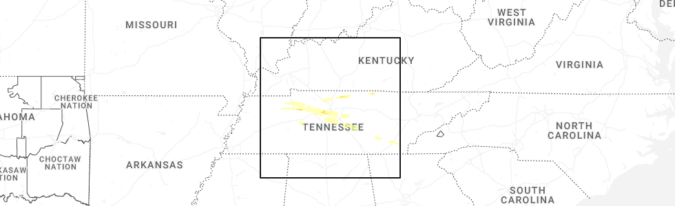
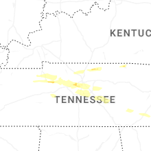
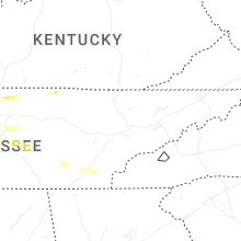
Hail Map for Friday, November 7, 2025
Number of Impacted Households on 11/7/2025
0
Impacted by 1" or Larger Hail
0
Impacted by 1.75" or Larger Hail
0
Impacted by 2.5" or Larger Hail
Square Miles of Populated Area Impacted on 11/7/2025
0
Impacted by 1" or Larger Hail
0
Impacted by 1.75" or Larger Hail
0
Impacted by 2.5" or Larger Hail
Cities Most Affected by Hail Storms of 11/7/2025
| Hail Size | Demographics of Zip Codes Affected | ||||||
|---|---|---|---|---|---|---|---|
| City | Count | Average | Largest | Pop Density | House Value | Income | Age |
Hail and Wind Damage Spotted on 11/7/2025
Filter by Report Type:Hail ReportsWind Reports
Montana
| Local Time | Report Details |
|---|---|
| 11:56 AM MST | Asos station kctb cut bank airpor in glacier county MT, 90.2 miles NNW of Great Falls, MT |
| 12:00 PM MST | Mesonet station delmt dellwo (mcscn in teton county MT, 69 miles WNW of Great Falls, MT |
| 12:00 PM MST | Mesonet station gw3546 whitlash seven sout in liberty county MT, 74.8 miles WNW of Havre, MT |
| 2:15 PM MST | Mesonet station mtvar valier jct 1-15 mp 347. in pondera county MT, 61.6 miles NNW of Great Falls, MT |
Tennessee
| Local Time | Report Details |
|---|---|
| 2:56 PM CST | A brief microburst caused damage to tree limbs... uprooted a tree... and damaged a barn along cedar grove rd and hollands road. small hail also occurre in benton county TN, 26.4 miles E of Mc Kenzie, TN |
| 3:50 PM CST | A tree blown onto a house on w 1st st in dickso in dickson county TN, 35.3 miles W of Nashville, TN |
| 4:05 PM CST | Numerous trees down across montgomery bell state park. some roads are close in dickson county TN, 28.7 miles WSW of Nashville, TN |
| 4:23 PM CST | Quarter sized hail reported near Nashville, TN, 13.9 miles SW of Nashville, TN, report from mping: quarter (1.00 in.). |
| 4:24 PM CST | Quarter sized hail reported near Nashville, TN, 13 miles SW of Nashville, TN, report from mping: quarter (1.00 in.). |
| 4:26 PM CST | 60+ mph winds reported in bellevue by broadcast media and storm chasers. trees reported down in the are in davidson county TN, 10.4 miles SW of Nashville, TN |
| 4:31 PM CST | Trees down near hwy 431 southeast of bellevu in williamson county TN, 12 miles SSW of Nashville, TN |
| 7:12 PM CST | Quarter sized hail reported near Arrington, TN, 20.9 miles S of Nashville, TN, hail up to quarter size reported near arrington. |
Connect with Interactive Hail Maps