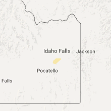
Hail Map for Saturday, October 1, 2016

Number of Impacted Households on 10/1/2016
0
Impacted by 1" or Larger Hail
0
Impacted by 1.75" or Larger Hail
0
Impacted by 2.5" or Larger Hail
Square Miles of Populated Area Impacted on 10/1/2016
0
Impacted by 1" or Larger Hail
0
Impacted by 1.75" or Larger Hail
0
Impacted by 2.5" or Larger Hail
Regions Impacted by Hail on 10/1/2016
Cities Most Affected by Hail Storms of 10/1/2016
| Hail Size | Demographics of Zip Codes Affected | ||||||
|---|---|---|---|---|---|---|---|
| City | Count | Average | Largest | Pop Density | House Value | Income | Age |
Hail and Wind Damage Spotted on 10/1/2016
Filter by Report Type:Hail ReportsWind Reports
Montana
| Local Time | Report Details |
|---|---|
| 3:06 PM MDT | 62 mph wind gust at the dot sensor at deep creek pass on highway 1 in broadwater county MT, 46.4 miles N of Bozeman, MT |
| 5:13 PM MDT | Thunderstorm wind gust 71 mph. no damage reporte in fergus county MT, 69.8 miles ESE of Great Falls, MT |
| 5:18 PM MDT | 63 mph thunderstorm wind gust a few miles northeast of dento in fergus county MT, 70.3 miles E of Great Falls, MT |
| 5:18 PM MDT | Thunderstorm wind gust 71 mph. no damage reporte in fergus county MT, 69.8 miles ESE of Great Falls, MT |
| 7:00 PM MDT | Hays montana dot weather station recorded a wind gust to 61 mph between 645pm-700p in blaine county MT, 61.5 miles SE of Havre, MT |
| 7:00 PM MDT | 62 mph thunderstorm wind gust at the dot sensor south of hay in blaine county MT, 60.7 miles SE of Havre, MT |
Utah
| Local Time | Report Details |
|---|---|
| 6:15 PM MDT | Gunnison island - 4242 ft in box elder county UT, 64.3 miles NW of Salt Lake City, UT |


Connect with Interactive Hail Maps