

Hail Map for Thursday, October 6, 2016

Number of Impacted Households on 10/6/2016
0
Impacted by 1" or Larger Hail
0
Impacted by 1.75" or Larger Hail
0
Impacted by 2.5" or Larger Hail
Square Miles of Populated Area Impacted on 10/6/2016
0
Impacted by 1" or Larger Hail
0
Impacted by 1.75" or Larger Hail
0
Impacted by 2.5" or Larger Hail


Cities Most Affected by Hail Storms of 10/6/2016
| Hail Size | Demographics of Zip Codes Affected | ||||||
|---|---|---|---|---|---|---|---|
| City | Count | Average | Largest | Pop Density | House Value | Income | Age |
| Seiling, OK | 2 | 2.63 | 2.75 | 3 | $47k | $25.7k | 40.1 |
| Elk City, OK | 2 | 2.13 | 2.50 | 77 | $64k | $29.0k | 34.9 |
| Clifton, KS | 2 | 2.00 | 2.00 | 5 | $25k | $25.5k | 45.6 |
| Daykin, NE | 1 | 2.75 | 2.75 | 2 | $38k | $29.0k | 48.0 |
| Clay Center, KS | 1 | 2.00 | 2.00 | 17 | $56k | $35.2k | 44.5 |
| Childress, TX | 1 | 1.75 | 1.75 | 7 | $45k | $27.5k | 33.8 |
| Hollis, OK | 1 | 1.75 | 1.75 | 10 | $28k | $21.5k | 38.9 |
| Narka, KS | 1 | 1.75 | 1.75 | 3 | $10k | $22.3k | 49.2 |
| Leedey, OK | 1 | 1.75 | 1.75 | 2 | $26k | $32.1k | 45.3 |
Hail and Wind Damage Spotted on 10/6/2016
Filter by Report Type:Hail ReportsWind Reports
Nebraska
| Local Time | Report Details |
|---|---|
| 11:10 AM CDT | Quarter sized hail reported near Hickman, NE, 55.5 miles SW of Omaha, NE |
| 12:25 PM CDT | Half Dollar sized hail reported near Papillion, NE, 13.3 miles SSW of Omaha, NE, nickel to half-dollar sized hail. |
| 4:21 PM CDT | Half Dollar sized hail reported near Hebron, NE, 76.3 miles SE of Grand Island, NE, brief period of half dollar size hail |
| 4:28 PM CDT | Half Dollar sized hail reported near Fairbury, NE, 76.8 miles NNW of Manhattan, KS |
| 4:45 PM CDT | Baseball sized hail reported near Daykin, NE, 68.8 miles SE of Grand Island, NE |
| 4:46 PM CDT | Quarter sized hail reported near Daykin, NE, 70.5 miles SE of Grand Island, NE |
| 4:59 PM CDT | Quarter sized hail reported near Western, NE, 71.1 miles ESE of Grand Island, NE |
Florida
| Local Time | Report Details |
|---|---|
| 3:25 PM EDT | Mesonet station 1 nw port charlotte /d9045 in charlotte county FL, 45.2 miles SE of Bradenton, FL |
Kansas
| Local Time | Report Details |
|---|---|
| 2:26 PM CDT | Quarter sized hail reported near Mound Valley, KS, 34.1 miles S of Chanute, KS |
| 2:26 PM CDT | Quarter sized hail reported near Atlanta, KS, 31.2 miles ESE of Wichita, KS |
| 3:44 PM CDT | Quarter sized hail reported near Clyde, KS, 52.8 miles WNW of Manhattan, KS |
| 3:55 PM CDT | Hen Egg sized hail reported near Clifton, KS, 47 miles NW of Manhattan, KS, photo evidence supports 2.25 inch hail. |
| 3:59 PM CDT | Hen Egg sized hail reported near Clifton, KS, 47 miles NW of Manhattan, KS |
| 4:01 PM CDT | Quarter sized hail reported near Clifton, KS, 47 miles NW of Manhattan, KS |
| 4:09 PM CDT | Golf Ball sized hail reported near Narka, KS, 69.5 miles NW of Manhattan, KS, golfball hail covering the ground. |
| 4:22 PM CDT | Quarter sized hail reported near Eureka, KS, 53.5 miles WNW of Chanute, KS |
| 4:42 PM CDT | Hen Egg sized hail reported near Clay Center, KS, 33 miles WNW of Manhattan, KS, largest hail stone in photo evidence was approximately 2 inches. |
| 4:50 PM CDT | Numerous powerlines down in dickinson county KS, 39.2 miles WSW of Manhattan, KS |
| 5:19 PM CDT | Quarter sized hail reported near Severy, KS, 40.7 miles W of Chanute, KS |
| 5:40 PM CDT | Quarter sized hail reported near Herington, KS, 35.6 miles SSW of Manhattan, KS, . |
| 5:40 PM CDT | Ping Pong Ball sized hail reported near Humboldt, KS, 9.4 miles NNW of Chanute, KS |
| 5:51 PM CDT | Storm damage reported in allen county KS, 17.3 miles N of Chanute, KS |
| 6:08 PM CDT | Storm damage reported in geary county KS, 21.4 miles S of Manhattan, KS |
| 6:28 PM CDT | Quarter sized hail reported near Blue Mound, KS, 33.2 miles NE of Chanute, KS |
| 6:30 PM CDT | Quarter sized hail reported near Moran, KS, 24.5 miles NE of Chanute, KS, storm chaser reports dime to quarter sized hail near the allen and bourbon county lines. |
| 6:30 PM CDT | Quarter sized hail reported near Bronson, KS, 26.1 miles NE of Chanute, KS, hail to the size of quarters just north of bronson |
| 7:00 PM CDT | Storm damage reported in linn county KS, 47.6 miles NE of Chanute, KS |
| 8:22 PM CDT | Power lines down with sub-severe winds. 47 mph wind gust reported in tonganoxi in leavenworth county KS, 19.3 miles W of Kansas City, MO |
Texas
| Local Time | Report Details |
|---|---|
| 3:45 PM CDT | Golf Ball sized hail reported near Childress, TX, 8.5 miles ESE of Childress, TX |
| 4:02 PM CDT | Quarter sized hail reported near Childress, TX, 7.4 miles ESE of Childress, TX |
| 4:10 PM CDT | Storm damage reported in hardeman county TX, 16.7 miles ESE of Childress, TX |
| 5:09 PM CDT | Quarter sized hail reported near Quanah, TX, 25.4 miles ESE of Childress, TX, relayed by kolj radio |
| 5:46 PM CDT | Quarter sized hail reported near Chillicothe, TX, 44.3 miles E of Childress, TX |
| 6:22 PM CDT | Quarter sized hail reported near Chillicothe, TX, 41.7 miles ESE of Childress, TX |
| 7:43 PM CDT | Measured in wichita county TX, 23 miles NW of Wichita Falls, TX |
| 9:15 PM CDT | At kickapoo downtown airport in wichita county TX, 2.7 miles SSE of Wichita Falls, TX |
Oklahoma
| Local Time | Report Details |
|---|---|
| 3:50 PM CDT | Golf Ball sized hail reported near Hollis, OK, 23 miles NE of Childress, TX |
| 5:05 PM CDT | Quarter sized hail reported near Hammon, OK, 58.9 miles S of Woodward, OK, relayed by em |
| 5:07 PM CDT | Golf Ball sized hail reported near Elk City, OK, 73.4 miles S of Woodward, OK |
| 5:12 PM CDT | Tennis Ball sized hail reported near Elk City, OK, 70.6 miles S of Woodward, OK |
| 5:27 PM CDT | Quarter sized hail reported near Alva, OK, 47.7 miles ENE of Woodward, OK, reported by radio station kalv |
| 5:50 PM CDT | Quarter sized hail reported near Taloga, OK, 36.6 miles SE of Woodward, OK |
| 5:58 PM CDT | Golf Ball sized hail reported near Leedey, OK, 49.6 miles S of Woodward, OK |
| 6:00 PM CDT | Tennis Ball sized hail reported near Seiling, OK, 33.1 miles SE of Woodward, OK |
| 6:00 PM CDT | Baseball sized hail reported near Seiling, OK, 33.1 miles SE of Woodward, OK, from kwtv |
| 6:13 PM CDT | Ping Pong Ball sized hail reported near Cherokee, OK, 63.5 miles ENE of Woodward, OK |
| 6:22 PM CDT | Ping Pong Ball sized hail reported near Cherokee, OK, 63.8 miles ENE of Woodward, OK |
| 6:45 PM CDT | Ping Pong Ball sized hail reported near Davidson, OK, 41.5 miles NW of Wichita Falls, TX |
| 9:47 PM CDT | From koco tv in blaine county OK, 46.3 miles WNW of Oklahoma City, OK |
| 9:50 PM CDT | Storm damage reported in stephens county OK, 60.7 miles NE of Wichita Falls, TX |
| 9:55 PM CDT | Storm damage reported in stephens county OK, 60.7 miles NE of Wichita Falls, TX |
| 9:57 PM CDT | Power lines downed at this location... as well as a few more lines downed and tree blown into the roadway in ne ok in oklahoma county OK, 6.1 miles ENE of Oklahoma City, OK |
| 10:45 PM CDT | Chandler site in lincoln county OK, 42.4 miles ENE of Oklahoma City, OK |
Illinois
| Local Time | Report Details |
|---|---|
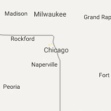
| 7:38 PM CDT | 20 inch diameter tree down near cherry valley rd and court of shorewoo in lake county IL, 29.6 miles NW of Chicago, IL |
| 8:30 PM CDT | Trees and powerlines down ingleside area. time estimated based on radar in lake county IL, 42.1 miles NNW of Chicago, IL |
| 8:36 PM CDT | Tree down across route 59 partially blocking some lanes in lake county IL, 44.1 miles NW of Chicago, IL |
| 8:39 PM CDT | Power lines and large tree downed. time estimated based on rada in lake county IL, 46.5 miles NNW of Chicago, IL |
Iowa
| Local Time | Report Details |
|---|---|
| 10:13 PM CDT | Storm damage reported in muscatine county IA, 48.9 miles SE of Cedar Rapids, IA |
| 10:15 PM CDT | Building damage and multiple trees down on water street in fairpor in muscatine county IA, 54.5 miles SE of Cedar Rapids, IA |
| 10:32 PM CDT | Near intersection of elm and jersey ridge... report of several branches down. possible tornad in scott county IA, 62.5 miles ESE of Cedar Rapids, IA |
| 10:39 PM CDT | Partial roof off home on w 3rd street... possible tornado damage. estimated time based off rada in scott county IA, 62.5 miles ESE of Cedar Rapids, IA |
| 10:40 PM CDT | Tree down on car on south hampton drive in bettendorf. report relayed from social medi in scott county IA, 68 miles ESE of Cedar Rapids, IA |
| 10:40 PM CDT | Widespread tree damage with 2 to 3 foot diameter limbs down and some trees snapped off. also at least 3 reports of holes in roofs due to trees and damage to shingles an in scott county IA, 67.1 miles ESE of Cedar Rapids, IA |
| 11:17 PM CDT | Tree down across railroad tracks... has also brought down power lines with i in muscatine county IA, 54.5 miles SE of Cedar Rapids, IA |
| 11:39 PM CDT | Building damage and multiple trees down on water street in fairpor in muscatine county IA, 54.5 miles SE of Cedar Rapids, IA |
Connect with Interactive Hail Maps