

Hail Map New Orleans, Louisiana February 24, 2013
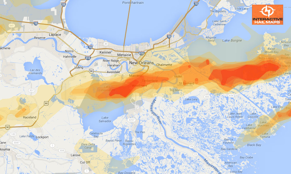
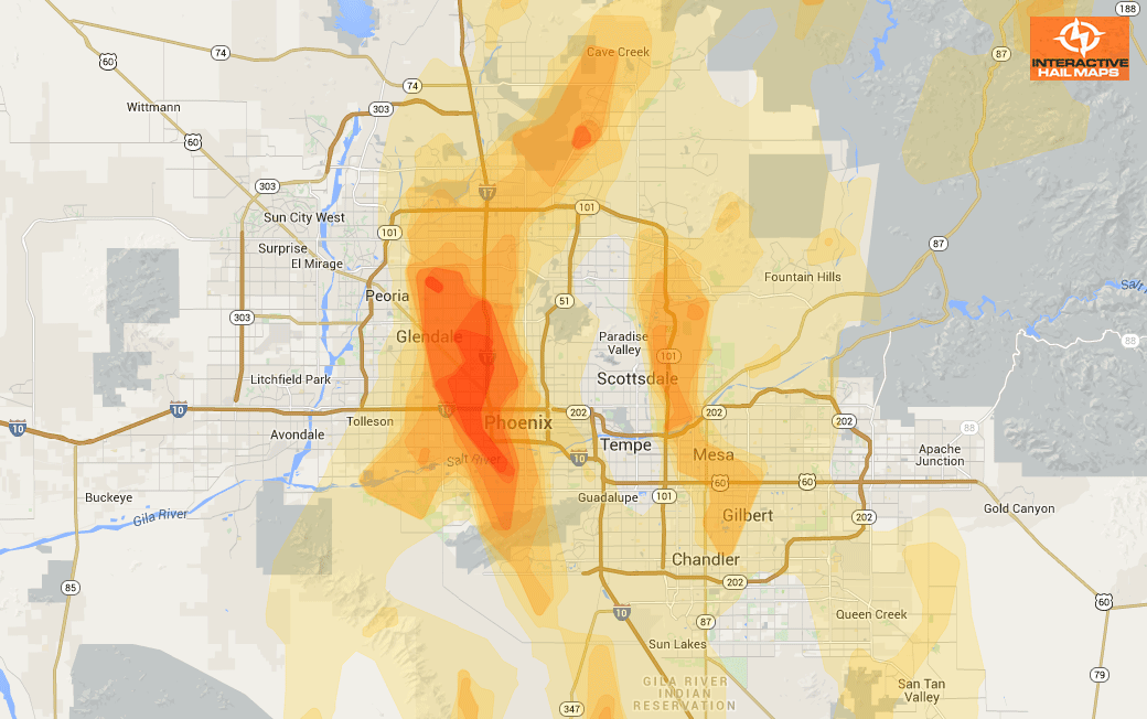
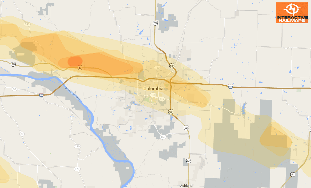
This map shows the hail that hit the West Bank in the New Orleans area on February 24, 2013. This is a huge hail storm many miles wide and many miles long. Thousands of roofs and vehicles were damaged. Use Interactive Hail Maps to zoom in and pinpoint the exact neighborhoods affected. Find the hail storms others are missing. Subscribe to Interactive Hail Maps to receive unlimited full screen hail maps, nationwide.
Cities Most Affected by Hail Storms of 2/24/2013
| Hail Size | Demographics of Zip Codes Affected | ||||||
|---|---|---|---|---|---|---|---|
| City | Count | Average | Largest | Pop Density | House Value | Income | Age |
| Marrero, LA | 2 | 2.13 | 2.50 | 2896 | $79k | $37.5k | 36.7 |
| Tallahassee, FL | 1 | 1.75 | 1.75 | 2615 | $87k | $29.3k | 27.6 |
| Paulina, LA | 1 | 1.75 | 1.75 | 284 | $96k | $48.6k | 34.8 |
| Gibson, LA | 1 | 1.75 | 1.75 | 32 | $71k | $23.5k | 39.2 |
| Quitman, GA | 1 | 1.75 | 1.75 | 34 | $64k | $25.1k | 39.0 |

Connect with Interactive Hail Maps