

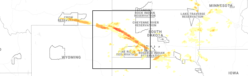
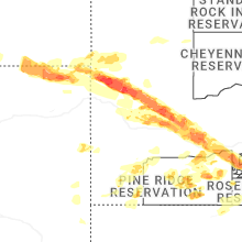
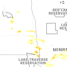
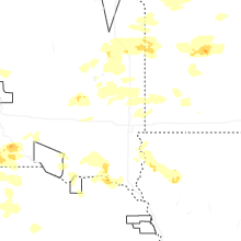
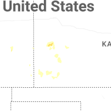
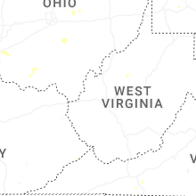
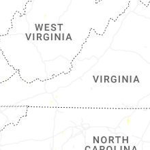
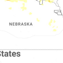
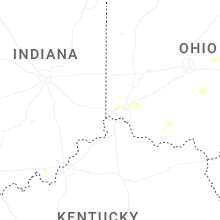
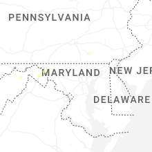
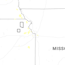
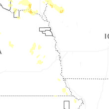
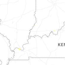
Hail Map for Saturday, June 28, 2025
Number of Impacted Households on 6/28/2025
0
Impacted by 1" or Larger Hail
0
Impacted by 1.75" or Larger Hail
0
Impacted by 2.5" or Larger Hail
Square Miles of Populated Area Impacted on 6/28/2025
0
Impacted by 1" or Larger Hail
0
Impacted by 1.75" or Larger Hail
0
Impacted by 2.5" or Larger Hail

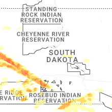
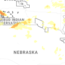

Cities Most Affected by Hail Storms of 6/28/2025
| Hail Size | Demographics of Zip Codes Affected | ||||||
|---|---|---|---|---|---|---|---|
| City | Count | Average | Largest | Pop Density | House Value | Income | Age |
| Philip, SD | 1 | 4.50 | 4.50 | 0 | $52k | $31.7k | 49.7 |
| Sturgis, SD | 2 | 2.13 | 2.50 | 15 | $79k | $34.9k | 44.7 |
| Maineville, OH | 2 | 1.75 | 1.75 | 1534 | $154k | $66.8k | 36.2 |
| Vale, SD | 1 | 2.50 | 2.50 | 2 | $28k | $33.5k | 47.5 |
| Gary, SD | 1 | 2.00 | 2.00 | 6 | $24k | $28.2k | 48.6 |
| Nisland, SD | 1 | 1.75 | 1.75 | 3 | $25k | $23.9k | 49.8 |
| Tolna, ND | 1 | 1.75 | 1.75 | 1 | $29k | $24.6k | 48.3 |
Hail and Wind Damage Spotted on 6/28/2025
Filter by Report Type:Hail ReportsWind Reports
States Impacted
South Dakota, Pennsylvania, New York, Virginia, Alabama, North Carolina, Arkansas, Ohio, South Carolina, Florida, North Dakota, Maryland, Indiana, Minnesota, Tennessee, Nebraska, West Virginia, Georgia, Colorado, Kansas, Wyoming, Montana, Wisconsin, IowaSouth Dakota
| Local Time | Report Details |
|---|---|
| 7:16 AM CDT | Tree damage and around 1 mile of power poles downed by thunderstorm wind in kingsbury county SD, 66.2 miles NNW of Sioux Falls, SD |
| 7:40 AM CDT | Measured by personal weather statio in brookings county SD, 55.7 miles N of Sioux Falls, SD |
| 7:41 AM CDT | Mesonet station vgas2 volga (sd mesonet in brookings county SD, 52.9 miles N of Sioux Falls, SD |
| 7:45 AM CDT | Awos station kbkx brookings municipal airpor in brookings county SD, 50.9 miles N of Sioux Falls, SD |
| 3:01 PM MDT | Storm damage reported in butte county SD, 63.4 miles NW of Rapid City, SD |
| 3:15 PM MDT | Quarter sized hail reported near Belle Fourche, SD, 63.5 miles NNW of Rapid City, SD |
| 3:15 PM MDT | Ping Pong Ball sized hail reported near Belle Fourche, SD, 58.4 miles NNW of Rapid City, SD, winds also to 60 mph. |
| 3:35 PM MDT | Half Dollar sized hail reported near Nisland, SD, 49.2 miles NNW of Rapid City, SD, winds to at least 60 mph. windows broken in the house and camper. |
| 3:42 PM MDT | Golf Ball sized hail reported near Nisland, SD, 44.6 miles NNW of Rapid City, SD |
| 3:42 PM MDT | Storm damage reported in butte county SD, 44.6 miles NNW of Rapid City, SD |
| 3:45 PM MDT | Storm damage reported in butte county SD, 44.4 miles NNW of Rapid City, SD |
| 3:50 PM MDT | Storm damage reported in butte county SD, 44.4 miles NNW of Rapid City, SD |
| 4:00 PM MDT | Storm damage reported in butte county SD, 38.1 miles NNW of Rapid City, SD |
| 4:00 PM MDT | Tennis Ball sized hail reported near Vale, SD, 38.1 miles NNW of Rapid City, SD |
| 4:35 PM MDT | Golf Ball sized hail reported near Sturgis, SD, 31 miles NNE of Rapid City, SD |
| 4:42 PM MDT | Tennis Ball sized hail reported near Sturgis, SD, 28.1 miles NE of Rapid City, SD |
| 4:42 PM MDT | Storm damage reported in meade county SD, 28.1 miles NE of Rapid City, SD |
| 4:55 PM MDT | Ping Pong Ball sized hail reported near Rapid City, SD, 3.4 miles N of Rapid City, SD |
| 4:55 PM MDT | Ping Pong Ball sized hail reported near Box Elder, SD, 14 miles NE of Rapid City, SD |
| 5:00 PM MDT | Storm damage reported in meade county SD, 20.7 miles ENE of Rapid City, SD |
| 5:05 PM MDT | Storm damage reported in meade county SD, 22.4 miles ENE of Rapid City, SD |
| 5:20 PM MDT | Storm damage reported in meade county SD, 40.1 miles ENE of Rapid City, SD |
| 5:20 PM MDT | Half Dollar sized hail reported near Box Elder, SD, 14 miles NE of Rapid City, SD |
| 5:45 PM MDT | Storm damage reported in pennington county SD, 36.4 miles E of Rapid City, SD |
| 5:47 PM MDT | Quarter sized hail reported near New Underwood, SD, 20.7 miles ENE of Rapid City, SD |
| 6:11 PM MDT | Storm damage reported in jackson county SD, 61.3 miles E of Rapid City, SD |
| 6:21 PM MDT | Storm damage reported in jackson county SD, 61.3 miles E of Rapid City, SD |
| 6:25 PM MDT | Softball sized hail reported near Philip, SD, 70.1 miles ESE of Rapid City, SD, took out jackson co. deputy sheriff's windshield on i-90 |
| 6:25 PM MDT | Storm damage reported in jackson county SD, 72.3 miles ESE of Rapid City, SD |
| 6:30 PM MDT | Storm damage reported in jackson county SD, 72.3 miles ESE of Rapid City, SD |
| 6:35 PM MDT | Storm damage reported in jackson county SD, 72.3 miles ESE of Rapid City, SD |
| 6:45 PM MDT | Storm damage reported in jackson county SD, 72.3 miles ESE of Rapid City, SD |
| 6:50 PM MDT | Quarter sized hail reported near Kadoka, SD, 68.7 miles WSW of Pierre, SD |
| 8:24 PM CDT | Storm damage reported in mellette county SD, 47.7 miles NW of Valentine, NE |
| 7:40 PM MDT | Estimated 60 to 70 mph in jackson county SD, 66.3 miles NW of Valentine, NE |
| 8:58 PM CDT | Hen Egg sized hail reported near Gary, SD, 39 miles WSW of Montevideo, MN, report from mping: hen egg (2.00 in.). |
| 9:20 PM CDT | Storm damage reported in todd county SD, 15.8 miles N of Valentine, NE |
| 9:40 PM CDT | Quarter sized hail reported near Castlewood, SD, 70.1 miles WSW of Montevideo, MN |
| 9:50 PM CDT | Quarter sized hail reported near Hayti, SD, 74.4 miles WSW of Montevideo, MN |
| 10:54 PM CDT | Quarter sized hail reported near Estelline, SD, 69.7 miles WSW of Montevideo, MN, trained spotter had quarter plus sized hail 1 mile east of lake poinsett. |
| 10:41 PM MDT | Storm damage reported in oglala lakota county SD, 72.8 miles SE of Rapid City, SD |
| 11:48 PM CDT | Mesonet station vgas2 volga (sd mesonet in brookings county SD, 52.9 miles N of Sioux Falls, SD |
| 12:03 AM CDT | Awos station kbkx brookings municipal airpor in brookings county SD, 50.9 miles N of Sioux Falls, SD |
| 11:05 PM MDT | Storm damage reported in bennett county SD, 62.2 miles WNW of Valentine, NE |
| 11:10 PM MDT | Storm damage reported in bennett county SD, 60 miles WNW of Valentine, NE |
| 12:32 AM CDT | Mesonet station 224 sd rwis war in moody county SD, 41.8 miles N of Sioux Falls, SD |
| 11:35 PM MDT | Storm damage reported in butte county SD, 63.4 miles NW of Rapid City, SD |
| 12:40 AM CDT | Storm damage reported in todd county SD, 41 miles NW of Valentine, NE |
| 11:45 PM MDT | Storm damage reported in bennett county SD, 41.5 miles NW of Valentine, NE |
| 12:45 AM CDT | Time estimated from radar in todd county SD, 43.2 miles NW of Valentine, NE |
| 12:50 AM CDT | Storm damage reported in todd county SD, 41 miles NW of Valentine, NE |
| 1:10 AM CDT | Storm damage reported in mellette county SD, 48.3 miles NNW of Valentine, NE |
| 1:16 AM CDT | Storm damage reported in todd county SD, 15.8 miles N of Valentine, NE |
| 5:09 AM CDT | Mesonet station 19 harrold (sddot in hughes county SD, 33.1 miles ENE of Pierre, SD |
| 5:14 AM CDT | Davis weather station in holabir in hyde county SD, 38.7 miles ENE of Pierre, SD |
| 5:30 AM CDT | Mesonet station hihs2 highmore (sd mesonet in hyde county SD, 45.4 miles ENE of Pierre, SD |
| 5:37 AM CDT | Mesonet station 183 macs corner (sddot in hyde county SD, 45.7 miles E of Pierre, SD |
| 5:48 AM CDT | Mesonet station 183 macs corner (sddot in hyde county SD, 45.7 miles E of Pierre, SD |
| 5:49 AM CDT | Mesonet station 312 ree heights (sddot in hand county SD, 58 miles ENE of Pierre, SD |
| 5:53 AM CDT | Mesonet station 201 gann valley (sddot in buffalo county SD, 70.4 miles ESE of Pierre, SD |
| 6:04 AM CDT | Mesonet station 289 lees corner (sddot in buffalo county SD, 54.4 miles ESE of Pierre, SD |
| 6:06 AM CDT | Personal weather station peak gus in jerauld county SD, 77.6 miles E of Pierre, SD |
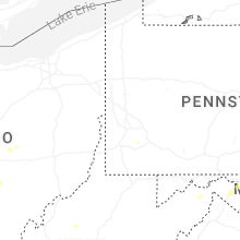
Pennsylvania
| Local Time | Report Details |
|---|---|
| 11:12 AM EDT | Tree and wires down on walnut stree in mercer county PA, 67.4 miles E of Cleveland, OH |
| 11:12 AM EDT | Power lines down on crestview drive near rutledge roa in mercer county PA, 63.6 miles NNW of Pittsburgh, PA |
| 11:15 AM EDT | Wires down in greenville... p in mercer county PA, 67.8 miles E of Cleveland, OH |
| 11:16 AM EDT | Power lines down on bentley av in mercer county PA, 68.4 miles E of Cleveland, OH |
| 11:37 AM EDT | Trees down in western part of the count in venango county PA, 51.9 miles N of Pittsburgh, PA |
| 11:48 AM EDT | A number of trees down in western half of the count in venango county PA, 66.1 miles N of Pittsburgh, PA |
| 11:56 AM EDT | Trees down in cranberry township in venango county PA, 68.7 miles NNE of Pittsburgh, PA |
| 12:01 PM EDT | Flockerzi rd has a number of trees dow in venango county PA, 68.8 miles NNE of Pittsburgh, PA |
| 12:14 PM EDT | Report of a tree and wires down blocking scott rd in somerset township. time estimated from rada in washington county PA, 22 miles SSW of Pittsburgh, PA |
| 12:14 PM EDT | Tree down near route 322 and route 33 in clarion county PA, 62.2 miles NNE of Pittsburgh, PA |
| 12:15 PM EDT | Wires down on amsler roa in clarion county PA, 60.3 miles NNE of Pittsburgh, PA |
| 12:15 PM EDT | Tree down on sunny road with wire in clarion county PA, 73 miles NNE of Pittsburgh, PA |
| 12:17 PM EDT | Tree down on marble strobleton road near old fryburg roa in clarion county PA, 69.4 miles NNE of Pittsburgh, PA |
| 12:22 PM EDT | Tree down and wires down on lickingville roa in clarion county PA, 72.8 miles NNE of Pittsburgh, PA |
| 12:25 PM EDT | Wires down on guitonville roa in forest county PA, 80.5 miles NNE of Pittsburgh, PA |
| 12:26 PM EDT | Tree down on route 3 in clarion county PA, 75 miles NNE of Pittsburgh, PA |
| 12:31 PM EDT | Tree down on miola roa in clarion county PA, 72.4 miles NNE of Pittsburgh, PA |
| 12:37 PM EDT | Report of a tree and wires down along lincoln avenue. time estimated from rada in washington county PA, 21.2 miles SSE of Pittsburgh, PA |
| 12:40 PM EDT | Tree down at intersection of route 899 and blue ridge road. time estimated via rada in forest county PA, 77.3 miles WNW of State College, PA |
| 12:54 PM EDT | Trees down in spring creek tw in elk county PA, 65.2 miles NW of State College, PA |
| 12:55 PM EDT | Wires down on creek valley roa in armstrong county PA, 31 miles NE of Pittsburgh, PA |
| 1:19 PM EDT | Tree down near the bells mill bridg in jefferson county PA, 56.5 miles WNW of State College, PA |
| 1:20 PM EDT | Koa campground waltz mill rd tree down on a occupied camper... 3 individuals trapped negative injurie in westmoreland county PA, 23.3 miles SE of Pittsburgh, PA |
| 1:22 PM EDT | Tree down on lost hill roa in jefferson county PA, 55.2 miles NE of Pittsburgh, PA |
| 1:40 PM EDT | Tree down blocking larch road. time estimated via rada in indiana county PA, 55.5 miles ENE of Pittsburgh, PA |
| 1:52 PM EDT | Churchill rd down power lines... temporary road closur in indiana county PA, 54.1 miles W of State College, PA |
| 3:11 PM EDT | Corrects previous tstm wnd dmg report from 1 e shippingport. report of a tree down along pa 3016 near the intersection with starr road. time estimated from rada in beaver county PA, 25.1 miles WNW of Pittsburgh, PA |
| 3:30 PM EDT | Multiple trees and wires down in loganto in clinton county PA, 33.1 miles ENE of State College, PA |
| 3:55 PM EDT | Trees/wires down in muncy tw in lycoming county PA, 60.2 miles W of Scranton, PA |
| 5:39 PM EDT | Tree down on bouquet road near frye roa in westmoreland county PA, 20.8 miles E of Pittsburgh, PA |
| 5:47 PM EDT | Multiple reports of trees and wires down along route 51 near rostraver rd. time estimated from rada in westmoreland county PA, 20.4 miles SSE of Pittsburgh, PA |
| 6:10 PM EDT | Social media video of a tree falling in a back yard along connellsville roa in fayette county PA, 24.7 miles SSE of Pittsburgh, PA |
| 6:19 PM EDT | Report of a tree down along pa 3016 near the intersection with starr road. time estimated from rada in beaver county PA, 25.1 miles WNW of Pittsburgh, PA |
| 7:20 PM EDT | Half Dollar sized hail reported near Columbia, PA, 53.2 miles N of Baltimore, MD |
| 8:35 PM EDT | Tree down blocking bean hill road in lancaster townshi in lancaster county PA, 52 miles NNE of Baltimore, MD |
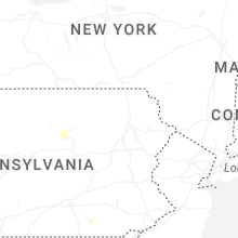
New York
| Local Time | Report Details |
|---|---|
| 1:51 PM EDT | Tree down on county road 22 near canfield road. time estimated from rada in oswego county NY, 27.3 miles N of Syracuse, NY |
| 2:25 PM EDT | Tree and wires down on prince brook roa in lewis county NY, 38.1 miles NNE of Syracuse, NY |
Virginia
| Local Time | Report Details |
|---|---|
| 2:02 PM EDT | Thunderstorm winds blew down one tree along the 600 block of dillons fork roa in henry county VA, 39.4 miles S of Roanoke, VA |
| 3:38 PM EDT | Two trees reported down on weyers cave road between the 1000 block and the 1600 bloc in augusta county VA, 67.7 miles SE of Elkins, WV |
| 4:06 PM EDT | Trees down on power lines on shenandoah avenue in elkto in rockingham county VA, 75.1 miles ESE of Elkins, WV |
| 5:03 PM EDT | Numerous trees down north of madison on hampton village road... hebron church road... and ruth roa in madison county VA, 69.6 miles NNW of Richmond, VA |
| 5:09 PM EDT | Tree reported down on the 100 block of jonesboro roa in nelson county VA, 62.4 miles NE of Roanoke, VA |
| 5:18 PM EDT | Tree down on 215 spring branch roa in madison county VA, 68.5 miles NNW of Richmond, VA |
| 6:15 PM EDT | Tree down in south of the mountain rd near clintwoo in dickenson county VA, 43.3 miles NNW of Bristol, TN |
| 6:35 PM EDT | One tree down in barren spring in wythe county VA, 53.6 miles WSW of Roanoke, VA |
| 6:59 PM EDT | Tree downed onto power lines in the 4900 block of lee highway. time estimated from rada in pulaski county VA, 44.1 miles WSW of Roanoke, VA |
| 7:18 PM EDT | A powerpoll was snapped along green spring roa in frederick county VA, 86.4 miles W of Baltimore, MD |
| 7:45 PM EDT | Tree down on dickenson highway in clinchc in dickenson county VA, 39.9 miles N of Bristol, TN |
| 7:46 PM EDT | Power lines down in the 4000 block of kentucky avenue. time estimated from rada in city of roanoke county VA, 3.8 miles WNW of Roanoke, VA |
| 7:58 PM EDT | A 73 mph gust was measured at the roanoke-blacksburg regional airpor in city of roanoke county VA, 4.6 miles NNW of Roanoke, VA |
| 8:35 PM EDT | A few trees were down along wardensville grade and mcdonald roa in frederick county VA, 87.8 miles ENE of Elkins, WV |
| 9:28 PM EDT | A powerpoll was snapped along green spring roa in frederick county VA, 86.4 miles W of Baltimore, MD |
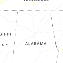
Alabama
| Local Time | Report Details |
|---|---|
| 1:25 PM CDT | Corrects previous tstm wnd dmg report from 4 n fort payne. tree down... blocking the road at 1985 cr 85. time estimated based on rada in dekalb county AL, 42.2 miles SSW of Chattanooga, TN |
| 6:20 PM CDT | A tree was knocked down blocking both lanes of the roadway at 2310 cr 92. time estimated by rada in lauderdale county AL, 16.9 miles ENE of Florence, AL |
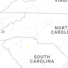
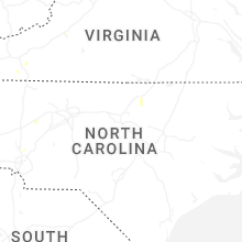
North Carolina
| Local Time | Report Details |
|---|---|
| 2:43 PM EDT | Outage was caused by fallen trees on equipmen in randolph county NC, 66.2 miles NE of Charlotte, NC |
| 2:51 PM EDT | Trees down on power equipmen in durham county NC, 19.7 miles NW of Raleigh, NC |
| 2:57 PM EDT | Caller reported a tree fell and struck their apartmen in durham county NC, 22.6 miles NW of Raleigh, NC |
| 3:04 PM EDT | Trees fallen on power equipmen in durham county NC, 25.4 miles NW of Raleigh, NC |
| 3:19 PM EDT | Downed tree in roadwa in durham county NC, 29.8 miles NNW of Raleigh, NC |
| 3:25 PM EDT | Utility company reports power outage due to fallen trees on equipmen in buncombe county NC, 55.9 miles N of Greenville, SC |
| 3:26 PM EDT | Tree dow in davidson county NC, 54.3 miles NE of Charlotte, NC |
| 3:28 PM EDT | Tree dow in davidson county NC, 44.9 miles NE of Charlotte, NC |
| 4:00 PM EDT | Kittrell fire dept had to remove a tree from the road at 757 kittrell college r in vance county NC, 31.8 miles NNE of Raleigh, NC |
| 4:24 PM EDT | 911 communications center reports numerous trees and power lines down across the mocksville are in davie county NC, 49.3 miles NNE of Charlotte, NC |
| 4:45 PM EDT | 911 communications reports powerlines down near downtown hickor in catawba county NC, 44.8 miles NW of Charlotte, NC |
| 5:00 PM EDT | 911 communications reported powerlines down leading to power outage near hickory lincolnton hw in catawba county NC, 39.1 miles NW of Charlotte, NC |
| 6:00 PM EDT | Utility company reports trees down causing power outages near troutma in iredell county NC, 33.1 miles N of Charlotte, NC |
| 6:09 PM EDT | Trees down on buffalo shoals rd. time estimate in iredell county NC, 33.9 miles NNW of Charlotte, NC |
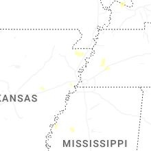
Arkansas
| Local Time | Report Details |
|---|---|
| 2:20 PM CDT | Roof damage to a metal storage buildin in baxter county AR, 76.1 miles SE of Springfield, MO |
| 4:25 PM CDT | Damage occurred to a home garage door and a large exterior porch structure. nearby power poles were knocked over as wel in lonoke county AR, 22.4 miles ENE of Little Rock, AR |
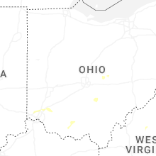
Ohio
| Local Time | Report Details |
|---|---|
| 3:28 PM EDT | A few trees were blown down... scattered about the count in licking county OH, 28.1 miles ENE of Columbus, OH |
| 5:18 PM EDT | Tree down near cedar street and east main street. time estimated from rada in licking county OH, 27.2 miles E of Columbus, OH |
| 6:06 PM EDT | Storm damage reported in butler county OH, 17.5 miles N of Cincinnati, OH |
| 6:36 PM EDT | Multiple trees down in the sugar grove area. time estimated from rada in fairfield county OH, 33.3 miles SE of Columbus, OH |
| 6:42 PM EDT | Golf Ball sized hail reported near Maineville, OH, 19.9 miles NE of Cincinnati, OH, corrects time of previous hail report from 2 nne landen. golf ball size hail reported in deerfield twp. |
| 6:57 PM EDT | Trees down. time estimated from rada in warren county OH, 27.6 miles ENE of Cincinnati, OH |
| 7:10 PM EDT | Treeline along old state route 32 and big run had trees blown dow in adams county OH, 54.3 miles E of Cincinnati, OH |
| 7:15 PM EDT | Limbs blown onto old state route 3 in adams county OH, 58.6 miles E of Cincinnati, OH |
| 8:06 PM EDT | Golf Ball sized hail reported near Maineville, OH, 19.9 miles NE of Cincinnati, OH, golf ball size hail reported in deerfield twp. |
South Carolina
| Local Time | Report Details |
|---|---|
| 3:35 PM EDT | Glassy mountain vfd reported a tree down on a powerline near the intersection of sc 11 and sc 101. time estimated from rada in greenville county SC, 24.5 miles NE of Greenville, SC |
| 7:55 PM EDT | 911 communications reports tree blocking roadway on the intersection of neal shoals road and davis jeter roa in union county SC, 53.7 miles SW of Charlotte, NC |
| 8:00 PM EDT | 911 communications reports tree blocking roadway in monarch mil in union county SC, 55.4 miles SW of Charlotte, NC |
| 10:31 PM EDT | Social media report of a tree down on a chicken coop... time and location estimated by rada in laurens county SC, 40.7 miles SE of Greenville, SC |
| 10:46 PM EDT | Social media report of trees down between ware shoals and lake greenwood... time and location estimated by rada in greenwood county SC, 38.8 miles SE of Greenville, SC |
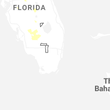
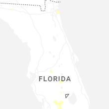
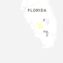
Florida
| Local Time | Report Details |
|---|---|
| 4:10 PM EDT | Jea reported equipment damage from a severe thunderstorm just south of atlantic blvd between sunnyside ave and riverview drive. the time of damage was based on rada in duval county FL, 12.9 miles E of Jacksonville, FL |
| 4:15 PM EDT | Severe thunderstorm damage occurred to utility equipment in neptune beach between first and 2nd street... just north of 3rd street. the time of damage was based on rada in duval county FL, 15.3 miles E of Jacksonville, FL |
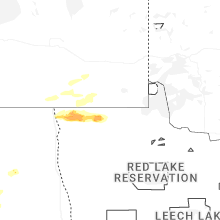
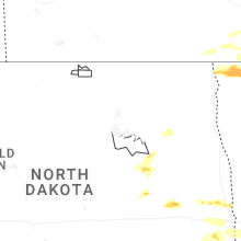
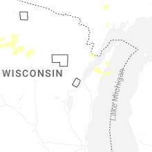
North Dakota
| Local Time | Report Details |
|---|---|
| 3:30 PM CDT | Golf Ball sized hail reported near Tolna, ND, 28.2 miles SSE of Devils Lake, ND, photo received via social media. largest hail stone estimated to be almost to golf ball sized... most of which were irregular and jagged shaped. |
| 4:50 PM CDT | Quarter sized hail reported near Erie, ND, 33 miles WNW of Fargo, ND |
| 5:06 PM CDT | Quarter sized hail reported near Arthur, ND, 26.7 miles NW of Fargo, ND, picture shared via social media. time estimated based on radar. |
| 5:20 PM CDT | Quarter sized hail reported near Luverne, ND, 60.8 miles WNW of Fargo, ND, was also reports of a few tree branches down. |
| 5:22 PM CDT | Quarter sized hail reported near Luverne, ND, 60.8 miles WNW of Fargo, ND, corrects previous hail report from 15 n valley city. was also reports of a few tree branches down. |
| 5:57 PM CDT | Quarter sized hail reported near Valley City, ND, 58.1 miles WNW of Fargo, ND, report from mping. |
| 6:47 PM CDT | Quarter sized hail reported near Leonard, ND, 29.5 miles WSW of Fargo, ND, report from mping. |
| 8:24 PM CDT | Half Dollar sized hail reported near Wahpeton, ND, 45.3 miles S of Fargo, ND, report via icechip research team. |
| 8:24 PM CDT | Half Dollar sized hail reported near Wahpeton, ND, 46 miles S of Fargo, ND, report from mping: half dollar (1.25 in.). |
| 8:30 PM CDT | Quarter sized hail reported near Hankinson, ND, 56 miles S of Fargo, ND, public sent in photo of hail beside a quarter. time estimated from radar. |
Maryland
| Local Time | Report Details |
|---|---|
| 5:28 PM EDT | A few trees were down around halfwa in washington county MD, 65.9 miles WNW of Baltimore, MD |
| 5:37 PM EDT | A few trees were down around funkstow in washington county MD, 62.1 miles WNW of Baltimore, MD |
| 5:59 PM EDT | A few trees were down around sharpsburg in washington county MD, 63.3 miles WNW of Baltimore, MD |
| 6:08 PM EDT | Tree down on us-40 alternate eas in washington county MD, 58.2 miles WNW of Baltimore, MD |
| 6:10 PM EDT | Large tree branches dow in washington county MD, 58.4 miles WNW of Baltimore, MD |
| 7:00 PM EDT | Trees down on devilbliss bridge roa in frederick county MD, 42.2 miles WNW of Baltimore, MD |
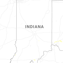
Indiana
| Local Time | Report Details |
|---|---|
| 5:50 PM EDT | A few trees down in haysvill in dubois county IN, 49.8 miles NE of Evansville, IN |
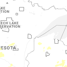
Minnesota
| Local Time | Report Details |
|---|---|
| 5:05 PM CDT | Ping Pong Ball sized hail reported near Lancaster, MN, 47.1 miles W of Roseau, MN, picture with tape measure shared on social media. time estimated by radar. |
| 5:14 PM CDT | Quarter sized hail reported near Lancaster, MN, 47.1 miles W of Roseau, MN, call out to gas station in lancaster resulted in report of lots of hail estimated to be around 1 inch. time estimated on radar. |
| 7:12 PM CDT | Downed tree. time estimated from rada in clay county MN, 14.3 miles S of Fargo, ND |
| 8:08 PM CDT | Quarter sized hail reported near Alexandria, MN, 66.1 miles NNE of Montevideo, MN |
| 8:08 PM CDT | Half Dollar sized hail reported near Barnesville, MN, 23 miles SE of Fargo, ND, 20-30mm hail via icechip research team. |
| 8:12 PM CDT | Quarter sized hail reported near Barnesville, MN, 23 miles SE of Fargo, ND, report from mping. |
| 8:16 PM CDT | Quarter sized hail reported near Alexandria, MN, 65.8 miles N of Montevideo, MN, report from mping: quarter (1.00 in.). |
| 8:20 PM CDT | Half Dollar sized hail reported near Barnesville, MN, 23.7 miles SE of Fargo, ND, report from mping: half dollar (1.25 in.). |
| 8:22 PM CDT | Ping Pong Ball sized hail reported near Barnesville, MN, 23.7 miles SE of Fargo, ND, report from mping: ping pong ball (1.50 in.). |
| 8:23 PM CDT | Ping Pong Ball sized hail reported near Barnesville, MN, 23.7 miles SE of Fargo, ND, 25-40mm stones via icechip research team. |
| 8:35 PM CDT | Sherriff dispatch reported tree damage 1 mile s of murdock. damage possibly caused by tornad in swift county MN, 24 miles NE of Montevideo, MN |
| 9:34 PM CDT | Storm damage reported in yellow medicine county MN, 32.3 miles WSW of Montevideo, MN |
| 9:50 PM CDT | Mesonet station mn033 t.h.23 - hanley falls - mp 9 in yellow medicine county MN, 18.8 miles SSE of Montevideo, MN |
| 9:55 PM CDT | 3-inch tree limbs down. report via mping. time estimated via rada in stearns county MN, 63.9 miles NW of Minneapolis, MN |
| 10:00 PM CDT | Mesonet station mn064 t.h.10 - rice - mp 16 in benton county MN, 72 miles NW of Minneapolis, MN |
| 10:02 PM CDT | Storm chaser reported numerous trees down in renvill in renville county MN, 27.3 miles ESE of Montevideo, MN |
| 10:10 PM CDT | Personal weather statio in lyon county MN, 29.9 miles SSW of Montevideo, MN |
| 10:51 PM CDT | Strong winds broken down 2 inch diameter tree branche in lyon county MN, 30.2 miles SSW of Montevideo, MN |
| 11:15 PM CDT | Asos station krwf redwood falls a in redwood county MN, 41.9 miles SE of Montevideo, MN |
| 11:25 PM CDT | Report via x of trees down in the city of st. michael. time estimated via rada in wright county MN, 25.1 miles NW of Minneapolis, MN |
| 11:25 PM CDT | 3 inch diameter tree branches dow in chisago county MN, 38.1 miles NNE of Minneapolis, MN |
| 12:41 AM CDT | Half Dollar sized hail reported near Young America, MN, 34.3 miles WSW of Minneapolis, MN |
| 1:28 AM CDT | Storm damage reported in washington county MN, 16.8 miles ESE of Minneapolis, MN |
Tennessee
| Local Time | Report Details |
|---|---|
| 5:12 PM CDT | Tree and storage building damage on hima r in hardin county TN, 43.2 miles NW of Florence, AL |
Nebraska
| Local Time | Report Details |
|---|---|
| 4:17 PM MDT | Asos station ksny sidney airpor in cheyenne county NE, 63.4 miles SE of Scottsbluff, NE |
| 5:13 PM MDT | Mesonet station agtn1 3 ene agate ne - agate fossil beds raws - ag in sioux county NE, 38.7 miles N of Scottsbluff, NE |
| 6:24 PM MDT | Quarter sized hail reported near Big Springs, NE, 66.2 miles W of North Platte, NE |
| 6:24 PM MDT | Quarter sized hail reported near Alliance, NE, 49.4 miles ENE of Scottsbluff, NE, mainly dime to nickel size hail with a few quarters. |
| 6:26 PM MDT | Quarter sized hail reported near Angora, NE, 33.2 miles E of Scottsbluff, NE |
| 8:15 PM MDT | Storm damage reported in perkins county NE, 52.7 miles WSW of North Platte, NE |
| 8:19 PM MDT | Wind gust from decaying thunderstorm in perkins county NE, 54.5 miles WSW of North Platte, NE |
| 8:43 PM MDT | Storm damage reported in perkins county NE, 52.7 miles WSW of North Platte, NE |
| 10:16 PM CDT | Storm damage reported in cherry county NE, 0.3 miles S of Valentine, NE |
| 1:29 AM CDT | Asos station kvtn valentine airpor in cherry county NE, 1 miles S of Valentine, NE |
| 5:38 AM CDT | Koma asos measured gust of 61 mp in douglas county NE, 3.4 miles NE of Omaha, NE |
| 5:55 AM CDT | Storm damage reported in sarpy county NE, 11.1 miles S of Omaha, NE |
| 5:57 AM CDT | Storm damage reported in sarpy county NE, 10 miles SSW of Omaha, NE |
| 6:00 AM CDT | Personal weather station measured gust of 58 mp in sarpy county NE, 10.7 miles SSW of Omaha, NE |
West Virginia
| Local Time | Report Details |
|---|---|
| 6:34 PM EDT | Numerous trees down along bloomery pike around slanesvill in hampshire county WV, 77.5 miles ENE of Elkins, WV |
| 7:41 PM EDT | Trees down on winebrenner road near quincy lan in berkeley county WV, 68.7 miles W of Baltimore, MD |
| 8:25 PM EDT | Tree and wires down across the road. time estimated via rada in marion county WV, 51.1 miles NW of Elkins, WV |
| 8:30 PM EDT | Tree down in a curve in the road on rocket boys drive near wa in mcdowell county WV, 57.6 miles NNE of Bristol, TN |
Georgia
| Local Time | Report Details |
|---|---|
| 6:55 PM EDT | Social media report showing a tree down at lavista rd between houston mill rd nw and n druid hills r in dekalb county GA, 6.4 miles NE of Atlanta, GA |
| 8:48 PM EDT | Public called in with report of tree and fence down and trampoline lifted at two bridge ct near two bridge d in gwinnett county GA, 31.3 miles NE of Atlanta, GA |
| 9:08 PM EDT | Em reports tree down at whitney court near surveyor wal in cherokee county GA, 28.8 miles N of Atlanta, GA |
| 9:23 PM EDT | Em reports tree down at sequoyah circle at hickory r in cherokee county GA, 30.3 miles N of Atlanta, GA |
Colorado
| Local Time | Report Details |
|---|---|
| 5:52 PM MDT | Mesonet station co048 us 385 holyok in phillips county CO, 33 miles NE of Yuma, CO |
| 5:55 PM MDT | Storm damage reported in phillips county CO, 38.9 miles NE of Yuma, CO |
| 5:58 PM MDT | Storm damage reported in phillips county CO, 40.1 miles NE of Yuma, CO |
Kansas
| Local Time | Report Details |
|---|---|
| 8:03 PM CDT | Spotter estimated peak winds of 60 mp in wichita county KS, 43.1 miles NW of Garden City, KS |
| 9:15 PM CDT | Mesonet station fw1490 leoti measured 71 mph wind gus in wichita county KS, 44.1 miles NW of Garden City, KS |
| 9:24 PM CDT | Emergency manager reports a microburst with broken poles and downed tree limbs around 6 inches in diamete in wichita county KS, 44.6 miles NW of Garden City, KS |
| 9:58 PM CDT | Storm damage reported in finney county KS, 0.7 miles SSE of Garden City, KS |
| 10:38 PM CDT | Prairie ag weather statio in haskell county KS, 19.6 miles SSE of Garden City, KS |
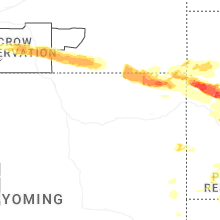
Wyoming
| Local Time | Report Details |
|---|---|
| 7:39 PM MDT | Asos station krwl 1 ene rawlin in carbon county WY, 85.1 miles SSW of Casper, WY |
| 7:48 PM MDT | Asos station krwl 1 ene rawlin in carbon county WY, 85.1 miles SSW of Casper, WY |
| 8:08 PM MDT | Wy1. coleman wydo in platte county WY, 74.8 miles ESE of Casper, WY |
| 10:14 PM MDT | Storm damage reported in campbell county WY, 50.6 miles NNE of Gillette, WY |
| 10:15 PM MDT | Storm damage reported in crook county WY, 50.8 miles NNE of Gillette, WY |
| 10:19 PM MDT | Storm damage reported in crook county WY, 50.8 miles NNE of Gillette, WY |
| 5:28 AM MDT | Quarter sized hail reported near Newcastle, WY, 50.7 miles WSW of Rapid City, SD |
| 5:31 AM MDT | Half Dollar sized hail reported near Newcastle, WY, 50.9 miles WSW of Rapid City, SD |
Montana
| Local Time | Report Details |
|---|---|
| 8:06 PM MDT | Half Dollar sized hail reported near Busby, MT, 81.7 miles ESE of Billings, MT |
| 8:45 PM MDT | Parts of roof falling of in rosebud county MT, 74.9 miles NW of Gillette, WY |
| 9:24 PM MDT | Mesonet station bshm8 bradshaw cree in powder river county MT, 56.7 miles NNW of Gillette, WY |
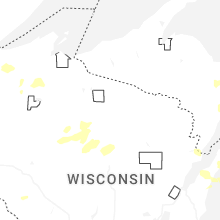
Wisconsin
| Local Time | Report Details |
|---|---|
| 12:46 AM CDT | Report of a couple of powerlines dow in douglas county WI, 37.9 miles SSE of Duluth, MN |
Iowa
| Local Time | Report Details |
|---|---|
| 3:48 AM CDT | Awos station ksxk 1 ne mauric in sioux county IA, 48.2 miles SE of Sioux Falls, SD |
| 3:50 AM CDT | Personal weather station peak wind gus in sioux county IA, 44.4 miles SE of Sioux Falls, SD |
| 3:52 AM CDT | Awos station klrj le mars airpor in plymouth county IA, 51.5 miles W of Storm Lake, IA |
| 3:55 AM CDT | Tree damage throughout town. damage to local campground. power outages across portions of the cit in plymouth county IA, 50.3 miles WNW of Storm Lake, IA |
| 3:57 AM CDT | Personal weather station peak wind gus in plymouth county IA, 45.2 miles WNW of Storm Lake, IA |
| 4:00 AM CDT | Large tree snapped in half in the city of remse in plymouth county IA, 40.7 miles WNW of Storm Lake, IA |
| 4:00 AM CDT | Personal weather station peak wind gus in plymouth county IA, 45.2 miles WNW of Storm Lake, IA |
| 4:22 AM CDT | Personal weather station peak wind gus in cherokee county IA, 30.4 miles WNW of Storm Lake, IA |
Connect with Interactive Hail Maps