

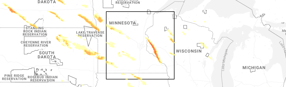
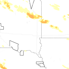
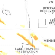
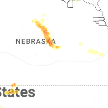
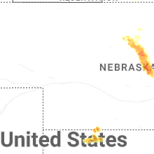
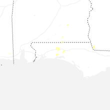
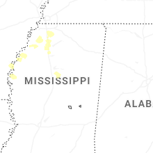
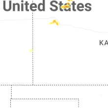
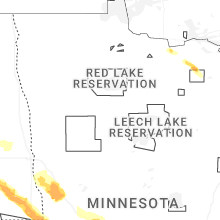
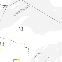
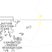
Hail Map for Thursday, June 19, 2025
Number of Impacted Households on 6/19/2025
0
Impacted by 1" or Larger Hail
0
Impacted by 1.75" or Larger Hail
0
Impacted by 2.5" or Larger Hail
Square Miles of Populated Area Impacted on 6/19/2025
0
Impacted by 1" or Larger Hail
0
Impacted by 1.75" or Larger Hail
0
Impacted by 2.5" or Larger Hail

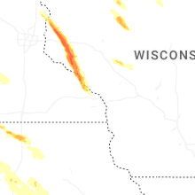
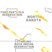
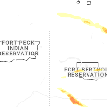
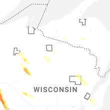
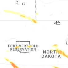
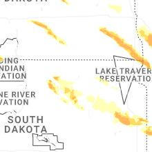

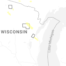

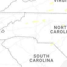
Cities Most Affected by Hail Storms of 6/19/2025
| Hail Size | Demographics of Zip Codes Affected | ||||||
|---|---|---|---|---|---|---|---|
| City | Count | Average | Largest | Pop Density | House Value | Income | Age |
| Dickinson, ND | 3 | 1.83 | 2.00 | 39 | $73k | $33.0k | 37.1 |
| New Richmond, WI | 2 | 1.75 | 1.75 | 126 | $121k | $47.2k | 35.3 |
| Burwell, NE | 1 | 2.50 | 2.50 | 1 | $39k | $26.8k | 50.4 |
| Belfield, ND | 1 | 2.50 | 2.50 | 1 | $38k | $28.4k | 45.6 |
| Onaka, SD | 1 | 2.00 | 2.00 | 1 | $12k | $32.1k | 50.0 |
| Faulkton, SD | 1 | 2.00 | 2.00 | 1 | $43k | $29.4k | 44.1 |
| North Loup, NE | 1 | 1.75 | 1.75 | 4 | $19k | $23.8k | 50.9 |
| Mansfield, SD | 1 | 1.75 | 1.75 | 3 | $31k | $41.1k | 40.9 |
| Baldwin, WI | 1 | 1.75 | 1.75 | 79 | $118k | $46.1k | 34.9 |
Hail and Wind Damage Spotted on 6/19/2025
Filter by Report Type:Hail ReportsWind Reports
States Impacted
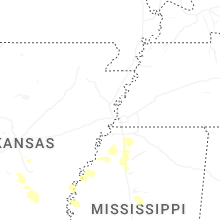
Mississippi, North Carolina, West Virginia, Nebraska, Virginia, Maryland, Ohio, New Jersey, New York, Vermont, Connecticut, Florida, Alabama, Pennsylvania, District of Columbia, Montana, Georgia, New Hampshire, Michigan, Colorado, Indiana, Delaware, Wisconsin, Idaho, Kansas, North Dakota, South Dakota, New Mexico, Minnesota, Oregon, IowaMississippi
| Local Time | Report Details |
|---|---|
| 8:51 AM CDT | Numerous trees down across lafayette count in lafayette county MS, 61.9 miles SSE of Memphis, TN |
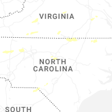
North Carolina
| Local Time | Report Details |
|---|---|
| 11:10 AM EDT | Multiple trees down in mount oliv in wayne county NC, 51.5 miles SE of Raleigh, NC |
| 1:55 PM EDT | 911 call center in surry county... nc reported a tree down across the road near the intersection of kapps mill road and david barker road near elki in surry county NC, 77.7 miles SW of Roanoke, VA |
| 2:00 PM EDT | 911 call center in surry county reported a tree had fallen in the road near the intersection of brindle road and caves mill road near dobso in surry county NC, 76.1 miles SW of Roanoke, VA |
| 2:03 PM EDT | Tree down on pipers gap roa in surry county NC, 65 miles SW of Roanoke, VA |
| 2:05 PM EDT | Tree is down near the intersection of waterford way and cody trail near dobson... nc. time is estimated from rada in surry county NC, 75.7 miles SW of Roanoke, VA |
| 2:05 PM EDT | Tree down on powerlines on boone trail roa in wilkes county NC, 62.1 miles ESE of Bristol, TN |
| 2:10 PM EDT | 911 call center in surry county reported a tree and power lines are down and blocking greenhill road near mount airy... n in surry county NC, 63.2 miles SW of Roanoke, VA |
| 2:10 PM EDT | Tree is down near the intersection of springs road and north hills drive in mount airy... nc. time is estimated from rada in surry county NC, 62.8 miles SW of Roanoke, VA |
| 2:15 PM EDT | Multiple reports of trees down across the northern part of the count in surry county NC, 67.4 miles SW of Roanoke, VA |
| 2:15 PM EDT | Tree is down near farm lane in ararat... n in surry county NC, 72.1 miles SSW of Roanoke, VA |
| 2:15 PM EDT | Tree is down near the dead end of key road in ararat... nc. time is estimated from rada in surry county NC, 71.2 miles SSW of Roanoke, VA |
| 2:15 PM EDT | Delayed report: tree is down near the intersection of reeves mill road and massey road in mount airy... nc. time is estimated from rada in surry county NC, 64.5 miles SSW of Roanoke, VA |
| 2:20 PM EDT | Tree is down near the intersection of woodville road and caterpillar trail in mount airy... nc. time is estimated from rada in surry county NC, 59.9 miles SSW of Roanoke, VA |
| 3:24 PM EDT | Tree down on utility equipmen in caldwell county NC, 58.9 miles SE of Bristol, TN |
| 4:04 PM EDT | Tree down at edmiston roa in wilkes county NC, 62.5 miles ESE of Bristol, TN |
| 4:09 PM EDT | Tree down in the 1000 block of myers mill r in iredell county NC, 54.4 miles N of Charlotte, NC |
| 4:13 PM EDT | Tree down at howards bridge rd and mitch r in iredell county NC, 55.7 miles N of Charlotte, NC |
| 4:24 PM EDT | Tree down in the 300 block of linneys mills r in iredell county NC, 55.5 miles N of Charlotte, NC |
| 4:28 PM EDT | A number of trees were downed across far northwest iredell county in the union grove area. this includes trees on grassy knob rd... union grove rd... sandy springs rd in iredell county NC, 56.7 miles N of Charlotte, NC |
| 4:52 PM EDT | A tree was blown down along jeannine d in forsyth county NC, 65.1 miles NNE of Charlotte, NC |
| 4:55 PM EDT | Numerous trees down in western and northwestern winston-salem. trees reported down on austin lane... hedgecock avenue... and bartram roa in forsyth county NC, 67.6 miles NNE of Charlotte, NC |
| 4:59 PM EDT | A tree was blown down along clover st. in winston-salem. numerous other trees were blown down in the winston-salem are in forsyth county NC, 68.7 miles NNE of Charlotte, NC |
| 5:00 PM EDT | Several trees down in the west wend area and near downtown winston-salem including on fourth stree in forsyth county NC, 68.7 miles NNE of Charlotte, NC |
| 5:04 PM EDT | A tree was blown down along airport rd. near barkwood d in forsyth county NC, 72.2 miles NNE of Charlotte, NC |
| 5:08 PM EDT | A tree was blown down along merganser wa in forsyth county NC, 71.8 miles NNE of Charlotte, NC |
| 5:20 PM EDT | A tree was blown down at the 400 block of north bunker hill r in guilford county NC, 78.3 miles NE of Charlotte, NC |
| 5:40 PM EDT | A tree was blown down near the intersection of wayne rd and alamance r in guilford county NC, 71.3 miles WNW of Raleigh, NC |
| 5:45 PM EDT | A tree was blown down along azalea dr. near argonne blv in guilford county NC, 69.2 miles WNW of Raleigh, NC |
| 6:18 PM EDT | Several trees were blown down along friendship patterson mill rd... many between s nc hwy 62 and nc 4 in alamance county NC, 49.5 miles WNW of Raleigh, NC |
| 6:24 PM EDT | Several trees were blown down along south nc hwy 87... many between southern high school rd and woods chapel r in alamance county NC, 44.5 miles WNW of Raleigh, NC |
| 6:25 PM EDT | Trees down near bowman dairy road and old route 421 roa in randolph county NC, 54.9 miles W of Raleigh, NC |
| 6:43 PM EDT | A tree was blown down along ned moore r in person county NC, 37.8 miles NNW of Raleigh, NC |
| 6:48 PM EDT | A tree was blown down along surl-mount tirzah r in person county NC, 39.6 miles NNW of Raleigh, NC |
| 6:55 PM EDT | Numerous trees were blown down along enon rd and culbreth r in granville county NC, 33.1 miles N of Raleigh, NC |
| 7:00 PM EDT | Wind damaged a trailer along hwy 15 in granville county NC, 32.1 miles N of Raleigh, NC |
| 7:09 PM EDT | Fallen trees damaged power equipment near the intersection of watson dr. and terrace av in vance county NC, 38.1 miles NNE of Raleigh, NC |
| 7:20 PM EDT | Multiple trees down include one on a house. several homes around the area had roof damag in vance county NC, 43.4 miles NNE of Raleigh, NC |
| 7:30 PM EDT | Local em reported multiple trees and power poles down along the i-85 corridor in the county due to straight line winds. i-85 was closed for short time but is back open in warren county NC, 53.8 miles NNE of Raleigh, NC |
| 7:38 PM EDT | Several trees and powerlines downed in the rhoney/blackburn communities including on rhoney school rd... hwy 10 and whitener r in catawba county NC, 39.9 miles NW of Charlotte, NC |
| 7:50 PM EDT | Tree down on powerline in halifax county NC, 61 miles NE of Raleigh, NC |
| 7:55 PM EDT | Trees and powerlines down on poe roa in chatham county NC, 48.2 miles W of Raleigh, NC |
| 8:00 PM EDT | Tree down across heartland drive blocking the roa in chatham county NC, 27.7 miles W of Raleigh, NC |
| 8:05 PM EDT | Tree down in roa in chatham county NC, 29.6 miles W of Raleigh, NC |
| 8:10 PM EDT | Power lines down in the street and large oak tree in the roadwa in chatham county NC, 26.7 miles WNW of Raleigh, NC |
| 8:10 PM EDT | Multiple trees down across gasto in northampton county NC, 69.2 miles S of Richmond, VA |
| 8:10 PM EDT | Tree fell down across warner bridge r in northampton county NC, 67.1 miles S of Richmond, VA |
| 8:10 PM EDT | Tree down in cul de sa in chatham county NC, 27.1 miles W of Raleigh, NC |
| 8:12 PM EDT | Tree across roa in chatham county NC, 25.2 miles W of Raleigh, NC |
| 8:15 PM EDT | Tree dow in chatham county NC, 25.1 miles W of Raleigh, NC |
| 8:26 PM EDT | Tree fell down along peanut market r in northampton county NC, 68.7 miles S of Richmond, VA |
| 8:32 PM EDT | Tree fell down across nc-186 near margarettsville n in northampton county NC, 69.2 miles SSE of Richmond, VA |
| 8:38 PM EDT | Trees down in car in wake county NC, 6.6 miles W of Raleigh, NC |
| 8:42 PM EDT | Tree down along deberrys mill r in northampton county NC, 69.6 miles WSW of Virginia Beach, VA |
| 8:43 PM EDT | A tree was blown down across blenheim dr. near manuel s in wake county NC, 3.4 miles NNW of Raleigh, NC |
| 9:00 PM EDT | A tree was blown down across knightdale eagle rock rd near wendell fall in wake county NC, 11.4 miles E of Raleigh, NC |
| 9:05 PM EDT | 4 trees and 1 powerline were knocked down. power went out for the entire town of murfreesbor in hertford county NC, 61.8 miles WSW of Virginia Beach, VA |
| 9:07 PM EDT | A tree was blown down near the intersection of johnson pond rd and brozak d in wake county NC, 11.4 miles SSW of Raleigh, NC |
| 9:10 PM EDT | Corrects previous tstm wnd dmg report from 1 e emit. power lines down near the intersection of barnes rd and brooke l in johnston county NC, 22.4 miles E of Raleigh, NC |
| 9:10 PM EDT | A tree was blown down near the intersection of barnes rd and brooke l in johnston county NC, 22.4 miles E of Raleigh, NC |
| 9:13 PM EDT | A tree was blown down along woodards dairy rd. near flower hill r in johnston county NC, 24.7 miles E of Raleigh, NC |
| 9:21 PM EDT | A power lines reported down on banner elk rd near nc 5 in johnston county NC, 26.3 miles S of Raleigh, NC |
| 9:25 PM EDT | Tree down and power outages in the pine hollow are in wake county NC, 10.4 miles SE of Raleigh, NC |
| 9:30 PM EDT | Tree down on powerline in nash county NC, 47 miles E of Raleigh, NC |
| 9:35 PM EDT | Tree down on lake wilson roa in wilson county NC, 42.9 miles E of Raleigh, NC |
| 9:40 PM EDT | Tree down on powerlines on covered bridge roa in johnston county NC, 15.7 miles ESE of Raleigh, NC |
| 9:55 PM EDT | Tree down on smith roa in johnston county NC, 20.2 miles SSE of Raleigh, NC |
| 10:17 PM EDT | One tree blown down near the 200 block of hopedale s in cumberland county NC, 55.2 miles SSW of Raleigh, NC |
| 10:20 PM EDT | Tree down on powerlines north of saratog in wilson county NC, 51.5 miles E of Raleigh, NC |
| 10:25 PM EDT | A tree was blown down and blocking both lanes of traffic near the intersection of nc-222 and pelt r in wilson county NC, 47.1 miles ESE of Raleigh, NC |
| 10:45 PM EDT | Tree down on powerlines near wrye branch roa in sampson county NC, 46.9 miles SSE of Raleigh, NC |
| 11:10 PM EDT | Tree down on powerline in sampson county NC, 56.3 miles SSE of Raleigh, NC |
| 11:10 PM EDT | Corrects previous tstm wnd dmg report from 1 nne mount olive. multiple trees down in mount oliv in wayne county NC, 51.5 miles SE of Raleigh, NC |
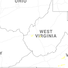
West Virginia
| Local Time | Report Details |
|---|---|
| 12:35 PM EDT | 911 call center in greenbrier county... wv reported a large tree down on alta rd (wv12) near alderson... that is blocking the roa in greenbrier county WV, 49.3 miles NW of Roanoke, VA |
| 12:40 PM EDT | 911 call center in greenbrier county... wv reported a tree down... blocking the roadway near the intersection of grand avenue and fairview road near lewisbur in greenbrier county WV, 46.7 miles NW of Roanoke, VA |
| 1:33 PM EDT | Tree dow in wood county WV, 62.8 miles N of Charleston, WV |
| 1:33 PM EDT | Power lines dow in wood county WV, 62.1 miles N of Charleston, WV |
| 1:38 PM EDT | Tree down on a hous in wood county WV, 65.1 miles N of Charleston, WV |
| 1:41 PM EDT | Tree and power lines dow in wood county WV, 63.7 miles N of Charleston, WV |
| 1:42 PM EDT | Tree down on a vehicl in wood county WV, 62.2 miles N of Charleston, WV |
| 1:43 PM EDT | Tree down and power ou in wood county WV, 65.8 miles N of Charleston, WV |
| 1:46 PM EDT | Tree dow in wood county WV, 67.8 miles N of Charleston, WV |
| 2:07 PM EDT | Power lines dow in ritchie county WV, 64.7 miles NNE of Charleston, WV |
| 2:19 PM EDT | Tree dow in ritchie county WV, 67.7 miles NNE of Charleston, WV |
| 2:24 PM EDT | Tree dow in ritchie county WV, 60.5 miles NE of Charleston, WV |
| 2:25 PM EDT | Trees blew down in the 3700 block of wv-51 middleway pik in jefferson county WV, 74 miles W of Baltimore, MD |
| 2:30 PM EDT | Tree down on galmish roa in wetzel county WV, 61.5 miles NW of Elkins, WV |
| 2:31 PM EDT | Tree reported down on the 2400 block of s childs roa in jefferson county WV, 72.4 miles W of Baltimore, MD |
| 2:33 PM EDT | Power outage caused by tree damage along staten chapel r in mason county WV, 27.1 miles WNW of Charleston, WV |
| 2:33 PM EDT | Tree reported down on the 5900 block of charles town roa in jefferson county WV, 68.9 miles W of Baltimore, MD |
| 2:35 PM EDT | Tree down on power lines and power lines are smokin in wetzel county WV, 61.2 miles NW of Elkins, WV |
| 2:37 PM EDT | Tree reported down on the 2000 block of kearneysville pik in jefferson county WV, 67.5 miles W of Baltimore, MD |
| 2:40 PM EDT | Tree down on lines along collins lane. time estimated from rada in wayne county WV, 49.6 miles W of Charleston, WV |
| 2:42 PM EDT | Tree reported down on 100 block spring lake lan in jefferson county WV, 62.7 miles W of Baltimore, MD |
| 2:42 PM EDT | Tree reported down on the 2100 block of bloomery roa in jefferson county WV, 63.3 miles W of Baltimore, MD |
| 2:45 PM EDT | Trees blew down blocking us-340 william l. wilson freeway near cr-32 chestnut hill roa in jefferson county WV, 60.1 miles W of Baltimore, MD |
| 2:46 PM EDT | Tree reported down on the 19...000 blk of charles town roa in jefferson county WV, 62.9 miles W of Baltimore, MD |
| 2:46 PM EDT | Large tree down on middleway pike in jefferson county WV, 72.4 miles W of Baltimore, MD |
| 2:50 PM EDT | Tree dow in putnam county WV, 20.2 miles NW of Charleston, WV |
| 2:50 PM EDT | Tree dow in putnam county WV, 20.8 miles NNW of Charleston, WV |
| 2:50 PM EDT | Large tree down on princeton st near eagle school rd in berkeley county WV, 72.4 miles W of Baltimore, MD |
| 2:51 PM EDT | Tree down blocking roa in putnam county WV, 17.8 miles NNW of Charleston, WV |
| 2:56 PM EDT | Tree down reported at henson rd and us 60. time estimated from rada in putnam county WV, 20 miles WNW of Charleston, WV |
| 2:57 PM EDT | Corrects previous non-tstm wnd dmg report from fairview. tree down in fairvie in marion county WV, 50.8 miles NNW of Elkins, WV |
| 3:02 PM EDT | Tree down blocking cunningham rd in kenna. time estimated from rada in jackson county WV, 18.7 miles N of Charleston, WV |
| 3:05 PM EDT | Tree down in fairmon in marion county WV, 41.7 miles NNW of Elkins, WV |
| 3:18 PM EDT | Wv doh reports a tree down across us-119 in southern roane county. time estimated from rada in roane county WV, 21.2 miles NE of Charleston, WV |
| 3:23 PM EDT | Power outage caused by tree damage along washington street west... between tyler mountain and cross lane in kanawha county WV, 6.5 miles WNW of Charleston, WV |
| 3:26 PM EDT | A couple of power outages reported in the knollwood and mink shoals areas beginning at the time of the thunderstorm passag in kanawha county WV, 3.5 miles NE of Charleston, WV |
| 3:27 PM EDT | Tree down on kingwood pik in monongalia county WV, 47.6 miles N of Elkins, WV |
| 3:29 PM EDT | Tree down along river roa in monongalia county WV, 47.5 miles N of Elkins, WV |
| 3:32 PM EDT | Wv doh reports a tree down along wv-36 in southeastern roane county. time estimated from rada in roane county WV, 29.4 miles NE of Charleston, WV |
| 3:37 PM EDT | Tree down on preston highwa in preston county WV, 36.9 miles N of Elkins, WV |
| 3:45 PM EDT | Tree down at north preston highway and beech run roa in preston county WV, 41.9 miles NNE of Elkins, WV |
| 3:45 PM EDT | Tree down across trail bridg in preston county WV, 38.1 miles NNE of Elkins, WV |
| 6:10 PM EDT | Tree fell on hous in greenbrier county WV, 42.1 miles NW of Roanoke, VA |
| 6:13 PM EDT | Large tree blown down blocking teaberry roa in greenbrier county WV, 43.8 miles NW of Roanoke, VA |
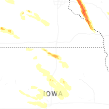
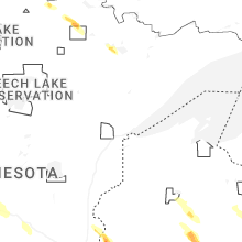
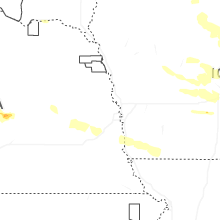
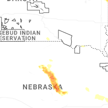
Nebraska
| Local Time | Report Details |
|---|---|
| 11:56 AM CDT | Personal weather statio in saunders county NE, 36.7 miles WSW of Omaha, NE |
| 6:37 PM CDT | Quarter sized hail reported near Danbury, NE, 56.1 miles NE of Colby, KS, estimated nickel to a couple quarter size hail stones. |
| 8:04 PM CDT | Storm damage reported in garfield county NE, 51.5 miles SSW of Oneill, NE |
| 8:35 PM CDT | Tennis Ball sized hail reported near Burwell, NE, 48.4 miles SSW of Oneill, NE |
| 8:53 PM CDT | Storm damage reported in valley county NE, 54.3 miles SSW of Oneill, NE |
| 8:56 PM CDT | Spotter reports 2 to 4 inch diameter limbs down in burwell. winds estimated at 60 mph. no hail currentl in garfield county NE, 52.9 miles SSW of Oneill, NE |
| 8:57 PM CDT | Storm damage reported in valley county NE, 54.1 miles SSW of Oneill, NE |
| 8:57 PM CDT | Corrects time of previous tstm wnd dmg report from 4 w fort hartsuff state park. emergency management reported a farmstead which suffered some outbuilding and roof dama in valley county NE, 54.3 miles SSW of Oneill, NE |
| 9:10 PM CDT | Storm damage reported in valley county NE, 57.5 miles NNW of Grand Island, NE |
| 9:17 PM CDT | Delayed report. emergency manager reports large tree damage in burwell along with power out. estimated winds at 80 mp in garfield county NE, 52.9 miles SSW of Oneill, NE |
| 9:19 PM CDT | Half Dollar sized hail reported near Burwell, NE, 46.8 miles S of Oneill, NE |
| 9:31 PM CDT | Emergency management reports building damage at the garfield county fairground in garfield county NE, 52.7 miles SSW of Oneill, NE |
| 9:45 PM CDT | Quarter sized hail reported near North Loup, NE, 45.8 miles NNW of Grand Island, NE |
| 9:45 PM CDT | Wind gusts were estimated to be around 65 mph. tree damage also reported in tow in valley county NE, 45.6 miles NNW of Grand Island, NE |
| 9:50 PM CDT | Some larger tree limbs downed in town... one blocking a portion of hwy 22. time est from rada in greeley county NE, 42.1 miles NNW of Grand Island, NE |
| 9:52 PM CDT | Golf Ball sized hail reported near North Loup, NE, 45.8 miles NNW of Grand Island, NE |
| 9:57 PM CDT | Emergency management reported a farmstead which suffered some outbuilding and roof damage just south of the garfield and valley county line near hwy 11. noted damage wa in valley county NE, 54.3 miles SSW of Oneill, NE |
| 11:50 PM CDT | Power line damag in douglas county NE, 15.6 miles W of Omaha, NE |
| 11:56 PM CDT | Corrects previous tstm wnd gst report from 4 s wahoo. personal weather statio in saunders county NE, 36.7 miles WSW of Omaha, NE |
| 12:27 AM CDT | Measured using a handheld weather statio in sarpy county NE, 23.3 miles SW of Omaha, NE |
Virginia
| Local Time | Report Details |
|---|---|
| 1:45 PM EDT | Delayed report: several reports of trees down from stuart... va northward into woolwine... va. time is estimated from rada in patrick county VA, 40.3 miles SSW of Roanoke, VA |
| 1:50 PM EDT | Delayed report: tree down across floyd highway north in floyd... va. time is estimated from rada in floyd county VA, 26.6 miles SW of Roanoke, VA |
| 2:00 PM EDT | Trees and wires blew down in the 8100 block of va-613 spring creek roa in rockingham county VA, 55.7 miles SE of Elkins, WV |
| 2:02 PM EDT | Tree reported down on the 1300 block of north hayfield roa in frederick county VA, 87.1 miles ENE of Elkins, WV |
| 2:05 PM EDT | Several large trees blew down around dayton... including in the 200 block of sunset drive... and on slab roa in rockingham county VA, 60.4 miles SE of Elkins, WV |
| 2:05 PM EDT | Several trees blew down around churchville... including in the 200 block of us-250 hankey mountain highway... and near the intersection of jennings gap road and dryden in augusta county VA, 59.3 miles SE of Elkins, WV |
| 2:09 PM EDT | Large tree down at 15833 senedo rd in shenandoah county VA, 63.5 miles E of Elkins, WV |
| 2:09 PM EDT | Tree down at johnstown rd and fr 92 rd in shenandoah county VA, 65.5 miles E of Elkins, WV |
| 2:10 PM EDT | Several trees blew down along us-33 east market stree in rockingham county VA, 62.4 miles ESE of Elkins, WV |
| 2:15 PM EDT | Several trees and wires blew down in the city of staunto in city of staunton county VA, 67.7 miles SE of Elkins, WV |
| 2:15 PM EDT | 911 call center in franklin county reported that multiple trees are down near brooks mill road in wirtz... v in franklin county VA, 16.7 miles SE of Roanoke, VA |
| 2:15 PM EDT | Tree is down and blocking keffer road near hardy... v in franklin county VA, 13 miles SE of Roanoke, VA |
| 2:15 PM EDT | Four trees are down on hardy road in franklin county... va. one is completely blocking the roadwa in franklin county VA, 12.2 miles SE of Roanoke, VA |
| 2:15 PM EDT | Tree reported down into a house on dunlap street between bruce street and green stree in frederick county VA, 82.9 miles W of Baltimore, MD |
| 2:15 PM EDT | Seven trees uproote in franklin county VA, 15.8 miles SE of Roanoke, VA |
| 2:17 PM EDT | Multiple trees down at the intersection of pea ridge ln and brooks mill roa in franklin county VA, 17.1 miles SE of Roanoke, VA |
| 2:19 PM EDT | Tree reported down on the 600 block of woods mill roa in frederick county VA, 79.7 miles W of Baltimore, MD |
| 2:20 PM EDT | Several trees blew down around veron in augusta county VA, 67.4 miles SE of Elkins, WV |
| 2:20 PM EDT | Several trees blew down around weyers cav in augusta county VA, 66.9 miles SE of Elkins, WV |
| 2:20 PM EDT | Large tree limbs blew down along mountain valley road in keezletow in rockingham county VA, 67 miles ESE of Elkins, WV |
| 2:20 PM EDT | Personal weather station gusted to 69 mph. trees reported down nearb in rockingham county VA, 59.8 miles ESE of Elkins, WV |
| 2:24 PM EDT | Tree down near old valley pike and toll house rd in shenandoah county VA, 75.1 miles E of Elkins, WV |
| 2:24 PM EDT | Tree down near 2318 swartz rd in shenandoah county VA, 73 miles E of Elkins, WV |
| 2:24 PM EDT | Tree down on east reservoir rd near broadview ln in shenandoah county VA, 71.5 miles E of Elkins, WV |
| 2:24 PM EDT | Tree down at jess sine rd and swartz rd in shenandoah county VA, 73 miles E of Elkins, WV |
| 2:25 PM EDT | Several trees blew down around riverhead in augusta county VA, 67.9 miles NE of Roanoke, VA |
| 2:25 PM EDT | Several trees blew down around new hop in augusta county VA, 71.1 miles SE of Elkins, WV |
| 2:25 PM EDT | Several trees and large branches blew down in shenandoa in page county VA, 72.6 miles ESE of Elkins, WV |
| 2:29 PM EDT | A wind gust of 50 knots (58 mph) was measured by a personal weather station at page county high school (kvashena19 in page county VA, 71.3 miles ESE of Elkins, WV |
| 2:30 PM EDT | Delayed report: tree and power line down on ocala road. time is estimated from rada in franklin county VA, 18.2 miles SSE of Roanoke, VA |
| 2:35 PM EDT | Tree is down and blocking one lane on colonial drive in collinsville... va. time is estimated from rada in henry county VA, 36.7 miles S of Roanoke, VA |
| 2:35 PM EDT | Several trees and wires blew down around elkton... including in the 1800 block of newtown road... and in the 11700 block of red brush roa in rockingham county VA, 76.2 miles ESE of Elkins, WV |
| 2:35 PM EDT | Several trees blew down around stuarts draft... including in the 1800 block of va-608 tinkling spring roa in augusta county VA, 73.8 miles NE of Roanoke, VA |
| 2:35 PM EDT | Several trees blew down around fishersvill in augusta county VA, 74 miles SE of Elkins, WV |
| 2:35 PM EDT | Tree is down near brooks mill road in union hall... va. time is estimated from rada in franklin county VA, 22.9 miles SSE of Roanoke, VA |
| 2:40 PM EDT | 911 center reports multiple trees down in stanley including trees blocking both lanes near the intersection of keystone rd and lucas hollow r in page county VA, 75.8 miles ESE of Elkins, WV |
| 2:40 PM EDT | Numerous trees... branches... and wires blew down in the city of waynesbor in city of waynesboro county VA, 77.8 miles WNW of Richmond, VA |
| 2:40 PM EDT | Several trees blew down around greenville... including in the 300 block of va-662 stover school road... and in the 200 block of mcclures mill roa in augusta county VA, 66.5 miles NE of Roanoke, VA |
| 2:40 PM EDT | Several trees blew down around crimora... including in the unit block of odell drive... and near the intersection of us-340 east side highway and odell driv in augusta county VA, 74.8 miles SE of Elkins, WV |
| 2:40 PM EDT | Tree is down and blocking the entire road... near the intersection of gilford road and lovely valley road in wirtz... va. time is estimated from rada in franklin county VA, 18.7 miles SE of Roanoke, VA |
| 2:40 PM EDT | Several trees blew down around doom in augusta county VA, 77.5 miles SE of Elkins, WV |
| 2:40 PM EDT | Tree is down and blocking the entire road near the intersection of reginald drive and terrys mountain road near martinsville... v in henry county VA, 37.8 miles S of Roanoke, VA |
| 2:40 PM EDT | Numerous swath of trees down along with powerlines roughly from fieldale to leatherwood and then east to the pittsylvania/henry county borde in henry county VA, 38.1 miles SSE of Roanoke, VA |
| 2:40 PM EDT | 911 center reports tree down on powerline near stanle in page county VA, 76.4 miles ESE of Elkins, WV |
| 2:40 PM EDT | Delayed report: tree is down near the intersection of lovely valley road and scruggs road in moneta... va. time is estimated from rada in franklin county VA, 18.6 miles SE of Roanoke, VA |
| 2:42 PM EDT | 911 center reports tree blocking jordan hollow rd in eastern page count in page county VA, 78.4 miles ESE of Elkins, WV |
| 2:43 PM EDT | Tree down blocking one lane on us 46 in bedford county VA, 33.1 miles E of Roanoke, VA |
| 2:45 PM EDT | Several trees and wires blew down around rileyvill in page county VA, 79.2 miles E of Elkins, WV |
| 2:45 PM EDT | Tree is down on town fork road in evington... va. time is estimated from rada in campbell county VA, 36.4 miles E of Roanoke, VA |
| 2:55 PM EDT | Broadcast media reports that a tree fell across us 501 and landed on a car. time is estimated from rada in city of lynchburg county VA, 41.2 miles E of Roanoke, VA |
| 2:55 PM EDT | Tree is down on one side of the road near the intersection of tahoe drive and sunset road near collinsville... va. time is estimated from rada in henry county VA, 38.8 miles S of Roanoke, VA |
| 2:55 PM EDT | Trees blew down on us-15 at va-672 lovettsville roa in loudoun county VA, 50.4 miles W of Baltimore, MD |
| 2:55 PM EDT | Multiple reports of trees down in lovettsvill in loudoun county VA, 55.3 miles W of Baltimore, MD |
| 2:56 PM EDT | Multiple trees down in the sterling to countryside are in loudoun county VA, 47.4 miles WSW of Baltimore, MD |
| 3:00 PM EDT | Rappahannock county reported at least 10-12 calls for downed trees across the count in rappahannock county VA, 86.4 miles NNW of Richmond, VA |
| 3:03 PM EDT | Power pole snapped on dyer store roa in henry county VA, 37.6 miles SSE of Roanoke, VA |
| 3:10 PM EDT | Tree has fallen and is blocking irish road near newby lane and creek bottom road in chatham... v in pittsylvania county VA, 43.4 miles SE of Roanoke, VA |
| 3:11 PM EDT | Tree down on newby l in pittsylvania county VA, 43.8 miles SE of Roanoke, VA |
| 3:14 PM EDT | A wind gust of 57 knots (66 mph) was measured by a mesonet in hume (n4hac/ax084 in fauquier county VA, 82.6 miles WSW of Baltimore, MD |
| 3:15 PM EDT | Tree has fallen across cherrystone road. time is estimated from rada in pittsylvania county VA, 44.2 miles SE of Roanoke, VA |
| 3:18 PM EDT | Reports for multiple trees down in bluemon in loudoun county VA, 66.7 miles W of Baltimore, MD |
| 3:18 PM EDT | 911 center reports downed tree blocking intersection of oak park rd and beahm town r in madison county VA, 65.7 miles NNW of Richmond, VA |
| 3:20 PM EDT | Tree has fallen across peach orchard road near axton... va. time is estimated from rada in pittsylvania county VA, 45.8 miles SSE of Roanoke, VA |
| 3:25 PM EDT | Multiple trees blown down on us-460 near concord... v in appomattox county VA, 54.8 miles E of Roanoke, VA |
| 3:25 PM EDT | Trees and wires blew down near the interchange of us-29 and us-1 in fauquier county VA, 73.9 miles WSW of Baltimore, MD |
| 3:25 PM EDT | 911 center reports multiple downed trees along old waterloo r in fauquier county VA, 77 miles WSW of Baltimore, MD |
| 3:29 PM EDT | Tree down near the intersection of halifax road and java roa in pittsylvania county VA, 45.9 miles SE of Roanoke, VA |
| 3:29 PM EDT | Tree down across java road... north of stone roa in pittsylvania county VA, 49.7 miles SE of Roanoke, VA |
| 3:30 PM EDT | Tree is down and blocking finch drive near danville... va. time is estimated from rada in pittsylvania county VA, 51.8 miles SE of Roanoke, VA |
| 3:32 PM EDT | 911 center reports large number of trees down in the vicinity of halfway rd in northern fauquier count in fauquier county VA, 65.9 miles WSW of Baltimore, MD |
| 3:35 PM EDT | Tree down on pine lake roa in pittsylvania county VA, 49.5 miles SSE of Roanoke, VA |
| 3:35 PM EDT | Storm damage reported in culpeper county VA, 72.4 miles N of Richmond, VA |
| 3:40 PM EDT | Numerous trees blew down near the intersection of trailhead drive and us-50 little river turnpik in loudoun county VA, 57.2 miles WSW of Baltimore, MD |
| 3:40 PM EDT | Numerous trees blew down along va-55 john marshall highway between haymarket and gainesvill in prince william county VA, 64 miles WSW of Baltimore, MD |
| 3:42 PM EDT | Multiple trees down in aldi in loudoun county VA, 59.4 miles WSW of Baltimore, MD |
| 3:42 PM EDT | Large tree down along rapidan rd at old rapidan rd in orange county VA, 60.1 miles NNW of Richmond, VA |
| 3:45 PM EDT | Multiple trees were uprooted in south riding... including one that fell onto a ca in loudoun county VA, 55.2 miles WSW of Baltimore, MD |
| 3:50 PM EDT | A wind gust of 57 knots (66 mph) was measured by the asos at washington dulles international airport (kiad in loudoun county VA, 51.2 miles WSW of Baltimore, MD |
| 3:50 PM EDT | Trees blew down onto southbound va-28 sully road past va-606 old ox roa in loudoun county VA, 49.3 miles WSW of Baltimore, MD |
| 3:50 PM EDT | Numerous trees blew down near ashbur in loudoun county VA, 50.8 miles WSW of Baltimore, MD |
| 3:55 PM EDT | Multiple tree branches down around the monument dr transit center near intersection of monument dr and i-66 in fairfax county VA, 50.1 miles SW of Baltimore, MD |
| 3:56 PM EDT | 911 center reports multiple downed trees in the vicinity of brent town in southern fauquier count in fauquier county VA, 72 miles SW of Baltimore, MD |
| 3:56 PM EDT | Multiple trees down in the sterling to countryside are in loudoun county VA, 47.4 miles WSW of Baltimore, MD |
| 4:00 PM EDT | Large trees blew down along md-193 georgetown pike near ellsworth avenu in fairfax county VA, 42.2 miles WSW of Baltimore, MD |
| 4:00 PM EDT | Trees blew down on va-681 walker road near golden falcon stree in fairfax county VA, 42 miles WSW of Baltimore, MD |
| 4:00 PM EDT | Trees blew down on us-50 fairfax boulevard/arlington boulevard at blake lane/pickett roa in city of fairfax county VA, 46.3 miles SW of Baltimore, MD |
| 4:01 PM EDT | Tree reported down on hunter mill road between lawyers road and wo and d trai in fairfax county VA, 45.1 miles WSW of Baltimore, MD |
| 4:02 PM EDT | Multiple large trees down all along hunter mill rd and near lawyers rd and vale rd in fairfax county VA, 45.1 miles SW of Baltimore, MD |
| 4:03 PM EDT | Tree reported down follin lane between hine street and echols stree in fairfax county VA, 43.3 miles SW of Baltimore, MD |
| 4:03 PM EDT | National park service reports that the entrance to great falls national park on the virginia is blocked by tree in fairfax county VA, 40.6 miles WSW of Baltimore, MD |
| 4:05 PM EDT | Large trees blew down onto va-267 dulles connector road between i-495 capital beltway and i-66 custis memorial parkway... completely blocking the roa in fairfax county VA, 40.8 miles SW of Baltimore, MD |
| 4:05 PM EDT | Large trees blew down along va-644 old keene mill road near bardu avenu in fairfax county VA, 48.2 miles SW of Baltimore, MD |
| 4:05 PM EDT | Trees blew down onto i-495 capital beltway at mile marker 42. in fairfax county VA, 38.2 miles SW of Baltimore, MD |
| 4:05 PM EDT | Trees blew down on george washington memorial parkway between turkey run and i-495 capital beltwa in fairfax county VA, 37.3 miles SW of Baltimore, MD |
| 4:10 PM EDT | A large tree blew down onto two house on north frederick stree in arlington county VA, 39.4 miles SW of Baltimore, MD |
| 4:10 PM EDT | Trees blew down onto eastbound i-66 custis memorial parkway at mile marker 68. in arlington county VA, 40.5 miles SW of Baltimore, MD |
| 4:10 PM EDT | Trees blew down onto northound i-95/i-495 capital beltway outer loop at mile marker 173. in fairfax county VA, 44.3 miles SW of Baltimore, MD |
| 4:10 PM EDT | Tree down on sports lake rd in cumberland county. time estimated from rada in cumberland county VA, 35.3 miles W of Richmond, VA |
| 4:12 PM EDT | A large tree down onto pohick rd at gambrill rd in fairfax county VA, 50.6 miles SW of Baltimore, MD |
| 4:14 PM EDT | Trees down at the va entrance of great falls park in fairfax county VA, 41 miles WSW of Baltimore, MD |
| 4:15 PM EDT | Trees blew down on i-95 south of courthouse roa in stafford county VA, 64.5 miles N of Richmond, VA |
| 4:15 PM EDT | Trees blew down onto westbound i-66 custis memorial parkway at mile marker 73. in arlington county VA, 37.3 miles SW of Baltimore, MD |
| 4:15 PM EDT | Tree down on cumberland rd near agee lane in cumberland county. time estimated from rada in cumberland county VA, 35.8 miles W of Richmond, VA |
| 4:15 PM EDT | Numerous trees... branches... and wires blew down in the city of alexandri in city of alexandria county VA, 40.2 miles SW of Baltimore, MD |
| 4:15 PM EDT | Tree down on old ridge road in farmville. time estimated from rada in prince edward county VA, 42.7 miles WSW of Richmond, VA |
| 4:19 PM EDT | A wind gust of 53 knots (61 mph) was measured by the asos at ronald reagan washington national airport (kdca in arlington county VA, 37.9 miles SW of Baltimore, MD |
| 4:20 PM EDT | Trees down at n howard st and w braddock rd in city of alexandria county VA, 41.3 miles SW of Baltimore, MD |
| 4:20 PM EDT | Multiple trees down on us-60 east and west. time estimated from rada in cumberland county VA, 32.3 miles W of Richmond, VA |
| 4:20 PM EDT | Tree down on stony point rd in cumberland county. time estimated from rada in cumberland county VA, 30.8 miles W of Richmond, VA |
| 4:24 PM EDT | Trees down at the intersection of south fairfax station and gibbon street in city of alexandria county VA, 41 miles SW of Baltimore, MD |
| 4:24 PM EDT | Tree down at the 200 block of s pickett st in city of alexandria county VA, 43 miles SW of Baltimore, MD |
| 4:29 PM EDT | Tree down at the 800 block of s pitt s in city of alexandria county VA, 41.3 miles SW of Baltimore, MD |
| 4:29 PM EDT | Ironside cove inaccessible due to multiple trees across the roa in stafford county VA, 66.9 miles NNE of Richmond, VA |
| 4:30 PM EDT | Multiple trees down reported across powhatan county via 911 call center. a tree fell on a car near rt 609 and maco in powhatan county VA, 17 miles W of Richmond, VA |
| 4:30 PM EDT | Tree down on monroe church rd in rice... va. time estimated from rada in prince edward county VA, 41 miles WSW of Richmond, VA |
| 4:31 PM EDT | Video relayed on social media shows multiple tree branches that have fallen on a powerline causing it to catch fir in powhatan county VA, 17 miles W of Richmond, VA |
| 4:40 PM EDT | Tree down on pleasant grove rd. time estimated from rada in lunenburg county VA, 52.2 miles SW of Richmond, VA |
| 4:45 PM EDT | Tree down on cartersville rd in louisa county. time estimated from rada in louisa county VA, 27.8 miles NNW of Richmond, VA |
| 4:47 PM EDT | Tree down blocking the road in victoria... va. time estimated from rada in lunenburg county VA, 47.7 miles SW of Richmond, VA |
| 4:59 PM EDT | Picture on social media shows a downed tree on patterson ave near the goochland county borde in goochland county VA, 6.8 miles N of Richmond, VA |
| 5:00 PM EDT | Media reported tree had fallen along duval rd. time estimated by rada in chesterfield county VA, 9.6 miles SW of Richmond, VA |
| 5:04 PM EDT | Awos station kbkt blackstone for in nottoway county VA, 34.1 miles SSW of Richmond, VA |
| 5:05 PM EDT | 10 trees and two instances of powerlines down along us 360 between amelia ave and chula rd. time estimated from rada in amelia county VA, 19.7 miles WSW of Richmond, VA |
| 5:05 PM EDT | Large tree down on catesby lane in richmon in henrico county VA, 8.9 miles NNE of Richmond, VA |
| 5:05 PM EDT | Picture on social media shows a damaged sign to the puff cloud vape shop on patterson av in henrico county VA, 7.1 miles NNE of Richmond, VA |
| 5:10 PM EDT | Tree down on darvills rd near blackstone. time estimated from rada in nottoway county VA, 34.4 miles SSW of Richmond, VA |
| 5:10 PM EDT | Picture relayed on social media shows a large tree down in the trader joes parking lot along stoney point r in city of richmond county VA, 5.6 miles ENE of Richmond, VA |
| 5:12 PM EDT | Tree fallen onto house on camptown ct and countryside lane via 911 call center. time estimated based on rada in hanover county VA, 19.1 miles NE of Richmond, VA |
| 5:15 PM EDT | Tree down in coop observer yard in ashlan in hanover county VA, 19.4 miles NNE of Richmond, VA |
| 5:15 PM EDT | Tree down on brunswick rd in nottoway county. time estimated from rada in nottoway county VA, 37.6 miles SSW of Richmond, VA |
| 5:15 PM EDT | Tree down along cedar creek r in brunswick county VA, 40.4 miles SSW of Richmond, VA |
| 5:15 PM EDT | Picture on social media shows a large tree that has fallen onto a hous in henrico county VA, 11.7 miles NE of Richmond, VA |
| 5:17 PM EDT | Multiple trees and powerlines down. multiple trees fallen on powerlines causing fires. one location on west broad st and west club lane via 911 center. time estimated v in henrico county VA, 9.8 miles NE of Richmond, VA |
| 5:17 PM EDT | Tree down on i-95 near mm 83... blocking traffic. time estimated from rada in henrico county VA, 14.1 miles NE of Richmond, VA |
| 5:19 PM EDT | Tree down blocking exit 37 on i-295 s. time estimated from rada in hanover county VA, 17.6 miles ENE of Richmond, VA |
| 5:20 PM EDT | Tree down on wilvurn rd near blackstone. time estimated from rada in nottoway county VA, 32.9 miles SSW of Richmond, VA |
| 5:30 PM EDT | Two completely filled 80 gallon trashcans (~265lbs) were knocked over from the thunderstorm wind in hanover county VA, 19.4 miles ENE of Richmond, VA |
| 5:30 PM EDT | Tree down on nahant rd in midlothian v in chesterfield county VA, 4.3 miles SSE of Richmond, VA |
| 5:39 PM EDT | Tree down in roadway on rt. 633 north in the vicinity of maidens rd via va 51 in goochland county VA, 18.3 miles NW of Richmond, VA |
| 5:40 PM EDT | Tree down blocking us 460 west bound. also... multiple reports of trees and powerlines down scattered about the county. time estimated from rada in dinwiddie county VA, 24.8 miles S of Richmond, VA |
| 5:45 PM EDT | 911 call center reports multiple trees down across the county... including one that fell on a powerline. time estimated from rada in king and queen county VA, 40.2 miles ENE of Richmond, VA |
| 5:47 PM EDT | Multiple trees down across the county. one notable location on etna mills road via 911 call center. time estimated based on rada in king william county VA, 27.8 miles NE of Richmond, VA |
| 5:48 PM EDT | Large tree branches fell and smashed fenc in prince george county VA, 26.9 miles SE of Richmond, VA |
| 5:50 PM EDT | Tree down on powerlines on continental rd in new kent county. time estimate in new kent county VA, 28.5 miles E of Richmond, VA |
| 5:50 PM EDT | Tree down on walton lake rd. time estimate in prince george county VA, 29.6 miles SE of Richmond, VA |
| 5:55 PM EDT | Tree down near intersection of new kent highway and olivet church rd. time estimate in new kent county VA, 32.5 miles E of Richmond, VA |
| 5:55 PM EDT | Powerlines down on south quaker rd in new kent county. time estimated from rada in new kent county VA, 26.5 miles E of Richmond, VA |
| 5:55 PM EDT | Tree down on courthouse rd. time estimate in prince george county VA, 27.4 miles SE of Richmond, VA |
| 5:57 PM EDT | Tree and powerlines down off of mount pleasant road via 911 call center. time estimated based on rada in king william county VA, 31.8 miles ENE of Richmond, VA |
| 6:00 PM EDT | Tree down on us 460 near queens st. time estimate in prince george county VA, 34.7 miles SE of Richmond, VA |
| 6:05 PM EDT | Tree down on james river dr near pole run road. time estimate in prince george county VA, 36.9 miles ESE of Richmond, VA |
| 6:05 PM EDT | Tree down on carson ruritan rd. time estimate in prince george county VA, 35.3 miles SSE of Richmond, VA |
| 6:05 PM EDT | Tree down on rowanty rd. time estimate in prince george county VA, 35.9 miles SSE of Richmond, VA |
| 6:05 PM EDT | Tree down on chester dr. time estimate in prince george county VA, 33.1 miles SE of Richmond, VA |
| 6:10 PM EDT | Tree down on flower dew hundred rd. time estimate in prince george county VA, 32.7 miles ESE of Richmond, VA |
| 6:10 PM EDT | Tree down at intersection of lebanon rd and cedar ln. time estimate in prince george county VA, 36.8 miles SE of Richmond, VA |
| 6:10 PM EDT | Tree down near intersection of willow hill road and upper brandon rd. time estimate in prince george county VA, 38.5 miles ESE of Richmond, VA |
| 6:11 PM EDT | Tree down on sturgeon point road in charles city county. time estimated from rada in charles city county VA, 38.2 miles ESE of Richmond, VA |
| 6:20 PM EDT | Wires down near intersection of bush neck road and jolly pond roa in james city county VA, 47.3 miles ESE of Richmond, VA |
| 6:20 PM EDT | Tree down on john tyler memorial highway in charles city county. time estimated from rada in charles city county VA, 42.3 miles ESE of Richmond, VA |
| 6:25 PM EDT | Tree down on i-95 near mm 24. time estimated from rada in sussex county VA, 46.2 miles SSE of Richmond, VA |
| 6:25 PM EDT | Tree down on millenbeck rd in lancaster county. time estimate in lancaster county VA, 64.3 miles ENE of Richmond, VA |
| 6:25 PM EDT | 911 call center reports 25 trees down... some of which fell on powerlines. locations were scattered across the county. time estimate in northumberland county VA, 72 miles ENE of Richmond, VA |
| 6:25 PM EDT | Two trees down on haradd lan in james city county VA, 49.5 miles ESE of Richmond, VA |
| 6:25 PM EDT | Picture on social media shows multiple trees down in the heathsville vicinit in northumberland county VA, 70.8 miles ENE of Richmond, VA |
| 6:30 PM EDT | Tree down on sr 626 near va 35. time estimated from rada in sussex county VA, 41.5 miles SSE of Richmond, VA |
| 6:30 PM EDT | Multiple trees and powerlines down in the toano area of james city county... including a tree that fell on a hous in james city county VA, 47.6 miles E of Richmond, VA |
| 6:30 PM EDT | Multiple trees down across the entire count in northumberland county VA, 75.8 miles WSW of Ocean City, MD |
| 6:31 PM EDT | Tree down in roadway on rt. 628 in the vicinity of richmond rd and us 360 via va 51 in richmond county VA, 59.1 miles ENE of Richmond, VA |
| 6:43 PM EDT | Tree fell down along salam church r in gloucester county VA, 57.8 miles E of Richmond, VA |
| 6:43 PM EDT | Tree fell down along frays mill r in gloucester county VA, 56.5 miles NNW of Virginia Beach, VA |
| 6:49 PM EDT | Tree down in roadway on rt. 615 in the vicinity of rainier dr and rt. 1620e/w via va 51 in hanover county VA, 22.4 miles ENE of Richmond, VA |
| 6:50 PM EDT | Tree down along friendship r in gloucester county VA, 55.5 miles NNW of Virginia Beach, VA |
| 6:55 PM EDT | Tree down at intersection of richmond rd and wellesley blvd. time estimate in james city county VA, 51.5 miles ESE of Richmond, VA |
| 6:56 PM EDT | Tree down. time estimated from rada in york county VA, 42.2 miles NW of Virginia Beach, VA |
| 6:57 PM EDT | Tree down across ware neck r in gloucester county VA, 49.7 miles NNW of Virginia Beach, VA |
| 6:58 PM EDT | Tree down. time estimated from rada in york county VA, 41.5 miles NW of Virginia Beach, VA |
| 6:58 PM EDT | Tree fell across providence rd and knocked out powe in middlesex county VA, 57.4 miles NNW of Virginia Beach, VA |
| 6:59 PM EDT | Roof blown off a storage unit along cricket hill r in mathews county VA, 51.4 miles NNW of Virginia Beach, VA |
| 7:05 PM EDT | Cable line knocked down along old ferry r in mathews county VA, 52.9 miles NNW of Virginia Beach, VA |
| 7:16 PM EDT | Tree down. time estimated from rada in york county VA, 38.9 miles NW of Virginia Beach, VA |
| 7:21 PM EDT | Tree down. time estimated from rada in york county VA, 34.1 miles NW of Virginia Beach, VA |
| 7:24 PM EDT | Nos station rplv2 rappahannock ligh in anz631 county VA, 54.2 miles N of Virginia Beach, VA |
| 7:42 PM EDT | Tree snapped and blocking intersection of shore main dr. and back st. in bloxo in accomack county VA, 45.4 miles SW of Ocean City, MD |
| 7:45 PM EDT | A couple of trees down in eastville... va. time estimate in northampton county VA, 41.5 miles N of Virginia Beach, VA |
| 8:21 PM EDT | Tree down along skippers r in greensville county VA, 65.4 miles S of Richmond, VA |
| 8:40 PM EDT | Tree fell down along pittman rd near boykin in southampton county VA, 65.1 miles W of Virginia Beach, VA |
| 9:00 PM EDT | Downed powerline on apache ci in southampton county VA, 51.4 miles W of Virginia Beach, VA |
| 9:17 PM EDT | Tree down across holland rd & chapel d in city of suffolk county VA, 36.3 miles W of Virginia Beach, VA |
| 9:24 PM EDT | Tree branches knocked down powerline in city of suffolk county VA, 32.3 miles W of Virginia Beach, VA |
| 9:25 PM EDT | Tree down along us-46 in city of suffolk county VA, 33.4 miles W of Virginia Beach, VA |
| 9:45 PM EDT | *** 1 inj *** tree fell on top of a car heading east bound of i-264 near the intersection of fredrick blvd. there were minor injuries to the perso in city of portsmouth county VA, 15.7 miles WNW of Virginia Beach, VA |
| 9:55 PM EDT | Tree down across chesapeake expy near exit 10 in city of chesapeake county VA, 10.5 miles WSW of Virginia Beach, VA |
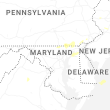
Maryland
| Local Time | Report Details |
|---|---|
| 2:03 PM EDT | Tree down onto wires near 14123 clear spring rd in washington county MD, 71.9 miles WNW of Baltimore, MD |
| 2:45 PM EDT | Trees blew down on us-340 at keep tryst roa in washington county MD, 57.4 miles W of Baltimore, MD |
| 2:46 PM EDT | Tree reported down near the intersection of washington street and mcdowell stree in jefferson county WV, 60.6 miles W of Baltimore, MD |
| 2:50 PM EDT | Trees blew down on petersville road at burkittsville roa in frederick county MD, 54.8 miles W of Baltimore, MD |
| 2:54 PM EDT | A couple calls for trees down in myersville and middletow in frederick county MD, 44.5 miles WNW of Baltimore, MD |
| 3:00 PM EDT | Trees blew down on us-40 alternate/old national pike at south clifton roa in frederick county MD, 48 miles W of Baltimore, MD |
| 3:00 PM EDT | Multiple reports of trees down in jefferson area of frederick count in frederick county MD, 49.5 miles W of Baltimore, MD |
| 3:05 PM EDT | Reports of multiple trees down in frederic in frederick county MD, 44.5 miles WNW of Baltimore, MD |
| 3:15 PM EDT | Reports of multiple trees down in new marke in frederick county MD, 35.9 miles W of Baltimore, MD |
| 3:23 PM EDT | A couple trees down in adamstow in frederick county MD, 45.6 miles W of Baltimore, MD |
| 3:25 PM EDT | Numerous trees blew down along md-26 liberty road between franklinville road and woodbine roa in carroll county MD, 28.7 miles WNW of Baltimore, MD |
| 3:25 PM EDT | Multiple large tree limbs snapped along watersville roa in carroll county MD, 27.2 miles WNW of Baltimore, MD |
| 3:29 PM EDT | Large trees blew down along va-407 marston roa in carroll county MD, 29 miles WNW of Baltimore, MD |
| 3:40 PM EDT | Trees blew down on md-91 emory road at springhurst cour in carroll county MD, 20.4 miles NW of Baltimore, MD |
| 3:45 PM EDT | Trees blew down on md-25 falls road near benson mill roa in baltimore county MD, 20.7 miles NNW of Baltimore, MD |
| 3:45 PM EDT | Trees blew down on md-25 falls road at md-88 black rock roa in baltimore county MD, 19.2 miles NNW of Baltimore, MD |
| 3:45 PM EDT | Numerous trees blew down along md-25 falls road near knox avenue and shawan roa in baltimore county MD, 14.8 miles NNW of Baltimore, MD |
| 3:53 PM EDT | Few large trees down onto roadway near intersection of md rt 26 and klee mill rd in carroll county MD, 22.7 miles WNW of Baltimore, MD |
| 3:55 PM EDT | Trees blew down on md-45 york road at gifford lan in baltimore county MD, 20.8 miles N of Baltimore, MD |
| 3:59 PM EDT | Trees and wires down at whites ferry rd at darnestown rd in montgomery county MD, 40.7 miles WSW of Baltimore, MD |
| 4:00 PM EDT | Trees blew down on md-146 jarrettsville pike at dulaney valley roa in baltimore county MD, 11.8 miles N of Baltimore, MD |
| 4:00 PM EDT | Trees blew down near the intersection of md-23 norrisville road and white hall roa in harford county MD, 23.6 miles N of Baltimore, MD |
| 4:05 PM EDT | Numerous large trees blew down along md-190 river road between falls road and i-495 capital beltwa in montgomery county MD, 36.7 miles WSW of Baltimore, MD |
| 4:05 PM EDT | Trees blew down on eastbound clara barton parkway near i-495 capital beltwa in montgomery county MD, 37.8 miles SW of Baltimore, MD |
| 4:05 PM EDT | Trees blew down on southbound i-495 capital beltway outer loop after md-190 river roa in montgomery county MD, 36.5 miles SW of Baltimore, MD |
| 4:07 PM EDT | National park service reports that the entrance to great fall national park maryland side is blocked by tree in montgomery county MD, 39.4 miles WSW of Baltimore, MD |
| 4:07 PM EDT | Numerous reports of trees reported down in the jarrettsville are in harford county MD, 22.4 miles NNE of Baltimore, MD |
| 4:10 PM EDT | A tree blew down onto a house in the 11000 block of home place lan in montgomery county MD, 37.2 miles WSW of Baltimore, MD |
| 4:10 PM EDT | Trees blew down on southbound i-83 at exit 18/md-943 warren roa in baltimore county MD, 12.7 miles NNW of Baltimore, MD |
| 4:10 PM EDT | Part of clara barton parkway is blocked by a tree in the direction of i-49 in montgomery county MD, 37.4 miles SW of Baltimore, MD |
| 4:14 PM EDT | Trees and wires down in montgomery county MD, 36.1 miles WSW of Baltimore, MD |
| 4:14 PM EDT | Right lane of clara barton pkwy heading toward i-495 closed due to a tree down in montgomery county MD, 36.9 miles SW of Baltimore, MD |
| 4:15 PM EDT | A large tree blew down onto a metro bus near the intersection of md-410 east-west highway and md-185 connecticut avenu in montgomery county MD, 32.7 miles SW of Baltimore, MD |
| 4:15 PM EDT | Trees blew down on md-543 ady road at walters mill roa in harford county MD, 27.2 miles NNE of Baltimore, MD |
| 4:15 PM EDT | Trees blew down on eastbound i-495 capital beltway inner loop at exit 33/md-185 connecticut avenue... and on westbound i-495 capital betlway outer loop at exit 36/md-18 in montgomery county MD, 31.8 miles SW of Baltimore, MD |
| 4:15 PM EDT | Trees blew down on eastbound i-495 capital beltway inner loop at md-355 wisconsin avenue/rockville pik in montgomery county MD, 32.3 miles SW of Baltimore, MD |
| 4:15 PM EDT | Trees blew down on md-646 prospect road at bay roa in harford county MD, 30.4 miles NNE of Baltimore, MD |
| 4:15 PM EDT | Trees and large tree limbs blew down onto power lines in silver sprin in montgomery county MD, 31 miles SW of Baltimore, MD |
| 4:15 PM EDT | A tree blew down onto a house in the 1600 block of noyes drive (near second avenue in montgomery county MD, 30.6 miles SW of Baltimore, MD |
| 4:15 PM EDT | A tree blew down onto a house in the 7900 block of takoma avenu in montgomery county MD, 30.3 miles SW of Baltimore, MD |
| 4:16 PM EDT | Tree on a house at the 6200 block of vorlich ln in montgomery county MD, 36.1 miles SW of Baltimore, MD |
| 4:18 PM EDT | Several reports of trees and wires down across the potomac section of montgomery county in montgomery county MD, 37.5 miles WSW of Baltimore, MD |
| 4:19 PM EDT | Several small branches... around 2 inches in diameter... down in the area in harford county MD, 21.6 miles NE of Baltimore, MD |
| 4:20 PM EDT | Trees and wires down in montgomery county MD, 36.2 miles WSW of Baltimore, MD |
| 4:20 PM EDT | Trees and wires down on a vehicle in montgomery county MD, 36.1 miles SW of Baltimore, MD |
| 4:20 PM EDT | Tree on a house at the 7900 block of tacoma ave in montgomery county MD, 30.3 miles SW of Baltimore, MD |
| 4:20 PM EDT | Trees blew down on us-29 columbia pike near industrial parkwa in montgomery county MD, 25.1 miles SW of Baltimore, MD |
| 4:20 PM EDT | Wires down at the 3600 block of spurell c in montgomery county MD, 30.6 miles SW of Baltimore, MD |
| 4:20 PM EDT | Large tree down at the 1620 block of western ave in montgomery county MD, 33.6 miles SW of Baltimore, MD |
| 4:24 PM EDT | Tree on a house at the 1600 noyes dr near 2nd ave in montgomery county MD, 30.6 miles SW of Baltimore, MD |
| 4:24 PM EDT | Tree down in 5900 block of river roa in charles county MD, 49.7 miles SSW of Baltimore, MD |
| 4:25 PM EDT | A wind gust of 51 knots (59 mph) was measured by the awos at college park airport (kcgs in prince georges county MD, 27.2 miles SW of Baltimore, MD |
| 4:25 PM EDT | Trees blew down near the intersection of suitland parkway and md-5 branch avenu in prince georges county MD, 35.8 miles SSW of Baltimore, MD |
| 4:26 PM EDT | Numerous trees and wires down across silver spring in montgomery county MD, 34.4 miles WSW of Baltimore, MD |
| 4:30 PM EDT | Trees blew down on southbound us-29 at exit 25a/southbound i-70. trees blew down on md-144 frederick road at starhill lan in howard county MD, 11.8 miles W of Baltimore, MD |
| 4:34 PM EDT | Tree down at the intersection suitland parkway and naylor roa in prince georges county MD, 35.8 miles SSW of Baltimore, MD |
| 4:34 PM EDT | Tree down on a road in bowie in prince georges county MD, 22.7 miles SSW of Baltimore, MD |
| 4:35 PM EDT | Trees blew down on us-50 john hanson highway at md-197 collington roa in prince georges county MD, 24.5 miles SSW of Baltimore, MD |
| 4:35 PM EDT | Trees blew down on md-193 enterprise road at chantilly lan in prince georges county MD, 26.3 miles SSW of Baltimore, MD |
| 4:40 PM EDT | Trees blew down on md-4 pennsylvania avenue between md-980d ritchie marlboro road and old crain highwa in prince georges county MD, 34.3 miles SSW of Baltimore, MD |
| 4:40 PM EDT | Trees blew down on md-197 collington road near us-301 crain highwa in prince georges county MD, 24.9 miles SSW of Baltimore, MD |
| 4:40 PM EDT | Numerous trees blew down near the interchange of us-301 crain highway and md-214 central avenu in prince georges county MD, 27.6 miles SSW of Baltimore, MD |
| 4:40 PM EDT | Trees blew down on southbound us-301 crain highway at leeland roa in prince georges county MD, 30.4 miles SSW of Baltimore, MD |
| 4:40 PM EDT | Over a dozen reports of trees down across the northern portion of cecil county from the first storm that came throug in cecil county MD, 40.4 miles NE of Baltimore, MD |
| 4:43 PM EDT | Large branches reported down on central ave near paxtuent river roa in anne arundel county MD, 26.4 miles S of Baltimore, MD |
| 4:45 PM EDT | Trees blew down on md-424 davidsonville road at governor bridge roa in anne arundel county MD, 23.6 miles S of Baltimore, MD |
| 4:47 PM EDT | Tree fell onto house causing some structural damage to the corner of the house on walnut trail at n riverside d in anne arundel county MD, 16 miles S of Baltimore, MD |
| 4:48 PM EDT | Tree down and pole split in half on evergreen road at oak view driv in anne arundel county MD, 15.2 miles S of Baltimore, MD |
| 4:50 PM EDT | Trees blew down on md-2 governor ritchie highway at cypress cove roa in anne arundel county MD, 16.5 miles SSE of Baltimore, MD |
| 4:50 PM EDT | Trees blew down on md-43 white marsh boulevard at perry hall boulevar in baltimore county MD, 9.7 miles NE of Baltimore, MD |
| 4:50 PM EDT | Five trees blew down near the intersection of chesterfield road and hawkins roa in anne arundel county MD, 20 miles S of Baltimore, MD |
| 4:50 PM EDT | Several tree branches down near intersection of 4th avenue and crain hwy in anne arundel county MD, 9.1 miles S of Baltimore, MD |
| 4:51 PM EDT | Trees and wires down with roadway closed on arundel beach road and woodland roa in anne arundel county MD, 15 miles SSE of Baltimore, MD |
| 4:52 PM EDT | Trees down in roadway... fully blocked at drum ave n & christy r in anne arundel county MD, 12 miles S of Baltimore, MD |
| 4:52 PM EDT | Trees down on roadway at willow tree dr & high oak r in anne arundel county MD, 9.9 miles SSE of Baltimore, MD |
| 4:57 PM EDT | Trees and wires down... fully blocked roadway at hazel trail & kyle r in anne arundel county MD, 16.7 miles S of Baltimore, MD |
| 4:57 PM EDT | Trees down blocking the roadway at virginia ave & our p in anne arundel county MD, 14.9 miles SSE of Baltimore, MD |
| 5:02 PM EDT | Corrects previous tstm wnd dmg report from 1 ssw arnold. trees down across road and on power lines on severn way & grandview r in anne arundel county MD, 18.8 miles SSE of Baltimore, MD |
| 5:06 PM EDT | Trees down across road and on power lines on bayard rd & s polling house r in anne arundel county MD, 30.4 miles S of Baltimore, MD |
| 5:09 PM EDT | Tree with wires down-love point rd. near kent island high school. time estimated from rada in queen anne's county MD, 26.2 miles SE of Baltimore, MD |
| 5:10 PM EDT | Several trees uprooted. time estimated from rada in kent county MD, 20.4 miles ESE of Baltimore, MD |
| 5:11 PM EDT | Eight reports of trees down across northern calvert count in calvert county MD, 46.3 miles S of Baltimore, MD |
| 5:20 PM EDT | Tree with wires down at double creek rd and evergreen farm ln and mcginnes rd. time estimated from rada in kent county MD, 29.5 miles E of Baltimore, MD |
| 5:20 PM EDT | Multiple trees with wires down along 4h park rd between john brown rd... white house ln... and tilghman neck. time estimated from rada in queen anne's county MD, 31.8 miles SE of Baltimore, MD |
| 5:25 PM EDT | Over a dozen reports of downed trees across southern cecil county from the second round of storms that came throug in cecil county MD, 46.8 miles ENE of Baltimore, MD |
| 5:25 PM EDT | Tree down near intersection of fairground road and bel alton newtown roa in charles county MD, 60.9 miles SSW of Baltimore, MD |
| 5:27 PM EDT | Large tree limbs downe in kent county MD, 39.2 miles E of Baltimore, MD |
| 5:30 PM EDT | Tree on wires at broad and 4th street. time estimated from rada in queen anne's county MD, 37.1 miles E of Baltimore, MD |
| 5:40 PM EDT | Multiple trees down at sudlersville cemetery road and higman mill road. time estimated from rada in queen anne's county MD, 40.9 miles E of Baltimore, MD |
| 6:23 PM EDT | Wind gusts of up to 50 knots (58 mph) were measured by the point lookout weatherflow sensor (xptl) between 6:23 and 6:28 p in anz537 county MD, 70.3 miles WSW of Ocean City, MD |
| 6:55 PM EDT | Tree down along henry cross r in dorchester county MD, 43.1 miles W of Ocean City, MD |
| 7:05 PM EDT | Trees fell down on powerlines and caused them to catch fir in somerset county MD, 48 miles WSW of Ocean City, MD |
| 7:05 PM EDT | A tree fell down along silver l in somerset county MD, 47.2 miles WSW of Ocean City, MD |
| 7:08 PM EDT | Multiple trees down along anderson r in somerset county MD, 38.3 miles WSW of Ocean City, MD |
| 7:10 PM EDT | Tree fell across old princess anne r in somerset county MD, 35.6 miles WSW of Ocean City, MD |
| 7:12 PM EDT | Trees and branches fell on powerlines across brownstone r in somerset county MD, 36 miles WSW of Ocean City, MD |
| 7:17 PM EDT | Tree fell across wallace taylor r in somerset county MD, 30.8 miles WSW of Ocean City, MD |
| 7:28 PM EDT | Tree fell across forest lan in worcester county MD, 19.2 miles WSW of Ocean City, MD |
| 7:30 PM EDT | Tree fell down along castle hill r in worcester county MD, 21.4 miles SW of Ocean City, MD |
| 7:41 PM EDT | Weatherflow site at assateague recorded a wind gust to 50 k in worcester county MD, 9.8 miles SW of Ocean City, MD |
Ohio
| Local Time | Report Details |
|---|---|
| 2:11 PM EDT | Tree down across us 422 in eastbound lane in geauga county OH, 34.5 miles ESE of Cleveland, OH |
| 2:30 PM EDT | Tree down on apollo road near mechanicstow in carroll county OH, 51.7 miles WNW of Pittsburgh, PA |
| 3:17 PM EDT | Tree down between dellroy and carrolto in carroll county OH, 61.4 miles W of Pittsburgh, PA |
New Jersey
| Local Time | Report Details |
|---|---|
| 2:23 PM EDT | Corrects time from previous tstm wnd dmg report from bedminster twp. multiple trees down. time estimated from rada in somerset county NJ, 34.7 miles W of Brooklyn, NY |
| 2:47 PM EDT | Multiple trees down on wires. time estimated from rada in morris county NJ, 27 miles W of Brooklyn, NY |
| 2:47 PM EDT | Tree on vehicle. time estimated from rada in morris county NJ, 27 miles W of Brooklyn, NY |
| 3:27 PM EDT | Trees and wires down. time estimated from rada in hunterdon county NJ, 41 miles W of Brooklyn, NY |
| 3:32 PM EDT | Tree downed ... time estimate in sussex county NJ, 44.3 miles WNW of Brooklyn, NY |
| 3:36 PM EDT | Multiple trees down. time estimated from rada in somerset county NJ, 34.7 miles W of Brooklyn, NY |
| 3:46 PM EDT | Trees and wires down. time estimated from rada in hunterdon county NJ, 48.1 miles WSW of Brooklyn, NY |
| 4:18 PM EDT | Wires down across willow av in union county NJ, 21.7 miles W of Brooklyn, NY |
| 4:18 PM EDT | Mutliple trees and large tree limbs down. time estimated by rada in union county NJ, 16.4 miles W of Brooklyn, NY |
| 4:19 PM EDT | Wires down on roadwa in union county NJ, 17.4 miles W of Brooklyn, NY |
| 4:22 PM EDT | Large tree across roadwa in essex county NJ, 11.5 miles WNW of Brooklyn, NY |
| 4:39 PM EDT | Station xby in hudson county NJ, 5 miles WSW of Brooklyn, NY |
| 4:41 PM EDT | Asos station kewr newark airpor in union county NJ, 9.5 miles W of Brooklyn, NY |
| 4:51 PM EDT | Tree on hous in union county NJ, 15.9 miles W of Brooklyn, NY |
| 5:25 PM EDT | Tree onto house kensington d in monmouth county NJ, 33.4 miles SW of Brooklyn, NY |
| 5:50 PM EDT | Njwxne in salem county NJ, 64.2 miles ENE of Baltimore, MD |
| 5:55 PM EDT | Large tree branches fell on a car and blocked creek road. time estimated from rada in burlington county NJ, 67.6 miles SW of Brooklyn, NY |
| 6:00 PM EDT | Large tree down on hainesport-mt. laurel road near academy dr. tree laying across road and fell on power line in burlington county NJ, 72.5 miles SW of Brooklyn, NY |
| 6:00 PM EDT | Several large tree limbs downed ... time appro in mercer county NJ, 53.7 miles WSW of Brooklyn, NY |
| 6:00 PM EDT | Tree downed... little egg harbor... time es in ocean county NJ, 77.7 miles SSW of Brooklyn, NY |
| 6:01 PM EDT | Corrects previous tstm wnd dmg report from ewing. many scattered trees down in the western portion of ewing and northwestern trenton along route 29 and around banchoff in mercer county NJ, 51.7 miles SW of Brooklyn, NY |
| 6:10 PM EDT | Large branches and few trees downe in cumberland county NJ, 66.8 miles N of Ocean City, MD |
| 6:18 PM EDT | Multiple trees and wires down. time estimated from rada in mercer county NJ, 48.3 miles SW of Brooklyn, NY |
| 6:18 PM EDT | Multiple trees and power lines down. time estimated from rada in hunterdon county NJ, 55.2 miles WSW of Brooklyn, NY |
| 6:22 PM EDT | Several trees and limbs downed; time estimate in somerset county NJ, 40.9 miles WSW of Brooklyn, NY |
| 6:25 PM EDT | Corrects previous tstm wnd dmg report from manalapan twp. tree onto house kensington d in monmouth county NJ, 33.4 miles SW of Brooklyn, NY |
| 6:26 PM EDT | Multiple trees and power lines down. time estimated from rada in middlesex county NJ, 29.4 miles SW of Brooklyn, NY |
| 6:26 PM EDT | Tree down. time estimated from rada in middlesex county NJ, 33.5 miles SW of Brooklyn, NY |
| 6:30 PM EDT | Tree downed... time estimate in middlesex county NJ, 29.4 miles SW of Brooklyn, NY |
| 6:30 PM EDT | Several trees and large limbs downed; time estimate in hunterdon county NJ, 44.2 miles WSW of Brooklyn, NY |
| 6:40 PM EDT | Tree into house on laurel ave. time estimated from rada in monmouth county NJ, 20.4 miles SSW of Brooklyn, NY |
| 6:41 PM EDT | Tree into house at thompson ave/ocean ave. time estimated from rada in monmouth county NJ, 20.8 miles SSW of Brooklyn, NY |
| 6:44 PM EDT | Tree into house on mechanic street. time estimated from rada in monmouth county NJ, 24 miles S of Brooklyn, NY |
| 6:45 PM EDT | Tree through homes on wedgewood ave. time estimated from rada in monmouth county NJ, 29.5 miles SSW of Brooklyn, NY |
| 6:45 PM EDT | Tree into houses on forest ave. time estimated from rada in monmouth county NJ, 18.9 miles SSW of Brooklyn, NY |
New York
| Local Time | Report Details |
|---|---|
| 2:40 PM EDT | Downed tree across road at 190 hollow roa in dutchess county NY, 67.2 miles S of Schenectady, NY |
| 2:56 PM EDT | Multiple trees down on bangall roa in dutchess county NY, 65.6 miles SSE of Schenectady, NY |
| 3:08 PM EDT | Large trees down blocking route 44 between millerton and amenia. time estimated from rada in dutchess county NY, 64.4 miles SSE of Schenectady, NY |
| 3:40 PM EDT | Tree down on gifford rd. time estimated from rada in rensselaer county NY, 23.9 miles ENE of Schenectady, NY |
| 4:04 PM EDT | Tree down on babcock lake rd. time estimated from rada in rensselaer county NY, 28 miles E of Schenectady, NY |
| 4:43 PM EDT | Mesonet site honorable william wal in anz338 county NY, 2.7 miles WNW of Brooklyn, NY |
| 5:00 PM EDT | Tree and wires across 60th place/flushing ave in maspet in queens county NY, 5.1 miles ENE of Brooklyn, NY |
| 7:30 PM EDT | Large tree blocking road on clubhouse r in nassau county NY, 23.4 miles E of Brooklyn, NY |
| 9:07 PM EDT | Tree down blocking roadway (radar estimated time in delaware county NY, 51.7 miles NNE of Scranton, PA |
| 9:10 PM EDT | Tree down blocking roadway (radar estimated time in delaware county NY, 53.2 miles NNE of Scranton, PA |
Vermont
| Local Time | Report Details |
|---|---|
| 3:12 PM EDT | Tree down into power lines at around 330 carroll hill roa in franklin county VT, 21.4 miles NNE of Burlington, VT |
| 3:38 PM EDT | Tree down onto edwards road in lamoille county VT, 22 miles ENE of Burlington, VT |
| 3:46 PM EDT | Tree down onto edwards road in lamoille county VT, 22 miles ENE of Burlington, VT |
| 4:05 PM EDT | Tree down onto belvidere road (vt 118) north of vt 10 in lamoille county VT, 36.6 miles ENE of Burlington, VT |
Connecticut
| Local Time | Report Details |
|---|---|
| 3:14 PM EDT | Tree down across both lanes of east plymouth road and matthews stree in litchfield county CT, 82.6 miles W of Providence, RI |
| 3:14 PM EDT | Tree down on road near allen street and east washington roa in litchfield county CT, 82.8 miles W of Providence, RI |
| 3:14 PM EDT | Tree down in yard of 85 main stree in litchfield county CT, 82.7 miles W of Providence, RI |
| 3:14 PM EDT | Tree down in yard of 114 bermis stree in litchfield county CT, 83.6 miles W of Providence, RI |
| 3:30 PM EDT | In burlington there were multiple trees and wires down. report relayed via amateur radi in hartford county CT, 79 miles W of Providence, RI |
| 3:40 PM EDT | In canton... there were power lines down on cherry road. report relayed via amateur radi in hartford county CT, 77.9 miles W of Providence, RI |
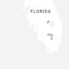
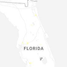
Florida
| Local Time | Report Details |
|---|---|
| 3:35 PM EDT | Duval fire rescue reported powerlines blown down near the intersection of i-295 and i-10 on the jacksonville westsid in duval county FL, 8.1 miles W of Jacksonville, FL |
| 3:50 PM EDT | Several trees down near county rd 13a and county rd 305. time estimated via rada in st. johns county FL, 38.9 miles SSE of Jacksonville, FL |
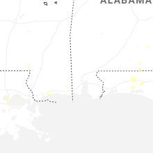
Alabama
| Local Time | Report Details |
|---|---|
| 2:50 PM CDT | Tree down near the intersection of a b stubbs road and mose ware roa in dale county AL, 76.6 miles S of Auburn, AL |
Pennsylvania
| Local Time | Report Details |
|---|---|
| 4:04 PM EDT | Several trees and wires dow in lancaster county PA, 47.1 miles NNE of Baltimore, MD |
| 4:09 PM EDT | Tree dow in york county PA, 38.7 miles N of Baltimore, MD |
| 4:20 PM EDT | Multiple large trees uproote in york county PA, 33.8 miles NNE of Baltimore, MD |
| 4:22 PM EDT | Tree dow in york county PA, 40.7 miles NNE of Baltimore, MD |
| 4:27 PM EDT | Trees and wires down along lancaster pik in lancaster county PA, 40.8 miles NE of Baltimore, MD |
| 4:40 PM EDT | Power pole snapped onto car... buildin in chester county PA, 67.1 miles NNE of Baltimore, MD |
| 4:57 PM EDT | Tree into house. time estimated from rada in chester county PA, 62.5 miles NE of Baltimore, MD |
| 5:00 PM EDT | Tree down on ca in delaware county PA, 84.6 miles NE of Baltimore, MD |
| 5:07 PM EDT | Multiple trees down. time estimated from rada in chester county PA, 71.7 miles NE of Baltimore, MD |
| 5:09 PM EDT | Route 202 southbound vicinity of skiles blvd is completely blocked due to trees and wires down. time estimated from rada in chester county PA, 71.7 miles NE of Baltimore, MD |
| 5:09 PM EDT | A tree fell onto a house. time estimated from rada in chester county PA, 71.7 miles NE of Baltimore, MD |
| 5:10 PM EDT | Several large tree limbs downed with damage ; time es in chester county PA, 74.7 miles NE of Baltimore, MD |
| 5:10 PM EDT | Numerout limbs downed onto roads. time estimate in delaware county PA, 71 miles NE of Baltimore, MD |
| 5:15 PM EDT | Tree into house. time estimated from rada in delaware county PA, 73.9 miles NE of Baltimore, MD |
| 5:16 PM EDT | Multiple trees snapped at calvary cemetery. time estimated from rada in delaware county PA, 78.2 miles NE of Baltimore, MD |
| 5:20 PM EDT | Several trees down. a few trees blocking roadways. time estimated from rada in delaware county PA, 78.2 miles NE of Baltimore, MD |
| 5:23 PM EDT | Corrects previous tstm wnd dmg report from penn. tree reported dow in westmoreland county PA, 20.3 miles ESE of Pittsburgh, PA |
| 5:25 PM EDT | Numerous trees downed... some onto homes and cars. time appro in montgomery county PA, 83.2 miles SW of Brooklyn, NY |
| 5:25 PM EDT | Corrects time of previous tstm wnd dmg report from havertown. tree down on car. time estimated from rada in delaware county PA, 84.6 miles NE of Baltimore, MD |
| 5:29 PM EDT | A tree fell on wires on evansburg rd and township line road. time estimated from rada in montgomery county PA, 81.3 miles WSW of Brooklyn, NY |
| 5:30 PM EDT | Tree down on executive avenue near the economy lot at philadelphia international airport. time estimated from rada in philadelphia county PA, 84.1 miles ENE of Baltimore, MD |
| 5:30 PM EDT | Part of the roof blew off a building damaging cars in the parking lo in montgomery county PA, 81.5 miles SW of Brooklyn, NY |
| 5:30 PM EDT | Numerous trees down across the roxborough/ivy ridge/andorra section of the city including bells mill rd... and the ridge avenue united methodist church. time estimated in philadelphia county PA, 80.6 miles SW of Brooklyn, NY |
| 5:33 PM EDT | *** 2 inj *** 2 people were injured when a tree fell and trapped the individuals in the east oak lane neighborhood of philadelphia. time estimated from rada in philadelphia county PA, 74.7 miles SW of Brooklyn, NY |
| 5:34 PM EDT | Trees uprooted in homer city. report from mpin in indiana county PA, 44.7 miles E of Pittsburgh, PA |
| 5:40 PM EDT | Trees and wires dow in clearfield county PA, 23.4 miles WNW of State College, PA |
| 5:43 PM EDT | Multiple trees snapped. time estimated from rada in bucks county PA, 63.8 miles SW of Brooklyn, NY |
| 5:43 PM EDT | Tree down on lucerne roa in indiana county PA, 46.1 miles ENE of Pittsburgh, PA |
| 5:45 PM EDT | Trees downed onto cars... time estimate in bucks county PA, 63.8 miles SW of Brooklyn, NY |
| 5:45 PM EDT | Trees and branches onto i-9 in bucks county PA, 66.8 miles SW of Brooklyn, NY |
| 5:45 PM EDT | Large tree snapped. time estimated from rada in bucks county PA, 66 miles WSW of Brooklyn, NY |
| 5:52 PM EDT | Multiple trees down near steel hollow road and maurer lan in centre county PA, 10 miles WNW of State College, PA |
| 5:52 PM EDT | Multiple trees snapped near hansell road... malin road... and briarwood road. time estimated from rada in delaware county PA, 80.6 miles NE of Baltimore, MD |
| 5:52 PM EDT | Tree down on shed. time estimated from rada in bucks county PA, 57.9 miles SW of Brooklyn, NY |
| 5:53 PM EDT | Tree and wires blocking steele hollow road at mauer lan in centre county PA, 8.7 miles WNW of State College, PA |
| 5:55 PM EDT | Trees down along quarter turn west rd. time estimated from rada in bucks county PA, 58 miles SW of Brooklyn, NY |
| 6:01 PM EDT | Power lines dow in centre county PA, 9.1 miles WNW of State College, PA |
| 6:12 PM EDT | Tree reported dow in westmoreland county PA, 20.3 miles ESE of Pittsburgh, PA |
| 6:15 PM EDT | Several trees dow in lycoming county PA, 44.2 miles NE of State College, PA |
| 6:20 PM EDT | Two trees dow in cambria county PA, 55.9 miles E of Pittsburgh, PA |
| 6:51 PM EDT | Trees down 3 miles south of trout ru in lycoming county PA, 60.4 miles NE of State College, PA |
| 6:51 PM EDT | Trees down along route 8 in lycoming county PA, 58.8 miles ENE of State College, PA |
| 7:00 PM EDT | Trees down along route 8 in lycoming county PA, 58.7 miles W of Scranton, PA |
| 7:09 PM EDT | Trees down near hillsgrov in sullivan county PA, 54.5 miles W of Scranton, PA |
| 7:25 PM EDT | Multiple trees down across east buffalo townshi in union county PA, 50.8 miles ENE of State College, PA |
| 7:25 PM EDT | Multiple trees down across lewisburg boroug in union county PA, 52.8 miles ENE of State College, PA |
| 7:30 PM EDT | Multiple trees down across west chillisquaque townshi in northumberland county PA, 54.8 miles ENE of State College, PA |
| 7:42 PM EDT | Trees down near colle in sullivan county PA, 33.7 miles WNW of Scranton, PA |
| 8:03 PM EDT | Tree/wires down. tree on fir in columbia county PA, 48 miles WSW of Scranton, PA |
| 8:08 PM EDT | Tree down across allen stree in wyoming county PA, 24.4 miles NW of Scranton, PA |
| 8:31 PM EDT | Tree down on kasko road jackson townshi in luzerne county PA, 19.3 miles WSW of Scranton, PA |
| 8:44 PM EDT | Tree down over road in chinchilla p in lackawanna county PA, 4.9 miles NNW of Scranton, PA |
| 8:49 PM EDT | Wires fell on trees on penn avenue in scranton p in lackawanna county PA, 0 miles E of Scranton, PA |
| 8:59 PM EDT | Wires down on tree on market stree in lackawanna county PA, 9.2 miles ESE of Scranton, PA |
District of Columbia
| Local Time | Report Details |
|---|---|
| 4:10 PM EDT | Trees blew down on soutbound dalecarlia parkway northwest before loughboro road northwes in district of columb county DC, 36.2 miles SW of Baltimore, MD |
| 4:14 PM EDT | Tree reported down on a house on the 5200 block of connecticut ave northwest in district of columb county DC, 33.6 miles SW of Baltimore, MD |
| 4:15 PM EDT | Trees blew down on 16th street northwest at alaska avenue northwes in district of columb county DC, 32 miles SW of Baltimore, MD |
| 4:15 PM EDT | Numerous large trees and branches blew down in northwest d in district of columb county DC, 34.1 miles SW of Baltimore, MD |
| 4:18 PM EDT | Large tree branch down onto powerlines and onto a car at 4512 davenport s in district of columb county DC, 34.9 miles SW of Baltimore, MD |
| 4:20 PM EDT | Large tree struck a house at the 100 block of elm av in montgomery county MD, 30.9 miles SW of Baltimore, MD |
| 4:24 PM EDT | Tree reported down on ohio drive between buckeye drive and golf course entranc in district of columb county DC, 36.2 miles SW of Baltimore, MD |
| 4:25 PM EDT | A six story building under construction collapsed near the intersection of 19th street ne and h street n in district of columb county DC, 33.5 miles SW of Baltimore, MD |
Montana
| Local Time | Report Details |
|---|---|
| 2:18 PM MDT | Mesonet station lmrm8 antelope raws. time of gust is estimated given the station reports once per hour and reports a peak wind gust over the prior hou in beaverhead county MT, 74.6 miles ESE of Salmon, ID |
| 5:00 PM MDT | Corrects previous non-tstm wnd gst report from 1 se dillon. ambient station chicken coo in beaverhead county MT, 61.9 miles E of Salmon, ID |
| 6:40 PM MDT | Mesonet station ncrm8 newlan creek raws. time of gust is estimated using radar given the site reports a peak gust once per hou in meagher county MT, 57.2 miles SSE of Great Falls, MT |
| 7:45 PM MDT | Mesonet station mtgys geyser (mt dot in judith basin county MT, 42.6 miles ESE of Great Falls, MT |
Georgia
| Local Time | Report Details |
|---|---|
| 4:20 PM EDT | Tree down near the intersection of county road 374 and northside driv in seminole county GA, 42.4 miles NW of Tallahassee, FL |
| 4:41 PM EDT | Picture on social media of a tree down off of boyette roa in lowndes county GA, 45.1 miles SW of Douglas, GA |
| 4:50 PM EDT | A tree was blown onto a power line in ray cit in berrien county GA, 36.5 miles SW of Douglas, GA |
| 4:55 PM EDT | Tree down near allenville road and garner roa in berrien county GA, 33.8 miles SW of Douglas, GA |
New Hampshire
| Local Time | Report Details |
|---|---|
| 4:40 PM EDT | Large trees down blocking walker brook r in merrimack county NH, 84.1 miles W of Portland, ME |
| 4:43 PM EDT | Reports of trees down on spa rd... north rd... and ragged mtn hwy in danbud in merrimack county NH, 80.9 miles W of Portland, ME |
| 4:44 PM EDT | Ping Pong Ball sized hail reported near Hill, NH, 78.3 miles W of Portland, ME, hail up to 1.5in... hail lasted for 8 minutes. minor damage to car. |
| 4:45 PM EDT | Half Dollar sized hail reported near Danbury, NH, 80.9 miles W of Portland, ME, chaser reports half dollar sized hail falling in danbury. |
| 4:45 PM EDT | Observed downed wires as well as trees and large branches across waukeena lake rd and sedgewick rd in danbur in merrimack county NH, 82.5 miles W of Portland, ME |
| 4:48 PM EDT | Trees downed wires on us route 4 and ford mill rd in fords crossing villag in merrimack county NH, 82.3 miles W of Portland, ME |
| 4:57 PM EDT | Observed trees downed on mcmurphy rd near split from karl gordon rd; diameter of downed trees between 8-18i in grafton county NH, 76.1 miles W of Portland, ME |
| 4:58 PM EDT | Observed trees down along bristol hill rd near plumer hill r in grafton county NH, 75 miles W of Portland, ME |
| 4:58 PM EDT | Half Dollar sized hail reported near Bristol, NH, 74.5 miles W of Portland, ME, half dollar sized hail on main street in bristol. |
| 4:59 PM EDT | Trees and wires down on new chester mtn r in grafton county NH, 74.1 miles W of Portland, ME |
| 5:16 PM EDT | Half Dollar sized hail reported near Bristol, NH, 75 miles W of Portland, ME, reported by amateur radio. half dollar size hail at hannaford parking lot. |
| 5:25 PM EDT | Observed large tree partially blocking stage rd near spectacle pon in belknap county NH, 69 miles W of Portland, ME |
Michigan
| Local Time | Report Details |
|---|---|
| 3:40 PM CDT | Ping Pong Ball sized hail reported near Watersmeet, MI, 46.5 miles NNE of Rhinelander, WI, video shows hail covering the ground at a golf course. |
| 7:49 PM EDT | Quarter sized hail reported near Fenton, MI, 20.3 miles S of Flint, MI, social media images of hailstones around 1 inch in diameter. |
| 8:59 PM EDT | Report of a large tree down blocking a couple lanes of eastbound ford r in wayne county MI, 52.6 miles SSE of Flint, MI |
Colorado
| Local Time | Report Details |
|---|---|
| 2:59 PM MDT | Ktad aso in las animas county CO, 70.3 miles SSE of Pueblo, CO |
Indiana
| Local Time | Report Details |
|---|---|
| 4:07 PM CDT | Measured 58 mph wind gust. a few tree limbs downed. time estimated based on rada in porter county IN, 42.9 miles SE of Chicago, IL |
Delaware
| Local Time | Report Details |
|---|---|
| 5:07 PM EDT | A tree into a house. time estimated from rada in new castle county DE, 67.8 miles ENE of Baltimore, MD |
| 5:15 PM EDT | Trees into house. time estimated from rada in new castle county DE, 67.9 miles ENE of Baltimore, MD |
| 5:17 PM EDT | Tree into house. time estimated from rada in new castle county DE, 67.4 miles ENE of Baltimore, MD |
| 6:56 PM EDT | Dewey beach gusted to 52 k in anz455 county DE, 23.8 miles N of Ocean City, MD |
| 6:56 PM EDT | Dewey beach mesonet gusted to 52 k in sussex county DE, 23.8 miles N of Ocean City, MD |
Wisconsin
| Local Time | Report Details |
|---|---|
| 4:28 PM CDT | Quarter sized hail reported near Tomahawk, WI, 24.7 miles WSW of Rhinelander, WI, located near west bay drive and honey road in tripoli. |
| 7:29 PM CDT | Half Dollar sized hail reported near Somerset, WI, 35.4 miles ENE of Minneapolis, MN |
| 7:30 PM CDT | Half Dollar sized hail reported near New Richmond, WI, 36.2 miles ENE of Minneapolis, MN |
| 7:34 PM CDT | Quarter sized hail reported near New Richmond, WI, 36.8 miles ENE of Minneapolis, MN, from mping. |
| 7:34 PM CDT | Half Dollar sized hail reported near New Richmond, WI, 37.1 miles ENE of Minneapolis, MN |
| 7:35 PM CDT | Golf Ball sized hail reported near New Richmond, WI, 35.8 miles ENE of Minneapolis, MN, getting strong winds as well... |
| 7:35 PM CDT | Ping Pong Ball sized hail reported near New Richmond, WI, 37.1 miles ENE of Minneapolis, MN |
| 7:36 PM CDT | Golf Ball sized hail reported near New Richmond, WI, 37.4 miles ENE of Minneapolis, MN |
| 7:36 PM CDT | Quarter sized hail reported near New Richmond, WI, 37.4 miles ENE of Minneapolis, MN, pea to quarter size hail. |
| 7:38 PM CDT | Half Dollar sized hail reported near New Richmond, WI, 36.8 miles ENE of Minneapolis, MN, report from mping. |
| 7:50 PM CDT | Quarter sized hail reported near Baldwin, WI, 43.9 miles E of Minneapolis, MN |
| 7:50 PM CDT | Golf Ball sized hail reported near Baldwin, WI, 43.4 miles E of Minneapolis, MN |
| 7:55 PM CDT | Half Dollar sized hail reported near Baldwin, WI, 44.4 miles E of Minneapolis, MN |
| 8:18 PM CDT | Photo via social media. medium to large size tree snapped. located on the 700 block of 3rd street in kiel. time estimated by rada in manitowoc county WI, 41.6 miles S of Green Bay, WI |
| 8:19 PM CDT | Located on hillcrest drive in kiel. medium sized tree snapped / uproote in manitowoc county WI, 41.6 miles S of Green Bay, WI |
| 8:25 PM CDT | Ping Pong Ball sized hail reported near Elmwood, WI, 57.1 miles ESE of Minneapolis, MN |
| 9:02 PM CDT | Quarter sized hail reported near Nelson, WI, 57.8 miles NW of La Crosse, WI, heavy rain and hail up to quarter size north of nelson. |
| 9:05 PM CDT | Half Dollar sized hail reported near Nelson, WI, 58.3 miles NW of La Crosse, WI |
| 9:07 PM CDT | Quarter sized hail reported near Nelson, WI, 56.9 miles NW of La Crosse, WI |
| 12:55 AM CDT | Downed tree in taylor county WI, 74.2 miles WSW of Rhinelander, WI |
| 12:57 AM CDT | Downed tree in taylor county WI, 74.1 miles WSW of Rhinelander, WI |
| 1:00 AM CDT | Quarter sized hail reported near Gilman, WI, 74.8 miles WSW of Rhinelander, WI |
| 1:00 AM CDT | Winds of 60-65 mph called i in taylor county WI, 74.5 miles WSW of Rhinelander, WI |
Idaho
| Local Time | Report Details |
|---|---|
| 3:40 PM MDT | Mesonet station pc371 medicine lodg in clark county ID, 61.3 miles NNW of Idaho Falls, ID |
| 5:40 PM MDT | Mesonet station ket kettle butt in bonneville county ID, 15 miles WNW of Idaho Falls, ID |
| 6:40 PM MDT | Mesonet station tab 3 w tabe in bingham county ID, 34.7 miles WSW of Idaho Falls, ID |
| 7:26 PM MDT | Mesonet station ezri1 ezra cree in lemhi county ID, 23.5 miles SSW of Salmon, ID |
| 7:36 PM MDT | Mesonet station ldoi1 leador in lemhi county ID, 42.5 miles SE of Salmon, ID |
| 2:25 AM MDT | Mesonet station blu blue dom in clark county ID, 56.4 miles NW of Idaho Falls, ID |
Kansas
| Local Time | Report Details |
|---|---|
| 6:00 PM CDT | Estimated 60 mph wind gust by the publi in thomas county KS, 13.3 miles SW of Colby, KS |
| 6:00 PM CDT | Quarter sized hail reported near Levant, KS, 13.3 miles SW of Colby, KS, estimated dime to slightly bigger than a quarter hail. report stated the hail started around 6pm ct. |
| 6:15 PM CDT | Half Dollar sized hail reported near Levant, KS, 13.8 miles SW of Colby, KS, video of quarter to half dollar size hail. |
| 6:27 PM CDT | Quarter sized hail reported near Colby, KS, 8.8 miles S of Colby, KS, estimated nickel to quarter size hail along with video of the hail. time estimated radar. |
| 6:35 PM CDT | Mesonet station fw6347 colby 2 in thomas county KS, 1.9 miles E of Colby, KS |
| 7:00 PM CDT | Quarter sized hail reported near Oberlin, KS, 45.1 miles NE of Colby, KS, delayed report of dime to 1 inch hail 5 northeast of oberlin. |
| 7:29 PM CDT | Quarter sized hail reported near Oberlin, KS, 39.1 miles NE of Colby, KS, quarter sized hail and sustained winds of 35 mph south of oberlin. |
| 7:30 PM CDT | Quarter sized hail reported near Oberlin, KS, 33.3 miles NE of Colby, KS, public report relayed by em of 1 inch hail. |
| 7:42 PM CDT | Em report of estimated 60 mph winds behind the storm in decatur county KS, 39.1 miles NE of Colby, KS |
North Dakota
| Local Time | Report Details |
|---|---|
| 5:35 PM MDT | Tennis Ball sized hail reported near Belfield, ND, 77 miles SSE of Williston, ND, relayed from public. time estimated from radar. |
| 5:53 PM MDT | Quarter sized hail reported near Belfield, ND, 85.5 miles SSE of Williston, ND, belfield ndawn station camera. |
| 6:20 PM MDT | Golf Ball sized hail reported near Dickinson, ND, 95.6 miles SSE of Williston, ND, relayed through broadcast media. time estimated from radar. |
| 6:23 PM MDT | Golf Ball sized hail reported near Dickinson, ND, 94.2 miles SSE of Williston, ND, hail began at 723 cdt and lasted two minutes. hail from the size of quarters to a few golf ball sized stones. |
| 6:30 PM MDT | Hen Egg sized hail reported near Dickinson, ND, 95.5 miles W of Bismarck, ND, photo relayed through broadcast media. |
| 8:40 PM CDT | Quarter sized hail reported near Wyndmere, ND, 45.7 miles SSW of Fargo, ND, up to quarter size hail reported outside dollar general in wyndmere. time estimated via radar. |
| 9:00 PM CDT | Quarter sized hail reported near Hankinson, ND, 56 miles S of Fargo, ND, corrects previous hail report from hankinson. estimated nickel to quarter size hail at the hankinson school. |
| 8:18 PM MDT | Quarter sized hail reported near New Leipzig, ND, 65.9 miles WSW of Bismarck, ND, mping report of large hail. |
| 9:26 PM CDT | Quarter sized hail reported near Hankinson, ND, 56 miles S of Fargo, ND, estimated nickel to quarter size hail at the hankinson school. |
| 9:31 PM CDT | Tempest weather station recorded a wind gust of 65 mph at 9:31 cd in richland county ND, 59.3 miles S of Fargo, ND |
| 9:43 PM CDT | Ping Pong Ball sized hail reported near Hankinson, ND, 59.2 miles S of Fargo, ND, ping-pong ball sized hail reported between exit 1 and exit 8 on i-29. |
| 12:30 AM CDT | Tree damag in richland county ND, 42 miles SSE of Fargo, ND |
South Dakota
| Local Time | Report Details |
|---|---|
| 6:40 PM CDT | Quarter sized hail reported near Herrick, SD, 54.7 miles NNW of Oneill, NE, dime to quarter-sized hail falling near herrick. |
| 7:43 PM CDT | Quarter sized hail reported near Hosmer, SD, 41.7 miles W of Aberdeen, SD |
| 8:14 PM CDT | Ping Pong Ball sized hail reported near Roscoe, SD, 52.2 miles W of Aberdeen, SD, via social media. |
| 8:16 PM CDT | Half Dollar sized hail reported near Roscoe, SD, 44.9 miles WSW of Aberdeen, SD, report from mping: half dollar (1.25 in.). |
| 8:32 PM CDT | Hen Egg sized hail reported near Onaka, SD, 49.1 miles WSW of Aberdeen, SD, via social media. |
| 8:54 PM CDT | Quarter sized hail reported near Ipswich, SD, 31.8 miles WSW of Aberdeen, SD, pea sized hail... with a few quarters mixed in. |
| 9:06 PM CDT | Half Dollar sized hail reported near Cresbard, SD, 28.4 miles SW of Aberdeen, SD, time estimated. |
| 9:23 PM CDT | Golf Ball sized hail reported near Mansfield, SD, 21.3 miles SW of Aberdeen, SD |
| 9:34 PM CDT | Hen Egg sized hail reported near Faulkton, SD, 43.1 miles SW of Aberdeen, SD, time estimated by radar. |
| 10:29 PM CDT | Mesonet station 316 doland (sddot in spink county SD, 41.4 miles SSE of Aberdeen, SD |
| 10:32 PM CDT | Half Dollar sized hail reported near Redfield, SD, 40.7 miles S of Aberdeen, SD, relayed through social media. time estimated via radar. |
| 10:34 PM CDT | Mesonet station 316 doland (sddot in spink county SD, 41.4 miles SSE of Aberdeen, SD |
| 11:10 PM CDT | Mesonet station 291 4n altamont (sddot in deuel county SD, 47.4 miles W of Montevideo, MN |
| 11:13 PM CDT | Quarter sized hail reported near Clark, SD, 54.5 miles SE of Aberdeen, SD, via social media. time estimated by radar. |
| 11:52 PM CDT | Storm damage reported in hamlin county SD, 72.8 miles NNW of Sioux Falls, SD |
| 11:54 PM CDT | Mesonet station 318 4 wsw stone bridge (sddot in hamlin county SD, 73.8 miles WSW of Montevideo, MN |
| 12:00 AM CDT | Winds of 60-65mph and nickel to quarter sized hai in hamlin county SD, 72.8 miles NNW of Sioux Falls, SD |
| 12:05 AM CDT | Large limb down in estellin in hamlin county SD, 63.6 miles WSW of Montevideo, MN |
| 12:06 AM CDT | Quarter sized hail reported near Bruce, SD, 67 miles WSW of Montevideo, MN, social media report of quarter-sized hail. |
| 12:15 AM CDT | Mesonet station bkms2 brookings 2n in brookings county SD, 54.2 miles N of Sioux Falls, SD |
New Mexico
| Local Time | Report Details |
|---|---|
| 5:55 PM MDT | Storm damage reported in colfax county NM, 65.9 miles ENE of Taos, NM |
Minnesota
| Local Time | Report Details |
|---|---|
| 9:16 PM CDT | Social media report of trees and branches down along the highwa in wabasha county MN, 51.6 miles NW of La Crosse, WI |
| 9:49 PM CDT | Half Dollar sized hail reported near Wheaton, MN, 71.5 miles SSE of Fargo, ND, report from mping: half dollar (1.25 in.). |
| 12:05 AM CDT | Rwis north of kent along us highway 7 in wilkin county MN, 28.9 miles S of Fargo, ND |
| 12:24 AM CDT | Ndawn at foxhom in wilkin county MN, 47.4 miles SSE of Fargo, ND |
| 12:45 AM CDT | Corrects previous tstm wnd gst report from foxhome. ndawn at foxhome... wind gusts over 50mph lasted 20 minutes starting at 12:25 peaking around 12:3 in wilkin county MN, 47.4 miles SSE of Fargo, ND |
| 12:54 AM CDT | Quarter sized hail reported near Arco, MN, 47.8 miles SSW of Montevideo, MN, report from mping: quarter (1.00 in.). |
| 1:40 AM CDT | Measured by mndot rwi in douglas county MN, 72.4 miles N of Montevideo, MN |
| 2:04 AM CDT | Measured at chandler fiel in douglas county MN, 65.4 miles NNE of Montevideo, MN |
| 2:05 AM CDT | Trees reported down in alexandria. some areas without powe in douglas county MN, 66.8 miles NNE of Montevideo, MN |
| 2:49 AM CDT | Measured at the sauk centre airport. fire department reports power is out within sauk centr in stearns county MN, 64.9 miles NE of Montevideo, MN |
| 3:40 AM CDT | Quarter sized hail reported near Kerkhoven, MN, 26.3 miles ENE of Montevideo, MN, report from mping: quarter (1.00 in.). |
Oregon
| Local Time | Report Details |
|---|---|
| 7:49 PM PDT | Mesonet station bqfo3 basque hill in harney county OR, 70.7 miles E of Lakeview, OR |
Iowa
| Local Time | Report Details |
|---|---|
| 1:16 AM CDT | Personal weather statio in mills county IA, 20.6 miles SSE of Omaha, NE |
| 1:24 AM CDT | Personal weather statio in mills county IA, 27.1 miles SE of Omaha, NE |
| 1:34 AM CDT | Gust estimate in mills county IA, 27.7 miles SE of Omaha, NE |
| 1:40 AM CDT | Pws observatio in mills county IA, 29.7 miles SE of Omaha, NE |
| 1:57 AM CDT | Pws observatio in page county IA, 46.3 miles SE of Omaha, NE |
| 2:00 AM CDT | Pws observatio in montgomery county IA, 34.4 miles ESE of Omaha, NE |
| 2:26 AM CDT | Measured at the estherville airpor in emmet county IA, 57.4 miles NNE of Storm Lake, IA |
| 3:49 AM CDT | Measured by personal weather statio in hancock county IA, 30.3 miles WSW of Mason City, IA |
| 4:10 AM CDT | Measured at the mason city airpor in cerro gordo county IA, 6.6 miles W of Mason City, IA |
Connect with Interactive Hail Maps