

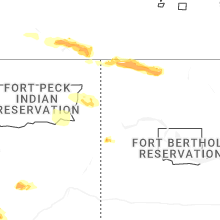
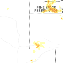
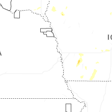
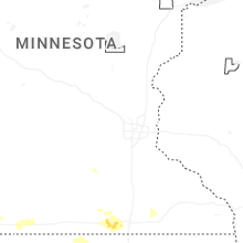
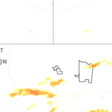
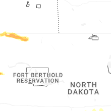
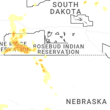
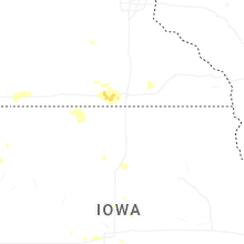
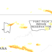
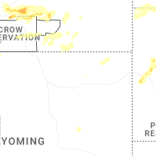
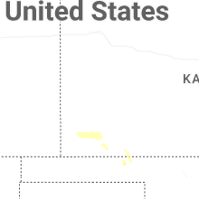
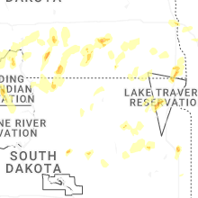
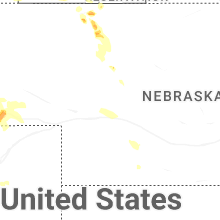
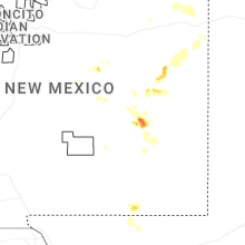
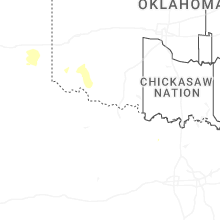
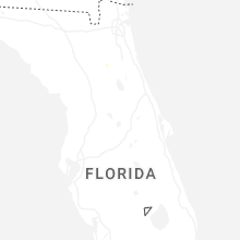
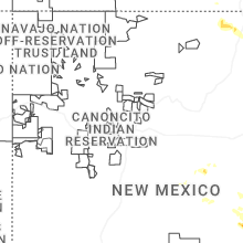
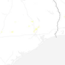
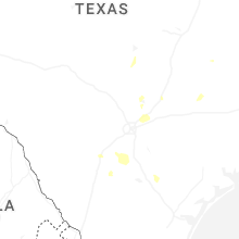
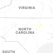
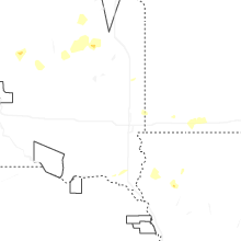
Hail Map for Sunday, June 15, 2025
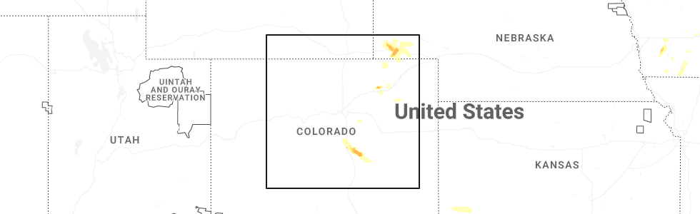
Number of Impacted Households on 6/15/2025
0
Impacted by 1" or Larger Hail
0
Impacted by 1.75" or Larger Hail
0
Impacted by 2.5" or Larger Hail
Square Miles of Populated Area Impacted on 6/15/2025
0
Impacted by 1" or Larger Hail
0
Impacted by 1.75" or Larger Hail
0
Impacted by 2.5" or Larger Hail
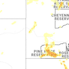
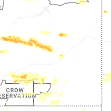

Cities Most Affected by Hail Storms of 6/15/2025
| Hail Size | Demographics of Zip Codes Affected | ||||||
|---|---|---|---|---|---|---|---|
| City | Count | Average | Largest | Pop Density | House Value | Income | Age |
| Winnett, MT | 4 | 2.38 | 3.50 | 0 | $58k | $24.1k | 48.0 |
| Colorado Springs, CO | 3 | 1.75 | 1.75 | 3660 | $140k | $50.0k | 34.6 |
| Lewistown, MT | 2 | 2.13 | 2.50 | 8 | $74k | $30.8k | 47.6 |
| Highwood, MT | 2 | 2.13 | 2.50 | 1 | $100k | $37.7k | 46.3 |
| Grass Range, MT | 1 | 2.00 | 2.00 | 0 | $38k | $27.1k | 50.3 |
| Taiban, NM | 1 | 1.75 | 1.75 | 0 | $10k | $21.9k | 55.0 |
| Stanford, MT | 1 | 1.75 | 1.75 | 0 | $56k | $23.5k | 47.1 |
Hail and Wind Damage Spotted on 6/15/2025
Filter by Report Type:Hail ReportsWind Reports
States Impacted
South Dakota, Oklahoma, Texas, Florida, Virginia, Montana, New Mexico, North Carolina, Nebraska, Wyoming, North Dakota, Colorado, Missouri, IowaSouth Dakota
| Local Time | Report Details |
|---|---|
| 6:06 AM MDT | Mesonet station grrs2 bullhead 10 in corson county SD, 83.7 miles S of Bismarck, ND |
| 7:15 PM MDT | Quarter sized hail reported near Lead, SD, 31.9 miles WNW of Rapid City, SD |
| 7:45 PM MDT | Half Dollar sized hail reported near Spearfish, SD, 36.5 miles NW of Rapid City, SD, quarter to ping pong |
| 7:46 PM MDT | Quarter sized hail reported near Whitewood, SD, 37.9 miles NW of Rapid City, SD |
| 8:00 PM MDT | Storm damage reported in pennington county SD, 20.3 miles WSW of Rapid City, SD |
| 8:01 PM MDT | Quarter sized hail reported near Vale, SD, 38.4 miles NNW of Rapid City, SD |
| 8:03 PM MDT | Ping Pong Ball sized hail reported near Vale, SD, 38.4 miles NNW of Rapid City, SD |
| 8:10 PM MDT | Storm damage reported in pennington county SD, 19.9 miles WSW of Rapid City, SD |
| 8:23 PM MDT | Storm damage reported in pennington county SD, 9.1 miles SSW of Rapid City, SD |
| 8:39 PM MDT | Storm damage reported in pennington county SD, 4.2 miles S of Rapid City, SD |
| 8:40 PM MDT | Storm damage reported in fall river county SD, 56.1 miles SW of Rapid City, SD |
| 8:40 PM MDT | Storm damage reported in pennington county SD, 4.2 miles S of Rapid City, SD |
| 8:43 PM MDT | Storm damage reported in custer county SD, 37.1 miles SSW of Rapid City, SD |
| 8:43 PM MDT | Storm damage reported in pennington county SD, 9.1 miles SSW of Rapid City, SD |
| 8:43 PM MDT | Storm damage reported in pennington county SD, 7.6 miles SSE of Rapid City, SD |
| 8:50 PM MDT | Storm damage reported in custer county SD, 28.2 miles SSE of Rapid City, SD |
| 8:50 PM MDT | Storm damage reported in pennington county SD, 12.8 miles ESE of Rapid City, SD |
| 8:50 PM MDT | Storm damage reported in pennington county SD, 4.2 miles S of Rapid City, SD |
| 8:54 PM MDT | Storm damage reported in pennington county SD, 1.3 miles SE of Rapid City, SD |
| 8:56 PM MDT | Storm damage reported in bennett county SD, 72.7 miles WNW of Valentine, NE |
| 8:56 PM MDT | Storm damage reported in pennington county SD, 3.1 miles ENE of Rapid City, SD |
| 9:22 PM MDT | Storm damage reported in oglala lakota county SD, 71.6 miles SSE of Rapid City, SD |
| 9:25 PM MDT | Storm damage reported in pennington county SD, 45.3 miles ESE of Rapid City, SD |
| 9:29 PM MDT | Storm damage reported in oglala lakota county SD, 66.3 miles SSE of Rapid City, SD |
| 9:35 PM MDT | Storm damage reported in oglala lakota county SD, 69.6 miles SE of Rapid City, SD |
| 9:35 PM MDT | Storm damage reported in pennington county SD, 38.9 miles E of Rapid City, SD |
| 9:38 PM MDT | Storm damage reported in pennington county SD, 36.4 miles E of Rapid City, SD |
| 9:45 PM MDT | Storm damage reported in pennington county SD, 38.9 miles E of Rapid City, SD |
| 9:50 PM MDT | Storm damage reported in oglala lakota county SD, 72.8 miles SE of Rapid City, SD |
| 9:57 PM MDT | Storm damage reported in jackson county SD, 61.3 miles E of Rapid City, SD |
| 10:00 PM MDT | Storm damage reported in jackson county SD, 69.3 miles E of Rapid City, SD |
| 10:13 PM MDT | Storm damage reported in jackson county SD, 72.3 miles ESE of Rapid City, SD |
| 10:15 PM MDT | Storm damage reported in jackson county SD, 75.1 miles ESE of Rapid City, SD |
| 10:23 PM MDT | Storm damage reported in jackson county SD, 72.3 miles ESE of Rapid City, SD |
| 10:28 PM MDT | Storm damage reported in jackson county SD, 69.1 miles NW of Valentine, NE |
| 11:28 PM CDT | Storm damage reported in todd county SD, 43.2 miles NW of Valentine, NE |
| 10:41 PM MDT | Storm damage reported in bennett county SD, 63.1 miles WNW of Valentine, NE |
| 11:58 PM CDT | Storm damage reported in todd county SD, 15.8 miles N of Valentine, NE |
| 11:25 PM MDT | Storm damage reported in haakon county SD, 44 miles WSW of Pierre, SD |
| 11:27 PM MDT | Storm damage reported in harding county SD, 109.7 miles ESE of Miles City, MT |
| 11:30 PM MDT | Storm damage reported in haakon county SD, 44 miles WSW of Pierre, SD |
| 11:40 PM MDT | Storm damage reported in harding county SD, 124 miles ESE of Miles City, MT |
| 11:45 PM MDT | Storm damage reported in jackson county SD, 49.4 miles SW of Pierre, SD |
| 11:45 PM MDT | Storm damage reported in haakon county SD, 44 miles WSW of Pierre, SD |
| 12:00 AM MDT | Storm damage reported in perkins county SD, 119.6 miles WSW of Bismarck, ND |
| 12:10 AM MDT | Storm damage reported in perkins county SD, 119.6 miles WSW of Bismarck, ND |
| 2:05 AM CDT | Storm damage reported in tripp county SD, 43.1 miles NE of Valentine, NE |
| 1:05 AM MDT | Storm damage reported in harding county SD, 109.7 miles ESE of Miles City, MT |
| 1:08 AM MDT | Storm damage reported in perkins county SD, 102.9 miles SW of Bismarck, ND |
| 1:10 AM MDT | Storm damage reported in harding county SD, 109.7 miles ESE of Miles City, MT |
| 1:15 AM MDT | Storm damage reported in harding county SD, 124 miles ESE of Miles City, MT |
| 1:20 AM MDT | Storm damage reported in harding county SD, 124 miles ESE of Miles City, MT |
| 1:25 AM MDT | Storm damage reported in ziebach county SD, 90 miles NW of Pierre, SD |
| 1:25 AM MDT | Storm damage reported in harding county SD, 109.7 miles ESE of Miles City, MT |
| 2:30 AM CDT | Mesonet station 50 herreid (sddot in campbell county SD, 73 miles SSE of Bismarck, ND |
| 1:40 AM MDT | Mesonet station tims2 timber lake (sd mesonet in dewey county SD, 81.2 miles NNW of Pierre, SD |
| 1:40 AM MDT | Mesonet station 293 timber lake (sddot in dewey county SD, 81.3 miles NNW of Pierre, SD |
| 2:45 AM CDT | Storm damage reported in tripp county SD, 40.2 miles ENE of Valentine, NE |
| 1:55 AM MDT | Storm damage reported in perkins county SD, 119.6 miles WSW of Bismarck, ND |
| 1:56 AM MDT | Mesonet station 178 trail city (sddot in corson county SD, 79.3 miles NNW of Pierre, SD |
| 1:58 AM MDT | Mesonet station grrs2 bullhead 10 s. time estimated based on rada in corson county SD, 83.7 miles S of Bismarck, ND |
Oklahoma
| Local Time | Report Details |
|---|---|
| 7:38 AM CDT | Klt in jackson county OK, 55.8 miles ENE of Childress, TX |
| 7:53 AM CDT | Section of a metal and wood barn blown off. social media image. event time estimated from rada in jackson county OK, 49.3 miles E of Childress, TX |
Texas
| Local Time | Report Details |
|---|---|
| 8:01 AM CDT | Odell (odel) mesone in wilbarger county TX, 49.4 miles E of Childress, TX |
| 9:23 AM CDT | Hefner (hefn) mesonet. multiple severe wind gusts between 922 and 924 am cd in knox county TX, 65.6 miles WSW of Wichita Falls, TX |
| 9:27 AM CDT | Knox city (knox) mesonet. additional gust of 58 mph at 929 am cd in knox county TX, 69.4 miles N of Abilene, TX |
| 10:09 AM CDT | Mesonet station 102 5ese stamford stamford/jones count in jones county TX, 31.8 miles N of Abilene, TX |
| 11:12 AM CDT | Metal roof blown off a small building across from the abilene livestock auctio in taylor county TX, 3.4 miles NNE of Abilene, TX |
| 11:13 AM CDT | Asos station kabi abilen in taylor county TX, 4.1 miles ESE of Abilene, TX |
| 11:16 AM CDT | Hangar door blown off track at freeman jet center-abilene regional airpor in taylor county TX, 4.5 miles SE of Abilene, TX |
| 11:25 AM CDT | Billboard completely destroyed and wrapped around a telephone pol in taylor county TX, 6 miles E of Abilene, TX |
| 7:56 PM CDT | Trees down reported in the cit in live oak county TX, 66.3 miles NW of Corpus Christi, TX |
| 8:10 PM CDT | Tree blown down onto roadwa in bee county TX, 58.6 miles NNW of Corpus Christi, TX |
| 8:26 PM CDT | Reports of a tree blocking the roa in live oak county TX, 43 miles NW of Corpus Christi, TX |
Florida
| Local Time | Report Details |
|---|---|
| 12:48 PM EDT | Downed power line resulted in the closure of ne 16th av in alachua county FL, 60.5 miles SW of Jacksonville, FL |
Virginia
| Local Time | Report Details |
|---|---|
| 1:35 PM EDT | Thunderstorm winds blew down a tree and a power pole along the 100 block of little mountain circl in franklin county VA, 13.2 miles S of Roanoke, VA |
| 2:11 PM EDT | Thunderstorm winds blew down one tree along the 2300 block of henry road across from a churc in franklin county VA, 27.8 miles SSW of Roanoke, VA |
| 2:13 PM EDT | Thunderstorm winds blew down one tree down along the 2400 block of booker t washington highwa in franklin county VA, 16.7 miles SSE of Roanoke, VA |
| 2:36 PM EDT | Thunderstorm winds blew down one tree along the 3000 block of burnt chimney roa in franklin county VA, 15.7 miles SE of Roanoke, VA |
| 2:54 PM EDT | Thunderstorm winds blew down one tree limb that knocked down a telephone line along the 400 block of moses mill roa in pittsylvania county VA, 42.8 miles SE of Roanoke, VA |
| 3:55 PM EDT | Thunderstorm winds blew down one tree that fell on to a power line along the 2000 block of pointer roa in halifax county VA, 60.7 miles NNW of Raleigh, NC |
| 4:05 PM EDT | Large branches down in stree in halifax county VA, 65.3 miles NNW of Raleigh, NC |
| 4:25 PM EDT | Tree across powerline. power is ou in campbell county VA, 50.7 miles E of Roanoke, VA |
| 4:32 PM EDT | Tree down across highway (va 92... clover road) blocking both lane in halifax county VA, 72.9 miles N of Raleigh, NC |
| 5:00 PM EDT | Large limb across power lin in buckingham county VA, 44.1 miles W of Richmond, VA |
| 5:16 PM EDT | A brick chimney was knocked down due to strong wind gusts. time estimated from rada in city of richmond county VA, 12.1 miles ENE of Richmond, VA |
| 5:37 PM EDT | Corrects previous tstm wnd dmg report from 3 sse golansville. large limb down blocking a portion of telegraph road. time estimated from rada in hanover county VA, 16.1 miles NE of Richmond, VA |
| 5:37 PM EDT | Large limb down blocking a portion of telegraph road. time estimated from rada in caroline county VA, 31.5 miles NNE of Richmond, VA |
| 6:05 PM EDT | Tree fell across poor house r in brunswick county VA, 51.7 miles SSW of Richmond, VA |
| 6:32 PM EDT | Quarter sized hail reported near Jarratt, VA, 46.6 miles S of Richmond, VA, trained spotter reported 1 inch hail. |
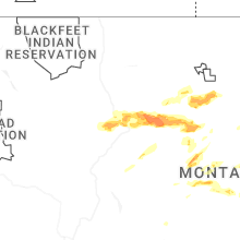
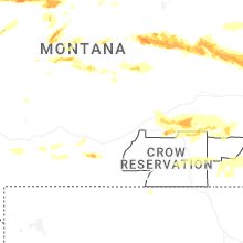
Montana
| Local Time | Report Details |
|---|---|
| 2:05 PM MDT | Quarter sized hail reported near Stanford, MT, 67.3 miles ESE of Great Falls, MT, public report of quarter sized hail around benchland. |
| 2:10 PM MDT | Golf Ball sized hail reported near Stanford, MT, 67.3 miles ESE of Great Falls, MT, public caller updated with golf ball sized hail a few minutes after initial call. |
| 2:20 PM MDT | Half Dollar sized hail reported near Stanford, MT, 67.3 miles ESE of Great Falls, MT, trained spotter reports hail of quarter size to half dollar size along us-87 between moccasin and windham. damage to automobiles reported as well. |
| 3:24 PM MDT | Quarter sized hail reported near Fort Shaw, MT, 22.1 miles WNW of Great Falls, MT, report from mping: quarter (1.00 in.). |
| 3:25 PM MDT | Quarter sized hail reported near Fort Shaw, MT, 22.1 miles WNW of Great Falls, MT, quarter size hail reported by member of the public. |
| 3:40 PM MDT | Quarter sized hail reported near Great Falls, MT, 2.3 miles N of Great Falls, MT, quarter size hail reported. damage to vehicles and rv reported as well. |
| 3:55 PM MDT | Ambient weather statio in cascade county MT, 7.4 miles NNW of Great Falls, MT |
| 4:00 PM MDT | Quarter sized hail reported near Great Falls, MT, 1.4 miles NW of Great Falls, MT, public report with image of quarter sized hail next to a quarter for reference. |
| 4:00 PM MDT | Quarter sized hail reported near Floweree, MT, 9.6 miles NNE of Great Falls, MT, trained spotter reports quarter size hail along with 30 to 50 mph winds along highway 87 north of the republic services landfill and south of dent bridge road. |
| 4:00 PM MDT | Quarter sized hail reported near Great Falls, MT, 1.8 miles NNE of Great Falls, MT, quarter size hail reported. |
| 4:00 PM MDT | Quarter sized hail reported near Great Falls, MT, 1.7 miles NNW of Great Falls, MT, quarter size hail reported. |
| 4:00 PM MDT | Ping Pong Ball sized hail reported near Great Falls, MT, 1.8 miles NNE of Great Falls, MT, public report with image of ping pong sized hail near north middle school. |
| 4:01 PM MDT | Quarter sized hail reported near Fort Benton, MT, 37.5 miles NE of Great Falls, MT, social media report of one inch diameter hail in fort benton. |
| 4:05 PM MDT | Quarter sized hail reported near Great Falls, MT, 1.7 miles NNW of Great Falls, MT, social media report of three quarter of an inch to an inch sized hail. |
| 4:06 PM MDT | Quarter sized hail reported near Great Falls, MT, 1.8 miles NNE of Great Falls, MT, social media report of 1 inch hail. time and location estimated. |
| 4:10 PM MDT | Quarter sized hail reported near Floweree, MT, 11.5 miles NNE of Great Falls, MT, trained spotter reports quarter size to slightly larger than quarter size hail. |
| 4:10 PM MDT | Quarter sized hail reported near Great Falls, MT, 1.1 miles NW of Great Falls, MT, quarter size hail reported. |
| 4:30 PM MDT | Golf Ball sized hail reported near Highwood, MT, 24.7 miles ENE of Great Falls, MT, social media image of approximately golf ball sized hail in highwood. time estimated using radar. |
| 4:30 PM MDT | Tennis Ball sized hail reported near Highwood, MT, 27.4 miles E of Great Falls, MT, report from social media. hail started at 4:30 pm and lasted for approximately 15 minutes. |
| 4:48 PM MDT | Tennis Ball sized hail reported near Lewistown, MT, 94.6 miles ESE of Great Falls, MT, trained spotter reports egg to tennis ball size hail. images were provided. |
| 5:25 PM MDT | Golf Ball sized hail reported near Lewistown, MT, 87.7 miles NNW of Billings, MT, time estimated based on radar. |
| 5:57 PM MDT | Quarter sized hail reported near Grass Range, MT, 88.9 miles N of Billings, MT, report from mping: quarter (1.00 in.). |
| 6:00 PM MDT | Half Dollar sized hail reported near Grass Range, MT, 87.2 miles N of Billings, MT, hail ranging from pea size to half dollar size fell for about 5 minutes. |
| 6:00 PM MDT | Spotter reported pea sized hail... heavy rain... and winds winds 50 to 60 mph estimate in phillips county MT, 70.7 miles E of Havre, MT |
| 6:14 PM MDT | Ping Pong Ball sized hail reported near Grass Range, MT, 87.2 miles N of Billings, MT, report from mping: ping pong ball (1.50 in.). |
| 6:19 PM MDT | Hen Egg sized hail reported near Grass Range, MT, 87.7 miles N of Billings, MT, report from spotter network. |
| 6:39 PM MDT | Golf Ball sized hail reported near Winnett, MT, 85 miles N of Billings, MT, hail up to the size of golf balls with winds 30-40 mph. |
| 6:40 PM MDT | Quarter sized hail reported near Judith Gap, MT, 88.5 miles ESE of Great Falls, MT, trained spotter reports quarter size hail. |
| 6:45 PM MDT | Golf Ball sized hail reported near Winnett, MT, 84.9 miles N of Billings, MT |
| 6:50 PM MDT | Montana mesonet near sac in phillips county MT, 37.2 miles WNW of Glasgow, MT |
| 6:52 PM MDT | Ping Pong Ball sized hail reported near Winnett, MT, 85.1 miles N of Billings, MT, broken windows and damage to vehicles. |
| 7:00 PM MDT | Tennis Ball sized hail reported near Winnett, MT, 85.1 miles N of Billings, MT, a storm chaser on x measured multiple hail stones of 2.5 inches in diameter with a ruler. |
| 7:01 PM MDT | Tea Cup sized hail reported near Winnett, MT, 80.1 miles N of Billings, MT, large hail about 3.5 inches... lasting for about 15 mins. |
| 7:20 PM MDT | Quarter sized hail reported near Roundup, MT, 57.2 miles N of Billings, MT |
| 7:30 PM MDT | Quarter sized hail reported near Glasgow, MT, 1.2 miles NNW of Glasgow, MT |
| 7:42 PM MDT | Asos reported 71 mph wind gus in valley county MT, 1.1 miles NNE of Glasgow, MT |
| 7:42 PM MDT | Half Dollar sized hail reported near Glasgow, MT, 1.1 miles NNE of Glasgow, MT, hail sized noted by staff at nws glasgow mt. |
| 7:50 PM MDT | Mosby se (hydromet) statio in garfield county MT, 89.7 miles NNE of Billings, MT |
| 8:00 PM MDT | Nashua ne (hydromet) statio in valley county MT, 14.6 miles E of Glasgow, MT |
| 8:50 PM MDT | Bredette ne (hydromet) statio in roosevelt county MT, 68 miles ENE of Glasgow, MT |
| 8:52 PM MDT | Fort peck dam statio in mccone county MT, 16.8 miles SE of Glasgow, MT |
| 9:00 PM MDT | Wolf point nw (hydromet) statio in roosevelt county MT, 43.2 miles E of Glasgow, MT |
| 9:00 PM MDT | Mesonet station mtm89 angela in rosebud county MT, 40.7 miles WNW of Miles City, MT |
| 9:18 PM MDT | Glasgow sw (hydromet in valley county MT, 4.9 miles WSW of Glasgow, MT |
| 9:20 PM MDT | Poplar raws station. time estimated by rada in roosevelt county MT, 67 miles W of Williston, ND |
| 9:35 PM MDT | Awos station k00u 2 wnw hardi in big horn county MT, 41 miles E of Billings, MT |
| 9:40 PM MDT | Corrects previous tstm wnd gst report from 10 w homestead. public reported on facebook... and 0.5 inches of rai in roosevelt county MT, 55.8 miles WNW of Williston, ND |
| 9:40 PM MDT | Public reported on faceboo in roosevelt county MT, 55.8 miles WNW of Williston, ND |
| 9:40 PM MDT | Storm damage reported in treasure county MT, 58.9 miles ENE of Billings, MT |
| 9:45 PM MDT | Badger creek (aprswxnet/cwop) statio in richland county MT, 62.6 miles WSW of Williston, ND |
| 9:50 PM MDT | Storm damage reported in rosebud county MT, 35.4 miles NW of Miles City, MT |
| 10:12 PM MDT | Storm damage reported in custer county MT, 2.5 miles NW of Miles City, MT |
| 10:16 PM MDT | Bloomfield... mt (aprswxnet/cwop) statio in dawson county MT, 80 miles SW of Williston, ND |
| 12:00 AM MDT | Ash creek mt dot (wibaux county in wibaux county MT, 79 miles ENE of Miles City, MT |
| 12:15 AM MDT | Mesonet station mteka baker mt-7 mp 14. in fallon county MT, 71.2 miles ESE of Miles City, MT |
| 12:30 AM MDT | Storm damage reported in fallon county MT, 71.2 miles ESE of Miles City, MT |
| 12:54 AM MDT | Storm damage reported in carter county MT, 78.4 miles ESE of Miles City, MT |
New Mexico
| Local Time | Report Details |
|---|---|
| 3:14 PM MDT | Outflow winds from nearby thunderstorms resulted in a 67 mph gust at the roswell air cente in chaves county NM, 6.7 miles SSE of Roswell, NM |
| 3:15 PM MDT | Awos station kats artesi in eddy county NM, 37.7 miles S of Roswell, NM |
| 4:53 PM MDT | Asos station kcnm carlsba in eddy county NM, 75.1 miles SSE of Roswell, NM |
| 5:35 PM MDT | Golf Ball sized hail reported near Taiban, NM, 62.6 miles SSW of Tucumcari, NM, a trained spotter along nm 294 south of taiban observed a few golf ball sized hail among lots of pea size hail. |
| 6:00 PM MDT | Quarter sized hail reported near Melrose, NM, 51.4 miles S of Tucumcari, NM, a trained spotter along u.s. 60 and 84 a few miles east of taiban observed nickel to quarter size hail from a severe thunderstorm. |
| 7:30 PM MDT | The melrose range mesonet station observed a 70 mph wind gust from nearby collapsing thunderstorm in roosevelt county NM, 61.9 miles S of Tucumcari, NM |
| 7:45 PM MDT | The asos at raton crew airport observed a wind gust of 68 mph from nearby thunderstorm in colfax county NM, 63.6 miles ENE of Taos, NM |
North Carolina
| Local Time | Report Details |
|---|---|
| 7:00 PM EDT | Trees dow in nash county NC, 44.5 miles E of Raleigh, NC |
| 9:38 PM EDT | Powerlines down along beaumont drive due to a tree dow in pitt county NC, 73.4 miles E of Raleigh, NC |
Nebraska
| Local Time | Report Details |
|---|---|
| 5:34 PM MDT | Kbff reported 61mph gus in scotts bluff county NE, 3.8 miles E of Scottsbluff, NE |
| 6:01 PM MDT | Ping Pong Ball sized hail reported near Dix, NE, 44.5 miles SSE of Scottsbluff, NE, storm chaser reporting ping pong ball sized hail ongoing in dix. |
| 6:04 PM MDT | Half Dollar sized hail reported near Cody, NE, 49.9 miles W of Valentine, NE, report from mping. |
| 6:27 PM MDT | Quarter sized hail reported near Merriman, NE, 54 miles W of Valentine, NE |
| 6:34 PM MDT | Storm chaser estimating 60mph winds with half in hai in cheyenne county NE, 48.1 miles SSE of Scottsbluff, NE |
| 6:35 PM MDT | Mesonet near brownson reported a 62mph gus in cheyenne county NE, 54 miles SSE of Scottsbluff, NE |
| 6:51 PM MDT | Emergency manager estimated gusts of 60mp in cheyenne county NE, 55.4 miles SE of Scottsbluff, NE |
| 7:10 PM MDT | Ksny reported 58mph gus in cheyenne county NE, 63.1 miles SSE of Scottsbluff, NE |
| 7:43 PM MDT | Storm damage reported in garden county NE, 79.1 miles WNW of North Platte, NE |
| 8:12 PM MDT | Storm damage reported in keith county NE, 55.3 miles W of North Platte, NE |
| 8:16 PM MDT | Koga awo in keith county NE, 52.6 miles W of North Platte, NE |
| 8:18 PM MDT | Anemometer measured 62mph wind gus in keith county NE, 51 miles W of North Platte, NE |
| 8:18 PM MDT | Storm damage reported in keith county NE, 49.9 miles W of North Platte, NE |
| 8:27 PM MDT | Storm damage reported in keith county NE, 46.9 miles W of North Platte, NE |
| 10:43 PM CDT | Klbf aso in lincoln county NE, 5 miles ESE of North Platte, NE |
Wyoming
| Local Time | Report Details |
|---|---|
| 6:08 PM MDT | Quarter sized hail reported near Gillette, WY, 6.9 miles NNW of Gillette, WY |
| 6:12 PM MDT | Storm damage reported in campbell county WY, 55.3 miles SSE of Gillette, WY |
| 7:10 PM MDT | Quarter sized hail reported near Hulett, WY, 45.4 miles NE of Gillette, WY, nickel to quarter |
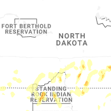
North Dakota
| Local Time | Report Details |
|---|---|
| 7:15 PM CDT | Half Dollar sized hail reported near Fortuna, ND, 59 miles NNW of Williston, ND, reports hail while driving north northwest of fortuna near the historical airforce station. also sent photo via social media. |
| 8:01 PM CDT | Estimates winds up to 60 mph with nickel to slightly larger size hail after strong wind in divide county ND, 54.8 miles NNE of Williston, ND |
| 11:49 PM CDT | Williston airport aso in williams county ND, 9.8 miles NW of Williston, ND |
| 12:04 AM MDT | 3w cedar lake ndawn. 10 meter peak win in slope county ND, 113.3 miles WSW of Bismarck, ND |
| 12:05 AM MDT | Storm damage reported in harding county SD, 123.4 miles N of Rapid City, SD |
| 12:15 AM MDT | Nw hettinger ndawn. 10 meter peak wind gus in adams county ND, 105.3 miles WSW of Bismarck, ND |
| 12:59 AM MDT | 2e pretty rock ndawn. 10 meter peak wind gus in grant county ND, 65 miles SW of Bismarck, ND |
| 1:00 AM MDT | 2 e pretty rock ndawn. 10 meter peak wind gus in grant county ND, 65 miles SW of Bismarck, ND |
| 1:15 AM MDT | Williams lookout raws. delayed report with time estimated from rada in hettinger county ND, 68.3 miles WSW of Bismarck, ND |
| 1:35 AM MDT | Storm damage reported in harding county SD, 123.4 miles N of Rapid City, SD |
| 2:40 AM CDT | Tatanka prairie raws. time estimated from rada in sioux county ND, 45 miles S of Bismarck, ND |
| 1:45 AM MDT | Storm damage reported in harding county SD, 123.4 miles N of Rapid City, SD |
| 1:50 AM MDT | Storm damage reported in harding county SD, 123.4 miles N of Rapid City, SD |
| 3:44 AM CDT | 5 w wishek ndawn. 10 meter peak wind gus in mcintosh county ND, 64.9 miles SE of Bismarck, ND |
| 6:08 AM CDT | Quarter sized hail reported near West Fargo, ND, 5.6 miles W of Fargo, ND |
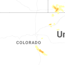
Colorado
| Local Time | Report Details |
|---|---|
| 6:18 PM MDT | Quarter sized hail reported near Colorado Springs, CO, 46.5 miles NNW of Pueblo, CO |
| 6:19 PM MDT | Quarter sized hail reported near Colorado Springs, CO, 45.1 miles NNW of Pueblo, CO, report from mping: quarter (1.00 in.). |
| 6:30 PM MDT | Golf Ball sized hail reported near Colorado Springs, CO, 46.9 miles NNW of Pueblo, CO, report from storm spotter network. |
| 6:34 PM MDT | Quarter sized hail reported near Colorado Springs, CO, 45.5 miles NNW of Pueblo, CO, report from mping: quarter (1.00 in.). |
| 6:35 PM MDT | Quarter sized hail reported near Colorado Springs, CO, 44.7 miles N of Pueblo, CO |
| 6:40 PM MDT | Quarter sized hail reported near Colorado Springs, CO, 42.5 miles N of Pueblo, CO, report from mping: quarter (1.00 in.). |
| 6:40 PM MDT | Golf Ball sized hail reported near Colorado Springs, CO, 40.9 miles N of Pueblo, CO, picture with measurement on social media. |
| 6:41 PM MDT | Quarter sized hail reported near Colorado Springs, CO, 44 miles N of Pueblo, CO, report from mping: quarter (1.00 in.). |
| 6:43 PM MDT | Quarter sized hail reported near Colorado Springs, CO, 39.7 miles N of Pueblo, CO, report from mping: quarter (1.00 in.). |
| 6:43 PM MDT | Ping Pong Ball sized hail reported near Colorado Springs, CO, 38.2 miles N of Pueblo, CO |
| 6:44 PM MDT | Ping Pong Ball sized hail reported near Colorado Springs, CO, 39.7 miles N of Pueblo, CO, report from mping: ping pong ball (1.50 in.). |
| 6:45 PM MDT | Half Dollar sized hail reported near Colorado Springs, CO, 44 miles N of Pueblo, CO, report from mping: half dollar (1.25 in.). |
| 6:47 PM MDT | Quarter sized hail reported near Colorado Springs, CO, 41.6 miles N of Pueblo, CO, report from mping: quarter (1.00 in.). |
| 6:48 PM MDT | Quarter sized hail reported near Colorado Springs, CO, 40.7 miles N of Pueblo, CO, report from mping: quarter (1.00 in.). |
| 6:48 PM MDT | Golf Ball sized hail reported near Colorado Springs, CO, 43 miles N of Pueblo, CO, report from mping: golf ball (1.75 in.). |
| 6:52 PM MDT | Half Dollar sized hail reported near Colorado Springs, CO, 37.5 miles N of Pueblo, CO |
| 6:54 PM MDT | Half Dollar sized hail reported near Colorado Springs, CO, 35.7 miles N of Pueblo, CO |
| 7:20 PM MDT | Quarter sized hail reported near Colorado Springs, CO, 33.9 miles NNE of Pueblo, CO, report from mping: quarter (1.00 in.). |
| 7:27 PM MDT | Quarter sized hail reported near Colorado Springs, CO, 46.3 miles N of Pueblo, CO, report from mping: quarter (1.00 in.). |
| 7:30 PM MDT | Half Dollar sized hail reported near Colorado Springs, CO, 45.6 miles N of Pueblo, CO, report from mping: half dollar (1.25 in.). |
| 7:32 PM MDT | Ping Pong Ball sized hail reported near Colorado Springs, CO, 45.6 miles N of Pueblo, CO, report from mping: ping pong ball (1.50 in.). |
Missouri
| Local Time | Report Details |
|---|---|
| 7:26 PM CDT | About a half dozen trees down along highway j south of fremon in carter county MO, 56.4 miles SSE of Salem, MO |
Iowa
| Local Time | Report Details |
|---|---|
| 8:55 PM CDT | Ping Pong Ball sized hail reported near Griswold, IA, 41.7 miles E of Omaha, NE, largest hail to ping pong ball sized. |
Connect with Interactive Hail Maps