

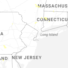
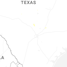
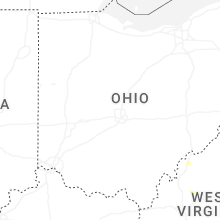
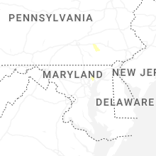
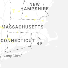
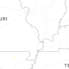
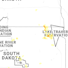
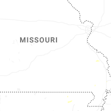
Hail Map for Wednesday, August 13, 2025

Number of Impacted Households on 8/13/2025
0
Impacted by 1" or Larger Hail
0
Impacted by 1.75" or Larger Hail
0
Impacted by 2.5" or Larger Hail
Square Miles of Populated Area Impacted on 8/13/2025
0
Impacted by 1" or Larger Hail
0
Impacted by 1.75" or Larger Hail
0
Impacted by 2.5" or Larger Hail
Cities Most Affected by Hail Storms of 8/13/2025
| Hail Size | Demographics of Zip Codes Affected | ||||||
|---|---|---|---|---|---|---|---|
| City | Count | Average | Largest | Pop Density | House Value | Income | Age |
Hail and Wind Damage Spotted on 8/13/2025
Filter by Report Type:Hail ReportsWind Reports
States Impacted
South Dakota, Montana, New York, Connecticut, West Virginia, Wyoming, Massachusetts, New Hampshire, Maine, VirginiaSouth Dakota
| Local Time | Report Details |
|---|---|
| 9:38 AM CDT | Quarter sized hail reported near Java, SD, 70.8 miles W of Aberdeen, SD, nickel to quarter sized hail. |
Montana
| Local Time | Report Details |
|---|---|
| 9:00 AM MDT | Mesonet station fslm8 fishtai in stillwater county MT, 56.2 miles WSW of Billings, MT |
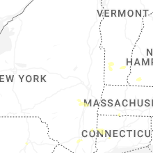
New York
| Local Time | Report Details |
|---|---|
| 1:06 PM EDT | Tree and power lines down on blodgett hill road in the town of coeyman in albany county NY, 23.1 miles S of Schenectady, NY |
| 1:07 PM EDT | Tree down on house on morehouse road in the town of coeyman in albany county NY, 21.7 miles S of Schenectady, NY |
| 1:08 PM EDT | Several trees and wires down with wires on a car near route 143 and waterboard road near coeymans hollo in albany county NY, 23 miles S of Schenectady, NY |
| 1:32 PM EDT | Large tree down on harpersfield rd west of jefferson leading to road closure. time estimated from rada in schoharie county NY, 41.9 miles WSW of Schenectady, NY |
| 2:18 PM EDT | Report of trees down in the vicinity of the lake george escape campgroun in warren county NY, 48.4 miles NNE of Schenectady, NY |
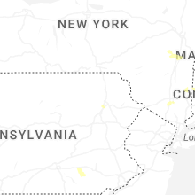
Connecticut
| Local Time | Report Details |
|---|---|
| 3:00 PM EDT | A trained spotter reported a downed tree and powerline wires on main st in the town of broad brook. relayed by amateur radi in hartford county CT, 59.1 miles W of Providence, RI |
| 3:15 PM EDT | Two tree limbs about 4 inches in diameter were downed in the area of ellington rd. relayed by amateur radi in hartford county CT, 59.3 miles W of Providence, RI |
| 4:40 PM EDT | Wires down causing a brush fire on cornwall bridge roa in litchfield county CT, 71.8 miles SSE of Schenectady, NY |
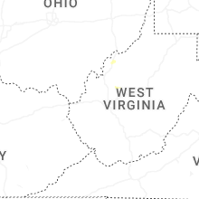
West Virginia
| Local Time | Report Details |
|---|---|
| 3:36 PM EDT | Quarter sized hail reported near Mineral Wells, WV, 59.5 miles N of Charleston, WV, pictures provided. |
Wyoming
| Local Time | Report Details |
|---|---|
| 1:40 PM MDT | Time estimated from radar in campbell county WY, 20.6 miles NW of Gillette, WY |
| 2:09 PM MDT | Storm damage reported in campbell county WY, 3.7 miles NNW of Gillette, WY |
| 2:10 PM MDT | Time estimated based on radar in campbell county WY, 20.6 miles NW of Gillette, WY |
| 2:20 PM MDT | Wydot senso in natrona county WY, 40.2 miles N of Casper, WY |
| 2:20 PM MDT | Midwest... wy pacificorp sit in natrona county WY, 41.4 miles N of Casper, WY |
| 2:20 PM MDT | Tisdale mountain... wy pacificorp sit in johnson county WY, 45.1 miles NNW of Casper, WY |
| 2:32 PM MDT | Storm damage reported in campbell county WY, 25.2 miles S of Gillette, WY |
| 3:00 PM MDT | Power lines down in pine haven. blowing dust on i90 causing low visibilit in crook county WY, 34.7 miles E of Gillette, WY |
| 3:24 PM MDT | Tree limbs down in tow in crook county WY, 56.2 miles E of Gillette, WY |
| 3:26 PM MDT | Storm damage reported in crook county WY, 53.8 miles W of Rapid City, SD |
| 3:26 PM MDT | Storm damage reported in crook county WY, 50.3 miles NE of Gillette, WY |
| 3:36 PM MDT | Storm damage reported in weston county WY, 45.2 miles W of Rapid City, SD |
| 3:42 PM MDT | Storm damage reported in weston county WY, 45.2 miles W of Rapid City, SD |
Massachusetts
| Local Time | Report Details |
|---|---|
| 4:00 PM EDT | Law enforcement reported a tree downed on wires on burt hill rd in tolland. relayed by amateur radi in hampden county MA, 69.4 miles SE of Schenectady, NY |
| 4:55 PM EDT | Large downed tree blocking part of sartelle st in pepperell. relayed by amateur radi in middlesex county MA, 59.2 miles N of Providence, RI |
| 4:55 PM EDT | Trees downed on sheffield st in pepperell. relayed by amateur radi in middlesex county MA, 59.3 miles N of Providence, RI |
| 4:55 PM EDT | Tree and powerline wires downed from thunderstorm winds caused closure of prescott st in pepperell. relayed by amateur radi in middlesex county MA, 60.5 miles N of Providence, RI |
New Hampshire
| Local Time | Report Details |
|---|---|
| 4:44 PM EDT | Wires dow in hillsborough county NH, 63.8 miles NNW of Providence, RI |
| 4:44 PM EDT | Tree down on lawrence lane near junction of worcester roa in hillsborough county NH, 62.1 miles N of Providence, RI |
| 5:00 PM EDT | Tree down blocking pepperell roa in hillsborough county NH, 62.9 miles N of Providence, RI |
| 5:00 PM EDT | Tree and wires down blocking west hollis r in hillsborough county NH, 62.2 miles N of Providence, RI |
| 5:08 PM EDT | Quarter sized hail reported near Amherst, NH, 73.4 miles N of Providence, RI, hail fell for 5 to 6 minutes and gusty winds knocked down some large branches. time estimated by radar. |
| 5:10 PM EDT | Tree down on hunt stree in hillsborough county NH, 64 miles N of Providence, RI |
| 5:10 PM EDT | Tree down on ash stree in hillsborough county NH, 64.7 miles N of Providence, RI |
| 5:10 PM EDT | Tree down on highland stree in hillsborough county NH, 65.3 miles N of Providence, RI |
| 5:25 PM EDT | Tree down on wires and second tree down on car on carter roa in hillsborough county NH, 74 miles N of Providence, RI |
| 5:30 PM EDT | Large tree down on top of crushed ca in hillsborough county NH, 81.2 miles WSW of Portland, ME |
| 5:38 PM EDT | Reports of numerous trees down north of town. two trees partially blocking traffic on n. main s in hillsborough county NH, 76.2 miles N of Providence, RI |
Maine
| Local Time | Report Details |
|---|---|
| 4:45 PM EDT | Report from social media. tree down near madawaska lake shoreline. large tree limb down as well. time estimated based on rada in aroostook county ME, 15.1 miles NW of Caribou, ME |
| 5:09 PM EDT | Report on social media of trees uprooted and others snapped in half. time estimated based on rada in aroostook county ME, 27.8 miles N of Caribou, ME |
Virginia
| Local Time | Report Details |
|---|---|
| 5:00 PM EDT | Three calls for trees and wires down on the northern and northeastern side of charlottesvill in albemarle county VA, 58.6 miles NW of Richmond, VA |
Connect with Interactive Hail Maps