

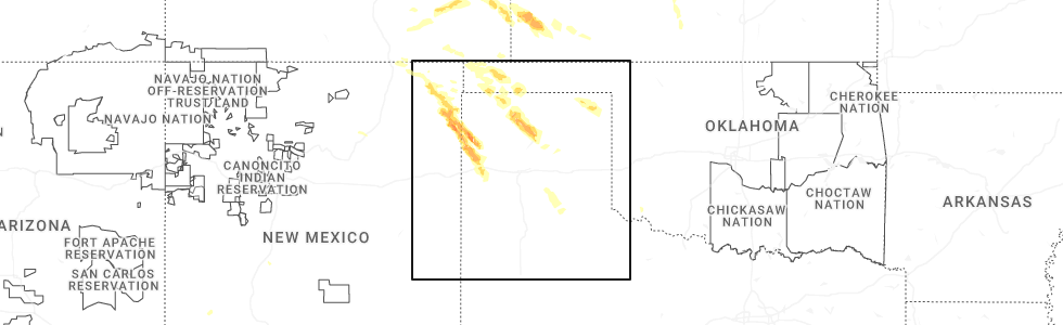
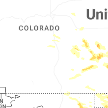
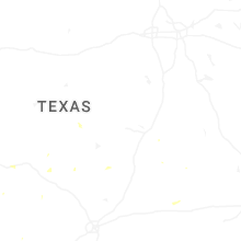
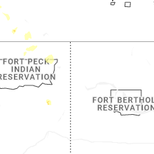
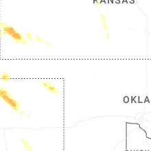
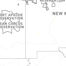
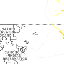
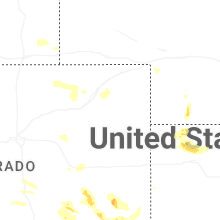
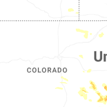
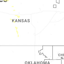
Hail Map for Saturday, August 2, 2025
Number of Impacted Households on 8/2/2025
0
Impacted by 1" or Larger Hail
0
Impacted by 1.75" or Larger Hail
0
Impacted by 2.5" or Larger Hail
Square Miles of Populated Area Impacted on 8/2/2025
0
Impacted by 1" or Larger Hail
0
Impacted by 1.75" or Larger Hail
0
Impacted by 2.5" or Larger Hail
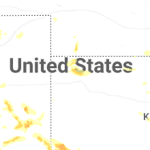
Cities Most Affected by Hail Storms of 8/2/2025
| Hail Size | Demographics of Zip Codes Affected | ||||||
|---|---|---|---|---|---|---|---|
| City | Count | Average | Largest | Pop Density | House Value | Income | Age |
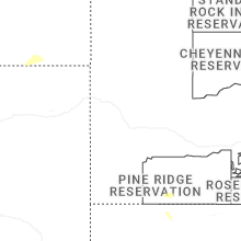
| Clayton, NM | 2 | 1.88 | 2.00 | 2 | $51k | $27.5k | 39.8 |
Hail and Wind Damage Spotted on 8/2/2025
Filter by Report Type:Hail ReportsWind Reports
States Impacted
Texas, Wyoming, Georgia, Colorado, Idaho, Utah, New Mexico, Nebraska, Kansas, OklahomaTexas
| Local Time | Report Details |
|---|---|
| 2:59 PM CDT | Trained spotter reported a 60 mph wind gust with a handheld anemometer in morgans poin in bell county TX, 16.7 miles E of Killeen, TX |
| 11:10 PM CDT | Half Dollar sized hail reported near Dalhart, TX, 58.8 miles NE of Tucumcari, NM |
| 11:50 PM CDT | Storm damage reported in oldham county TX, 50.9 miles ENE of Tucumcari, NM |
| 2:28 AM CDT | Storm damage reported in lipscomb county TX, 58.3 miles WSW of Woodward, OK |
| 2:30 AM CDT | Emergency manager got reports of power out in sunray and multiple reports of damage... from downed buildings... to power poles snapped in half... trees down bloacking r in moore county TX, 56 miles N of Amarillo, TX |
| 2:31 AM CDT | Storm damage reported in moore county TX, 43.2 miles N of Amarillo, TX |
| 3:12 AM CDT | Storm damage reported in moore county TX, 32.8 miles NNE of Amarillo, TX |
Wyoming
| Local Time | Report Details |
|---|---|
| 2:18 PM MDT | Asos station krks rock springs airpor in sweetwater county WY, 8 miles E of Rock Springs, WY |
| 3:15 PM MDT | Mesonet station cw8386 thermopoli in hot springs county WY, 43.2 miles N of Riverton, WY |
| 3:20 PM MDT | Mesonet station pc397 warm spring in hot springs county WY, 45.1 miles NNE of Riverton, WY |
| 3:20 PM MDT | Picture of 3-inch diameter cottonwood tree branches down at hot springs state par in hot springs county WY, 44.1 miles NNE of Riverton, WY |
| 4:17 PM MDT | Mesonet station psdw4 worland 10 ss in washakie county WY, 61.5 miles NNE of Riverton, WY |
| 4:28 PM MDT | Asos station krwl 1 ene rawlin in carbon county WY, 85.1 miles SSW of Casper, WY |
| 4:30 PM MDT | Mesonet station pc457 hidden dom in washakie county WY, 76.7 miles NNE of Riverton, WY |
| 5:12 PM MDT | Corrects previous non-tstm wnd gst report from 7 nw elk mountain. mesonet station wy18 halleck ridge (wydot in carbon county WY, 56.5 miles WNW of Laramie, WY |
| 5:26 PM MDT | Corrects previous non-tstm wnd gst report from 3 nw arlington. mesonet station wy22 2.7 nw arlington (wydot in carbon county WY, 39.9 miles WNW of Laramie, WY |
| 5:56 PM MDT | Mesonet station wy27 14.5 sw bosler (wydot in albany county WY, 13.5 miles WNW of Laramie, WY |
| 6:30 PM MDT | Corrects previous non-tstm wnd gst report from 7 e laramie. mesonet station pc236 pilot hil in albany county WY, 7.3 miles E of Laramie, WY |
| 6:36 PM MDT | Mesonet station up203 2.0 w buford (upr in albany county WY, 18.5 miles SE of Laramie, WY |
Georgia
| Local Time | Report Details |
|---|---|
| 4:50 PM EDT | Tree reported down on fort mcallister road near whitehall lane. time estimated from rada in bryan county GA, 16.1 miles SW of Savannah, GA |
Colorado
| Local Time | Report Details |
|---|---|
| 4:23 PM MDT | Mesonet station co198 aurora i-70/airport blv in adams county CO, 11 miles E of Denver, CO |
| 4:35 PM MDT | Mesonet station csu7 in adams county CO, 62 miles WSW of Yuma, CO |
| 4:41 PM MDT | Quarter sized hail reported near Karval, CO, 73.4 miles NE of Pueblo, CO, report from mping: quarter (1.00 in.). |
| 4:48 PM MDT | Quarter sized hail reported near Karval, CO, 72 miles ENE of Pueblo, CO, report from mping: quarter (1.00 in.). |
| 5:46 PM MDT | Awos station kako akro in washington county CO, 26.6 miles W of Yuma, CO |
| 6:02 PM MDT | Station name yuma dair in yuma county CO, 4.9 miles ENE of Yuma, CO |
| 6:46 PM MDT | Ping Pong Ball sized hail reported near Eads, CO, 100.7 miles E of Pueblo, CO, report from mping: ping pong ball (1.50 in.). |
| 7:45 PM MDT | Mesonet station hly02 holly no. in prowers county CO, 75.5 miles W of Garden City, KS |
Idaho
| Local Time | Report Details |
|---|---|
| 4:25 PM MDT | Mesonet station ham 1 wnw cama in jefferson county ID, 37.1 miles NNW of Idaho Falls, ID |
| 4:30 PM MDT | Mesonet station itde3 d6 camas i-1 in jefferson county ID, 37 miles NNW of Idaho Falls, ID |
| 5:00 PM MDT | Mesonet station 8433 d5 franklin us-9 in franklin county ID, 86.4 miles N of Salt Lake City, UT |
| 7:55 PM MDT | Mesonet station lof inl specific manufacturin in butte county ID, 42.8 miles NW of Idaho Falls, ID |
Utah
| Local Time | Report Details |
|---|---|
| 4:30 PM MDT | Mesonet station pc358 hansel valle in box elder county UT, 85.6 miles NNW of Salt Lake City, UT |
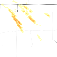
New Mexico
| Local Time | Report Details |
|---|---|
| 6:14 PM MDT | Quarter sized hail reported near Clayton, NM, 78.8 miles NNE of Tucumcari, NM |
| 6:25 PM MDT | Golf Ball sized hail reported near Clayton, NM, 78.8 miles NNE of Tucumcari, NM |
| 6:30 PM MDT | Quarter sized hail reported near Clayton, NM, 78.7 miles NNE of Tucumcari, NM |
| 6:40 PM MDT | Hen Egg sized hail reported near Clayton, NM, 79.4 miles NNE of Tucumcari, NM |
| 7:42 PM MDT | Quarter sized hail reported near Clayton, NM, 78.5 miles NNE of Tucumcari, NM, lasted until 8 pm or so. |
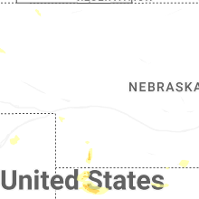
Nebraska
| Local Time | Report Details |
|---|---|
| 8:40 PM CDT | Ping Pong Ball sized hail reported near Stratton, NE, 56.9 miles NNW of Colby, KS |
| 7:55 PM MDT | Personal weather station on the west side of benkelma in dundy county NE, 51.9 miles NNW of Colby, KS |
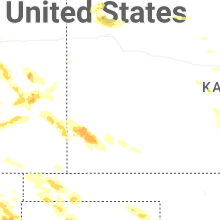
Kansas
| Local Time | Report Details |
|---|---|
| 10:10 PM CDT | Estimated 50 to 60 mph wind gusts. quarter sized hail was also reported at the same time and location. time was estimated by rada in rawlins county KS, 28.7 miles N of Colby, KS |
| 10:30 PM CDT | Quarter sized hail reported near Atwood, KS, 28.7 miles N of Colby, KS, estimated 50-60 mph winds were also reported at the same location at this time. the time was estimated by radar. |
| 10:58 PM CDT | Ambient weather network site: videra weathe in grant county KS, 36.8 miles SW of Garden City, KS |
| 12:04 AM CDT | Kansas state mesonet in satant in seward county KS, 46.2 miles S of Garden City, KS |
| 12:28 AM CDT | Mesonet station up407 0.6 sw hayne (upr in seward county KS, 60 miles S of Garden City, KS |
| 12:29 AM CDT | Seward county em reported estimated 60 mph wind gusts at us-160 and us-8 in seward county KS, 48.2 miles S of Garden City, KS |
| 12:38 AM CDT | Mesonet up40 in seward county KS, 60 miles S of Garden City, KS |
| 12:42 AM CDT | Seward county em sent a picture of power poles down roughly 3 miles east of the us-160 and us-83 intersection. time estimated from rada in seward county KS, 48.3 miles S of Garden City, KS |
| 12:47 AM CDT | Mesonet ur35 in seward county KS, 56.9 miles S of Garden City, KS |
Oklahoma
| Local Time | Report Details |
|---|---|
| 5:47 AM CDT | Klts observatio in jackson county OK, 56.2 miles ENE of Childress, TX |
| 5:55 AM CDT | Personal weather statio in jackson county OK, 25 miles E of Childress, TX |
| 6:25 AM CDT | Oklahoma mesonet sit in tillman county OK, 51.8 miles NW of Wichita Falls, TX |
Connect with Interactive Hail Maps