

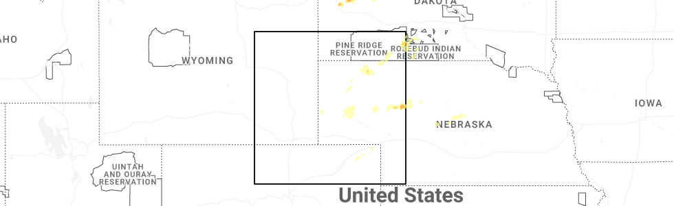
Hail Map for Saturday, July 26, 2025
Number of Impacted Households on 7/26/2025
0
Impacted by 1" or Larger Hail
0
Impacted by 1.75" or Larger Hail
0
Impacted by 2.5" or Larger Hail
Square Miles of Populated Area Impacted on 7/26/2025
0
Impacted by 1" or Larger Hail
0
Impacted by 1.75" or Larger Hail
0
Impacted by 2.5" or Larger Hail
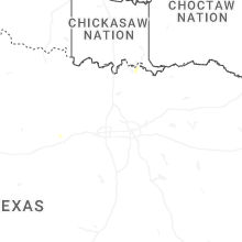

Cities Most Affected by Hail Storms of 7/26/2025
| Hail Size | Demographics of Zip Codes Affected | ||||||
|---|---|---|---|---|---|---|---|
| City | Count | Average | Largest | Pop Density | House Value | Income | Age |
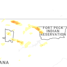
| Glasgow, MT | 1 | 2.75 | 2.75 | 2 | $65k | $32.3k | 45.9 |
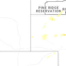
| Martin, SD | 1 | 1.75 | 1.75 | 1 | $41k | $27.3k | 31.6 |
Hail and Wind Damage Spotted on 7/26/2025
Filter by Report Type:Hail ReportsWind Reports
States Impacted
Pennsylvania, West Virginia, Indiana, Ohio, Virginia, Idaho, Montana, Texas, South Dakota, Nebraska, Wyoming, MarylandPennsylvania
| Local Time | Report Details |
|---|---|
| 12:07 PM EDT | Tree... wires... and power pole down on tipton manor r in blair county PA, 25.2 miles WSW of State College, PA |
| 1:08 PM EDT | Trees down on us22... william penn highwa in huntingdon county PA, 27.4 miles S of State College, PA |
| 2:03 PM EDT | Trees and wires down on maddesnsville pik in huntingdon county PA, 41.8 miles S of State College, PA |
| 5:15 PM EDT | Several trees and wires down around atlantic. time estimated via rada in crawford county PA, 69.5 miles E of Cleveland, OH |
| 5:36 PM EDT | Report of trees down along lewisville road. time estimated based on rada in indiana county PA, 36 miles E of Pittsburgh, PA |
| 5:37 PM EDT | Report of a utility line down along newport road. time estimated based on rada in indiana county PA, 35.9 miles E of Pittsburgh, PA |
| 5:37 PM EDT | Report of a tree down along cramer road. time estimated on rada in indiana county PA, 36 miles E of Pittsburgh, PA |
| 5:38 PM EDT | Public safety scanner reported a tree down on atlantic lake road near west calvin road. time estimated via rada in crawford county PA, 70.1 miles E of Cleveland, OH |
| 5:45 PM EDT | Public safety scanner reported a tree and wires down on tamarack drive. time estimated via rada in crawford county PA, 81.1 miles N of Pittsburgh, PA |
| 5:56 PM EDT | Public safety scanner reported a tree down and blocking state highway 27 between moyer road south wayland road. time estimated via rada in crawford county PA, 82.3 miles N of Pittsburgh, PA |
| 6:09 PM EDT | Report of trees down on wires along hamel road. time estimated based on rada in butler county PA, 25.1 miles N of Pittsburgh, PA |
| 6:16 PM EDT | Report of tree down along bonniebrook road near the route 422. time estimated based on rada in butler county PA, 31.1 miles NNE of Pittsburgh, PA |
| 6:18 PM EDT | Reports of multiple trees and power lines down in the area. time estimated based on rada in butler county PA, 28.8 miles NNE of Pittsburgh, PA |
| 6:18 PM EDT | Report of trees down on wires along logan road. time estimated based on rada in butler county PA, 20.8 miles NNE of Pittsburgh, PA |
| 6:20 PM EDT | Report of multiple trees and power lines down in middlesex township. time estimated based on rada in butler county PA, 19.2 miles NNE of Pittsburgh, PA |
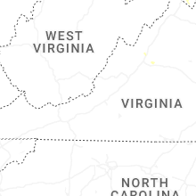
West Virginia
| Local Time | Report Details |
|---|---|
| 2:27 PM EDT | Tree down near the intersection of dewdrop lane and audubon r in berkeley county WV, 83.4 miles WNW of Baltimore, MD |
| 2:40 PM EDT | State doh reports a tree down on larkmead rd near lemon lane. time estimated from rada in wood county WV, 61.4 miles N of Charleston, WV |
| 2:59 PM EDT | A few trees down near hedgesvill in berkeley county WV, 76.7 miles WNW of Baltimore, MD |
| 3:08 PM EDT | Trees down in and around martinsbur in berkeley county WV, 75.9 miles W of Baltimore, MD |
| 3:31 PM EDT | Tree down onto power lines near the 800 block of hidden hollow driv in jefferson county WV, 74 miles W of Baltimore, MD |
| 3:31 PM EDT | Tree down onto powerlines near the intersection of brucetown road and happy creek driv in jefferson county WV, 74.5 miles W of Baltimore, MD |
| 3:31 PM EDT | Three trees down along brucetown r in jefferson county WV, 74.5 miles W of Baltimore, MD |
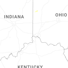
Indiana
| Local Time | Report Details |
|---|---|
| 2:55 PM EDT | Photo on facebook of several large tree limbs down in culver. time estimated via rada in marshall county IN, 69.6 miles W of Fort Wayne, IN |
| 3:20 PM EDT | Photo on facebook of a large tree down between two homes near the intersection of 12th and elm street in rochester. no injuries. time estimated via rada in fulton county IN, 58 miles W of Fort Wayne, IN |
| 6:12 PM EDT | Trw winds estimated at 60 mp in morgan county IN, 21.4 miles SW of Indianapolis, IN |
| 8:06 PM EDT | A few small tree limbs down and several pieces of metal lofted into nearby corn fields near the intersection of s 200 e and e 650 s. time estimated via rada in jay county IN, 50.8 miles S of Fort Wayne, IN |
| 8:07 PM EDT | 4 large trees snapped and several limbs down in the 3900 block of east treaty line rd near boundary city. time estimated via rada in jay county IN, 51.1 miles SSE of Fort Wayne, IN |
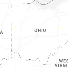
Ohio
| Local Time | Report Details |
|---|---|
| 4:20 PM EDT | C-man station hhlo1 huron measured at 51 kt marine thunderstorm wind gus in lez144 county OH, 45.2 miles W of Cleveland, OH |
| 7:05 PM EDT | Public safety scanner reported tree limbs and power lines down on state route 4 near quaintance road. time estimated via rada in crawford county OH, 62 miles N of Columbus, OH |
| 7:07 PM EDT | Public safety scanner reported a tree limb down across beechgrove road between hieber road and spore brandywine road. time estimated via rada in crawford county OH, 62.7 miles N of Columbus, OH |
Virginia
| Local Time | Report Details |
|---|---|
| 4:44 PM EDT | Tree down near the intersection of sperryville pike and f.t valley roa in rappahannock county VA, 84.9 miles NNW of Richmond, VA |
| 4:44 PM EDT | Several trees down in sperryville in rappahannock county VA, 85.8 miles NNW of Richmond, VA |
| 4:44 PM EDT | Several trees down in sperryville in rappahannock county VA, 85.8 miles NNW of Richmond, VA |
| 5:24 PM EDT | Tree down onto roadway on reva r in culpeper county VA, 73.1 miles NNW of Richmond, VA |
| 6:30 PM EDT | Trees blew down on va-731 natural chimney roa in augusta county VA, 58.2 miles SE of Elkins, WV |
| 7:43 PM EDT | Trees and wires blew down in the 700 block of dooms crossing roa in augusta county VA, 77 miles WNW of Richmond, VA |
| 7:59 PM EDT | Two trees down in rockfish ga in albemarle county VA, 70.6 miles WNW of Richmond, VA |
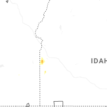
Idaho
| Local Time | Report Details |
|---|---|
| 3:21 PM MDT | Kllj challis airpor in custer county ID, 48 miles SSW of Salmon, ID |
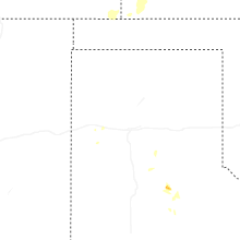
Montana
| Local Time | Report Details |
|---|---|
| 4:00 PM MDT | Mesonet station gw0007 big timbe in sweet grass county MT, 53.5 miles ENE of Bozeman, MT |
| 5:46 PM MDT | Asos station kbtm butte-mooney a in silver bow county MT, 73.6 miles WNW of Bozeman, MT |
| 7:09 PM MDT | Asos station kmso missoula... m in missoula county MT, 5.9 miles WNW of Missoula, MT |
| 7:12 PM MDT | Baseball sized hail reported near Glasgow, MT, 22.9 miles N of Glasgow, MT, photo on social media show hailstones with a quarter showing max hail size of 2.75 inches. |
Texas
| Local Time | Report Details |
|---|---|
| 5:35 PM CDT | Storm damage reported in hardeman county TX, 16.7 miles ESE of Childress, TX |
| 7:25 PM CDT | Storm damage reported in foard county TX, 42.2 miles SE of Childress, TX |
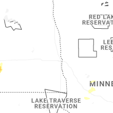
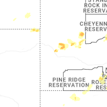
South Dakota
| Local Time | Report Details |
|---|---|
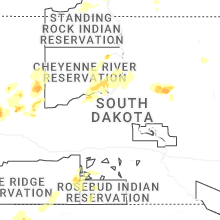
| 5:02 PM MDT | Half Dollar sized hail reported near Hayes, SD, 39.8 miles NW of Pierre, SD |
| 7:15 PM CDT | Sdsu site at gettysburg in potter county SD, 44.6 miles N of Pierre, SD |
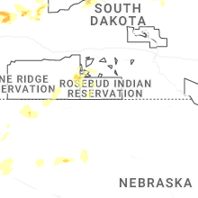
| 6:29 PM MDT | Golf Ball sized hail reported near Martin, SD, 52 miles NW of Valentine, NE |
| 6:30 PM MDT | Ping Pong Ball sized hail reported near Ridgeview, SD, 67.8 miles NNW of Pierre, SD, hail occurred for a couple of minutes. |
| 7:45 PM CDT | Storm damage reported in mellette county SD, 48.3 miles NNW of Valentine, NE |
Nebraska
| Local Time | Report Details |
|---|---|
| 5:05 PM MDT | Quarter sized hail reported near Rushville, NE, 85 miles NE of Scottsbluff, NE, time estimated from radar. |
Wyoming
| Local Time | Report Details |
|---|---|
| 5:52 PM MDT | Mesonet station hhrw4 hyattville 5 en in big horn county WY, 98.3 miles NNE of Riverton, WY |
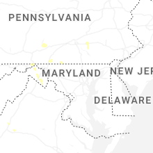
Maryland
| Local Time | Report Details |
|---|---|
| 8:15 PM EDT | Several trees and wires blew down between lonaconing and cumberland... including on arch street and dan's mountai in allegany county MD, 76.7 miles NE of Elkins, WV |
Connect with Interactive Hail Maps