

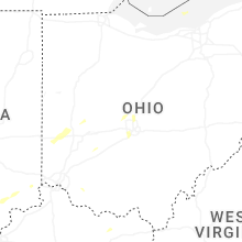
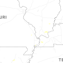
Hail Map for Saturday, July 12, 2025

Number of Impacted Households on 7/12/2025
0
Impacted by 1" or Larger Hail
0
Impacted by 1.75" or Larger Hail
0
Impacted by 2.5" or Larger Hail
Square Miles of Populated Area Impacted on 7/12/2025
0
Impacted by 1" or Larger Hail
0
Impacted by 1.75" or Larger Hail
0
Impacted by 2.5" or Larger Hail

Cities Most Affected by Hail Storms of 7/12/2025
| Hail Size | Demographics of Zip Codes Affected | ||||||
|---|---|---|---|---|---|---|---|
| City | Count | Average | Largest | Pop Density | House Value | Income | Age |
Hail and Wind Damage Spotted on 7/12/2025
Filter by Report Type:Hail ReportsWind Reports
States Impacted
Michigan, Ohio, Virginia, Kentucky, Tennessee, Florida, Indiana, South Carolina, North Carolina, MissouriMichigan
| Local Time | Report Details |
|---|---|
| 12:13 PM EDT | Report and photo of a large tree limb dow in lenawee county MI, 70.8 miles S of Flint, MI |
| 12:35 PM EDT | Report of tree limbs down... approximately 6 to 8 inches diamter in oakland county MI, 34.7 miles S of Flint, MI |
| 12:36 PM EDT | Report of a large tree limb down on road in oakland county MI, 38.1 miles S of Flint, MI |
| 1:04 PM EDT | Large tree uprooted... likely shallow rooted syste in wayne county MI, 45.6 miles SSE of Flint, MI |
| 1:40 PM EDT | Storm damage reported in wayne county MI, 58.6 miles SE of Flint, MI |
| 6:18 PM UTC | Report and photos of multiple trees and large branches down in huron county MI, 77.9 miles NE of Flint, MI |
Ohio
| Local Time | Report Details |
|---|---|
| 4:45 PM UTC | Several trees down across the area near oak openings preserve metropar in lucas county OH, 73.7 miles ENE of Fort Wayne, IN |
| 2:59 PM EDT | Trees down with two power poles and wires down on state route 430 at the entrance to charles mills lake park. time estimate via rada in ashland county OH, 61.8 miles SW of Cleveland, OH |
| 3:24 PM EDT | Large tree down onto powerlines near the intersection of anderley rd and brown r in franklin county OH, 4.7 miles SSW of Columbus, OH |
| 3:45 PM EDT | Several trees across the road in huron township. time was estimated by rada in erie county OH, 45.8 miles W of Cleveland, OH |
| 3:54 PM EDT | Several trees down in lincoln heights. downed trees reported near the intersection of prairie ave and leggett st... along with wabash av in hamilton county OH, 10.2 miles NNE of Cincinnati, OH |
| 3:54 PM EDT | Trees and powerlines down along woodknoll terrace. time estimated from rada in hamilton county OH, 7.9 miles N of Cincinnati, OH |
| 3:55 PM EDT | Trees down along burns avenue... near both cooper and east mills. time estimated from rada in hamilton county OH, 8 miles NNE of Cincinnati, OH |
| 3:56 PM EDT | Large tree limb down in florence townshi in erie county OH, 39.5 miles WSW of Cleveland, OH |
| 4:00 PM EDT | Trees and powerlines down in the 300 block of larami in hamilton county OH, 8.5 miles N of Cincinnati, OH |
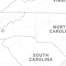
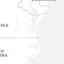
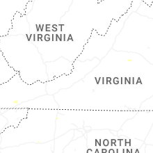
Virginia
| Local Time | Report Details |
|---|---|
| 1:13 PM EDT | Tree down on power lines along cedar stree in henry county VA, 36.8 miles SSW of Roanoke, VA |
| 1:35 PM EDT | 5 trees down in the 4000 block of monocan trail road in albemarle county VA, 63.3 miles WNW of Richmond, VA |
| 1:48 PM EDT | A 64 mph wind gust was measured by the richmond international airport aso in henrico county VA, 18.2 miles E of Richmond, VA |
| 2:04 PM EDT | Tree reported down on old buckingham rd blocking all lane in chesterfield county VA, 0.8 miles NE of Richmond, VA |
| 2:28 PM EDT | 4 different reports of downed trees across scottsvill in albemarle county VA, 50.3 miles WNW of Richmond, VA |
| 3:11 PM EDT | The 911 call center reported a tree down along the intersection of cooks mill road and highway 24 in new kent county VA, 37.4 miles E of Richmond, VA |
| 3:16 PM EDT | The 911 call center reported a tree down along the intersection of va 33 and va 249. time estimated from rada in new kent county VA, 42.9 miles E of Richmond, VA |
| 3:43 PM EDT | The 911 call center reported a tree down along i-95 northbound near mile marker 35. vdot reported the tree down at mile marker 35.2. time estimated from rada in prince george county VA, 37.6 miles SSE of Richmond, VA |
| 9:01 PM UTC | Tree down in the roadway at kettle pond lane near route in fairfax county VA, 43.8 miles WSW of Baltimore, MD |
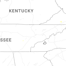
Kentucky
| Local Time | Report Details |
|---|---|
| 2:27 PM EDT | A social media report said a porch roof was peeled halfway off on the 100 block of bethany school lane. time estimated from rada in wolfe county KY, 27.3 miles E of Irvine, KY |
Tennessee
| Local Time | Report Details |
|---|---|
| 2:30 PM EDT | Tree dow in campbell county TN, 28.4 miles NNW of Knoxville, TN |
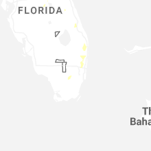
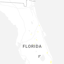
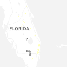
Florida
| Local Time | Report Details |
|---|---|
| 2:40 PM EDT | Quarter sized hail reported near Fort Lauderdale, FL, 31.7 miles N of Miami, FL, spotter reported up up to 1 inch in size near nw 27th & inverrary blvd. |
| 3:00 PM EDT | Quarter sized hail reported near Pompano Beach, FL, 35.2 miles N of Miami, FL, public nickel to quarter size hail along with street flooding near the area of coral spring nissan and the stranahan river. |
| 3:30 PM EDT | Multiple trees down on state route 100 east of florahome. time estimated via rada in putnam county FL, 43.6 miles S of Jacksonville, FL |
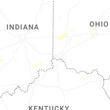
Indiana
| Local Time | Report Details |
|---|---|
| 1:54 PM CDT | Storm damage reported in gibson county IN, 24.4 miles N of Evansville, IN |
| 2:05 PM CDT | 60 mph wind gust within the rain core. power is flickerin in gibson county IN, 24.4 miles N of Evansville, IN |
| 3:40 PM EDT | Multiple trees down at 600 e and 100 s near belfountain. time estimated via rada in jay county IN, 46.3 miles SSE of Fort Wayne, IN |
| 3:40 PM EDT | Multiple trees down at state road 26 and 800 e. time estimated via rada in jay county IN, 46.9 miles SSE of Fort Wayne, IN |
| 3:41 PM EDT | Tree down on power line on club roa in dubois county IN, 44.6 miles ENE of Evansville, IN |
South Carolina
| Local Time | Report Details |
|---|---|
| 3:45 PM EDT | Tree down near the intersection of broad river blvd and river chase blvd. time based on report received by the 911 call cente in beaufort county SC, 28.9 miles NE of Savannah, GA |
North Carolina
| Local Time | Report Details |
|---|---|
| 3:51 PM EDT | Tree downed by thunderstorm winds on beach roa in surry county NC, 74.4 miles N of Charlotte, NC |
| 4:14 PM EDT | Tree downed by thunderstorm winds at the intersection of cockerham road and west mount herman church roa in surry county NC, 74.5 miles N of Charlotte, NC |
| 4:21 PM EDT | Multiple trees reported down on spainhour mill roa in forsyth county NC, 74.6 miles NNE of Charlotte, NC |
Missouri
| Local Time | Report Details |
|---|---|
| 2:54 PM CDT | Large 6 inch in diameter tree branch down on the north side of cape girardea in cape girardeau county MO, 2.6 miles N of Cape Girardeau, MO |
Connect with Interactive Hail Maps