Hail Map for Sunday, August 21, 2022

Number of Impacted Households on 8/21/2022
0
Impacted by 1" or Larger Hail
0
Impacted by 1.75" or Larger Hail
0
Impacted by 2.5" or Larger Hail
Square Miles of Populated Area Impacted on 8/21/2022
0
Impacted by 1" or Larger Hail
0
Impacted by 1.75" or Larger Hail
0
Impacted by 2.5" or Larger Hail
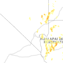
Regions Impacted by Hail on 8/21/2022
Cities Most Affected by Hail Storms of 8/21/2022
| Hail Size | Demographics of Zip Codes Affected | ||||||
|---|---|---|---|---|---|---|---|
| City | Count | Average | Largest | Pop Density | House Value | Income | Age |
Hail and Wind Damage Spotted on 8/21/2022
Filter by Report Type:Hail ReportsWind Reports
States Impacted
Virginia, Mississippi, Ohio, North Carolina, Kentucky, New York, South Carolina, Utah, Florida, Georgia, Arizona, Nevada, CaliforniaVirginia
| Local Time | Report Details |
|---|---|
| 11:20 AM EDT | Several trees and large tree limbs blew down across va-795 blenheim road from the 7000 block to the 7600 block. a few blocked the roadway and adjacent driveways. trees in albemarle county VA, 52 miles WNW of Richmond, VA |
Mississippi
| Local Time | Report Details |
|---|---|
| 12:15 PM CDT | Barn destroyed by possible straight line wind in smith county MS, 47.3 miles SE of Jackson, MS |
Ohio
| Local Time | Report Details |
|---|---|
| 1:48 PM EDT | Numerous trees down in the area. time estimated from rada in delaware county OH, 14.1 miles NNW of Columbus, OH |
| 1:50 PM EDT | Trees and power poles down. most of west jefferson without power. time estimated from rada in madison county OH, 14.3 miles W of Columbus, OH |
| 3:10 PM EDT | Quarter sized hail reported near Zanesville, OH, 52.7 miles E of Columbus, OH, quarter sized hail in muskingum co. time and location estimated by radar. |
| 3:22 PM EDT | Wires down on james road. time estimated from rada in licking county OH, 27.1 miles E of Columbus, OH |
| 5:13 PM EDT | Perry county 911 dispatch has a report of a fallen tree at monday creek township rd and township rd 186. time estimated by rada in perry county OH, 42 miles ESE of Columbus, OH |
| 6:04 PM EDT | Trees uprooted and siding from buildings ripped off. possible tornado. time estimated from rada in greene county OH, 47.2 miles NNE of Cincinnati, OH |
| 6:42 PM EDT | Wires down on us 42. time estimated from rada in warren county OH, 30.3 miles NE of Cincinnati, OH |
North Carolina
| Local Time | Report Details |
|---|---|
| 3:20 PM EDT | Trees down just east of rocky moun in edgecombe county NC, 52.7 miles E of Raleigh, NC |
| 3:40 PM EDT | Two trees down near the intersection of edgewood church road and sharp point roa in edgecombe county NC, 58.8 miles E of Raleigh, NC |
Kentucky
| Local Time | Report Details |
|---|---|
| 2:37 PM CDT | Wrn ambassador sent pictures of large tree limbs broken on highway 76 in the community of eli. barn roof metal was also peeled back... but not blown away. time estimate in russell county KY, 70.8 miles SW of Irvine, KY |
New York
| Local Time | Report Details |
|---|---|
| 4:30 PM EDT | Trees and wires dow in onondaga county NY, 9.6 miles WNW of Syracuse, NY |
| 4:35 PM EDT | Trees and wires dow in onondaga county NY, 11.3 miles WNW of Syracuse, NY |
| 5:23 PM EDT | Trees and wires dow in oswego county NY, 16.3 miles NNE of Syracuse, NY |
| 6:17 PM EDT | Trees dow in jefferson county NY, 54.5 miles SSW of Ogdensburg, NY |
South Carolina
| Local Time | Report Details |
|---|---|
| 4:40 PM EDT | A 911 call center reported a tree down along pinckney colony blvd blocking the roadwa in beaufort county SC, 19.1 miles NE of Savannah, GA |
Utah
| Local Time | Report Details |
|---|---|
| 3:25 PM MDT | Strong winds blew a roof off a house. time of report estimate in garfield county UT, 73.3 miles S of Monroe, UT |
Florida
| Local Time | Report Details |
|---|---|
| 5:32 PM EDT | Broadcast media relayed photos on social media of multiple trees down along walnut bend rd. time estimate based on rada in duval county FL, 10.1 miles SSE of Jacksonville, FL |
| 5:35 PM EDT | Fdem relayed reports of damage to around a dozen manufactured homes consisting mostly of metal pieces being peeled away from roofs and sides of structures. downburst si in manatee county FL, 6.6 miles NE of Bradenton, FL |
| 5:50 PM EDT | Report of tree down due to thunderstorm wind in duval county FL, 13.4 miles S of Jacksonville, FL |
Georgia
| Local Time | Report Details |
|---|---|
| 6:45 PM EDT | A 911 call center reported a tree that knocked down a power line near the intersection of hwy 80 and griffin ave. time was estimated via radar dat in chatham county GA, 5.3 miles W of Savannah, GA |
Arizona
| Local Time | Report Details |
|---|---|
| 5:48 PM MST | Humbug creek raws reports 36 mph wind with 71 mph gus in yavapai county AZ, 46.2 miles NNW of Phoenix, AZ |
| 8:25 PM MST | Arizona department of transportation reported a semi truck had been blown over on highway 93 by mile marker 14 in arizon in mohave county AZ, 36.3 miles SE of Las Vegas, NV |
| 10:06 PM MST | The aprswxnet/cwop site in yucca... az gusted to 60 mph at 1013pm. also gusted to 59 mph at 1006p in mohave county AZ, 30.6 miles NNE of Lake Havasu City, AZ |
Nevada
| Local Time | Report Details |
|---|---|
| 6:06 PM PDT | Nevada department of transportation site measured a 60 mph thunderstorm wind gust at 544pm. gusted to 70 mph at 554p in clark county NV, 20 miles NE of Las Vegas, NV |
California
| Local Time | Report Details |
|---|---|
| 11:35 PM PDT | Measured wind gust from blythe airport aso in riverside county CA, 63.3 miles SSW of Lake Havasu City, AZ |
| 11:57 PM PDT | Measured wind gust at blythe airpor in riverside county CA, 62.8 miles SSW of Lake Havasu City, AZ |


Connect with Interactive Hail Maps