Hail Map for Monday, July 12, 2021

Number of Impacted Households on 7/12/2021
0
Impacted by 1" or Larger Hail
0
Impacted by 1.75" or Larger Hail
0
Impacted by 2.5" or Larger Hail
Square Miles of Populated Area Impacted on 7/12/2021
0
Impacted by 1" or Larger Hail
0
Impacted by 1.75" or Larger Hail
0
Impacted by 2.5" or Larger Hail
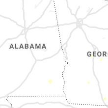
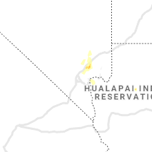
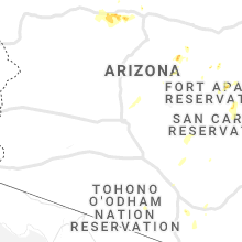
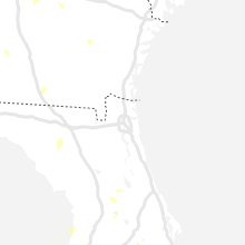
Regions Impacted by Hail on 7/12/2021
Cities Most Affected by Hail Storms of 7/12/2021
| Hail Size | Demographics of Zip Codes Affected | ||||||
|---|---|---|---|---|---|---|---|
| City | Count | Average | Largest | Pop Density | House Value | Income | Age |
Hail and Wind Damage Spotted on 7/12/2021
Filter by Report Type:Hail ReportsWind Reports
States Impacted
Nevada, Texas, Alabama, West Virginia, Florida, New Jersey, Maryland, Pennsylvania, Illinois, Georgia, Arizona, Virginia, Utah, North Carolina, Wyoming, South Carolina, Delaware, Kentucky, New MexicoNevada
| Local Time | Report Details |
|---|---|
| 10:15 AM PDT | Tree limb damage from severe thunderstorms in east las vegas off of paradise and harmon. time estimated from radar and observation in clark county NV, 4.3 miles S of Las Vegas, NV |
| 11:22 AM PDT | Nvenergy reported 7500 homes without power due to damage from thunderstorm winds. power was restored at 0322 a in clark county NV, 3.4 miles E of Las Vegas, NV |
| 11:30 AM PDT | Palm tree struck by lightning and on fire. embers falling onto building. reported by las vegas fire and rescue. estimated time of lightning 1130pm pdt. time estimated f in clark county NV, 10.8 miles NW of Las Vegas, NV |
| 4:27 PM PDT | Mesonet station pann2 pancake raw in nye county NV, 95.7 miles SW of Ely, NV |
| 6:45 PM PDT | Thunderstorm related wind gust measured in southern nye county at climax mine arl sord a10aa. peak gust 61 mph at 645pm loca in nye county NV, 86.2 miles NW of Las Vegas, NV |
| 9:41 PM PDT | Corrects previous tstm wnd gst report from 12 sw elgin to include a higher peak wind gust. thunderstorm related wind gust measured in southern lincoln county at kane sp in lincoln county NV, 62.9 miles W of Saint George, UT |
| 9:51 PM PDT | Wind measured near the intersection of patrick way and s henrie drive in moapa. data courtesy of earth network in clark county NV, 46 miles NE of Las Vegas, NV |
| 10:56 PM PDT | Mccarran international airport asos reported a gust of 51 kts or 59 mph at 1056pm pt and lasted until 1105pm p in clark county NV, 7.1 miles S of Las Vegas, NV |
| 11:00 PM PDT | Tree snapped and is in powerlines as reported by the las vegas fire and rescue team. estimated time of tree fall 1100pm local. time estimated by radar and other observa in clark county NV, 1.1 miles E of Las Vegas, NV |
Texas
| Local Time | Report Details |
|---|---|
| 1:26 PM CDT | Reports of power lines down... large trees down... and fence damage along and near bluegrove road. time estimated via rada in dallas county TX, 12.3 miles S of Dallas, TX |
| 1:45 PM CDT | Power lines down along spinner road and stain glass drive. time estimated via rada in dallas county TX, 13.5 miles SSW of Dallas, TX |
| 3:15 PM CDT | A large tree branch was blown down blocking fm 778 just southeast of quitma in wood county TX, 78.9 miles E of Dallas, TX |
| 4:45 PM CDT | Roof partially removed from building in the fort worth stockyards. time estimated via rada in tarrant county TX, 32.3 miles W of Dallas, TX |
Alabama
| Local Time | Report Details |
|---|---|
| 1:55 PM CDT | Tree dow in dale county AL, 79.6 miles S of Auburn, AL |
West Virginia
| Local Time | Report Details |
|---|---|
| 3:02 PM EDT | Tree fell down on nightingale l in jefferson county WV, 64.9 miles W of Baltimore, MD |
| 3:47 PM EDT | Large tree fell on a car near the intersection of leetown rd and david leight ln (no injuries) in jefferson county WV, 73.5 miles W of Baltimore, MD |
| 4:07 PM EDT | Large tree limb down blocking flowing springs rd near flowing acres rd in jefferson county WV, 66 miles W of Baltimore, MD |
Florida
| Local Time | Report Details |
|---|---|
| 3:04 PM EDT | Broadcast media relayed the report of an approximately 50-ft tall tree that fell on a trailer inside a private property. no injuries reported. time of incident estimate in osceola county FL, 20.2 miles S of Orlando, FL |
| 3:25 PM EDT | Wpshs suncoast river high school reported a wind gust of 58mph at 3:25pm as a strong thunderstorm moved through the area. elevation is 16 fee in palm beach county FL, 38.2 miles SSE of Port Saint Lucie, FL |
| 3:33 PM EDT | Plmgr palm beach gardens high school reported a wind gust of 61mph at 3:33pm as a strong thunderstorm moved through the area. elevation is 26 fee in palm beach county FL, 34.6 miles SSE of Port Saint Lucie, FL |
| 8:38 PM EDT | Local broadcast media relayed report of a large tree that fell on a car on near the intersection of the venetian causeway and herald plaza. time estimated from rada in miami-dade county FL, 5.1 miles NE of Miami, FL |
New Jersey
| Local Time | Report Details |
|---|---|
| 3:10 PM EDT | Wires down in cinnaminson. time estimated from radar and dispatch repor in burlington county NJ, 71.2 miles SW of Brooklyn, NY |
| 3:13 PM EDT | Downed wires and power outages in the fieldsboro area and near dunns mill road. time estimated from rada in burlington county NJ, 54.3 miles SW of Brooklyn, NY |
| 3:15 PM EDT | Scanner report of downed wires in florence. time estimated from radar and dispatch repor in burlington county NJ, 58.6 miles SW of Brooklyn, NY |
| 3:16 PM EDT | Downed wires near old york road. time estimated from rada in burlington county NJ, 54.1 miles SW of Brooklyn, NY |
| 3:19 PM EDT | Multiple reports of wires down and power outages in the jamesburg area. time estimated from rada in middlesex county NJ, 33.5 miles SW of Brooklyn, NY |
| 3:23 PM EDT | Wires down in jamesburg. time estimated from rada in middlesex county NJ, 33.5 miles SW of Brooklyn, NY |
| 3:32 PM EDT | A couple of reports of downed wires in the spotswood area. time estimated from rada in middlesex county NJ, 29.2 miles SW of Brooklyn, NY |
| 3:52 PM EDT | Downed wires near thorntown lane. time estimated from rada in burlington county NJ, 52.9 miles SW of Brooklyn, NY |
| 4:45 PM EDT | Several reports of downed wires and power outages in the island heights area. time estimated from rada in ocean county NJ, 52.5 miles S of Brooklyn, NY |
| 4:45 PM EDT | Downed power lines near oak avenue. time estimated from rada in ocean county NJ, 49.5 miles SSW of Brooklyn, NY |
| 4:52 PM EDT | Wires down on ocean ave in lakewood. time estimated from rada in ocean county NJ, 42.8 miles SSW of Brooklyn, NY |
| 4:55 PM EDT | Numerous reports of downed wires between lakewood and toms rive in ocean county NJ, 48 miles SSW of Brooklyn, NY |
| 4:55 PM EDT | Several trees down in brick twp. time estimated from rada in ocean county NJ, 44.3 miles S of Brooklyn, NY |
| 4:56 PM EDT | Numerous downed wire reports in brick twp. time estimated from rada in ocean county NJ, 44.3 miles S of Brooklyn, NY |
| 5:00 PM EDT | Several reports of downed wires in the bay head area. time estimated from rada in ocean county NJ, 43 miles S of Brooklyn, NY |
| 5:06 PM EDT | Quarter sized hail reported near Toms River, NJ, 50.4 miles S of Brooklyn, NY |
| 5:13 PM EDT | Downed trees and wires near brookdale park drive. time estimated from rada in ocean county NJ, 59.4 miles SSW of Brooklyn, NY |
| 5:18 PM EDT | Wires down on lincoln ave. time estimated from radar and scanner repor in burlington county NJ, 65.3 miles SW of Brooklyn, NY |
| 5:27 PM EDT | Downed wires on lincoln avenue. time estimated from rada in burlington county NJ, 64.9 miles SW of Brooklyn, NY |
| 5:29 PM EDT | Wires down on hamilton ave. time estimated from rada in burlington county NJ, 57.9 miles SW of Brooklyn, NY |
| 6:00 PM EDT | Trees and wires dow in passaic county NJ, 35.9 miles NW of Brooklyn, NY |
| 6:09 PM EDT | Downed wires near kings highway. time estimated from rada in burlington county NJ, 72.8 miles SW of Brooklyn, NY |
| 6:46 PM EDT | Several reports of downed wires and power outages in the collingswood area. time estimated from rada in camden county NJ, 78.1 miles SW of Brooklyn, NY |
Maryland
| Local Time | Report Details |
|---|---|
| 3:10 PM EDT | Tree down on wires and blocking roadway in the 17000 block of spielman rd in washington county MD, 63.4 miles WNW of Baltimore, MD |
| 6:45 PM EDT | Tree across the roadway near the intersection of pocock road and ebenezer roa in harford county MD, 20 miles NNE of Baltimore, MD |
| 7:48 PM EDT | Tree down near the intersection of north paradise road and lee roa in harford county MD, 29.6 miles NE of Baltimore, MD |
| 7:51 PM EDT | Tree blocking the roadway near the intersection of paradise road and old robinhood roa in harford county MD, 29.1 miles NE of Baltimore, MD |
| 7:59 PM EDT | Tree down near the intersection of laurel bush road and burgh westra wa in harford county MD, 21.1 miles NE of Baltimore, MD |
| 8:02 PM EDT | Tree down near the intersection of oakington road and n post roa in harford county MD, 29.7 miles ENE of Baltimore, MD |
Pennsylvania
| Local Time | Report Details |
|---|---|
| 3:20 PM EDT | Trees and wires dow in perry county PA, 41.8 miles SE of State College, PA |
| 3:25 PM EDT | Tree on wire in perry county PA, 41.7 miles SE of State College, PA |
| 4:12 PM EDT | Trees on wires on bruce av in lancaster county PA, 57.4 miles N of Baltimore, MD |
| 4:17 PM EDT | Tree down on wire in dauphin county PA, 57.5 miles ESE of State College, PA |
| 4:18 PM EDT | Large tree on wires across clarks valley r in dauphin county PA, 57.5 miles ESE of State College, PA |
| 4:57 PM EDT | A few reports of downed wires west of levittown. time estimated from rada in bucks county PA, 62.6 miles SW of Brooklyn, NY |
| 5:08 PM EDT | Downed wires in several locations east of levittown. time estimated from rada in bucks county PA, 59.2 miles SW of Brooklyn, NY |
| 5:09 PM EDT | Downed wires near frankford avenue. time estimated from rada in philadelphia county PA, 72.2 miles SW of Brooklyn, NY |
| 5:10 PM EDT | Downed tree on u.s. highway 1 near southampton road. time estimated from rada in philadelphia county PA, 66.3 miles SW of Brooklyn, NY |
| 5:11 PM EDT | Several reports of downed power lines in the croydon and bristol areas. time estimated from rada in bucks county PA, 63.1 miles SW of Brooklyn, NY |
| 5:19 PM EDT | Tree on wires on pequea manor roa in lancaster county PA, 55.6 miles NNE of Baltimore, MD |
| 5:21 PM EDT | Downed wires near rosehill street. time estimated from rada in philadelphia county PA, 75.6 miles SW of Brooklyn, NY |
| 7:48 PM EDT | Multiple trees down. area where radar showed a tornadic debris signatur in bradford county PA, 59.8 miles WNW of Scranton, PA |
| 8:13 PM EDT | Multiple trees dow in wayne county PA, 38.7 miles NNE of Scranton, PA |
| 10:21 PM EDT | Tree and wires down in roa in wyoming county PA, 16.6 miles NNW of Scranton, PA |
| 3:48 AM EDT | Trees and powerlines down on wible run rd at hillwood r in allegheny county PA, 4.5 miles NNE of Pittsburgh, PA |
| 3:58 AM EDT | Trees and powerlines down on bausman s in allegheny county PA, 2 miles S of Pittsburgh, PA |
| 4:00 AM EDT | Powerlines down on banksville rd in allegheny county PA, 2.6 miles SW of Pittsburgh, PA |
| 4:05 AM EDT | Storm damage reported in allegheny county PA, 7.3 miles SE of Pittsburgh, PA |
Illinois
| Local Time | Report Details |
|---|---|
| 2:47 PM CDT | Several branches downed along u.s. highway 4 in iroquois county IL, 71.4 miles SSW of Chicago, IL |
Georgia
| Local Time | Report Details |
|---|---|
| 4:28 PM EDT | Numerous trees and powerlines down along sr-125 in bemiss between bemiss knights academy road and studstill road. some trees on houses. time estimated by rada in lowndes county GA, 45.9 miles SSW of Douglas, GA |
| 4:29 PM EDT | Roof off a barn near old pine road and mulligan road. time estimated by rada in lowndes county GA, 46.2 miles SSW of Douglas, GA |
| 4:56 PM EDT | Tree down on old coffee road. time estimated by rada in cook county GA, 42.6 miles SW of Douglas, GA |
| 5:02 PM EDT | Tree down on register roa in cook county GA, 38.4 miles SW of Douglas, GA |
| 5:04 PM EDT | Tree down on boone road. time estimated by rada in cook county GA, 38 miles SW of Douglas, GA |
| 6:15 PM EDT | Tree down in meriwether county GA, 50.3 miles ENE of Auburn, AL |
| 6:25 PM EDT | Trees down in meriwether county GA, 53.3 miles ENE of Auburn, AL |
| 6:25 PM EDT | Trees down in meriwether county GA, 54.1 miles SSW of Atlanta, GA |
| 6:30 PM EDT | Tree down in meriwether county GA, 46.5 miles SSW of Atlanta, GA |
| 8:50 PM EDT | Trees and power lines down near jekyll rd and poor robin r in appling county GA, 35.1 miles ENE of Douglas, GA |
Arizona
| Local Time | Report Details |
|---|---|
| 1:37 PM MST | Quarter sized hail reported near Flagstaff, AZ, 8 miles NNW of Flagstaff, AZ |
| 4:00 PM MST | Ping Pong Ball sized hail reported near Pinetop, AZ, 14.3 miles SE of Show Low, AZ |
| 8:30 PM MST | Mesonet station tt418 tonto portable #2 (raws). time estimated from rada in gila county AZ, 64.7 miles N of Tucson, AZ |
| 9:50 PM MST | Mature palo verde tree broken at trunk. another large tree down or partially dow in maricopa county AZ, 28.9 miles NE of Phoenix, AZ |
| 10:18 PM MST | And 0.5 inch. hail and near zero visibility in heavy rai in maricopa county AZ, 16.3 miles NNE of Phoenix, AZ |
| 10:38 PM MST | Thunderstorm related wind gust measured in at hoover dam at us93 hdmnv. peak gust 59 mph at 1038pm loca in clark county NV, 25 miles ESE of Las Vegas, NV |
Virginia
| Local Time | Report Details |
|---|---|
| 4:39 PM EDT | Power line down on graywolf trail in wincheste in frederick county VA, 83.8 miles ENE of Elkins, WV |
Utah
| Local Time | Report Details |
|---|---|
| 4:00 PM MDT | Udot mesonet sensor sr-30 at curlew junction in box elder county UT, 82.6 miles ESE of Twin Falls, ID |
North Carolina
| Local Time | Report Details |
|---|---|
| 6:30 PM EDT | 911 call center reported tree down on a house on glen eagles l in cabarrus county NC, 13.8 miles NE of Charlotte, NC |
Wyoming
| Local Time | Report Details |
|---|---|
| 4:55 PM MDT | Tree branches and roof damage to two mobile home from downburst. bpi asos 61 mph gust at 4:55 pm md in sublette county WY, 80.4 miles NW of Rock Springs, WY |
South Carolina
| Local Time | Report Details |
|---|---|
| 7:25 PM EDT | Beech island fd reported trees down on old jackson hw and steed s in aiken county SC, 14.4 miles SE of Augusta, GA |
| 9:26 PM EDT | Broadcast media reported trees down on woodruff r in greenville county SC, 15.4 miles E of Greenville, SC |
| 9:43 PM EDT | Broadcast media reported trees down on gilmer r in anderson county SC, 24.9 miles S of Greenville, SC |
| 9:48 PM EDT | 911 call center reported several trees down along belton hwy between the dollar general and the richard m campbell veterans nursing hom in anderson county SC, 24.2 miles S of Greenville, SC |
| 10:26 PM EDT | Broadcast media reported trees down on woodruff r in greenville county SC, 15.4 miles E of Greenville, SC |
Delaware
| Local Time | Report Details |
|---|---|
| 7:29 PM EDT | A couple of reports of downed wires near rogers road and new castle avenue. time estimated from rada in new castle county DE, 63.6 miles ENE of Baltimore, MD |
| 7:36 PM EDT | A couple of reports of downed wires near 10th street. time estimated from rada in new castle county DE, 64.6 miles ENE of Baltimore, MD |
Kentucky
| Local Time | Report Details |
|---|---|
| 8:26 PM EDT | Tree fell on a mobile home. no injurie in jessamine county KY, 31.9 miles WNW of Irvine, KY |
New Mexico
| Local Time | Report Details |
|---|---|
| 7:18 PM MDT | Quarter sized hail reported near Stanley, NM, 38.2 miles E of Albuquerque, NM |










Connect with Interactive Hail Maps