Hail Map for Tuesday, July 13, 2021

Number of Impacted Households on 7/13/2021
0
Impacted by 1" or Larger Hail
0
Impacted by 1.75" or Larger Hail
0
Impacted by 2.5" or Larger Hail
Square Miles of Populated Area Impacted on 7/13/2021
0
Impacted by 1" or Larger Hail
0
Impacted by 1.75" or Larger Hail
0
Impacted by 2.5" or Larger Hail
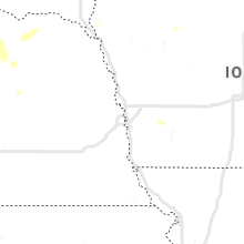
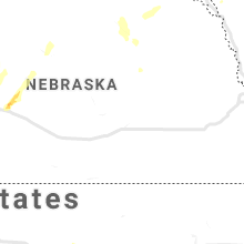
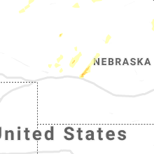
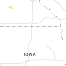
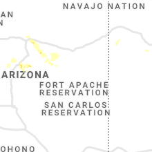
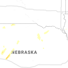
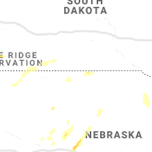
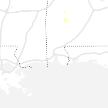
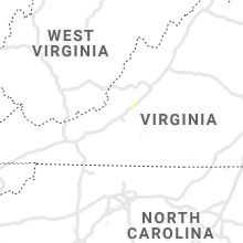
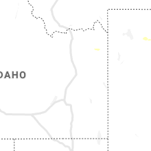
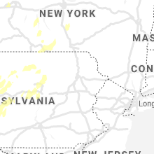
Regions Impacted by Hail on 7/13/2021
Cities Most Affected by Hail Storms of 7/13/2021
| Hail Size | Demographics of Zip Codes Affected | ||||||
|---|---|---|---|---|---|---|---|
| City | Count | Average | Largest | Pop Density | House Value | Income | Age |
Hail and Wind Damage Spotted on 7/13/2021
Filter by Report Type:Hail ReportsWind Reports
States Impacted
Arizona, Tennessee, Montana, Virginia, Ohio, Pennsylvania, Utah, Maryland, Nevada, New York, Colorado, Wisconsin, Mississippi, Minnesota, Texas, Kansas, Idaho, Wyoming, South Dakota, NebraskaArizona
| Local Time | Report Details |
|---|---|
| 6:25 AM MST | High winds lasted from approximately 0625 to 0720... and the peak gust occurred at 0645. a spotter also reported a downed tree at the fairgrounds. this is believed to h in mohave county AZ, 59.1 miles NNE of Lake Havasu City, AZ |
| 3:30 PM MST | Empire raws measured a 63 mph wind gus in pima county AZ, 36.1 miles SSE of Tucson, AZ |
| 8:55 PM MST | Corrects previous tstm wnd dmg report from 1 n littlefield. winds resulting in fallen trees blocking roadways and trees falling on power lines resulting in power outage in mohave county AZ, 23.6 miles SW of Saint George, UT |
Tennessee
| Local Time | Report Details |
|---|---|
| 12:19 PM CDT | Several large trees down in the hawkins rd and trammel creek rd area in macon county TN, 43.4 miles NE of Nashville, TN |
Montana
| Local Time | Report Details |
|---|---|
| 12:00 PM MDT | Mesonet station ginm8 ginger raws. time of event estimate in broadwater county MT, 52.3 miles NNW of Bozeman, MT |
| 6:45 PM MDT | Some branches down but no significant damage in powder river county MT, 56.4 miles N of Gillette, WY |
Virginia
| Local Time | Report Details |
|---|---|
| 2:50 PM EDT | Corrects previous tstm wnd dmg report from 2 ne blacksburg. corrects previous tstm wnd dmg report from 2 ne blacksburg. at least two trees down. several small limbs dow in montgomery county VA, 24.8 miles W of Roanoke, VA |
| 2:54 PM EDT | Tree down blocking road... near intersection of houston and harrell stree in montgomery county VA, 26.1 miles W of Roanoke, VA |
| 2:58 PM EDT | Tree down near intersection of mt. tabor and bishop roa in montgomery county VA, 25.3 miles W of Roanoke, VA |
| 3:50 PM EDT | At least two trees down. several small limbs down as in the area as well. power out. pea-sized hail was also observe in montgomery county VA, 24.8 miles W of Roanoke, VA |
| 3:50 PM EDT | At least two trees down. several small limbs down as in the area as well. power out. pea-sized hail was also observe in montgomery county VA, 24.8 miles W of Roanoke, VA |
| 3:55 PM EDT | Branch blown down... taking down a power line along grissom lan in montgomery county VA, 25.6 miles W of Roanoke, VA |
| 4:14 PM EDT | One tree dow in botetourt county VA, 22.7 miles NNE of Roanoke, VA |
Ohio
| Local Time | Report Details |
|---|---|
| 3:02 PM EDT | Multiple trees down throughout the city of warren. time estimated by rada in trumbull county OH, 48.8 miles ESE of Cleveland, OH |
| 3:06 PM EDT | Multiple trees down. time estimated by rada in trumbull county OH, 51.9 miles ESE of Cleveland, OH |
| 3:16 PM EDT | Multiple trees down. time estimated by rada in trumbull county OH, 61.5 miles ESE of Cleveland, OH |
Pennsylvania
| Local Time | Report Details |
|---|---|
| 3:16 PM EDT | Multiple trees and power lines down in lawrence county PA, 43 miles NNW of Pittsburgh, PA |
| 3:25 PM EDT | Tree down on homer lane and colt roa in mercer county PA, 66.7 miles NNW of Pittsburgh, PA |
| 3:29 PM EDT | Trees down on old mercer roa in lawrence county PA, 48.4 miles NNW of Pittsburgh, PA |
| 3:33 PM EDT | Tree and wires down. time estimated from rada in crawford county PA, 63.3 miles E of Cleveland, OH |
| 3:34 PM EDT | Trees down in riverside par in mercer county PA, 68.3 miles E of Cleveland, OH |
| 3:36 PM EDT | Trees and power lines down in mercer county PA, 63.5 miles E of Cleveland, OH |
| 3:39 PM EDT | Tree and wires down on old williamson rd near tractor suppy co. tree also on fir in mercer county PA, 69.4 miles E of Cleveland, OH |
| 3:41 PM EDT | Tree down. time estimated from rada in crawford county PA, 66.2 miles E of Cleveland, OH |
| 3:46 PM EDT | Tree down. time estimated from rada in crawford county PA, 71 miles E of Cleveland, OH |
| 4:02 PM EDT | Tree down. time estimated from rada in crawford county PA, 83.1 miles E of Cleveland, OH |
| 4:02 PM EDT | Tree down. time estimated from rada in crawford county PA, 83 miles E of Cleveland, OH |
| 4:05 PM EDT | A few trees reported down in the are in venango county PA, 69.2 miles N of Pittsburgh, PA |
| 4:10 PM EDT | Couple trees down around route 3 in butler county PA, 39.7 miles NNE of Pittsburgh, PA |
| 4:12 PM EDT | Tree down on hooker roa in butler county PA, 41.2 miles NNE of Pittsburgh, PA |
| 4:15 PM EDT | A few trees reported dow in venango county PA, 73.6 miles N of Pittsburgh, PA |
| 4:15 PM EDT | Trees down in east beaver stree in butler county PA, 25.4 miles NNW of Pittsburgh, PA |
| 4:18 PM EDT | Trees down on st. patricks rd in armstrong county PA, 35.6 miles NNE of Pittsburgh, PA |
| 4:23 PM EDT | Tree down on bunker hill r in armstrong county PA, 33.7 miles NE of Pittsburgh, PA |
| 4:32 PM EDT | Tree down. time estimated from rada in erie county PA, 85.6 miles SW of Buffalo, NY |
| 4:45 PM EDT | Several trees and wires dow in erie county PA, 76.6 miles SSW of Buffalo, NY |
| 4:55 PM EDT | Tree down on wood street in clarion county PA, 62.3 miles NNE of Pittsburgh, PA |
| 5:01 PM EDT | Tree down on washington r in clarion county PA, 63.1 miles NNE of Pittsburgh, PA |
| 5:01 PM EDT | Route 28 closed in the area of 217 brookville st due to live power line in clarion county PA, 53.8 miles NE of Pittsburgh, PA |
| 5:01 PM EDT | A few trees dow in forest county PA, 83.9 miles NNE of Pittsburgh, PA |
| 5:02 PM EDT | Trees down around the tow in forest county PA, 78.7 miles NNE of Pittsburgh, PA |
| 5:04 PM EDT | Trees down along route 2 in clarion county PA, 58.1 miles NE of Pittsburgh, PA |
| 5:07 PM EDT | A number of trees down in the northeast portion of indiana count in indiana county PA, 52.3 miles W of State College, PA |
| 5:12 PM EDT | Trees dow in somerset county PA, 68.5 miles SE of Pittsburgh, PA |
| 5:15 PM EDT | Trees across the road on 2600 pa-95 in warren county PA, 71.1 miles SSW of Buffalo, NY |
| 5:19 PM EDT | Trees down on state route 66 in forest county PA, 78.1 miles NW of State College, PA |
| 5:26 PM EDT | Tree down on route 36 in jefferson county PA, 73.9 miles WNW of State College, PA |
| 5:34 PM EDT | Trees down between brush valley and armagh on route 5 in indiana county PA, 50.1 miles E of Pittsburgh, PA |
| 5:34 PM EDT | Quarter sized hail reported near Homer City, PA, 50.1 miles E of Pittsburgh, PA |
| 5:45 PM EDT | Multiple trees blocking roadway along route in mckean county PA, 80.5 miles S of Buffalo, NY |
| 5:50 PM EDT | Multiple reports of trees and wires down along route 6 in warren county PA, 76.9 miles SSW of Buffalo, NY |
| 5:51 PM EDT | Tree down on centerville lan in washington county PA, 28.2 miles S of Pittsburgh, PA |
| 6:09 PM EDT | Trees down across roa in clearfield county PA, 35.7 miles WNW of State College, PA |
| 6:10 PM EDT | Trees snapped on propert in indiana county PA, 49.4 miles E of Pittsburgh, PA |
| 6:14 PM EDT | Power pole snapped in half. other reports of trees across road in are in clearfield county PA, 52.2 miles WNW of State College, PA |
| 6:15 PM EDT | Large tree fell on garag in clearfield county PA, 52.5 miles WNW of State College, PA |
| 6:15 PM EDT | Tree across i-70 exit 46b in westmoreland county PA, 22.4 miles SSE of Pittsburgh, PA |
| 6:30 PM EDT | Several reports of trees and wires down in duboi in clearfield county PA, 52.6 miles WNW of State College, PA |
| 6:37 PM EDT | Multiple trees down in wharto in potter county PA, 51.5 miles N of State College, PA |
| 6:45 PM EDT | Multiple reports of trees and wires down between smethport and port allegan in mckean county PA, 75.7 miles NNW of State College, PA |
| 6:47 PM EDT | 4 trees down on route 46 near old north creek r in cameron county PA, 59.1 miles NNW of State College, PA |
| 6:55 PM EDT | Trees and wires down on airport roa in blair county PA, 29.8 miles SW of State College, PA |
| 7:05 PM EDT | Multiple trees down in austi in potter county PA, 58.9 miles NNW of State College, PA |
| 7:25 PM EDT | Multiple trees and wires down on anaconda d in centre county PA, 8.5 miles SW of State College, PA |
| 7:53 PM EDT | Quarter sized hail reported near State College, PA, 0.3 miles S of State College, PA, multiple reports of quarter sized hail in state college. |
| 8:08 PM EDT | Trees down in richmond townshi in tioga county PA, 78.8 miles WNW of Scranton, PA |
| 8:18 PM EDT | Corrects previous non-tstm wnd dmg report from 1 wsw reedsville. tree on wires on route 41 in mifflin county PA, 15.2 miles SE of State College, PA |
| 8:19 PM EDT | Corrects previous non-tstm wnd dmg report from 6 n buttonwood. trees on wire in tioga county PA, 65.4 miles NE of State College, PA |
| 8:20 PM EDT | Corrects previous non-tstm wnd dmg report from 1 wnw slate run. trees on wire in lycoming county PA, 50.3 miles NNE of State College, PA |
| 8:51 PM EDT | Multiple trees down in forks townshi in sullivan county PA, 49.1 miles W of Scranton, PA |
| 8:55 PM EDT | Ping Pong Ball sized hail reported near Montgomery, PA, 57.9 miles ENE of State College, PA |
| 9:17 PM EDT | Corrects previous tstm wnd dmg report from forksville (time based on radar analysis). multiple trees down in forks townshi in sullivan county PA, 49.1 miles W of Scranton, PA |
| 11:45 PM EDT | Tree down in roadway on grove st near ray s in wayne county PA, 24.3 miles ENE of Scranton, PA |
Utah
| Local Time | Report Details |
|---|---|
| 1:30 PM MDT | Reports of large tree damage from local television media. time estimated based on radar of thunderstorm. hail was also report / size unknow in utah county UT, 46.8 miles SSE of Salt Lake City, UT |
| 3:00 PM MDT | Tower grid mesonet site in tooele county UT, 73.4 miles SW of Salt Lake City, UT |
| 3:05 PM MDT | Simpson springs mesonet site in tooele county UT, 80.2 miles SW of Salt Lake City, UT |
| 3:15 PM MDT | Camel back mtn mesonet site in tooele county UT, 71.3 miles SW of Salt Lake City, UT |
| 10:04 PM MDT | White reef raws in washington county UT, 13.6 miles NE of Saint George, UT |
Maryland
| Local Time | Report Details |
|---|---|
| 4:42 PM EDT | Tree down on md 135 at gemanell avenue in bloomington in garrett county MD, 56.2 miles NE of Elkins, WV |
| 4:47 PM EDT | Tree down on westernport roa in garrett county MD, 56.6 miles NE of Elkins, WV |
| 4:54 PM EDT | Trees down blocking sugar maple road and new georges creek roa in allegany county MD, 60.9 miles NE of Elkins, WV |
| 6:41 PM EDT | Tree down on bear creek roa in garrett county MD, 57 miles NNE of Elkins, WV |
Nevada
| Local Time | Report Details |
|---|---|
| 1:47 PM PDT | Mesonet station ccrn2 currant creek raw in nye county NV, 43.6 miles SW of Ely, NV |
| 3:27 PM PDT | Mesonet station pann2 pancake raw in nye county NV, 95.7 miles SW of Ely, NV |
| 3:38 PM PDT | Mesonet station grvn2 desatoya mountain raw in lander county NV, 115.7 miles S of Winnemucca, NV |
| 8:09 PM PDT | Storm damage reported in clark county NV, 48.7 miles NE of Las Vegas, NV |
New York
| Local Time | Report Details |
|---|---|
| 4:55 PM EDT | Trees down in panam in chautauqua county NY, 63.8 miles SSW of Buffalo, NY |
| 4:55 PM EDT | Trees down in south riple in chautauqua county NY, 60 miles SW of Buffalo, NY |
| 4:55 PM EDT | Trees down in sherma in chautauqua county NY, 62.2 miles SW of Buffalo, NY |
| 5:33 PM EDT | Trees and powerlines down in scriba. time estimated based upon rada in oswego county NY, 31.5 miles NNW of Syracuse, NY |
| 5:35 PM EDT | Tree down on i-86 eastbound near exit 1 in chautauqua county NY, 62.7 miles SW of Buffalo, NY |
| 5:45 PM EDT | Tree down on wire in oneida county NY, 29.6 miles NE of Syracuse, NY |
| 5:51 PM EDT | Tree on a powerline in osceola. time estimated based on rada in lewis county NY, 37.8 miles NE of Syracuse, NY |
| 6:11 PM EDT | Several reports of trees down...trees on cars...trees on houses and powerlines down in salamanc in cattaraugus county NY, 50 miles S of Buffalo, NY |
| 6:17 PM EDT | Trees down in carrollton. time estimated based on rada in cattaraugus county NY, 54.1 miles SSE of Buffalo, NY |
| 6:22 PM EDT | Trees down in allegany. time estimated based on rada in cattaraugus county NY, 58.4 miles SSE of Buffalo, NY |
| 6:23 PM EDT | Trees down in the town of tonawanda. time estimated based on rada in erie county NY, 7.2 miles N of Buffalo, NY |
| 6:28 PM EDT | Trees down in olean. time estimated based on rada in cattaraugus county NY, 59.5 miles SSE of Buffalo, NY |
| 6:30 PM EDT | Multiple reports of downed trees and powerline in niagara county NY, 10 miles N of Buffalo, NY |
| 6:36 PM EDT | Multiple reports of downed trees and powerlines in the southern area of pendleto in niagara county NY, 16 miles NNE of Buffalo, NY |
| 6:39 PM EDT | Trees down in cuba. time estimated based on rada in allegany county NY, 55.2 miles SSE of Buffalo, NY |
| 6:44 PM EDT | Multiple reports of downed trees and powerlines in the city of lockpor in niagara county NY, 21.6 miles NNE of Buffalo, NY |
| 6:48 PM EDT | Trees down in caneadea. time estimated from rada in allegany county NY, 50.5 miles SE of Buffalo, NY |
| 6:48 PM EDT | Trees down in friendship. time estimated based on rada in allegany county NY, 59.9 miles SE of Buffalo, NY |
| 6:52 PM EDT | Trees down in hume. time estimated based on rada in allegany county NY, 47.3 miles SE of Buffalo, NY |
| 6:59 PM EDT | Trees down in angelica. time estimated based on rada in allegany county NY, 59.1 miles SE of Buffalo, NY |
| 6:59 PM EDT | Trees down in scio. time estimated based on rada in allegany county NY, 66.9 miles SE of Buffalo, NY |
| 7:00 PM EDT | Trees down in allen. time estimated based on rada in allegany county NY, 54.7 miles SE of Buffalo, NY |
| 7:15 PM EDT | Tree down on roosevelt highway near breeze roa in orleans county NY, 41.7 miles NE of Buffalo, NY |
| 7:19 PM EDT | Trees and wires down in the wheatland are in monroe county NY, 53.4 miles ENE of Buffalo, NY |
| 7:34 PM EDT | Reports of downed trees and powerlines in the town of geneseo... along country club rd and lima r in livingston county NY, 56 miles E of Buffalo, NY |
| 7:36 PM EDT | Trees and wires down in gate in monroe county NY, 62.4 miles ENE of Buffalo, NY |
| 7:42 PM EDT | Trees and wires down in greec in monroe county NY, 63.7 miles ENE of Buffalo, NY |
| 8:02 PM EDT | Trees down in macedon. time estimated based on rada in wayne county NY, 58.4 miles W of Syracuse, NY |
| 8:25 PM EDT | Tree and wires down blocking roa in schuyler county NY, 67.5 miles SW of Syracuse, NY |
| 8:30 PM EDT | Corrects previous tstm wnd dmg report from bradford. corrects previous tstm wnd dmg report from bradford. tree and wires down blocking roa in schuyler county NY, 67.5 miles SW of Syracuse, NY |
| 8:40 PM EDT | Storm damage reported in yates county NY, 53.2 miles WSW of Syracuse, NY |
| 8:40 PM EDT | Multiple trees and wires dow in yates county NY, 48.5 miles WSW of Syracuse, NY |
| 9:15 PM EDT | Trees down in the town of hannibal. time estimated by rada in oswego county NY, 28.7 miles NW of Syracuse, NY |
| 9:20 PM EDT | Trees down in oswego. time estimated by rada in oswego county NY, 33.4 miles NNW of Syracuse, NY |
| 9:28 PM EDT | Thunderstorm winds knocked down tree blocking roadway near van burnen rd exit on sb route 69 in onondaga county NY, 9.5 miles NW of Syracuse, NY |
| 9:28 PM EDT | Thunderstorm wind damage knocked tree down blocking a roadwa in onondaga county NY, 12 miles NW of Syracuse, NY |
| 9:30 PM EDT | Several trees down in mobile home park in barton... including some larger trees... in the area near ny-17c and kinney roa in tioga county NY, 59.6 miles NW of Scranton, PA |
| 9:31 PM EDT | Thunderstorm winds knocked tree and wires down on roadwa in tioga county NY, 58.6 miles NW of Scranton, PA |
| 9:42 PM EDT | Thunderstorm winds snapped two utility pole in tioga county NY, 56.8 miles NNW of Scranton, PA |
| 9:50 PM EDT | Trees down in the town of parish. time estimated by rada in oswego county NY, 24.2 miles N of Syracuse, NY |
| 9:50 PM EDT | About 20 trees down on smith rd. near cr 84 in the town of hastings. time estimated by rada in oswego county NY, 22.2 miles N of Syracuse, NY |
| 9:55 PM EDT | Tree down on house and ca in onondaga county NY, 4.2 miles ESE of Syracuse, NY |
| 10:15 PM EDT | Tree on mobile home on killawog hill roa in broome county NY, 46.2 miles S of Syracuse, NY |
| 10:15 PM EDT | Large maple tree down across road in marathon village (specific road unknown in cortland county NY, 42.5 miles S of Syracuse, NY |
| 10:16 PM EDT | Tree down blocking cold springs road and partially on a house. time estimate in cortland county NY, 43 miles SSE of Syracuse, NY |
| 10:18 PM EDT | Wire down in swimming pool on merrill creek road. time estimate in cortland county NY, 45 miles S of Syracuse, NY |
| 10:22 PM EDT | Thunderstorm winds knocked tree down on wire in cortland county NY, 31.1 miles S of Syracuse, NY |
| 10:30 PM EDT | Trees and wires down on osceola r in lewis county NY, 38.4 miles NE of Syracuse, NY |
| 11:04 PM EDT | Trees and wires down on long pond r in lewis county NY, 51.8 miles SSE of Ogdensburg, NY |
Colorado
| Local Time | Report Details |
|---|---|
| 3:08 PM MDT | Mesonet station up743 2.2 sw parachute (upr in garfield county CO, 35.5 miles NE of Grand Junction, CO |
| 3:17 PM MDT | Asos station kril garfield county rgnl a in garfield county CO, 54.9 miles NE of Grand Junction, CO |
| 5:52 PM MDT | Mesonet station jayc2 jay... hotchkiss 3nn in delta county CO, 46.9 miles ESE of Grand Junction, CO |
Wisconsin
| Local Time | Report Details |
|---|---|
| 4:23 PM CDT | Report and photo received via social media of a large white pine broken during the storm along with a large oak tree. time estimated from rada in washburn county WI, 60.3 miles SSE of Duluth, MN |
| 5:45 PM CDT | Quarter sized hail reported near Hayward, WI, 58.6 miles SSE of Duluth, MN, photo of 1 inch diameter hail relayed by local tv meteorologist. |
Mississippi
| Local Time | Report Details |
|---|---|
| 5:07 PM CDT | Several trees were blown down and some fell onto homes in the myrick communit in jones county MS, 82.2 miles ESE of Jackson, MS |
Minnesota
| Local Time | Report Details |
|---|---|
| 5:10 PM CDT | Quarter sized hail reported near Franklin, MN, 50.5 miles SE of Montevideo, MN, social media photo. |
| 8:35 PM CDT | Quarter sized hail reported near Saint Paul, MN, 9.3 miles NE of Minneapolis, MN |
Texas
| Local Time | Report Details |
|---|---|
| 5:15 PM CDT | Tree on likely saturated ground was downed by an estimated 50 mph win in brazos county TX, 83.6 miles NW of Houston, TX |
Kansas
| Local Time | Report Details |
|---|---|
| 6:40 PM CDT | Storm damage reported in ellis county KS, 13.2 miles WNW of Hays, KS |
Idaho
| Local Time | Report Details |
|---|---|
| 5:56 PM MDT | Quarter sized hail reported near Ashton, ID, 50.6 miles NE of Idaho Falls, ID, dime to quarter size hail reported. |
Wyoming
| Local Time | Report Details |
|---|---|
| 6:43 PM MDT | Just starting to rain and a lot of cloud to cloud lightnin in campbell county WY, 50.4 miles NNE of Gillette, WY |
| 6:59 PM MDT | Storm damage reported in campbell county WY, 50.6 miles NNE of Gillette, WY |
| 6:59 PM MDT | Storm damage reported in campbell county WY, 40.8 miles NW of Gillette, WY |
| 6:59 PM MDT | Storm damage reported in campbell county WY, 31.9 miles NW of Gillette, WY |
| 7:17 PM MDT | Storm damage reported in campbell county WY, 20.6 miles NW of Gillette, WY |
| 7:35 PM MDT | Storm damage reported in crook county WY, 47.8 miles NE of Gillette, WY |
| 7:49 PM MDT | Half Dollar sized hail reported near Gillette, WY, 6.7 miles N of Gillette, WY |
| 7:51 PM MDT | Quarter sized hail reported near Gillette, WY, 6.7 miles N of Gillette, WY |
| 7:55 PM MDT | 0.5 inch hail completely covering the ground in campbell county WY, 10.2 miles N of Gillette, WY |
| 8:23 PM MDT | Ping Pong Ball sized hail reported near Rozet, WY, 10.2 miles E of Gillette, WY |
| 8:45 PM MDT | Very heavy rain in crook county WY, 59.5 miles NW of Rapid City, SD |
| 8:58 PM MDT | 50-60 mph wind gusts with torrential rai in crook county WY, 27.6 miles E of Gillette, WY |
South Dakota
| Local Time | Report Details |
|---|---|
| 9:35 PM MDT | Pea to half inch hail and torrential rai in lawrence county SD, 42.5 miles NW of Rapid City, SD |
| 9:50 PM MDT | Storm damage reported in lawrence county SD, 31.8 miles NW of Rapid City, SD |
| 10:14 PM MDT | 65-70 mph peak wind gust estimate. torrential rai in meade county SD, 13 miles NW of Rapid City, SD |
| 11:05 PM MDT | Storm damage reported in custer county SD, 27.7 miles S of Rapid City, SD |
Nebraska
| Local Time | Report Details |
|---|---|
| 12:20 AM CDT | Quarter sized hail reported near Stapleton, NE, 18.6 miles NE of North Platte, NE |
















Connect with Interactive Hail Maps