

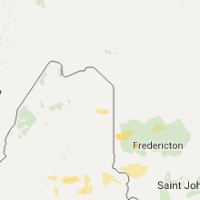
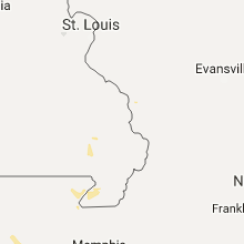
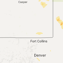
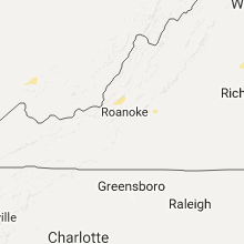
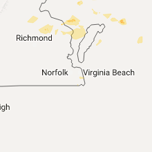
Hail Map for Thursday, July 28, 2016

Number of Impacted Households on 7/28/2016
0
Impacted by 1" or Larger Hail
0
Impacted by 1.75" or Larger Hail
0
Impacted by 2.5" or Larger Hail
Square Miles of Populated Area Impacted on 7/28/2016
0
Impacted by 1" or Larger Hail
0
Impacted by 1.75" or Larger Hail
0
Impacted by 2.5" or Larger Hail


Cities Most Affected by Hail Storms of 7/28/2016
| Hail Size | Demographics of Zip Codes Affected | ||||||
|---|---|---|---|---|---|---|---|
| City | Count | Average | Largest | Pop Density | House Value | Income | Age |
| Colorado Springs, CO | 18 | 1.99 | 2.50 | 1481 | $133k | $45.9k | 33.0 |
| Sylvia, KS | 2 | 1.88 | 2.00 | 2 | $28k | $31.5k | 47.1 |
| Cunningham, KS | 1 | 2.50 | 2.50 | 3 | $48k | $33.1k | 50.4 |
| Peyton, CO | 1 | 1.75 | 1.75 | 127 | $173k | $54.4k | 36.2 |
Hail and Wind Damage Spotted on 7/28/2016
Filter by Report Type:Hail ReportsWind Reports
States Impacted
Kansas, Nebraska, Pennsylvania, Maine, New York, Utah, Maryland, Oklahoma, Illinois, Missouri, Texas, Delaware, Virginia, Nevada, Wyoming, Arizona, Colorado, IndianaKansas
| Local Time | Report Details |
|---|---|
| 10:00 AM CDT | Observer reported that a tree fell onto a roof of a home in eri in neosho county KS, 14 miles ESE of Chanute, KS |
| 3:28 PM CDT | Storm damage reported in decatur county KS, 40.1 miles NE of Colby, KS |
| 3:41 PM CDT | Storm damage reported in cowley county KS, 40 miles SSE of Wichita, KS |
| 3:41 PM CDT | Quarter sized hail reported near Wellington, KS, 29 miles S of Wichita, KS, hail was nickel to quarter size. |
| 3:55 PM CDT | There were multiple reports of limbs and trees downed. this is a correction of the report issued at 355 pm cd in cowley county KS, 45.6 miles SSE of Wichita, KS |
| 3:56 PM CDT | Tree damage reported on the north side of tow in cowley county KS, 45.6 miles SSE of Wichita, KS |
| 4:00 PM CDT | Power line down at 3200 north summit. from ksok radio. time verified by rada in cowley county KS, 45.6 miles SSE of Wichita, KS |
| 4:06 PM CDT | Storm damage reported in norton county KS, 68.8 miles ENE of Colby, KS |
| 4:15 PM CDT | Estimated 60 mph or higher wind gusts. a grain bin in construction was blown ove in phillips county KS, 67.4 miles N of Hays, KS |
| 4:20 PM CDT | Time estimated from radar in phillips county KS, 56.6 miles NNW of Hays, KS |
| 4:26 PM CDT | Sarrada farms mesonet in loga in phillips county KS, 55.9 miles NNW of Hays, KS |
| 4:30 PM CDT | Time estimated from rada in phillips county KS, 54.9 miles N of Hays, KS |
| 4:34 PM CDT | Pea size hail in phillips county KS, 64.5 miles N of Hays, KS |
| 4:40 PM CDT | County storm spotters report several trees up to 12 inches in diameter were snapped with the storm and 1 business lost part of its roof with the storm. pea size hail wa in phillips county KS, 60.6 miles N of Hays, KS |
| 4:40 PM CDT | Storm damage reported in phillips county KS, 61 miles N of Hays, KS |
| 4:55 PM CDT | Storm damage reported in smith county KS, 64.8 miles NNE of Hays, KS |
| 4:55 PM CDT | Reports of tree branches and possibly trees down in athol. time estimated from rada in smith county KS, 65.8 miles NNE of Hays, KS |
| 5:10 PM CDT | Storm damage reported in smith county KS, 67.9 miles NNE of Hays, KS |
| 5:11 PM CDT | Storm damage reported in osborne county KS, 44.4 miles NNE of Hays, KS |
| 5:40 PM CDT | Estimated 60mph winds with some tree limbs dow in russell county KS, 29.2 miles ENE of Hays, KS |
| 5:40 PM CDT | Reported at ellsworth airport in ellsworth county KS, 60.2 miles E of Hays, KS |
| 5:43 PM CDT | Personal mesonet station. exact time estimated from radar as it occurred between 5-minute obs in mitchell county KS, 78.1 miles ENE of Hays, KS |
| 5:45 PM CDT | 6 inch diameter healthy tree branch down in beloit. report and photo via social medi in mitchell county KS, 77.6 miles ENE of Hays, KS |
| 5:47 PM CDT | This is a new peak gust associated with the back-side of the storm in smith county KS, 67.9 miles NNE of Hays, KS |
| 5:54 PM CDT | Storm damage reported in smith county KS, 67.9 miles NNE of Hays, KS |
| 6:09 PM CDT | Sustained 55 mph with gusts to 70 mph... possibly highe in cloud county KS, 70.5 miles WNW of Manhattan, KS |
| 6:12 PM CDT | Estimated 70-80 mph wind gusts. tree damage unknow in cloud county KS, 63.4 miles W of Manhattan, KS |
| 6:22 PM CDT | 18 inch diameter tree snapped and numerous 3-5 inch diameter limbs are dow in cloud county KS, 65.2 miles WNW of Manhattan, KS |
| 6:22 PM CDT | Storm damage reported in cloud county KS, 63.7 miles WNW of Manhattan, KS |
| 6:23 PM CDT | Reported at ellsworth airport...corrected for tim in ellsworth county KS, 60.2 miles E of Hays, KS |
| 6:40 PM CDT | Estimated 60mph winds in rice county KS, 67.8 miles ESE of Hays, KS |
| 6:40 PM CDT | Estimated 60mph wind in ellsworth county KS, 64.1 miles ESE of Hays, KS |
| 6:53 PM CDT | Estimated 60mph winds...corrected for tim in rice county KS, 67.8 miles ESE of Hays, KS |
| 7:12 PM CDT | Golf Ball sized hail reported near Sylvia, KS, 61.7 miles WNW of Wichita, KS |
| 7:14 PM CDT | Hen Egg sized hail reported near Sylvia, KS, 61.7 miles WNW of Wichita, KS |
| 7:19 PM CDT | Estimated 60mph wind gus in reno county KS, 61.7 miles WNW of Wichita, KS |
| 7:24 PM CDT | 2 foot diameter tree blown over. golf cart picked up and blown into a fiel in rice county KS, 53.3 miles NW of Wichita, KS |
| 7:25 PM CDT | 60 to 70 mph. pea size hail also reporte in mcpherson county KS, 52.6 miles NW of Wichita, KS |
| 7:26 PM CDT | Storm damage reported in mcpherson county KS, 50.3 miles NNW of Wichita, KS |
| 7:27 PM CDT | 50-60 mph wind gusts in geary county KS, 16.2 miles W of Manhattan, KS |
| 7:30 PM CDT | Storm damage reported in geary county KS, 18.1 miles SW of Manhattan, KS |
| 7:35 PM CDT | Storm damage reported in reno county KS, 41 miles NW of Wichita, KS |
| 7:42 PM CDT | Estimated 60mph wind in reno county KS, 39.2 miles NW of Wichita, KS |
| 7:55 PM CDT | Tennis Ball sized hail reported near Cunningham, KS, 53 miles W of Wichita, KS, ping pong to tennis ball hail. |
| 8:04 PM CDT | 65 to 70 mp in sedgwick county KS, 21.8 miles NW of Wichita, KS |
| 8:05 PM CDT | Storm damage reported in sedgwick county KS, 21.8 miles NW of Wichita, KS |
| 8:05 PM CDT | Storm damage reported in sedgwick county KS, 21.8 miles NW of Wichita, KS |
| 8:10 PM CDT | Several large limbs down across tow in sedgwick county KS, 21.8 miles NW of Wichita, KS |
| 8:15 PM CDT | Several large branches down across town. trees twisted and split. estimated 85 mph winds. delayed repor in sedgwick county KS, 21.8 miles NW of Wichita, KS |
| 8:19 PM CDT | Storm damage reported in sedgwick county KS, 21.8 miles NW of Wichita, KS |
| 8:20 PM CDT | Storm damage reported in sedgwick county KS, 8.9 miles NW of Wichita, KS |
| 8:20 PM CDT | Large tree blown down. via twitte in sedgwick county KS, 13.6 miles NW of Wichita, KS |
| 8:23 PM CDT | Storm damage reported in sedgwick county KS, 6 miles WSW of Wichita, KS |
| 8:24 PM CDT | 75-80 mph winds between tyler and maize road on 21st stree in sedgwick county KS, 7.2 miles WNW of Wichita, KS |
| 8:28 PM CDT | Near 119th and 21s in sedgwick county KS, 8.2 miles WNW of Wichita, KS |
| 8:28 PM CDT | Storm damage reported in sedgwick county KS, 17.6 miles WNW of Wichita, KS |
| 8:28 PM CDT | Large tree limbs down near 21st and tyler. report via twitte in sedgwick county KS, 6.9 miles W of Wichita, KS |
| 8:30 PM CDT | Storm damage reported in kingman county KS, 31 miles WSW of Wichita, KS |
| 8:32 PM CDT | Half a bradford pear tree broken of in sedgwick county KS, 7.2 miles WNW of Wichita, KS |
| 8:34 PM CDT | 50 to 60 mph wind in kingman county KS, 53.6 miles WSW of Wichita, KS |
| 8:41 PM CDT | Power pole snappe in kingman county KS, 53.6 miles WSW of Wichita, KS |
| 8:43 PM CDT | Storm damage reported in sedgwick county KS, 4.4 miles ENE of Wichita, KS |
| 8:56 PM CDT | 1 to 2 inch diameter limbs down. estimates 50 mph wind gus in wabaunsee county KS, 34.9 miles ESE of Manhattan, KS |
| 9:08 PM CDT | Storm damage reported in butler county KS, 27.9 miles ENE of Wichita, KS |
Nebraska
| Local Time | Report Details |
|---|---|
| 9:07 AM MDT | Half Dollar sized hail reported near Scottsbluff, NE, 8.2 miles N of Scottsbluff, NE |
| 9:41 AM MDT | Half Dollar sized hail reported near Bayard, NE, 16.5 miles ESE of Scottsbluff, NE |
| 9:43 AM MDT | Ping Pong Ball sized hail reported near Bayard, NE, 17.4 miles ESE of Scottsbluff, NE |
| 9:50 AM MDT | Quarter sized hail reported near Bayard, NE, 19.1 miles ESE of Scottsbluff, NE, reported via facebook post. |
| 9:53 AM MDT | Quarter sized hail reported near Bayard, NE, 23.8 miles ESE of Scottsbluff, NE |
| 12:46 PM MDT | Quarter sized hail reported near Champion, NE, 53 miles ENE of Yuma, CO, hail covered the road and the largest was quarter size. |
| 3:06 PM CDT | Storm damage reported in red willow county NE, 59.8 miles NNE of Colby, KS |
| 9:31 PM CDT | Ping Pong Ball sized hail reported near Sargent, NE, 71.7 miles SW of Oneill, NE, pea to ping pong ball size hail. |
Pennsylvania
| Local Time | Report Details |
|---|---|
| 1:05 PM EDT | Report of trees and power lines down in the township in chester county PA, 65.9 miles NE of Baltimore, MD |
| 1:05 PM EDT | Tree and wires down on car on stargazers rd in chester county PA, 64.9 miles NE of Baltimore, MD |
Maine
| Local Time | Report Details |
|---|---|
| 2:20 PM EDT | A number of trees down along route in penobscot county ME, 45.2 miles NNE of Bangor, ME |
| 2:20 PM EDT | A number of trees down along route in penobscot county ME, 45.2 miles NNE of Bangor, ME |
| 2:20 PM EDT | Quarter sized hail reported near Lee, ME, 45.2 miles NNE of Bangor, ME |
| 2:20 PM EDT | Ping Pong Ball sized hail reported near Lee, ME, 45.2 miles NNE of Bangor, ME |
| 2:25 PM EDT | 4 trees down along mile marker 238 on interstate 9 in penobscot county ME, 57 miles NNE of Bangor, ME |
| 2:40 PM EDT | Multiple trees down in town. time estimated from the rada in penobscot county ME, 52.9 miles NNE of Bangor, ME |
| 2:40 PM EDT | Trees down on curtis farm roa in penobscot county ME, 40.6 miles NNE of Bangor, ME |
| 2:40 PM EDT | Multiple trees down along route 16 in penobscot county ME, 51.4 miles NNE of Bangor, ME |
| 2:50 PM EDT | Trees down on curtis farm road. time estimated from the rada in penobscot county ME, 40.6 miles NNE of Bangor, ME |
| 3:02 PM EDT | 5 trees down along route 163 near haystack mountain blocking the roa in aroostook county ME, 13.4 miles SSW of Caribou, ME |
| 3:10 PM EDT | Trees down at umpi. time estimated from the rada in aroostook county ME, 12.4 miles S of Caribou, ME |
| 3:20 PM EDT | Quarter sized hail reported near Presque Isle, ME, 12.4 miles S of Caribou, ME |
| 3:23 PM EDT | Ping Pong Ball sized hail reported near Easton, ME, 15.9 miles SSE of Caribou, ME |
| 3:45 PM EDT | Tree down in middle of dunn roa in kennebec county ME, 57.6 miles WSW of Bangor, ME |
| 3:49 PM EDT | Tree down on power lines oakland roa in kennebec county ME, 57.6 miles WSW of Bangor, ME |
| 3:55 PM EDT | 2 trees down on west road in kennebec county ME, 58.8 miles WSW of Bangor, ME |
| 4:00 PM EDT | Tree down near dennis court in kennebec county ME, 46.5 miles WSW of Bangor, ME |
| 4:15 PM EDT | Large tree down. time estimated from radar. delayed repor in kennebec county ME, 50.7 miles WSW of Bangor, ME |
| 4:15 PM EDT | Tree on wires and telephone poles down on west river road. time estimated from radar. delayed repor in kennebec county ME, 52.2 miles WSW of Bangor, ME |
New York
| Local Time | Report Details |
|---|---|
| 2:25 PM EDT | 1 tree down at intersection of rte 8 and 28 in warren county NY, 53.2 miles N of Schenectady, NY |
Utah
| Local Time | Report Details |
|---|---|
| 1:57 PM MDT | Dry microburst at telegraph flat raws in kane county UT, 87 miles E of Saint George, UT |
| 3:03 PM MDT | Dry microburst at enterprise raws in washington county UT, 32.5 miles NNW of Saint George, UT |
| 4:45 PM MDT | Dry microburst in washington county UT, 5.7 miles SE of Saint George, UT |
Maryland
| Local Time | Report Details |
|---|---|
| 4:30 PM EDT | Storm damage reported in anz531 county MD, 20.1 miles ESE of Baltimore, MD |
| 4:40 PM EDT | Storm damage reported in kent county MD, 20.4 miles ESE of Baltimore, MD |
Oklahoma
| Local Time | Report Details |
|---|---|
| 3:40 PM CDT | Storm damage reported in garfield county OK, 65.4 miles N of Oklahoma City, OK |
| 4:01 PM CDT | Near zero visibility in blowing dus in garfield county OK, 55 miles N of Oklahoma City, OK |
| 4:05 PM CDT | Storm damage reported in kay county OK, 51.1 miles SSE of Wichita, KS |
| 4:25 PM CDT | Storm damage reported in logan county OK, 43.5 miles N of Oklahoma City, OK |
| 5:26 PM CDT | Quarter sized hail reported near Tulsa, OK, 4.3 miles ESE of Tulsa, OK, 29th and peoria |
| 5:50 PM CDT | Power lines down at woodland hills mal in tulsa county OK, 4.3 miles ESE of Tulsa, OK |
| 6:50 PM CDT | Storm damage reported in caddo county OK, 54.1 miles W of Oklahoma City, OK |
| 4:50 AM CDT | Storm damage reported in garfield county OK, 65.4 miles N of Oklahoma City, OK |
| 6:23 AM CDT | Storm damage reported in oklahoma county OK, 12.5 miles N of Oklahoma City, OK |
Illinois
| Local Time | Report Details |
|---|---|
| 3:55 PM CDT | Intense heavy rain. thunder and lightning. extensive lowland and street floodin in kane county IL, 43.2 miles W of Chicago, IL |
| 8:05 PM CDT | Estimated 50 - 60 mph winds. evansville se sid in randolph county IL, 39.9 miles SSE of Saint Louis, MO |
Missouri
| Local Time | Report Details |
|---|---|
| 3:59 PM CDT | Sheriffs department reporting both lanes of state route 51...6 miles north of broseley...blocked by trees blown down in butler county MO, 52.3 miles SW of Cape Girardeau, MO |
Texas
| Local Time | Report Details |
|---|---|
| 4:25 PM CDT | Numerous trees dow in sabine county TX, 51.9 miles E of Lufkin, TX |
| 5:15 PM CDT | 60 mph wind gust reported in sagina in tarrant county TX, 34 miles W of Dallas, TX |
| 5:22 PM CDT | Spotter reports 60 mph wind gust as well as 3 inch diameter tree limbs dow in tarrant county TX, 34 miles W of Dallas, TX |
| 6:06 PM CDT | Storm damage reported in nolan county TX, 46.6 miles W of Abilene, TX |
Delaware
| Local Time | Report Details |
|---|---|
| 5:26 PM EDT | Storm damage reported in kent county DE, 58.7 miles NNW of Ocean City, MD |
Virginia
| Local Time | Report Details |
|---|---|
| 5:30 PM EDT | One tree down on turnpike road in rockbridge county VA, 40.6 miles NNE of Roanoke, VA |
| 5:50 PM EDT | One large tree branch down along walker street in lexington in city of lexington county VA, 44.6 miles NE of Roanoke, VA |
| 5:50 PM EDT | One tree down on overhill drive in city of lexington county VA, 44.2 miles NE of Roanoke, VA |
| 6:11 PM EDT | Tree blown down into garage. via social medi in bedford county VA, 35.3 miles ENE of Roanoke, VA |
| 6:25 PM EDT | Tree fell across powerline and partially blocked 3245 forrest brook roa in city of lynchburg county VA, 41.3 miles ENE of Roanoke, VA |
| 6:26 PM EDT | One tree down near the intersection of park avenue and fort avenue in city of lynchburg county VA, 44 miles ENE of Roanoke, VA |
| 6:40 PM EDT | Several trees blown down near 2018 riverville road in amherst county VA, 59.8 miles ENE of Roanoke, VA |
| 6:42 PM EDT | Tree blown down near 270 riverville roa in amherst county VA, 57.3 miles ENE of Roanoke, VA |
| 7:40 PM EDT | Tree down on power lin in lancaster county VA, 67.2 miles NNW of Virginia Beach, VA |
| 7:55 PM EDT | Storm damage reported in anz543 county VA, 50.1 miles WSW of Ocean City, MD |
| 8:35 PM EDT | Numerous trees and power lines down around the parksley area. in accomack county VA, 49.5 miles SW of Ocean City, MD |
| 8:37 PM EDT | Tree down at intersection of coonskin hollow road and wolf creek roa in giles county VA, 50.2 miles W of Roanoke, VA |
| 8:52 PM EDT | Tree down along route 10 in giles county VA, 44.1 miles W of Roanoke, VA |
| 10:31 PM EDT | One tree down on white house road near moneta in bedford county VA, 18.8 miles ESE of Roanoke, VA |
| 10:35 PM EDT | One tree down at the intersection of feldspar road and morgans church road in bedford county VA, 20.1 miles ESE of Roanoke, VA |
| 10:45 PM EDT | One tree down on route 460 next to johnson school road in bedford county VA, 17.9 miles ENE of Roanoke, VA |
| 11:01 PM EDT | One tree down near 3100 lizard ridge road in bedford county VA, 27.4 miles ENE of Roanoke, VA |
| 11:06 PM EDT | One tree down on route 501 north near the graves mill exit in city of lynchburg county VA, 40.4 miles E of Roanoke, VA |
Nevada
| Local Time | Report Details |
|---|---|
| 3:10 PM PDT | An automated weather sensor in alamo reported a wind gust from a thunderstorm of 76 mph. there was also a report of a small tree down near the intersection of highway 9 in lincoln county NV, 81.9 miles N of Las Vegas, NV |
Wyoming
| Local Time | Report Details |
|---|---|
| 5:00 PM MDT | Ping Pong Ball sized hail reported near Cheyenne, WY, 27.6 miles ESE of Laramie, WY |
| 5:15 PM MDT | Quarter sized hail reported near Cheyenne, WY, 42.1 miles E of Laramie, WY, hail was slightly larger than quarters but less than half dollar size. reported on horse creek road. |
| 5:15 PM MDT | Half Dollar sized hail reported near Cheyenne, WY, 39.7 miles E of Laramie, WY |
Arizona
| Local Time | Report Details |
|---|---|
| 4:16 PM MST | Ping Pong Ball sized hail reported near Prescott, AZ, 64.7 miles SW of Flagstaff, AZ, pictures from trained spotter via social media showing 1.5 inch hail. |
Colorado
| Local Time | Report Details |
|---|---|
| 6:05 PM MDT | Quarter sized hail reported near Colorado Springs, CO, 36.9 miles NNW of Pueblo, CO, . |
| 6:10 PM MDT | Half Dollar sized hail reported near Colorado Springs, CO, 44 miles NNW of Pueblo, CO, . |
| 6:15 PM MDT | Ping Pong Ball sized hail reported near Colorado Springs, CO, 36.5 miles NNW of Pueblo, CO, . |
| 6:21 PM MDT | Quarter sized hail reported near Colorado Springs, CO, 37.8 miles NNW of Pueblo, CO, . |
| 6:24 PM MDT | Half Dollar sized hail reported near Colorado Springs, CO, 38.1 miles NNW of Pueblo, CO, . |
| 6:25 PM MDT | Ping Pong Ball sized hail reported near Colorado Springs, CO, 38.7 miles NNW of Pueblo, CO, . |
| 6:34 PM MDT | Ping Pong Ball sized hail reported near Colorado Springs, CO, 35.3 miles NNW of Pueblo, CO, . |
| 6:34 PM MDT | Golf Ball sized hail reported near Colorado Springs, CO, 35.3 miles NNW of Pueblo, CO, . |
| 6:43 PM MDT | Ping Pong Ball sized hail reported near Colorado Springs, CO, 34.2 miles NNW of Pueblo, CO, . |
| 6:43 PM MDT | Golf Ball sized hail reported near Colorado Springs, CO, 34.1 miles N of Pueblo, CO, quarter to golf ball size hail. . |
| 6:44 PM MDT | Golf Ball sized hail reported near Colorado Springs, CO, 36.8 miles N of Pueblo, CO, . |
| 7:15 PM MDT | Hen Egg sized hail reported near Colorado Springs, CO, 38 miles NNW of Pueblo, CO, . |
| 7:41 PM MDT | Quarter sized hail reported near Ordway, CO, 49.5 miles ENE of Pueblo, CO |
| 8:27 PM MDT | Asos station la junta airport /lhx in otero county CO, 61.8 miles ESE of Pueblo, CO |
| 9:07 PM MDT | Quarter sized hail reported near Golden, CO, 11.6 miles W of Denver, CO |
| 9:07 PM MDT | Half Dollar sized hail reported near Denver, CO, 6.9 miles WSW of Denver, CO |
| 9:07 PM MDT | Ping Pong Ball sized hail reported near Golden, CO, 11.8 miles W of Denver, CO |
| 9:22 PM MDT | Quarter sized hail reported near Colorado Springs, CO, 44.6 miles N of Pueblo, CO, . |
| 9:25 PM MDT | Half Dollar sized hail reported near Denver, CO, 6.9 miles WSW of Denver, CO |
| 9:30 PM MDT | Ping Pong Ball sized hail reported near Denver, CO, 7.5 miles WSW of Denver, CO |
| 9:34 PM MDT | Quarter sized hail reported near Colorado Springs, CO, 36.7 miles N of Pueblo, CO, . |
| 9:40 PM MDT | Ping Pong Ball sized hail reported near Littleton, CO, 10.8 miles SSW of Denver, CO |
| 9:41 PM MDT | Half Dollar sized hail reported near Littleton, CO, 10.4 miles S of Denver, CO |
| 9:52 PM MDT | Quarter sized hail reported near Colorado Springs, CO, 41.3 miles N of Pueblo, CO, . |
| 9:53 PM MDT | Ping Pong Ball sized hail reported near Colorado Springs, CO, 43.7 miles N of Pueblo, CO, . |
| 9:57 PM MDT | Ping Pong Ball sized hail reported near Colorado Springs, CO, 40.8 miles N of Pueblo, CO, . |
| 9:59 PM MDT | Ping Pong Ball sized hail reported near Colorado Springs, CO, 49.8 miles N of Pueblo, CO, . |
| 10:00 PM MDT | Golf Ball sized hail reported near Colorado Springs, CO, 41.4 miles N of Pueblo, CO, . |
| 10:00 PM MDT | Golf Ball sized hail reported near Colorado Springs, CO, 48.3 miles N of Pueblo, CO, . |
| 10:03 PM MDT | Tennis Ball sized hail reported near Colorado Springs, CO, 37.3 miles N of Pueblo, CO, 2.25 inch hail reported by kcos. . |
| 10:04 PM MDT | Golf Ball sized hail reported near Colorado Springs, CO, 42.1 miles N of Pueblo, CO, . |
| 10:05 PM MDT | Hen Egg sized hail reported near Colorado Springs, CO, 42 miles N of Pueblo, CO, . |
| 10:06 PM MDT | Half Dollar sized hail reported near Colorado Springs, CO, 42.1 miles N of Pueblo, CO, . |
| 10:06 PM MDT | Golf Ball sized hail reported near Colorado Springs, CO, 42.1 miles N of Pueblo, CO, . |
| 10:11 PM MDT | Ping Pong Ball sized hail reported near Colorado Springs, CO, 47.8 miles N of Pueblo, CO, . |
| 10:13 PM MDT | Hen Egg sized hail reported near Colorado Springs, CO, 44.3 miles N of Pueblo, CO, measured 2.0"... but some stones could be larger. . |
| 10:15 PM MDT | Hen Egg sized hail reported near Colorado Springs, CO, 40.7 miles N of Pueblo, CO, . |
| 10:15 PM MDT | Hen Egg sized hail reported near Colorado Springs, CO, 42.9 miles N of Pueblo, CO, . |
| 10:15 PM MDT | Hen Egg sized hail reported near Colorado Springs, CO, 44.8 miles N of Pueblo, CO, . |
| 10:18 PM MDT | Ping Pong Ball sized hail reported near Colorado Springs, CO, 43.1 miles N of Pueblo, CO, hail ranging from 1.25" to 1.5". . |
| 10:21 PM MDT | Tennis Ball sized hail reported near Colorado Springs, CO, 37.3 miles N of Pueblo, CO, 2.5" hail measured by kcos observer. . |
| 10:23 PM MDT | Hen Egg sized hail reported near Colorado Springs, CO, 44.8 miles N of Pueblo, CO, . |
| 10:23 PM MDT | Quarter sized hail reported near Colorado Springs, CO, 40.6 miles N of Pueblo, CO, . |
| 10:28 PM MDT | Hen Egg sized hail reported near Colorado Springs, CO, 44.8 miles N of Pueblo, CO, . |
| 10:35 PM MDT | Tennis Ball sized hail reported near Colorado Springs, CO, 45.4 miles N of Pueblo, CO, . |
| 10:35 PM MDT | Half Dollar sized hail reported near Colorado Springs, CO, 51.5 miles N of Pueblo, CO, . |
| 10:35 PM MDT | Half Dollar sized hail reported near Colorado Springs, CO, 44.4 miles N of Pueblo, CO, . |
| 10:51 PM MDT | Quarter sized hail reported near Peyton, CO, 46 miles N of Pueblo, CO, . |
| 10:54 PM MDT | Golf Ball sized hail reported near Peyton, CO, 44.6 miles N of Pueblo, CO, . |
| 10:58 PM MDT | Half Dollar sized hail reported near Peyton, CO, 45.9 miles N of Pueblo, CO, . |
| 11:17 PM MDT | Ping Pong Ball sized hail reported near Elbert, CO, 50.8 miles SSE of Denver, CO, lasted until 1117 pm. |
| 11:37 PM MDT | Quarter sized hail reported near Peyton, CO, 54.2 miles N of Pueblo, CO, . |
Indiana
| Local Time | Report Details |
|---|---|
| 8:05 PM CDT | Estimated 50 - 60 mph winds. evansville se sid in vanderburgh county IN, 1.3 miles E of Evansville, IN |
Connect with Interactive Hail Maps