Hail Map for Friday, June 7, 2019

Number of Impacted Households on 6/7/2019
0
Impacted by 1" or Larger Hail
0
Impacted by 1.75" or Larger Hail
0
Impacted by 2.5" or Larger Hail
Square Miles of Populated Area Impacted on 6/7/2019
0
Impacted by 1" or Larger Hail
0
Impacted by 1.75" or Larger Hail
0
Impacted by 2.5" or Larger Hail
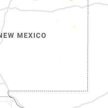
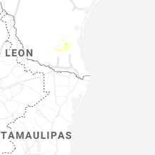
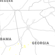
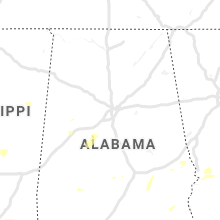
Regions Impacted by Hail on 6/7/2019
Cities Most Affected by Hail Storms of 6/7/2019
| Hail Size | Demographics of Zip Codes Affected | ||||||
|---|---|---|---|---|---|---|---|
| City | Count | Average | Largest | Pop Density | House Value | Income | Age |
| Broadus, MT | 1 | 1.75 | 1.75 | 0 | $58k | $27.8k | 49.9 |
Hail and Wind Damage Spotted on 6/7/2019
Filter by Report Type:Hail ReportsWind Reports
States Impacted
Mississippi, Alabama, Georgia, Florida, Nebraska, South Carolina, Colorado, Texas, Tennessee, Montana, South Dakota, North Dakota, New Mexico, MinnesotaMississippi
| Local Time | Report Details |
|---|---|
| 7:15 AM CDT | Three trees were blown down along st. john roa in simpson county MS, 26.3 miles SE of Jackson, MS |
| 8:09 AM CDT | Tree down along hwy 50 in smith county MS, 46.6 miles E of Jackson, MS |
| 9:20 AM CDT | A tree fell on a power line and broke the pole along valley roa in lauderdale county MS, 81.1 miles S of Starkville, MS |
| 9:35 AM CDT | A tree fell onto a power line in the vimville communit in lauderdale county MS, 77.9 miles WNW of Camden, AL |
| 2:24 PM CDT | Trees down on forest grove rd and greenwood chapel r in leake county MS, 40.5 miles NE of Jackson, MS |
| 3:00 PM CDT | Several snapped pines... laying generally in the same directio in covington county MS, 72.3 miles SE of Jackson, MS |
| 3:03 PM CDT | Multiple trees down on riels rd and on shellie r in jones county MS, 73.1 miles SE of Jackson, MS |
| 3:27 PM CDT | Several trees down along old highway 2 in greene county MS, 46.5 miles NW of Mobile, AL |
| 3:32 PM CDT | Several trees down on power lines along old augusta rd. pea sized hail also reporte in perry county MS, 70 miles WNW of Mobile, AL |
| 4:32 PM CDT | Knm in lauderdale county MS, 64.9 miles SSE of Starkville, MS |
| 4:36 PM CDT | Quarter sized hail reported near Leakesville, MS, 44.4 miles NW of Mobile, AL, emergency management reports quarter sized hail in leakesville. |
| 4:36 PM CDT | Ping Pong Ball sized hail reported near Leakesville, MS, 44 miles NW of Mobile, AL, picture of ping pong sized hail in leakesville. report via social media. |
| 4:51 PM CDT | Several trees down throughout the city of columbus... including 4 down on house in lowndes county MS, 22.9 miles E of Starkville, MS |
Alabama
| Local Time | Report Details |
|---|---|
| 12:36 PM CDT | Measured wind gust of 59 mph at dannelly fiel in montgomery county AL, 56.9 miles ENE of Camden, AL |
| 12:48 PM CDT | Two trees down on coosada parkway in coosada. time estimated from rada in elmore county AL, 50.1 miles W of Auburn, AL |
| 12:50 PM CDT | Many large trees uprooted or snapped across the east montgomery metro area... between dannelly field and the hwy 231 corridor. locations include the alabama state univ in montgomery county AL, 48.1 miles WSW of Auburn, AL |
| 12:56 PM CDT | Tree down on a home. time estimated from rada in lee county AL, 3.6 miles E of Auburn, AL |
| 1:10 PM CDT | Camper at maeher state park blown ove in baldwin county AL, 7.4 miles E of Mobile, AL |
| 1:26 PM CDT | Tree down at hwy 49 and hwy 14. winds estimated at 40mp in tallapoosa county AL, 20 miles W of Auburn, AL |
| 1:55 PM CDT | Multiple trees down on lee road 29. time estimated from rada in lee county AL, 7.6 miles SSE of Auburn, AL |
| 1:56 PM CDT | Corrects time on previous tstm wnd dmg report from 1 sse robert g. pitts airport. tree down on a home. time estimated from rada in lee county AL, 3.6 miles E of Auburn, AL |
| 2:07 PM CDT | Multiple trees down at hwy 169 and hwy 175. time estimated from rada in lee county AL, 14.8 miles ESE of Auburn, AL |
| 2:18 PM CDT | Trees down in beulah. time estimated from rada in lee county AL, 19 miles ENE of Auburn, AL |
| 2:21 PM CDT | Multiple trees down in smiths station. time estimated from rada in lee county AL, 23.3 miles ESE of Auburn, AL |
| 5:00 PM CDT | One large tree was blown down along cr 12. winds were estimated around 50 mp in sumter county AL, 67.3 miles NW of Camden, AL |
| 5:21 PM CDT | Broadcast media reports some trees down in mcintosh. report via social medi in washington county AL, 40.2 miles N of Mobile, AL |
| 7:01 PM CDT | Twitter report indicates a few trees were blown down and a trampoline destroyed in northport. winds were estimated around 50 mp in tuscaloosa county AL, 48.2 miles WSW of Birmingham, AL |
Georgia
| Local Time | Report Details |
|---|---|
| 3:00 PM EDT | A tree was reported down on trammel road a mile down from buford highwa in forsyth county GA, 31.5 miles NNE of Atlanta, GA |
| 3:24 PM EDT | A tree was reported down near the intersection of francis road and clark driv in forsyth county GA, 28 miles NNE of Atlanta, GA |
| 3:36 PM EDT | A tree was reported down on a car on 41st street and 16th avenu in muscogee county GA, 30.8 miles ESE of Auburn, AL |
| 3:36 PM EDT | A tree was reported down on sightseeing road near bernheim dental clini in chattahoochee county GA, 34.3 miles ESE of Auburn, AL |
| 3:36 PM EDT | A tree was reported down on j.r. allen parkway near exit in muscogee county GA, 36 miles E of Auburn, AL |
| 3:36 PM EDT | A tree was reported down on highway 315 at exit 1 in harris county GA, 29.5 miles E of Auburn, AL |
| 3:42 PM EDT | A tree and power lines were reported down on long island drive near burdette roa in fulton county GA, 10.5 miles N of Atlanta, GA |
| 3:54 PM EDT | A tree was reported down near the intersection of fields pond overlook and mockingbird roa in forsyth county GA, 39.9 miles NNE of Atlanta, GA |
| 4:00 PM EDT | A tree was reported down on dr. brooks roa in marion county GA, 53 miles E of Auburn, AL |
| 4:02 PM EDT | A tree was reported down on juniper mill pond roa in talbot county GA, 52.2 miles E of Auburn, AL |
| 4:16 PM EDT | A power line was reported down on deerfield circl in schley county GA, 72.7 miles ESE of Auburn, AL |
| 4:18 PM EDT | Power lines were reported down on north thompson stree in schley county GA, 73 miles ESE of Auburn, AL |
| 4:18 PM EDT | Wind damage occured in the north eastern part of taylor county along hwy 12 in taylor county GA, 80 miles E of Auburn, AL |
| 4:20 PM EDT | A tree was reported down near the intersection of roberta highway and fickling mill roa in taylor county GA, 76 miles E of Auburn, AL |
| 4:40 PM EDT | A tree was reported down on dabney avenu in crawford county GA, 74.4 miles SSE of Atlanta, GA |
| 4:40 PM EDT | A tree was reported down on winifred stree in crawford county GA, 74.4 miles SSE of Atlanta, GA |
| 4:41 PM EDT | A tree was reported down on hopewell road near highway 34 in crawford county GA, 69.4 miles SSE of Atlanta, GA |
| 4:42 PM EDT | A tree was reported down on river road just off of highway 9 in crawford county GA, 86.3 miles SSE of Atlanta, GA |
| 4:42 PM EDT | A tree was reported down on a house damaging the home in addition to the car in the carpor in macon county GA, 87.8 miles ESE of Auburn, AL |
| 4:42 PM EDT | A tree was reported down near the intersection of clifton bradley drive and anna driv in macon county GA, 85.9 miles ESE of Auburn, AL |
| 4:48 PM EDT | A tree was reported down near the intersection of clements road and pool gin house roa in sumter county GA, 78.9 miles WNW of Douglas, GA |
| 4:50 PM EDT | Trees reported down at 218 sewell rd in elko houston county g in houston county GA, 78.9 miles NW of Douglas, GA |
| 4:54 PM EDT | A tree was reported down on rock quarry road just at the county lin in upson county GA, 59 miles SSE of Atlanta, GA |
| 4:55 PM EDT | A tree was reported down in the 1000 block of edge roa in monroe county GA, 60.7 miles SSE of Atlanta, GA |
| 4:58 PM EDT | A tree was reported down on eastwood driv in crawford county GA, 79.8 miles SSE of Atlanta, GA |
| 4:58 PM EDT | Power lines reported down at the 1400 block of sam nunn blv in houston county GA, 84.5 miles NW of Douglas, GA |
| 5:00 PM EDT | A tree was reported down along highway 83 at parker chapel churc in monroe county GA, 60.2 miles SSE of Atlanta, GA |
| 5:06 PM EDT | A tree was reported down on highway 18 just before highway 8 in monroe county GA, 62.4 miles SE of Atlanta, GA |
| 5:06 PM EDT | Two trees were reported down along estes roa in monroe county GA, 66.6 miles SSE of Atlanta, GA |
| 5:09 PM EDT | Power lines reported down at the intersection of brantley rd and houston lake r in houston county GA, 86.5 miles SSE of Atlanta, GA |
| 5:10 PM EDT | Several trees reported down near the intersection of kovac rd and s highway 24 in houston county GA, 76.8 miles NNW of Douglas, GA |
| 5:10 PM EDT | A tree was reported down on interstate 75 sb near the highfalls road exi in monroe county GA, 45.3 miles SSE of Atlanta, GA |
| 5:11 PM EDT | Tree reported down near the 200 block of sewell r in houston county GA, 78.4 miles NW of Douglas, GA |
| 5:12 PM EDT | A tree was reported down in the 200 block of alexandria driv in bibb county GA, 72 miles SE of Atlanta, GA |
| 5:12 PM EDT | A tree was reported down on 41 south near new providence baptist churc in monroe county GA, 60 miles SSE of Atlanta, GA |
| 5:12 PM EDT | A tree was reported down on a house in the 400 block of kingsbury circl in houston county GA, 89.4 miles SSE of Atlanta, GA |
| 5:12 PM EDT | A tree was reported down on new forsyth roa in monroe county GA, 66.7 miles SE of Atlanta, GA |
| 5:12 PM EDT | A tree was reported down near the intersection of highway 18 and highway 4 in monroe county GA, 56.5 miles SSE of Atlanta, GA |
| 5:14 PM EDT | Trees reported down on apartment buildings at the 100 block of tanya p in houston county GA, 88.8 miles SSE of Atlanta, GA |
| 5:14 PM EDT | Trees down across the road in pinehurst g in dooly county GA, 71.8 miles NW of Douglas, GA |
| 5:15 PM EDT | A tree was reported down near the intersection of treyburne way and north mumford roa in bibb county GA, 72.5 miles SSE of Atlanta, GA |
| 6:18 PM EDT | A tree was reported down near the intersection of upper river road and woodland driv in bibb county GA, 74.3 miles SE of Atlanta, GA |
| 6:40 PM EDT | Trees down near the bypass of hwy 57 and hwy in emanuel county GA, 68.7 miles SSW of Augusta, GA |
| 6:40 PM EDT | Trees down off of hwy 57 near stillmor in emanuel county GA, 71.6 miles WNW of Savannah, GA |
Florida
| Local Time | Report Details |
|---|---|
| 2:19 PM CDT | Reported several trees down at inez circle walton county f in walton county FL, 13.4 miles NE of Miramar Beach, FL |
Nebraska
| Local Time | Report Details |
|---|---|
| 2:10 PM MDT | Quarter sized hail reported near , , 0.2 miles SE of Scottsbluff, NE, hail falling for several minutes with almost a full layer of accumulation on the ground. |
| 2:15 PM MDT | Quarter sized hail reported near Scottsbluff, NE, 0.4 miles WSW of Scottsbluff, NE, hail falling for just over 5 minutes. |
| 2:21 PM MDT | Quarter sized hail reported near , , 1 miles WNW of Scottsbluff, NE |
| 2:30 PM MDT | Ping Pong Ball sized hail reported near Scottsbluff, NE, 2.3 miles NNE of Scottsbluff, NE, hail measured at the corner of cr j and sugar factory road. |
| 2:33 PM MDT | Half Dollar sized hail reported near Scottsbluff, NE, 0.4 miles WSW of Scottsbluff, NE, hail up to the size of half dollar measured with ruler. image forwarded from scottsbluff pd. |
| 4:09 PM MDT | Half Dollar sized hail reported near Minatare, NE, 10.8 miles ENE of Scottsbluff, NE, hail falling for a few minutes. |
South Carolina
| Local Time | Report Details |
|---|---|
| 4:27 PM EDT | A tree was reported to have fallen across two lanes on william hilton parkway and shipyard driv in beaufort county SC, 20.7 miles ENE of Savannah, GA |
| 6:15 PM EDT | Schp reported tree in roadway at zenker and wildlife roads. time estimated by rada in lexington county SC, 52.9 miles NE of Augusta, GA |
| 6:18 PM EDT | Multiple trees down along muddy springs road at robbie road and cool springs road. time estimated by rada in lexington county SC, 50.3 miles NE of Augusta, GA |
| 6:18 PM EDT | Schp reported trees in roadway industrial drive and porsche drive. time estimated by rada in lexington county SC, 53.8 miles NE of Augusta, GA |
| 6:18 PM EDT | Schp reported multiple trees down on zenker road... industrial drive and porsche drive. time estimated by rada in lexington county SC, 53.3 miles NE of Augusta, GA |
| 6:24 PM EDT | Schp reported a tree down on i-20 at mile marker 60 eb. time estimated by rada in lexington county SC, 56.9 miles NE of Augusta, GA |
| 6:54 PM EDT | Richland county sheriff reports trees down on power lines at buchanan and beltline. time estimated by rada in richland county SC, 68 miles ENE of Augusta, GA |
| 7:30 PM EDT | Corrects previous tstm wnd dmg report from 9 n eastover. schp reported a tree down on a roadway on us601 and leesburg road in lexington count in richland county SC, 69 miles NW of Charleston, SC |
| 7:48 PM EDT | Schp reported a tree down on a roadway on us601 and leesburg road in lexington count in richland county SC, 69 miles NW of Charleston, SC |
Colorado
| Local Time | Report Details |
|---|---|
| 2:32 PM MDT | Quarter sized hail reported near U S A F Academy, CO, 51.7 miles S of Denver, CO, one-inch hail reported at falcon stadium on usafa campus. |
| 3:44 PM MDT | Half Dollar sized hail reported near New Raymer, CO, 69.5 miles WNW of Yuma, CO |
| 3:45 PM MDT | Quarter sized hail reported near New Raymer, CO, 68 miles WNW of Yuma, CO |
| 3:48 PM MDT | Quarter sized hail reported near Fort Morgan, CO, 67.1 miles WNW of Yuma, CO, estimated 50 mph wind gusts. |
| 6:10 PM MDT | Half Dollar sized hail reported near Limon, CO, 72.9 miles SW of Yuma, CO |
| 7:25 PM MDT | Quarter sized hail reported near Limon, CO, 78.3 miles NE of Pueblo, CO |
| 7:38 PM MDT | Asos station kako akro in washington county CO, 26.6 miles W of Yuma, CO |
Texas
| Local Time | Report Details |
|---|---|
| 4:08 PM CDT | Storm damage reported in hidalgo county TX, 67.9 miles NW of Brownsville, TX |
| 4:12 PM CDT | Mccook co-op observer reported downed power lines 4 miles southeast of the town of mccoo in hidalgo county TX, 64.3 miles NW of Brownsville, TX |
Tennessee
| Local Time | Report Details |
|---|---|
| 6:45 PM EDT | Few tree limbs... trees... and power lines down near cosby... tennesse in cocke county TN, 40 miles ESE of Knoxville, TN |
| 8:44 PM EDT | Several trees dow in campbell county TN, 30.4 miles NNW of Knoxville, TN |
Montana
| Local Time | Report Details |
|---|---|
| 5:24 PM MDT | Half Dollar sized hail reported near Broadus, MT, 68.6 miles N of Gillette, WY, highway 59 mm18 |
| 5:25 PM MDT | Golf Ball sized hail reported near Broadus, MT, 68 miles N of Gillette, WY, dimes to golf ball sized hail. estimated 30 mph winds. |
| 6:45 PM MDT | Storm damage reported in carter county MT, 86.7 miles NE of Gillette, WY |
South Dakota
| Local Time | Report Details |
|---|---|
| 5:45 PM MDT | Quarter sized hail reported near Lead, SD, 35.2 miles WNW of Rapid City, SD |
| 6:10 PM MDT | Quarter sized hail reported near Spearfish, SD, 36.5 miles NW of Rapid City, SD |
| 6:25 PM MDT | Half Dollar sized hail reported near Buffalo, SD, 92.8 miles NNW of Rapid City, SD |
| 6:55 PM MDT | Quarter sized hail reported near Buffalo, SD, 90 miles N of Rapid City, SD, 50 mph winds estimated |
| 7:05 PM MDT | Quarter sized hail reported near Buffalo, SD, 93.2 miles N of Rapid City, SD |
| 7:23 PM MDT | Storm damage reported in harding county SD, 106 miles N of Rapid City, SD |
| 7:44 PM MDT | Ping Pong Ball sized hail reported near Prairie City, SD, 102.4 miles NNE of Rapid City, SD |
| 7:56 PM MDT | Small hail in perkins county SD, 103.1 miles NNE of Rapid City, SD |
| 9:12 PM MDT | Storm damage reported in ziebach county SD, 85.9 miles NW of Pierre, SD |
North Dakota
| Local Time | Report Details |
|---|---|
| 7:45 PM CDT | Quarter sized hail reported near Devils Lake, ND, 0.6 miles WSW of Devils Lake, ND, dime to quarter size hail... just ended. |
| 7:47 PM CDT | Quarter sized hail reported near Medina, ND, 70.3 miles E of Bismarck, ND, hail up to quarter size lasted 4 minutes... until 751 pm. |
| 7:51 PM CDT | Half Dollar sized hail reported near Medina, ND, 70.3 miles E of Bismarck, ND, relayed by broadcast media via social media. |
| 8:15 PM CDT | Quarter sized hail reported near Devils Lake, ND, 7.3 miles E of Devils Lake, ND |
| 8:30 PM CDT | Tree... 8 inches in diameter... downed vicinity of mt. carmel recreation are in cavalier county ND, 61.1 miles NNE of Devils Lake, ND |
| 9:30 PM CDT | Half Dollar sized hail reported near Lankin, ND, 35.6 miles ENE of Devils Lake, ND |
| 12:47 AM CDT | Mesonet station ts633 long lake nw in burleigh county ND, 27 miles ESE of Bismarck, ND |
New Mexico
| Local Time | Report Details |
|---|---|
| 8:30 PM MDT | Storm damage reported in union county NM, 91 miles ENE of Taos, NM |
Minnesota
| Local Time | Report Details |
|---|---|
| 12:37 AM CDT | The wind gust was measured at the hallock awo in kittson county MN, 53.7 miles W of Roseau, MN |
| 12:55 AM CDT | Several trees were blown down and a trampoline was wrapped around a tre in marshall county MN, 69.4 miles SW of Roseau, MN |









Connect with Interactive Hail Maps