

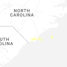
Hail Map for Monday, March 10, 2025

Number of Impacted Households on 3/10/2025
0
Impacted by 1" or Larger Hail
0
Impacted by 1.75" or Larger Hail
0
Impacted by 2.5" or Larger Hail
Square Miles of Populated Area Impacted on 3/10/2025
0
Impacted by 1" or Larger Hail
0
Impacted by 1.75" or Larger Hail
0
Impacted by 2.5" or Larger Hail
Cities Most Affected by Hail Storms of 3/10/2025
| Hail Size | Demographics of Zip Codes Affected | ||||||
|---|---|---|---|---|---|---|---|
| City | Count | Average | Largest | Pop Density | House Value | Income | Age |
Hail and Wind Damage Spotted on 3/10/2025
Filter by Report Type:Hail ReportsWind Reports
States Impacted
FloridaFlorida
| Local Time | Report Details |
|---|---|
| 12:21 PM EDT | The mesonet station okeechobee measured a peak wind gust of 68mph/59kt from the southwest at 12:21 p in okeechobee county FL, 30.2 miles W of Port Saint Lucie, FL |
| 12:25 PM EDT | Tree damage and damage to rv north of okeechobee off of us 441. time estimated by rada in okeechobee county FL, 28.7 miles W of Port Saint Lucie, FL |
| 1:10 PM EDT | Emergency manager reports tree branches and limbs down. noted damage to a trailer awning from branche in st. lucie county FL, 12.1 miles N of Port Saint Lucie, FL |
Connect with Interactive Hail Maps