Hail Map for Wednesday, May 29, 2019

Number of Impacted Households on 5/29/2019
0
Impacted by 1" or Larger Hail
0
Impacted by 1.75" or Larger Hail
0
Impacted by 2.5" or Larger Hail
Square Miles of Populated Area Impacted on 5/29/2019
0
Impacted by 1" or Larger Hail
0
Impacted by 1.75" or Larger Hail
0
Impacted by 2.5" or Larger Hail
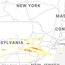
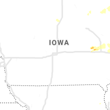
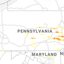
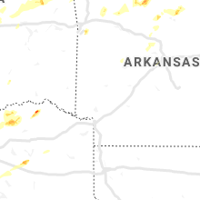
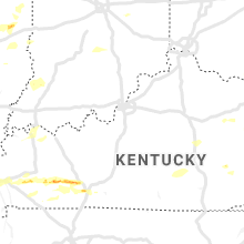
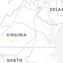
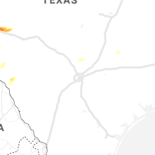
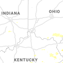
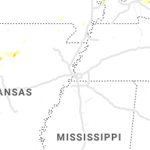
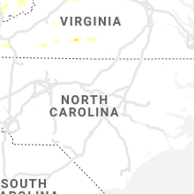
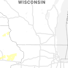
Regions Impacted by Hail on 5/29/2019
Cities Most Affected by Hail Storms of 5/29/2019
| Hail Size | Demographics of Zip Codes Affected | ||||||
|---|---|---|---|---|---|---|---|
| City | Count | Average | Largest | Pop Density | House Value | Income | Age |
| Branson, MO | 2 | 2.38 | 2.75 | 367 | $114k | $33.6k | 39.8 |
| Blossom, TX | 1 | 2.75 | 2.75 | 35 | $44k | $31.6k | 40.8 |
| Mertztown, PA | 1 | 2.00 | 2.00 | 196 | $129k | $54.6k | 43.7 |
| Quakertown, PA | 1 | 2.00 | 2.00 | 522 | $140k | $49.9k | 39.7 |
| Powersite, MO | 1 | 2.00 | 2.00 | 103 | $107k | $34.7k | 41.9 |
| Paris, TX | 1 | 2.00 | 2.00 | 59 | $82k | $42.9k | 41.4 |
| Stockton, NJ | 1 | 1.75 | 1.75 | 117 | $253k | $83.8k | 48.9 |
| Ozona, TX | 1 | 1.75 | 1.75 | 0 | $52k | $29.9k | 39.5 |
| Morgantown, KY | 1 | 1.75 | 1.75 | 31 | $61k | $29.8k | 39.6 |
| Concord, AR | 1 | 1.75 | 1.75 | 18 | $47k | $29.5k | 41.0 |
| Dunmor, KY | 1 | 1.75 | 1.75 | 33 | $69k | $25.4k | 40.0 |
| Hollister, MO | 1 | 1.75 | 1.75 | 151 | $89k | $27.7k | 36.8 |
| Loganton, PA | 1 | 1.75 | 1.75 | 32 | $80k | $34.4k | 35.0 |
| Macungie, PA | 1 | 1.75 | 1.75 | 1180 | $143k | $61.3k | 40.7 |
Hail and Wind Damage Spotted on 5/29/2019
Filter by Report Type:Hail ReportsWind Reports
States Impacted
Texas, Illinois, Missouri, Kentucky, Ohio, Indiana, Oklahoma, West Virginia, Arkansas, Pennsylvania, Virginia, New Jersey, Maryland, Delaware, North Carolina, IowaTexas
| Local Time | Report Details |
|---|---|
| 7:03 AM CDT | Quarter sized hail reported near Sweetwater, TX, 38.5 miles W of Abilene, TX |
| 7:45 AM CDT | Tree snapped in half in front of abilene city hall. picture submitted on twitter by city governmen in taylor county TX, 1 miles NE of Abilene, TX |
| 7:55 AM CDT | Clyde mesonet reported 57mph wind gus in callahan county TX, 14.4 miles E of Abilene, TX |
| 1:30 PM CDT | Storm damage reported in denton county TX, 41.3 miles NW of Dallas, TX |
| 1:44 PM CDT | Power poles and trailer damaged in tarrant county TX, 34 miles W of Dallas, TX |
| 2:45 PM CDT | Several power poles down in greenville in hunt county TX, 46.1 miles ENE of Dallas, TX |
| 2:56 PM CDT | Golf Ball sized hail reported near Ozona, TX, 89 miles SE of Odessa, TX, at highway 137 and farm to market road 1964. |
| 3:06 PM CDT | Quarter sized hail reported near Ozona, TX, 94.8 miles SE of Odessa, TX |
| 3:10 PM CDT | Hen Egg sized hail reported near Paris, TX, 62.1 miles SE of Atoka, OK, hen egg size hail from reno... tx in lamar county. |
| 3:25 PM CDT | Baseball sized hail reported near Blossom, TX, 65.4 miles SE of Atoka, OK, baseball size hail reported near blossom. |
| 4:30 PM CDT | *** 1 inj *** damage reported at cedar creek country club in kaufman county TX, 44.8 miles SE of Dallas, TX |
| 4:55 PM CDT | Wind damage to chicken houses cr 446 in wood county TX, 89.3 miles WNW of Shreveport, LA |
| 5:02 PM CDT | Fm 115 about a quarter mile before the railroad track in scroggins a mobile home has a tree on it... and another home has a tree on it as well. no injuries reported as in franklin county TX, 89.1 miles WNW of Shreveport, LA |
| 5:42 PM CDT | Trees reported down cr 4460 and hwy 11 blocking the roa in wood county TX, 89.8 miles WNW of Shreveport, LA |
| 6:00 PM CDT | Homes damaged along hwy 34 south of honey grove in fannin county TX, 57.5 miles SSE of Atoka, OK |
| 7:27 PM CDT | Reports of trees down all around boxelder as well as a shed blown over on fm 412 north of boxelde in red river county TX, 67.7 miles WSW of Nashville, AR |
| 7:27 PM CDT | Spotter reports tree on home 9000 block on 44 south near boxelde in red river county TX, 65 miles WSW of Nashville, AR |
| 8:02 PM CDT | Wind gust estimated at the intersection of highway 259 and highway 82 on the west side of dekal in bowie county TX, 54.4 miles WSW of Nashville, AR |
| 8:03 PM CDT | A tree was down on a power line at the intersection of west fannin street and south runnels street in dekal in bowie county TX, 53.8 miles SW of Nashville, AR |
| 8:29 PM CDT | Tree down on highway 8 outside of new bosto in bowie county TX, 49.6 miles SW of Nashville, AR |
| 4:47 AM CDT | Several trees down and power outages reported near the intersection of hwy 95 and chestnut s in bastrop county TX, 73.7 miles SSE of Killeen, TX |
Illinois
| Local Time | Report Details |
|---|---|
| 7:30 AM CDT | Delayed report. tree snapped at the base and fell into a garage. time estimate in union county IL, 23.1 miles NE of Cape Girardeau, MO |
| 7:45 AM CDT | Delayed report. large maple tree limbs down on the north side of marion. time estimate in williamson county IL, 45.7 miles NE of Cape Girardeau, MO |
| 4:18 PM CDT | Tree limbs down and a carport flipped ove in alexander county IL, 29 miles SE of Cape Girardeau, MO |
| 5:12 PM CDT | Quarter sized hail reported near Macon, IL, 34 miles WNW of Mattoon, IL |
| 5:12 PM CDT | Quarter sized hail reported near Mackinaw, IL, 18.8 miles SE of Peoria, IL |
| 5:12 PM CDT | Storm damage reported in macon county IL, 34 miles WNW of Mattoon, IL |
| 6:45 PM CDT | Several planes flipped over at vandalia municipal airport. also... 8 to 9 power poles snapped off and a hanger was damage in fayette county IL, 54.5 miles SW of Mattoon, IL |
| 6:54 PM CDT | Several power poles snapped or leaning on rickleman ave. time estimate in effingham county IL, 24.7 miles SSW of Mattoon, IL |
| 7:19 PM CDT | County dispatch reports a tree that fell on a power line... knocking out power and cable for some resident in montgomery county IL, 52.5 miles NE of Saint Louis, MO |
| 7:21 PM CDT | Quarter sized hail reported near Augusta, IL, 41.7 miles ESE of Kahoka, MO, some hail stones near quarter size. |
| 8:00 PM CDT | Large tree limbs down in sangamon county IL, 64.4 miles S of Peoria, IL |
| 8:08 PM CDT | Tree limb down on a power line. time estimate in sangamon county IL, 64.8 miles WNW of Mattoon, IL |
Missouri
| Local Time | Report Details |
|---|---|
| 7:53 AM CDT | Delayed report. trees reported down around cape girardeau... including a tree that fell onto a house. time estimated from rada in cape girardeau county MO, 0.9 miles WSW of Cape Girardeau, MO |
| 8:10 AM CDT | One tree down in town. winds measured off home weather station at 60mp in dunklin county MO, 55.4 miles SSW of Cape Girardeau, MO |
| 12:42 PM CDT | Mesonet station crwm7 cassville raw in barry county MO, 45.8 miles SSW of Springfield, MO |
| 1:20 PM CDT | Half Dollar sized hail reported near Branson, MO, 42.7 miles S of Springfield, MO, half dollar size hail. |
| 1:27 PM CDT | Golf Ball sized hail reported near Hollister, MO, 40.9 miles S of Springfield, MO, hollister resident had 1.75 inch hail. |
| 1:27 PM CDT | Tree damage at the college of the ozark in taney county MO, 40.7 miles S of Springfield, MO |
| 1:27 PM CDT | Pictures of multiple trees down in the country bluff estates area... with hail damage to trees as well. limbs up to 12 inches in diameter also broken off in the welk re in taney county MO, 40.7 miles S of Springfield, MO |
| 1:30 PM CDT | Hen Egg sized hail reported near Branson, MO, 39.7 miles S of Springfield, MO, corrects previous hail report from 2 nw kirbyville. pictures of ping pong and up to 2 inch sized hail east of branson near east 76 and t highway. |
| 1:30 PM CDT | Baseball sized hail reported near Branson, MO, 39.6 miles S of Springfield, MO, baseball sized hail reported near the holiday hills resort by e hwy 76. time estimated from radar. |
| 1:30 PM CDT | Trees down in are in taney county MO, 40.9 miles S of Springfield, MO |
| 1:30 PM CDT | Half Dollar sized hail reported near Hollister, MO, 40.8 miles S of Springfield, MO, 1.25 inch hail. |
| 1:30 PM CDT | Half Dollar sized hail reported near Branson, MO, 39.4 miles S of Springfield, MO, 1.25 inch hail in branson. via social media picture. |
| 1:30 PM CDT | Ping Pong Ball sized hail reported near Branson, MO, 39.7 miles S of Springfield, MO, picture of ping pong ball sized hail 2 miles east of branson near east 76 and t highway. |
| 1:30 PM CDT | Tree down and hail damage to vehicle windows off of hwy 76 east of branso in taney county MO, 40.4 miles S of Springfield, MO |
| 1:30 PM CDT | Private weather station measured 75 mph wind gust in hollister. social media pictures also show tree damage and hail damage to sidin in taney county MO, 40.9 miles S of Springfield, MO |
| 1:30 PM CDT | Reports of trees down across the city of branson from pointe royale to branson hills parkway to city hall. at least one tree estimated at 36 inches in diameter down on in taney county MO, 39.4 miles S of Springfield, MO |
| 1:30 PM CDT | Quarter sized hail reported near Branson, MO, 38.5 miles S of Springfield, MO, 1 inch hail at the branson fire department. |
| 1:32 PM CDT | Multiple areas with trees and powerlines down from hollister... kirbyville and powersite area in taney county MO, 39.9 miles S of Springfield, MO |
| 1:36 PM CDT | Large tree fell on house. picture via social media and time estimated from rada in taney county MO, 41.3 miles S of Springfield, MO |
| 1:37 PM CDT | Hen Egg sized hail reported near Powersite, MO, 39 miles SSE of Springfield, MO, 2 inch hail in powersite. picture via social media with time estimated from radar. |
| 1:37 PM CDT | Picture of large uprooted tree in powersite. time estimated from rada in taney county MO, 39 miles SSE of Springfield, MO |
| 1:37 PM CDT | Quarter sized hail reported near Forsyth, MO, 39.3 miles SSE of Springfield, MO, 1 inch hail 1 ene of powersite. |
| 1:42 PM CDT | Trees down in the kissee mills are in taney county MO, 38.2 miles SSE of Springfield, MO |
| 3:28 PM CDT | Tree fell onto power lines and is on fire off of hwy 160 about 5 miles southwest of west plain in howell county MO, 70.6 miles SSW of Salem, MO |
| 4:44 PM CDT | Trees down on powerlines and blocking roadway at the intersection of 7th and pine st. also several limbs down in yard in oregon county MO, 77 miles S of Salem, MO |
| 4:44 PM CDT | Half Dollar sized hail reported near O Fallon, MO, 28.8 miles WNW of Saint Louis, MO |
| 4:49 PM CDT | Quarter sized hail reported near Saint Charles, MO, 26.3 miles WNW of Saint Louis, MO |
| 5:10 PM CDT | Tree down on county road 224 near highway c in oregon county MO, 71.3 miles S of Salem, MO |
| 5:50 PM CDT | Trees down in doniphan. one home sustained roof damage from fallen tre in ripley county MO, 80.5 miles SSE of Salem, MO |
| 5:53 PM CDT | Wind gust measured at raws observation station in donipha in ripley county MO, 81 miles SSE of Salem, MO |
| 5:55 PM CDT | Many trees down throughout the county. numerous power outages as well. time estimated by rada in ripley county MO, 80.5 miles SSE of Salem, MO |
| 5:57 PM CDT | Large portion of tree blown down in hyde park. via twitter with pictur in st. louis city county MO, 2.2 miles N of Saint Louis, MO |
| 5:58 PM CDT | Late report. trees down and 60 mph wind gust estimate in ripley county MO, 77.8 miles SW of Cape Girardeau, MO |
| 6:05 PM CDT | Medium sized tree branches down east of fairdealing. time estimated by rada in butler county MO, 72.9 miles SW of Cape Girardeau, MO |
| 6:50 PM CDT | Numerous trees down from dexter to puxico due to severe wind gusts. power lines down as wel in stoddard county MO, 40.1 miles SW of Cape Girardeau, MO |
| 6:50 PM CDT | Trees down on roads and homes in dexte in stoddard county MO, 42.2 miles SSW of Cape Girardeau, MO |
| 7:25 PM CDT | Trees down across the count in scott county MO, 15.8 miles SSW of Cape Girardeau, MO |
| 7:37 PM CDT | Corrects previous tstm wnd gst report. measured wind gust at cape girardeau regional airport kcgi aso in scott county MO, 5.9 miles SSW of Cape Girardeau, MO |
| 7:37 PM CDT | Measured wind gust at cape girardeau regional airport kcgi aso in scott county MO, 5.9 miles SSW of Cape Girardeau, MO |
Kentucky
| Local Time | Report Details |
|---|---|
| 9:11 AM EDT | Several trees were downed near the intersection of washington trace road and dead timbers road in campbell county KY, 16.4 miles SE of Cincinnati, OH |
| 1:12 PM EDT | Tree down near the intersection of tabernacle rd. and hwy 70 in morgan county KY, 36.4 miles ENE of Irvine, KY |
| 2:10 PM EDT | Tree fell on a hous in floyd county KY, 65.5 miles E of Irvine, KY |
| 2:12 PM EDT | *** 1 fatal *** a roof was lifted off a building and blown on the road below. this struck a vehicle and led to a fatality near the hock shop on w court st in downtown p in floyd county KY, 66.1 miles E of Irvine, KY |
| 2:15 PM EDT | Roof blown off business. roof on top of cars and blocking street in floyd county KY, 66.1 miles E of Irvine, KY |
| 2:15 PM EDT | Estimated 60 mph winds. broke out top of pear tree. large limbs dow in floyd county KY, 62.8 miles E of Irvine, KY |
| 1:25 PM CDT | Quarter sized hail reported near Princeton, KY, 64 miles SSW of Evansville, IN, reported southeast of princeton along ky highway 91. |
| 2:35 PM EDT | Roof blown off carport at ventors lan in pike county KY, 70 miles NNW of Bristol, TN |
| 2:37 PM EDT | Trees down on cr 3384. road blocked in magoffin county KY, 51.6 miles E of Irvine, KY |
| 2:38 PM EDT | Tree fell on a powerlin in pike county KY, 58.9 miles SW of Charleston, WV |
| 2:38 PM EDT | Trees reported down around the cit in pike county KY, 63.3 miles NNW of Bristol, TN |
| 2:39 PM EDT | Trees down on highway 80 between nancy and somerset as well as a pontoon boat blown off of lake cumberland at pulaski county par in pulaski county KY, 60.3 miles SW of Irvine, KY |
| 1:43 PM CDT | Quarter sized hail reported near Crofton, KY, 64.1 miles S of Evansville, IN, delayed report. dime to quarter size hail. time estimated. |
| 2:46 PM EDT | Multiple trees down along ky rt. 7 south of salyersville from the mason area to one mile south of ky rt. 40 in magoffin county KY, 50.7 miles E of Irvine, KY |
| 2:56 PM EDT | Trees reported down near johns cree in pike county KY, 62.8 miles N of Bristol, TN |
| 2:57 PM EDT | Trees down in the mudlick communit in pike county KY, 63.9 miles SSW of Charleston, WV |
| 3:12 PM EDT | Tree down blocking highway 80 in letcher county KY, 46.3 miles NNW of Bristol, TN |
| 3:12 PM EDT | Quarter sized hail reported near Jenkins, KY, 48.3 miles NNW of Bristol, TN, dime to quarter size hail reported along highway 23. |
| 2:16 PM CDT | Trees down along clifty-kirkmansville road. time estimated by rada in todd county KY, 63.3 miles NNW of Nashville, TN |
| 2:35 PM CDT | Trees down in the princeton road and dawson springs road area. time estimated by rada in christian county KY, 65.6 miles NW of Nashville, TN |
| 2:38 PM CDT | Golf Ball sized hail reported near Dunmor, KY, 64.1 miles N of Nashville, TN, half dollar to golfball size hail. |
| 2:50 PM CDT | Quarter sized hail reported near Lewisburg, KY, 58.8 miles N of Nashville, TN |
| 3:01 PM CDT | Golf Ball sized hail reported near Morgantown, KY, 60.9 miles N of Nashville, TN, large hail impacted the davis crossroads area of butler county. |
| 3:05 PM CDT | Quarter sized hail reported near Russellville, KY, 57.5 miles N of Nashville, TN |
| 4:25 PM CDT | Half Dollar sized hail reported near Bowling Green, KY, 52 miles NNE of Nashville, TN |
Ohio
| Local Time | Report Details |
|---|---|
| 9:15 AM EDT | A tree was downed along jett hill road in clermont county OH, 18.7 miles SE of Cincinnati, OH |
| 9:33 AM EDT | Trees and power lines down along bethel new hope roa in brown county OH, 28.2 miles ESE of Cincinnati, OH |
| 11:27 AM EDT | Tree down on piketon roa in scioto county OH, 74.9 miles WNW of Charleston, WV |
| 11:40 AM EDT | Tree down on boggs roa in scioto county OH, 64.6 miles WNW of Charleston, WV |
| 11:40 AM EDT | 24 ft above ground swimming pool damaged. time estimated from rada in jackson county OH, 68.6 miles NW of Charleston, WV |
| 11:45 AM EDT | Numerous trees dow in jackson county OH, 63.1 miles NW of Charleston, WV |
| 11:54 AM EDT | Power pole broken with lines down in rio grand in gallia county OH, 54.3 miles NW of Charleston, WV |
| 12:00 PM EDT | Trees down along state route 775 and 23 in gallia county OH, 49.5 miles NW of Charleston, WV |
| 12:10 PM EDT | Trees down on highway 775 near mile marker 2 in lawrence county OH, 45.8 miles WNW of Charleston, WV |
Indiana
| Local Time | Report Details |
|---|---|
| 9:15 AM CDT | Delayed report. large tree branch broken. time estimated by radar. relayed via twitte in vanderburgh county IN, 6 miles ESE of Evansville, IN |
| 11:07 AM EDT | Several trees uprooted in tow in knox county IN, 45.7 miles NNE of Evansville, IN |
| 11:12 AM EDT | Spotter reported several power poles down and a few trees uprooted in washington. time estimated from rada in daviess county IN, 51.8 miles NNE of Evansville, IN |
Oklahoma
| Local Time | Report Details |
|---|---|
| 9:25 AM CDT | One inch tree limbs broken off... roof shingles blown of in tulsa county OK, 17 miles SSE of Tulsa, OK |
| 9:36 AM CDT | Barn damaged by thunderstorm winds in the haskell are in muskogee county OK, 29.1 miles SE of Tulsa, OK |
| 10:31 AM CDT | Quarter sized hail reported near Healdton, OK, 61.5 miles ENE of Wichita Falls, TX, em relayed through nwschat. located at the district 2 barn on mobil rd. |
| 10:43 AM CDT | Deputy director of emergency management measured thunderstorm winds to 60 mph in city of tahlequa in cherokee county OK, 48.1 miles NW of Fort Smith, AR |
| 11:40 AM CDT | Significant wind damage. large trees down and roof damag in lincoln county OK, 46.8 miles E of Oklahoma City, OK |
West Virginia
| Local Time | Report Details |
|---|---|
| 12:12 PM EDT | Multiple large trees uprooted with some down on structure in mason county WV, 43.5 miles NW of Charleston, WV |
| 12:14 PM EDT | Tree down on a hous in mason county WV, 42.9 miles NW of Charleston, WV |
| 12:35 PM EDT | Numerous trees down on roads throughout the county. little sandy road is one road blocked by fallen tree in jackson county WV, 43.8 miles N of Charleston, WV |
| 12:45 PM EDT | Half Dollar sized hail reported near Fairview, WV, 52.9 miles S of Pittsburgh, PA, varied sizes up to size of a half-dollar coin |
| 12:46 PM EDT | Quarter sized hail reported near Maidsville, WV, 50.7 miles S of Pittsburgh, PA |
| 12:51 PM EDT | Half Dollar sized hail reported near Morgantown, WV, 51.7 miles S of Pittsburgh, PA |
| 12:55 PM EDT | Several trees down on us 33 near roane and jackson county line in roane county WV, 33.1 miles NNE of Charleston, WV |
| 12:55 PM EDT | Tree dow in wirt county WV, 42.8 miles N of Charleston, WV |
| 12:55 PM EDT | Roofs ripped off houses and garages. trees downe in wood county WV, 49.9 miles N of Charleston, WV |
| 1:00 PM EDT | *** 1 fatal *** 55 year old female was killed when a large oak tree fell on her while she was getting her mai in roane county WV, 36.5 miles NNE of Charleston, WV |
| 1:02 PM EDT | Roof torn partially off house. trees sheared off. other building damage as wel in wirt county WV, 48.5 miles NNE of Charleston, WV |
| 1:04 PM EDT | Em reported that spencer was the hardest hit community in roane county. numerous trees and powerlines dow in roane county WV, 34.5 miles NNE of Charleston, WV |
| 1:05 PM EDT | Trees down along barrcut rd. time estimated from rada in roane county WV, 35.9 miles NNE of Charleston, WV |
| 1:18 PM EDT | Several trees down in looneyville in roane county WV, 28.2 miles NE of Charleston, WV |
| 2:52 PM EDT | Trees down and a relatively new roof ripped off a nearby restauran in mingo county WV, 58.2 miles SW of Charleston, WV |
| 3:07 PM EDT | Numerouss trees down in stirra in logan county WV, 47.1 miles SSW of Charleston, WV |
| 3:16 PM EDT | Trees down and a relatively new roof ripped off a nearby restauran in logan county WV, 43.9 miles SSW of Charleston, WV |
| 3:18 PM EDT | Several trees down in gilbert in mingo county WV, 52.6 miles SSW of Charleston, WV |
| 3:34 PM EDT | Tree and lines down in wyoming county WV, 45.9 miles S of Charleston, WV |
| 3:41 PM EDT | Tree and lines dow in mcdowell county WV, 60.8 miles NNE of Bristol, TN |
| 3:51 PM EDT | Trees down in josephine... including on areas roads in raleigh county WV, 55.3 miles SSE of Charleston, WV |
| 3:53 PM EDT | Two trees down. time estimated from rada in mcdowell county WV, 57.2 miles NNE of Bristol, TN |
| 3:56 PM EDT | Several trees down in coal city in raleigh county WV, 51.8 miles SSE of Charleston, WV |
| 4:09 PM EDT | Tree and lines dow in raleigh county WV, 50.2 miles SE of Charleston, WV |
| 4:15 PM EDT | Quarter sized hail reported near Camp Creek, WV, 66.3 miles SSE of Charleston, WV, quarter size hail on nubbins ridge. |
| 4:16 PM EDT | Trees reported down county wide. road closures and power lines also dow in summers county WV, 59.7 miles SE of Charleston, WV |
| 4:33 PM EDT | Large pine tree down in pence spring in summers county WV, 51.3 miles WNW of Roanoke, VA |
| 4:38 PM EDT | Power lines down on monroe st in alderso in greenbrier county WV, 49.8 miles NW of Roanoke, VA |
| 4:38 PM EDT | Social media photo shows multiple large limbs down. time estimated by rada in monroe county WV, 49.4 miles NW of Roanoke, VA |
| 4:47 PM EDT | Trees down county wide in monroe count in monroe county WV, 33 miles NW of Roanoke, VA |
Arkansas
| Local Time | Report Details |
|---|---|
| 11:22 AM CDT | Multiple trees down... blocking dawn hill road northeast of siloam springs. report relayed by medi in benton county AR, 57.1 miles N of Fort Smith, AR |
| 11:30 AM CDT | Storm damage reported in benton county AR, 55.9 miles N of Fort Smith, AR |
| 11:37 AM CDT | Police report trees and power lines down. report relayed by medi in benton county AR, 60.5 miles N of Fort Smith, AR |
| 1:00 PM CDT | Quarter sized hail reported near Berryville, AR, 52.4 miles S of Springfield, MO, relayed by nws springfield. |
| 4:10 PM CDT | Powerlines were down near hwy. 65 and old hwy. 9. no power at the sheriff offic in van buren county AR, 58.2 miles N of Little Rock, AR |
| 4:12 PM CDT | Half Dollar sized hail reported near Clinton, AR, 58.9 miles N of Little Rock, AR, half dollar size hail in clinton... ar. |
| 4:12 PM CDT | Quarter sized hail reported near Clinton, AR, 58.1 miles N of Little Rock, AR, mping report of 1" hail in clinton. |
| 4:36 PM CDT | Trees down reported by police dispatch in de queen... a in sevier county AR, 29.2 miles WNW of Nashville, AR |
| 4:50 PM CDT | Thunderstorm wind gust above 60 mph near timber lake reservoi in conway county AR, 37.6 miles NW of Little Rock, AR |
| 4:58 PM CDT | Golf Ball sized hail reported near Concord, AR, 67.3 miles NNE of Little Rock, AR |
| 5:20 PM CDT | Trees downed in the city of conwa in faulkner county AR, 23.8 miles NNW of Little Rock, AR |
| 5:20 PM CDT | Trees were blown down on a house in ravenden spring in randolph county AR, 93.1 miles S of Salem, MO |
| 5:23 PM CDT | Trees down in conway... a in faulkner county AR, 25.6 miles NNW of Little Rock, AR |
| 5:39 PM CDT | Large trees were blown down near homes north of maynar in randolph county AR, 89.1 miles SSE of Salem, MO |
| 5:45 PM CDT | Large trees were blown down in viloni in faulkner county AR, 23.1 miles N of Little Rock, AR |
| 5:56 PM CDT | Large trees down near bryant... a in saline county AR, 18 miles WSW of Little Rock, AR |
| 6:00 PM CDT | Large limbs down and minor shingle damag in clay county AR, 84.5 miles SW of Cape Girardeau, MO |
| 6:30 PM CDT | Wind damage to corning high school. mainly roof problem in clay county AR, 84.5 miles SW of Cape Girardeau, MO |
Pennsylvania
| Local Time | Report Details |
|---|---|
| 12:58 PM EDT | Trees and wires down in mckean county PA, 77.6 miles NW of State College, PA |
| 1:35 PM EDT | Quarter sized hail reported near Tyrone, PA, 21.9 miles WSW of State College, PA |
| 1:40 PM EDT | Quarter sized hail reported near Tyrone, PA, 21.9 miles WSW of State College, PA |
| 2:00 PM EDT | Multiple trees down on hills creek lake rd. time estimated from rada in tioga county PA, 78.1 miles NNE of State College, PA |
| 2:03 PM EDT | Golf Ball sized hail reported near Loganton, PA, 33.6 miles ENE of State College, PA, golf ball sized hail reported near loganton. |
| 2:05 PM EDT | Trees down on kepple rd in jackson twp. time estimated from rada in cambria county PA, 59.5 miles E of Pittsburgh, PA |
| 2:10 PM EDT | Utility pole down on e valley r in clinton county PA, 36.5 miles ENE of State College, PA |
| 2:22 PM EDT | Trees and wires dow in allegheny county PA, 6.4 miles N of Pittsburgh, PA |
| 2:30 PM EDT | Large tree down on vehicl in luzerne county PA, 10 miles SW of Scranton, PA |
| 2:31 PM EDT | Trees dow in allegheny county PA, 3.2 miles NNE of Pittsburgh, PA |
| 2:32 PM EDT | Trees and wires dow in westmoreland county PA, 22.6 miles E of Pittsburgh, PA |
| 2:42 PM EDT | Trees and wires down near mud pond in luzerne county PA, 28 miles SW of Scranton, PA |
| 2:44 PM EDT | Wires down in roadway with pole snappe in luzerne county PA, 22.8 miles SW of Scranton, PA |
| 2:44 PM EDT | Portions of rt 120 closed between lock haven and ronovo due to trees down on r in clinton county PA, 36.8 miles NNE of State College, PA |
| 2:45 PM EDT | Quarter sized hail reported near Trexlertown, PA, 59.4 miles S of Scranton, PA |
| 2:46 PM EDT | Trees and wires down at golf course rd and crawford rd in sinking valle in blair county PA, 23 miles WSW of State College, PA |
| 2:47 PM EDT | Several trees down at rt 819 and hancock ave in westmoreland county PA, 22.6 miles E of Pittsburgh, PA |
| 2:48 PM EDT | Multiple trees down in barr twp. time estimated from rada in cambria county PA, 53.3 miles WSW of State College, PA |
| 2:50 PM EDT | Hen Egg sized hail reported near Mertztown, PA, 62.1 miles S of Scranton, PA, hail up to 2 inches reported in mertztown. |
| 2:50 PM EDT | Trees down in center township. time estimated from rada in indiana county PA, 43.7 miles E of Pittsburgh, PA |
| 3:00 PM EDT | Ping Pong Ball sized hail reported near Mc Alisterville, PA, 31.8 miles ESE of State College, PA |
| 3:00 PM EDT | Half Dollar sized hail reported near Emmaus, PA, 61.4 miles S of Scranton, PA |
| 3:00 PM EDT | Quarter sized hail reported near Breinigsville, PA, 60.1 miles S of Scranton, PA |
| 3:05 PM EDT | Quarter sized hail reported near Richfield, PA, 38.4 miles ESE of State College, PA |
| 3:05 PM EDT | Several trees down in indiana county PA, 51.8 miles E of Pittsburgh, PA |
| 3:08 PM EDT | Golf Ball sized hail reported near Macungie, PA, 61.6 miles S of Scranton, PA |
| 3:12 PM EDT | Tree down on castle farms r in blair county PA, 35.8 miles WSW of State College, PA |
| 3:15 PM EDT | Ping Pong Ball sized hail reported near Emmaus, PA, 60.7 miles S of Scranton, PA |
| 3:15 PM EDT | Trees and wires down near 326 blue ridge trail in luzerne county PA, 28 miles SW of Scranton, PA |
| 3:16 PM EDT | Multiple trees down. time estimated from rada in lycoming county PA, 41.7 miles NE of State College, PA |
| 3:19 PM EDT | Numerous trees and wires down in lock have in clinton county PA, 32.1 miles NE of State College, PA |
| 3:20 PM EDT | Numerous trees and wires down in pine creek tw in clinton county PA, 39.3 miles NE of State College, PA |
| 3:20 PM EDT | Quarter sized hail reported near Quakertown, PA, 69 miles SSE of Scranton, PA |
| 3:21 PM EDT | Trees down in westmoreland county PA, 25.7 miles ESE of Pittsburgh, PA |
| 3:23 PM EDT | Trees and wires down on w 1st s in columbia county PA, 50.4 miles SW of Scranton, PA |
| 3:26 PM EDT | Hen Egg sized hail reported near Quakertown, PA, 66.8 miles SSE of Scranton, PA, hail fell for approx 10 minutes. widespread quarter to half dollar sized hail with 2 inch hail included. |
| 3:26 PM EDT | Trees and wires down near 1926 pierce road in greenfield townshi in lackawanna county PA, 15.8 miles NNE of Scranton, PA |
| 3:26 PM EDT | Large trees down... garage crushed... and portion of roof blown off of a house near newton lak in lackawanna county PA, 16.2 miles NNE of Scranton, PA |
| 3:26 PM EDT | Tree down on wires in greenfield township in lackawanna county PA, 16.2 miles NNE of Scranton, PA |
| 3:27 PM EDT | Tree down on wires in greenfield township in lackawanna county PA, 16.2 miles NNE of Scranton, PA |
| 3:29 PM EDT | Trees down near crystal lake road and old baker road in lackawanna county PA, 16 miles NNE of Scranton, PA |
| 3:30 PM EDT | Tree down on rt 22 near flowing spring r in blair county PA, 30.5 miles SW of State College, PA |
| 3:35 PM EDT | Downed tree in wires on school house rd. time estimated from rada in monroe county PA, 33.9 miles SE of Scranton, PA |
| 3:43 PM EDT | Multiple trees down in muncy creek twp. time estimated from rada in lycoming county PA, 59.4 miles WSW of Scranton, PA |
| 3:50 PM EDT | Numerous trees and wires down. dozens of evergreens snapped. time estimated from rada in union county PA, 37.6 miles ENE of State College, PA |
| 3:52 PM EDT | Multiple trees snapped. observer reported a swath of trees down on the hillside behind her hous in westmoreland county PA, 21.7 miles SE of Pittsburgh, PA |
| 3:55 PM EDT | Trees down in westmoreland county PA, 38.4 miles ESE of Pittsburgh, PA |
| 3:55 PM EDT | Ping Pong Ball sized hail reported near Quakertown, PA, 69 miles SSE of Scranton, PA |
| 4:00 PM EDT | Trees down on muddy run rd and paradise rd in turbot tw in northumberland county PA, 58.1 miles ENE of State College, PA |
| 4:00 PM EDT | Pa 192 and pa 45 closed from mifflinburg to laurltown due to trees and wires down. 50 to 100 trees down in west buffalo tw in union county PA, 43.1 miles ENE of State College, PA |
| 4:02 PM EDT | Tree down on road. time estimated from rada in somerset county PA, 57.7 miles ESE of Pittsburgh, PA |
| 4:03 PM EDT | Storm damage reported in monroe county PA, 34.4 miles SSE of Scranton, PA |
| 4:05 PM EDT | Trees and wires down in saville... centre... and spring twp in perry county PA, 42 miles SE of State College, PA |
| 4:07 PM EDT | Multiple trees down on holfa mill rd in lewisburg p in union county PA, 49.1 miles ENE of State College, PA |
| 4:17 PM EDT | Numerous trees down in watts... miller... and buffalo twps... including cluster trees in watts tw in perry county PA, 49.4 miles ESE of State College, PA |
| 4:19 PM EDT | Trees dow in westmoreland county PA, 42.3 miles ESE of Pittsburgh, PA |
| 4:20 PM EDT | Numerous trees down in watts... miller... and buffalo twps... including cluster trees in watts tw in perry county PA, 49.4 miles ESE of State College, PA |
| 4:24 PM EDT | Mobile home destroyed on sherman valley rd. dozens of trees down across count in bedford county PA, 51.7 miles SSW of State College, PA |
| 4:25 PM EDT | Numerous trees down. spotter estimated wind gust of 90 mp in lebanon county PA, 74.5 miles N of Baltimore, MD |
| 4:27 PM EDT | Numerous trees and wires down. barn roof partially blown off on parker dr. damage to shelters and buildings in camp hedro in dauphin county PA, 53.8 miles ESE of State College, PA |
| 4:30 PM EDT | Multiple large trees snapped or uprooted. public report relayed by emergency management. time estimate in berks county PA, 76.2 miles NNE of Baltimore, MD |
| 4:32 PM EDT | Downed tree on wires on vera cruz rd. time estimated from rada in lehigh county PA, 66.9 miles S of Scranton, PA |
| 4:33 PM EDT | Several trees down in wells twp. two barn roofs blown off. partial damage to roof of home. time estimated from rada in fulton county PA, 48.5 miles SSW of State College, PA |
| 4:34 PM EDT | Tree down on somerset pik in somerset county PA, 53.1 miles ESE of Pittsburgh, PA |
| 4:35 PM EDT | Tree down across rd. time estimated from rada in somerset county PA, 58.8 miles ESE of Pittsburgh, PA |
| 4:38 PM EDT | Large trees down in three spring in huntingdon county PA, 41.4 miles S of State College, PA |
| 4:45 PM EDT | Barn collapse and damage to multiple pine tree in fulton county PA, 49.3 miles S of State College, PA |
| 4:48 PM EDT | Trees snapped in fort loudo in franklin county PA, 58.9 miles S of State College, PA |
| 4:48 PM EDT | At least one large tree down. time estimated from rada in bucks county PA, 72.2 miles WSW of Brooklyn, NY |
| 4:53 PM EDT | Multiple trees down in pine grove tw in schuylkill county PA, 70.5 miles SSW of Scranton, PA |
| 4:55 PM EDT | Report of trees down. time estimated from rada in montgomery county PA, 74.5 miles S of Scranton, PA |
| 4:55 PM EDT | Numerous trees down. time estimated from rada in montgomery county PA, 75.3 miles S of Scranton, PA |
| 4:55 PM EDT | Neiffer rd closed from rte 73 to ridge pike due to downed trees. time estimated from rada in montgomery county PA, 79 miles S of Scranton, PA |
| 4:55 PM EDT | Multiple reports of several trees uprooted or snapped. time estimated from rada in montgomery county PA, 75.1 miles S of Scranton, PA |
| 4:56 PM EDT | Quarter sized hail reported near Green Lane, PA, 74.5 miles S of Scranton, PA |
| 5:00 PM EDT | Numerous trees dow in franklin county PA, 54 miles SSE of State College, PA |
| 5:00 PM EDT | Numerous trees down. time estimated from rada in franklin county PA, 54.1 miles S of State College, PA |
| 5:00 PM EDT | Numerous trees and wires down in west labonon tw in lebanon county PA, 73 miles N of Baltimore, MD |
| 5:05 PM EDT | Wires down... along with large branches. time estimated from rada in northampton county PA, 45.4 miles S of Scranton, PA |
| 5:12 PM EDT | Measured by a personal weather station. time estimated from rada in berks county PA, 60 miles SSW of Scranton, PA |
| 5:15 PM EDT | Trees and power lines reported dow in bucks county PA, 65.6 miles WSW of Brooklyn, NY |
| 5:25 PM EDT | Tree down onto wires. time estimated from rada in lehigh county PA, 66.9 miles S of Scranton, PA |
| 5:35 PM EDT | Many large tree branches (6 in diameter) broken. time estimated from rada in bucks county PA, 59.7 miles WSW of Brooklyn, NY |
| 5:35 PM EDT | Photo of a large tree snapped near the bas in montgomery county PA, 76.1 miles S of Scranton, PA |
| 5:38 PM EDT | Multiple trees reported down at the landis parking lot in harleysville. time estimated from rada in montgomery county PA, 79.2 miles S of Scranton, PA |
| 5:41 PM EDT | Numerous trees down near elk drive in hanove in adams county PA, 41.1 miles NNW of Baltimore, MD |
| 5:49 PM EDT | Numerous trees dow in york county PA, 43.1 miles NNW of Baltimore, MD |
| 5:50 PM EDT | Home reported damaged on walnut ln with resident needing assistance to be extracted. time estimated from rada in montgomery county PA, 77.3 miles S of Scranton, PA |
| 5:50 PM EDT | Quarter sized hail reported near Coopersburg, PA, 65.7 miles SSE of Scranton, PA |
| 6:05 PM EDT | Quarter sized hail reported near Bensalem, PA, 63.8 miles SW of Brooklyn, NY |
| 6:06 PM EDT | Tree down on waterloo rd. time estimated from rada in chester county PA, 81.9 miles NE of Baltimore, MD |
| 6:10 PM EDT | Quarter sized hail reported near Huntingdon Valley, PA, 67.3 miles WSW of Brooklyn, NY |
| 6:10 PM EDT | Quarter sized hail reported near Willow Grove, PA, 70.7 miles WSW of Brooklyn, NY |
| 6:10 PM EDT | Time estimated from rada in bucks county PA, 58 miles WSW of Brooklyn, NY |
| 6:10 PM EDT | Quarter sized hail reported near Willow Grove, PA, 71.2 miles WSW of Brooklyn, NY |
| 6:15 PM EDT | Storm damage reported in philadelphia county PA, 68.4 miles SW of Brooklyn, NY |
| 6:35 PM EDT | Tree dow in chester county PA, 81.9 miles NE of Baltimore, MD |
| 7:00 PM EDT | Several roads impassable in sumneytow in montgomery county PA, 75.3 miles S of Scranton, PA |
Virginia
| Local Time | Report Details |
|---|---|
| 3:30 PM EDT | Quarter sized hail reported near Clintwood, VA, 44.7 miles NNW of Bristol, TN |
| 3:34 PM EDT | Several trees down north of pound virgini in wise county VA, 43.9 miles NNW of Bristol, TN |
| 3:37 PM EDT | Tree down. time estimated from rada in buchanan county VA, 58.2 miles N of Bristol, TN |
| 3:50 PM EDT | Small trees down. time estimated from radar. gravel roads washed ou in buchanan county VA, 49 miles NNE of Bristol, TN |
| 4:15 PM EDT | Several trees down just south of poun in wise county VA, 41.1 miles NNW of Bristol, TN |
| 4:25 PM EDT | Tree down at the saltville golf course. time estimated by rada in smyth county VA, 32.4 miles NE of Bristol, TN |
| 4:29 PM EDT | Multiple trees down near the pedlar river and rt 6 in amherst county VA, 49.9 miles NE of Roanoke, VA |
| 4:35 PM EDT | Trees down near the city of norto in city of norton county VA, 32.9 miles NW of Bristol, TN |
| 4:40 PM EDT | Trees and power lines down county wide in smyth count in smyth county VA, 42.5 miles ENE of Bristol, TN |
| 4:42 PM EDT | Widespread trees down near lowesville road and indian creek road. one tree fell on a business. time from rada in amherst county VA, 56.6 miles ENE of Roanoke, VA |
| 4:59 PM EDT | Severe trees down south of clevelan in russell county VA, 21.4 miles N of Bristol, TN |
| 5:03 PM EDT | Large limb down on power line. time estimated by rada in roanoke county VA, 7.7 miles W of Roanoke, VA |
| 5:05 PM EDT | Multiple trees down in the potts creek area of the county. power lines also reported down. time estimated by rada in alleghany county VA, 28 miles NNW of Roanoke, VA |
| 5:05 PM EDT | 4 trees snapped off near the intersection of cleveland ave and thompson memorial driv in city of salem county VA, 6.3 miles WNW of Roanoke, VA |
| 5:06 PM EDT | Trees down on multiple cars along surrey avenu in city of roanoke county VA, 4.3 miles WNW of Roanoke, VA |
| 5:15 PM EDT | Multiple trees down in wythe count in wythe county VA, 66.7 miles WSW of Roanoke, VA |
| 5:16 PM EDT | Tree down on whittaker av in city of roanoke county VA, 2 miles NNE of Roanoke, VA |
| 5:16 PM EDT | Tree down on lindbergh ln. time estimated by rada in city of roanoke county VA, 2.7 miles NNE of Roanoke, VA |
| 5:30 PM EDT | Tree down on trailer on bruno drive. no injuries reporte in bedford county VA, 13.6 miles ESE of Roanoke, VA |
| 5:30 PM EDT | Multiple trees down in the eagle rock are in botetourt county VA, 27.1 miles NNE of Roanoke, VA |
| 5:30 PM EDT | Power line down in the 5000 block of craig creek r in botetourt county VA, 29 miles N of Roanoke, VA |
| 5:34 PM EDT | Multiple trees down between sandy level rd and goodview r in bedford county VA, 14 miles E of Roanoke, VA |
| 5:36 PM EDT | Wsls viewer reported shattered windows to a residence on emmaus church rd in moneta. time estimated from rada in bedford county VA, 15.2 miles E of Roanoke, VA |
| 5:38 PM EDT | Tree down on joppa mill r in bedford county VA, 18.8 miles E of Roanoke, VA |
| 5:44 PM EDT | Trees down near blue grass trail and spring branch r in rockbridge county VA, 36.1 miles NNE of Roanoke, VA |
| 5:53 PM EDT | Two trees down in the dugspur area of carroll count in carroll county VA, 48.8 miles SW of Roanoke, VA |
| 6:20 PM EDT | 7 trees down in the brookneal are in campbell county VA, 54.8 miles ESE of Roanoke, VA |
| 6:25 PM EDT | Trees down on philpott driv in henry county VA, 34.1 miles S of Roanoke, VA |
| 7:12 PM EDT | Numerous trees down across the county... including charlotte court house and red hous in charlotte county VA, 68.7 miles SW of Richmond, VA |
| 7:33 PM EDT | At least 15 trees down between halifax and nathalie. time estimated from rada in halifax county VA, 65.7 miles ESE of Roanoke, VA |
New Jersey
| Local Time | Report Details |
|---|---|
| 3:58 PM EDT | Golf Ball sized hail reported near Stockton, NJ, 58.6 miles WSW of Brooklyn, NY |
| 4:20 PM EDT | Ping Pong Ball sized hail reported near Flemington, NJ, 44.5 miles WSW of Brooklyn, NY |
| 4:20 PM EDT | Quarter sized hail reported near Hopewell, NJ, 45.6 miles WSW of Brooklyn, NY |
| 4:42 PM EDT | Half Dollar sized hail reported near Trenton, NJ, 50.3 miles SW of Brooklyn, NY |
| 5:15 PM EDT | Quarter sized hail reported near Freehold, NJ, 36.8 miles SSW of Brooklyn, NY |
| 5:30 PM EDT | Downed tree and wires on nj-31 in both directions north of cr-612. all lanes closed. time estimated from rada in mercer county NJ, 48.1 miles WSW of Brooklyn, NY |
| 5:33 PM EDT | Wires/tree down on the road in warren county NJ, 46.6 miles SE of Scranton, PA |
| 5:44 PM EDT | Downed utility pole and wires on nj-27 in both directions at cr 571 and washington st. all lanes close in mercer county NJ, 42.4 miles WSW of Brooklyn, NY |
| 7:06 PM EDT | Storm damage reported in anz430 county NJ, 64.3 miles N of Ocean City, MD |
| 7:35 PM EDT | A few tees down... including one downed into wires at the intersection of evergreen and spring garden. time estimated from rada in cumberland county NJ, 68 miles N of Ocean City, MD |
Maryland
| Local Time | Report Details |
|---|---|
| 5:09 PM EDT | Several trees down near the intersection of maryland state route 32 and lakeland driv in carroll county MD, 20.4 miles WNW of Baltimore, MD |
| 5:30 PM EDT | Tree down on jarretsville pike near hess roa in baltimore county MD, 16.9 miles NNE of Baltimore, MD |
| 5:38 PM EDT | Large diameter trees down on falston roa in harford county MD, 18.8 miles NNE of Baltimore, MD |
| 5:54 PM EDT | Storm damage reported in baltimore county MD, 10.7 miles ENE of Baltimore, MD |
| 5:54 PM EDT | Numerous trees down throughout perry hal in baltimore county MD, 10.8 miles NE of Baltimore, MD |
| 5:58 PM EDT | Numerous trees down throughout white mars in baltimore county MD, 10.1 miles NE of Baltimore, MD |
| 5:58 PM EDT | Ping Pong Ball sized hail reported near Middle River, MD, 10 miles ENE of Baltimore, MD |
| 6:08 PM EDT | Large diameter trees down on falston roa in harford county MD, 18.8 miles NNE of Baltimore, MD |
| 6:08 PM EDT | Tree down on jarretsville pike near hess roa in baltimore county MD, 16.9 miles NNE of Baltimore, MD |
| 6:08 PM EDT | Tree down on garnett road near joppa farm roa in harford county MD, 16.6 miles ENE of Baltimore, MD |
| 6:12 PM EDT | Tree down on greene r in harford county MD, 18.4 miles NNE of Baltimore, MD |
| 6:13 PM EDT | Multiple trees down near the intersection of route 2 and leelyn driv in anne arundel county MD, 14.9 miles SSE of Baltimore, MD |
| 6:17 PM EDT | Multiple power lines and 2 ft diameter trees dow in harford county MD, 19 miles NNE of Baltimore, MD |
| 6:18 PM EDT | Wires down near the intersection of broadwater road and willys driv in anne arundel county MD, 17.2 miles SSE of Baltimore, MD |
| 6:25 PM EDT | Numerous trees down on still pond roa in kent county MD, 31.1 miles E of Baltimore, MD |
| 6:27 PM EDT | Trees down on 2100 block of pleasantville roa in harford county MD, 19.5 miles NNE of Baltimore, MD |
| 6:27 PM EDT | Roof damage to a house in the 2800 block of orchard lakes driv in harford county MD, 17.7 miles NNE of Baltimore, MD |
| 6:49 PM EDT | Roof blown off of house on the 200 block of n washington stree in harford county MD, 33.1 miles ENE of Baltimore, MD |
| 7:08 PM EDT | Multiple trees and power lines down. time estimated from rada in caroline county MD, 48 miles ESE of Baltimore, MD |
Delaware
| Local Time | Report Details |
|---|---|
| 6:45 PM EDT | Several large trees down in the sherwood ii development. time estimated from rada in new castle county DE, 59 miles ENE of Baltimore, MD |
| 6:57 PM EDT | Storm damage reported in new castle county DE, 59.5 miles ENE of Baltimore, MD |
| 8:45 PM EDT | Storm damage reported in anz431 county DE, 30.8 miles N of Ocean City, MD |
North Carolina
| Local Time | Report Details |
|---|---|
| 7:36 PM EDT | Tree down on sherwood dr. in reidsvill in rockingham county NC, 65 miles SSE of Roanoke, VA |
| 7:36 PM EDT | Large tree down through a house on oakland dr in winston-sale in forsyth county NC, 70.1 miles NNE of Charlotte, NC |
Iowa
| Local Time | Report Details |
|---|---|
| 9:38 PM CDT | Several large tree limbs down in stanwood. largest is 14 inches in diameter and is on a home and power lines. time estimated based on rada in cedar county IA, 27.6 miles ESE of Cedar Rapids, IA |
| 9:58 PM CDT | Large 24 inch diameter tree down. time estimated based on rada in cedar county IA, 32.2 miles E of Cedar Rapids, IA |
| 10:36 PM CDT | Quarter sized hail reported near Waverly, IA, 46.9 miles SE of Mason City, IA, corrects previous hail report from waverly. |















Connect with Interactive Hail Maps