Hail Map for Thursday, October 24, 2024

Number of Impacted Households on 10/24/2024
0
Impacted by 1" or Larger Hail
0
Impacted by 1.75" or Larger Hail
0
Impacted by 2.5" or Larger Hail
Square Miles of Populated Area Impacted on 10/24/2024
0
Impacted by 1" or Larger Hail
0
Impacted by 1.75" or Larger Hail
0
Impacted by 2.5" or Larger Hail
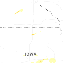
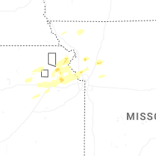
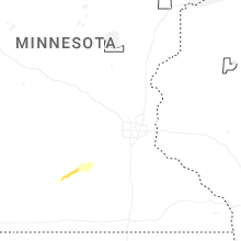
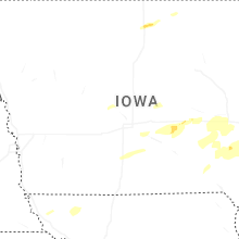
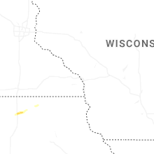
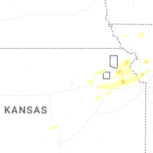
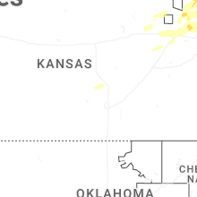
Regions Impacted by Hail on 10/24/2024
Cities Most Affected by Hail Storms of 10/24/2024
| Hail Size | Demographics of Zip Codes Affected | ||||||
|---|---|---|---|---|---|---|---|
| City | Count | Average | Largest | Pop Density | House Value | Income | Age |
| Clear Lake, IA | 1 | 1.75 | 1.75 | 88 | $92k | $37.4k | 47.0 |
Hail and Wind Damage Spotted on 10/24/2024
Filter by Report Type:Hail ReportsWind Reports
Iowa
| Local Time | Report Details |
|---|---|
| 4:53 PM CDT | Golf Ball sized hail reported near Clear Lake, IA, 8 miles WSW of Mason City, IA |
| 4:54 PM CDT | Quarter sized hail reported near Clear Lake, IA, 8.1 miles W of Mason City, IA, via clear lake police. |
| 5:02 PM CDT | Quarter sized hail reported near Mason City, IA, 0.2 miles NNE of Mason City, IA, just south of downtown. |
| 8:00 PM CDT | Quarter sized hail reported near Kalona, IA, 30.4 miles S of Cedar Rapids, IA |
| 8:55 PM CDT | Quarter sized hail reported near New Virginia, IA, 29.6 miles SSW of Des Moines, IA, via social media. |
| 9:17 PM CDT | Quarter sized hail reported near Amana, IA, 14.3 miles SW of Cedar Rapids, IA |
| 9:20 PM CDT | Storm damage reported in clinton county IA, 76.9 miles E of Cedar Rapids, IA |
Missouri
| Local Time | Report Details |
|---|---|
| 6:20 PM CDT | Quarter sized hail reported near Trimble, MO, 25.3 miles N of Kansas City, MO, spotter reported quarter sized hail between 620-624 pm. |
| 7:04 PM CDT | Quarter sized hail reported near Polo, MO, 39.7 miles NNE of Kansas City, MO, report from mping: quarter (1.00 in.). time corrected from radar data. |
| 8:01 PM CDT | Downed power lines and widespread power outages southwest of st. joseph. time estimated from rada in buchanan county MO, 45.8 miles NNW of Kansas City, MO |
| 8:04 PM CDT | Social media report of several tree limbs and power lines down on the south side of st. joseph. time estimated from rada in buchanan county MO, 43.9 miles NNW of Kansas City, MO |
| 8:05 PM CDT | Several reports of trees and wires down in the st. joseph area. time estimated from rada in buchanan county MO, 48.2 miles NNW of Kansas City, MO |
| 8:40 PM CDT | Social media report of downed tree limbs on 45 highway spur near farley. time estimated from rada in platte county MO, 22.3 miles NW of Kansas City, MO |
| 8:42 PM CDT | Several reports of power lines down and widespread power outages north of smithville. time estimated from rada in clay county MO, 21.9 miles N of Kansas City, MO |
| 8:56 PM CDT | Social media report of downed tree limbs in the parkville area. time estimated from rada in platte county MO, 8.5 miles NW of Kansas City, MO |
| 9:07 PM CDT | Time confirmed from rada in clay county MO, 13.8 miles NNE of Kansas City, MO |
| 9:09 PM CDT | Public report of tree limbs down near the pleasant valley area. time estimated from rada in clay county MO, 9.8 miles NE of Kansas City, MO |
| 9:09 PM CDT | Social media report of downed trees and limbs near orchard avenue. time estimated from rada in clay county MO, 12.2 miles NE of Kansas City, MO |
| 9:12 PM CDT | Social media report of a downed tree into a shed and a fence at a residence. time estimated from rada in clay county MO, 13.4 miles NE of Kansas City, MO |
| 9:12 PM CDT | Several downed trees and limbs near shoal creek parkway. time estimated from rada in clay county MO, 11.3 miles NNE of Kansas City, MO |
| 9:14 PM CDT | Route 291 closed between liberty drive and kansas street due to downed power lines. time estimated from rada in clay county MO, 12.2 miles NE of Kansas City, MO |
| 9:16 PM CDT | Multiple reports of power lines down and power outages... with social media photos and video provided. time estimated from rada in clay county MO, 13.4 miles NE of Kansas City, MO |
| 9:16 PM CDT | Time confirmed from rada in caldwell county MO, 53.9 miles NE of Kansas City, MO |
| 9:33 PM CDT | Social media report of downed tree limbs south of sugar creek. time estimated from rada in jackson county MO, 7.7 miles E of Kansas City, MO |
| 11:54 PM CDT | Storm damage reported in pettis county MO, 48.1 miles WSW of Columbia, MO |
Kansas
| Local Time | Report Details |
|---|---|
| 6:38 PM CDT | Quarter sized hail reported near Wamego, KS, 14.2 miles E of Manhattan, KS |
| 7:05 PM CDT | Personal weather statio in jackson county KS, 44.9 miles ENE of Manhattan, KS |
| 7:35 PM CDT | Storm damage reported in jackson county KS, 48.8 miles E of Manhattan, KS |
| 7:35 PM CDT | Downed trees and limbs in effingham. time estimated from rada in atchison county KS, 52.4 miles WNW of Kansas City, MO |
| 7:39 PM CDT | Measured from private weather statio in atchison county KS, 49.3 miles NW of Kansas City, MO |
| 7:40 PM CDT | Storm damage reported in atchison county KS, 50.1 miles NW of Kansas City, MO |
| 7:43 PM CDT | Quarter sized hail reported near Lancaster, KS, 50.1 miles NW of Kansas City, MO |
| 7:45 PM CDT | Downed tree limbs and wires reported in lancaster. time estimated from rada in atchison county KS, 50.5 miles NW of Kansas City, MO |
| 7:46 PM CDT | Downed tree limbs and wires and power outages reported in the atchison area. time estimated from rada in atchison county KS, 45.5 miles NW of Kansas City, MO |
| 7:56 PM CDT | Social media report of power poles downed near troy. time estimated from rada in doniphan county KS, 54.1 miles NNW of Kansas City, MO |
| 8:00 PM CDT | Storm damage reported in shawnee county KS, 48.2 miles E of Manhattan, KS |
| 8:06 PM CDT | Ktop billard airpor in shawnee county KS, 51.2 miles E of Manhattan, KS |
| 8:11 PM CDT | Quarter sized hail reported near Ozawkie, KS, 47.8 miles W of Kansas City, MO, time estimated from radar. |
| 8:15 PM CDT | Time confirmed from rada in leavenworth county KS, 34.1 miles NW of Kansas City, MO |
| 8:20 PM CDT | Storm damage reported in jefferson county KS, 45.6 miles WNW of Kansas City, MO |
| 8:20 PM CDT | Storm damage reported in jefferson county KS, 39.7 miles W of Kansas City, MO |
| 8:26 PM CDT | Personal weather statio in jefferson county KS, 36.7 miles WNW of Kansas City, MO |
| 8:27 PM CDT | Large tree blown down. time estimated from rada in jefferson county KS, 34.6 miles WNW of Kansas City, MO |
| 8:43 PM CDT | Downed power lines and power outages near lansing. time estimated from rada in leavenworth county KS, 19.8 miles WNW of Kansas City, MO |
| 8:43 PM CDT | Kemp emporia municipal airpor in lyon county KS, 60.2 miles NW of Chanute, KS |
| 8:51 PM CDT | Downed tree blocking the road near the intersection of 123rd street and polfer road. time estimated from rada in wyandotte county KS, 16 miles WNW of Kansas City, MO |
| 9:01 PM CDT | Downed tree and wires near lyons avenue. time estimated from rada in wyandotte county KS, 9 miles W of Kansas City, MO |
| 9:03 PM CDT | Storm damage reported in coffey county KS, 39.5 miles NNW of Chanute, KS |
| 9:41 PM CDT | Downed tree and limbs near 95th and state line. time estimated from rada in jackson county MO, 10 miles S of Kansas City, MO |
Illinois
| Local Time | Report Details |
|---|---|
| 9:58 PM CDT | Quarter sized hail reported near Orion, IL, 61.1 miles NW of Peoria, IL, lots of dime size hail and a couple stones the size of quarters. |



Connect with Interactive Hail Maps