Hail Map for Wednesday, October 30, 2024

Number of Impacted Households on 10/30/2024
0
Impacted by 1" or Larger Hail
0
Impacted by 1.75" or Larger Hail
0
Impacted by 2.5" or Larger Hail
Square Miles of Populated Area Impacted on 10/30/2024
0
Impacted by 1" or Larger Hail
0
Impacted by 1.75" or Larger Hail
0
Impacted by 2.5" or Larger Hail
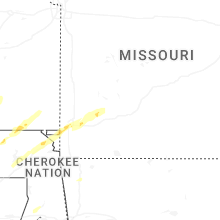
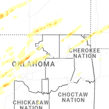
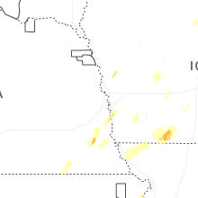
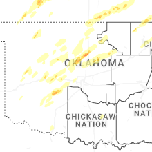
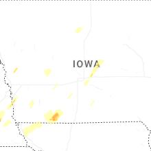
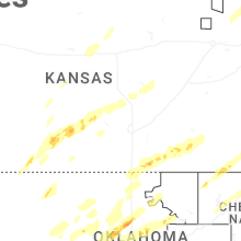
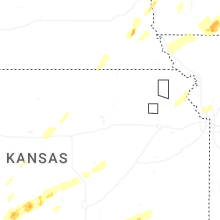
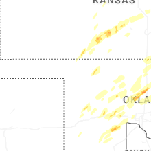
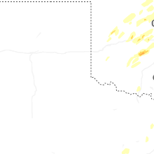
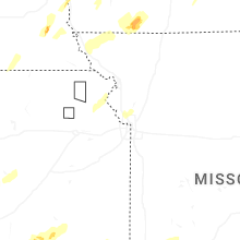
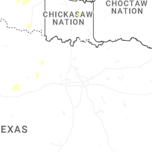
Regions Impacted by Hail on 10/30/2024
Cities Most Affected by Hail Storms of 10/30/2024
| Hail Size | Demographics of Zip Codes Affected | ||||||
|---|---|---|---|---|---|---|---|
| City | Count | Average | Largest | Pop Density | House Value | Income | Age |
| Orlando, OK | 1 | 1.75 | 1.75 | 4 | $35k | $35.9k | 41.8 |
Hail and Wind Damage Spotted on 10/30/2024
Filter by Report Type:Hail ReportsWind Reports
Nebraska
| Local Time | Report Details |
|---|---|
| 10:45 AM CDT | Quarter sized hail reported near Syracuse, NE, 41.8 miles SSW of Omaha, NE |
| 11:27 AM CDT | Quarter sized hail reported near Plattsmouth, NE, 17.5 miles S of Omaha, NE, dime to quarter size hail in plattsmouth. |
| 1:00 PM CDT | 6 train cars on a double-stacked train are leaning from a tree that fell onto train. time estimated based on rada in richardson county NE, 78 miles NE of Manhattan, KS |
| 1:06 PM CDT | Trees down all over town and using snowplows to assist in removal of tree debris. trees went through the roofs of 2 homes. large factory lost 3-4k square feet of their in richardson county NE, 79.6 miles NE of Manhattan, KS |
| 1:07 PM CDT | Storm damage reported in richardson county NE, 80.1 miles NE of Manhattan, KS |
| 1:08 PM CDT | Wall of house blown down... bus moved... debris in field... powerlines dow in richardson county NE, 81.1 miles SSE of Omaha, NE |
| 1:15 PM CDT | Several trees dow in richardson county NE, 80.1 miles NE of Manhattan, KS |
Kansas
| Local Time | Report Details |
|---|---|
| 12:18 PM CDT | Emergency manager reported several outhouse buildings and power poles damaged. one house was destroyed as it slid off its foundation and one occupant inside it was inju in marshall county KS, 39 miles NNE of Manhattan, KS |
| 12:18 PM CDT | Sheriffs office reported widespread damage near vermillion with outbuildings damaged... trees down... and power lines dow in marshall county KS, 41.3 miles NNE of Manhattan, KS |
| 12:31 PM CDT | Measured at personal weather statio in nemaha county KS, 52.4 miles NNE of Manhattan, KS |
| 12:35 PM CDT | Storm damage reported in nemaha county KS, 55.8 miles NNE of Manhattan, KS |
| 12:38 PM CDT | Multiple trees down in seneca... truck blown off highway 36 east of senec in nemaha county KS, 52.6 miles NNE of Manhattan, KS |
| 12:40 PM CDT | Storm damage reported in nemaha county KS, 50.6 miles NNE of Manhattan, KS |
| 12:46 PM CDT | Storm damage reported in nemaha county KS, 63.1 miles NE of Manhattan, KS |
| 12:52 PM CDT | Personal weather statio in brown county KS, 68.4 miles NE of Manhattan, KS |
| 2:28 PM CDT | Quarter sized hail reported near Pratt, KS, 68.3 miles W of Wichita, KS, report made by broadcast media via chat. |
| 2:47 PM CDT | Trained spotter estimates 50 to 60 mph winds and reports pea sized hai in kingman county KS, 51.3 miles W of Wichita, KS |
| 5:42 PM CDT | 60 mph winds and blowing debris at highway 166 and 11th road which was relayed via emergency managemen in cowley county KS, 44.7 miles SSE of Wichita, KS |
| 5:50 PM CDT | Quarter sized hail reported near Arkansas City, KS, 44.9 miles SSE of Wichita, KS, emergency manager and trained spotters report quarter sized hail. a picture was shared too. |
| 6:35 PM CDT | Half Dollar sized hail reported near Cambridge, KS, 46.3 miles ESE of Wichita, KS, a little bigger than quarter sized hail and estimated 50 mph winds. |
| 6:50 PM CDT | Trained spotter estimates brief 60 mph winds and dime sized hai in elk county KS, 51.6 miles WSW of Chanute, KS |
| 7:05 PM CDT | Pea sized hail was reported as wel in elk county KS, 39.6 miles WSW of Chanute, KS |
| 7:12 PM CDT | Storm damage reported in douglas county KS, 29.8 miles WSW of Kansas City, MO |
| 7:26 PM CDT | Downed power lines and power outages near 56th street. time estimated from rada in johnson county KS, 14.2 miles WSW of Kansas City, MO |
| 7:30 PM CDT | 60 mph winds on the south side of toronto lake relayed via emergency managemen in woodson county KS, 25.4 miles W of Chanute, KS |
| 7:31 PM CDT | Asos station kixd olathe industria in johnson county KS, 25.2 miles SW of Kansas City, MO |
| 7:39 PM CDT | Downed tree limbs and wires near floyd street. time estimated from rada in johnson county KS, 7.9 miles SW of Kansas City, MO |
| 7:39 PM CDT | Downed tree limbs and wires near waverly avenue. time estimated from rada in wyandotte county KS, 8.1 miles WNW of Kansas City, MO |
| 7:41 PM CDT | Downed tree limbs and wires near lamar avenue. time estimated from rada in johnson county KS, 9.4 miles SSW of Kansas City, MO |
| 7:44 PM CDT | Downed power lines and power outages near 63rd street. time estimated from rada in johnson county KS, 6.6 miles SSW of Kansas City, MO |
| 7:51 PM CDT | 70 mph winds with pea to marble sized hai in woodson county KS, 10.2 miles NW of Chanute, KS |
| 8:09 PM CDT | Tree down in the town of la harp in allen county KS, 18.4 miles NNE of Chanute, KS |
| 8:13 PM CDT | Downed power lines and power outages near parker. time estimated from rada in linn county KS, 51.3 miles NNE of Chanute, KS |
| 8:40 PM CDT | Corrects previous tstm wnd dmg report from 7 n mccune. fire department reported a power pole and lines down on an occupied vehicle at 580th and 40t in crawford county KS, 28.2 miles ESE of Chanute, KS |
| 9:27 PM CDT | Fire department reported a power pole and lines down on an occupied vehicle at 580th and 40t in crawford county KS, 28.2 miles ESE of Chanute, KS |
Missouri
| Local Time | Report Details |
|---|---|
| 1:14 PM CDT | Private weather statio in atchison county MO, 71.7 miles SSE of Omaha, NE |
| 1:20 PM CDT | Downed power lines and power outages in the craig area. time estimated from radar and dispatch report in holt county MO, 79.7 miles SSE of Omaha, NE |
| 1:24 PM CDT | Downed wires and widespread power outages in southeastern atchison county. time estimated from rada in atchison county MO, 71.9 miles SSE of Omaha, NE |
| 1:24 PM CDT | Portions of school building torn off. time estimated from rada in holt county MO, 78.9 miles SSE of Omaha, NE |
| 1:39 PM CDT | Several reports of wires down and power outages in western nodaway county... primarily north of skidmore and west of maryville. time estimated from rada in nodaway county MO, 78.5 miles SE of Omaha, NE |
| 1:40 PM CDT | Social media report and photos of downed power poles and wires between craig and big lake. time estimated from rada in holt county MO, 77.4 miles NNW of Kansas City, MO |
| 1:43 PM CDT | Social media photo of downed trees on business property. time estimated from rada in nodaway county MO, 81.2 miles SE of Omaha, NE |
| 1:43 PM CDT | Multiple trees and buildings damaged along route ab. time estimated from rada in nodaway county MO, 76.8 miles SE of Omaha, NE |
| 1:43 PM CDT | Several reports of downed power poles in northern holt county... with widespread outages. time estimated from rada in holt county MO, 80.3 miles SSE of Omaha, NE |
| 1:43 PM CDT | Report of a semi overturned on i-29 near craig. report relayed by nws oax. time estimated from rada in holt county MO, 79.9 miles SSE of Omaha, NE |
| 1:43 PM CDT | Downed power lines and power outages near route ff. several reports of trees and grain bins blown down as well. time estimated from rada in nodaway county MO, 77.3 miles SE of Omaha, NE |
| 1:47 PM CDT | Multiple power poles down near route 46 and route 113. time estimated from rada in nodaway county MO, 78.6 miles SE of Omaha, NE |
| 1:48 PM CDT | Downed power lines and power outages in the pickering area. time based on dispatch repor in nodaway county MO, 79.9 miles SE of Omaha, NE |
| 1:54 PM CDT | Several reports of trees down in northern portions of nodaway county. time estimated from rada in nodaway county MO, 77.5 miles SE of Omaha, NE |
| 1:58 PM CDT | Downed tree on a home. time estimated from rada in nodaway county MO, 80.3 miles SE of Omaha, NE |
| 1:58 PM CDT | Downed trees on route ee. time estimated from rada in nodaway county MO, 85.6 miles SE of Omaha, NE |
| 6:27 PM CDT | Downed power lines and power outages near 36th street. time estimated from rada in buchanan county MO, 49.6 miles NNW of Kansas City, MO |
| 6:28 PM CDT | Downed power lines and power outages near gene field road. time estimated from rada in buchanan county MO, 48.8 miles NNW of Kansas City, MO |
| 6:43 PM CDT | Downed power lines and power outages near route 6. time estimated from rada in buchanan county MO, 47.1 miles N of Kansas City, MO |
| 7:49 PM CDT | Downed power lines and power outages near prospect avenue. time estimated from rada in jackson county MO, 7.9 miles S of Kansas City, MO |
| 8:13 PM CDT | Corrects previous tstm wnd dmg report from 2 sse orrick. downed wires and power outages near floyd circle. time estimated from rada in ray county MO, 26.1 miles ENE of Kansas City, MO |
| 8:15 PM CDT | Private weather statio in clay county MO, 17.4 miles NE of Kansas City, MO |
| 8:29 PM CDT | Social media report. time estimated from rada in livingston county MO, 67.8 miles NE of Kansas City, MO |
| 8:30 PM CDT | Member of public reported a shed blown over and damage to multiple other buildings at a farm near stet. report relayed via broadcast media. time estimated from rada in carroll county MO, 49.3 miles ENE of Kansas City, MO |
| 8:40 PM CDT | Report of semi tipped over at hwy 36 and liv 25 in livingston county MO, 75.3 miles NE of Kansas City, MO |
| 8:40 PM CDT | Downed power lines and power outages in the freeman area. time estimated from rada in cass county MO, 33.5 miles S of Kansas City, MO |
| 8:43 PM CDT | Downed trees reported in wheeling. multiple houses damaged. time estimated from rada in livingston county MO, 79.5 miles NE of Kansas City, MO |
| 8:56 PM CDT | Time estimated from rada in linn county MO, 77.6 miles NW of Columbia, MO |
| 8:56 PM CDT | Downed power lines and power outages near archie. time estimated from rada in cass county MO, 44.8 miles SSE of Kansas City, MO |
| 9:13 PM CDT | Downed wires and power outages near floyd circle. time estimated from rada in ray county MO, 26.1 miles ENE of Kansas City, MO |
| 9:19 PM CDT | Social media report and photos of downed tree limbs and minor property damage at a residence in bucklin. time estimated from rada in linn county MO, 64.4 miles NNW of Columbia, MO |
| 10:41 PM CDT | Report of 4-5 inch diameter tree down across hwy z and steel truss... metal... and lumber across hwy 15 in shelby county MO, 53.1 miles N of Columbia, MO |
| 10:51 PM CDT | Measured with a davis weather statio in monroe county MO, 45.2 miles NNE of Columbia, MO |
| 10:56 PM CDT | Pole barn severely damaged. limbs down and at least one tree snapped. time estimated from rada in monroe county MO, 48.7 miles NNE of Columbia, MO |
| 11:06 PM CDT | Quarter sized hail reported near Joplin, MO, 67.5 miles W of Springfield, MO, mping report of quarter size hail. |
| 11:16 PM CDT | Quarter sized hail reported near Joplin, MO, 60.2 miles W of Springfield, MO, mping report of quarter... or one inch... hail. |
| 11:20 PM CDT | Delayed report... time estimated by radar. photos of large tree limb broken sent by skywarn radio operator in nwscha in jasper county MO, 62.4 miles W of Springfield, MO |
| 11:55 PM CDT | Delayed report. emergency management reported power outages on northeast side of bolivar... approximately at the intersection of market ave and e parkvie in polk county MO, 29.1 miles NNW of Springfield, MO |
| 12:22 AM CDT | 2 foot diameter tree down on market st and 1 ft diameter tree down on beech s in marion county MO, 52.9 miles SSE of Kahoka, MO |
| 1:36 AM CDT | Multiple trees and powerlines down in the kirbyville are in taney county MO, 41.3 miles S of Springfield, MO |
| 1:56 AM CDT | Storm damage reported in taney county MO, 36.3 miles SE of Springfield, MO |
Iowa
| Local Time | Report Details |
|---|---|
| 1:30 PM CDT | Personal weather statio in adair county IA, 43.3 miles WSW of Des Moines, IA |
| 3:24 PM CDT | Delayed report... time estimated by radar. damage to grain bin... barn destroyed... farm equipment shifted... tin lofted and transported. pictures from emergency manage in clarke county IA, 39.4 miles S of Des Moines, IA |
| 7:30 PM CDT | Peak gust from a personal weather statio in lucas county IA, 49.6 miles SSE of Des Moines, IA |
| 8:05 PM CDT | Wind gust of 62 mph measured on home anemometer with power flickering in the area. time estimated by rada in appanoose county IA, 65.2 miles WNW of Kahoka, MO |
| 10:35 PM CDT | Awos station keok keokuk arp in lee county IA, 16.1 miles ENE of Kahoka, MO |
Oklahoma
| Local Time | Report Details |
|---|---|
| 2:40 PM CDT | Butler mesone in custer county OK, 58.6 miles S of Woodward, OK |
| 3:35 PM CDT | Storm damage reported in harmon county OK, 27.3 miles NE of Childress, TX |
| 3:40 PM CDT | Storm damage reported in major county OK, 48.5 miles E of Woodward, OK |
| 3:44 PM CDT | Storm damage reported in major county OK, 52.7 miles E of Woodward, OK |
| 3:45 PM CDT | Power poles down; time estimated from rada in major county OK, 53.5 miles E of Woodward, OK |
| 4:04 PM CDT | Storm damage reported in major county OK, 58.9 miles ESE of Woodward, OK |
| 4:11 PM CDT | Time estimated from rada in garfield county OK, 74.9 miles NNW of Oklahoma City, OK |
| 4:34 PM CDT | Storm damage reported in major county OK, 58.9 miles ESE of Woodward, OK |
| 4:40 PM CDT | Downed power pole at the high school. time estimated from rada in blaine county OK, 63.3 miles NW of Oklahoma City, OK |
| 4:42 PM CDT | Storm damage reported in blaine county OK, 61.9 miles NW of Oklahoma City, OK |
| 4:45 PM CDT | Storm damage reported in custer county OK, 70.5 miles W of Oklahoma City, OK |
| 4:52 PM CDT | Quarter sized hail reported near Weatherford, OK, 66.8 miles W of Oklahoma City, OK, report from mping: quarter (1.00 in.). |
| 5:04 PM CDT | Storm damage reported in garfield county OK, 68.4 miles NNW of Oklahoma City, OK |
| 5:24 PM CDT | Storm damage reported in garfield county OK, 75.2 miles N of Oklahoma City, OK |
| 5:43 PM CDT | Quarter sized hail reported near Geary, OK, 46.3 miles WNW of Oklahoma City, OK |
| 5:55 PM CDT | Storm damage reported in kay county OK, 64.8 miles S of Wichita, KS |
| 6:24 PM CDT | Time estimated from rada in garfield county OK, 57.8 miles N of Oklahoma City, OK |
| 6:40 PM CDT | Corrects previous tstm wnd dmg report from 3 ene orlando. overturned tractor trailer on i-35. time estimated from rada in noble county OK, 48.6 miles NNE of Oklahoma City, OK |
| 6:45 PM CDT | Downed tree and power lines. twitter report. time estimated from rada in logan county OK, 38 miles N of Oklahoma City, OK |
| 6:50 PM CDT | Storm damage reported in logan county OK, 43.5 miles N of Oklahoma City, OK |
| 7:00 PM CDT | Overturned tractor trailer on i-35. time estimated from rada in noble county OK, 48.6 miles NNE of Oklahoma City, OK |
| 7:05 PM CDT | Storm damage reported in logan county OK, 40.9 miles N of Oklahoma City, OK |
| 7:22 PM CDT | Ping Pong Ball sized hail reported near Orlando, OK, 44.7 miles N of Oklahoma City, OK |
| 7:28 PM CDT | Golf Ball sized hail reported near Orlando, OK, 47.8 miles N of Oklahoma City, OK |
| 7:28 PM CDT | Storm damage reported in logan county OK, 47.2 miles N of Oklahoma City, OK |
| 8:30 PM CDT | Corrects the previous lsr... initially as 3 w guthrie. tree is on broadway near camp and is blocking entire southbound lan in logan county OK, 25.5 miles N of Oklahoma City, OK |
| 8:30 PM CDT | Tree down and in the road at 33rd and broadwa in logan county OK, 28.2 miles N of Oklahoma City, OK |
| 8:35 PM CDT | Mesonet station ftcb fort cob in caddo county OK, 58.1 miles WSW of Oklahoma City, OK |
| 10:31 PM CDT | Storm chaser reported multiple snapped power poles and tree damage northwest of fairland... near e 150 rd and highway 125. relayed by broadcast medi in ottawa county OK, 69 miles SSE of Chanute, KS |
Louisiana
| Local Time | Report Details |
|---|---|
| 4:27 PM CDT | Law enforcement reported at least one tree down at the intersection of old plain dealing road and abe martin road. time estimated by rada in bossier county LA, 22.4 miles N of Shreveport, LA |
Illinois
| Local Time | Report Details |
|---|---|
| 11:30 PM CDT | Multiple small trees down... blocking access to a subdivision and damaging roof in adams county IL, 39.2 miles SSE of Kahoka, MO |
| 11:43 PM CDT | 81 mph wind gust measured by kuin aso in adams county IL, 43.4 miles SE of Kahoka, MO |
Arkansas
| Local Time | Report Details |
|---|---|
| 12:32 AM CDT | Wood privacy fence blown down in prairie grove. information relayed via social medi in washington county AR, 41.5 miles N of Fort Smith, AR |
| 12:32 AM CDT | Multiple reports of wind damage in prairie grove... including tree limbs downed... roof damage... damage to windows and garage doors bent. relayed by broadcast medi in washington county AR, 41.7 miles N of Fort Smith, AR |


Connect with Interactive Hail Maps