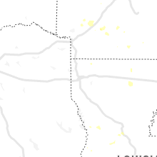
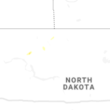
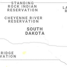
Hail Map for Wednesday, September 1, 2021

Number of Impacted Households on 9/1/2021
0
Impacted by 1" or Larger Hail
0
Impacted by 1.75" or Larger Hail
0
Impacted by 2.5" or Larger Hail
Square Miles of Populated Area Impacted on 9/1/2021
0
Impacted by 1" or Larger Hail
0
Impacted by 1.75" or Larger Hail
0
Impacted by 2.5" or Larger Hail
Regions Impacted by Hail on 9/1/2021
Cities Most Affected by Hail Storms of 9/1/2021
| Hail Size | Demographics of Zip Codes Affected | ||||||
|---|---|---|---|---|---|---|---|
| City | Count | Average | Largest | Pop Density | House Value | Income | Age |
| Bayard, NE | 2 | 1.75 | 1.75 | 5 | $52k | $30.8k | 43.5 |
| Bridgeport, NE | 1 | 2.00 | 2.00 | 2 | $50k | $30.3k | 42.9 |
Hail and Wind Damage Spotted on 9/1/2021
Filter by Report Type:Hail ReportsWind Reports
States Impacted
Virginia, Mississippi, Maryland, Pennsylvania, Arkansas, Florida, New Mexico, New Jersey, Georgia, Nebraska, Kansas, New York, Colorado, Louisiana, Massachusetts, North DakotaVirginia
| Local Time | Report Details |
|---|---|
| 1:05 PM EDT | Large tree limbs downed along va-207 rogers clark blv in caroline county VA, 35.2 miles NNE of Richmond, VA |
| 2:00 PM EDT | Numerous trees dow in northumberland county VA, 74.4 miles WSW of Ocean City, MD |
| 3:16 PM EDT | Tree down on kingsport dr near crownpoint r in james city county VA, 48.7 miles NW of Virginia Beach, VA |
| 4:00 PM EDT | Tree branches down on power lines near moran creek r in lancaster county VA, 67.3 miles ENE of Richmond, VA |
Mississippi
| Local Time | Report Details |
|---|---|
| 1:09 PM CDT | Tree downed on ott r in lowndes county MS, 34 miles ENE of Starkville, MS |
| 1:18 PM CDT | A tree was downed across the road on border springs r in lowndes county MS, 33.8 miles ENE of Starkville, MS |
| 3:22 PM CDT | Report of several trees dow in clay county MS, 13.6 miles NE of Starkville, MS |
| 3:30 PM CDT | Trees downed on w plymouth rd and tibbee d in lowndes county MS, 15.6 miles ENE of Starkville, MS |
| 3:40 PM CDT | Tree downed on robinson r in lowndes county MS, 19.2 miles E of Starkville, MS |
| 3:41 PM CDT | Tree downed on evans r in lowndes county MS, 19.3 miles E of Starkville, MS |
| 3:49 PM CDT | Trees and power lines downed at intersection of ms hwy 14 and massey hisaw rd and higgason r in winston county MS, 37 miles SW of Starkville, MS |
| 4:05 PM CDT | Tree down on east winston road off hwy 39 in winston county MS, 32.9 miles S of Starkville, MS |
| 4:11 PM CDT | Tree fell on powerline on calhoun r in winston county MS, 34.2 miles SSW of Starkville, MS |
| 4:11 PM CDT | Tree downed on ms 69 near the al state lin in lowndes county MS, 30.7 miles ESE of Starkville, MS |
| 4:29 PM CDT | Several trees downed scattered across neshoba c in neshoba county MS, 51.6 miles SSW of Starkville, MS |
| 4:40 PM CDT | Several trees downed in eastern holmes c in holmes county MS, 53.1 miles NNE of Jackson, MS |
| 4:42 PM CDT | Tree and large limbs downed at kosciusko coop sit in attala county MS, 52.5 miles WSW of Starkville, MS |
| 4:47 PM CDT | Tree fell on house near goodman stree in attala county MS, 53.5 miles WSW of Starkville, MS |
| 4:47 PM CDT | Large tree down on natchez trace roa in attala county MS, 54.5 miles SW of Starkville, MS |
| 4:47 PM CDT | Tree fell on house near fairground stree in attala county MS, 52.5 miles WSW of Starkville, MS |
| 4:47 PM CDT | A tower at a radio station fell on the building. no injuries reporte in attala county MS, 53 miles WSW of Starkville, MS |
| 5:09 PM CDT | A tree fell through a roof on eden main s in yazoo county MS, 47.6 miles N of Jackson, MS |
| 5:09 PM CDT | On church st... a doublewide mobile home was shifted and sustained roof damag in yazoo county MS, 48.3 miles N of Jackson, MS |
| 5:17 PM CDT | Trees downed on eden midway r in yazoo county MS, 44.4 miles N of Jackson, MS |
| 5:28 PM CDT | Multiple trees down scattered across leake c in leake county MS, 48.2 miles NE of Jackson, MS |
| 5:36 PM CDT | Power lines downed on academy dr and several trees downed on ms hwy 433 about one mile south of ms hwy 1 in yazoo county MS, 36.2 miles N of Jackson, MS |
| 5:38 PM CDT | Tree across ms hwy 16 at intersection with mollett r in yazoo county MS, 37.3 miles N of Jackson, MS |
| 5:47 PM CDT | Tree downed near cr 48 in clarke county MS, 83.4 miles W of Camden, AL |
| 5:55 PM CDT | Tree downed along cr 14 in clarke county MS, 81.6 miles W of Camden, AL |
| 6:10 PM CDT | Several trees downed across madison c in madison county MS, 23 miles NNE of Jackson, MS |
| 6:23 PM CDT | Structural damage and downed trees reported along highway 80 between hickory and newto in newton county MS, 62.7 miles E of Jackson, MS |
| 6:23 PM CDT | A large tree fell across stribling road ex in madison county MS, 16.5 miles NNE of Jackson, MS |
| 6:39 PM CDT | Tree downed along grants ferry r in rankin county MS, 10.6 miles ENE of Jackson, MS |
| 6:44 PM CDT | Tree down on highway 8 in rankin county MS, 20.5 miles E of Jackson, MS |
| 7:37 PM CDT | A powerline and several trees down on cox ferry r in yazoo county MS, 25.9 miles NW of Jackson, MS |
| 7:37 PM CDT | Trees down blocking roadway on jackson raymond rd near springridge r in hinds county MS, 9.7 miles WSW of Jackson, MS |
| 8:18 PM CDT | Several trees down in byra in hinds county MS, 9 miles SW of Jackson, MS |
| 8:30 PM CDT | Fallen tree on house at springridge r in hinds county MS, 10.2 miles WSW of Jackson, MS |
| 8:37 PM CDT | Trees down blocking roadway on siwell rd at byram estate in hinds county MS, 9.1 miles SW of Jackson, MS |
| 8:37 PM CDT | Tress down blocking roadway on springridge rd at owens r in hinds county MS, 11.5 miles SW of Jackson, MS |
| 9:20 PM CDT | A few trees and power lines down in tow in warren county MS, 39.9 miles W of Jackson, MS |
| 9:45 PM CDT | A tree was blown down...reported by copiah s in copiah county MS, 43.2 miles SSW of Jackson, MS |
Maryland
| Local Time | Report Details |
|---|---|
| 2:25 PM EDT | Multiple trees down on arundel expressway near east ordnance roa in anne arundel county MD, 7 miles S of Baltimore, MD |
| 3:16 PM EDT | A few trees down blocking roadways in easton. time estimated from rada in talbot county MD, 46 miles SE of Baltimore, MD |
| 3:20 PM EDT | Downed trees or wires caused a portion of md-329 to be closed north of station rd. time estimated from rada in talbot county MD, 43.9 miles SSE of Baltimore, MD |
| 3:22 PM EDT | Trees down blocking road ways near wye mills. time estimated from rada in talbot county MD, 38.3 miles SE of Baltimore, MD |
| 3:23 PM EDT | A few trees down blocking roadways. time estimated from rada in talbot county MD, 40.4 miles SSE of Baltimore, MD |
| 3:43 PM EDT | Md-495 bittinger road was closed in both directions due to flooding at maple grove roa in garrett county MD, 63.5 miles NE of Elkins, WV |
| 4:10 PM EDT | Tree down on lums roa in cecil county MD, 42 miles ENE of Baltimore, MD |
Pennsylvania
| Local Time | Report Details |
|---|---|
| 2:34 PM EDT | Multiple trees and wires down on the 11000 block of carlisle pik in adams county PA, 57.5 miles NNW of Baltimore, MD |
| 4:17 PM EDT | Trees and power poles snapped and roof damage along slate hill drive in east nottingham township. probable tornado. time estimated from rada in chester county PA, 48.4 miles NE of Baltimore, MD |
| 4:21 PM EDT | Multiple trees down along us 1 south near new london. possible tornado. time estimated from rada in chester county PA, 50.2 miles NE of Baltimore, MD |
| 5:39 PM EDT | Numerous trees down and minor damage to structures in a swath generally parallel to and just north of york road between sugar bottom road and route 20 in bucks county PA, 64.1 miles WSW of Brooklyn, NY |
| 5:39 PM EDT | Considerable tree damage in fort washington near the high school. possible tornado. time estimated from rada in montgomery county PA, 74 miles WSW of Brooklyn, NY |
| 5:39 PM EDT | Singificant tree damage in the fort washington area. possible tornado. time estimated from rada in montgomery county PA, 74.4 miles WSW of Brooklyn, NY |
| 5:44 PM EDT | Tree and power line damage around maple glen. possible tornado. time estimated from rada in montgomery county PA, 73.4 miles WSW of Brooklyn, NY |
| 5:46 PM EDT | Multiple buildings had their roofs blown off along norristown road. norristown road is completely blocked with debris. possible tornado. time estimated from rada in montgomery county PA, 70.7 miles WSW of Brooklyn, NY |
Arkansas
| Local Time | Report Details |
|---|---|
| 4:07 PM CDT | Multiple trees blown dow in dallas county AR, 51.2 miles SSW of Little Rock, AR |
| 4:54 PM CDT | Tree down onto arkansas hwy 22 in saline county AR, 30.5 miles SW of Little Rock, AR |
| 5:01 PM CDT | Multiple trees down in south garland county... along marion anderson road and central avenu in garland county AR, 52.9 miles WSW of Little Rock, AR |
| 5:16 PM CDT | A collapsing thunderstorm blew down two trees on highway 27 at washit in montgomery county AR, 51.7 miles NNE of Nashville, AR |
| 5:35 PM CDT | Trees down on hwy 24 east of prescot in nevada county AR, 31.7 miles ESE of Nashville, AR |
| 5:40 PM CDT | Tree down on hwy 195 near marlbrook baptist churc in hempstead county AR, 18.4 miles ESE of Nashville, AR |
| 5:40 PM CDT | Trees down in the 6100 block of hwy 371 east of blevin in hempstead county AR, 19.5 miles ESE of Nashville, AR |
Florida
| Local Time | Report Details |
|---|---|
| 5:10 PM EDT | Emergency management reports a fence blown over and large hardwood tree branch down due to a thunderstorm wind gust. time is radar estimate in miami-dade county FL, 3.3 miles W of Miami, FL |
| 5:36 PM EDT | Delayed report... a trained spotter called to report a large portion of a medium sized tree was broken and split in half when returning home from work. timing estimated in broward county FL, 30.6 miles N of Miami, FL |
New Mexico
| Local Time | Report Details |
|---|---|
| 3:40 PM MDT | Csbf fort sumne in de baca county NM, 55.8 miles SSW of Tucumcari, NM |
| 5:59 PM MDT | Kcao aso in union county NM, 94.3 miles NNE of Tucumcari, NM |
New Jersey
| Local Time | Report Details |
|---|---|
| 6:27 PM EDT | Funnel cloud spotted and damage reported in wenonah. possibly due to a tornado. time estimated from rada in gloucester county NJ, 85.2 miles ENE of Baltimore, MD |
| 6:40 PM EDT | Multiple trees and wires down around cherry hill. possible tornado. time estimated from rada in camden county NJ, 76.8 miles SW of Brooklyn, NY |
| 6:55 PM EDT | Damage reported near route 130 in the willingboro and edgewater park area. probable tornado. time estimated from rada in burlington county NJ, 64.5 miles SW of Brooklyn, NY |
| 7:06 PM EDT | Storm damage reported in burlington county NJ, 62.8 miles SW of Brooklyn, NY |
| 7:25 PM EDT | Trees and wires down in lawrenceville township. possible tornado. time estimated from rada in mercer county NJ, 48.3 miles SW of Brooklyn, NY |
| 8:51 PM EDT | Tree down into house with structural damage on voorhees roa in bergen county NJ, 23.8 miles NNW of Brooklyn, NY |
| 9:10 PM EDT | Storm damage reported in bergen county NJ, 12.1 miles NNW of Brooklyn, NY |
Georgia
| Local Time | Report Details |
|---|---|
| 6:35 PM EDT | Kaby reports wind gust of 58 mp in dougherty county GA, 75.9 miles N of Tallahassee, FL |
Nebraska
| Local Time | Report Details |
|---|---|
| 5:05 PM MDT | Golf Ball sized hail reported near Bayard, NE, 25.6 miles ESE of Scottsbluff, NE, received reports of cracked windshields due to hail along highway 26 between bridgeport and scottsbluff. time estimated based on radar. |
| 5:10 PM MDT | Hen Egg sized hail reported near Bridgeport, NE, 26.9 miles ESE of Scottsbluff, NE |
| 5:15 PM MDT | Golf Ball sized hail reported near Bayard, NE, 24.4 miles ESE of Scottsbluff, NE, received reports and photos of cracked windshields east of bayard. |
| 6:18 PM MDT | Corrects previous tstm wnd gst report from 5 se alliance. asos station kaia alliance airpor in box butte county NE, 46.3 miles ENE of Scottsbluff, NE |
| 6:25 PM MDT | Asos station kaia alliance airpor in box butte county NE, 46.3 miles ENE of Scottsbluff, NE |
Kansas
| Local Time | Report Details |
|---|---|
| 7:41 PM CDT | Report from mping: 1-inch tree limbs broken; shingles blown of in cheyenne county KS, 47.8 miles WNW of Colby, KS |
| 7:48 PM CDT | Storm damage reported in cheyenne county KS, 47 miles WNW of Colby, KS |
New York
| Local Time | Report Details |
|---|---|
| 10:09 PM EDT | Large tree down on new street took some wire in westchester county NY, 26.2 miles NE of Brooklyn, NY |
| 10:15 PM EDT | Wires down across natoma street and purchase stree in westchester county NY, 26.2 miles NE of Brooklyn, NY |
| 10:17 PM EDT | Tree down across playland parkway between forest ave and midland av in westchester county NY, 25.1 miles NE of Brooklyn, NY |
| 10:45 PM EDT | Numerous trees down. one large tree down into a hom in suffolk county NY, 35.8 miles ENE of Brooklyn, NY |
Colorado
| Local Time | Report Details |
|---|---|
| 8:18 PM MDT | Dispatch reported that much of burlington is without power. there are downed trees and power lines. mobile homes also sustained damage to window in kit carson county CO, 60.8 miles SSE of Yuma, CO |
| 8:20 PM MDT | Storm damage reported in kit carson county CO, 60.8 miles SSE of Yuma, CO |
Louisiana
| Local Time | Report Details |
|---|---|
| 9:35 PM CDT | Some trees down in the walnut bayou communit in madison county LA, 54.1 miles ESE of Bastrop, LA |
Massachusetts
| Local Time | Report Details |
|---|---|
| 1:25 AM EDT | Multiple trees reported down on route 6 in barnstable county MA, 62.9 miles E of Providence, RI |
North Dakota
| Local Time | Report Details |
|---|---|
| 5:50 AM CDT | Quarter sized hail reported near Stanley, ND, 51.7 miles W of Minot, ND |


Connect with Interactive Hail Maps