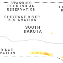
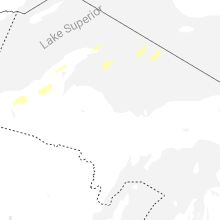
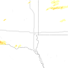
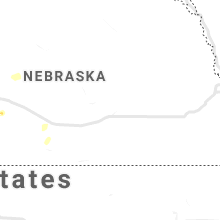
Hail Map for Thursday, September 16, 2021

Number of Impacted Households on 9/16/2021
0
Impacted by 1" or Larger Hail
0
Impacted by 1.75" or Larger Hail
0
Impacted by 2.5" or Larger Hail
Square Miles of Populated Area Impacted on 9/16/2021
0
Impacted by 1" or Larger Hail
0
Impacted by 1.75" or Larger Hail
0
Impacted by 2.5" or Larger Hail
Regions Impacted by Hail on 9/16/2021
Cities Most Affected by Hail Storms of 9/16/2021
| Hail Size | Demographics of Zip Codes Affected | ||||||
|---|---|---|---|---|---|---|---|
| City | Count | Average | Largest | Pop Density | House Value | Income | Age |
| Little Falls, MN | 2 | 2.25 | 2.50 | 66 | $83k | $37.3k | 41.8 |
Hail and Wind Damage Spotted on 9/16/2021
Filter by Report Type:Hail ReportsWind Reports
Wyoming
| Local Time | Report Details |
|---|---|
| 5:06 PM MDT | Mesonet station wy26 12.6 ne centennial (wydot) occurring between 458 and 506 p in albany county WY, 21.2 miles WNW of Laramie, WY |
Minnesota
| Local Time | Report Details |
|---|---|
| 6:20 PM CDT | Quarter sized hail reported near Crosby, MN, 80.6 miles SSE of Bemidji, MN |
| 6:21 PM CDT | Quarter sized hail reported near Palisade, MN, 59.8 miles W of Duluth, MN, nickle to occasional quarter size hail. |
| 6:25 PM CDT | Tennis Ball sized hail reported near Little Falls, MN, 88.7 miles NNW of Minneapolis, MN, cocorahs report. time estimated via radar. |
| 6:27 PM CDT | Quarter sized hail reported near Crosby, MN, 80.2 miles SSE of Bemidji, MN |
| 6:40 PM CDT | Hen Egg sized hail reported near Little Falls, MN, 88.7 miles NNW of Minneapolis, MN, photo on social media. |
| 6:55 PM CDT | Two trees down completely blocking roadway. time estimated from rada in st. louis county MN, 38.5 miles W of Duluth, MN |
| 7:00 PM CDT | Flag poles were blown over by wind gust in aitkin county MN, 66.2 miles W of Duluth, MN |
| 7:05 PM CDT | Half Dollar sized hail reported near Royalton, MN, 79.9 miles NW of Minneapolis, MN |
| 7:21 PM CDT | Quarter sized hail reported near Palisade, MN, 73.1 miles W of Duluth, MN |
| 7:35 PM CDT | Tree down across road on powerline in morrison county MN, 68.4 miles NNW of Minneapolis, MN |
| 8:10 PM CDT | Quarter sized hail reported near Wahkon, MN, 79.8 miles N of Minneapolis, MN |
| 8:25 PM CDT | Quarter sized hail reported near Wahkon, MN, 79.3 miles WSW of Duluth, MN |
| 10:28 PM CDT | Quarter sized hail reported near Saginaw, MN, 14.3 miles NW of Duluth, MN, relayed via social media with picture. |
| 12:00 AM CDT | Quarter sized hail reported near Cloquet, MN, 20.1 miles W of Duluth, MN, report relayed via social media. some nickel size hail was also reported... but quarters were the largest size. |
| 12:05 AM CDT | Quarter sized hail reported near Duluth, MN, 10 miles WNW of Duluth, MN |
| 12:30 AM CDT | Mesonet station rppm5 redstone raw in pipestone county MN, 38.1 miles NNE of Sioux Falls, SD |
| 12:37 AM CDT | Mesonet station mn006 beaver creek i-90 mile post in rock county MN, 18.2 miles ENE of Sioux Falls, SD |
| 12:40 AM CDT | Quarter sized hail reported near Ogilvie, MN, 59.3 miles N of Minneapolis, MN |
| 1:03 AM CDT | Awos station kdvp slayton municipal airpor in murray county MN, 56.3 miles ENE of Sioux Falls, SD |
| 2:15 AM CDT | Awos station kulm new ulm a in brown county MN, 74.2 miles SE of Montevideo, MN |
| 2:15 AM CDT | Spotter reported 10-12 inch diameter tree down. will send pictures in the mornin in brown county MN, 74.9 miles SW of Minneapolis, MN |
| 3:00 AM CDT | Phoned in report of damage to buildings and power infrastructure... with large amounts of debris scattered around. large portion of city without power. time estimated b in scott county MN, 15.8 miles SSW of Minneapolis, MN |
| 3:05 AM CDT | Rice co dispatch reported semi-trailer flipped over from wind gusts. time roughly estimated from rada in rice county MN, 34.5 miles S of Minneapolis, MN |
| 3:08 AM CDT | 4-6 inch tree limbs down over roadways. picture via twitter. time estimated via rada in dakota county MN, 14.2 miles SSE of Minneapolis, MN |
| 3:09 AM CDT | 64mph wind gust measured at msp international airpor in hennepin county MN, 7.2 miles SSE of Minneapolis, MN |
| 3:15 AM CDT | Small tree limbs down... home weather station recorded 58mph gus in scott county MN, 17.2 miles SSW of Minneapolis, MN |
Nebraska
| Local Time | Report Details |
|---|---|
| 5:40 PM MDT | Half Dollar sized hail reported near Big Springs, NE, 70.4 miles NNE of Yuma, CO, spotter called to report mostly peas but some inch to inch and a half hail... and 45 mph winds. |
| 5:52 PM MDT | Quarter sized hail reported near Big Springs, NE, 68.4 miles W of North Platte, NE, spotter estimated quarter sized hail in town. |
| 6:41 PM MDT | Storm damage reported in keith county NE, 49.9 miles W of North Platte, NE |
| 6:43 PM MDT | Quarter sized hail reported near Ogallala, NE, 49.9 miles W of North Platte, NE, mping report. |
| 6:55 PM MDT | Approx 3 inch branches down via twitte in keith county NE, 49.9 miles W of North Platte, NE |
| 8:42 PM CDT | Personal weather statio in lincoln county NE, 6.5 miles N of North Platte, NE |
South Dakota
| Local Time | Report Details |
|---|---|
| 10:10 PM CDT | Quarter sized hail reported near South Shore, SD, 69.4 miles WNW of Montevideo, MN, time estimated based on radar. hail may have been a little larger... enough to dent vehicles. |
| 11:58 PM CDT | Relayed report of high winds leading to transformers blown... with power outages being reported across the are in minnehaha county SD, 18.7 miles WNW of Sioux Falls, SD |
| 12:04 AM CDT | Mesonet station 224 sd rwis war in moody county SD, 41.8 miles N of Sioux Falls, SD |
| 12:15 AM CDT | Awos station kykn yankton municipal airpor in yankton county SD, 53.9 miles SW of Sioux Falls, SD |
| 12:15 AM CDT | Mesonet station btcs2 baltic 3 se (sd mesonet in minnehaha county SD, 13 miles NNE of Sioux Falls, SD |
| 12:28 AM CDT | Mesonet station 16 sd rwis beresfor in union county SD, 35.1 miles S of Sioux Falls, SD |
| 12:38 AM CDT | Personal weather station (ksdburba2 in clay county SD, 53.7 miles S of Sioux Falls, SD |
Iowa
| Local Time | Report Details |
|---|---|
| 12:50 AM CDT | Mesonet station fw6302 hawarde in sioux county IA, 40.2 miles SSE of Sioux Falls, SD |
| 1:07 AM CDT | Ksxk awos reported gust to 63 mp in sioux county IA, 48 miles SE of Sioux Falls, SD |
| 1:26 AM CDT | Awos station kshl sheldon airpor in o'brien county IA, 50.5 miles NW of Storm Lake, IA |
| 1:29 AM CDT | Roof completely removed from strip mall and deposited in pieces on roadwa in o'brien county IA, 48.9 miles NW of Storm Lake, IA |
Wisconsin
| Local Time | Report Details |
|---|---|
| 3:34 AM CDT | Twitter picture of 1/2 to 1 inch tree limbs down. time estimated by rada in st. croix county WI, 31.1 miles E of Minneapolis, MN |


Connect with Interactive Hail Maps