| 3/31/2025 7:24 PM CDT |
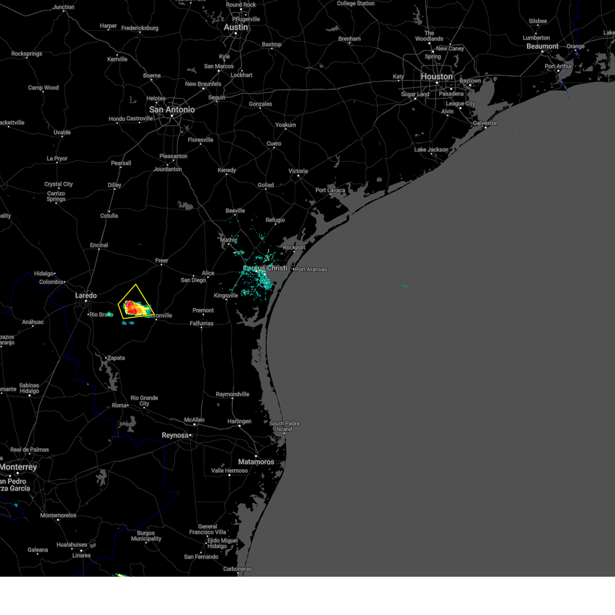 At 724 pm cdt, a severe thunderstorm was located over aguilares, or 24 miles west of hebbronville, moving northeast at 10 mph (radar indicated). Hazards include 60 mph wind gusts and quarter size hail. Hail damage to vehicles is expected. expect wind damage to roofs, siding, and trees. Locations impacted include, oilton, mirando city, aguilares, and bruni. At 724 pm cdt, a severe thunderstorm was located over aguilares, or 24 miles west of hebbronville, moving northeast at 10 mph (radar indicated). Hazards include 60 mph wind gusts and quarter size hail. Hail damage to vehicles is expected. expect wind damage to roofs, siding, and trees. Locations impacted include, oilton, mirando city, aguilares, and bruni.
|
| 3/31/2025 7:21 PM CDT |
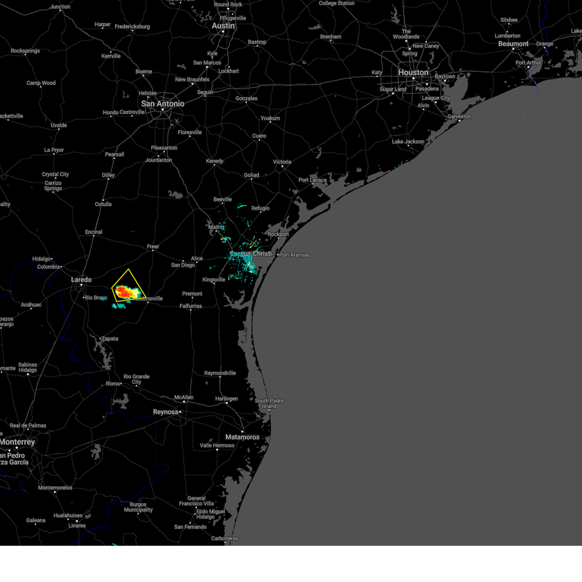 At 721 pm cdt, a severe thunderstorm was located over oilton, or 23 miles northwest of hebbronville, moving northeast at 10 mph (radar indicated). Hazards include 60 mph wind gusts and quarter size hail. Hail damage to vehicles is expected. expect wind damage to roofs, siding, and trees. Locations impacted include, oilton, mirando city, aguilares, and bruni. At 721 pm cdt, a severe thunderstorm was located over oilton, or 23 miles northwest of hebbronville, moving northeast at 10 mph (radar indicated). Hazards include 60 mph wind gusts and quarter size hail. Hail damage to vehicles is expected. expect wind damage to roofs, siding, and trees. Locations impacted include, oilton, mirando city, aguilares, and bruni.
|
| 3/31/2025 7:13 PM CDT |
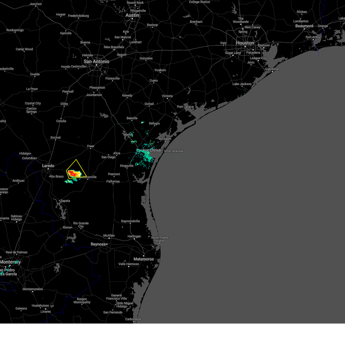 Svrcrp the national weather service in corpus christi has issued a * severe thunderstorm warning for, southwestern duval county in south central texas, southeastern webb county in south central texas, * until 800 pm cdt. * at 711 pm cdt, a severe thunderstorm was located near aguilares, or 24 miles west of hebbronville, moving northeast at 10 mph (radar indicated). Hazards include 60 mph wind gusts and nickel size hail. expect damage to roofs, siding, and trees Svrcrp the national weather service in corpus christi has issued a * severe thunderstorm warning for, southwestern duval county in south central texas, southeastern webb county in south central texas, * until 800 pm cdt. * at 711 pm cdt, a severe thunderstorm was located near aguilares, or 24 miles west of hebbronville, moving northeast at 10 mph (radar indicated). Hazards include 60 mph wind gusts and nickel size hail. expect damage to roofs, siding, and trees
|
| 3/27/2025 10:30 PM CDT |
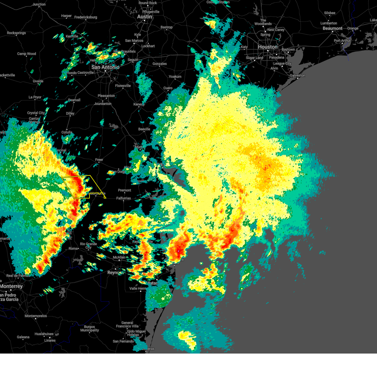 At 1029 pm cdt, severe thunderstorms were located along a line extending from 6 miles south of ranchitos las lomas to near thompsonville, moving east at 45 mph (radar indicated). Hazards include 70 mph wind gusts. Expect considerable tree damage. damage is likely to mobile homes, roofs, and outbuildings. locations impacted include, oilton, mirando city, aguilares, bruni, and ranchitos las lomas. This includes us highway 59 between mile markers 810 and 816. At 1029 pm cdt, severe thunderstorms were located along a line extending from 6 miles south of ranchitos las lomas to near thompsonville, moving east at 45 mph (radar indicated). Hazards include 70 mph wind gusts. Expect considerable tree damage. damage is likely to mobile homes, roofs, and outbuildings. locations impacted include, oilton, mirando city, aguilares, bruni, and ranchitos las lomas. This includes us highway 59 between mile markers 810 and 816.
|
| 3/27/2025 10:16 PM CDT |
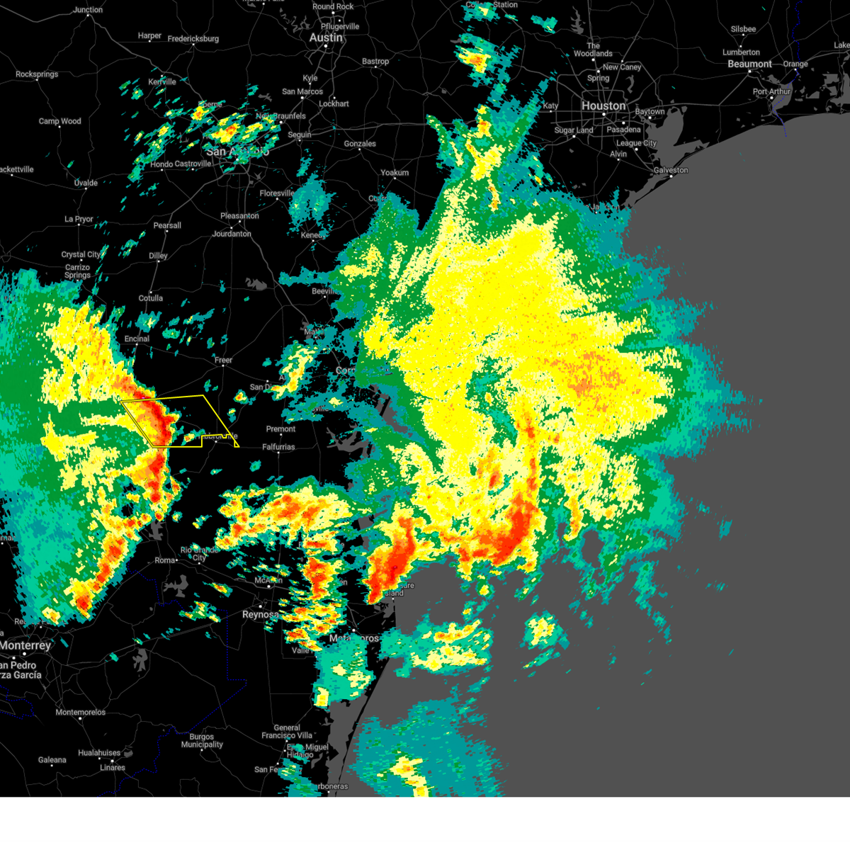 At 1015 pm cdt, severe thunderstorms were located along a line extending from 8 miles east of texas a&m to 10 miles northwest of thompsonville, moving east at 45 mph (radar indicated). Hazards include 70 mph wind gusts. Expect considerable tree damage. damage is likely to mobile homes, roofs, and outbuildings. locations impacted include, texas a&m, mirando city, doctors hospital of laredo, laredo country club, bruni, oilton, aguilares, ranchitos las lomas, and laredo. This includes us highway 59 between mile markers 810 and 824. At 1015 pm cdt, severe thunderstorms were located along a line extending from 8 miles east of texas a&m to 10 miles northwest of thompsonville, moving east at 45 mph (radar indicated). Hazards include 70 mph wind gusts. Expect considerable tree damage. damage is likely to mobile homes, roofs, and outbuildings. locations impacted include, texas a&m, mirando city, doctors hospital of laredo, laredo country club, bruni, oilton, aguilares, ranchitos las lomas, and laredo. This includes us highway 59 between mile markers 810 and 824.
|
| 3/27/2025 10:00 PM CDT |
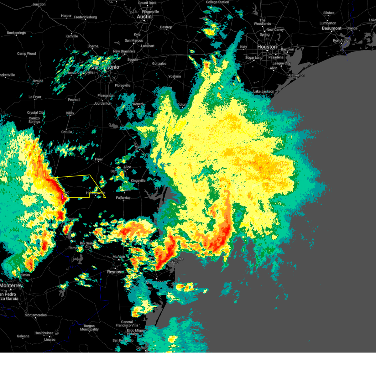 Svrcrp the national weather service in corpus christi has issued a * severe thunderstorm warning for, southwestern duval county in south central texas, southeastern webb county in south central texas, * until 1045 pm cdt. * at 1000 pm cdt, severe thunderstorms were located along a line extending from texas a&m to 13 miles southwest of aguilares, moving east at 45 mph (radar indicated). Hazards include 70 mph wind gusts. Expect considerable tree damage. Damage is likely to mobile homes, roofs, and outbuildings. Svrcrp the national weather service in corpus christi has issued a * severe thunderstorm warning for, southwestern duval county in south central texas, southeastern webb county in south central texas, * until 1045 pm cdt. * at 1000 pm cdt, severe thunderstorms were located along a line extending from texas a&m to 13 miles southwest of aguilares, moving east at 45 mph (radar indicated). Hazards include 70 mph wind gusts. Expect considerable tree damage. Damage is likely to mobile homes, roofs, and outbuildings.
|
| 5/28/2024 10:23 PM CDT |
 At 1023 pm cdt, severe thunderstorms were located along a line extending from 16 miles south of fort ewell site to near oilton to near thompsonville, moving east at 45 mph (radar indicated). Hazards include 60 mph wind gusts and penny size hail. Expect damage to roofs, siding, and trees. these severe storms will be near, bruni around 1030 pm cdt. realitos around 1045 pm cdt. freer around 1055 pm cdt. benavides around 1100 pm cdt. rosita around 1105 pm cdt. This includes us highway 59 between mile markers 754 and 806. At 1023 pm cdt, severe thunderstorms were located along a line extending from 16 miles south of fort ewell site to near oilton to near thompsonville, moving east at 45 mph (radar indicated). Hazards include 60 mph wind gusts and penny size hail. Expect damage to roofs, siding, and trees. these severe storms will be near, bruni around 1030 pm cdt. realitos around 1045 pm cdt. freer around 1055 pm cdt. benavides around 1100 pm cdt. rosita around 1105 pm cdt. This includes us highway 59 between mile markers 754 and 806.
|
| 5/28/2024 10:09 PM CDT |
 Svrcrp the national weather service in corpus christi has issued a * severe thunderstorm warning for, duval county in south central texas, eastern webb county in south central texas, * until 1115 pm cdt. * at 1008 pm cdt, severe thunderstorms were located along a line extending from 10 miles east of encinal to 6 miles southeast of ranchitos las lomas to 17 miles southwest of aguilares, moving east at 45 mph (radar indicated). Hazards include 60 mph wind gusts and penny size hail. Expect damage to roofs, siding, and trees. severe thunderstorms will be near, aguilares and mirando city around 1015 pm cdt. oilton around 1020 pm cdt. bruni around 1030 pm cdt. freer around 1045 pm cdt. seven sisters around 1055 pm cdt. rosita and realitos around 1100 pm cdt. benavides around 1105 pm cdt. this includes the following highways, interstate 35 between mile markers 31 and 34. Us highway 59 between mile markers 754 and 816. Svrcrp the national weather service in corpus christi has issued a * severe thunderstorm warning for, duval county in south central texas, eastern webb county in south central texas, * until 1115 pm cdt. * at 1008 pm cdt, severe thunderstorms were located along a line extending from 10 miles east of encinal to 6 miles southeast of ranchitos las lomas to 17 miles southwest of aguilares, moving east at 45 mph (radar indicated). Hazards include 60 mph wind gusts and penny size hail. Expect damage to roofs, siding, and trees. severe thunderstorms will be near, aguilares and mirando city around 1015 pm cdt. oilton around 1020 pm cdt. bruni around 1030 pm cdt. freer around 1045 pm cdt. seven sisters around 1055 pm cdt. rosita and realitos around 1100 pm cdt. benavides around 1105 pm cdt. this includes the following highways, interstate 35 between mile markers 31 and 34. Us highway 59 between mile markers 754 and 816.
|
| 5/28/2024 9:53 PM CDT |
 At 952 pm cdt, severe thunderstorms were located along a line extending from near encinal to 6 miles east of united south high school to 6 miles north of san ygnacio, moving east at 40 mph (radar indicated. at 945 pm cdt, 60 mph wind was reported at laredo international airport). Hazards include 60 mph wind gusts and penny size hail. Expect damage to roofs, siding, and trees. these severe storms will be near, ranchitos las lomas around 955 pm cdt. aguilares around 1010 pm cdt. mirando city around 1015 pm cdt. this includes the following highways, interstate 35 between mile markers 1 and 37. us highway 59 between mile markers 792 and 824. Us highway 83 between mile markers 684 and 734. At 952 pm cdt, severe thunderstorms were located along a line extending from near encinal to 6 miles east of united south high school to 6 miles north of san ygnacio, moving east at 40 mph (radar indicated. at 945 pm cdt, 60 mph wind was reported at laredo international airport). Hazards include 60 mph wind gusts and penny size hail. Expect damage to roofs, siding, and trees. these severe storms will be near, ranchitos las lomas around 955 pm cdt. aguilares around 1010 pm cdt. mirando city around 1015 pm cdt. this includes the following highways, interstate 35 between mile markers 1 and 37. us highway 59 between mile markers 792 and 824. Us highway 83 between mile markers 684 and 734.
|
| 5/28/2024 9:41 PM CDT |
 At 940 pm cdt, severe thunderstorms were located along a line extending from near encinal to near united south high school to 12 miles northwest of san ygnacio, moving southeast at 35 mph (radar indicated). Hazards include 60 mph wind gusts and penny size hail. Expect damage to roofs, siding, and trees. these severe storms will be near, laredo, rio bravo, and callaghan around 945 pm cdt. ranchitos las lomas around 950 pm cdt. aguilares around 1010 pm cdt. mirando city around 1020 pm cdt. this includes the following highways, interstate 35 between mile markers 1 and 38. us highway 59 between mile markers 792 and 824. Us highway 83 between mile markers 680 and 734. At 940 pm cdt, severe thunderstorms were located along a line extending from near encinal to near united south high school to 12 miles northwest of san ygnacio, moving southeast at 35 mph (radar indicated). Hazards include 60 mph wind gusts and penny size hail. Expect damage to roofs, siding, and trees. these severe storms will be near, laredo, rio bravo, and callaghan around 945 pm cdt. ranchitos las lomas around 950 pm cdt. aguilares around 1010 pm cdt. mirando city around 1020 pm cdt. this includes the following highways, interstate 35 between mile markers 1 and 38. us highway 59 between mile markers 792 and 824. Us highway 83 between mile markers 680 and 734.
|
| 5/28/2024 9:41 PM CDT |
 the severe thunderstorm warning has been cancelled and is no longer in effect the severe thunderstorm warning has been cancelled and is no longer in effect
|
| 5/28/2024 9:29 PM CDT |
 At 928 pm cdt, severe thunderstorms were located along a line extending from 8 miles south of light to orvil to 23 miles southwest of el cenizo, moving east at 40 mph (radar indicated). Hazards include 60 mph wind gusts and penny size hail. Expect damage to roofs, siding, and trees. these severe storms will be near, laredo, encinal, st augustine high school south laredo, callaghan, unitec industrial park, laredo international airport, doctors hospital of laredo, texas a&m, laredo country club, and united south high school around 935 pm cdt. rio bravo and el cenizo around 940 pm cdt. ranchitos las lomas around 945 pm cdt. aguilares around 1010 pm cdt. mirando city around 1015 pm cdt. this includes the following highways, interstate 35 between mile markers 1 and 50. us highway 59 between mile markers 792 and 824. Us highway 83 between mile markers 668 and 734. At 928 pm cdt, severe thunderstorms were located along a line extending from 8 miles south of light to orvil to 23 miles southwest of el cenizo, moving east at 40 mph (radar indicated). Hazards include 60 mph wind gusts and penny size hail. Expect damage to roofs, siding, and trees. these severe storms will be near, laredo, encinal, st augustine high school south laredo, callaghan, unitec industrial park, laredo international airport, doctors hospital of laredo, texas a&m, laredo country club, and united south high school around 935 pm cdt. rio bravo and el cenizo around 940 pm cdt. ranchitos las lomas around 945 pm cdt. aguilares around 1010 pm cdt. mirando city around 1015 pm cdt. this includes the following highways, interstate 35 between mile markers 1 and 50. us highway 59 between mile markers 792 and 824. Us highway 83 between mile markers 668 and 734.
|
| 5/28/2024 9:11 PM CDT |
 Svrcrp the national weather service in corpus christi has issued a * severe thunderstorm warning for, webb county in south central texas, southern la salle county in south central texas, * until 1015 pm cdt. * at 910 pm cdt, severe thunderstorms were located along a line extending from 8 miles north of la esperanza ranch airport to near columbia bridge to 31 miles west of el cenizo, moving east at 40 mph (radar indicated). Hazards include 60 mph wind gusts. Expect damage to roofs, siding, and trees. severe thunderstorms will be near, la esperanza ranch airport, las tiendas, and ranchos penitas west around 915 pm cdt. laredo around 920 pm cdt. orvil, unitec industrial park, doctors hospital of laredo, and botines around 925 pm cdt. encinal, callaghan, laredo international airport, texas a&m, laredo country club, and laredo community college around 930 pm cdt. united south high school around 935 pm cdt. rio bravo and el cenizo around 940 pm cdt. ranchitos las lomas around 945 pm cdt. this includes the following highways, interstate 35 between mile markers 1 and 50. us highway 59 between mile markers 792 and 824. Us highway 83 between mile markers 668 and 734. Svrcrp the national weather service in corpus christi has issued a * severe thunderstorm warning for, webb county in south central texas, southern la salle county in south central texas, * until 1015 pm cdt. * at 910 pm cdt, severe thunderstorms were located along a line extending from 8 miles north of la esperanza ranch airport to near columbia bridge to 31 miles west of el cenizo, moving east at 40 mph (radar indicated). Hazards include 60 mph wind gusts. Expect damage to roofs, siding, and trees. severe thunderstorms will be near, la esperanza ranch airport, las tiendas, and ranchos penitas west around 915 pm cdt. laredo around 920 pm cdt. orvil, unitec industrial park, doctors hospital of laredo, and botines around 925 pm cdt. encinal, callaghan, laredo international airport, texas a&m, laredo country club, and laredo community college around 930 pm cdt. united south high school around 935 pm cdt. rio bravo and el cenizo around 940 pm cdt. ranchitos las lomas around 945 pm cdt. this includes the following highways, interstate 35 between mile markers 1 and 50. us highway 59 between mile markers 792 and 824. Us highway 83 between mile markers 668 and 734.
|
| 5/13/2024 6:43 PM CDT |
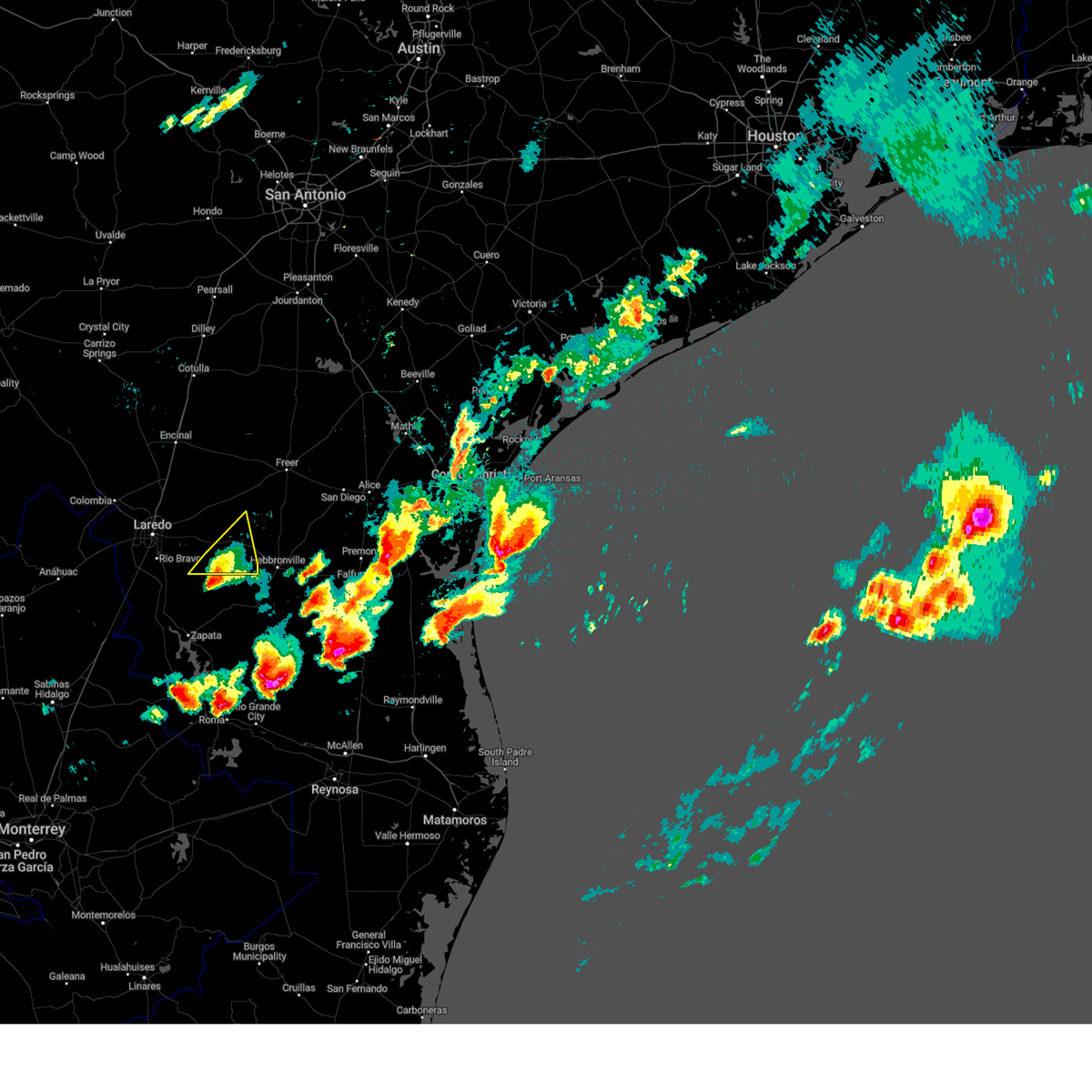 the severe thunderstorm warning has been cancelled and is no longer in effect the severe thunderstorm warning has been cancelled and is no longer in effect
|
| 5/13/2024 6:23 PM CDT |
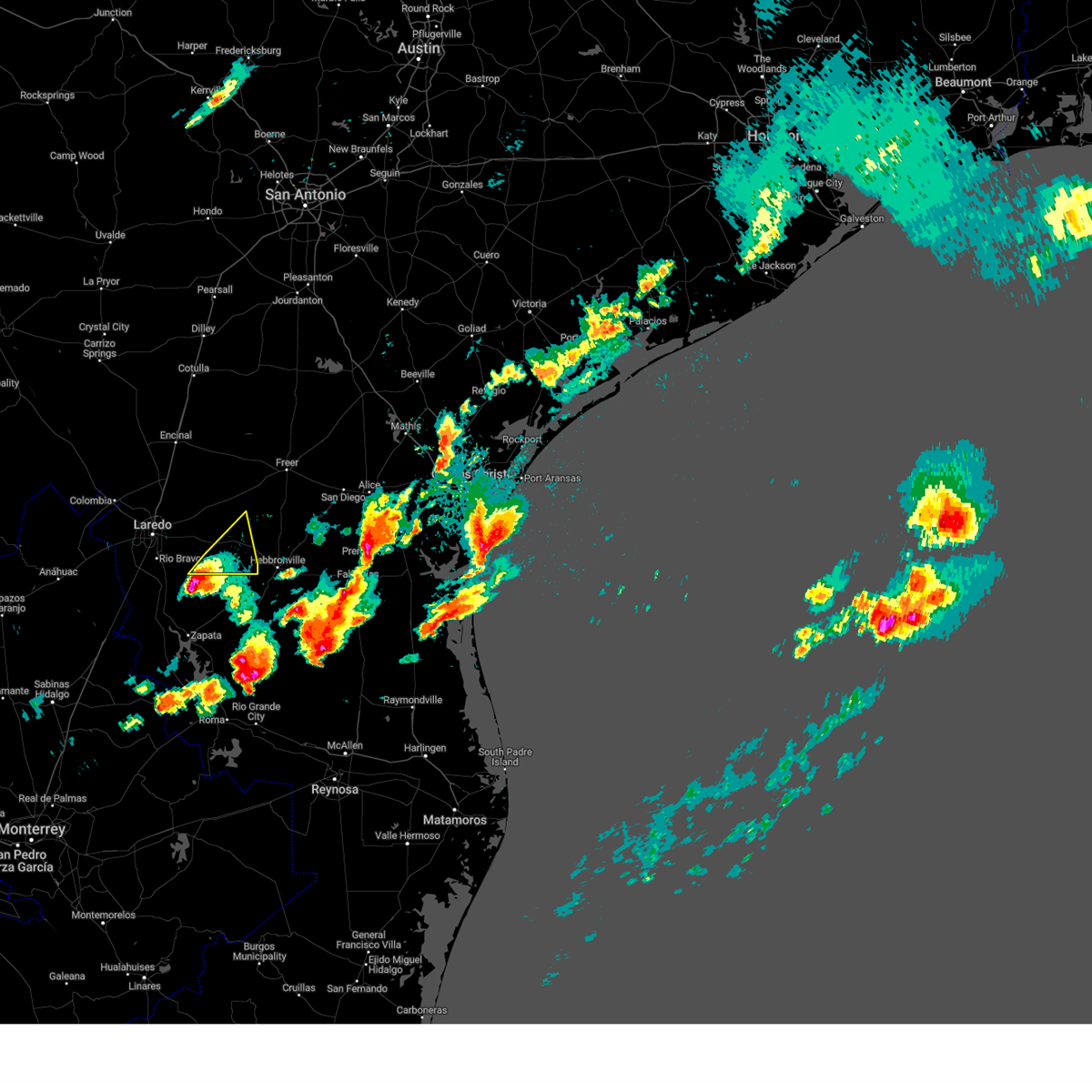 Svrcrp the national weather service in corpus christi has issued a * severe thunderstorm warning for, southeastern webb county in south central texas, * until 715 pm cdt. * at 623 pm cdt, a severe thunderstorm was located 16 miles southwest of aguilares, or 18 miles northwest of bustamante, moving northeast at 25 mph (radar indicated). Hazards include ping pong ball size hail and 60 mph wind gusts. People and animals outdoors will be injured. expect hail damage to roofs, siding, windows, and vehicles. Expect wind damage to roofs, siding, and trees. Svrcrp the national weather service in corpus christi has issued a * severe thunderstorm warning for, southeastern webb county in south central texas, * until 715 pm cdt. * at 623 pm cdt, a severe thunderstorm was located 16 miles southwest of aguilares, or 18 miles northwest of bustamante, moving northeast at 25 mph (radar indicated). Hazards include ping pong ball size hail and 60 mph wind gusts. People and animals outdoors will be injured. expect hail damage to roofs, siding, windows, and vehicles. Expect wind damage to roofs, siding, and trees.
|
| 5/13/2024 5:03 PM CDT |
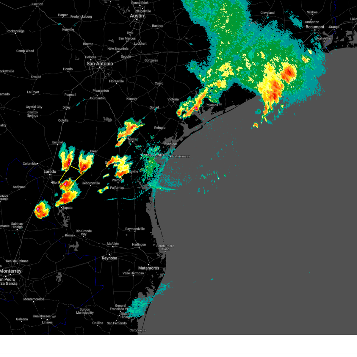 Svrcrp the national weather service in corpus christi has issued a * severe thunderstorm warning for, southeastern webb county in south central texas, * until 530 pm cdt. * at 503 pm cdt, a severe thunderstorm was located 7 miles southwest of aguilares, or 20 miles southeast of laredo, moving northeast at 40 mph (radar indicated). Hazards include ping pong ball size hail and 60 mph wind gusts. People and animals outdoors will be injured. expect hail damage to roofs, siding, windows, and vehicles. Expect wind damage to roofs, siding, and trees. Svrcrp the national weather service in corpus christi has issued a * severe thunderstorm warning for, southeastern webb county in south central texas, * until 530 pm cdt. * at 503 pm cdt, a severe thunderstorm was located 7 miles southwest of aguilares, or 20 miles southeast of laredo, moving northeast at 40 mph (radar indicated). Hazards include ping pong ball size hail and 60 mph wind gusts. People and animals outdoors will be injured. expect hail damage to roofs, siding, windows, and vehicles. Expect wind damage to roofs, siding, and trees.
|
| 3/15/2024 11:53 PM CDT |
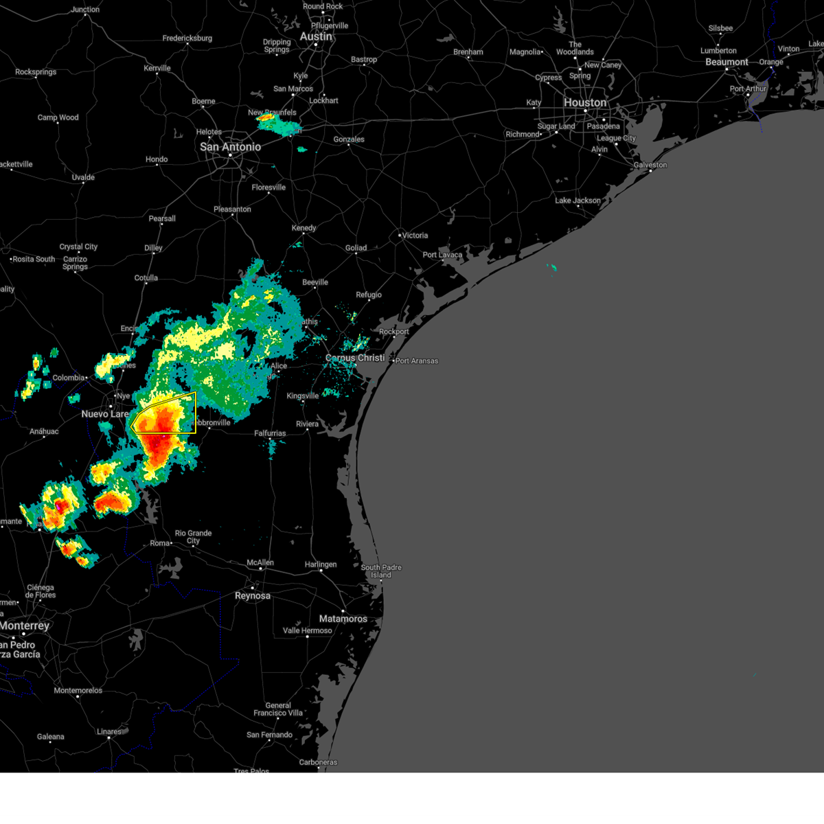 the severe thunderstorm warning has been cancelled and is no longer in effect the severe thunderstorm warning has been cancelled and is no longer in effect
|
| 3/15/2024 11:26 PM CDT |
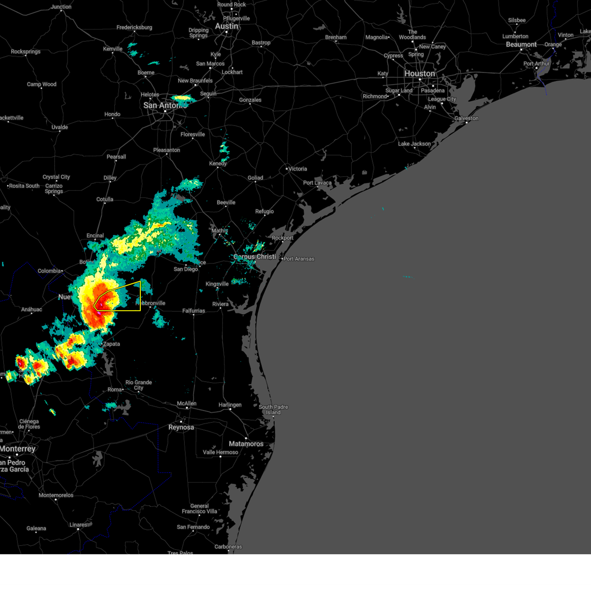 At 1126 pm cdt, severe thunderstorms were located along a line extending from near aguilares to 16 miles southwest of mirando city to 13 miles north of zapata county airport, moving east at 35 mph (radar indicated). Hazards include 60 mph wind gusts and quarter size hail. Hail damage to vehicles is expected. expect wind damage to roofs, siding, and trees. Locations impacted include, oilton, mirando city, aguilares, and bruni. At 1126 pm cdt, severe thunderstorms were located along a line extending from near aguilares to 16 miles southwest of mirando city to 13 miles north of zapata county airport, moving east at 35 mph (radar indicated). Hazards include 60 mph wind gusts and quarter size hail. Hail damage to vehicles is expected. expect wind damage to roofs, siding, and trees. Locations impacted include, oilton, mirando city, aguilares, and bruni.
|
| 3/15/2024 10:57 PM CDT |
 Svrcrp the national weather service in corpus christi has issued a * severe thunderstorm warning for, southeastern webb county in south central texas, * until midnight cdt. * at 1057 pm cdt, severe thunderstorms were located along a line extending from near united south high school to near rio bravo to 9 miles north of san ygnacio, moving east at 30 mph (radar indicated). Hazards include ping pong ball size hail and 60 mph wind gusts. People and animals outdoors will be injured. expect hail damage to roofs, siding, windows, and vehicles. Expect wind damage to roofs, siding, and trees. Svrcrp the national weather service in corpus christi has issued a * severe thunderstorm warning for, southeastern webb county in south central texas, * until midnight cdt. * at 1057 pm cdt, severe thunderstorms were located along a line extending from near united south high school to near rio bravo to 9 miles north of san ygnacio, moving east at 30 mph (radar indicated). Hazards include ping pong ball size hail and 60 mph wind gusts. People and animals outdoors will be injured. expect hail damage to roofs, siding, windows, and vehicles. Expect wind damage to roofs, siding, and trees.
|
| 6/3/2023 8:40 PM CDT |
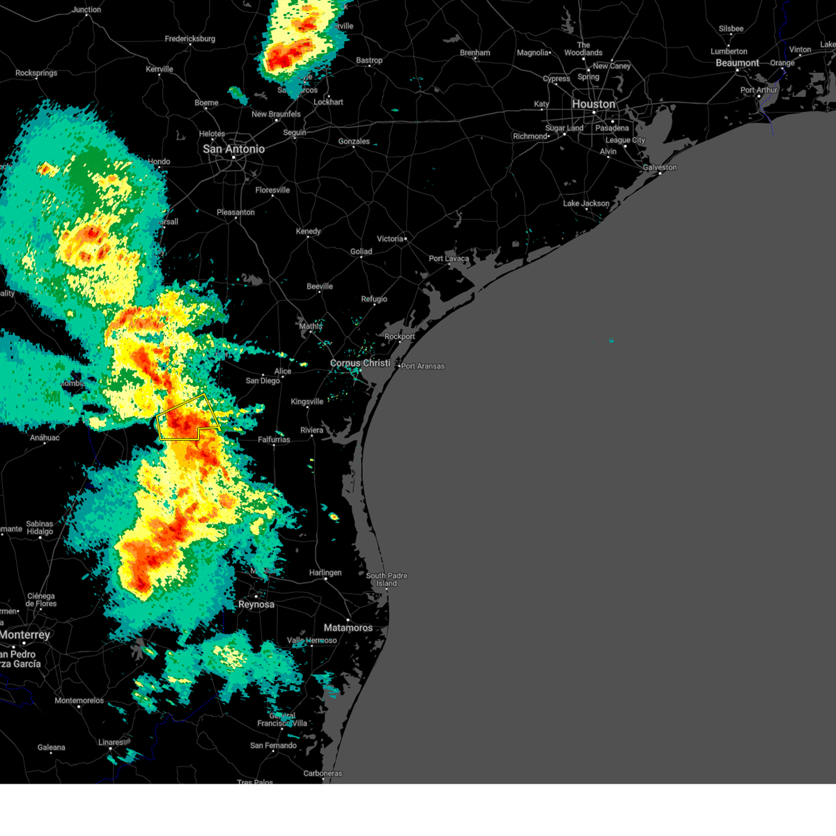 At 840 pm cdt, a severe thunderstorm was located near mirando city, or 17 miles west of hebbronville, moving east at 15 mph (radar indicated). Hazards include 60 mph wind gusts. Expect damage to roofs, siding, and trees. locations impacted include, oilton, mirando city, aguilares and bruni. hail threat, radar indicated max hail size, <. 75 in wind threat, radar indicated max wind gust, 60 mph. At 840 pm cdt, a severe thunderstorm was located near mirando city, or 17 miles west of hebbronville, moving east at 15 mph (radar indicated). Hazards include 60 mph wind gusts. Expect damage to roofs, siding, and trees. locations impacted include, oilton, mirando city, aguilares and bruni. hail threat, radar indicated max hail size, <. 75 in wind threat, radar indicated max wind gust, 60 mph.
|
| 6/3/2023 8:29 PM CDT |
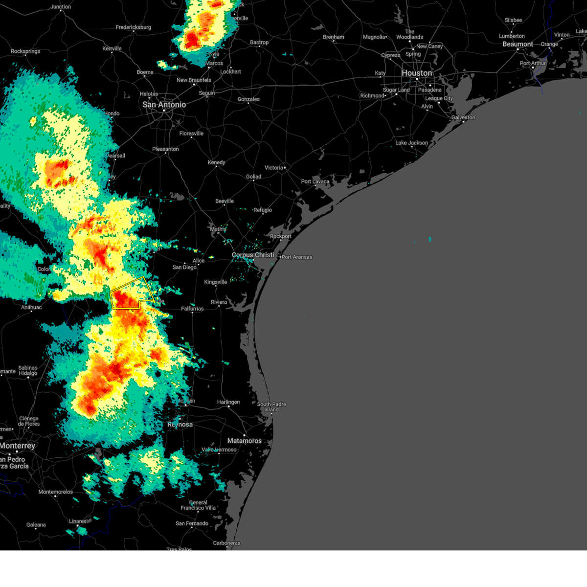 At 828 pm cdt, a severe thunderstorm was located near mirando city, or 20 miles west of hebbronville, moving east at 15 mph (radar indicated). Hazards include 60 mph wind gusts and quarter size hail. Hail damage to vehicles is expected. Expect wind damage to roofs, siding, and trees. At 828 pm cdt, a severe thunderstorm was located near mirando city, or 20 miles west of hebbronville, moving east at 15 mph (radar indicated). Hazards include 60 mph wind gusts and quarter size hail. Hail damage to vehicles is expected. Expect wind damage to roofs, siding, and trees.
|
| 4/23/2023 10:27 AM CDT |
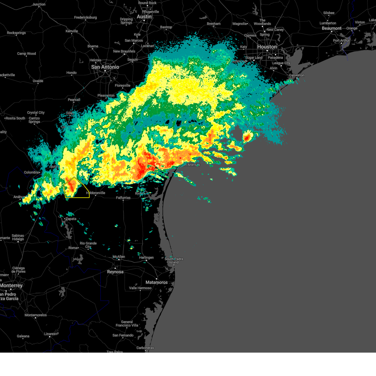 At 1027 am cdt, a severe thunderstorm was located 8 miles south of aguilares, or 22 miles north of bustamante, moving southeast at 35 mph (radar indicated). Hazards include quarter size hail. damage to vehicles is expected At 1027 am cdt, a severe thunderstorm was located 8 miles south of aguilares, or 22 miles north of bustamante, moving southeast at 35 mph (radar indicated). Hazards include quarter size hail. damage to vehicles is expected
|
| 4/23/2023 10:19 AM CDT |
 At 1019 am cdt, a severe thunderstorm was located 9 miles south of aguilares, or 21 miles north of bustamante, moving southeast at 30 mph (radar indicated). Hazards include quarter size hail. Damage to vehicles is expected. locations impacted include, oilton, ranchitos las lomas, mirando city and aguilares. this includes us highway 59 between mile markers 806 and 820. hail threat, radar indicated max hail size, 1. 00 in wind threat, radar indicated max wind gust, <50 mph. At 1019 am cdt, a severe thunderstorm was located 9 miles south of aguilares, or 21 miles north of bustamante, moving southeast at 30 mph (radar indicated). Hazards include quarter size hail. Damage to vehicles is expected. locations impacted include, oilton, ranchitos las lomas, mirando city and aguilares. this includes us highway 59 between mile markers 806 and 820. hail threat, radar indicated max hail size, 1. 00 in wind threat, radar indicated max wind gust, <50 mph.
|
| 4/23/2023 9:57 AM CDT |
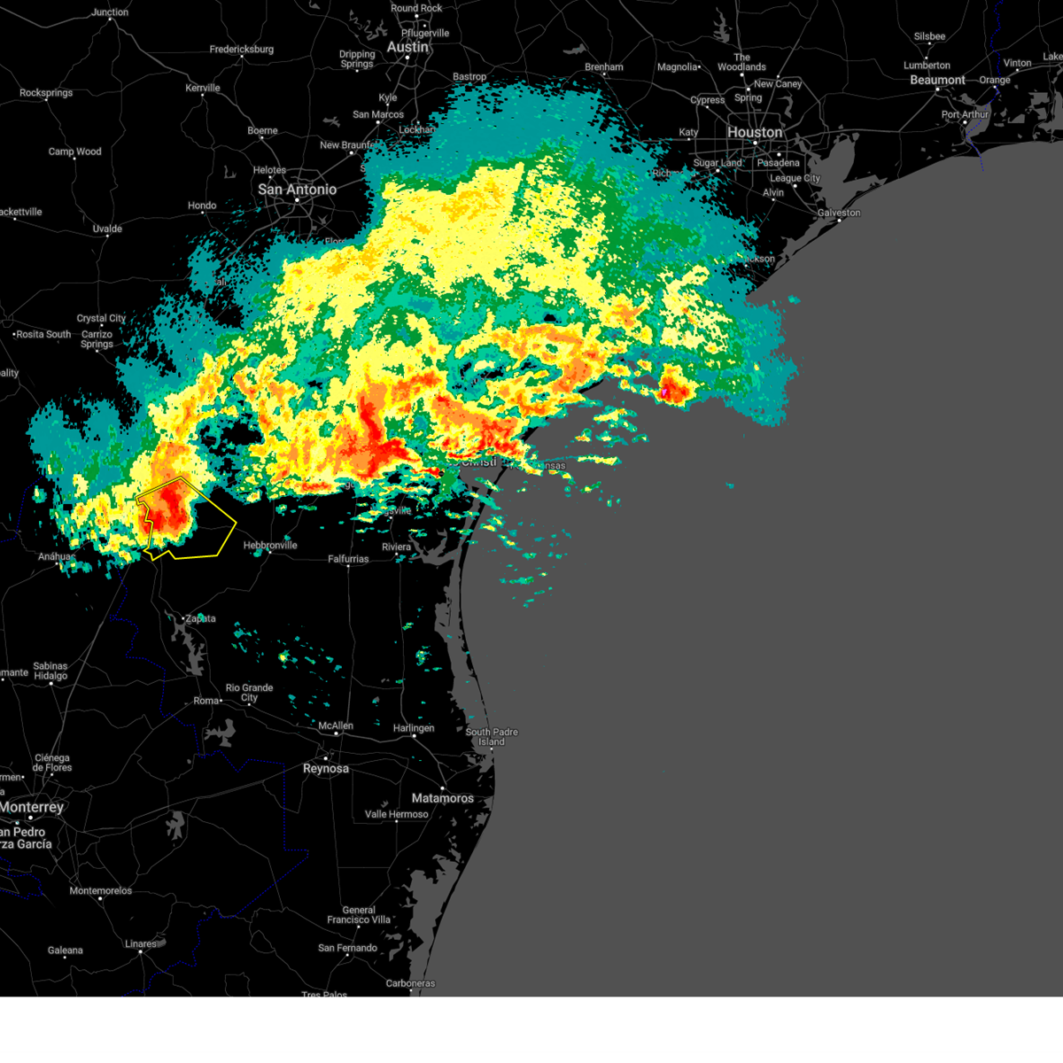 At 956 am cdt, a severe thunderstorm was located 8 miles west of aguilares, or 17 miles southeast of laredo, moving southeast at 30 mph (radar indicated). Hazards include half dollar size hail. Damage to vehicles is expected. locations impacted include, laredo, rio bravo, el cenizo, texas a&m, laredo international airport, unitec industrial park, mirando city, oilton, united south high school, aguilares, ranchitos las lomas, st augustine high school south laredo, doctors hospital of laredo, laredo country club, laredo community college and orvil. this includes the following highways, interstate 35 between mile markers 1 and 13. us highway 59 between mile markers 806 and 824. us highway 83 between mile markers 718 and 734. hail threat, radar indicated max hail size, 1. 25 in wind threat, radar indicated max wind gust, <50 mph. At 956 am cdt, a severe thunderstorm was located 8 miles west of aguilares, or 17 miles southeast of laredo, moving southeast at 30 mph (radar indicated). Hazards include half dollar size hail. Damage to vehicles is expected. locations impacted include, laredo, rio bravo, el cenizo, texas a&m, laredo international airport, unitec industrial park, mirando city, oilton, united south high school, aguilares, ranchitos las lomas, st augustine high school south laredo, doctors hospital of laredo, laredo country club, laredo community college and orvil. this includes the following highways, interstate 35 between mile markers 1 and 13. us highway 59 between mile markers 806 and 824. us highway 83 between mile markers 718 and 734. hail threat, radar indicated max hail size, 1. 25 in wind threat, radar indicated max wind gust, <50 mph.
|
| 4/23/2023 9:41 AM CDT |
 At 941 am cdt, a severe thunderstorm was located 7 miles southeast of texas a&m, or 9 miles east of laredo, moving southeast at 30 mph (radar indicated). Hazards include half dollar size hail. damage to vehicles is expected At 941 am cdt, a severe thunderstorm was located 7 miles southeast of texas a&m, or 9 miles east of laredo, moving southeast at 30 mph (radar indicated). Hazards include half dollar size hail. damage to vehicles is expected
|
|
|
| 4/5/2023 10:10 PM CDT |
 At 1010 pm cdt, a severe thunderstorm was located 11 miles west of aguilares, or 16 miles southeast of laredo, moving northeast at 35 mph (radar indicated). Hazards include half dollar size hail. Damage to vehicles is expected. locations impacted include, ranchitos las lomas, aguilares and mirando city. this includes the following highways, us highway 59 between mile markers 804 and 820. us highway 83 near mile marker 734. hail threat, radar indicated max hail size, 1. 25 in wind threat, radar indicated max wind gust, <50 mph. At 1010 pm cdt, a severe thunderstorm was located 11 miles west of aguilares, or 16 miles southeast of laredo, moving northeast at 35 mph (radar indicated). Hazards include half dollar size hail. Damage to vehicles is expected. locations impacted include, ranchitos las lomas, aguilares and mirando city. this includes the following highways, us highway 59 between mile markers 804 and 820. us highway 83 near mile marker 734. hail threat, radar indicated max hail size, 1. 25 in wind threat, radar indicated max wind gust, <50 mph.
|
| 4/5/2023 9:55 PM CDT |
 At 954 pm cdt, a severe thunderstorm was located 11 miles southeast of rio bravo, or 17 miles north of san ygnacio, moving northeast at 35 mph (radar indicated). Hazards include half dollar size hail. damage to vehicles is expected At 954 pm cdt, a severe thunderstorm was located 11 miles southeast of rio bravo, or 17 miles north of san ygnacio, moving northeast at 35 mph (radar indicated). Hazards include half dollar size hail. damage to vehicles is expected
|
| 5/24/2022 11:09 PM CDT |
 At 1109 pm cdt, a severe thunderstorm was located near mirando city, or 21 miles west of hebbronville, moving southeast at 35 mph (radar indicated). Hazards include 60 mph wind gusts and quarter size hail. Hail damage to vehicles is expected. expect wind damage to roofs, siding, and trees. locations impacted include, oilton, mirando city and aguilares. hail threat, radar indicated max hail size, 1. 00 in wind threat, radar indicated max wind gust, 60 mph. At 1109 pm cdt, a severe thunderstorm was located near mirando city, or 21 miles west of hebbronville, moving southeast at 35 mph (radar indicated). Hazards include 60 mph wind gusts and quarter size hail. Hail damage to vehicles is expected. expect wind damage to roofs, siding, and trees. locations impacted include, oilton, mirando city and aguilares. hail threat, radar indicated max hail size, 1. 00 in wind threat, radar indicated max wind gust, 60 mph.
|
| 5/24/2022 10:58 PM CDT |
 At 1058 pm cdt, a severe thunderstorm was located over aguilares, or 24 miles east of laredo, moving southeast at 35 mph (radar indicated). Hazards include 60 mph wind gusts and quarter size hail. Hail damage to vehicles is expected. Expect wind damage to roofs, siding, and trees. At 1058 pm cdt, a severe thunderstorm was located over aguilares, or 24 miles east of laredo, moving southeast at 35 mph (radar indicated). Hazards include 60 mph wind gusts and quarter size hail. Hail damage to vehicles is expected. Expect wind damage to roofs, siding, and trees.
|
| 5/24/2022 10:53 PM CDT |
 At 1052 pm cdt, a severe thunderstorm was located near aguilares, or 21 miles east of laredo, moving southeast at 45 mph (radar indicated). Hazards include 60 mph wind gusts and half dollar size hail. Hail damage to vehicles is expected. expect wind damage to roofs, siding, and trees. locations impacted include, ranchitos las lomas. this includes us highway 59 between mile markers 812 and 814. hail threat, radar indicated max hail size, 1. 25 in wind threat, radar indicated max wind gust, 60 mph. At 1052 pm cdt, a severe thunderstorm was located near aguilares, or 21 miles east of laredo, moving southeast at 45 mph (radar indicated). Hazards include 60 mph wind gusts and half dollar size hail. Hail damage to vehicles is expected. expect wind damage to roofs, siding, and trees. locations impacted include, ranchitos las lomas. this includes us highway 59 between mile markers 812 and 814. hail threat, radar indicated max hail size, 1. 25 in wind threat, radar indicated max wind gust, 60 mph.
|
| 5/24/2022 10:39 PM CDT |
 At 1038 pm cdt, a severe thunderstorm was located 10 miles east of united south high school, or 13 miles east of laredo, moving southeast at 30 mph (radar indicated). Hazards include 60 mph wind gusts and half dollar size hail. Hail damage to vehicles is expected. expect wind damage to roofs, siding, and trees. locations impacted include, ranchitos las lomas. this includes us highway 59 between mile markers 812 and 824. hail threat, radar indicated max hail size, 1. 25 in wind threat, radar indicated max wind gust, 60 mph. At 1038 pm cdt, a severe thunderstorm was located 10 miles east of united south high school, or 13 miles east of laredo, moving southeast at 30 mph (radar indicated). Hazards include 60 mph wind gusts and half dollar size hail. Hail damage to vehicles is expected. expect wind damage to roofs, siding, and trees. locations impacted include, ranchitos las lomas. this includes us highway 59 between mile markers 812 and 824. hail threat, radar indicated max hail size, 1. 25 in wind threat, radar indicated max wind gust, 60 mph.
|
| 5/24/2022 10:29 PM CDT |
 At 1029 pm cdt, a severe thunderstorm was located 7 miles southeast of texas a&m, or 8 miles east of laredo, moving southeast at 30 mph (radar indicated). Hazards include 70 mph wind gusts and ping pong ball size hail. People and animals outdoors will be injured. expect hail damage to roofs, siding, windows, and vehicles. expect considerable tree damage. wind damage is also likely to mobile homes, roofs, and outbuildings. locations impacted include, laredo, rio bravo, el cenizo, texas a&m, laredo international airport, unitec industrial park, united south high school, st augustine high school south laredo, doctors hospital of laredo, laredo country club, laredo community college, orvil and ranchitos las lomas. this includes the following highways, interstate 35 between mile markers 1 and 15. us highway 59 between mile markers 812 and 824. us highway 83 between mile markers 718 and 734. thunderstorm damage threat, considerable hail threat, radar indicated max hail size, 1. 50 in wind threat, radar indicated max wind gust, 70 mph. At 1029 pm cdt, a severe thunderstorm was located 7 miles southeast of texas a&m, or 8 miles east of laredo, moving southeast at 30 mph (radar indicated). Hazards include 70 mph wind gusts and ping pong ball size hail. People and animals outdoors will be injured. expect hail damage to roofs, siding, windows, and vehicles. expect considerable tree damage. wind damage is also likely to mobile homes, roofs, and outbuildings. locations impacted include, laredo, rio bravo, el cenizo, texas a&m, laredo international airport, unitec industrial park, united south high school, st augustine high school south laredo, doctors hospital of laredo, laredo country club, laredo community college, orvil and ranchitos las lomas. this includes the following highways, interstate 35 between mile markers 1 and 15. us highway 59 between mile markers 812 and 824. us highway 83 between mile markers 718 and 734. thunderstorm damage threat, considerable hail threat, radar indicated max hail size, 1. 50 in wind threat, radar indicated max wind gust, 70 mph.
|
| 5/24/2022 10:17 PM CDT |
 At 1016 pm cdt, a severe thunderstorm was located over laredo, moving southeast at 30 mph. this is a destructive storm for areas including and around laredo (radar indicated). Hazards include 80 mph wind gusts and two inch hail. Flying debris will be dangerous to those caught without shelter. mobile homes will be heavily damaged. expect considerable damage to roofs, windows, and vehicles. extensive tree damage and power outages are likely. locations impacted include, laredo, rio bravo, el cenizo, texas a&m, laredo international airport, unitec industrial park, ranchos penitas west, united south high school, st augustine high school south laredo, doctors hospital of laredo, laredo country club, laredo community college, orvil, botines and ranchitos las lomas. this includes the following highways, interstate 35 between mile markers 1 and 18. us highway 59 between mile markers 812 and 824. us highway 83 between mile markers 718 and 734. thunderstorm damage threat, destructive hail threat, radar indicated max hail size, 2. 00 in wind threat, radar indicated max wind gust, 80 mph. At 1016 pm cdt, a severe thunderstorm was located over laredo, moving southeast at 30 mph. this is a destructive storm for areas including and around laredo (radar indicated). Hazards include 80 mph wind gusts and two inch hail. Flying debris will be dangerous to those caught without shelter. mobile homes will be heavily damaged. expect considerable damage to roofs, windows, and vehicles. extensive tree damage and power outages are likely. locations impacted include, laredo, rio bravo, el cenizo, texas a&m, laredo international airport, unitec industrial park, ranchos penitas west, united south high school, st augustine high school south laredo, doctors hospital of laredo, laredo country club, laredo community college, orvil, botines and ranchitos las lomas. this includes the following highways, interstate 35 between mile markers 1 and 18. us highway 59 between mile markers 812 and 824. us highway 83 between mile markers 718 and 734. thunderstorm damage threat, destructive hail threat, radar indicated max hail size, 2. 00 in wind threat, radar indicated max wind gust, 80 mph.
|
| 5/24/2022 10:01 PM CDT |
 At 1001 pm cdt, a severe thunderstorm was located near ranchos penitas west, or 8 miles northwest of laredo, moving southeast at 30 mph (radar indicated). Hazards include tennis ball size hail and 70 mph wind gusts. People and animals outdoors will be injured. expect hail damage to roofs, siding, windows, and vehicles. expect considerable tree damage. Wind damage is also likely to mobile homes, roofs, and outbuildings. At 1001 pm cdt, a severe thunderstorm was located near ranchos penitas west, or 8 miles northwest of laredo, moving southeast at 30 mph (radar indicated). Hazards include tennis ball size hail and 70 mph wind gusts. People and animals outdoors will be injured. expect hail damage to roofs, siding, windows, and vehicles. expect considerable tree damage. Wind damage is also likely to mobile homes, roofs, and outbuildings.
|
| 3/21/2022 11:50 PM CDT |
 At 1150 pm cdt, a severe thunderstorm was located 12 miles west of aguilares, or 16 miles southeast of laredo, moving northeast at 40 mph (radar indicated). Hazards include 60 mph wind gusts and half dollar size hail. Hail damage to vehicles is expected. expect wind damage to roofs, siding, and trees. locations impacted include, aguilares. hail threat, radar indicated max hail size, 1. 25 in wind threat, radar indicated max wind gust, 60 mph. At 1150 pm cdt, a severe thunderstorm was located 12 miles west of aguilares, or 16 miles southeast of laredo, moving northeast at 40 mph (radar indicated). Hazards include 60 mph wind gusts and half dollar size hail. Hail damage to vehicles is expected. expect wind damage to roofs, siding, and trees. locations impacted include, aguilares. hail threat, radar indicated max hail size, 1. 25 in wind threat, radar indicated max wind gust, 60 mph.
|
| 3/21/2022 11:37 PM CDT |
 At 1136 pm cdt, a severe thunderstorm was located near el cenizo, or 16 miles south of laredo, moving northeast at 35 mph (radar indicated). Hazards include ping pong ball size hail and 60 mph wind gusts. People and animals outdoors will be injured. expect hail damage to roofs, siding, windows, and vehicles. Expect wind damage to roofs, siding, and trees. At 1136 pm cdt, a severe thunderstorm was located near el cenizo, or 16 miles south of laredo, moving northeast at 35 mph (radar indicated). Hazards include ping pong ball size hail and 60 mph wind gusts. People and animals outdoors will be injured. expect hail damage to roofs, siding, windows, and vehicles. Expect wind damage to roofs, siding, and trees.
|
| 3/21/2022 10:06 PM CDT |
 At 1004 pm cdt, a severe thunderstorm was located 9 miles northwest of aguilares, or 15 miles east of laredo, moving northeast at 40 mph. this is a destructive storm for laredo ranchettes and ranchitos las lomas (radar indicated). Hazards include baseball size hail and 70 mph wind gusts. People and animals outdoors will be severely injured. expect shattered windows, extensive damage to roofs, siding, and vehicles. locations impacted include, oilton, ranchitos las lomas, mirando city and aguilares. this includes us highway 59 between mile markers 784 and 822. thunderstorm damage threat, destructive hail threat, radar indicated max hail size, 2. 75 in wind threat, radar indicated max wind gust, 70 mph. At 1004 pm cdt, a severe thunderstorm was located 9 miles northwest of aguilares, or 15 miles east of laredo, moving northeast at 40 mph. this is a destructive storm for laredo ranchettes and ranchitos las lomas (radar indicated). Hazards include baseball size hail and 70 mph wind gusts. People and animals outdoors will be severely injured. expect shattered windows, extensive damage to roofs, siding, and vehicles. locations impacted include, oilton, ranchitos las lomas, mirando city and aguilares. this includes us highway 59 between mile markers 784 and 822. thunderstorm damage threat, destructive hail threat, radar indicated max hail size, 2. 75 in wind threat, radar indicated max wind gust, 70 mph.
|
| 3/21/2022 9:56 PM CDT |
 At 955 pm cdt, a severe thunderstorm was located 9 miles east of united south high school, or 11 miles east of laredo, moving northeast at 45 mph (radar indicated). Hazards include golf ball size hail and 70 mph wind gusts. People and animals outdoors will be injured. expect hail damage to roofs, siding, windows, and vehicles. expect considerable tree damage. wind damage is also likely to mobile homes, roofs, and outbuildings. locations impacted include, laredo, oilton, united south high school, ranchitos las lomas, mirando city and aguilares. this includes the following highways, us highway 59 between mile markers 778 and 824. us highway 83 between mile markers 720 and 726. thunderstorm damage threat, considerable hail threat, radar indicated max hail size, 1. 75 in wind threat, radar indicated max wind gust, 70 mph. At 955 pm cdt, a severe thunderstorm was located 9 miles east of united south high school, or 11 miles east of laredo, moving northeast at 45 mph (radar indicated). Hazards include golf ball size hail and 70 mph wind gusts. People and animals outdoors will be injured. expect hail damage to roofs, siding, windows, and vehicles. expect considerable tree damage. wind damage is also likely to mobile homes, roofs, and outbuildings. locations impacted include, laredo, oilton, united south high school, ranchitos las lomas, mirando city and aguilares. this includes the following highways, us highway 59 between mile markers 778 and 824. us highway 83 between mile markers 720 and 726. thunderstorm damage threat, considerable hail threat, radar indicated max hail size, 1. 75 in wind threat, radar indicated max wind gust, 70 mph.
|
| 3/21/2022 9:43 PM CDT |
 At 942 pm cdt, a severe thunderstorm was located 8 miles southeast of united south high school, or 12 miles southeast of laredo, moving northeast at 60 mph (radar indicated). Hazards include 60 mph wind gusts and quarter size hail. Hail damage to vehicles is expected. Expect wind damage to roofs, siding, and trees. At 942 pm cdt, a severe thunderstorm was located 8 miles southeast of united south high school, or 12 miles southeast of laredo, moving northeast at 60 mph (radar indicated). Hazards include 60 mph wind gusts and quarter size hail. Hail damage to vehicles is expected. Expect wind damage to roofs, siding, and trees.
|
| 10/13/2021 10:24 PM CDT |
 At 1024 pm cdt, a severe thunderstorm capable of producing a tornado was located over aguilares, or 24 miles east of laredo, moving northeast at 20 mph (radar indicated rotation). Hazards include tornado. Flying debris will be dangerous to those caught without shelter. mobile homes will be damaged or destroyed. damage to roofs, windows, and vehicles will occur. tree damage is likely. This dangerous storm will be near, oilton and mirando city around 1050 pm cdt. At 1024 pm cdt, a severe thunderstorm capable of producing a tornado was located over aguilares, or 24 miles east of laredo, moving northeast at 20 mph (radar indicated rotation). Hazards include tornado. Flying debris will be dangerous to those caught without shelter. mobile homes will be damaged or destroyed. damage to roofs, windows, and vehicles will occur. tree damage is likely. This dangerous storm will be near, oilton and mirando city around 1050 pm cdt.
|
| 10/13/2021 8:41 PM CDT |
 At 840 pm cdt, a severe thunderstorm capable of producing a tornado was located near aguilares, or 22 miles east of laredo, moving northeast at 15 mph (radar indicated rotation). Hazards include tornado. Flying debris will be dangerous to those caught without shelter. mobile homes will be damaged or destroyed. damage to roofs, windows, and vehicles will occur. tree damage is likely. This dangerous storm will be near, oilton and mirando city around 910 pm cdt. At 840 pm cdt, a severe thunderstorm capable of producing a tornado was located near aguilares, or 22 miles east of laredo, moving northeast at 15 mph (radar indicated rotation). Hazards include tornado. Flying debris will be dangerous to those caught without shelter. mobile homes will be damaged or destroyed. damage to roofs, windows, and vehicles will occur. tree damage is likely. This dangerous storm will be near, oilton and mirando city around 910 pm cdt.
|
| 6/1/2021 3:52 AM CDT |
 At 352 am cdt, severe thunderstorms were located along a line extending from 7 miles west of seven sisters to near oilton to 9 miles east of rio bravo, moving southeast at 30 mph (radar indicated). Hazards include 60 mph wind gusts and penny size hail. Expect damage to roofs, siding, and trees. locations impacted include, laredo, freer, benavides, texas a&m, laredo international airport, seven sisters, loma alta, mirando city, oilton, united south high school, aguilares, realitos, ranchitos las lomas, st augustine high school south laredo, laredo country club, bruni and rosita. this includes the following highways, interstate 35 between mile markers 1 and 4. us highway 59 between mile markers 746 and 824. Us highway 83 between mile markers 718 and 720. At 352 am cdt, severe thunderstorms were located along a line extending from 7 miles west of seven sisters to near oilton to 9 miles east of rio bravo, moving southeast at 30 mph (radar indicated). Hazards include 60 mph wind gusts and penny size hail. Expect damage to roofs, siding, and trees. locations impacted include, laredo, freer, benavides, texas a&m, laredo international airport, seven sisters, loma alta, mirando city, oilton, united south high school, aguilares, realitos, ranchitos las lomas, st augustine high school south laredo, laredo country club, bruni and rosita. this includes the following highways, interstate 35 between mile markers 1 and 4. us highway 59 between mile markers 746 and 824. Us highway 83 between mile markers 718 and 720.
|
| 6/1/2021 3:09 AM CDT |
 At 309 am cdt, severe thunderstorms were located along a line extending from 13 miles south of fowlerton to 17 miles northeast of ranchitos las lomas to near unitec industrial park, moving southeast at 40 mph (radar indicated). Hazards include 60 mph wind gusts and penny size hail. expect damage to roofs, siding, and trees At 309 am cdt, severe thunderstorms were located along a line extending from 13 miles south of fowlerton to 17 miles northeast of ranchitos las lomas to near unitec industrial park, moving southeast at 40 mph (radar indicated). Hazards include 60 mph wind gusts and penny size hail. expect damage to roofs, siding, and trees
|
| 5/18/2021 11:33 PM CDT |
 At 1133 pm cdt, a severe thunderstorm was located near aguilares, or 23 miles west of hebbronville, moving east at 25 mph (radar indicated). Hazards include ping pong ball size hail. People and animals outdoors will be injured. expect damage to roofs, siding, windows, and vehicles. Locations impacted include, oilton, mirando city and aguilares. At 1133 pm cdt, a severe thunderstorm was located near aguilares, or 23 miles west of hebbronville, moving east at 25 mph (radar indicated). Hazards include ping pong ball size hail. People and animals outdoors will be injured. expect damage to roofs, siding, windows, and vehicles. Locations impacted include, oilton, mirando city and aguilares.
|
| 5/18/2021 11:16 PM CDT |
 At 1115 pm cdt, a severe thunderstorm was located 8 miles southwest of aguilares, or 21 miles southeast of laredo, moving east at 25 mph (radar indicated). Hazards include ping pong ball size hail. People and animals outdoors will be injured. Expect damage to roofs, siding, windows, and vehicles. At 1115 pm cdt, a severe thunderstorm was located 8 miles southwest of aguilares, or 21 miles southeast of laredo, moving east at 25 mph (radar indicated). Hazards include ping pong ball size hail. People and animals outdoors will be injured. Expect damage to roofs, siding, windows, and vehicles.
|
| 5/25/2020 7:16 PM CDT |
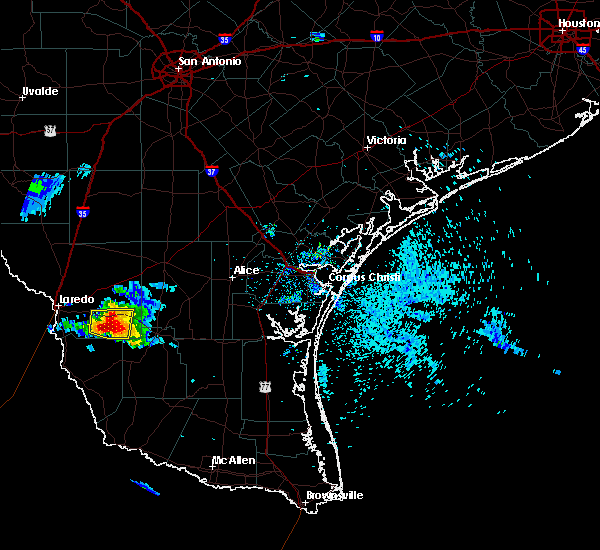 At 716 pm cdt, a severe thunderstorm was located 9 miles south of aguilares, or 21 miles north of bustamante, moving southeast at 15 mph (radar indicated). Hazards include ping pong ball size hail and 60 mph wind gusts. People and animals outdoors will be injured. expect hail damage to roofs, siding, windows, and vehicles. expect wind damage to roofs, siding, and trees. Locations impacted include, mirando city and aguilares. At 716 pm cdt, a severe thunderstorm was located 9 miles south of aguilares, or 21 miles north of bustamante, moving southeast at 15 mph (radar indicated). Hazards include ping pong ball size hail and 60 mph wind gusts. People and animals outdoors will be injured. expect hail damage to roofs, siding, windows, and vehicles. expect wind damage to roofs, siding, and trees. Locations impacted include, mirando city and aguilares.
|
| 5/25/2020 7:06 PM CDT |
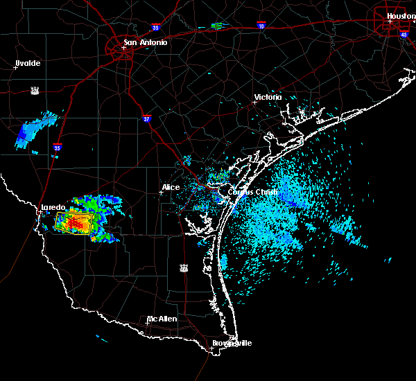 At 706 pm cdt, a severe thunderstorm was located 7 miles southwest of aguilares, or 24 miles north of bustamante, moving southeast at 10 mph (radar indicated). Hazards include 60 mph wind gusts and quarter size hail. Hail damage to vehicles is expected. expect wind damage to roofs, siding, and trees. Locations impacted include, oilton, mirando city and aguilares. At 706 pm cdt, a severe thunderstorm was located 7 miles southwest of aguilares, or 24 miles north of bustamante, moving southeast at 10 mph (radar indicated). Hazards include 60 mph wind gusts and quarter size hail. Hail damage to vehicles is expected. expect wind damage to roofs, siding, and trees. Locations impacted include, oilton, mirando city and aguilares.
|
| 5/25/2020 6:47 PM CDT |
 At 646 pm cdt, a severe thunderstorm was located near aguilares, or 22 miles southeast of laredo, moving southeast at 15 mph (radar indicated). Hazards include 60 mph wind gusts and quarter size hail. Hail damage to vehicles is expected. Expect wind damage to roofs, siding, and trees. At 646 pm cdt, a severe thunderstorm was located near aguilares, or 22 miles southeast of laredo, moving southeast at 15 mph (radar indicated). Hazards include 60 mph wind gusts and quarter size hail. Hail damage to vehicles is expected. Expect wind damage to roofs, siding, and trees.
|
| 5/24/2020 10:10 PM CDT |
 At 1009 pm cdt, severe thunderstorms were located along a line extending from 19 miles north of oilton to near ranchitos las lomas to st augustine high school south laredo, moving east at 45 mph (radar indicated). Hazards include 60 mph wind gusts. expect damage to roofs, siding, and trees At 1009 pm cdt, severe thunderstorms were located along a line extending from 19 miles north of oilton to near ranchitos las lomas to st augustine high school south laredo, moving east at 45 mph (radar indicated). Hazards include 60 mph wind gusts. expect damage to roofs, siding, and trees
|
| 5/24/2020 9:46 PM CDT |
 At 946 pm cdt, severe thunderstorms were located along a line extending from 18 miles northeast of ranchitos las lomas to near ranchos penitas west, moving east at 55 mph (radar indicated). Hazards include 60 mph wind gusts and quarter size hail. Hail damage to vehicles is expected. Expect wind damage to roofs, siding, and trees. At 946 pm cdt, severe thunderstorms were located along a line extending from 18 miles northeast of ranchitos las lomas to near ranchos penitas west, moving east at 55 mph (radar indicated). Hazards include 60 mph wind gusts and quarter size hail. Hail damage to vehicles is expected. Expect wind damage to roofs, siding, and trees.
|
|
|
| 5/16/2020 12:38 AM CDT |
 At 1237 am cdt, a severe thunderstorm was located near oilton, or 25 miles northwest of hebbronville, moving northeast at 45 mph (radar indicated). Hazards include 60 mph wind gusts and penny size hail. Expect damage to roofs, siding, and trees. Locations impacted include, oilton, ranchitos las lomas, mirando city, aguilares and bruni. At 1237 am cdt, a severe thunderstorm was located near oilton, or 25 miles northwest of hebbronville, moving northeast at 45 mph (radar indicated). Hazards include 60 mph wind gusts and penny size hail. Expect damage to roofs, siding, and trees. Locations impacted include, oilton, ranchitos las lomas, mirando city, aguilares and bruni.
|
| 5/16/2020 12:25 AM CDT |
 At 1224 am cdt, a severe thunderstorm was located near aguilares, or 20 miles east of laredo, moving northeast at 45 mph (radar indicated). Hazards include 60 mph wind gusts and penny size hail. expect damage to roofs, siding, and trees At 1224 am cdt, a severe thunderstorm was located near aguilares, or 20 miles east of laredo, moving northeast at 45 mph (radar indicated). Hazards include 60 mph wind gusts and penny size hail. expect damage to roofs, siding, and trees
|
| 6/24/2019 7:06 PM CDT |
 At 705 pm cdt, a severe thunderstorm was located near botines, or 15 miles northeast of laredo, moving south at 25 mph (radar indicated). Hazards include ping pong ball size hail and 60 mph wind gusts. People and animals outdoors will be injured. expect hail damage to roofs, siding, windows, and vehicles. Expect wind damage to roofs, siding, and trees. At 705 pm cdt, a severe thunderstorm was located near botines, or 15 miles northeast of laredo, moving south at 25 mph (radar indicated). Hazards include ping pong ball size hail and 60 mph wind gusts. People and animals outdoors will be injured. expect hail damage to roofs, siding, windows, and vehicles. Expect wind damage to roofs, siding, and trees.
|
| 5/3/2019 6:38 AM CDT |
 At 638 am cdt, a severe thunderstorm was located near aguilares, or 26 miles northwest of hebbronville, moving east at 40 mph (radar indicated). Hazards include 70 mph wind gusts and quarter size hail. Hail damage to vehicles is expected. expect considerable tree damage. wind damage is also likely to mobile homes, roofs, and outbuildings. Locations impacted include, oilton, realitos, ranchitos las lomas, mirando city, aguilares and bruni. At 638 am cdt, a severe thunderstorm was located near aguilares, or 26 miles northwest of hebbronville, moving east at 40 mph (radar indicated). Hazards include 70 mph wind gusts and quarter size hail. Hail damage to vehicles is expected. expect considerable tree damage. wind damage is also likely to mobile homes, roofs, and outbuildings. Locations impacted include, oilton, realitos, ranchitos las lomas, mirando city, aguilares and bruni.
|
| 5/3/2019 6:26 AM CDT |
 At 626 am cdt, a severe thunderstorm was located near aguilares, or 20 miles east of laredo, moving east at 25 mph (radar indicated). Hazards include 60 mph wind gusts and quarter size hail. Hail damage to vehicles is expected. expect wind damage to roofs, siding, and trees. Locations impacted include, oilton, realitos, ranchitos las lomas, mirando city, aguilares and bruni. At 626 am cdt, a severe thunderstorm was located near aguilares, or 20 miles east of laredo, moving east at 25 mph (radar indicated). Hazards include 60 mph wind gusts and quarter size hail. Hail damage to vehicles is expected. expect wind damage to roofs, siding, and trees. Locations impacted include, oilton, realitos, ranchitos las lomas, mirando city, aguilares and bruni.
|
| 5/3/2019 5:56 AM CDT |
 At 555 am cdt, a severe thunderstorm was located near texas a&m international university, or 8 miles northeast of laredo, moving east at 25 mph (radar indicated). Hazards include 60 mph wind gusts and quarter size hail. Hail damage to vehicles is expected. Expect wind damage to roofs, siding, and trees. At 555 am cdt, a severe thunderstorm was located near texas a&m international university, or 8 miles northeast of laredo, moving east at 25 mph (radar indicated). Hazards include 60 mph wind gusts and quarter size hail. Hail damage to vehicles is expected. Expect wind damage to roofs, siding, and trees.
|
| 5/3/2019 5:44 AM CDT |
 At 544 am cdt, a severe thunderstorm was located over laredo, moving east at 25 mph (radar indicated). Hazards include 60 mph wind gusts and quarter size hail. Hail damage to vehicles is expected. expect wind damage to roofs, siding, and trees. Locations impacted include, laredo, rio bravo, el cenizo, las tiendas, laredo international airport, botines, unitec industrial park, ranchos penitas west, united south high school, texas a&m international university, aguilares, ranchitos las lomas, st augustine high school south laredo, doctors hospital of laredo, laredo country club, laredo community college, orvil and callaghan. At 544 am cdt, a severe thunderstorm was located over laredo, moving east at 25 mph (radar indicated). Hazards include 60 mph wind gusts and quarter size hail. Hail damage to vehicles is expected. expect wind damage to roofs, siding, and trees. Locations impacted include, laredo, rio bravo, el cenizo, las tiendas, laredo international airport, botines, unitec industrial park, ranchos penitas west, united south high school, texas a&m international university, aguilares, ranchitos las lomas, st augustine high school south laredo, doctors hospital of laredo, laredo country club, laredo community college, orvil and callaghan.
|
| 5/3/2019 5:08 AM CDT |
 At 507 am cdt, a severe thunderstorm was located near columbia bridge, or 15 miles west of laredo, moving southeast at 30 mph (radar indicated). Hazards include 60 mph wind gusts and quarter size hail. Hail damage to vehicles is expected. Expect wind damage to roofs, siding, and trees. At 507 am cdt, a severe thunderstorm was located near columbia bridge, or 15 miles west of laredo, moving southeast at 30 mph (radar indicated). Hazards include 60 mph wind gusts and quarter size hail. Hail damage to vehicles is expected. Expect wind damage to roofs, siding, and trees.
|
| 3/28/2018 11:16 PM CDT |
 At 1115 pm cdt, severe thunderstorms were located along a line extending from 9 miles southwest of fort ewell site to 9 miles east of ranchitos las lomas to 10 miles southeast of el cenizo, moving east at 45 mph (radar indicated). Hazards include 70 mph wind gusts and quarter size hail. Hail damage to vehicles is expected. expect considerable tree damage. Wind damage is also likely to mobile homes, roofs, and outbuildings. At 1115 pm cdt, severe thunderstorms were located along a line extending from 9 miles southwest of fort ewell site to 9 miles east of ranchitos las lomas to 10 miles southeast of el cenizo, moving east at 45 mph (radar indicated). Hazards include 70 mph wind gusts and quarter size hail. Hail damage to vehicles is expected. expect considerable tree damage. Wind damage is also likely to mobile homes, roofs, and outbuildings.
|
| 5/29/2017 12:29 AM CDT |
 At 1228 am cdt, a severe thunderstorm was located near aguilares, or 24 miles southeast of laredo, moving northeast at 35 mph (radar indicated). Hazards include 60 mph wind gusts and penny size hail. expect damage to roofs, siding, and trees At 1228 am cdt, a severe thunderstorm was located near aguilares, or 24 miles southeast of laredo, moving northeast at 35 mph (radar indicated). Hazards include 60 mph wind gusts and penny size hail. expect damage to roofs, siding, and trees
|
| 5/29/2017 12:03 AM CDT |
 At 1202 am cdt, a severe thunderstorm was located 8 miles southwest of aguilares, or 20 miles southeast of laredo, moving northeast at 15 mph (radar indicated). Hazards include 60 mph wind gusts and penny size hail. Expect damage to roofs, siding, and trees. Locations impacted include, mirando city and aguilares. At 1202 am cdt, a severe thunderstorm was located 8 miles southwest of aguilares, or 20 miles southeast of laredo, moving northeast at 15 mph (radar indicated). Hazards include 60 mph wind gusts and penny size hail. Expect damage to roofs, siding, and trees. Locations impacted include, mirando city and aguilares.
|
| 5/28/2017 11:39 PM CDT |
 At 1138 pm cdt, a severe thunderstorm was located 11 miles east of rio bravo, or 18 miles southeast of laredo, moving northeast at 15 mph (radar indicated). Hazards include 60 mph wind gusts and penny size hail. expect damage to roofs, siding, and trees At 1138 pm cdt, a severe thunderstorm was located 11 miles east of rio bravo, or 18 miles southeast of laredo, moving northeast at 15 mph (radar indicated). Hazards include 60 mph wind gusts and penny size hail. expect damage to roofs, siding, and trees
|
| 5/21/2017 8:19 PM CDT |
 At 818 pm cdt, a severe thunderstorm was located 11 miles southwest of aguilares, or 19 miles southeast of laredo, moving east at 25 mph (radar indicated). Hazards include 60 mph wind gusts. expect damage to roofs, siding, and trees At 818 pm cdt, a severe thunderstorm was located 11 miles southwest of aguilares, or 19 miles southeast of laredo, moving east at 25 mph (radar indicated). Hazards include 60 mph wind gusts. expect damage to roofs, siding, and trees
|
| 5/21/2017 7:55 PM CDT |
 At 754 pm cdt, a severe thunderstorm was located 9 miles south of ranchitos las lomas, or 14 miles east of laredo, moving east at 35 mph (trained weather spotters). Hazards include 70 mph wind gusts and quarter size hail. Hail damage to vehicles is expected. expect considerable tree damage. wind damage is also likely to mobile homes, roofs, and outbuildings. Locations impacted include, laredo, rio bravo, el cenizo, laredo international airport, mirando city, oilton, united south high school, texas a&m international university, aguilares, st augustine high school south laredo, doctors hospital of laredo, laredo community college, laredo country club, bruni and ranchitos las lomas. At 754 pm cdt, a severe thunderstorm was located 9 miles south of ranchitos las lomas, or 14 miles east of laredo, moving east at 35 mph (trained weather spotters). Hazards include 70 mph wind gusts and quarter size hail. Hail damage to vehicles is expected. expect considerable tree damage. wind damage is also likely to mobile homes, roofs, and outbuildings. Locations impacted include, laredo, rio bravo, el cenizo, laredo international airport, mirando city, oilton, united south high school, texas a&m international university, aguilares, st augustine high school south laredo, doctors hospital of laredo, laredo community college, laredo country club, bruni and ranchitos las lomas.
|
| 5/21/2017 7:30 PM CDT |
 At 729 pm cdt, a severe thunderstorm was located near rio bravo, or 8 miles south of laredo, moving east at 30 mph (radar indicated). Hazards include 60 mph wind gusts and quarter size hail. Hail damage to vehicles is expected. Expect wind damage to roofs, siding, and trees. At 729 pm cdt, a severe thunderstorm was located near rio bravo, or 8 miles south of laredo, moving east at 30 mph (radar indicated). Hazards include 60 mph wind gusts and quarter size hail. Hail damage to vehicles is expected. Expect wind damage to roofs, siding, and trees.
|
| 5/21/2017 6:00 PM CDT |
 At 559 pm cdt, a severe thunderstorm was located 7 miles northeast of oilton, or 19 miles northwest of hebbronville, moving east at 35 mph (trained weather spotters). Hazards include 60 mph wind gusts and half dollar size hail. Hail damage to vehicles is expected. expect wind damage to roofs, siding, and trees. Locations impacted include, oilton, mirando city, aguilares and bruni. At 559 pm cdt, a severe thunderstorm was located 7 miles northeast of oilton, or 19 miles northwest of hebbronville, moving east at 35 mph (trained weather spotters). Hazards include 60 mph wind gusts and half dollar size hail. Hail damage to vehicles is expected. expect wind damage to roofs, siding, and trees. Locations impacted include, oilton, mirando city, aguilares and bruni.
|
| 5/21/2017 5:40 PM CDT |
 At 539 pm cdt, a severe thunderstorm was located near aguilares, or 25 miles east of laredo, moving east at 35 mph (trained weather spotters). Hazards include two inch hail and 60 mph wind gusts. People and animals outdoors will be injured. expect hail damage to roofs, siding, windows, and vehicles. Expect wind damage to roofs, siding, and trees. At 539 pm cdt, a severe thunderstorm was located near aguilares, or 25 miles east of laredo, moving east at 35 mph (trained weather spotters). Hazards include two inch hail and 60 mph wind gusts. People and animals outdoors will be injured. expect hail damage to roofs, siding, windows, and vehicles. Expect wind damage to roofs, siding, and trees.
|
| 5/21/2017 5:25 PM CDT |
 At 524 pm cdt, a severe thunderstorm was located over oilton, or 22 miles northwest of hebbronville, moving east at 40 mph (trained weather spotters). Hazards include 70 mph wind gusts and ping pong ball size hail. People and animals outdoors will be injured. expect hail damage to roofs, siding, windows, and vehicles. expect considerable tree damage. wind damage is also likely to mobile homes, roofs, and outbuildings. Locations impacted include, laredo, rio bravo, laredo international airport, mirando city, oilton, united south high school, texas a&m international university, aguilares, ranchitos las lomas, st augustine high school south laredo, laredo country club, bruni and realitos. At 524 pm cdt, a severe thunderstorm was located over oilton, or 22 miles northwest of hebbronville, moving east at 40 mph (trained weather spotters). Hazards include 70 mph wind gusts and ping pong ball size hail. People and animals outdoors will be injured. expect hail damage to roofs, siding, windows, and vehicles. expect considerable tree damage. wind damage is also likely to mobile homes, roofs, and outbuildings. Locations impacted include, laredo, rio bravo, laredo international airport, mirando city, oilton, united south high school, texas a&m international university, aguilares, ranchitos las lomas, st augustine high school south laredo, laredo country club, bruni and realitos.
|
| 5/21/2017 5:06 PM CDT |
 At 505 pm cdt, a severe thunderstorm was located near ranchitos las lomas, or 17 miles east of laredo, moving east at 40 mph (trained weather spotters). Hazards include two inch hail and 70 mph wind gusts. People and animals outdoors will be injured. expect hail damage to roofs, siding, windows, and vehicles. expect considerable tree damage. Wind damage is also likely to mobile homes, roofs, and outbuildings. At 505 pm cdt, a severe thunderstorm was located near ranchitos las lomas, or 17 miles east of laredo, moving east at 40 mph (trained weather spotters). Hazards include two inch hail and 70 mph wind gusts. People and animals outdoors will be injured. expect hail damage to roofs, siding, windows, and vehicles. expect considerable tree damage. Wind damage is also likely to mobile homes, roofs, and outbuildings.
|
| 5/21/2017 4:38 PM CDT |
 At 437 pm cdt, a severe thunderstorm was located over laredo country club, or over laredo, moving east at 30 mph (radar indicated). Hazards include two inch hail and 60 mph wind gusts. People and animals outdoors will be injured. expect hail damage to roofs, siding, windows, and vehicles. expect wind damage to roofs, siding, and trees. Locations impacted include, laredo, laredo international airport, mirando city, oilton, united south high school, texas a&m international university, aguilares, ranchitos las lomas, st augustine high school south laredo, doctors hospital of laredo, laredo community college, laredo country club, bruni and orvil. At 437 pm cdt, a severe thunderstorm was located over laredo country club, or over laredo, moving east at 30 mph (radar indicated). Hazards include two inch hail and 60 mph wind gusts. People and animals outdoors will be injured. expect hail damage to roofs, siding, windows, and vehicles. expect wind damage to roofs, siding, and trees. Locations impacted include, laredo, laredo international airport, mirando city, oilton, united south high school, texas a&m international university, aguilares, ranchitos las lomas, st augustine high school south laredo, doctors hospital of laredo, laredo community college, laredo country club, bruni and orvil.
|
| 5/21/2017 4:29 PM CDT |
 At 428 pm cdt, a severe thunderstorm was located over doctors hospital of laredo, or over laredo, moving east at 30 mph (radar indicated). Hazards include 60 mph wind gusts and half dollar size hail. Hail damage to vehicles is expected. expect wind damage to roofs, siding, and trees. Locations impacted include, laredo, laredo international airport, mirando city, oilton, united south high school, texas a&m international university, aguilares, ranchitos las lomas, st augustine high school south laredo, doctors hospital of laredo, laredo community college, laredo country club, bruni and orvil. At 428 pm cdt, a severe thunderstorm was located over doctors hospital of laredo, or over laredo, moving east at 30 mph (radar indicated). Hazards include 60 mph wind gusts and half dollar size hail. Hail damage to vehicles is expected. expect wind damage to roofs, siding, and trees. Locations impacted include, laredo, laredo international airport, mirando city, oilton, united south high school, texas a&m international university, aguilares, ranchitos las lomas, st augustine high school south laredo, doctors hospital of laredo, laredo community college, laredo country club, bruni and orvil.
|
| 5/21/2017 4:25 PM CDT |
 At 425 pm cdt, a severe thunderstorm was located over laredo, moving east at 60 mph (radar indicated). Hazards include 60 mph wind gusts and half dollar size hail. Hail damage to vehicles is expected. Expect wind damage to roofs, siding, and trees. At 425 pm cdt, a severe thunderstorm was located over laredo, moving east at 60 mph (radar indicated). Hazards include 60 mph wind gusts and half dollar size hail. Hail damage to vehicles is expected. Expect wind damage to roofs, siding, and trees.
|
| 4/17/2017 3:10 AM CDT |
 At 309 am cdt, severe thunderstorms were located along a line extending from 15 miles west of freer to 8 miles northwest of thompsonville, moving east at 45 mph (radar indicated). Hazards include 70 mph wind gusts and quarter size hail. Hail damage to vehicles is expected. expect considerable tree damage. Wind damage is also likely to mobile homes, roofs, and outbuildings. At 309 am cdt, severe thunderstorms were located along a line extending from 15 miles west of freer to 8 miles northwest of thompsonville, moving east at 45 mph (radar indicated). Hazards include 70 mph wind gusts and quarter size hail. Hail damage to vehicles is expected. expect considerable tree damage. Wind damage is also likely to mobile homes, roofs, and outbuildings.
|
| 4/17/2017 2:23 AM CDT |
 At 223 am cdt, severe thunderstorms were located along a line extending from 6 miles east of botines to near united south high school, moving east at 45 mph (radar indicated). Hazards include 70 mph wind gusts and quarter size hail. Hail damage to vehicles is expected. expect considerable tree damage. Wind damage is also likely to mobile homes, roofs, and outbuildings. At 223 am cdt, severe thunderstorms were located along a line extending from 6 miles east of botines to near united south high school, moving east at 45 mph (radar indicated). Hazards include 70 mph wind gusts and quarter size hail. Hail damage to vehicles is expected. expect considerable tree damage. Wind damage is also likely to mobile homes, roofs, and outbuildings.
|
| 4/11/2017 6:54 PM CDT |
 At 654 pm cdt, a severe thunderstorm was located 7 miles southeast of ranchitos las lomas, or 21 miles east of laredo, moving south at 30 mph (radar indicated). Hazards include 60 mph wind gusts and quarter size hail. Hail damage to vehicles is expected. expect wind damage to roofs, siding, and trees. Locations impacted include, oilton, ranchitos las lomas, mirando city, aguilares and bruni. At 654 pm cdt, a severe thunderstorm was located 7 miles southeast of ranchitos las lomas, or 21 miles east of laredo, moving south at 30 mph (radar indicated). Hazards include 60 mph wind gusts and quarter size hail. Hail damage to vehicles is expected. expect wind damage to roofs, siding, and trees. Locations impacted include, oilton, ranchitos las lomas, mirando city, aguilares and bruni.
|
|
|
| 4/11/2017 6:27 PM CDT |
 At 626 pm cdt, a severe thunderstorm was located 9 miles east of ranchitos las lomas, or 26 miles east of laredo, moving south at 40 mph (radar indicated). Hazards include tennis ball size hail and 60 mph wind gusts. People and animals outdoors will be injured. expect hail damage to roofs, siding, windows, and vehicles. Expect wind damage to roofs, siding, and trees. At 626 pm cdt, a severe thunderstorm was located 9 miles east of ranchitos las lomas, or 26 miles east of laredo, moving south at 40 mph (radar indicated). Hazards include tennis ball size hail and 60 mph wind gusts. People and animals outdoors will be injured. expect hail damage to roofs, siding, windows, and vehicles. Expect wind damage to roofs, siding, and trees.
|
| 2/19/2017 8:49 PM CST |
 At 848 pm cst, severe thunderstorms were located along a line extending from 9 miles north of ranchitos las lomas to near oilton to near thompsonville, moving east at 40 mph (radar indicated). Hazards include ping pong ball size hail and 60 mph wind gusts. People and animals outdoors will be injured. expect hail damage to roofs, siding, windows, and vehicles. Expect wind damage to roofs, siding, and trees. At 848 pm cst, severe thunderstorms were located along a line extending from 9 miles north of ranchitos las lomas to near oilton to near thompsonville, moving east at 40 mph (radar indicated). Hazards include ping pong ball size hail and 60 mph wind gusts. People and animals outdoors will be injured. expect hail damage to roofs, siding, windows, and vehicles. Expect wind damage to roofs, siding, and trees.
|
| 2/19/2017 8:44 PM CST |
 At 843 pm cst, a severe thunderstorm was located over mirando city, or 22 miles west of hebbronville, moving northeast at 65 mph (radar indicated). Hazards include ping pong ball size hail and 60 mph wind gusts. People and animals outdoors will be injured. expect hail damage to roofs, siding, windows, and vehicles. expect wind damage to roofs, siding, and trees. Locations impacted include, oilton, mirando city, aguilares and bruni. At 843 pm cst, a severe thunderstorm was located over mirando city, or 22 miles west of hebbronville, moving northeast at 65 mph (radar indicated). Hazards include ping pong ball size hail and 60 mph wind gusts. People and animals outdoors will be injured. expect hail damage to roofs, siding, windows, and vehicles. expect wind damage to roofs, siding, and trees. Locations impacted include, oilton, mirando city, aguilares and bruni.
|
| 2/19/2017 8:27 PM CST |
 At 826 pm cst, a severe thunderstorm was located near aguilares, or 21 miles southeast of laredo, moving northeast at 45 mph (radar indicated). Hazards include 60 mph wind gusts and half dollar size hail. Hail damage to vehicles is expected. Expect wind damage to roofs, siding, and trees. At 826 pm cst, a severe thunderstorm was located near aguilares, or 21 miles southeast of laredo, moving northeast at 45 mph (radar indicated). Hazards include 60 mph wind gusts and half dollar size hail. Hail damage to vehicles is expected. Expect wind damage to roofs, siding, and trees.
|
| 2/19/2017 8:11 PM CST |
 At 810 pm cst, severe thunderstorms were located along a line extending from near las tiendas to 10 miles east of rio bravo, moving northeast at 30 mph (radar indicated). Hazards include 60 mph wind gusts and quarter size hail. Hail damage to vehicles is expected. expect wind damage to roofs, siding, and trees. Locations impacted include, laredo, rio bravo, el cenizo, las tiendas, laredo international airport, botines, unitec industrial park, mirando city, la esperanza ranch airport, ranchos penitas west, oilton, columbia bridge, united south high school, texas a&m international university, aguilares, ranchitos las lomas, st augustine high school south laredo, laredo country club, doctors hospital of laredo and laredo community college. At 810 pm cst, severe thunderstorms were located along a line extending from near las tiendas to 10 miles east of rio bravo, moving northeast at 30 mph (radar indicated). Hazards include 60 mph wind gusts and quarter size hail. Hail damage to vehicles is expected. expect wind damage to roofs, siding, and trees. Locations impacted include, laredo, rio bravo, el cenizo, las tiendas, laredo international airport, botines, unitec industrial park, mirando city, la esperanza ranch airport, ranchos penitas west, oilton, columbia bridge, united south high school, texas a&m international university, aguilares, ranchitos las lomas, st augustine high school south laredo, laredo country club, doctors hospital of laredo and laredo community college.
|
| 2/19/2017 7:50 PM CST |
 At 749 pm cst, severe thunderstorms were located along a line extending from near columbia bridge to near rio bravo, moving northeast at 30 mph (radar indicated). Hazards include 60 mph wind gusts and quarter size hail. Hail damage to vehicles is expected. Expect wind damage to roofs, siding, and trees. At 749 pm cst, severe thunderstorms were located along a line extending from near columbia bridge to near rio bravo, moving northeast at 30 mph (radar indicated). Hazards include 60 mph wind gusts and quarter size hail. Hail damage to vehicles is expected. Expect wind damage to roofs, siding, and trees.
|
| 5/17/2016 8:24 PM CDT |
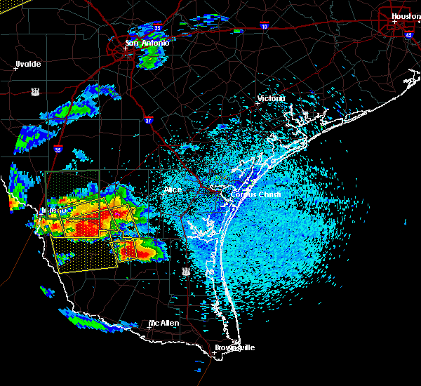 At 823 pm cdt, a severe thunderstorm was located near bruni, or near jim hogg county airport, moving southeast at 10 mph. another severe thunderstorm was located 7 miles north of realitos, moving northeast at 15 mph (radar indicated). Hazards include two inch hail and 70 mph wind gusts. People and animals outdoors will be injured. expect hail damage to roofs, siding, windows, and vehicles. expect considerable tree damage. Wind damage is also likely to mobile homes, roofs, and outbuildings. At 823 pm cdt, a severe thunderstorm was located near bruni, or near jim hogg county airport, moving southeast at 10 mph. another severe thunderstorm was located 7 miles north of realitos, moving northeast at 15 mph (radar indicated). Hazards include two inch hail and 70 mph wind gusts. People and animals outdoors will be injured. expect hail damage to roofs, siding, windows, and vehicles. expect considerable tree damage. Wind damage is also likely to mobile homes, roofs, and outbuildings.
|
| 5/17/2016 8:15 PM CDT |
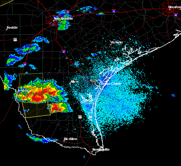 At 814 pm cdt, a severe thunderstorm was located 7 miles southeast of aguilares, or 18 miles west of jim hogg county airport, moving southeast at 15 mph. another severe thunderstorm was near bruni, moving southeast at 20 mph. these are very dangerous storms (radar indicated). Hazards include baseball size hail and 70 mph wind gusts. People and animals outdoors will be severely injured. expect shattered windows, extensive damage to roofs, siding, and vehicles. Locations impacted include, oilton, mirando city, bruni and aguilares. At 814 pm cdt, a severe thunderstorm was located 7 miles southeast of aguilares, or 18 miles west of jim hogg county airport, moving southeast at 15 mph. another severe thunderstorm was near bruni, moving southeast at 20 mph. these are very dangerous storms (radar indicated). Hazards include baseball size hail and 70 mph wind gusts. People and animals outdoors will be severely injured. expect shattered windows, extensive damage to roofs, siding, and vehicles. Locations impacted include, oilton, mirando city, bruni and aguilares.
|
| 5/17/2016 8:00 PM CDT |
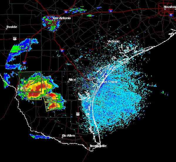 At 800 pm cdt, a severe thunderstorm was located near aguilares, or 19 miles west of jim hogg county airport, moving southeast at 20 mph. this is a very dangerous storm (radar indicated). Hazards include three inch hail and 70 mph wind gusts. People and animals outdoors will be severely injured. expect shattered windows, extensive damage to roofs, siding, and vehicles. Locations impacted include, oilton, mirando city, bruni and aguilares. At 800 pm cdt, a severe thunderstorm was located near aguilares, or 19 miles west of jim hogg county airport, moving southeast at 20 mph. this is a very dangerous storm (radar indicated). Hazards include three inch hail and 70 mph wind gusts. People and animals outdoors will be severely injured. expect shattered windows, extensive damage to roofs, siding, and vehicles. Locations impacted include, oilton, mirando city, bruni and aguilares.
|
| 5/17/2016 7:34 PM CDT |
 At 734 pm cdt, a severe thunderstorm was located near aguilares, or 22 miles east of laredo, moving south at 25 mph. this is a very dangerous storm (radar indicated). Hazards include softball size hail and 70 mph wind gusts. People and animals outdoors will be severely injured. expect shattered windows, extensive damage to roofs, siding, and vehicles. Locations impacted include, oilton, mirando city, bruni, aguilares and ranchitos las lomas. At 734 pm cdt, a severe thunderstorm was located near aguilares, or 22 miles east of laredo, moving south at 25 mph. this is a very dangerous storm (radar indicated). Hazards include softball size hail and 70 mph wind gusts. People and animals outdoors will be severely injured. expect shattered windows, extensive damage to roofs, siding, and vehicles. Locations impacted include, oilton, mirando city, bruni, aguilares and ranchitos las lomas.
|
| 5/17/2016 7:25 PM CDT |
 At 723 pm cdt, a severe thunderstorm was located 6 miles north of aguilares, or 22 miles east of laredo, moving southeast at 20 mph. another severe thunderstorm was located 15 miles northeast of aguilares, moving east at 10 mph. these are very dangerous storms (radar indicated). Hazards include baseball size hail and 70 mph wind gusts. People and animals outdoors will be severely injured. Expect shattered windows, extensive damage to roofs, siding, and vehicles. At 723 pm cdt, a severe thunderstorm was located 6 miles north of aguilares, or 22 miles east of laredo, moving southeast at 20 mph. another severe thunderstorm was located 15 miles northeast of aguilares, moving east at 10 mph. these are very dangerous storms (radar indicated). Hazards include baseball size hail and 70 mph wind gusts. People and animals outdoors will be severely injured. Expect shattered windows, extensive damage to roofs, siding, and vehicles.
|
| 4/20/2016 8:59 PM CDT |
 At 858 pm cdt, a severe thunderstorm was located 10 miles east of rio bravo, or 15 miles southeast of laredo, moving northeast at 15 mph. an additional strong to severe storm was located just west of rio bravo, and moving east (radar indicated). Hazards include 60 mph wind gusts and half dollar size hail. Hail damage to vehicles is expected. Expect wind damage to roofs, siding, and trees. At 858 pm cdt, a severe thunderstorm was located 10 miles east of rio bravo, or 15 miles southeast of laredo, moving northeast at 15 mph. an additional strong to severe storm was located just west of rio bravo, and moving east (radar indicated). Hazards include 60 mph wind gusts and half dollar size hail. Hail damage to vehicles is expected. Expect wind damage to roofs, siding, and trees.
|
| 4/18/2016 5:15 PM CDT |
 At 513 pm cdt, a severe thunderstorm was located over ranchitos las lomas, or 20 miles east of laredo, moving southeast at 20 mph (radar indicated). Hazards include 60 mph wind gusts and quarter size hail. Hail damage to vehicles is expected. Expect wind damage to roofs, siding, and trees. At 513 pm cdt, a severe thunderstorm was located over ranchitos las lomas, or 20 miles east of laredo, moving southeast at 20 mph (radar indicated). Hazards include 60 mph wind gusts and quarter size hail. Hail damage to vehicles is expected. Expect wind damage to roofs, siding, and trees.
|
| 3/18/2016 10:52 PM CDT |
 At 1052 pm cdt, severe thunderstorms were located along a line extending from 11 miles south of fort ewell site to 12 miles north of oilton to 8 miles south of aguilares, moving east at 30 mph (radar indicated). Hazards include 60 mph wind gusts and quarter size hail. Hail damage to vehicles is expected. expect wind damage to roofs, siding, and trees. Locations impacted include, oilton, mirando city, bruni, aguilares and ranchitos las lomas. At 1052 pm cdt, severe thunderstorms were located along a line extending from 11 miles south of fort ewell site to 12 miles north of oilton to 8 miles south of aguilares, moving east at 30 mph (radar indicated). Hazards include 60 mph wind gusts and quarter size hail. Hail damage to vehicles is expected. expect wind damage to roofs, siding, and trees. Locations impacted include, oilton, mirando city, bruni, aguilares and ranchitos las lomas.
|
| 3/18/2016 10:33 PM CDT |
 At 1032 pm cdt, severe thunderstorms were located along a line extending from 6 miles southwest of fort ewell site to 15 miles southwest of aguilares, moving east at 35 mph (radar indicated). Hazards include 60 mph wind gusts and quarter size hail. Hail damage to vehicles is expected. Expect wind damage to roofs, siding, and trees. At 1032 pm cdt, severe thunderstorms were located along a line extending from 6 miles southwest of fort ewell site to 15 miles southwest of aguilares, moving east at 35 mph (radar indicated). Hazards include 60 mph wind gusts and quarter size hail. Hail damage to vehicles is expected. Expect wind damage to roofs, siding, and trees.
|
| 3/18/2016 8:55 PM CDT |
 At 854 pm cdt, severe thunderstorms were located about 9 miles southwest of gilson groves, and 6 miles west of encinal. these storms were nearly stationary (radar indicated). Hazards include quarter size hail. Damage to vehicles is expected. Locations impacted include, laredo, rio bravo, botines, laredo international airport, ranchitos las lomas, mirando city, texas a&m international university, columbia bridge, orvil, united south high school, oilton, ranchos penitas west, callaghan, las tiendas, doctors hospital of laredo, la esperanza ranch airport, aguilares, unitec industrial park, laredo community college and st augustine high school south laredo. At 854 pm cdt, severe thunderstorms were located about 9 miles southwest of gilson groves, and 6 miles west of encinal. these storms were nearly stationary (radar indicated). Hazards include quarter size hail. Damage to vehicles is expected. Locations impacted include, laredo, rio bravo, botines, laredo international airport, ranchitos las lomas, mirando city, texas a&m international university, columbia bridge, orvil, united south high school, oilton, ranchos penitas west, callaghan, las tiendas, doctors hospital of laredo, la esperanza ranch airport, aguilares, unitec industrial park, laredo community college and st augustine high school south laredo.
|
| 3/18/2016 8:34 PM CDT |
 At 832 pm cdt, severe thunderstorms were located about 8 miles west of las tiendas to doctors hospital of laredo, showing little movement. these storms have weakened slightly, but could intensify again. more storms are located west of the rio grande and webb county (trained weather spotters). Hazards include quarter size hail. Damage to vehicles is expected. Locations impacted include, laredo, rio bravo, el cenizo, botines, laredo international airport, ranchitos las lomas, mirando city, texas a&m international university, columbia bridge, orvil, united south high school, oilton, ranchos penitas west, callaghan, las tiendas, doctors hospital of laredo, la esperanza ranch airport, rio bravo--el cenizo, aguilares and unitec industrial park. At 832 pm cdt, severe thunderstorms were located about 8 miles west of las tiendas to doctors hospital of laredo, showing little movement. these storms have weakened slightly, but could intensify again. more storms are located west of the rio grande and webb county (trained weather spotters). Hazards include quarter size hail. Damage to vehicles is expected. Locations impacted include, laredo, rio bravo, el cenizo, botines, laredo international airport, ranchitos las lomas, mirando city, texas a&m international university, columbia bridge, orvil, united south high school, oilton, ranchos penitas west, callaghan, las tiendas, doctors hospital of laredo, la esperanza ranch airport, rio bravo--el cenizo, aguilares and unitec industrial park.
|
| 3/18/2016 8:21 PM CDT |
 At 820 pm cdt, severe thunderstorms were about 6 miles southwest of las tiendas, and near doctors hospital of laredo. the stroms were nearly stationary, but generally drifting west (radar indicated). Hazards include 60 mph wind gusts and half dollar size hail. Hail damage to vehicles is expected. Expect wind damage to roofs, siding, and trees. At 820 pm cdt, severe thunderstorms were about 6 miles southwest of las tiendas, and near doctors hospital of laredo. the stroms were nearly stationary, but generally drifting west (radar indicated). Hazards include 60 mph wind gusts and half dollar size hail. Hail damage to vehicles is expected. Expect wind damage to roofs, siding, and trees.
|
| 10/24/2015 12:55 PM CDT |
 At 1252 pm cdt, severe thunderstorms were located along a line extending from near alfred to near aguilares, moving south at 25 mph (trained weather spotters). Hazards include 60 mph wind gusts. Expect damage to roofs. Siding and trees. At 1252 pm cdt, severe thunderstorms were located along a line extending from near alfred to near aguilares, moving south at 25 mph (trained weather spotters). Hazards include 60 mph wind gusts. Expect damage to roofs. Siding and trees.
|
| 10/24/2015 12:19 PM CDT |
 At 1217 pm cdt, severe thunderstorms were located along a line extending from near tecalote to 11 miles north of ranchitos las lomas, moving south at 30 mph (law enforcement. at 1215 pm law enforcement reported trees down within the city of freer). Hazards include 60 mph wind gusts. Expect damage to roofs. Siding and trees. At 1217 pm cdt, severe thunderstorms were located along a line extending from near tecalote to 11 miles north of ranchitos las lomas, moving south at 30 mph (law enforcement. at 1215 pm law enforcement reported trees down within the city of freer). Hazards include 60 mph wind gusts. Expect damage to roofs. Siding and trees.
|
| 5/29/2015 3:55 AM CDT |
At 355 am cdt, doppler radar indicated a line of severe thunderstorms capable of producing damaging winds in excess of 60 mph. these storms were located along a line extending from 9 miles northwest of freer to 6 miles southeast of ranchitos las lomas to near ranchos penitas west. these storms were nearly stationary. penny size hail may also accompany the damaging winds. locations impacted include, laredo, freer, benavides, jim hogg county airport, rio bravo, botines, united south high school, bruni, ranchos penitas west, callaghan, rio bravo--el cenizo, aguilares, san jose, unitec industrial park, laredo country club, laredo international airport, ranchitos las lomas, mirando city, texas a&m international university and orvil.
|
| 5/29/2015 3:21 AM CDT |
At 320 am cdt, doppler radar indicated a line of severe thunderstorms capable of producing damaging winds in excess of 60 mph. these storms were located along a line extending from 9 miles northwest of freer to 6 miles east of ranchitos las lomas to near ranchos penitas west, and moving southeast at 35 mph. penny size hail may also accompany the damaging winds.
|
| 4/12/2015 9:48 PM CDT |
A severe thunderstorm warning remains in effect until 1015 pm cdt for southeastern webb county. at 948 pm cdt. doppler radar indicated a line of severe thunderstorms capable of producing quarter size hail and damaging winds in excess of 60 mph. These storms were located along a line extending from 10 miles east of ranchitos las lomas to 7 miles south.
|
| 4/12/2015 9:28 PM CDT |
The national weather service in corpus christi has issued a * severe thunderstorm warning for. southeastern webb county in south central texas. until 1015 pm cdt * at 927 pm cdt. Doppler radar indicated a line of severe thunderstorms capable of producing quarter size hail and damaging.
|
| 4/12/2015 9:19 PM CDT |
A severe thunderstorm warning remains in effect until 930 pm cdt for southeastern webb county. at 917 pm cdt. trained weather spotters reported a line of severe thunderstorms producing damaging winds in excess of 60 mph. These storms were located along a line extending from 8 miles southeast of encinal to near texas a&m international university to 14 miles.
|
|
|
| 4/12/2015 8:40 PM CDT |
The national weather service in corpus christi has issued a * severe thunderstorm warning for. southeastern webb county in south central texas. until 930 pm cdt * at 839 pm cdt. Doppler radar indicated a line of severe thunderstorms capable of producing damaging winds in excess of 60.
|


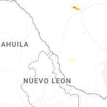


Connect with Interactive Hail Maps