

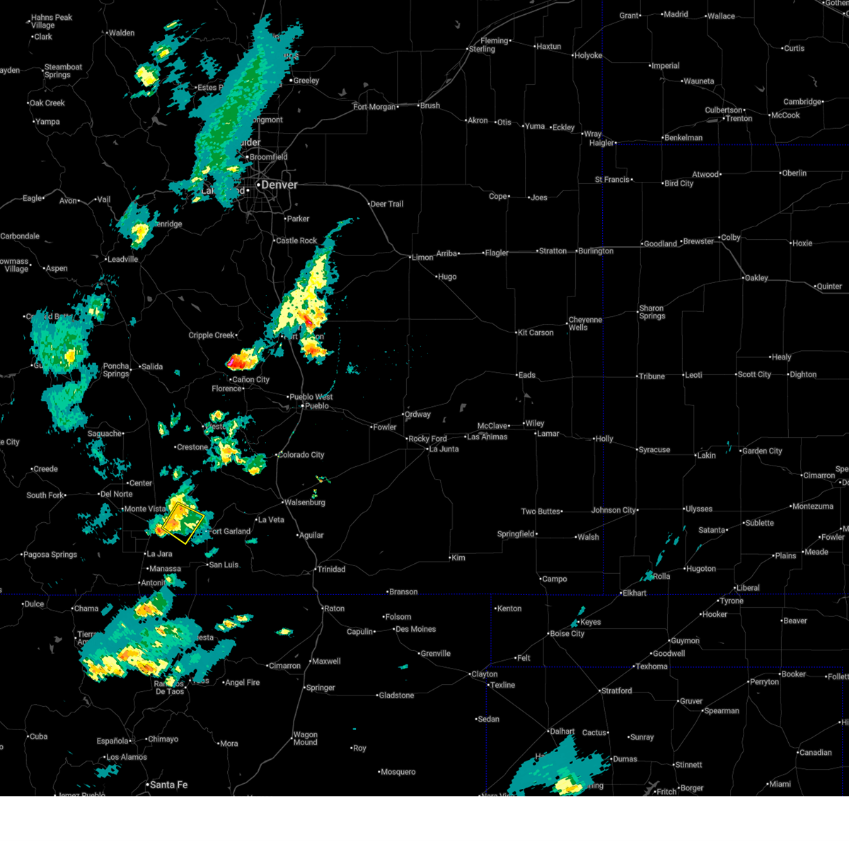
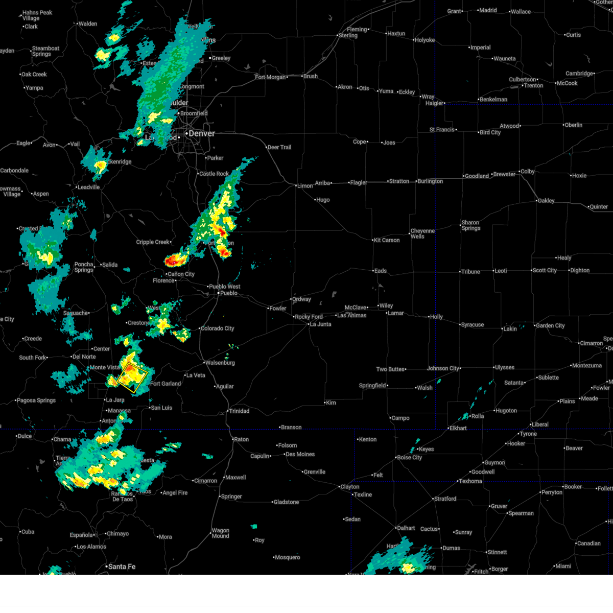
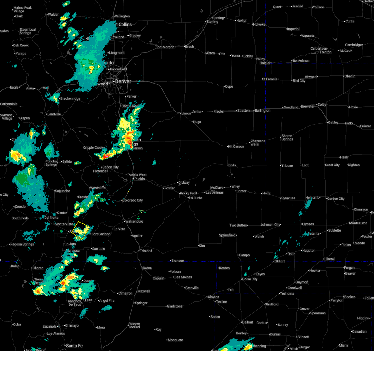
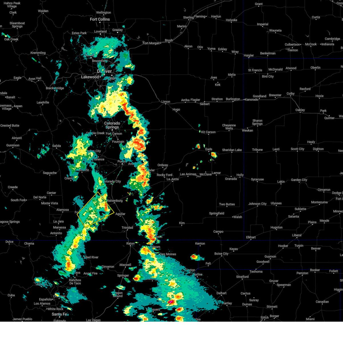
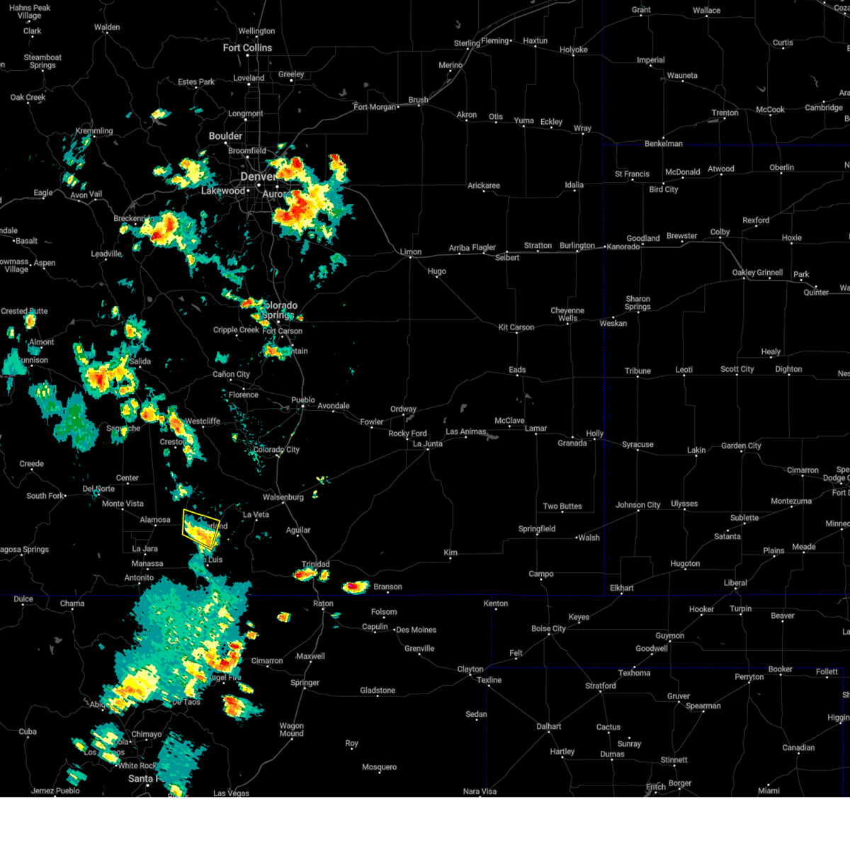
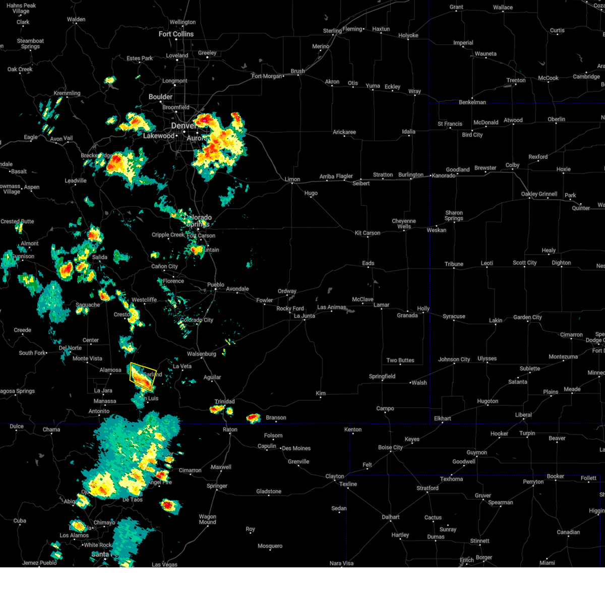
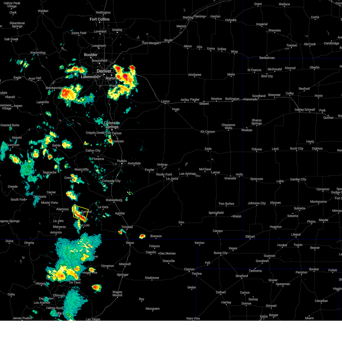
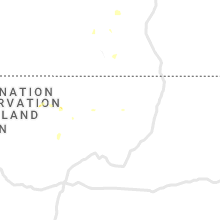
Hail Map for Blanca, CO
The Blanca, CO area has had 0 reports of on-the-ground hail by trained spotters, and has been under severe weather warnings 3 times during the past 12 months. Doppler radar has detected hail at or near Blanca, CO on 4 occasions.
| Name: | Blanca, CO |
| Where Located: | 70.9 miles N of Taos, NM |
| Map: | Google Map for Blanca, CO |
| Population: | 385 |
| Housing Units: | 167 |
| More Info: | Search Google for Blanca, CO |
0
The Top Recent Hail Date for Blanca, CO is Sunday, July 21, 2024 (2nd out of 4)

Hail and Wind Damage Spotted near Blanca, CO
| Date / Time | Report Details |
|---|---|
| 7/30/2025 4:21 PM MDT |
 The storm which prompted the warning has weakened below severe limits, and no longer poses an immediate threat to life or property. therefore, the warning will be allowed to expire. however, gusty winds and heavy rain are still possible with this thunderstorm. The storm which prompted the warning has weakened below severe limits, and no longer poses an immediate threat to life or property. therefore, the warning will be allowed to expire. however, gusty winds and heavy rain are still possible with this thunderstorm.
|
| 7/30/2025 4:14 PM MDT |
 At 414 pm mdt, a severe thunderstorm was located 9 miles northwest of blanca, or 12 miles east of alamosa, and is nearly stationary (radar indicated). Hazards include 60 mph wind gusts and nickel size hail. Expect damage to roofs, siding, and trees. Locations impacted include, blanca. At 414 pm mdt, a severe thunderstorm was located 9 miles northwest of blanca, or 12 miles east of alamosa, and is nearly stationary (radar indicated). Hazards include 60 mph wind gusts and nickel size hail. Expect damage to roofs, siding, and trees. Locations impacted include, blanca.
|
| 7/30/2025 3:59 PM MDT |
 Svrpub the national weather service in pueblo has issued a * severe thunderstorm warning for, central alamosa county in southeastern colorado, northwestern costilla county in south central colorado, * until 430 pm mdt. * at 359 pm mdt, a severe thunderstorm was located 9 miles northwest of blanca, or 11 miles east of alamosa, moving northeast at 10 mph (radar indicated). Hazards include 60 mph wind gusts and quarter size hail. Hail damage to vehicles is expected. Expect wind damage to roofs, siding, and trees. Svrpub the national weather service in pueblo has issued a * severe thunderstorm warning for, central alamosa county in southeastern colorado, northwestern costilla county in south central colorado, * until 430 pm mdt. * at 359 pm mdt, a severe thunderstorm was located 9 miles northwest of blanca, or 11 miles east of alamosa, moving northeast at 10 mph (radar indicated). Hazards include 60 mph wind gusts and quarter size hail. Hail damage to vehicles is expected. Expect wind damage to roofs, siding, and trees.
|
| 9/17/2024 3:33 PM MDT |
 the severe thunderstorm warning has been cancelled and is no longer in effect the severe thunderstorm warning has been cancelled and is no longer in effect
|
| 9/17/2024 3:00 PM MDT |
 Svrpub the national weather service in pueblo has issued a * severe thunderstorm warning for, southwestern huerfano county in southeastern colorado, northeastern costilla county in south central colorado, western las animas county in southeastern colorado, * until 345 pm mdt. * at 300 pm mdt, a severe thunderstorm was located over fort garland, or 25 miles east of san luis valley airport, moving northeast at 55 mph (radar indicated). Hazards include 70 mph wind gusts and nickel size hail. Expect considerable tree damage. Damage is likely to mobile homes, roofs, and outbuildings. Svrpub the national weather service in pueblo has issued a * severe thunderstorm warning for, southwestern huerfano county in southeastern colorado, northeastern costilla county in south central colorado, western las animas county in southeastern colorado, * until 345 pm mdt. * at 300 pm mdt, a severe thunderstorm was located over fort garland, or 25 miles east of san luis valley airport, moving northeast at 55 mph (radar indicated). Hazards include 70 mph wind gusts and nickel size hail. Expect considerable tree damage. Damage is likely to mobile homes, roofs, and outbuildings.
|
| 6/9/2024 4:22 PM MDT |
 The severe thunderstorm which prompted the warning has weakened. therefore, the warning will be allowed to expire. however, small hail, gusty winds and heavy rain are still possible with this thunderstorm. The severe thunderstorm which prompted the warning has weakened. therefore, the warning will be allowed to expire. however, small hail, gusty winds and heavy rain are still possible with this thunderstorm.
|
| 6/9/2024 4:08 PM MDT |
 At 408 pm mdt, a severe thunderstorm was located over blanca, or 20 miles east of san luis valley airport, moving north at 10 mph (radar indicated). Hazards include 60 mph wind gusts and quarter size hail. Hail damage to vehicles is expected. expect wind damage to roofs, siding, and trees. Locations impacted include, blanca and fort garland. At 408 pm mdt, a severe thunderstorm was located over blanca, or 20 miles east of san luis valley airport, moving north at 10 mph (radar indicated). Hazards include 60 mph wind gusts and quarter size hail. Hail damage to vehicles is expected. expect wind damage to roofs, siding, and trees. Locations impacted include, blanca and fort garland.
|
| 6/9/2024 3:55 PM MDT |
 Svrpub the national weather service in pueblo has issued a * severe thunderstorm warning for, east central alamosa county in southeastern colorado, northwestern costilla county in south central colorado, * until 430 pm mdt. * at 355 pm mdt, a severe thunderstorm was located over blanca, or 19 miles east of san luis valley airport, moving north at 10 mph (radar indicated). Hazards include 60 mph wind gusts and quarter size hail. Hail damage to vehicles is expected. Expect wind damage to roofs, siding, and trees. Svrpub the national weather service in pueblo has issued a * severe thunderstorm warning for, east central alamosa county in southeastern colorado, northwestern costilla county in south central colorado, * until 430 pm mdt. * at 355 pm mdt, a severe thunderstorm was located over blanca, or 19 miles east of san luis valley airport, moving north at 10 mph (radar indicated). Hazards include 60 mph wind gusts and quarter size hail. Hail damage to vehicles is expected. Expect wind damage to roofs, siding, and trees.
|
| 6/28/2015 3:15 PM MDT |
 At 315 pm mdt, a severe thunderstorm was located near alamosa east, or near alamosa, moving southwest at 20 mph (radar indicated). Hazards include 60 mph wind gusts and quarter size hail. Hail damage to vehicles is expected. expect wind damage to roofs, siding and trees. Locations impacted include, alamosa, sanford, la jara, blanca, san luis lake, mosca, alamosa east, san acacio and great sand dunes. At 315 pm mdt, a severe thunderstorm was located near alamosa east, or near alamosa, moving southwest at 20 mph (radar indicated). Hazards include 60 mph wind gusts and quarter size hail. Hail damage to vehicles is expected. expect wind damage to roofs, siding and trees. Locations impacted include, alamosa, sanford, la jara, blanca, san luis lake, mosca, alamosa east, san acacio and great sand dunes.
|
| 6/28/2015 3:03 PM MDT |
 At 302 pm mdt, a severe thunderstorm was located near san luis lake, or 9 miles northeast of alamosa, moving southwest at 20 mph (radar indicated). Hazards include 60 mph wind gusts and quarter size hail. Hail damage to vehicles is expected. Expect wind damage to roofs, siding and trees. At 302 pm mdt, a severe thunderstorm was located near san luis lake, or 9 miles northeast of alamosa, moving southwest at 20 mph (radar indicated). Hazards include 60 mph wind gusts and quarter size hail. Hail damage to vehicles is expected. Expect wind damage to roofs, siding and trees.
|
Hail Maps for Blanca, CO


Connect with Interactive Hail Maps