

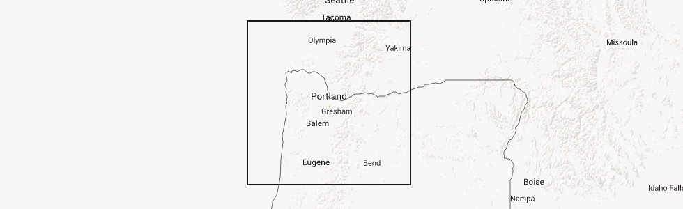
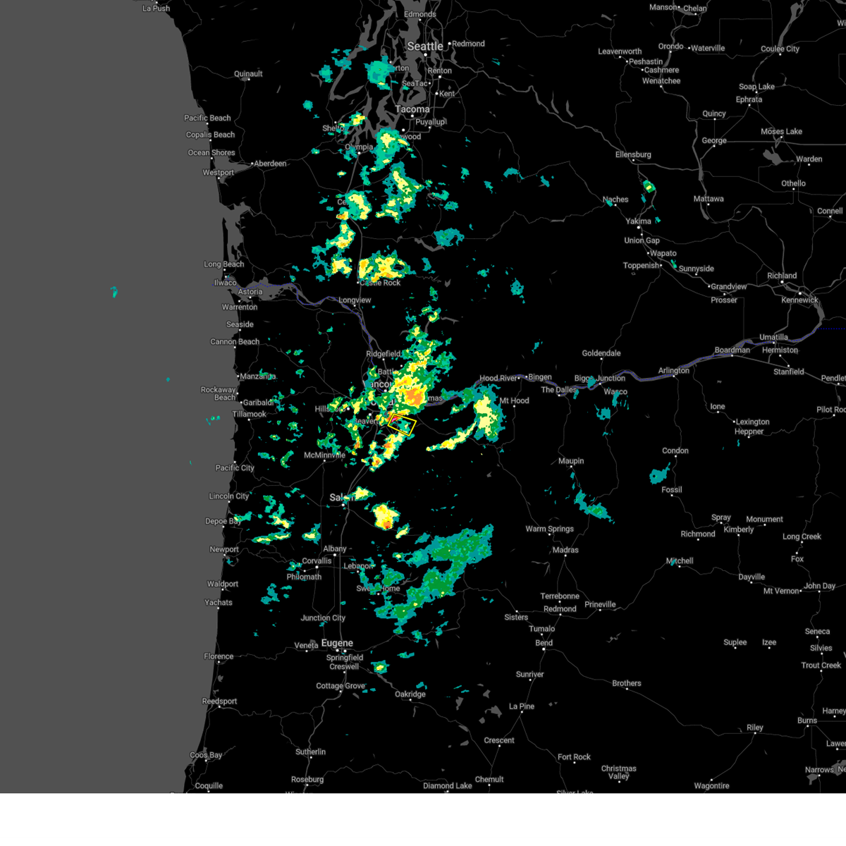
Hail Map for Johnson City, OR
The Johnson City, OR area has had 0 reports of on-the-ground hail by trained spotters, and has been under severe weather warnings 1 time during the past 12 months. Doppler radar has detected hail at or near Johnson City, OR on 1 occasion.
| Name: | Johnson City, OR |
| Where Located: | 8.7 miles SSE of Portland, OR |
| Map: | Google Map for Johnson City, OR |
| Population: | 566 |
| Housing Units: | 278 |
| More Info: | Search Google for Johnson City, OR |
0
The Top Recent Hail Date for Johnson City, OR is Monday, June 16, 2014 (1st out of 1)
Hail and Wind Damage Spotted near Johnson City, OR
| Date / Time | Report Details |
|---|---|
| 2/24/2025 4:24 PM PST |
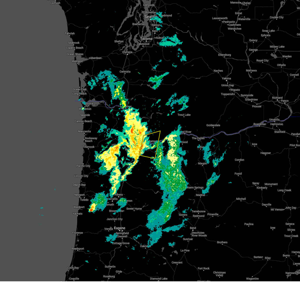 Svrpqr the national weather service in portland has issued a * severe thunderstorm warning for, northwestern clackamas county in northwestern oregon, south central multnomah county in northwestern oregon, southeastern clark county in southwestern washington, southwestern skamania county in southwestern washington, * until 500 pm pst. * at 423 pm pst, severe thunderstorms were located along a line extending from mill plain to gladstone, moving east at 30 mph (radar indicated). Hazards include 60 mph wind gusts. Expect damage to roofs, siding, and trees. Downed trees and power outages possible. Svrpqr the national weather service in portland has issued a * severe thunderstorm warning for, northwestern clackamas county in northwestern oregon, south central multnomah county in northwestern oregon, southeastern clark county in southwestern washington, southwestern skamania county in southwestern washington, * until 500 pm pst. * at 423 pm pst, severe thunderstorms were located along a line extending from mill plain to gladstone, moving east at 30 mph (radar indicated). Hazards include 60 mph wind gusts. Expect damage to roofs, siding, and trees. Downed trees and power outages possible.
|
| 10/16/2023 4:07 PM PDT |
 At 406 pm pdt, a severe thunderstorm was located over jennings lodge, or near oregon city, moving northeast at 20 mph (radar indicated). Hazards include 60 mph wind gusts. expect damage to roofs, siding, and trees At 406 pm pdt, a severe thunderstorm was located over jennings lodge, or near oregon city, moving northeast at 20 mph (radar indicated). Hazards include 60 mph wind gusts. expect damage to roofs, siding, and trees
|
| 10/16/2023 4:07 PM PDT |
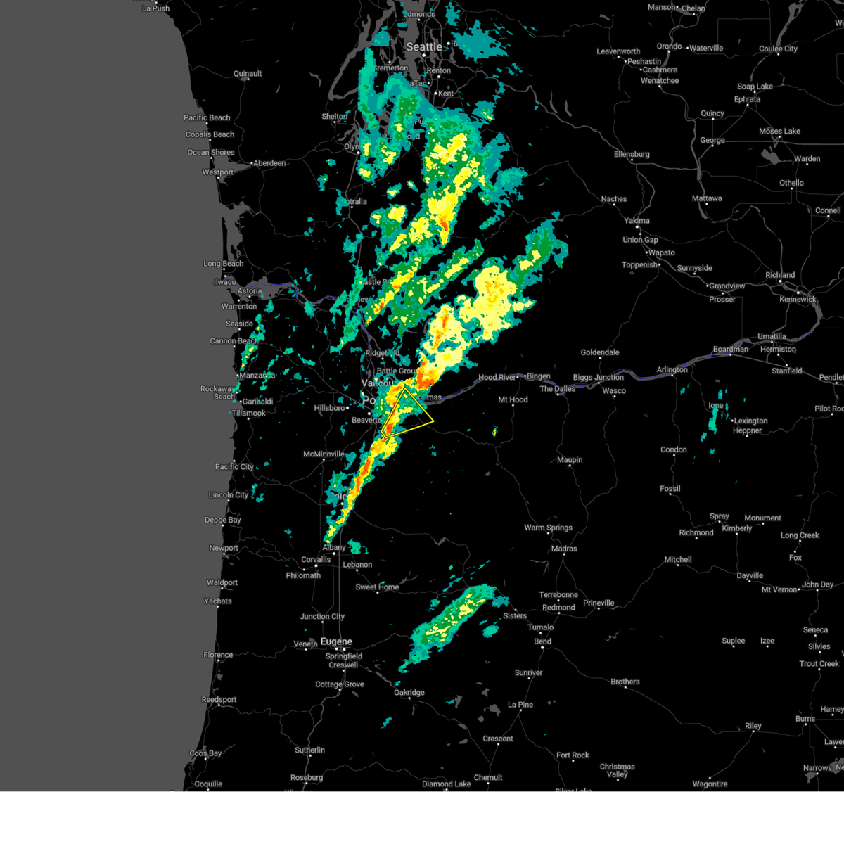 At 406 pm pdt, a severe thunderstorm was located over jennings lodge, or near oregon city, moving northeast at 20 mph (radar indicated). Hazards include 60 mph wind gusts. expect damage to roofs, siding, and trees At 406 pm pdt, a severe thunderstorm was located over jennings lodge, or near oregon city, moving northeast at 20 mph (radar indicated). Hazards include 60 mph wind gusts. expect damage to roofs, siding, and trees
|
| 6/18/2023 4:53 PM PDT |
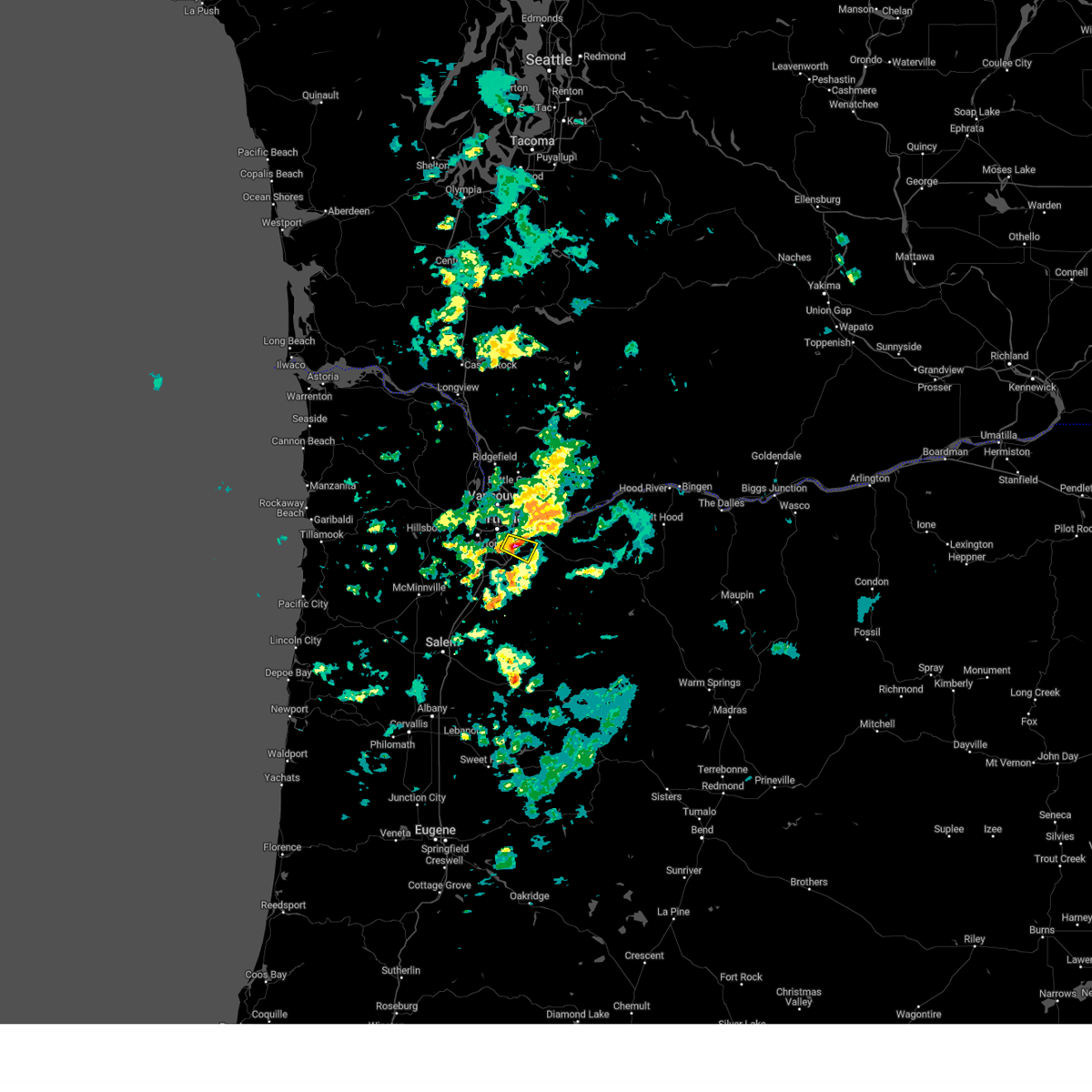 At 451 pm pdt, a severe thunderstorm was located over sunnyside, moving east at 15 mph (radar indicated. at 430 pm, penny sized hail was reported in sellwood). Hazards include quarter size hail. Damage to vehicles is expected. locations impacted include, milwaukie, gladstone, oatfield, clackamas, happy valley, damascus, johnson city, sunnyside and oak grove. in oregon this includes interstate 205 between mile markers 12 and 18. hail threat, observed max hail size, 1. 00 in wind threat, radar indicated max wind gust, <50 mph. At 451 pm pdt, a severe thunderstorm was located over sunnyside, moving east at 15 mph (radar indicated. at 430 pm, penny sized hail was reported in sellwood). Hazards include quarter size hail. Damage to vehicles is expected. locations impacted include, milwaukie, gladstone, oatfield, clackamas, happy valley, damascus, johnson city, sunnyside and oak grove. in oregon this includes interstate 205 between mile markers 12 and 18. hail threat, observed max hail size, 1. 00 in wind threat, radar indicated max wind gust, <50 mph.
|
| 6/18/2023 4:39 PM PDT |
 At 437 pm pdt, a severe thunderstorm was located over milwaukie, moving east at 15 mph (radar indicated). Hazards include quarter size hail. damage to vehicles is expected At 437 pm pdt, a severe thunderstorm was located over milwaukie, moving east at 15 mph (radar indicated). Hazards include quarter size hail. damage to vehicles is expected
|
Hail Maps for Johnson City, OR
Connect with Interactive Hail Maps