

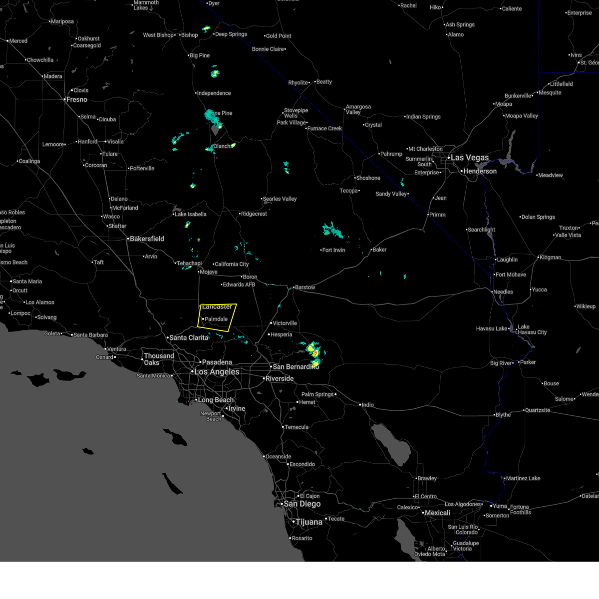
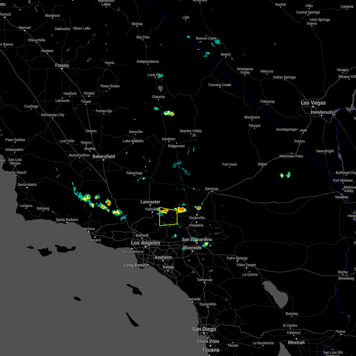
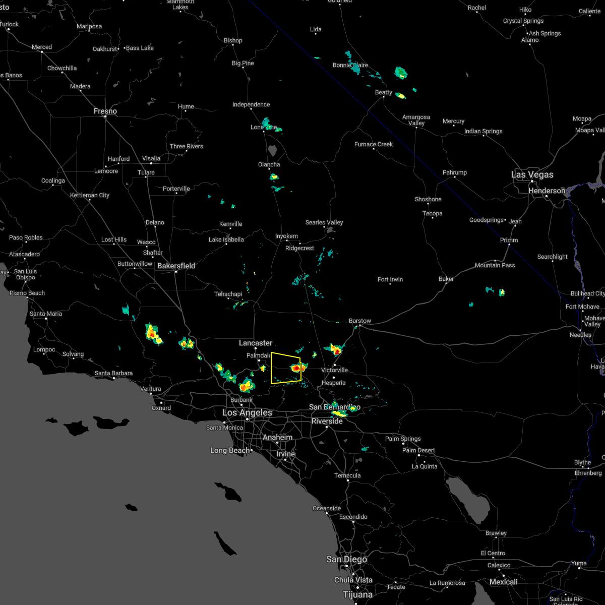
Hail Map for Lake Los Angeles, CA
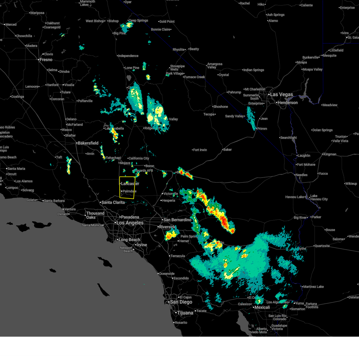
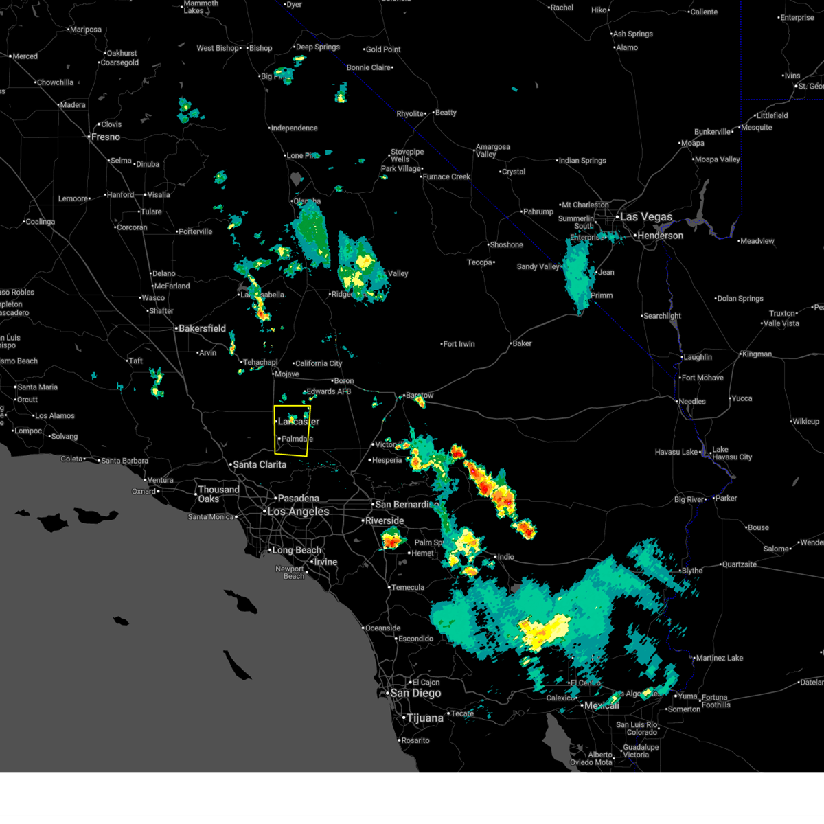
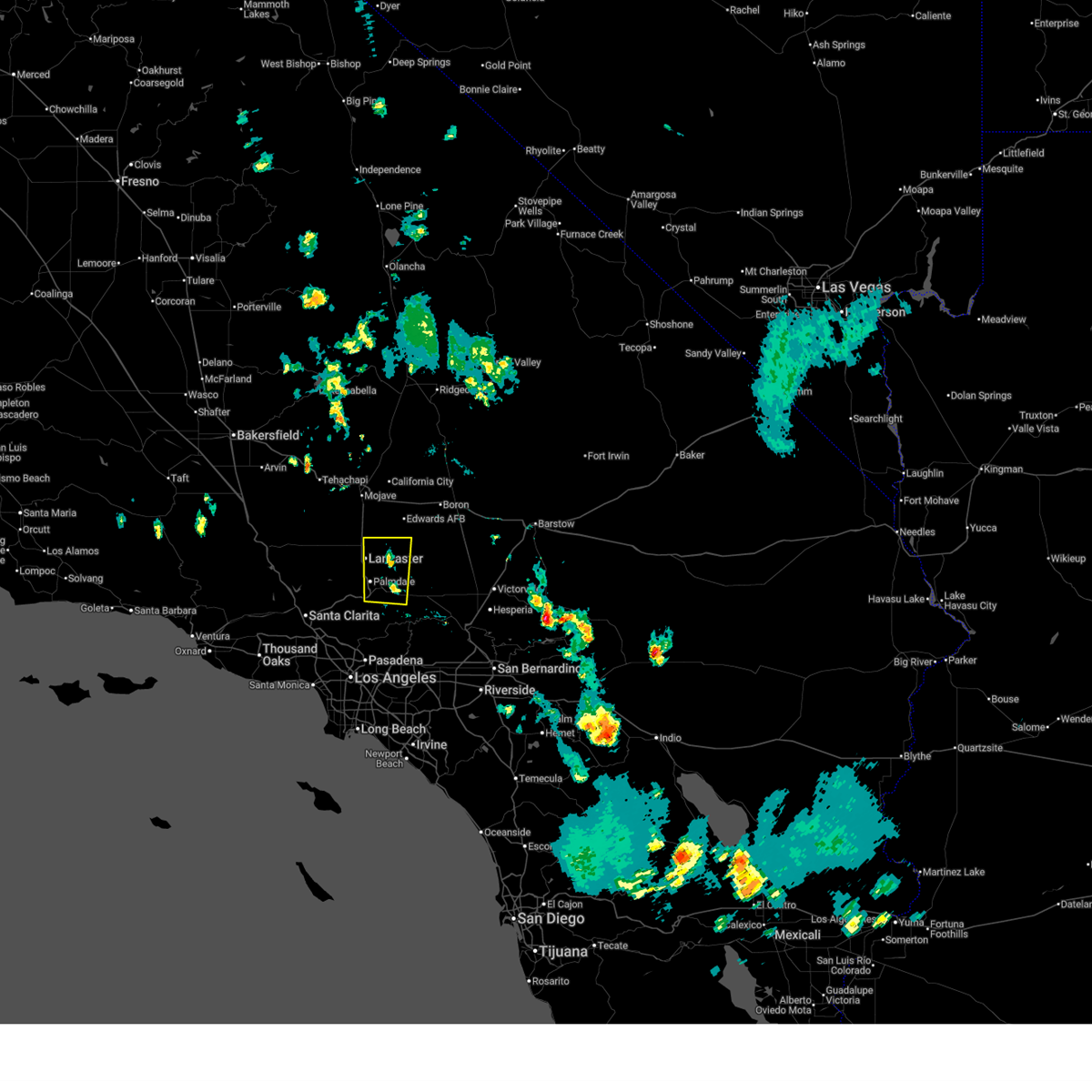
The Lake Los Angeles, CA area has had 0 reports of on-the-ground hail by trained spotters, and has been under severe weather warnings 6 times during the past 12 months. Doppler radar has detected hail at or near Lake Los Angeles, CA on 2 occasions.
| Name: | Lake Los Angeles, CA |
| Where Located: | 45.2 miles NNE of Los Angeles, CA |
| Map: | Google Map for Lake Los Angeles, CA |
| Population: | 12328 |
| Housing Units: | 3658 |
| More Info: | Search Google for Lake Los Angeles, CA |
5
The Top Recent Hail Date for Lake Los Angeles, CA is Saturday, September 10, 2011 (1st out of 2)

Hail and Wind Damage Spotted near Lake Los Angeles, CA
| Date / Time | Report Details |
|---|---|
| 12/24/2025 8:21 AM PST | Power lines are down. nearby sensor reported wind gusts to 62 mp in los angeles county CA, 9.1 miles N of Lake Los Angeles, CA |
| 8/26/2025 3:21 PM PDT |
 The storms which prompted the warning have weakened below severe limits, and no longer pose an immediate threat to life or property. therefore, the warning will be allowed to expire. however, gusty winds and heavy rain are still possible with these thunderstorms. to report severe weather, contact your nearest law enforcement agency. they will relay your report to the national weather service oxnard. The storms which prompted the warning have weakened below severe limits, and no longer pose an immediate threat to life or property. therefore, the warning will be allowed to expire. however, gusty winds and heavy rain are still possible with these thunderstorms. to report severe weather, contact your nearest law enforcement agency. they will relay your report to the national weather service oxnard.
|
| 8/26/2025 2:58 PM PDT |
 At 257 pm pdt, a cluster of severe thunderstorms were located along a line extending from near lancaster to near littlerock moving northeast at 5 mph (radar indicated). Hazards include 60 mph wind gusts. Expect damage to roofs, siding, and trees. Locations impacted include, lake los angeles, palmdale, lancaster, pearblossom, llano, littlerock, saddleback butte state park, and highway 138 between llano and the san bernardino county line. At 257 pm pdt, a cluster of severe thunderstorms were located along a line extending from near lancaster to near littlerock moving northeast at 5 mph (radar indicated). Hazards include 60 mph wind gusts. Expect damage to roofs, siding, and trees. Locations impacted include, lake los angeles, palmdale, lancaster, pearblossom, llano, littlerock, saddleback butte state park, and highway 138 between llano and the san bernardino county line.
|
| 8/26/2025 2:37 PM PDT |
 Svrlox the national weather service in oxnard has issued a * severe thunderstorm warning for, extreme northeastern los angeles county in southwestern california, * until 330 pm pdt. * at 237 pm pdt, a cluster of severe thunderstorms were located along a line extending from lake palmdale to near llano, moving east at 5 mph (radar indicated). Hazards include 60 mph wind gusts. expect damage to roofs, siding, and trees Svrlox the national weather service in oxnard has issued a * severe thunderstorm warning for, extreme northeastern los angeles county in southwestern california, * until 330 pm pdt. * at 237 pm pdt, a cluster of severe thunderstorms were located along a line extending from lake palmdale to near llano, moving east at 5 mph (radar indicated). Hazards include 60 mph wind gusts. expect damage to roofs, siding, and trees
|
| 8/25/2025 3:33 PM PDT |
 The storm which prompted the warning has weakened below severe limits, and no longer poses an immediate threat to life or property. therefore, the warning has been allowed to expire. however, gusty winds and heavy rain are still possible with this thunderstorm. a special weather statement is still in effect across the antelope valley for this storm for areas around lancaster, palmdale, and saddleback butte state park. The storm which prompted the warning has weakened below severe limits, and no longer poses an immediate threat to life or property. therefore, the warning has been allowed to expire. however, gusty winds and heavy rain are still possible with this thunderstorm. a special weather statement is still in effect across the antelope valley for this storm for areas around lancaster, palmdale, and saddleback butte state park.
|
| 8/25/2025 3:13 PM PDT |
 At 308 pm pdt, a severe thunderstorm was located from a line from lancaster to littlerock (radar indicated). Hazards include 60 mph wind gusts and small hail. Expect damage to roofs, siding, and trees. main impacts will be north of palmdale including surrounding areas of lancaster and saddleback butte state park. dry lightning strikes on periphery of storms could cause new fire ignitions. Locations impacted include, lake los angeles, palmdale, lancaster, pearblossom, littlerock, lake palmdale, saddleback butte state park, and desert view highlands. At 308 pm pdt, a severe thunderstorm was located from a line from lancaster to littlerock (radar indicated). Hazards include 60 mph wind gusts and small hail. Expect damage to roofs, siding, and trees. main impacts will be north of palmdale including surrounding areas of lancaster and saddleback butte state park. dry lightning strikes on periphery of storms could cause new fire ignitions. Locations impacted include, lake los angeles, palmdale, lancaster, pearblossom, littlerock, lake palmdale, saddleback butte state park, and desert view highlands.
|
| 8/25/2025 2:38 PM PDT |
 Svrlox the national weather service in oxnard has issued a * severe thunderstorm warning for, antelope valley and adajacent foothills in northeastern los angeles county in southwestern california, * until 330 pm pdt. * at 234 pm pdt, a cluster of severe thunderstorms was located from a line from lancaster to littlerock (radar indicated). Hazards include 60 mph wind gusts and penny size hail. Expect damage to roofs, siding, and trees. Dry lightning strikes on periphery of storms could cause new fire ignitions. Svrlox the national weather service in oxnard has issued a * severe thunderstorm warning for, antelope valley and adajacent foothills in northeastern los angeles county in southwestern california, * until 330 pm pdt. * at 234 pm pdt, a cluster of severe thunderstorms was located from a line from lancaster to littlerock (radar indicated). Hazards include 60 mph wind gusts and penny size hail. Expect damage to roofs, siding, and trees. Dry lightning strikes on periphery of storms could cause new fire ignitions.
|
| 8/23/2025 8:50 AM PDT | Mesonet station se331 llano (sce in los angeles county CA, 9.1 miles N of Lake Los Angeles, CA |
| 9/4/2022 4:22 PM PDT |
 The severe thunderstorm warning for northeastern los angeles county will expire at 430 pm pdt, the storm which prompted the warning has weakened below severe limits, and no longer poses an immediate threat to life or property. therefore, the warning will be allowed to expire. however gusty winds and heavy rain are still possible with this thunderstorm. The severe thunderstorm warning for northeastern los angeles county will expire at 430 pm pdt, the storm which prompted the warning has weakened below severe limits, and no longer poses an immediate threat to life or property. therefore, the warning will be allowed to expire. however gusty winds and heavy rain are still possible with this thunderstorm.
|
| 9/4/2022 3:39 PM PDT |
 At 339 pm pdt, a severe thunderstorm was located near pinon hills, or 9 miles north of wrightwood, moving west at 10 mph (radar indicated). Hazards include 60 mph wind gusts and penny size hail. expect damage to roofs, siding, and trees At 339 pm pdt, a severe thunderstorm was located near pinon hills, or 9 miles north of wrightwood, moving west at 10 mph (radar indicated). Hazards include 60 mph wind gusts and penny size hail. expect damage to roofs, siding, and trees
|
| 3/7/2016 7:15 AM PST |
 At 715 am pst, doppler radar continued to indicate a line of severe thunderstorms capable of producing damaging winds. winds gusts up to 60 mph have been observed with this line of thunderstorms. these storms were located along a line extending from near littlerock to placentia, moving northeast at 45 mph. locations impacted include, chino, lake los angeles, wrightwood, whittier, san dimas, glendora, west covina, pomona, and chino hills. At 715 am pst, doppler radar continued to indicate a line of severe thunderstorms capable of producing damaging winds. winds gusts up to 60 mph have been observed with this line of thunderstorms. these storms were located along a line extending from near littlerock to placentia, moving northeast at 45 mph. locations impacted include, chino, lake los angeles, wrightwood, whittier, san dimas, glendora, west covina, pomona, and chino hills.
|
| 3/7/2016 6:53 AM PST |
 At 653 am pst, doppler radar indicated a line of severe thunderstorms capable of producing damaging winds in excess of 60 mph. these storms were located along a line extending from near acton to westminster, moving northeast at 45 mph. locations impacted include, long beach, chino, seal beach, lake los angeles, acton, wrightwood, whittier, griffith park, pasadena, downtown los angeles, san dimas, glendora, alhambra, west covina, burbank, pomona, mount wilson, hollywood, buena park, and chino hills. At 653 am pst, doppler radar indicated a line of severe thunderstorms capable of producing damaging winds in excess of 60 mph. these storms were located along a line extending from near acton to westminster, moving northeast at 45 mph. locations impacted include, long beach, chino, seal beach, lake los angeles, acton, wrightwood, whittier, griffith park, pasadena, downtown los angeles, san dimas, glendora, alhambra, west covina, burbank, pomona, mount wilson, hollywood, buena park, and chino hills.
|
| 3/7/2016 6:46 AM PST |
 At 646 am pst, doppler radar indicated a line of severe thunderstorms capable of producing damaging winds in excess of 60 mph. these storms were located along a line extending from near acton to near seal beach, and moving northeast at 45 mph. At 646 am pst, doppler radar indicated a line of severe thunderstorms capable of producing damaging winds in excess of 60 mph. these storms were located along a line extending from near acton to near seal beach, and moving northeast at 45 mph.
|
| 1/31/2016 1:50 PM PST |
 At 148 pm pst, doppler radar indicated a severe thunderstorm capable of producing damaging winds in excess of 60 mph. this storm was located 7 miles northeast of mount wilson, and moving northeast at 45 mph. At 148 pm pst, doppler radar indicated a severe thunderstorm capable of producing damaging winds in excess of 60 mph. this storm was located 7 miles northeast of mount wilson, and moving northeast at 45 mph.
|
| 10/15/2015 5:29 PM PDT |
 At 523 pm pdt, doppler radar indicated a severe thunderstorm capable of producing ping pong ball size hail and damaging winds in excess of 60 mph. this storm was located over palmdale, leona valley and east lancaster, and drifting slowly eastward. At 523 pm pdt, doppler radar indicated a severe thunderstorm capable of producing ping pong ball size hail and damaging winds in excess of 60 mph. this storm was located over palmdale, leona valley and east lancaster, and drifting slowly eastward.
|
| 10/15/2015 12:02 AM PDT |
 At 1159 pm pdt, national weather service doppler radar continued to indicate a cluster of severe thunderstorms capable of producing quarter size hail and damaging winds in excess of 60 mph. these storm were located over the eastern antelope valley and moving northwest at 35 mph. locations impacted include, lake los angeles, pearblossom, llano, littlerock, valyermo, highway 138 between llano and the san bernardino county line, and saddleback butte state park. At 1159 pm pdt, national weather service doppler radar continued to indicate a cluster of severe thunderstorms capable of producing quarter size hail and damaging winds in excess of 60 mph. these storm were located over the eastern antelope valley and moving northwest at 35 mph. locations impacted include, lake los angeles, pearblossom, llano, littlerock, valyermo, highway 138 between llano and the san bernardino county line, and saddleback butte state park.
|
| 10/14/2015 11:44 PM PDT |
 At 1139 pm pdt, national weather service doppler radar continued to indicate a cluster of severe thunderstorms capable of producing quarter size hail and damaging winds in excess of 60 mph. there storm were located over the eastern antelope valley and eastern san gabriel range. locations impacted include, lake los angeles, pearblossom, llano, littlerock, valyermo, highway 138 between llano and the san bernardino county line, and saddleback butte state park. At 1139 pm pdt, national weather service doppler radar continued to indicate a cluster of severe thunderstorms capable of producing quarter size hail and damaging winds in excess of 60 mph. there storm were located over the eastern antelope valley and eastern san gabriel range. locations impacted include, lake los angeles, pearblossom, llano, littlerock, valyermo, highway 138 between llano and the san bernardino county line, and saddleback butte state park.
|
| 10/14/2015 11:31 PM PDT |
 At 1130 pm pdt, national weather service doppler radar indicated a cluster of severe thunderstorms capable of producing quarter size hail and damaging winds in excess of 60 mph. these storms were over the eastern portion of the antelope valley and the eastern san gabriel mountains, and moving northwest at 35 mph. At 1130 pm pdt, national weather service doppler radar indicated a cluster of severe thunderstorms capable of producing quarter size hail and damaging winds in excess of 60 mph. these storms were over the eastern portion of the antelope valley and the eastern san gabriel mountains, and moving northwest at 35 mph.
|
Hail Maps for Lake Los Angeles, CA


Connect with Interactive Hail Maps