

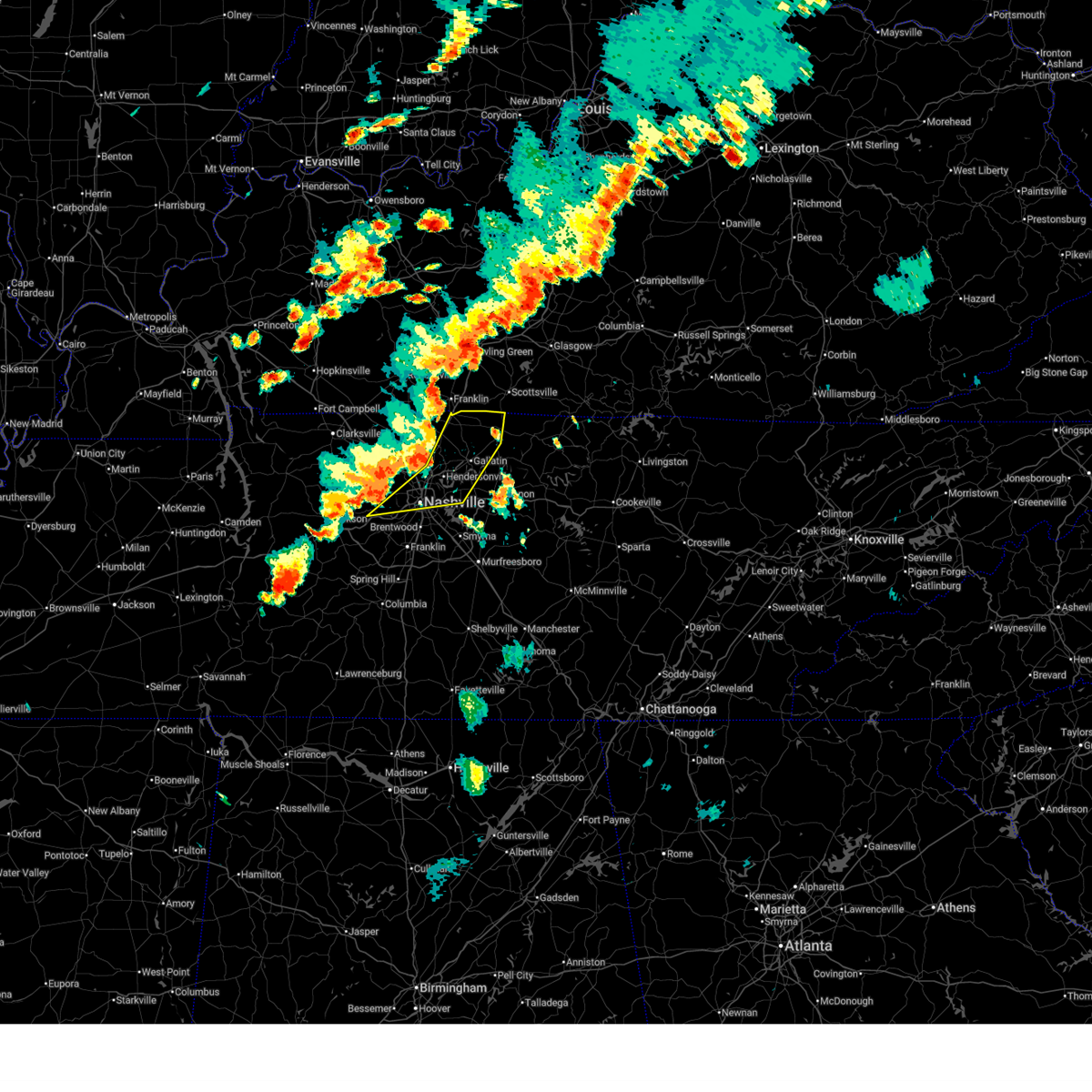
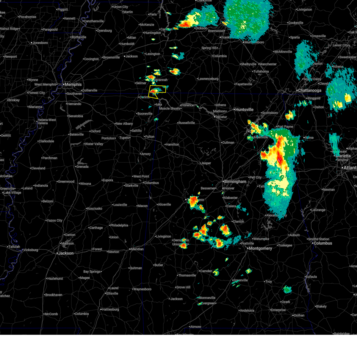
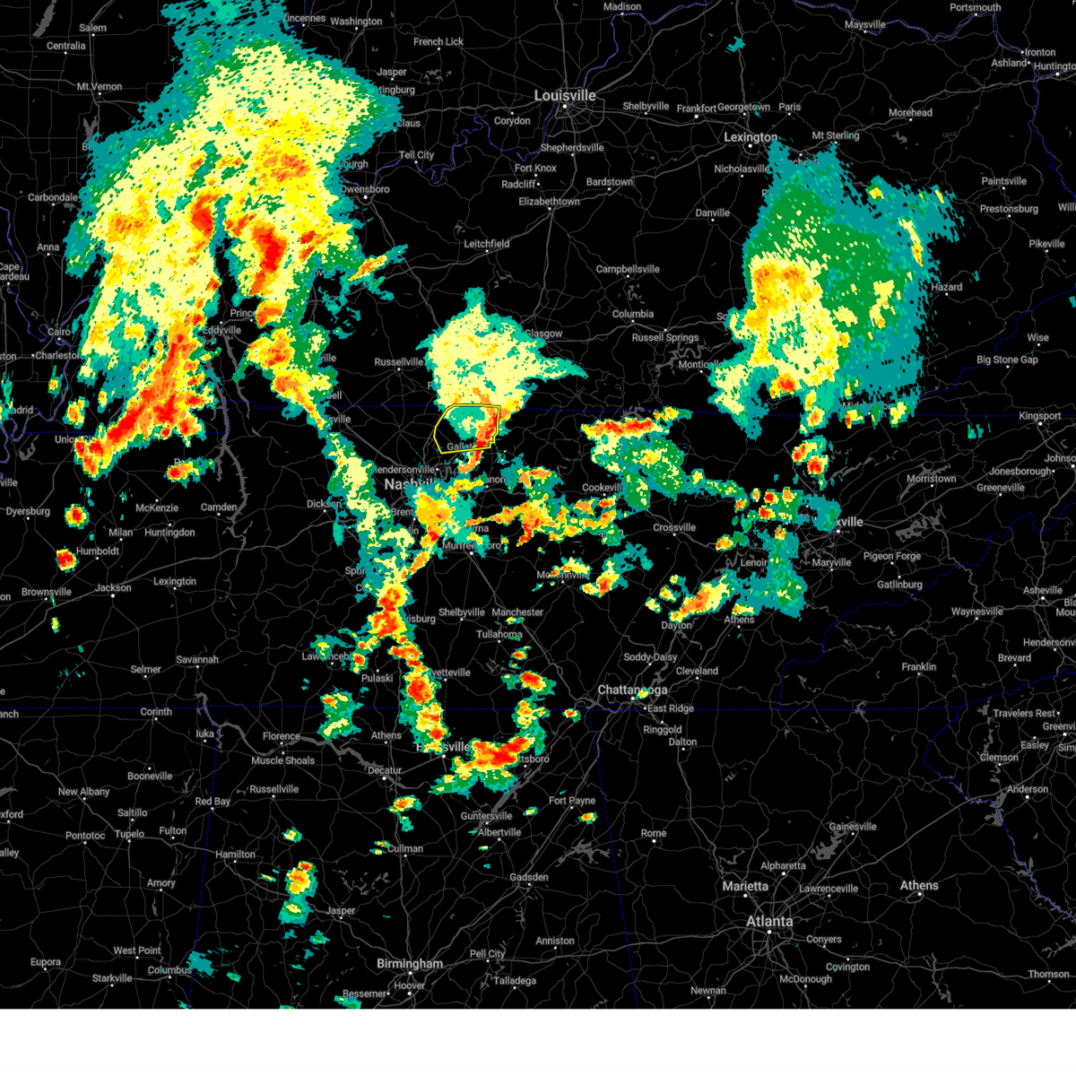
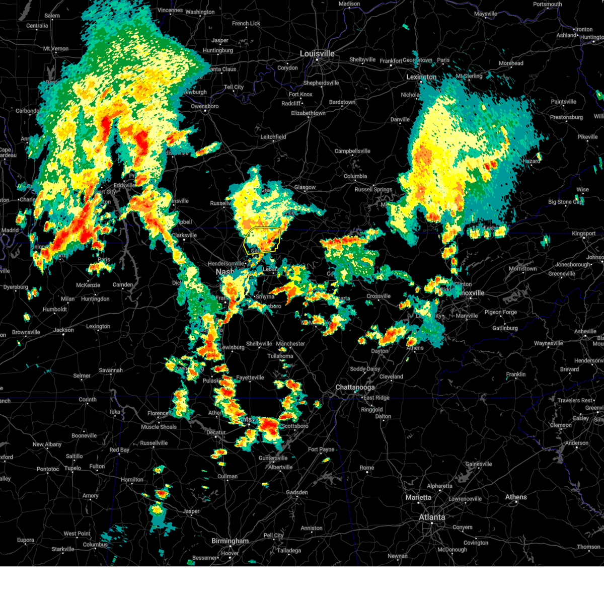
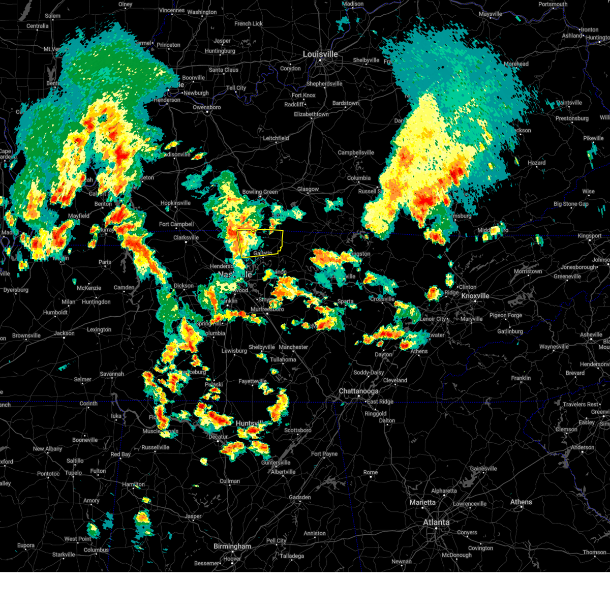
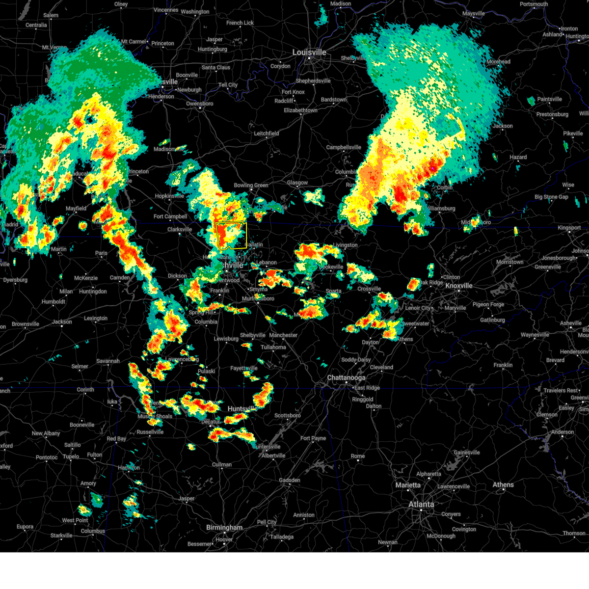
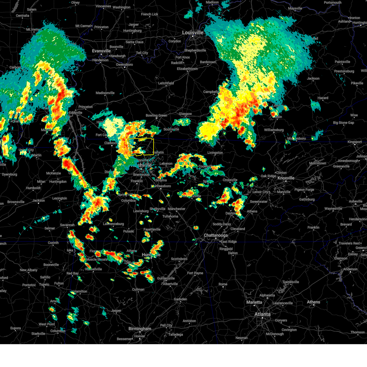
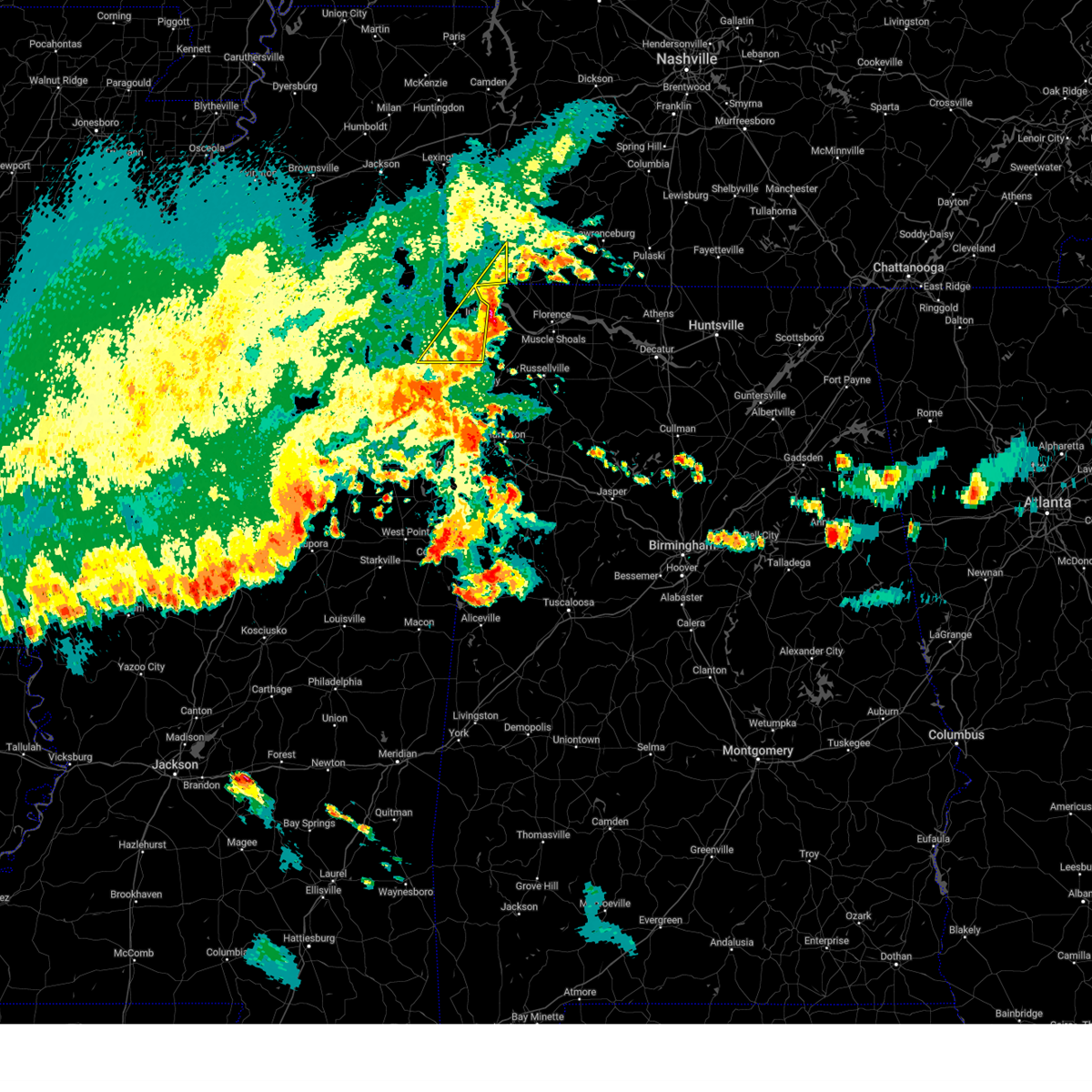
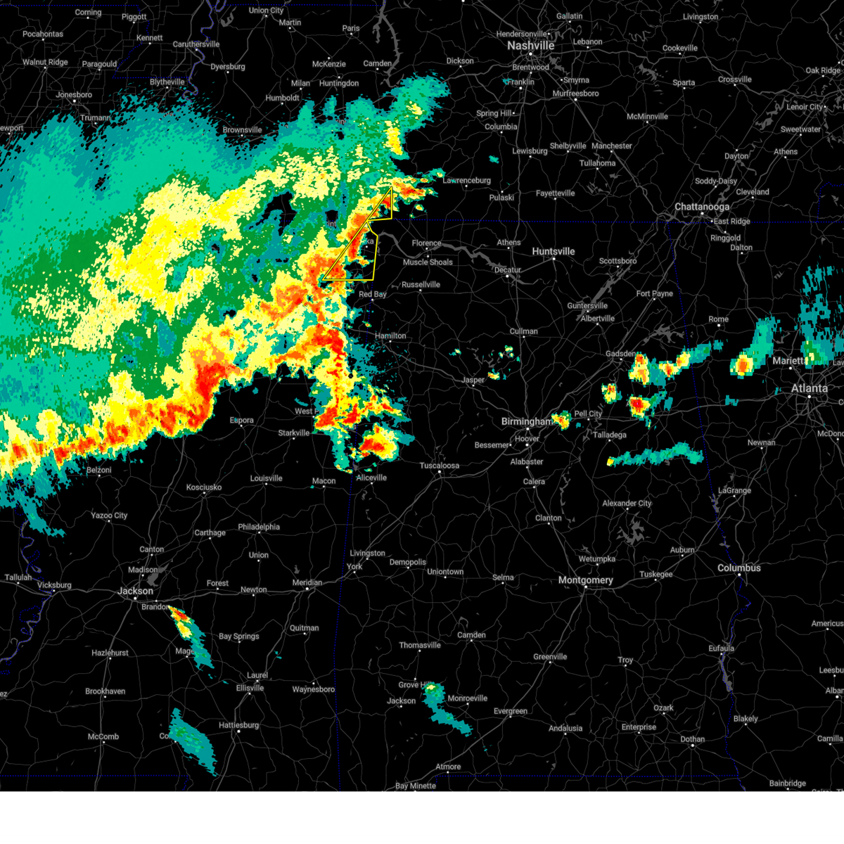
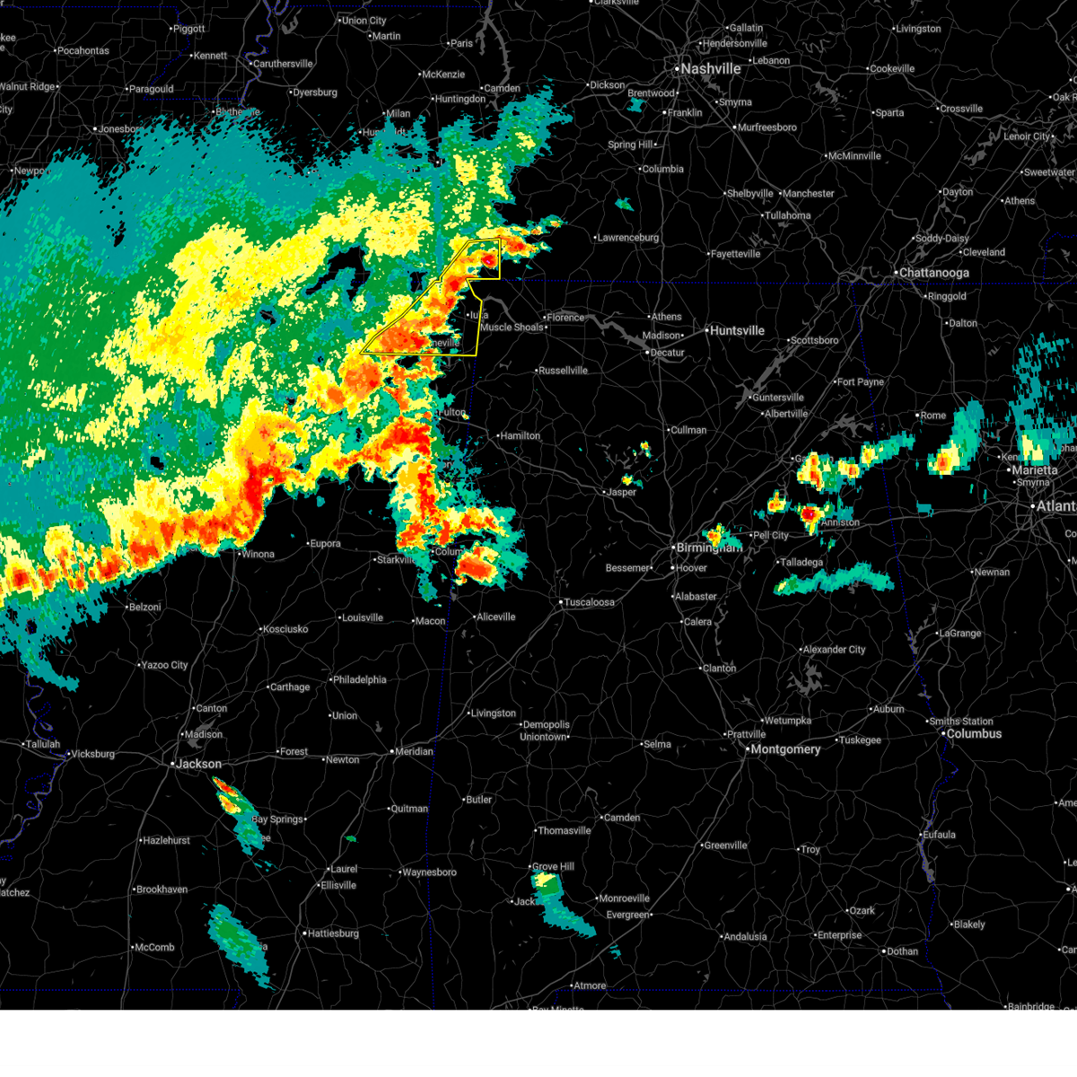
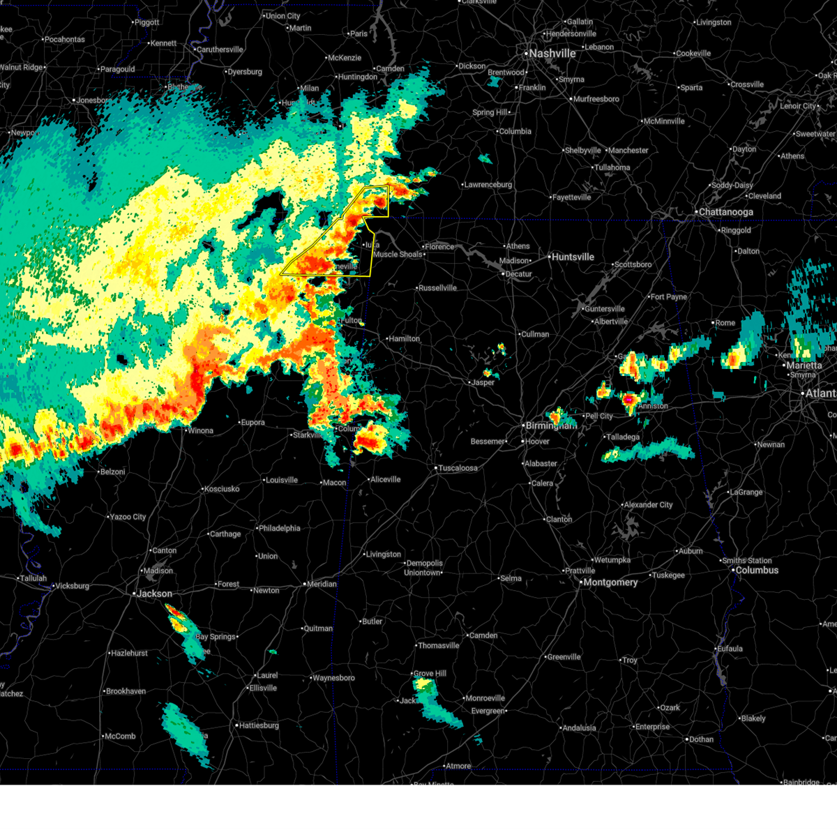
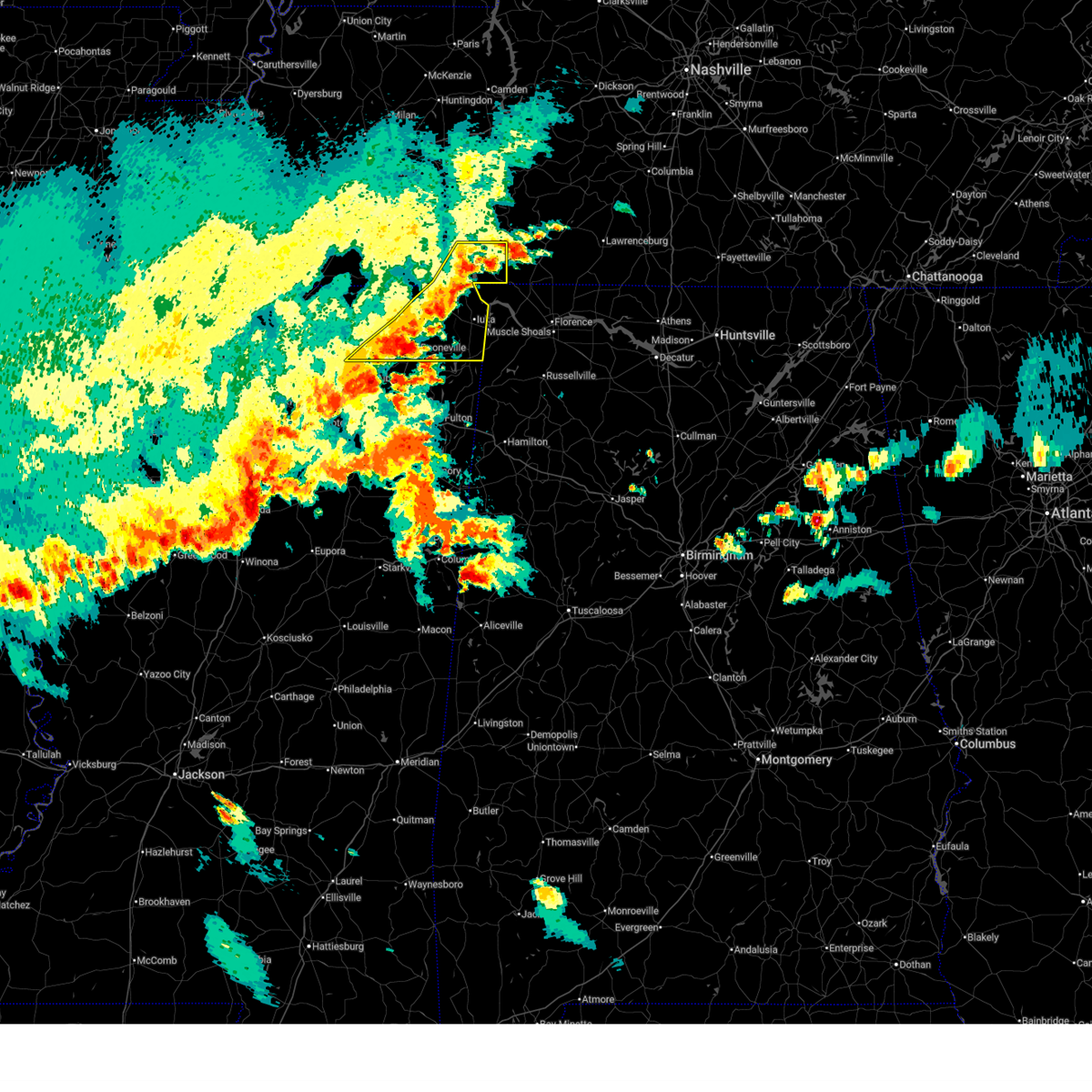
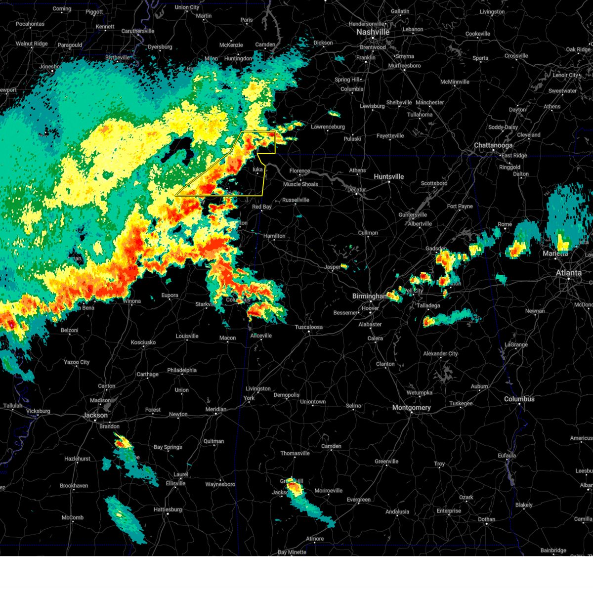
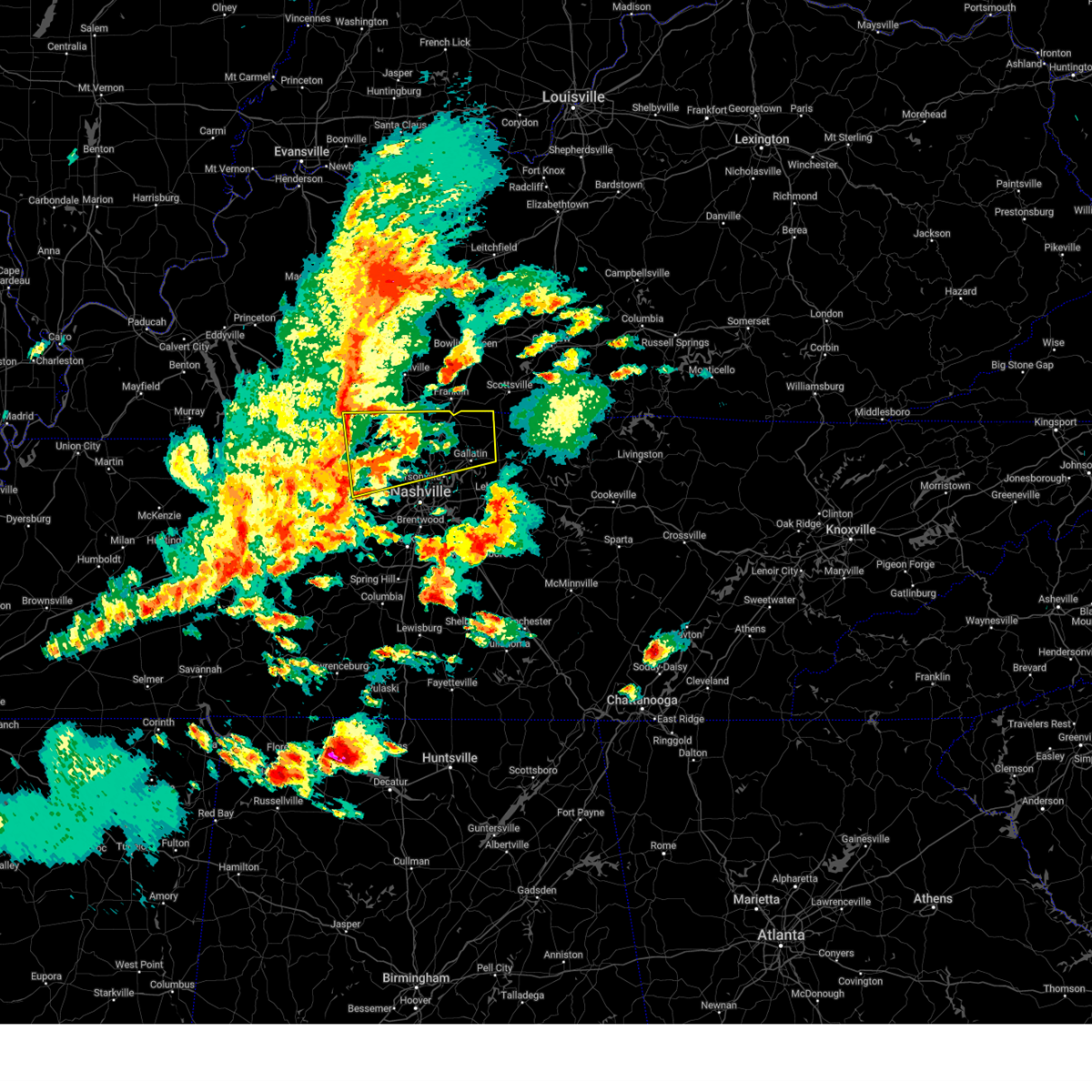
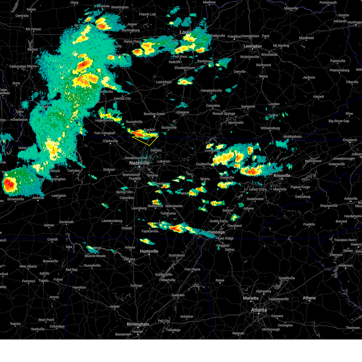
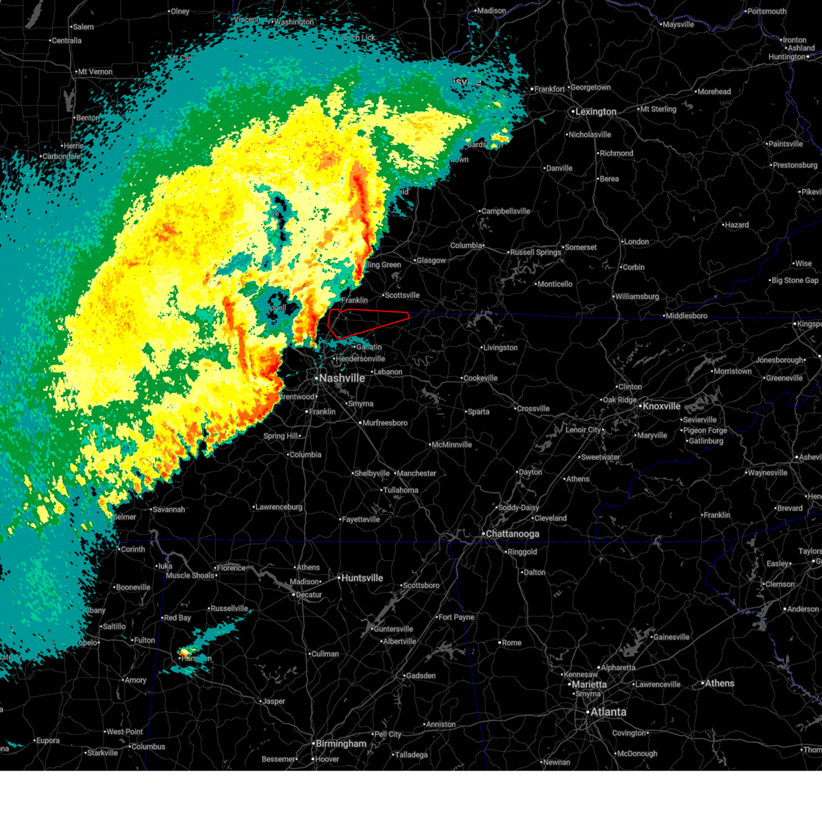
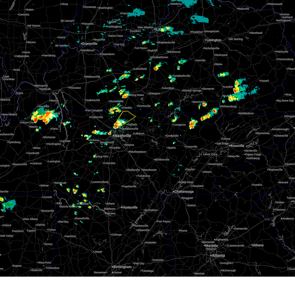
Hail Map for Walnut Grove, TN
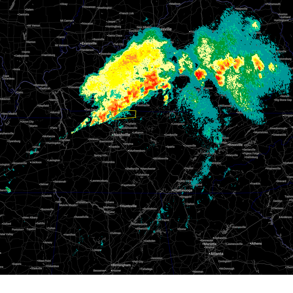
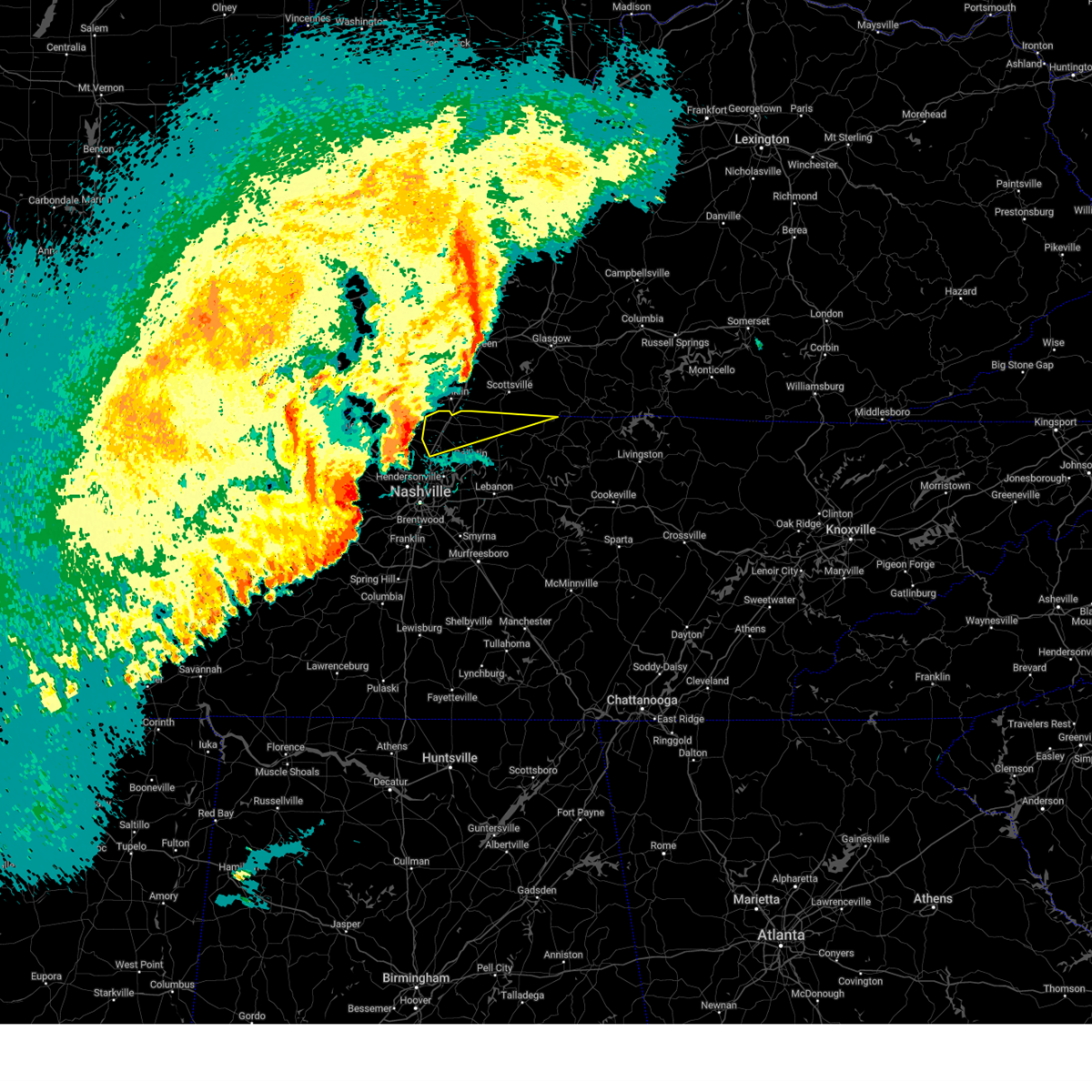
The Walnut Grove, TN area has had 3 reports of on-the-ground hail by trained spotters, and has been under severe weather warnings 143 times during the past 12 months. Doppler radar has detected hail at or near Walnut Grove, TN on 143 occasions, including 15 occasions during the past year.
| Name: | Walnut Grove, TN |
| Where Located: | 24.4 miles NNE of Nashville, TN |
| Map: | Google Map for Walnut Grove, TN |
| Population: | 864 |
| Housing Units: | 325 |
| More Info: | Search Google for Walnut Grove, TN |
2
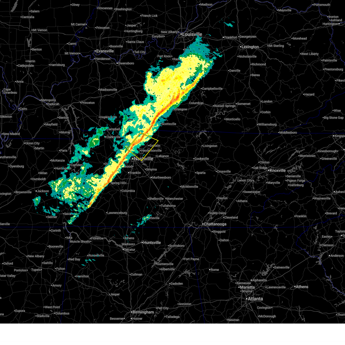
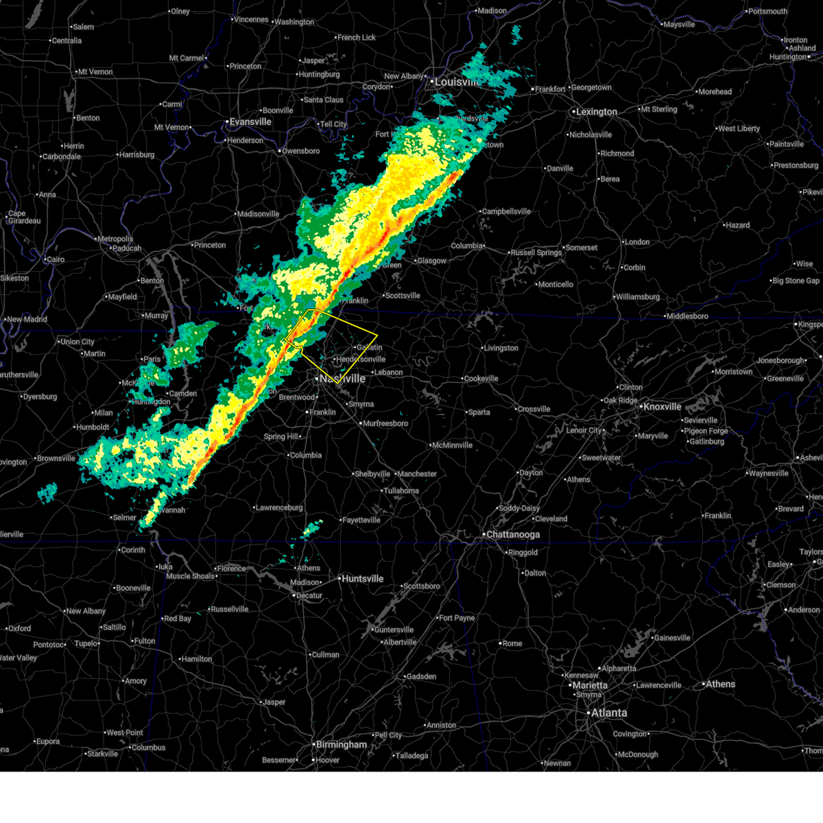
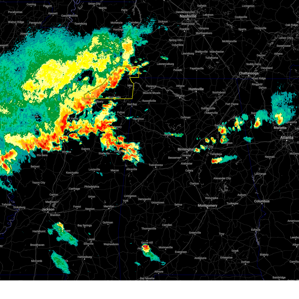
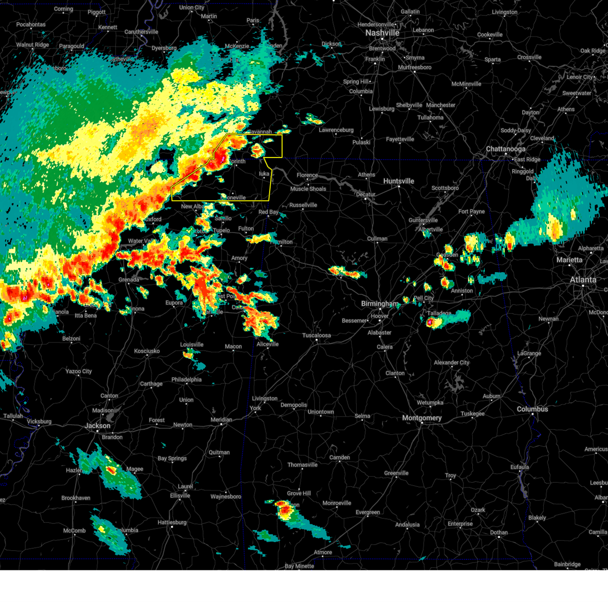
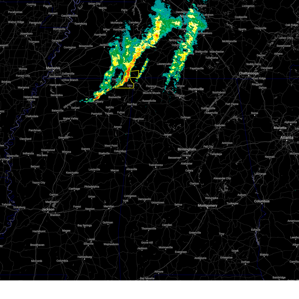
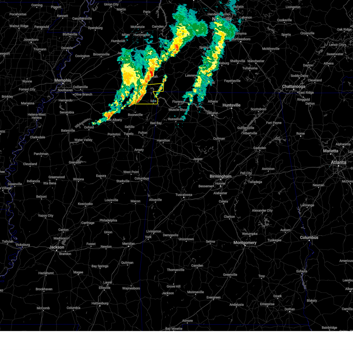
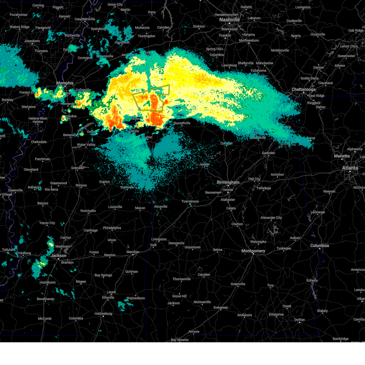
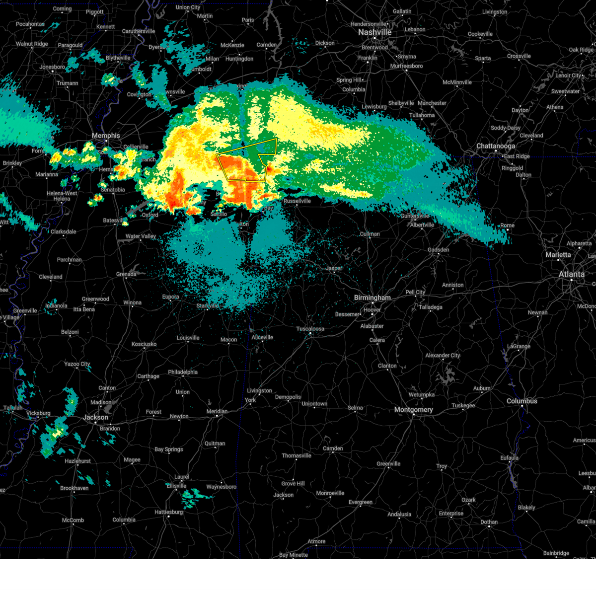
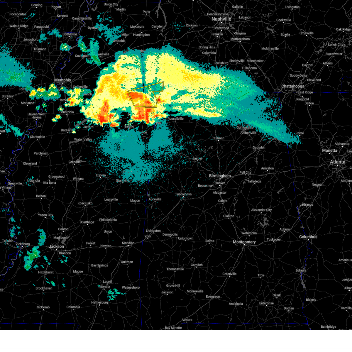
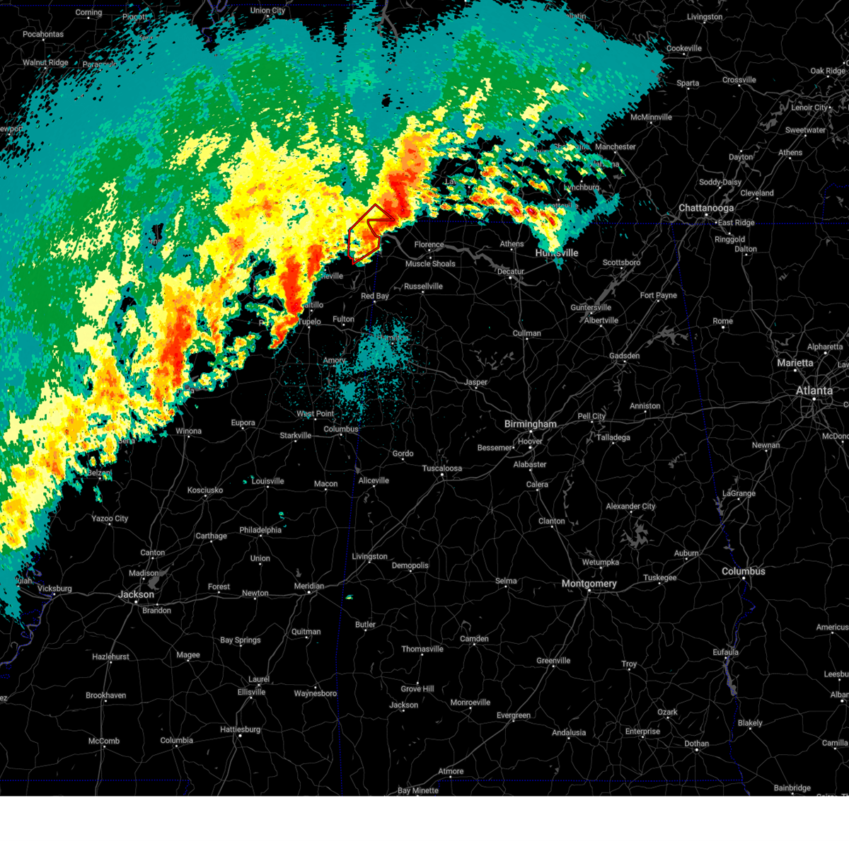
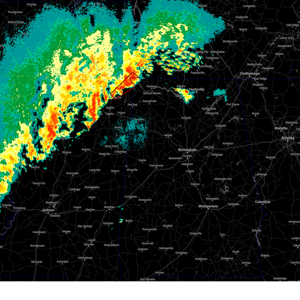
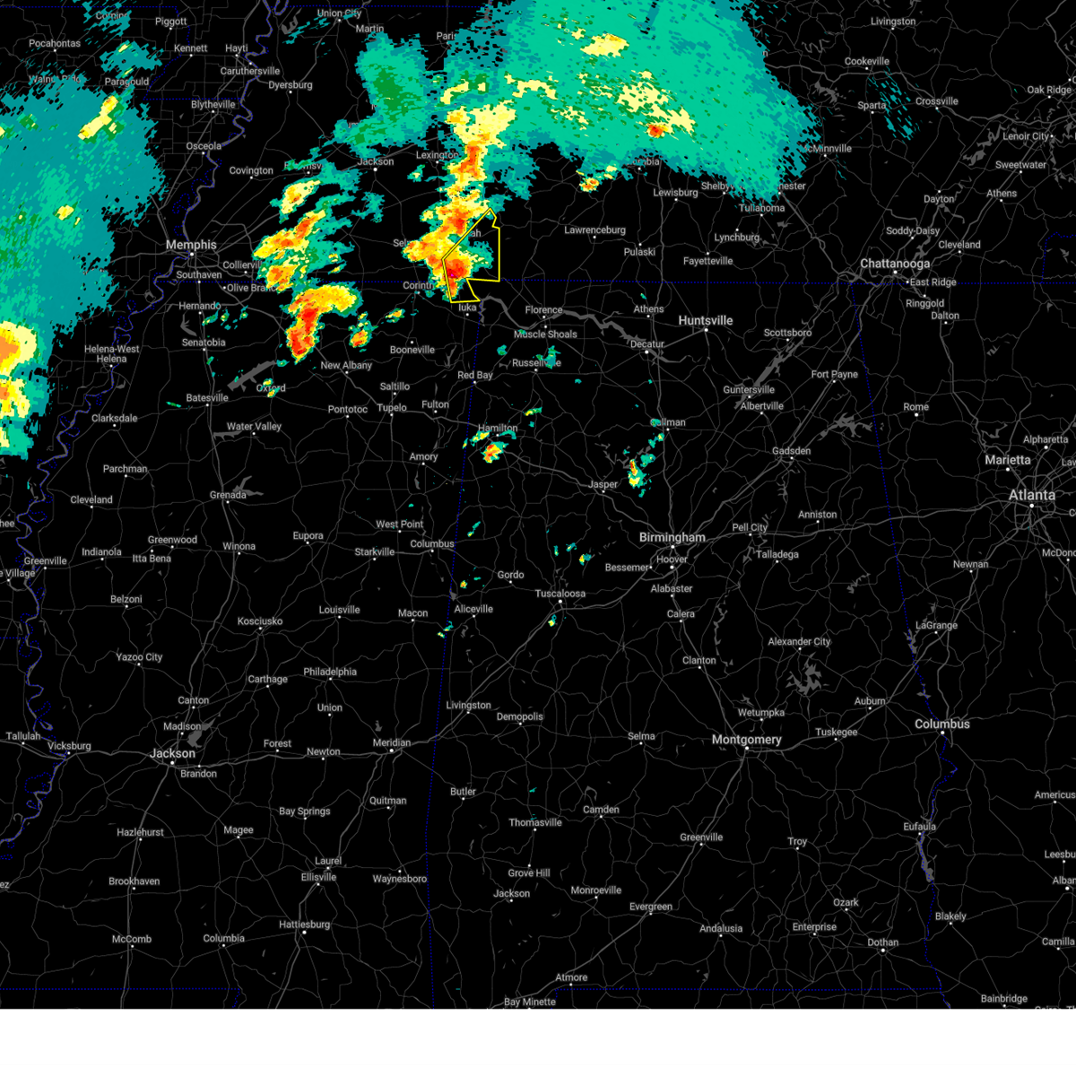
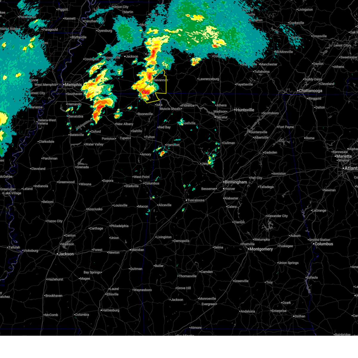
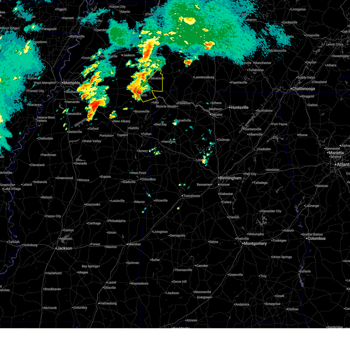
The Top Recent Hail Date for Walnut Grove, TN is Wednesday, April 2, 2025 (12th out of 143)

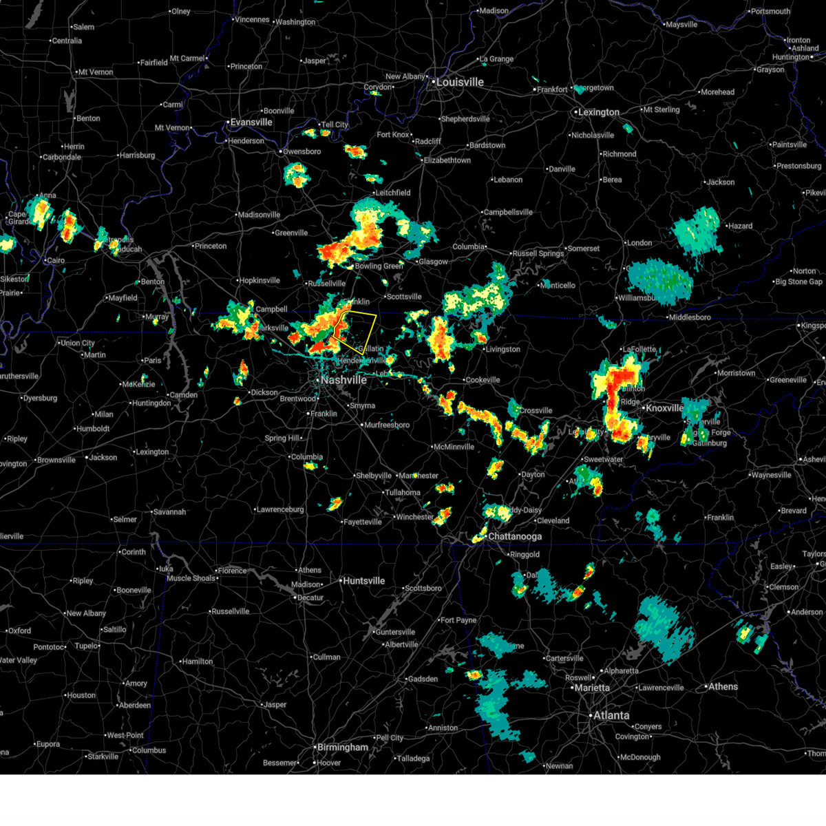
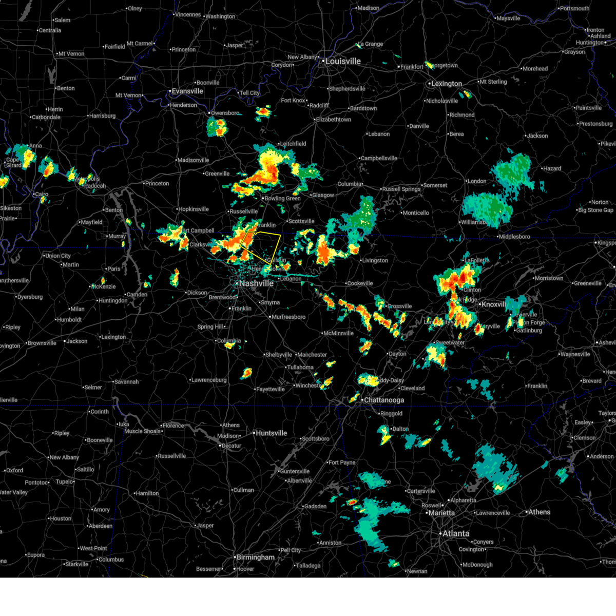
Hail and Wind Damage Spotted near Walnut Grove, TN
| Date / Time | Report Details |
|---|---|
| 12/28/2025 9:56 PM CST |
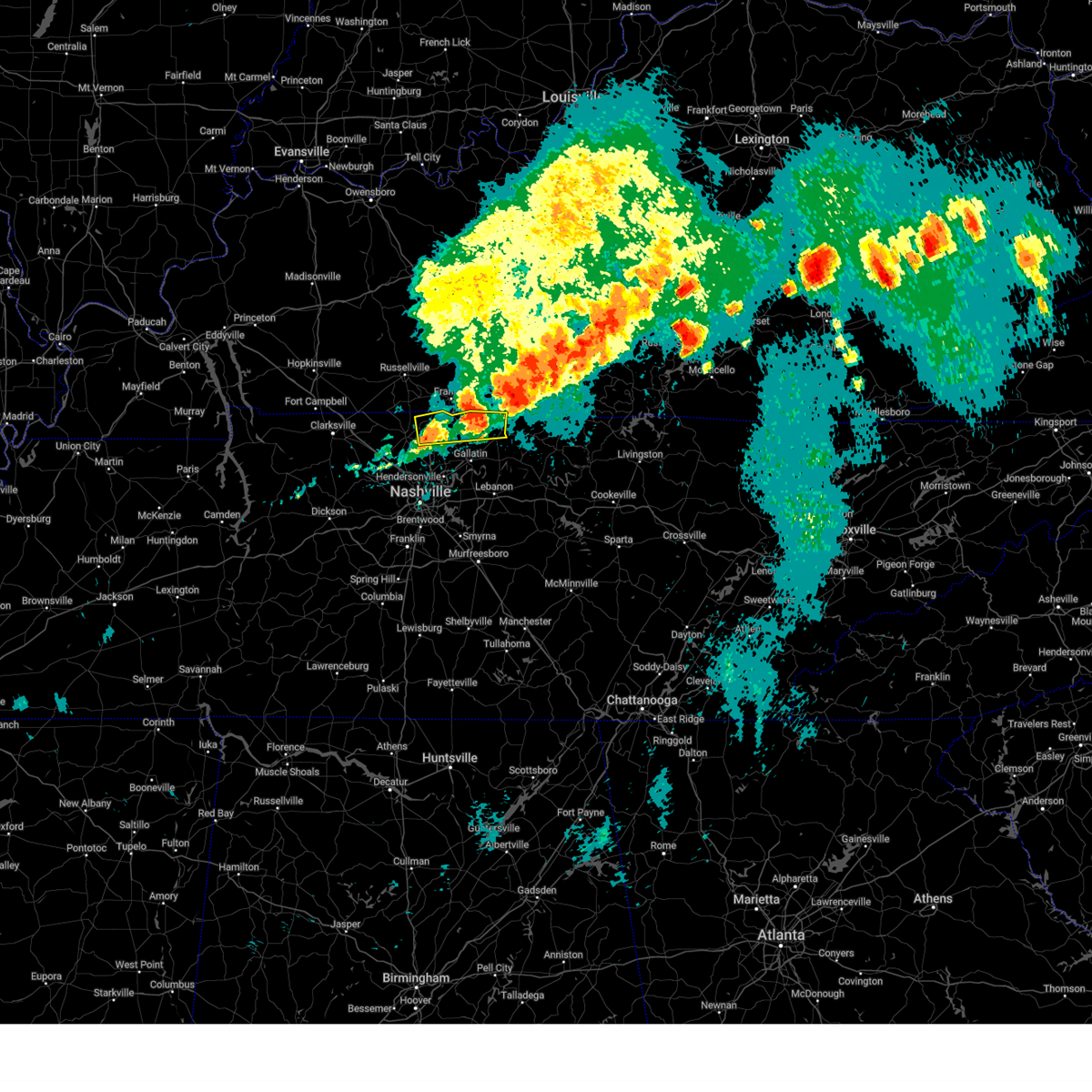
 At 956 pm cst, a severe thunderstorm was located over millersville, or 11 miles southeast of springfield, moving southeast at 40 mph (radar indicated). Hazards include 60 mph wind gusts. Expect damage to roofs, siding, and trees. locations impacted include, gallatin, madison, hendersonville, mount juliet, goodlettsville, white house, millersville, greenbrier, lakewood, ridgetop, cross plains, hermitage, old hickory, joelton, orlinda, green hill, bethpage, bledsoe creek state park, and cottontown. this includes the following highways, interstate 40 between mile markers 219 and 223. interstate 65 between mile markers 90 and 117. Interstate 24 between mile markers 34 and 42. At 956 pm cst, a severe thunderstorm was located over millersville, or 11 miles southeast of springfield, moving southeast at 40 mph (radar indicated). Hazards include 60 mph wind gusts. Expect damage to roofs, siding, and trees. locations impacted include, gallatin, madison, hendersonville, mount juliet, goodlettsville, white house, millersville, greenbrier, lakewood, ridgetop, cross plains, hermitage, old hickory, joelton, orlinda, green hill, bethpage, bledsoe creek state park, and cottontown. this includes the following highways, interstate 40 between mile markers 219 and 223. interstate 65 between mile markers 90 and 117. Interstate 24 between mile markers 34 and 42.
|
| 12/28/2025 9:38 PM CST |
 Svrohx the national weather service in nashville has issued a * severe thunderstorm warning for, northeastern davidson county in middle tennessee, sumner county in middle tennessee, northwestern wilson county in middle tennessee, robertson county in middle tennessee, * until 1030 pm cst. * at 938 pm cst, a severe thunderstorm was located over springfield, moving southeast at 35 mph (radar indicated). Hazards include 60 mph wind gusts. expect damage to roofs, siding, and trees Svrohx the national weather service in nashville has issued a * severe thunderstorm warning for, northeastern davidson county in middle tennessee, sumner county in middle tennessee, northwestern wilson county in middle tennessee, robertson county in middle tennessee, * until 1030 pm cst. * at 938 pm cst, a severe thunderstorm was located over springfield, moving southeast at 35 mph (radar indicated). Hazards include 60 mph wind gusts. expect damage to roofs, siding, and trees
|
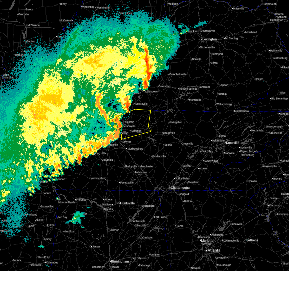
| 9/23/2025 2:15 AM CDT | Svrohx the national weather service in nashville has issued a * severe thunderstorm warning for, northeastern sumner county in middle tennessee, northwestern macon county in middle tennessee, * until 300 am cdt. * at 215 am cdt, a severe thunderstorm was located near gallatin, moving northeast at 35 mph (radar indicated). Hazards include 60 mph wind gusts and nickel size hail. expect damage to roofs, siding, and trees |
| 7/21/2025 3:58 PM CDT |
 the severe thunderstorm warning has been cancelled and is no longer in effect the severe thunderstorm warning has been cancelled and is no longer in effect
|
| 7/21/2025 3:58 PM CDT |
 At 357 pm cdt, a severe thunderstorm was located near portland, or 11 miles north of gallatin, moving east at 30 mph (radar indicated). Hazards include 60 mph wind gusts. Expect damage to roofs, siding, and trees. Locations impacted include, gallatin, white house, cross plains, portland, mitchellville, cottontown, oak grove, and black jack. At 357 pm cdt, a severe thunderstorm was located near portland, or 11 miles north of gallatin, moving east at 30 mph (radar indicated). Hazards include 60 mph wind gusts. Expect damage to roofs, siding, and trees. Locations impacted include, gallatin, white house, cross plains, portland, mitchellville, cottontown, oak grove, and black jack.
|
| 7/21/2025 3:49 PM CDT |
 Svrohx the national weather service in nashville has issued a * severe thunderstorm warning for, northern sumner county in middle tennessee, northeastern robertson county in middle tennessee, * until 415 pm cdt. * at 349 pm cdt, a severe thunderstorm was located near portland, or 14 miles northwest of gallatin, moving east at 35 mph (trained weather spotters). Hazards include 60 mph wind gusts. expect damage to roofs, siding, and trees Svrohx the national weather service in nashville has issued a * severe thunderstorm warning for, northern sumner county in middle tennessee, northeastern robertson county in middle tennessee, * until 415 pm cdt. * at 349 pm cdt, a severe thunderstorm was located near portland, or 14 miles northwest of gallatin, moving east at 35 mph (trained weather spotters). Hazards include 60 mph wind gusts. expect damage to roofs, siding, and trees
|
| 6/18/2025 8:03 PM CDT |
 Svrohx the national weather service in nashville has issued a * severe thunderstorm warning for, central davidson county in middle tennessee, sumner county in middle tennessee, northwestern wilson county in middle tennessee, southeastern cheatham county in middle tennessee, southeastern robertson county in middle tennessee, * until 830 pm cdt. * at 802 pm cdt, severe thunderstorms were located along a line extending from near portland to near millersville to pegram, moving east at 50 mph (radar indicated). Hazards include 60 mph wind gusts. expect damage to roofs, siding, and trees Svrohx the national weather service in nashville has issued a * severe thunderstorm warning for, central davidson county in middle tennessee, sumner county in middle tennessee, northwestern wilson county in middle tennessee, southeastern cheatham county in middle tennessee, southeastern robertson county in middle tennessee, * until 830 pm cdt. * at 802 pm cdt, severe thunderstorms were located along a line extending from near portland to near millersville to pegram, moving east at 50 mph (radar indicated). Hazards include 60 mph wind gusts. expect damage to roofs, siding, and trees
|
| 6/6/2025 7:16 PM CDT |
 the severe thunderstorm warning has been cancelled and is no longer in effect the severe thunderstorm warning has been cancelled and is no longer in effect
|
| 6/6/2025 7:02 PM CDT |
 the severe thunderstorm warning has been cancelled and is no longer in effect the severe thunderstorm warning has been cancelled and is no longer in effect
|
| 6/6/2025 7:02 PM CDT |
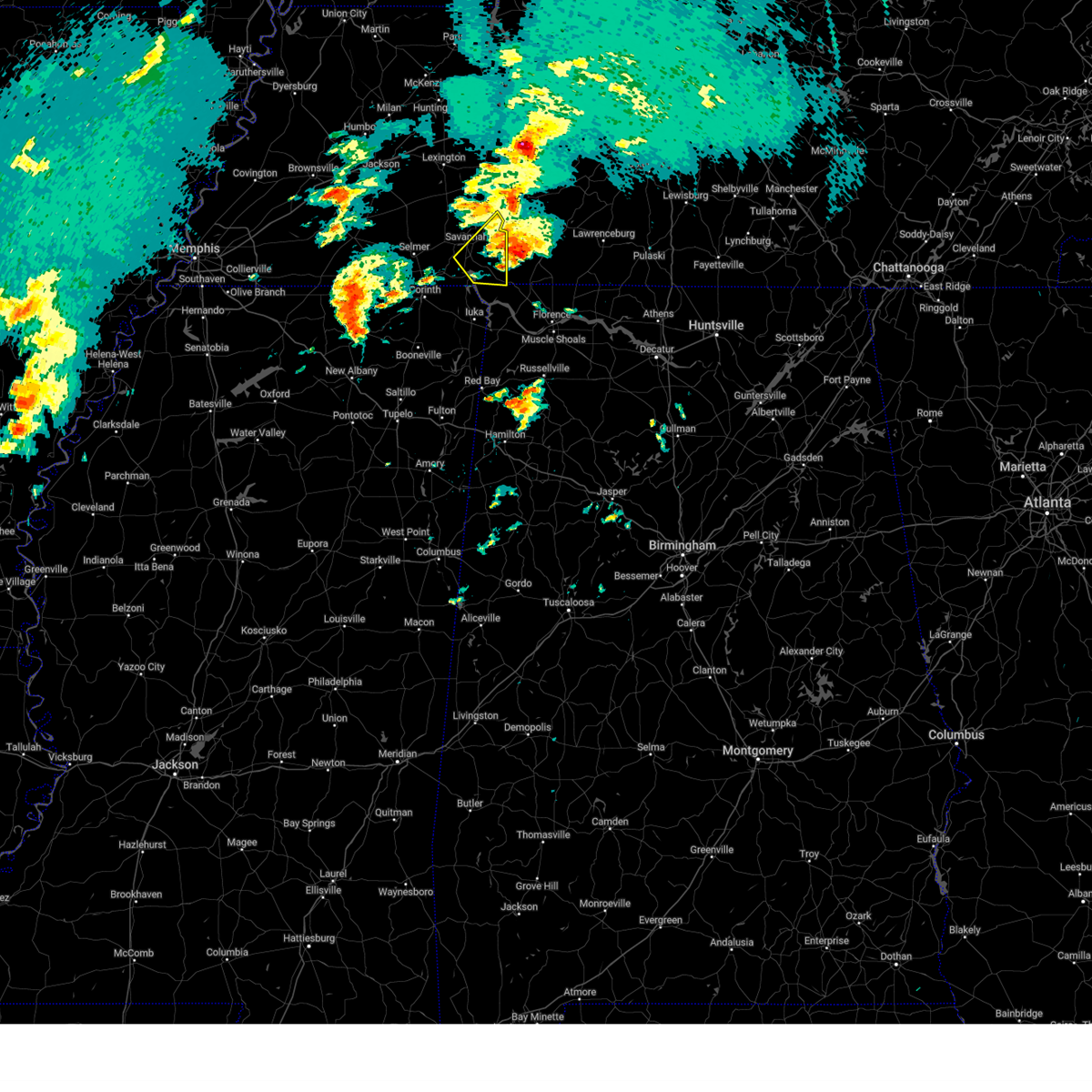
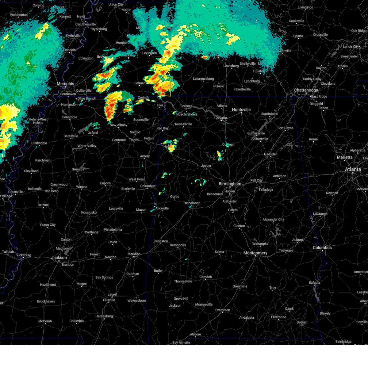
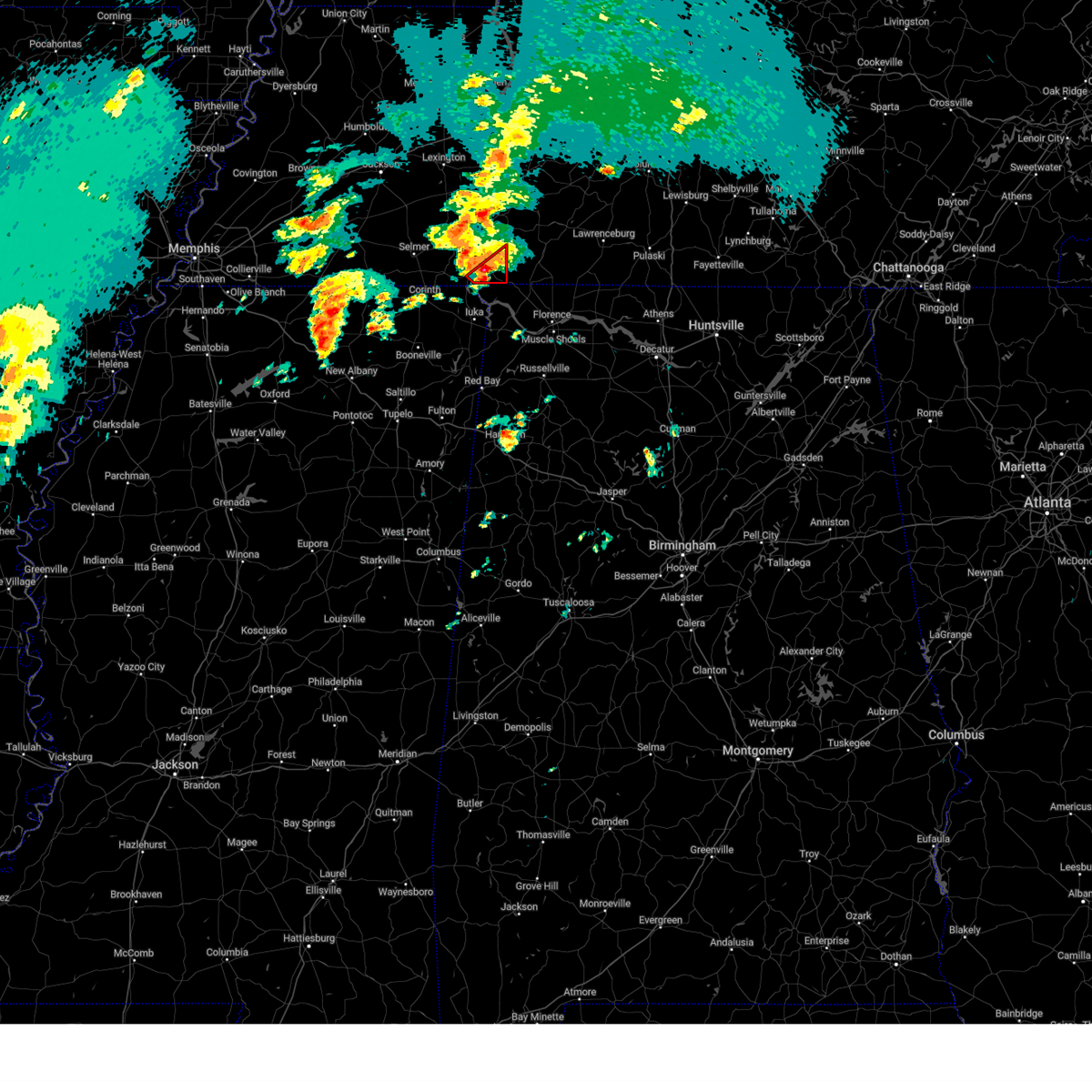
 At 701 pm cdt, a severe thunderstorm was located near walnut grove, or 8 miles northeast of j p coleman state park, moving east at 30 mph (radar indicated). Hazards include 60 mph wind gusts and quarter size hail. Hail damage to vehicles is expected. expect wind damage to roofs, siding, and trees. Locations impacted include, walnut grove, lowryville, and pollards mill. At 701 pm cdt, a severe thunderstorm was located near walnut grove, or 8 miles northeast of j p coleman state park, moving east at 30 mph (radar indicated). Hazards include 60 mph wind gusts and quarter size hail. Hail damage to vehicles is expected. expect wind damage to roofs, siding, and trees. Locations impacted include, walnut grove, lowryville, and pollards mill.
|
| 6/6/2025 6:50 PM CDT |
 At 650 pm cdt, a severe thunderstorm was located near pickwick landing state park, moving east at 30 mph (radar indicated). Hazards include 60 mph wind gusts and half dollar size hail. Hail damage to vehicles is expected. expect wind damage to roofs, siding, and trees. Locations impacted include, j p coleman state park, pickwick landing state park, walnut grove, pickwick dam, pineflat, lowryville, pollards mill, winn springs, bruton branch, and red sulphur springs. At 650 pm cdt, a severe thunderstorm was located near pickwick landing state park, moving east at 30 mph (radar indicated). Hazards include 60 mph wind gusts and half dollar size hail. Hail damage to vehicles is expected. expect wind damage to roofs, siding, and trees. Locations impacted include, j p coleman state park, pickwick landing state park, walnut grove, pickwick dam, pineflat, lowryville, pollards mill, winn springs, bruton branch, and red sulphur springs.
|
| 6/6/2025 6:44 PM CDT | Reported fairly large tree across holiday hills ln in counce... tn. time estimated on rada in hardin county TN, 9.3 miles E of Walnut Grove, TN |
| 6/6/2025 6:42 PM CDT |
 Svrmeg the national weather service in memphis has issued a * severe thunderstorm warning for, northeastern tishomingo county in northeastern mississippi, southern hardin county in west tennessee, * until 730 pm cdt. * at 642 pm cdt, a severe thunderstorm was located over pickwick landing state park, moving east at 30 mph (radar indicated). Hazards include 60 mph wind gusts and quarter size hail. Hail damage to vehicles is expected. Expect wind damage to roofs, siding, and trees. Svrmeg the national weather service in memphis has issued a * severe thunderstorm warning for, northeastern tishomingo county in northeastern mississippi, southern hardin county in west tennessee, * until 730 pm cdt. * at 642 pm cdt, a severe thunderstorm was located over pickwick landing state park, moving east at 30 mph (radar indicated). Hazards include 60 mph wind gusts and quarter size hail. Hail damage to vehicles is expected. Expect wind damage to roofs, siding, and trees.
|
| 6/6/2025 3:29 PM CDT |
 the severe thunderstorm warning has been cancelled and is no longer in effect the severe thunderstorm warning has been cancelled and is no longer in effect
|
| 6/6/2025 3:17 PM CDT |
 the severe thunderstorm warning has been cancelled and is no longer in effect the severe thunderstorm warning has been cancelled and is no longer in effect
|
| 6/6/2025 3:17 PM CDT |
 At 317 pm cdt, a severe thunderstorm was located near portland, or 16 miles north of gallatin, moving east at 40 mph (radar indicated). Hazards include 60 mph wind gusts and nickel size hail. Expect damage to roofs, siding, and trees. Locations impacted include, gallatin, white house, westmoreland, cross plains, portland, mitchellville, cottontown, bethpage, and oak grove. At 317 pm cdt, a severe thunderstorm was located near portland, or 16 miles north of gallatin, moving east at 40 mph (radar indicated). Hazards include 60 mph wind gusts and nickel size hail. Expect damage to roofs, siding, and trees. Locations impacted include, gallatin, white house, westmoreland, cross plains, portland, mitchellville, cottontown, bethpage, and oak grove.
|
| 6/6/2025 2:55 PM CDT |
 Svrohx the national weather service in nashville has issued a * severe thunderstorm warning for, sumner county in middle tennessee, eastern robertson county in middle tennessee, * until 345 pm cdt. * at 255 pm cdt, a severe thunderstorm was located over cross plains, or 12 miles northeast of springfield, moving east at 40 mph (radar indicated). Hazards include 60 mph wind gusts and nickel size hail. expect damage to roofs, siding, and trees Svrohx the national weather service in nashville has issued a * severe thunderstorm warning for, sumner county in middle tennessee, eastern robertson county in middle tennessee, * until 345 pm cdt. * at 255 pm cdt, a severe thunderstorm was located over cross plains, or 12 miles northeast of springfield, moving east at 40 mph (radar indicated). Hazards include 60 mph wind gusts and nickel size hail. expect damage to roofs, siding, and trees
|
| 6/6/2025 2:44 PM CDT |
 At 244 pm cdt, a severe thunderstorm was located near springfield, moving east at 35 mph (radar indicated). Hazards include 60 mph wind gusts and nickel size hail. Expect damage to roofs, siding, and trees. locations impacted include, springfield, white house, millersville, greenbrier, ridgetop, cross plains, orlinda, and mitchellville. This includes interstate 65 between mile markers 102 and 120. At 244 pm cdt, a severe thunderstorm was located near springfield, moving east at 35 mph (radar indicated). Hazards include 60 mph wind gusts and nickel size hail. Expect damage to roofs, siding, and trees. locations impacted include, springfield, white house, millersville, greenbrier, ridgetop, cross plains, orlinda, and mitchellville. This includes interstate 65 between mile markers 102 and 120.
|
| 6/6/2025 2:23 PM CDT |
 Svrohx the national weather service in nashville has issued a * severe thunderstorm warning for, northwestern sumner county in middle tennessee, robertson county in middle tennessee, * until 300 pm cdt. * at 222 pm cdt, a severe thunderstorm was located 9 miles northwest of coopertown, or 11 miles west of springfield, moving east at 45 mph (radar indicated). Hazards include 60 mph wind gusts and nickel size hail. expect damage to roofs, siding, and trees Svrohx the national weather service in nashville has issued a * severe thunderstorm warning for, northwestern sumner county in middle tennessee, robertson county in middle tennessee, * until 300 pm cdt. * at 222 pm cdt, a severe thunderstorm was located 9 miles northwest of coopertown, or 11 miles west of springfield, moving east at 45 mph (radar indicated). Hazards include 60 mph wind gusts and nickel size hail. expect damage to roofs, siding, and trees
|
| 5/25/2025 8:05 PM CDT |
 The storms which prompted the warning have moved out of the area. therefore, the warning will be allowed to expire. a severe thunderstorm watch remains in effect until 900 pm cdt for northeastern mississippi. The storms which prompted the warning have moved out of the area. therefore, the warning will be allowed to expire. a severe thunderstorm watch remains in effect until 900 pm cdt for northeastern mississippi.
|
| 5/25/2025 7:40 PM CDT |
 Svrmeg the national weather service in memphis has issued a * severe thunderstorm warning for, tishomingo county in northeastern mississippi, northeastern prentiss county in northeastern mississippi, southeastern hardin county in west tennessee, * until 815 pm cdt. * at 740 pm cdt, severe thunderstorms were located along a line extending from near j p coleman state park to 6 miles east of wheeler, moving east at 30 mph (radar indicated). Hazards include 60 mph wind gusts and quarter size hail. Hail damage to vehicles is expected. Expect wind damage to roofs, siding, and trees. Svrmeg the national weather service in memphis has issued a * severe thunderstorm warning for, tishomingo county in northeastern mississippi, northeastern prentiss county in northeastern mississippi, southeastern hardin county in west tennessee, * until 815 pm cdt. * at 740 pm cdt, severe thunderstorms were located along a line extending from near j p coleman state park to 6 miles east of wheeler, moving east at 30 mph (radar indicated). Hazards include 60 mph wind gusts and quarter size hail. Hail damage to vehicles is expected. Expect wind damage to roofs, siding, and trees.
|
| 5/25/2025 7:34 PM CDT |
 the severe thunderstorm warning has been cancelled and is no longer in effect the severe thunderstorm warning has been cancelled and is no longer in effect
|
| 5/25/2025 7:34 PM CDT |
 At 734 pm cdt, severe thunderstorms were located along a line extending from near collinwood to near j p coleman state park to wheeler, moving east at 60 mph (radar indicated). Hazards include 60 mph wind gusts and quarter size hail. Hail damage to vehicles is expected. expect wind damage to roofs, siding, and trees. Locations impacted include, iuka, pickwick dam, blythe crossing, rienzi, bruton branch, thrashers, pickwick landing state park, carter branch, hazard switch, midway, petertown, neil, tishomingo, bacon springs, damon, blackland, booneville, childers hill, center star, and kendrick. At 734 pm cdt, severe thunderstorms were located along a line extending from near collinwood to near j p coleman state park to wheeler, moving east at 60 mph (radar indicated). Hazards include 60 mph wind gusts and quarter size hail. Hail damage to vehicles is expected. expect wind damage to roofs, siding, and trees. Locations impacted include, iuka, pickwick dam, blythe crossing, rienzi, bruton branch, thrashers, pickwick landing state park, carter branch, hazard switch, midway, petertown, neil, tishomingo, bacon springs, damon, blackland, booneville, childers hill, center star, and kendrick.
|
| 5/25/2025 7:26 PM CDT |
 the severe thunderstorm warning has been cancelled and is no longer in effect the severe thunderstorm warning has been cancelled and is no longer in effect
|
| 5/25/2025 7:26 PM CDT |
 At 726 pm cdt, severe thunderstorms were located along a line extending from 6 miles southwest of collinwood to near j p coleman state park to 6 miles west of wheeler, moving east at 60 mph (radar indicated). Hazards include 60 mph wind gusts and quarter size hail. Hail damage to vehicles is expected. expect wind damage to roofs, siding, and trees. Locations impacted include, iuka, pickwick dam, blythe crossing, rienzi, bruton branch, thrashers, pickwick landing state park, carter branch, acton, hazard switch, hurley, walkertown, midway, petertown, corinth, neil, chambers, tishomingo, bacon springs, and kossuth. At 726 pm cdt, severe thunderstorms were located along a line extending from 6 miles southwest of collinwood to near j p coleman state park to 6 miles west of wheeler, moving east at 60 mph (radar indicated). Hazards include 60 mph wind gusts and quarter size hail. Hail damage to vehicles is expected. expect wind damage to roofs, siding, and trees. Locations impacted include, iuka, pickwick dam, blythe crossing, rienzi, bruton branch, thrashers, pickwick landing state park, carter branch, acton, hazard switch, hurley, walkertown, midway, petertown, corinth, neil, chambers, tishomingo, bacon springs, and kossuth.
|
| 5/25/2025 7:22 PM CDT |
 At 722 pm cdt, severe thunderstorms were located along a line extending from 9 miles west of collinwood to near burnsville to 9 miles northeast of keownville, moving east at 60 mph (radar indicated). Hazards include 60 mph wind gusts and quarter size hail. Hail damage to vehicles is expected. expect wind damage to roofs, siding, and trees. Locations impacted include, iuka, murry, pickwick dam, blythe crossing, rienzi, bruton branch, thrashers, pickwick landing state park, carter branch, acton, hazard switch, hurley, walkertown, midway, petertown, corinth, neil, chambers, tishomingo, and bacon springs. At 722 pm cdt, severe thunderstorms were located along a line extending from 9 miles west of collinwood to near burnsville to 9 miles northeast of keownville, moving east at 60 mph (radar indicated). Hazards include 60 mph wind gusts and quarter size hail. Hail damage to vehicles is expected. expect wind damage to roofs, siding, and trees. Locations impacted include, iuka, murry, pickwick dam, blythe crossing, rienzi, bruton branch, thrashers, pickwick landing state park, carter branch, acton, hazard switch, hurley, walkertown, midway, petertown, corinth, neil, chambers, tishomingo, and bacon springs.
|
| 5/25/2025 7:11 PM CDT |
 At 710 pm cdt, severe thunderstorms were located along a line extending from 6 miles north of walnut grove to near glen to near keownville, moving east at 45 mph (radar indicated). Hazards include 60 mph wind gusts and quarter size hail. Hail damage to vehicles is expected. expect wind damage to roofs, siding, and trees. Locations impacted include, murry, pickwick dam, blythe crossing, bruton branch, pickwick landing state park, acton, theo, walkertown, petertown, neil, kossuth, hightown, new lawton, martin camp, savannah, caffey, crumtown, booneville, peoples, and burnsville. At 710 pm cdt, severe thunderstorms were located along a line extending from 6 miles north of walnut grove to near glen to near keownville, moving east at 45 mph (radar indicated). Hazards include 60 mph wind gusts and quarter size hail. Hail damage to vehicles is expected. expect wind damage to roofs, siding, and trees. Locations impacted include, murry, pickwick dam, blythe crossing, bruton branch, pickwick landing state park, acton, theo, walkertown, petertown, neil, kossuth, hightown, new lawton, martin camp, savannah, caffey, crumtown, booneville, peoples, and burnsville.
|
| 5/25/2025 6:49 PM CDT |
 Svrmeg the national weather service in memphis has issued a * severe thunderstorm warning for, tippah county in northeastern mississippi, tishomingo county in northeastern mississippi, southern benton county in northeastern mississippi, northern prentiss county in northeastern mississippi, alcorn county in northeastern mississippi, mcnairy county in west tennessee, southern hardin county in west tennessee, * until 745 pm cdt. * at 648 pm cdt, severe thunderstorms were located along a line extending from near shiloh to theo to 8 miles northeast of bethlehem, moving east at 55 mph (radar indicated). Hazards include 60 mph wind gusts and quarter size hail. Hail damage to vehicles is expected. Expect wind damage to roofs, siding, and trees. Svrmeg the national weather service in memphis has issued a * severe thunderstorm warning for, tippah county in northeastern mississippi, tishomingo county in northeastern mississippi, southern benton county in northeastern mississippi, northern prentiss county in northeastern mississippi, alcorn county in northeastern mississippi, mcnairy county in west tennessee, southern hardin county in west tennessee, * until 745 pm cdt. * at 648 pm cdt, severe thunderstorms were located along a line extending from near shiloh to theo to 8 miles northeast of bethlehem, moving east at 55 mph (radar indicated). Hazards include 60 mph wind gusts and quarter size hail. Hail damage to vehicles is expected. Expect wind damage to roofs, siding, and trees.
|
| 5/20/2025 6:34 PM CDT |
 the severe thunderstorm warning has been cancelled and is no longer in effect the severe thunderstorm warning has been cancelled and is no longer in effect
|
| 5/20/2025 6:07 PM CDT |
 At 607 pm cdt, severe thunderstorms were located along a line extending from near portland to near hendersonville, moving east at 50 mph (radar indicated). Hazards include 60 mph wind gusts and quarter size hail. Hail damage to vehicles is expected. expect wind damage to roofs, siding, and trees. Locations impacted include, portland, ridgetop, bethpage, goodlettsville, mitchellville, oak grove, millersville, gallatin, white house, bledsoe creek state park, cottontown, hendersonville, cross plains, and orlinda. At 607 pm cdt, severe thunderstorms were located along a line extending from near portland to near hendersonville, moving east at 50 mph (radar indicated). Hazards include 60 mph wind gusts and quarter size hail. Hail damage to vehicles is expected. expect wind damage to roofs, siding, and trees. Locations impacted include, portland, ridgetop, bethpage, goodlettsville, mitchellville, oak grove, millersville, gallatin, white house, bledsoe creek state park, cottontown, hendersonville, cross plains, and orlinda.
|
| 5/20/2025 6:07 PM CDT |
 the severe thunderstorm warning has been cancelled and is no longer in effect the severe thunderstorm warning has been cancelled and is no longer in effect
|
| 5/20/2025 5:30 PM CDT |
 Svrohx the national weather service in nashville has issued a * severe thunderstorm warning for, northwestern davidson county in middle tennessee, northeastern dickson county in middle tennessee, eastern montgomery county in middle tennessee, sumner county in middle tennessee, cheatham county in middle tennessee, robertson county in middle tennessee, * until 645 pm cdt. * at 530 pm cdt, severe thunderstorms were located along a line extending from elkton to ashland city, moving east at 45 mph (radar indicated). Hazards include 60 mph wind gusts and quarter size hail. Hail damage to vehicles is expected. Expect wind damage to roofs, siding, and trees. Svrohx the national weather service in nashville has issued a * severe thunderstorm warning for, northwestern davidson county in middle tennessee, northeastern dickson county in middle tennessee, eastern montgomery county in middle tennessee, sumner county in middle tennessee, cheatham county in middle tennessee, robertson county in middle tennessee, * until 645 pm cdt. * at 530 pm cdt, severe thunderstorms were located along a line extending from elkton to ashland city, moving east at 45 mph (radar indicated). Hazards include 60 mph wind gusts and quarter size hail. Hail damage to vehicles is expected. Expect wind damage to roofs, siding, and trees.
|
| 5/20/2025 10:33 AM CDT |
 the severe thunderstorm warning has been cancelled and is no longer in effect the severe thunderstorm warning has been cancelled and is no longer in effect
|
| 5/20/2025 10:17 AM CDT |
 the severe thunderstorm warning has been cancelled and is no longer in effect the severe thunderstorm warning has been cancelled and is no longer in effect
|
| 5/20/2025 10:17 AM CDT |
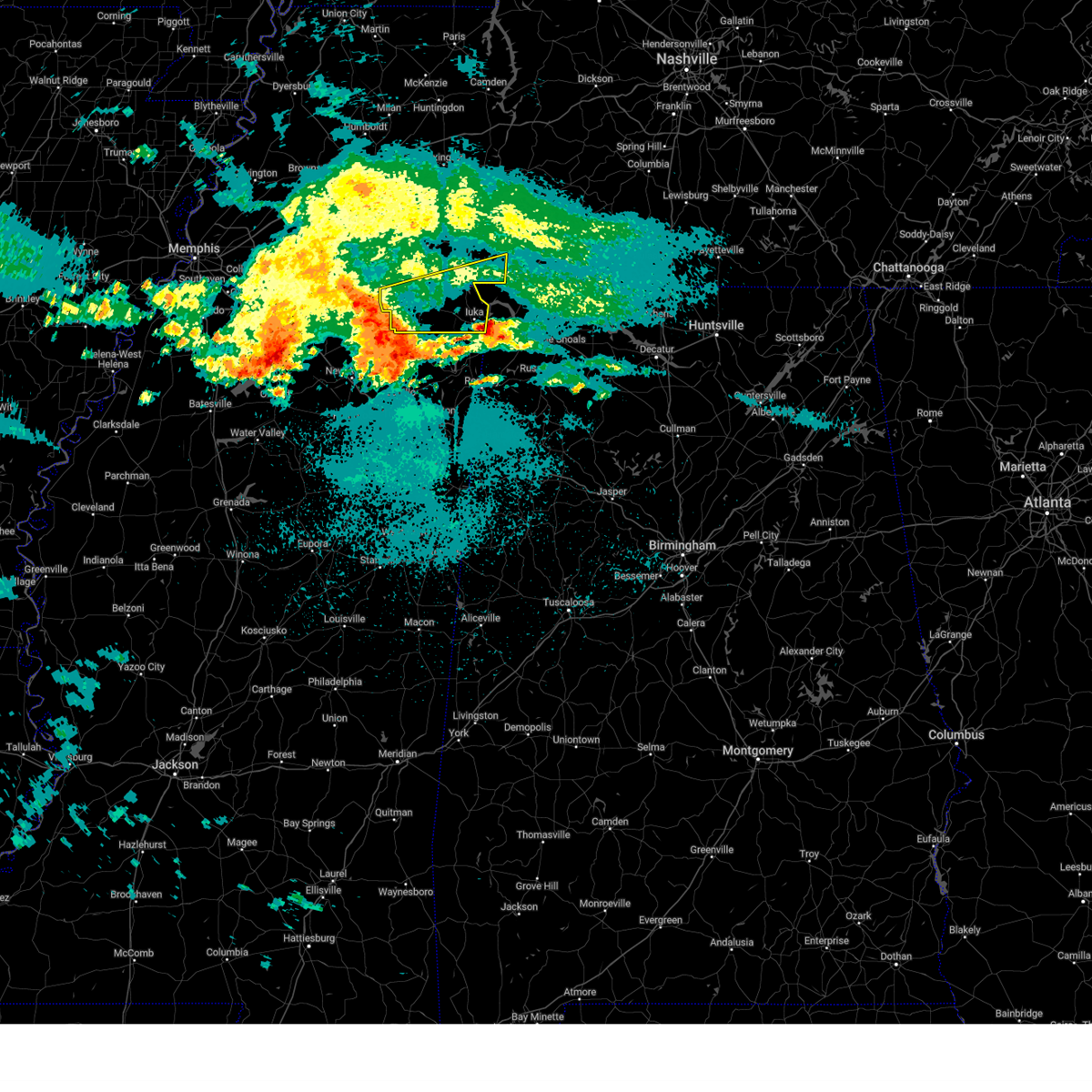
 At 1016 am cdt, a severe thunderstorm was located over j p coleman state park, moving east at 45 mph (radar indicated). Hazards include 60 mph wind gusts and nickel size hail. Expect damage to roofs, siding, and trees. Locations impacted include, bacon springs, iuka, lowryville, walnut grove, doskie, j p coleman state park, pineflat, pollards mill, bruton branch, pickwick landing state park, hazard switch, walker siding, burnsville, winn springs, red sulphur springs, and leedy. At 1016 am cdt, a severe thunderstorm was located over j p coleman state park, moving east at 45 mph (radar indicated). Hazards include 60 mph wind gusts and nickel size hail. Expect damage to roofs, siding, and trees. Locations impacted include, bacon springs, iuka, lowryville, walnut grove, doskie, j p coleman state park, pineflat, pollards mill, bruton branch, pickwick landing state park, hazard switch, walker siding, burnsville, winn springs, red sulphur springs, and leedy.
|
| 5/20/2025 10:07 AM CDT |
 At 1007 am cdt, a severe thunderstorm was located near pineflat, or near j p coleman state park, moving east at 50 mph (radar indicated). Hazards include 60 mph wind gusts and nickel size hail. Expect damage to roofs, siding, and trees. Locations impacted include, bacon springs, iuka, counce, lowryville, walnut grove, damon, doskie, j p coleman state park, pickwick dam, strickland, hamburg, pineflat, pollards mill, bruton branch, childers hill, pickwick landing state park, glen, hazard switch, walker siding, and burnsville. At 1007 am cdt, a severe thunderstorm was located near pineflat, or near j p coleman state park, moving east at 50 mph (radar indicated). Hazards include 60 mph wind gusts and nickel size hail. Expect damage to roofs, siding, and trees. Locations impacted include, bacon springs, iuka, counce, lowryville, walnut grove, damon, doskie, j p coleman state park, pickwick dam, strickland, hamburg, pineflat, pollards mill, bruton branch, childers hill, pickwick landing state park, glen, hazard switch, walker siding, and burnsville.
|
| 5/20/2025 10:07 AM CDT |
 the severe thunderstorm warning has been cancelled and is no longer in effect the severe thunderstorm warning has been cancelled and is no longer in effect
|
| 5/20/2025 9:54 AM CDT |
 Svrmeg the national weather service in memphis has issued a * severe thunderstorm warning for, northern tishomingo county in northeastern mississippi, eastern alcorn county in northeastern mississippi, southeastern mcnairy county in west tennessee, southern hardin county in west tennessee, * until 1045 am cdt. * at 954 am cdt, a severe thunderstorm was located near glen, or near corinth, moving east at 50 mph (radar indicated). Hazards include 60 mph wind gusts and nickel size hail. expect damage to roofs, siding, and trees Svrmeg the national weather service in memphis has issued a * severe thunderstorm warning for, northern tishomingo county in northeastern mississippi, eastern alcorn county in northeastern mississippi, southeastern mcnairy county in west tennessee, southern hardin county in west tennessee, * until 1045 am cdt. * at 954 am cdt, a severe thunderstorm was located near glen, or near corinth, moving east at 50 mph (radar indicated). Hazards include 60 mph wind gusts and nickel size hail. expect damage to roofs, siding, and trees
|
| 5/19/2025 1:07 AM CDT |
 The storm which prompted the warning has weakened below severe limits, and no longer poses an immediate threat to life or property. therefore, the warning will be allowed to expire. The storm which prompted the warning has weakened below severe limits, and no longer poses an immediate threat to life or property. therefore, the warning will be allowed to expire.
|
| 5/19/2025 1:01 AM CDT |
 the severe thunderstorm warning has been cancelled and is no longer in effect the severe thunderstorm warning has been cancelled and is no longer in effect
|
| 5/19/2025 1:01 AM CDT |
 At 101 am cdt, a severe thunderstorm was located near j p coleman state park, moving northeast at 55 mph (radar indicated). Hazards include 60 mph wind gusts and quarter size hail. Hail damage to vehicles is expected. expect wind damage to roofs, siding, and trees. Locations impacted include, iuka, walnut grove, oldham, doskie, j p coleman state park, pickwick dam, strickland, hamburg, pineflat, blythe crossing, wenasoga, guys, biggersville, rienzi, bruton branch, tulu, jobes, pickwick landing state park, hinkle, and glen. At 101 am cdt, a severe thunderstorm was located near j p coleman state park, moving northeast at 55 mph (radar indicated). Hazards include 60 mph wind gusts and quarter size hail. Hail damage to vehicles is expected. expect wind damage to roofs, siding, and trees. Locations impacted include, iuka, walnut grove, oldham, doskie, j p coleman state park, pickwick dam, strickland, hamburg, pineflat, blythe crossing, wenasoga, guys, biggersville, rienzi, bruton branch, tulu, jobes, pickwick landing state park, hinkle, and glen.
|
| 5/19/2025 12:26 AM CDT |
 Svrmeg the national weather service in memphis has issued a * severe thunderstorm warning for, northern tishomingo county in northeastern mississippi, northern prentiss county in northeastern mississippi, alcorn county in northeastern mississippi, southeastern mcnairy county in west tennessee, southern hardin county in west tennessee, * until 115 am cdt. * at 1226 am cdt, a severe thunderstorm was located near hinkle, or 8 miles northwest of booneville, moving northeast at 55 mph (radar indicated). Hazards include 60 mph wind gusts and quarter size hail. Hail damage to vehicles is expected. Expect wind damage to roofs, siding, and trees. Svrmeg the national weather service in memphis has issued a * severe thunderstorm warning for, northern tishomingo county in northeastern mississippi, northern prentiss county in northeastern mississippi, alcorn county in northeastern mississippi, southeastern mcnairy county in west tennessee, southern hardin county in west tennessee, * until 115 am cdt. * at 1226 am cdt, a severe thunderstorm was located near hinkle, or 8 miles northwest of booneville, moving northeast at 55 mph (radar indicated). Hazards include 60 mph wind gusts and quarter size hail. Hail damage to vehicles is expected. Expect wind damage to roofs, siding, and trees.
|
| 5/16/2025 11:08 PM CDT |
 the severe thunderstorm warning has been cancelled and is no longer in effect the severe thunderstorm warning has been cancelled and is no longer in effect
|
| 5/16/2025 11:08 PM CDT |
 At 1107 pm cdt, severe thunderstorms were located along a line extending from near red boiling springs to near burns, moving east at 55 mph (radar indicated). Hazards include 60 mph wind gusts and quarter size hail. Hail damage to vehicles is expected. expect wind damage to roofs, siding, and trees. locations impacted include, charlotte, black jack, hartsville, moss, pleasant shade, millersville, gallatin, bledsoe creek state park, dickerson chapel recreation area, hendersonville, cottontown, mount juliet, westmoreland, white bluff, forest hills, cheatham dam, goodlettsville, dixon springs, oak grove, and nashville. this includes the following highways, interstate 40 between mile markers 186 and 235. interstate 65 between mile markers 75 and 121. interstate 24 between mile markers 22 and 57. Interstate 840 near mile marker 76. At 1107 pm cdt, severe thunderstorms were located along a line extending from near red boiling springs to near burns, moving east at 55 mph (radar indicated). Hazards include 60 mph wind gusts and quarter size hail. Hail damage to vehicles is expected. expect wind damage to roofs, siding, and trees. locations impacted include, charlotte, black jack, hartsville, moss, pleasant shade, millersville, gallatin, bledsoe creek state park, dickerson chapel recreation area, hendersonville, cottontown, mount juliet, westmoreland, white bluff, forest hills, cheatham dam, goodlettsville, dixon springs, oak grove, and nashville. this includes the following highways, interstate 40 between mile markers 186 and 235. interstate 65 between mile markers 75 and 121. interstate 24 between mile markers 22 and 57. Interstate 840 near mile marker 76.
|
| 5/16/2025 10:40 PM CDT |
 Svrohx the national weather service in nashville has issued a * severe thunderstorm warning for, northern smith county in middle tennessee, southern montgomery county in middle tennessee, sumner county in middle tennessee, southeastern stewart county in middle tennessee, houston county in middle tennessee, northern wilson county in middle tennessee, cheatham county in middle tennessee, clay county in middle tennessee, northern humphreys county in middle tennessee, robertson county in middle tennessee, davidson county in middle tennessee, dickson county in middle tennessee, northern jackson county in middle tennessee, macon county in middle tennessee, trousdale county in middle tennessee, * until 1145 pm cdt. * at 1040 pm cdt, severe thunderstorms were located along a line extending from near westmoreland to near mcewen, moving east at 55 mph (radar indicated). Hazards include 60 mph wind gusts and quarter size hail. Hail damage to vehicles is expected. Expect wind damage to roofs, siding, and trees. Svrohx the national weather service in nashville has issued a * severe thunderstorm warning for, northern smith county in middle tennessee, southern montgomery county in middle tennessee, sumner county in middle tennessee, southeastern stewart county in middle tennessee, houston county in middle tennessee, northern wilson county in middle tennessee, cheatham county in middle tennessee, clay county in middle tennessee, northern humphreys county in middle tennessee, robertson county in middle tennessee, davidson county in middle tennessee, dickson county in middle tennessee, northern jackson county in middle tennessee, macon county in middle tennessee, trousdale county in middle tennessee, * until 1145 pm cdt. * at 1040 pm cdt, severe thunderstorms were located along a line extending from near westmoreland to near mcewen, moving east at 55 mph (radar indicated). Hazards include 60 mph wind gusts and quarter size hail. Hail damage to vehicles is expected. Expect wind damage to roofs, siding, and trees.
|
| 5/16/2025 11:03 AM CDT |
 the severe thunderstorm warning has been cancelled and is no longer in effect the severe thunderstorm warning has been cancelled and is no longer in effect
|
| 5/16/2025 10:29 AM CDT |
 Svrohx the national weather service in nashville has issued a * severe thunderstorm warning for, northern sumner county in middle tennessee, northeastern robertson county in middle tennessee, * until 1115 am cdt. * at 1028 am cdt, a severe thunderstorm was located over cross plains, or 10 miles northeast of springfield, moving east at 65 mph (radar indicated). Hazards include 60 mph wind gusts and quarter size hail. Hail damage to vehicles is expected. Expect wind damage to roofs, siding, and trees. Svrohx the national weather service in nashville has issued a * severe thunderstorm warning for, northern sumner county in middle tennessee, northeastern robertson county in middle tennessee, * until 1115 am cdt. * at 1028 am cdt, a severe thunderstorm was located over cross plains, or 10 miles northeast of springfield, moving east at 65 mph (radar indicated). Hazards include 60 mph wind gusts and quarter size hail. Hail damage to vehicles is expected. Expect wind damage to roofs, siding, and trees.
|
| 4/10/2025 5:41 PM CDT |
 Svrohx the national weather service in nashville has issued a * severe thunderstorm warning for, smith county in middle tennessee, southeastern davidson county in middle tennessee, western de kalb county in middle tennessee, northern rutherford county in middle tennessee, southern sumner county in middle tennessee, northeastern williamson county in middle tennessee, wilson county in middle tennessee, southern macon county in middle tennessee, trousdale county in middle tennessee, northern cannon county in middle tennessee, * until 630 pm cdt. * at 541 pm cdt, severe thunderstorms were located along a line extending from 6 miles northeast of gallatin to near murfreesboro, moving east at 35 mph (radar indicated). Hazards include 60 mph wind gusts. expect damage to roofs, siding, and trees Svrohx the national weather service in nashville has issued a * severe thunderstorm warning for, smith county in middle tennessee, southeastern davidson county in middle tennessee, western de kalb county in middle tennessee, northern rutherford county in middle tennessee, southern sumner county in middle tennessee, northeastern williamson county in middle tennessee, wilson county in middle tennessee, southern macon county in middle tennessee, trousdale county in middle tennessee, northern cannon county in middle tennessee, * until 630 pm cdt. * at 541 pm cdt, severe thunderstorms were located along a line extending from 6 miles northeast of gallatin to near murfreesboro, moving east at 35 mph (radar indicated). Hazards include 60 mph wind gusts. expect damage to roofs, siding, and trees
|
| 4/10/2025 5:31 PM CDT |
 the severe thunderstorm warning has been cancelled and is no longer in effect the severe thunderstorm warning has been cancelled and is no longer in effect
|
| 4/10/2025 5:31 PM CDT |
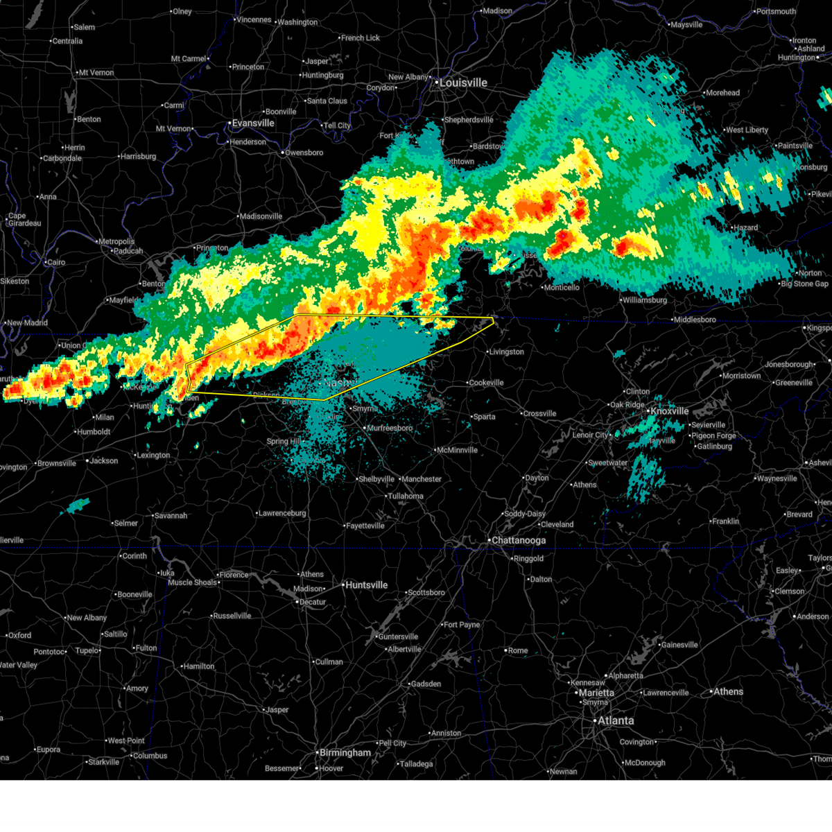
 At 531 pm cdt, severe thunderstorms were located along a line extending from 6 miles east of white house to near antioch, moving east at 45 mph (emergency management). Hazards include 60 mph wind gusts. Expect damage to roofs, siding, and trees. locations impacted include, madison, nolensville, hermitage, belle meade, la vergne, millersville, gallatin, bledsoe creek state park, hendersonville, greenbrier, berry hill, cottontown, mount juliet, smyrna, oak hill, green hill, forest hills, ridgetop, bethpage, and goodlettsville. this includes the following highways, interstate 40 between mile markers 201 and 238. interstate 65 between mile markers 69 and 110. interstate 24 between mile markers 36 and 70. Interstate 840 between mile markers 56 and 76. At 531 pm cdt, severe thunderstorms were located along a line extending from 6 miles east of white house to near antioch, moving east at 45 mph (emergency management). Hazards include 60 mph wind gusts. Expect damage to roofs, siding, and trees. locations impacted include, madison, nolensville, hermitage, belle meade, la vergne, millersville, gallatin, bledsoe creek state park, hendersonville, greenbrier, berry hill, cottontown, mount juliet, smyrna, oak hill, green hill, forest hills, ridgetop, bethpage, and goodlettsville. this includes the following highways, interstate 40 between mile markers 201 and 238. interstate 65 between mile markers 69 and 110. interstate 24 between mile markers 36 and 70. Interstate 840 between mile markers 56 and 76.
|
| 4/10/2025 5:24 PM CDT |
 At 524 pm cdt, severe thunderstorms were located along a line extending from near white house to near brentwood, moving east at 45 mph (emergency management). Hazards include 60 mph wind gusts. Expect damage to roofs, siding, and trees. locations impacted include, madison, nolensville, hermitage, belle meade, la vergne, millersville, gallatin, bledsoe creek state park, hendersonville, greenbrier, berry hill, cottontown, mount juliet, smyrna, oak hill, green hill, forest hills, ridgetop, bethpage, and goodlettsville. this includes the following highways, interstate 40 between mile markers 191 and 238. interstate 65 between mile markers 70 and 110. interstate 24 between mile markers 29 and 70. Interstate 840 between mile markers 56 and 76. At 524 pm cdt, severe thunderstorms were located along a line extending from near white house to near brentwood, moving east at 45 mph (emergency management). Hazards include 60 mph wind gusts. Expect damage to roofs, siding, and trees. locations impacted include, madison, nolensville, hermitage, belle meade, la vergne, millersville, gallatin, bledsoe creek state park, hendersonville, greenbrier, berry hill, cottontown, mount juliet, smyrna, oak hill, green hill, forest hills, ridgetop, bethpage, and goodlettsville. this includes the following highways, interstate 40 between mile markers 191 and 238. interstate 65 between mile markers 70 and 110. interstate 24 between mile markers 29 and 70. Interstate 840 between mile markers 56 and 76.
|
| 4/10/2025 5:05 PM CDT |
 Svrohx the national weather service in nashville has issued a * severe thunderstorm warning for, davidson county in middle tennessee, northwestern rutherford county in middle tennessee, southern sumner county in middle tennessee, northeastern williamson county in middle tennessee, western wilson county in middle tennessee, southeastern cheatham county in middle tennessee, western trousdale county in middle tennessee, southeastern robertson county in middle tennessee, * until 545 pm cdt. * at 504 pm cdt, severe thunderstorms were located along a line extending from near springfield to near pegram, moving east at 45 mph (radar indicated). Hazards include 60 mph wind gusts. expect damage to roofs, siding, and trees Svrohx the national weather service in nashville has issued a * severe thunderstorm warning for, davidson county in middle tennessee, northwestern rutherford county in middle tennessee, southern sumner county in middle tennessee, northeastern williamson county in middle tennessee, western wilson county in middle tennessee, southeastern cheatham county in middle tennessee, western trousdale county in middle tennessee, southeastern robertson county in middle tennessee, * until 545 pm cdt. * at 504 pm cdt, severe thunderstorms were located along a line extending from near springfield to near pegram, moving east at 45 mph (radar indicated). Hazards include 60 mph wind gusts. expect damage to roofs, siding, and trees
|
| 4/10/2025 3:29 PM CDT |
 At 327 pm cdt, a severe thunderstorm was located 7 miles north of cross plains, or 13 miles northeast of springfield, moving southeast at 20 mph (radar indicated). Hazards include 60 mph wind gusts and quarter size hail. Hail damage to vehicles is expected. expect wind damage to roofs, siding, and trees. locations impacted include, orlinda, portland, cross plains, mitchellville, and black jack. This includes interstate 65 between mile markers 113 and 121. At 327 pm cdt, a severe thunderstorm was located 7 miles north of cross plains, or 13 miles northeast of springfield, moving southeast at 20 mph (radar indicated). Hazards include 60 mph wind gusts and quarter size hail. Hail damage to vehicles is expected. expect wind damage to roofs, siding, and trees. locations impacted include, orlinda, portland, cross plains, mitchellville, and black jack. This includes interstate 65 between mile markers 113 and 121.
|
| 4/10/2025 3:18 PM CDT | Svrohx the national weather service in nashville has issued a * severe thunderstorm warning for, northwestern sumner county in middle tennessee, northeastern robertson county in middle tennessee, * until 400 pm cdt. * at 318 pm cdt, a severe thunderstorm was located 9 miles northwest of cross plains, or 13 miles northeast of springfield, moving southeast at 20 mph (radar indicated). Hazards include 60 mph wind gusts and quarter size hail. Hail damage to vehicles is expected. Expect wind damage to roofs, siding, and trees. |
| 4/5/2025 8:50 PM CDT |
 The storm which prompted the warning has moved out of the area. therefore, the warning will be allowed to expire. a tornado watch remains in effect until midnight cdt for northeastern mississippi, and west tennessee. The storm which prompted the warning has moved out of the area. therefore, the warning will be allowed to expire. a tornado watch remains in effect until midnight cdt for northeastern mississippi, and west tennessee.
|
| 4/5/2025 8:39 PM CDT |
 The storm which prompted the warning has moved out of the area. therefore, the warning will be allowed to expire. however, gusty winds and heavy rain are still possible with this thunderstorm. a tornado watch remains in effect until midnight cdt for west tennessee. The storm which prompted the warning has moved out of the area. therefore, the warning will be allowed to expire. however, gusty winds and heavy rain are still possible with this thunderstorm. a tornado watch remains in effect until midnight cdt for west tennessee.
|
| 4/5/2025 8:37 PM CDT |
 the tornado warning has been cancelled and is no longer in effect the tornado warning has been cancelled and is no longer in effect
|
| 4/5/2025 8:37 PM CDT |
 At 836 pm cdt, a severe thunderstorm capable of producing a tornado was located near j p coleman state park, moving northeast at 50 mph (radar indicated rotation). Hazards include tornado and ping pong ball size hail. Flying debris will be dangerous to those caught without shelter. mobile homes will be damaged or destroyed. damage to roofs, windows, and vehicles will occur. tree damage is likely. Locations impacted include, bacon springs, iuka, walnut grove, doskie, j p coleman state park, pineflat, blythe crossing, pollards mill, bruton branch, hazard switch, walker siding, holcut, burnsville, holts spur, winn springs, red sulphur springs, and leedy. At 836 pm cdt, a severe thunderstorm capable of producing a tornado was located near j p coleman state park, moving northeast at 50 mph (radar indicated rotation). Hazards include tornado and ping pong ball size hail. Flying debris will be dangerous to those caught without shelter. mobile homes will be damaged or destroyed. damage to roofs, windows, and vehicles will occur. tree damage is likely. Locations impacted include, bacon springs, iuka, walnut grove, doskie, j p coleman state park, pineflat, blythe crossing, pollards mill, bruton branch, hazard switch, walker siding, holcut, burnsville, holts spur, winn springs, red sulphur springs, and leedy.
|
| 4/5/2025 8:24 PM CDT |
 At 824 pm cdt, a severe thunderstorm capable of producing a tornado was located over leedy, or 9 miles west of iuka, moving northeast at 50 mph (radar indicated rotation). Hazards include tornado and ping pong ball size hail. Flying debris will be dangerous to those caught without shelter. mobile homes will be damaged or destroyed. damage to roofs, windows, and vehicles will occur. tree damage is likely. Locations impacted include, bacon springs, iuka, walnut grove, doskie, j p coleman state park, pineflat, blythe crossing, pollards mill, rienzi, bruton branch, booneville, thrashers, gaston, glen, hazard switch, walker siding, holcut, burnsville, holts spur, and winn springs. At 824 pm cdt, a severe thunderstorm capable of producing a tornado was located over leedy, or 9 miles west of iuka, moving northeast at 50 mph (radar indicated rotation). Hazards include tornado and ping pong ball size hail. Flying debris will be dangerous to those caught without shelter. mobile homes will be damaged or destroyed. damage to roofs, windows, and vehicles will occur. tree damage is likely. Locations impacted include, bacon springs, iuka, walnut grove, doskie, j p coleman state park, pineflat, blythe crossing, pollards mill, rienzi, bruton branch, booneville, thrashers, gaston, glen, hazard switch, walker siding, holcut, burnsville, holts spur, and winn springs.
|
| 4/5/2025 8:21 PM CDT |
 At 821 pm cdt, a confirmed tornado was located near leedy, or 11 miles northeast of booneville, moving northeast at 50 mph (law enforcement confirmed tornado). Hazards include damaging tornado and ping pong ball size hail. Flying debris will be dangerous to those caught without shelter. mobile homes will be damaged or destroyed. damage to roofs, windows, and vehicles will occur. tree damage is likely. Locations impacted include, bacon springs, iuka, walnut grove, doskie, j p coleman state park, pineflat, blythe crossing, pollards mill, rienzi, bruton branch, booneville, thrashers, gaston, glen, hazard switch, walker siding, holcut, burnsville, holts spur, and winn springs. At 821 pm cdt, a confirmed tornado was located near leedy, or 11 miles northeast of booneville, moving northeast at 50 mph (law enforcement confirmed tornado). Hazards include damaging tornado and ping pong ball size hail. Flying debris will be dangerous to those caught without shelter. mobile homes will be damaged or destroyed. damage to roofs, windows, and vehicles will occur. tree damage is likely. Locations impacted include, bacon springs, iuka, walnut grove, doskie, j p coleman state park, pineflat, blythe crossing, pollards mill, rienzi, bruton branch, booneville, thrashers, gaston, glen, hazard switch, walker siding, holcut, burnsville, holts spur, and winn springs.
|
| 4/5/2025 8:19 PM CDT |
 Tormeg the national weather service in memphis has issued a * tornado warning for, southern hardin county in west tennessee, * until 845 pm cdt. * at 819 pm cdt, a severe thunderstorm capable of producing a tornado was located near pickwick landing state park, moving northeast at 55 mph (radar indicated rotation). Hazards include tornado. Flying debris will be dangerous to those caught without shelter. mobile homes will be damaged or destroyed. damage to roofs, windows, and vehicles will occur. Tree damage is likely. Tormeg the national weather service in memphis has issued a * tornado warning for, southern hardin county in west tennessee, * until 845 pm cdt. * at 819 pm cdt, a severe thunderstorm capable of producing a tornado was located near pickwick landing state park, moving northeast at 55 mph (radar indicated rotation). Hazards include tornado. Flying debris will be dangerous to those caught without shelter. mobile homes will be damaged or destroyed. damage to roofs, windows, and vehicles will occur. Tree damage is likely.
|
| 4/5/2025 8:12 PM CDT |
 Tormeg the national weather service in memphis has issued a * tornado warning for, northern tishomingo county in northeastern mississippi, northern prentiss county in northeastern mississippi, southeastern alcorn county in northeastern mississippi, southeastern hardin county in west tennessee, * until 900 pm cdt. * at 812 pm cdt, a confirmed tornado was located over thrashers, or near booneville, moving northeast at 50 mph (law enforcement confirmed tornado). Hazards include damaging tornado. Flying debris will be dangerous to those caught without shelter. mobile homes will be damaged or destroyed. damage to roofs, windows, and vehicles will occur. Tree damage is likely. Tormeg the national weather service in memphis has issued a * tornado warning for, northern tishomingo county in northeastern mississippi, northern prentiss county in northeastern mississippi, southeastern alcorn county in northeastern mississippi, southeastern hardin county in west tennessee, * until 900 pm cdt. * at 812 pm cdt, a confirmed tornado was located over thrashers, or near booneville, moving northeast at 50 mph (law enforcement confirmed tornado). Hazards include damaging tornado. Flying debris will be dangerous to those caught without shelter. mobile homes will be damaged or destroyed. damage to roofs, windows, and vehicles will occur. Tree damage is likely.
|
| 4/5/2025 8:02 PM CDT |
 At 802 pm cdt, a confirmed large and extremely dangerous tornado was located near pineflat, or 8 miles southwest of pickwick landing state park, moving northeast at 45 mph. this is a particularly dangerous situation. take cover now! (law enforcement confirmed tornado). Hazards include damaging tornado. You are in a life-threatening situation. flying debris may be deadly to those caught without shelter. mobile homes will be destroyed. considerable damage to homes, businesses, and vehicles is likely and complete destruction is possible. Locations impacted include, iuka, pickwick dam, blythe crossing, guys, rienzi, crump, bruton branch, thrashers, pickwick landing state park, acton, hazard switch, hurley, walkertown, corinth, chambers, bacon springs, kossuth, hightown, damon, and michie. At 802 pm cdt, a confirmed large and extremely dangerous tornado was located near pineflat, or 8 miles southwest of pickwick landing state park, moving northeast at 45 mph. this is a particularly dangerous situation. take cover now! (law enforcement confirmed tornado). Hazards include damaging tornado. You are in a life-threatening situation. flying debris may be deadly to those caught without shelter. mobile homes will be destroyed. considerable damage to homes, businesses, and vehicles is likely and complete destruction is possible. Locations impacted include, iuka, pickwick dam, blythe crossing, guys, rienzi, crump, bruton branch, thrashers, pickwick landing state park, acton, hazard switch, hurley, walkertown, corinth, chambers, bacon springs, kossuth, hightown, damon, and michie.
|
| 4/5/2025 7:57 PM CDT |
 At 757 pm cdt, a severe thunderstorm capable of producing a tornado was located near corinth, moving northeast at 45 mph (radar indicated rotation). Hazards include tornado and quarter size hail. Flying debris will be dangerous to those caught without shelter. mobile homes will be damaged or destroyed. damage to roofs, windows, and vehicles will occur. tree damage is likely. Locations impacted include, iuka, pickwick dam, blythe crossing, guys, rienzi, crump, bruton branch, thrashers, pickwick landing state park, acton, hazard switch, hurley, walkertown, corinth, chambers, bacon springs, kossuth, hightown, damon, and michie. At 757 pm cdt, a severe thunderstorm capable of producing a tornado was located near corinth, moving northeast at 45 mph (radar indicated rotation). Hazards include tornado and quarter size hail. Flying debris will be dangerous to those caught without shelter. mobile homes will be damaged or destroyed. damage to roofs, windows, and vehicles will occur. tree damage is likely. Locations impacted include, iuka, pickwick dam, blythe crossing, guys, rienzi, crump, bruton branch, thrashers, pickwick landing state park, acton, hazard switch, hurley, walkertown, corinth, chambers, bacon springs, kossuth, hightown, damon, and michie.
|
| 4/5/2025 7:39 PM CDT |
 Tormeg the national weather service in memphis has issued a * tornado warning for, northern tishomingo county in northeastern mississippi, northern prentiss county in northeastern mississippi, alcorn county in northeastern mississippi, southeastern mcnairy county in west tennessee, southwestern hardin county in west tennessee, * until 830 pm cdt. * at 738 pm cdt, a large and extremely dangerous tornado was located over hinkle, or 7 miles north of booneville, moving northeast at 45 mph. this is a particularly dangerous situation. take cover now! (radar indicated rotation). Hazards include damaging tornado. You are in a life-threatening situation. flying debris may be deadly to those caught without shelter. mobile homes will be destroyed. Considerable damage to homes, businesses, and vehicles is likely and complete destruction is possible. Tormeg the national weather service in memphis has issued a * tornado warning for, northern tishomingo county in northeastern mississippi, northern prentiss county in northeastern mississippi, alcorn county in northeastern mississippi, southeastern mcnairy county in west tennessee, southwestern hardin county in west tennessee, * until 830 pm cdt. * at 738 pm cdt, a large and extremely dangerous tornado was located over hinkle, or 7 miles north of booneville, moving northeast at 45 mph. this is a particularly dangerous situation. take cover now! (radar indicated rotation). Hazards include damaging tornado. You are in a life-threatening situation. flying debris may be deadly to those caught without shelter. mobile homes will be destroyed. Considerable damage to homes, businesses, and vehicles is likely and complete destruction is possible.
|
| 4/5/2025 5:24 PM CDT |
 the severe thunderstorm warning has been cancelled and is no longer in effect the severe thunderstorm warning has been cancelled and is no longer in effect
|
| 4/5/2025 5:24 PM CDT |
 At 524 pm cdt, severe thunderstorms were located along a line extending from 6 miles west of westmoreland to 7 miles southwest of hartsville to near rural hill, moving east at 60 mph (radar indicated). Hazards include 70 mph wind gusts and quarter size hail. Hail damage to vehicles is expected. expect considerable tree damage. wind damage is also likely to mobile homes, roofs, and outbuildings. locations impacted include, red boiling springs, gordonsville, hartsville, pleasant shade, millersville, gallatin, bledsoe creek state park, dickerson chapel recreation area, hendersonville, carthage, cottontown, mount juliet, westmoreland, south carthage, green hill, tuckers crossroads, bethpage, rural hill, dixon springs, and oak grove. this includes the following highways, interstate 40 between mile markers 223 and 260. interstate 65 between mile markers 102 and 103. Interstate 840 between mile markers 66 and 76. At 524 pm cdt, severe thunderstorms were located along a line extending from 6 miles west of westmoreland to 7 miles southwest of hartsville to near rural hill, moving east at 60 mph (radar indicated). Hazards include 70 mph wind gusts and quarter size hail. Hail damage to vehicles is expected. expect considerable tree damage. wind damage is also likely to mobile homes, roofs, and outbuildings. locations impacted include, red boiling springs, gordonsville, hartsville, pleasant shade, millersville, gallatin, bledsoe creek state park, dickerson chapel recreation area, hendersonville, carthage, cottontown, mount juliet, westmoreland, south carthage, green hill, tuckers crossroads, bethpage, rural hill, dixon springs, and oak grove. this includes the following highways, interstate 40 between mile markers 223 and 260. interstate 65 between mile markers 102 and 103. Interstate 840 between mile markers 66 and 76.
|
| 4/5/2025 5:10 PM CDT |
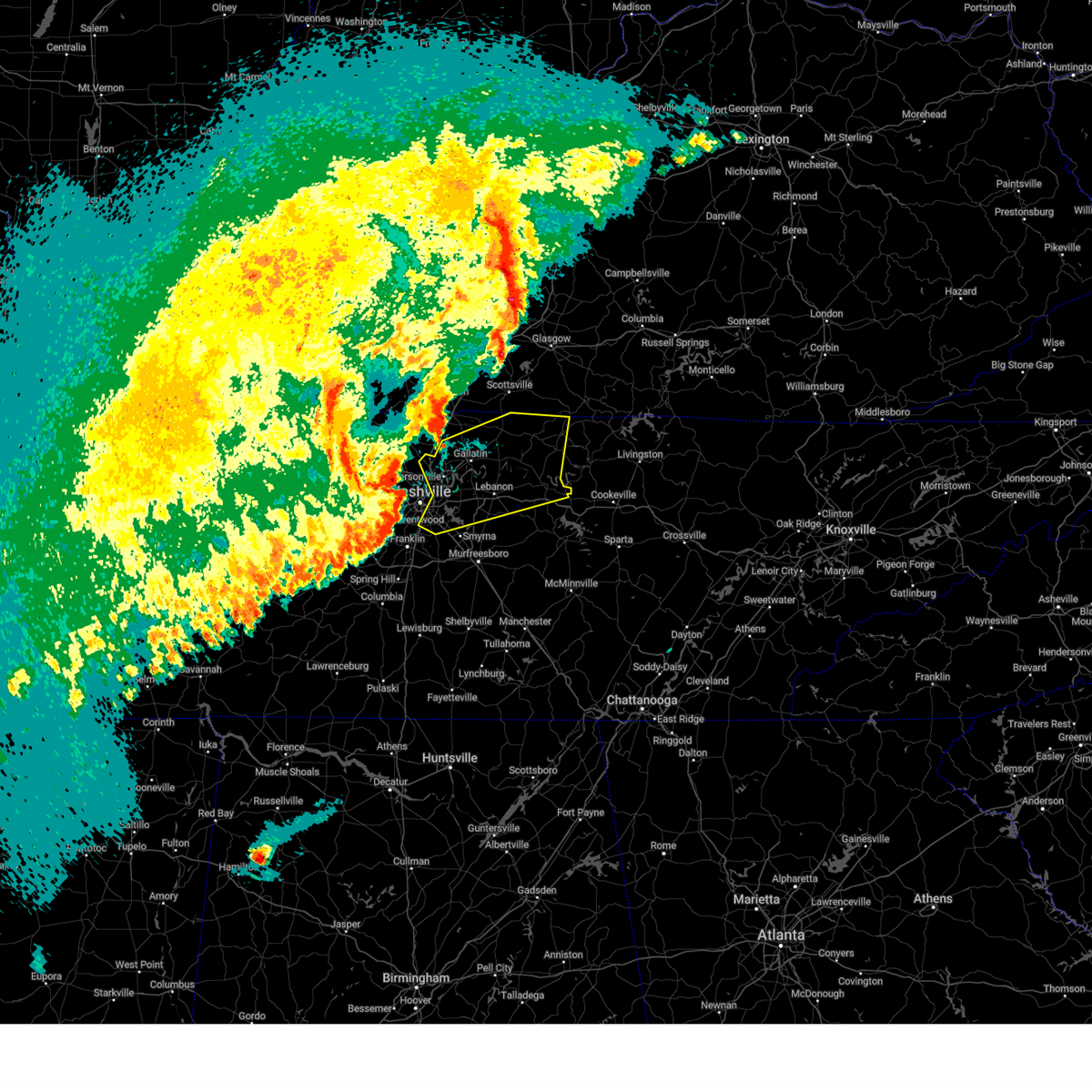
 Torohx the national weather service in nashville has issued a * tornado warning for, sumner county in middle tennessee, northwestern wilson county in middle tennessee, western macon county in middle tennessee, trousdale county in middle tennessee, * until 600 pm cdt. * at 510 pm cdt, a severe thunderstorm capable of producing a tornado was located near gallatin, moving east at 60 mph (radar indicated rotation). Hazards include tornado. Flying debris will be dangerous to those caught without shelter. mobile homes will be damaged or destroyed. damage to roofs, windows, and vehicles will occur. tree damage is likely. this dangerous storm will be near, gallatin around 515 pm cdt. lafayette around 535 pm cdt. Other locations impacted by this tornadic thunderstorm include oak grove, bledsoe creek state park, cottontown, dickerson chapel recreation area, and bethpage. Torohx the national weather service in nashville has issued a * tornado warning for, sumner county in middle tennessee, northwestern wilson county in middle tennessee, western macon county in middle tennessee, trousdale county in middle tennessee, * until 600 pm cdt. * at 510 pm cdt, a severe thunderstorm capable of producing a tornado was located near gallatin, moving east at 60 mph (radar indicated rotation). Hazards include tornado. Flying debris will be dangerous to those caught without shelter. mobile homes will be damaged or destroyed. damage to roofs, windows, and vehicles will occur. tree damage is likely. this dangerous storm will be near, gallatin around 515 pm cdt. lafayette around 535 pm cdt. Other locations impacted by this tornadic thunderstorm include oak grove, bledsoe creek state park, cottontown, dickerson chapel recreation area, and bethpage.
|
| 4/5/2025 5:00 PM CDT |
 Svrohx the national weather service in nashville has issued a * severe thunderstorm warning for, smith county in middle tennessee, eastern davidson county in middle tennessee, northwestern rutherford county in middle tennessee, sumner county in middle tennessee, wilson county in middle tennessee, macon county in middle tennessee, trousdale county in middle tennessee, * until 600 pm cdt. * at 500 pm cdt, severe thunderstorms were located along a line extending from millersville to lakewood to brentwood, moving east at 60 mph (radar indicated). Hazards include 70 mph wind gusts and quarter size hail. Hail damage to vehicles is expected. expect considerable tree damage. Wind damage is also likely to mobile homes, roofs, and outbuildings. Svrohx the national weather service in nashville has issued a * severe thunderstorm warning for, smith county in middle tennessee, eastern davidson county in middle tennessee, northwestern rutherford county in middle tennessee, sumner county in middle tennessee, wilson county in middle tennessee, macon county in middle tennessee, trousdale county in middle tennessee, * until 600 pm cdt. * at 500 pm cdt, severe thunderstorms were located along a line extending from millersville to lakewood to brentwood, moving east at 60 mph (radar indicated). Hazards include 70 mph wind gusts and quarter size hail. Hail damage to vehicles is expected. expect considerable tree damage. Wind damage is also likely to mobile homes, roofs, and outbuildings.
|
| 4/5/2025 4:54 PM CDT |
 At 453 pm cdt, a severe thunderstorm was located over portland, or 14 miles north of gallatin, moving northeast at 50 mph (radar indicated). Hazards include 60 mph wind gusts and nickel size hail. Expect damage to roofs, siding, and trees. locations impacted include, orlinda, portland, cross plains, mitchellville, oak grove, westmoreland, and white house. This includes interstate 65 between mile markers 111 and 120. At 453 pm cdt, a severe thunderstorm was located over portland, or 14 miles north of gallatin, moving northeast at 50 mph (radar indicated). Hazards include 60 mph wind gusts and nickel size hail. Expect damage to roofs, siding, and trees. locations impacted include, orlinda, portland, cross plains, mitchellville, oak grove, westmoreland, and white house. This includes interstate 65 between mile markers 111 and 120.
|
| 4/5/2025 4:51 PM CDT |
 Torohx the national weather service in nashville has issued a * tornado warning for, northern sumner county in middle tennessee, northwestern macon county in middle tennessee, northeastern robertson county in middle tennessee, * until 515 pm cdt. * at 451 pm cdt, a confirmed tornado was located near cross plains, or 14 miles northwest of gallatin, moving east at 55 mph (emergency management confirmed tornado). Hazards include damaging tornado. Flying debris will be dangerous to those caught without shelter. mobile homes will be damaged or destroyed. damage to roofs, windows, and vehicles will occur. tree damage is likely. the tornado will be near, portland around 455 pm cdt. other locations impacted by this tornadic thunderstorm include oak grove, mitchellville, and orlinda. This includes interstate 65 between mile markers 112 and 120. Torohx the national weather service in nashville has issued a * tornado warning for, northern sumner county in middle tennessee, northwestern macon county in middle tennessee, northeastern robertson county in middle tennessee, * until 515 pm cdt. * at 451 pm cdt, a confirmed tornado was located near cross plains, or 14 miles northwest of gallatin, moving east at 55 mph (emergency management confirmed tornado). Hazards include damaging tornado. Flying debris will be dangerous to those caught without shelter. mobile homes will be damaged or destroyed. damage to roofs, windows, and vehicles will occur. tree damage is likely. the tornado will be near, portland around 455 pm cdt. other locations impacted by this tornadic thunderstorm include oak grove, mitchellville, and orlinda. This includes interstate 65 between mile markers 112 and 120.
|
| 4/5/2025 4:42 PM CDT |
 Svrohx the national weather service in nashville has issued a * severe thunderstorm warning for, northern sumner county in middle tennessee, northwestern macon county in middle tennessee, eastern robertson county in middle tennessee, * until 530 pm cdt. * at 442 pm cdt, a severe thunderstorm was located over cross plains, or 10 miles east of springfield, moving east at 55 mph (radar indicated). Hazards include 60 mph wind gusts and nickel size hail. expect damage to roofs, siding, and trees Svrohx the national weather service in nashville has issued a * severe thunderstorm warning for, northern sumner county in middle tennessee, northwestern macon county in middle tennessee, eastern robertson county in middle tennessee, * until 530 pm cdt. * at 442 pm cdt, a severe thunderstorm was located over cross plains, or 10 miles east of springfield, moving east at 55 mph (radar indicated). Hazards include 60 mph wind gusts and nickel size hail. expect damage to roofs, siding, and trees
|
| 4/4/2025 3:19 PM CDT |
 the severe thunderstorm warning has been cancelled and is no longer in effect the severe thunderstorm warning has been cancelled and is no longer in effect
|
| 4/4/2025 3:16 PM CDT |
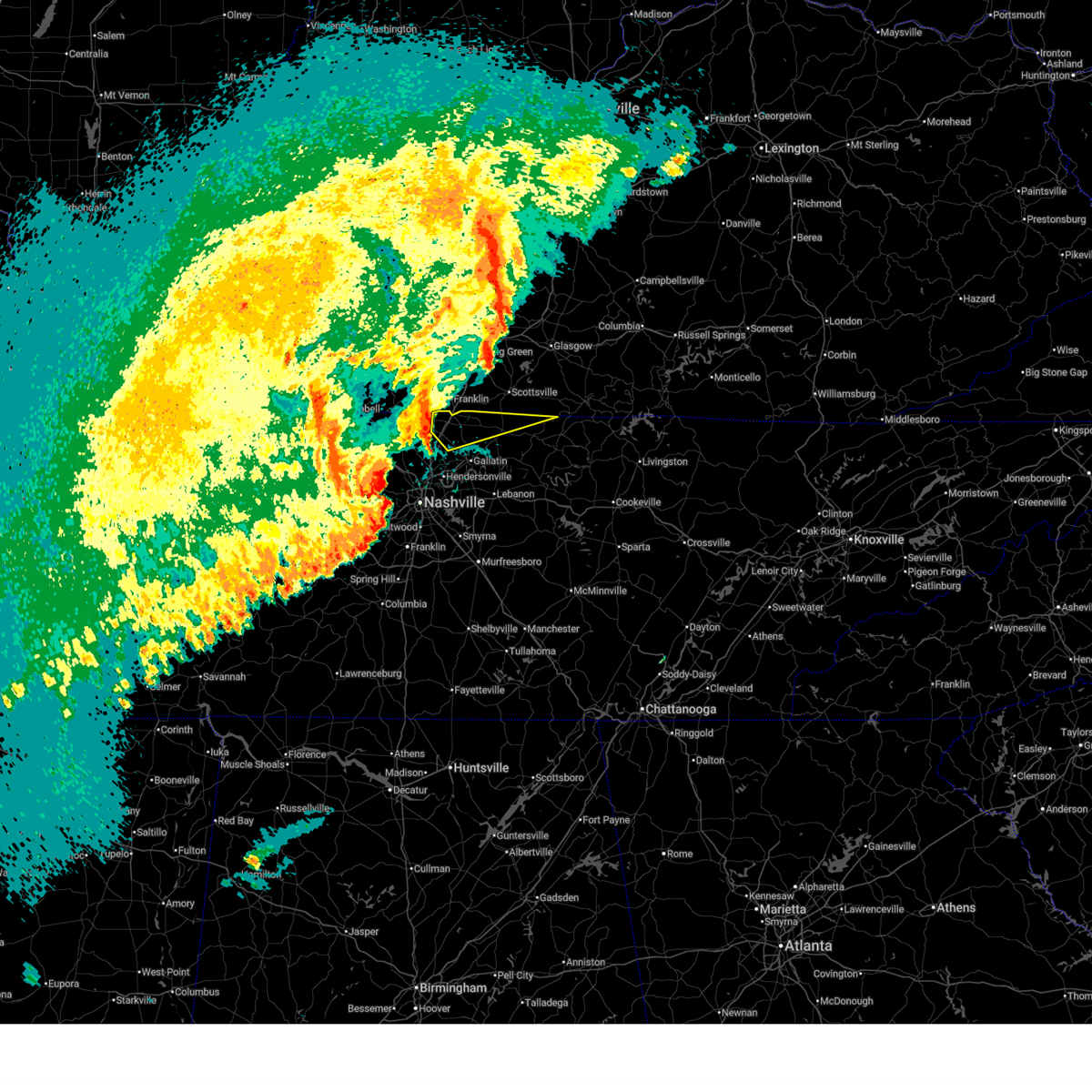
 At 315 pm cdt, a severe thunderstorm was located near white house, or 8 miles northwest of gallatin, moving northeast at 35 mph (radar indicated). Hazards include 60 mph wind gusts and quarter size hail. Hail damage to vehicles is expected. expect wind damage to roofs, siding, and trees. Locations impacted include, oak grove, cottontown, portland, mitchellville, white house, and westmoreland. At 315 pm cdt, a severe thunderstorm was located near white house, or 8 miles northwest of gallatin, moving northeast at 35 mph (radar indicated). Hazards include 60 mph wind gusts and quarter size hail. Hail damage to vehicles is expected. expect wind damage to roofs, siding, and trees. Locations impacted include, oak grove, cottontown, portland, mitchellville, white house, and westmoreland.
|
| 4/4/2025 3:16 PM CDT |
 the severe thunderstorm warning has been cancelled and is no longer in effect the severe thunderstorm warning has been cancelled and is no longer in effect
|
| 4/4/2025 3:02 PM CDT |
 Svrohx the national weather service in nashville has issued a * severe thunderstorm warning for, central sumner county in middle tennessee, southeastern robertson county in middle tennessee, * until 345 pm cdt. * at 302 pm cdt, a severe thunderstorm was located near millersville, or 11 miles west of gallatin, moving northeast at 35 mph (radar indicated). Hazards include 60 mph wind gusts and quarter size hail. Hail damage to vehicles is expected. Expect wind damage to roofs, siding, and trees. Svrohx the national weather service in nashville has issued a * severe thunderstorm warning for, central sumner county in middle tennessee, southeastern robertson county in middle tennessee, * until 345 pm cdt. * at 302 pm cdt, a severe thunderstorm was located near millersville, or 11 miles west of gallatin, moving northeast at 35 mph (radar indicated). Hazards include 60 mph wind gusts and quarter size hail. Hail damage to vehicles is expected. Expect wind damage to roofs, siding, and trees.
|
| 4/3/2025 5:22 PM CDT |
 the severe thunderstorm warning has been cancelled and is no longer in effect the severe thunderstorm warning has been cancelled and is no longer in effect
|
| 4/3/2025 5:21 PM CDT |
 The storm which prompted the warning has weakened below severe limits, and has exited the warned area. therefore, the warning will be allowed to expire. a tornado watch remains in effect until 1000 pm cdt for west tennessee. The storm which prompted the warning has weakened below severe limits, and has exited the warned area. therefore, the warning will be allowed to expire. a tornado watch remains in effect until 1000 pm cdt for west tennessee.
|
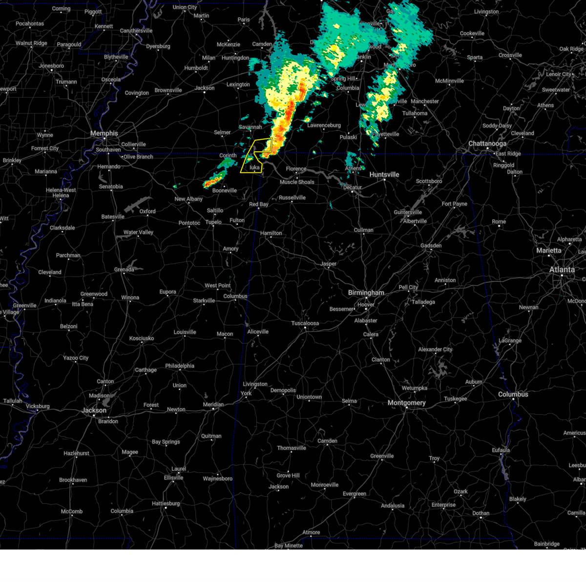
| 4/3/2025 5:11 PM CDT |
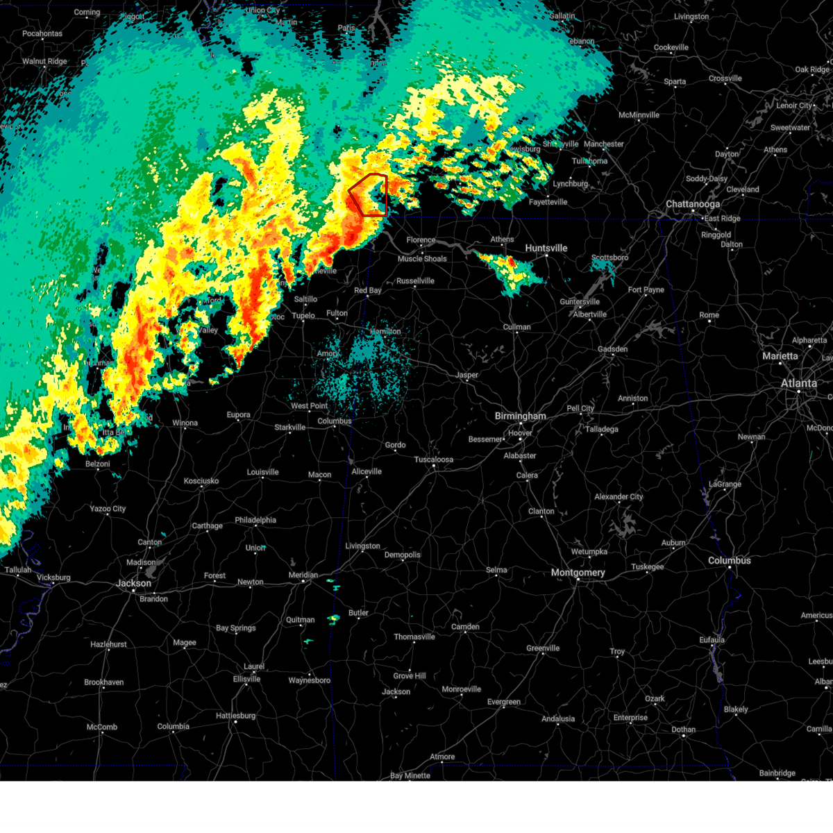
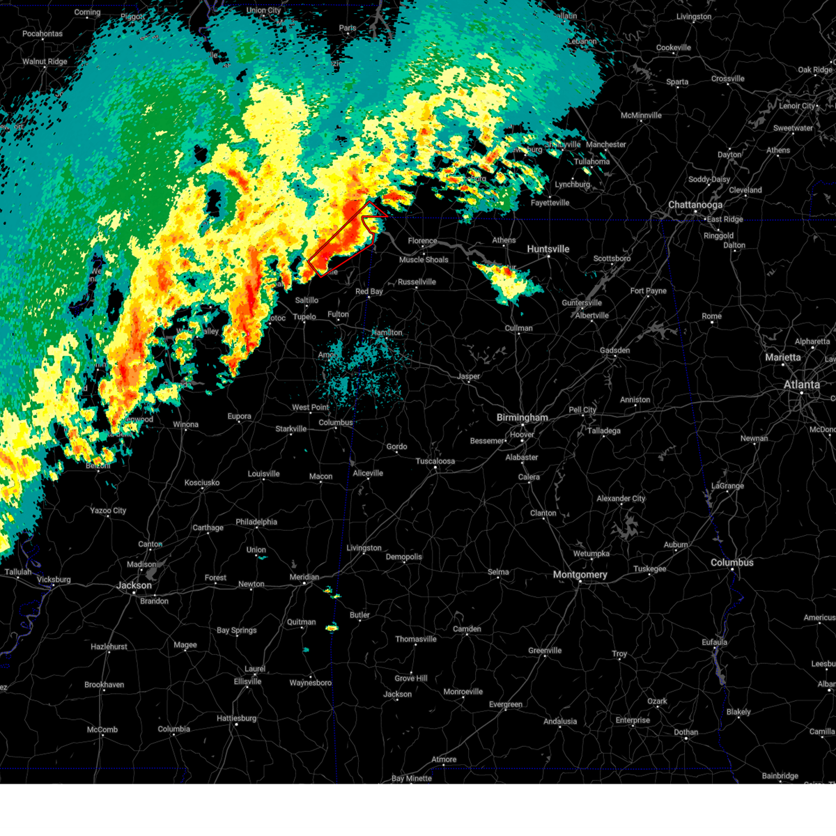
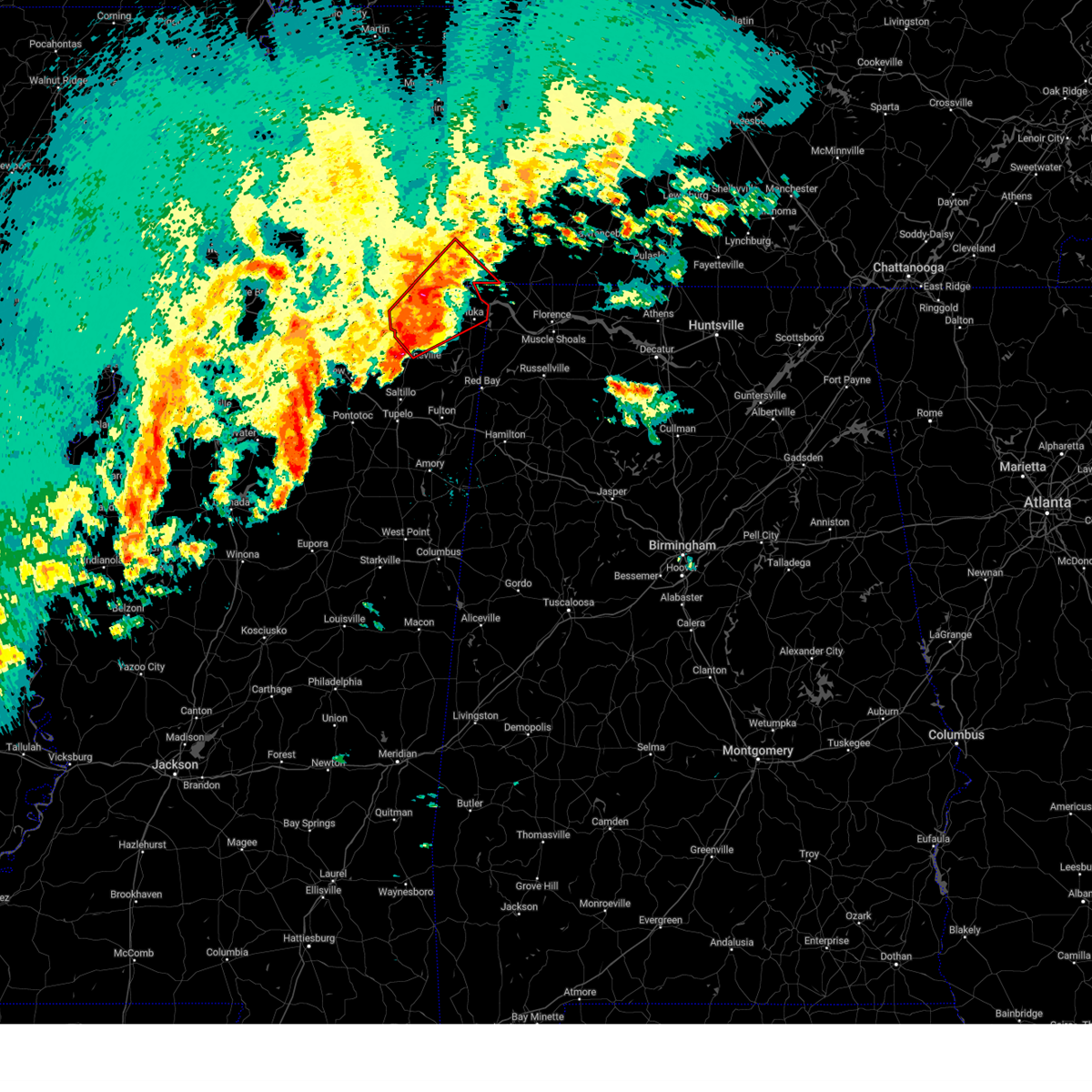
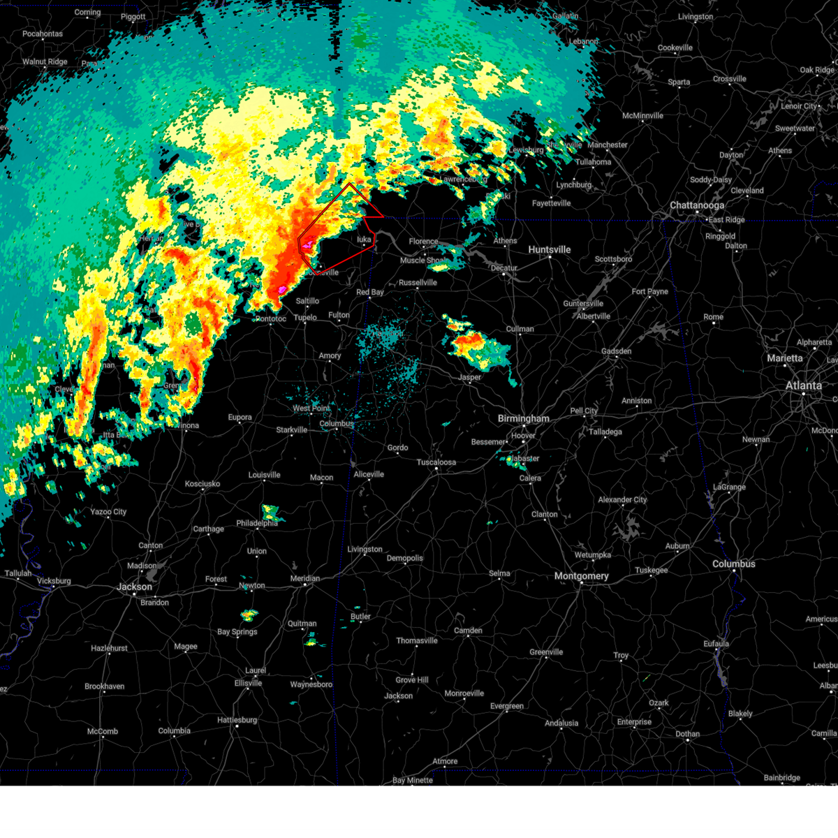
 At 511 pm cdt, a severe thunderstorm was located near walnut grove, or 8 miles northeast of pickwick landing state park, moving northeast at 45 mph (radar indicated). Hazards include golf ball size hail and 60 mph wind gusts. People and animals outdoors will be injured. expect hail damage to roofs, siding, windows, and vehicles. expect wind damage to roofs, siding, and trees. Locations impacted include, lowryville, walnut grove, savannah, olive hill, pollards mill, phillips, bruton branch, pickwick landing state park, center star, maddox, walkertown, olivehill, and bucktown. At 511 pm cdt, a severe thunderstorm was located near walnut grove, or 8 miles northeast of pickwick landing state park, moving northeast at 45 mph (radar indicated). Hazards include golf ball size hail and 60 mph wind gusts. People and animals outdoors will be injured. expect hail damage to roofs, siding, windows, and vehicles. expect wind damage to roofs, siding, and trees. Locations impacted include, lowryville, walnut grove, savannah, olive hill, pollards mill, phillips, bruton branch, pickwick landing state park, center star, maddox, walkertown, olivehill, and bucktown.
|
| 4/3/2025 5:11 PM CDT |
 the severe thunderstorm warning has been cancelled and is no longer in effect the severe thunderstorm warning has been cancelled and is no longer in effect
|
| 4/3/2025 5:09 PM CDT |
 At 508 pm cdt, a severe thunderstorm capable of producing a tornado was located over walnut grove, or 7 miles east of pickwick landing state park, moving northeast at 50 mph (radar indicated rotation). Hazards include tornado and golf ball size hail. Flying debris will be dangerous to those caught without shelter. mobile homes will be damaged or destroyed. damage to roofs, windows, and vehicles will occur. tree damage is likely. Locations impacted include, lowryville, center star, walnut grove, pickwick dam, pollards mill, bruton branch, and pickwick landing state park. At 508 pm cdt, a severe thunderstorm capable of producing a tornado was located over walnut grove, or 7 miles east of pickwick landing state park, moving northeast at 50 mph (radar indicated rotation). Hazards include tornado and golf ball size hail. Flying debris will be dangerous to those caught without shelter. mobile homes will be damaged or destroyed. damage to roofs, windows, and vehicles will occur. tree damage is likely. Locations impacted include, lowryville, center star, walnut grove, pickwick dam, pollards mill, bruton branch, and pickwick landing state park.
|
| 4/3/2025 5:09 PM CDT |
 the tornado warning has been cancelled and is no longer in effect the tornado warning has been cancelled and is no longer in effect
|
| 4/3/2025 5:00 PM CDT |
 At 500 pm cdt, a severe thunderstorm was located over pickwick landing state park, moving northeast at 50 mph (radar indicated). Hazards include golf ball size hail and 60 mph wind gusts. People and animals outdoors will be injured. expect hail damage to roofs, siding, windows, and vehicles. expect wind damage to roofs, siding, and trees. Locations impacted include, counce, lowryville, walnut grove, damon, savannah, olive hill, doskie, j p coleman state park, pickwick dam, hamburg, pineflat, pollards mill, phillips, bruton branch, childers hill, pickwick landing state park, center star, maddox, walkertown, and olivehill. At 500 pm cdt, a severe thunderstorm was located over pickwick landing state park, moving northeast at 50 mph (radar indicated). Hazards include golf ball size hail and 60 mph wind gusts. People and animals outdoors will be injured. expect hail damage to roofs, siding, windows, and vehicles. expect wind damage to roofs, siding, and trees. Locations impacted include, counce, lowryville, walnut grove, damon, savannah, olive hill, doskie, j p coleman state park, pickwick dam, hamburg, pineflat, pollards mill, phillips, bruton branch, childers hill, pickwick landing state park, center star, maddox, walkertown, and olivehill.
|
| 4/3/2025 5:00 PM CDT |
 the severe thunderstorm warning has been cancelled and is no longer in effect the severe thunderstorm warning has been cancelled and is no longer in effect
|
| 4/3/2025 4:59 PM CDT |
 At 458 pm cdt, a severe thunderstorm capable of producing a tornado was located over j p coleman state park, moving east at 60 mph (radar indicated rotation). Hazards include tornado and golf ball size hail. Flying debris will be dangerous to those caught without shelter. mobile homes will be damaged or destroyed. damage to roofs, windows, and vehicles will occur. tree damage is likely. Locations impacted include, counce, lowryville, walnut grove, doskie, j p coleman state park, pickwick dam, pineflat, pollards mill, bruton branch, pickwick landing state park, center star, winn springs, and red sulphur springs. At 458 pm cdt, a severe thunderstorm capable of producing a tornado was located over j p coleman state park, moving east at 60 mph (radar indicated rotation). Hazards include tornado and golf ball size hail. Flying debris will be dangerous to those caught without shelter. mobile homes will be damaged or destroyed. damage to roofs, windows, and vehicles will occur. tree damage is likely. Locations impacted include, counce, lowryville, walnut grove, doskie, j p coleman state park, pickwick dam, pineflat, pollards mill, bruton branch, pickwick landing state park, center star, winn springs, and red sulphur springs.
|
| 4/3/2025 4:59 PM CDT |
 the tornado warning has been cancelled and is no longer in effect the tornado warning has been cancelled and is no longer in effect
|
| 4/3/2025 4:53 PM CDT |
 At 452 pm cdt, a severe thunderstorm was located near pineflat, or 8 miles west of pickwick landing state park, moving northeast at 45 mph (radar indicated. at 450 pm cdt, hail up to two inches in diameter was reported near farmington). Hazards include two inch hail and 60 mph wind gusts. People and animals outdoors will be injured. expect hail damage to roofs, siding, windows, and vehicles. expect wind damage to roofs, siding, and trees. Locations impacted include, shiloh national military park, walnut grove, doskie, j p coleman state park, pickwick dam, hamburg, pineflat, phillips, bruton branch, tulu, pickwick landing state park, acton, hurley, walkertown, olivehill, red sulphur springs, chambers, counce, lowryville, and damon. At 452 pm cdt, a severe thunderstorm was located near pineflat, or 8 miles west of pickwick landing state park, moving northeast at 45 mph (radar indicated. at 450 pm cdt, hail up to two inches in diameter was reported near farmington). Hazards include two inch hail and 60 mph wind gusts. People and animals outdoors will be injured. expect hail damage to roofs, siding, windows, and vehicles. expect wind damage to roofs, siding, and trees. Locations impacted include, shiloh national military park, walnut grove, doskie, j p coleman state park, pickwick dam, hamburg, pineflat, phillips, bruton branch, tulu, pickwick landing state park, acton, hurley, walkertown, olivehill, red sulphur springs, chambers, counce, lowryville, and damon.
|
| 4/3/2025 4:51 PM CDT |
 At 450 pm cdt, a severe thunderstorm was located 7 miles west of pineflat, or 7 miles northeast of corinth, moving northeast at 50 mph (radar indicated). Hazards include 60 mph wind gusts and quarter size hail. Hail damage to vehicles is expected. expect wind damage to roofs, siding, and trees. Locations impacted include, shiloh national military park, walnut grove, doskie, j p coleman state park, pickwick dam, hamburg, pineflat, phillips, bruton branch, tulu, pickwick landing state park, acton, hurley, walkertown, olivehill, red sulphur springs, chambers, counce, lowryville, and damon. At 450 pm cdt, a severe thunderstorm was located 7 miles west of pineflat, or 7 miles northeast of corinth, moving northeast at 50 mph (radar indicated). Hazards include 60 mph wind gusts and quarter size hail. Hail damage to vehicles is expected. expect wind damage to roofs, siding, and trees. Locations impacted include, shiloh national military park, walnut grove, doskie, j p coleman state park, pickwick dam, hamburg, pineflat, phillips, bruton branch, tulu, pickwick landing state park, acton, hurley, walkertown, olivehill, red sulphur springs, chambers, counce, lowryville, and damon.
|
| 4/3/2025 4:48 PM CDT |
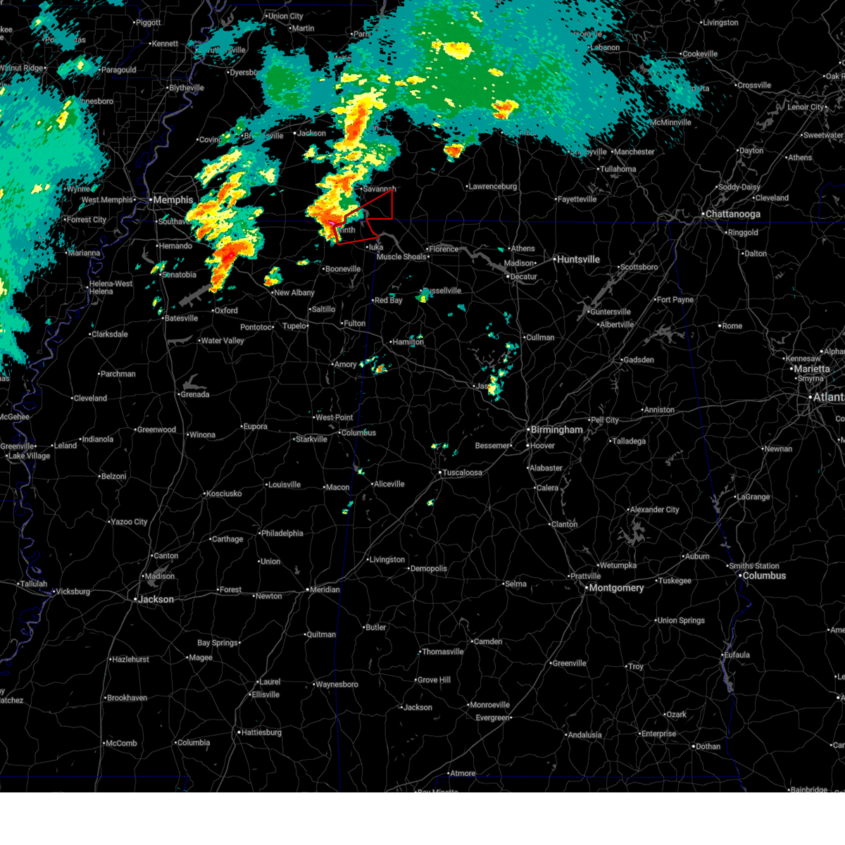 Tormeg the national weather service in memphis has issued a * tornado warning for, northern tishomingo county in northeastern mississippi, northeastern alcorn county in northeastern mississippi, southern hardin county in west tennessee, * until 530 pm cdt. * at 448 pm cdt, a severe thunderstorm capable of producing a tornado was located near glen, or 8 miles east of corinth, moving east at 60 mph (radar indicated rotation). Hazards include tornado and quarter size hail. Flying debris will be dangerous to those caught without shelter. mobile homes will be damaged or destroyed. damage to roofs, windows, and vehicles will occur. Tree damage is likely. Tormeg the national weather service in memphis has issued a * tornado warning for, northern tishomingo county in northeastern mississippi, northeastern alcorn county in northeastern mississippi, southern hardin county in west tennessee, * until 530 pm cdt. * at 448 pm cdt, a severe thunderstorm capable of producing a tornado was located near glen, or 8 miles east of corinth, moving east at 60 mph (radar indicated rotation). Hazards include tornado and quarter size hail. Flying debris will be dangerous to those caught without shelter. mobile homes will be damaged or destroyed. damage to roofs, windows, and vehicles will occur. Tree damage is likely.
|
| 4/3/2025 4:31 PM CDT |
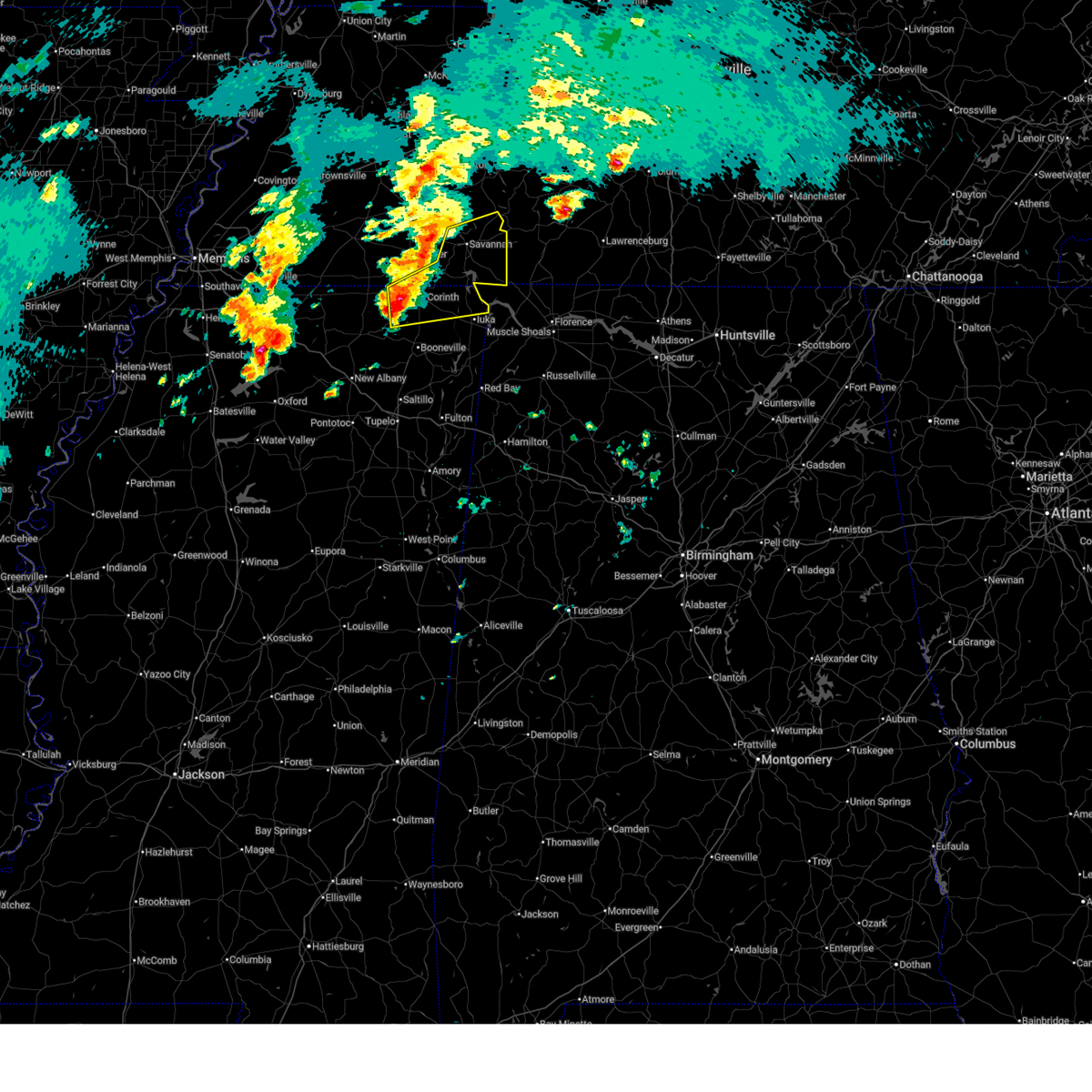 Svrmeg the national weather service in memphis has issued a * severe thunderstorm warning for, northern tishomingo county in northeastern mississippi, alcorn county in northeastern mississippi, southeastern mcnairy county in west tennessee, hardin county in west tennessee, * until 545 pm cdt. * at 431 pm cdt, a severe thunderstorm was located near theo, or 8 miles southwest of corinth, moving northeast at 45 mph (radar indicated). Hazards include 60 mph wind gusts and quarter size hail. Hail damage to vehicles is expected. Expect wind damage to roofs, siding, and trees. Svrmeg the national weather service in memphis has issued a * severe thunderstorm warning for, northern tishomingo county in northeastern mississippi, alcorn county in northeastern mississippi, southeastern mcnairy county in west tennessee, hardin county in west tennessee, * until 545 pm cdt. * at 431 pm cdt, a severe thunderstorm was located near theo, or 8 miles southwest of corinth, moving northeast at 45 mph (radar indicated). Hazards include 60 mph wind gusts and quarter size hail. Hail damage to vehicles is expected. Expect wind damage to roofs, siding, and trees.
|
| 4/3/2025 3:43 AM CDT |
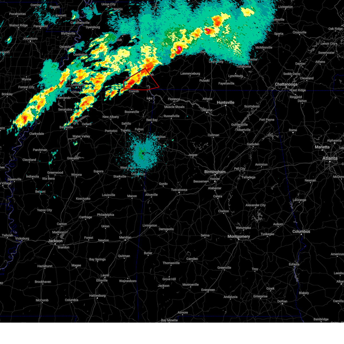 At 343 am cdt, a severe thunderstorm capable of producing a tornado was located near selmer, moving northeast at 50 mph (radar indicated rotation). Hazards include tornado. Flying debris will be dangerous to those caught without shelter. mobile homes will be damaged or destroyed. damage to roofs, windows, and vehicles will occur. tree damage is likely. Locations impacted include, selmer, pickwick dam, eastview, adamsville, guys, crump, bruton branch, pickwick landing state park, acton, hurley, ramer, walkertown, chambers, mount vinson, new lawton, martin camp, damon, savannah, michie, and caffey. At 343 am cdt, a severe thunderstorm capable of producing a tornado was located near selmer, moving northeast at 50 mph (radar indicated rotation). Hazards include tornado. Flying debris will be dangerous to those caught without shelter. mobile homes will be damaged or destroyed. damage to roofs, windows, and vehicles will occur. tree damage is likely. Locations impacted include, selmer, pickwick dam, eastview, adamsville, guys, crump, bruton branch, pickwick landing state park, acton, hurley, ramer, walkertown, chambers, mount vinson, new lawton, martin camp, damon, savannah, michie, and caffey.
|
| 4/3/2025 3:43 AM CDT |
 the tornado warning has been cancelled and is no longer in effect the tornado warning has been cancelled and is no longer in effect
|
| 4/3/2025 3:23 AM CDT |
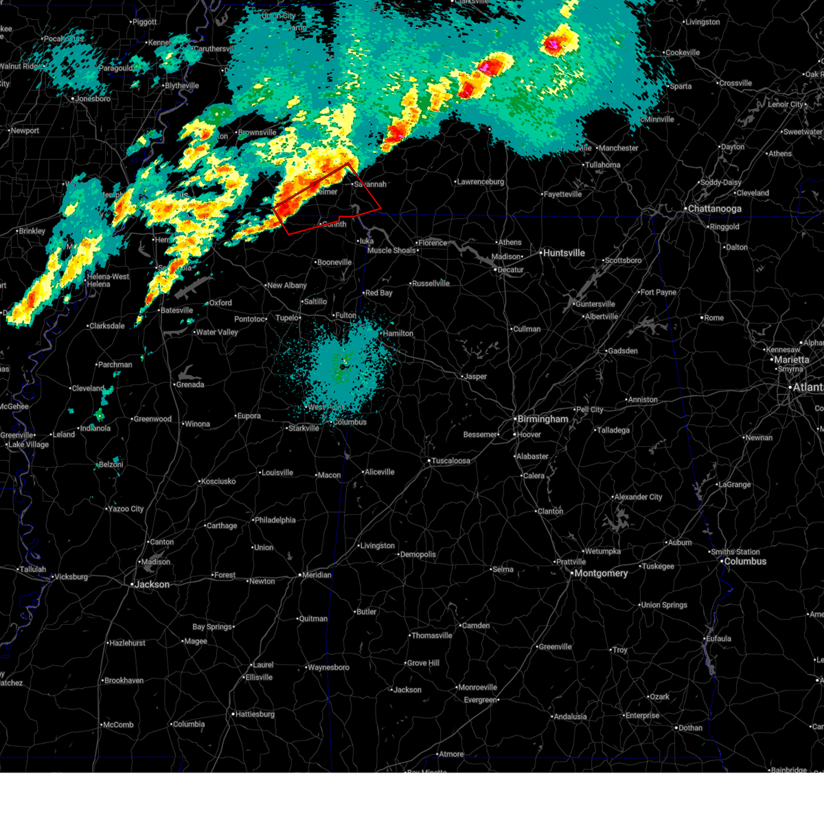 Tormeg the national weather service in memphis has issued a * tornado warning for, north central tippah county in northeastern mississippi, northern alcorn county in northeastern mississippi, southeastern hardeman county in west tennessee, mcnairy county in west tennessee, southwestern hardin county in west tennessee, * until 415 am cdt. * at 322 am cdt, a severe thunderstorm capable of producing a tornado was located near pocahontas, or 7 miles southwest of big hill pond state park, moving northeast at 50 mph (radar indicated rotation). Hazards include tornado. Flying debris will be dangerous to those caught without shelter. mobile homes will be damaged or destroyed. damage to roofs, windows, and vehicles will occur. Tree damage is likely. Tormeg the national weather service in memphis has issued a * tornado warning for, north central tippah county in northeastern mississippi, northern alcorn county in northeastern mississippi, southeastern hardeman county in west tennessee, mcnairy county in west tennessee, southwestern hardin county in west tennessee, * until 415 am cdt. * at 322 am cdt, a severe thunderstorm capable of producing a tornado was located near pocahontas, or 7 miles southwest of big hill pond state park, moving northeast at 50 mph (radar indicated rotation). Hazards include tornado. Flying debris will be dangerous to those caught without shelter. mobile homes will be damaged or destroyed. damage to roofs, windows, and vehicles will occur. Tree damage is likely.
|
| 4/3/2025 2:39 AM CDT |
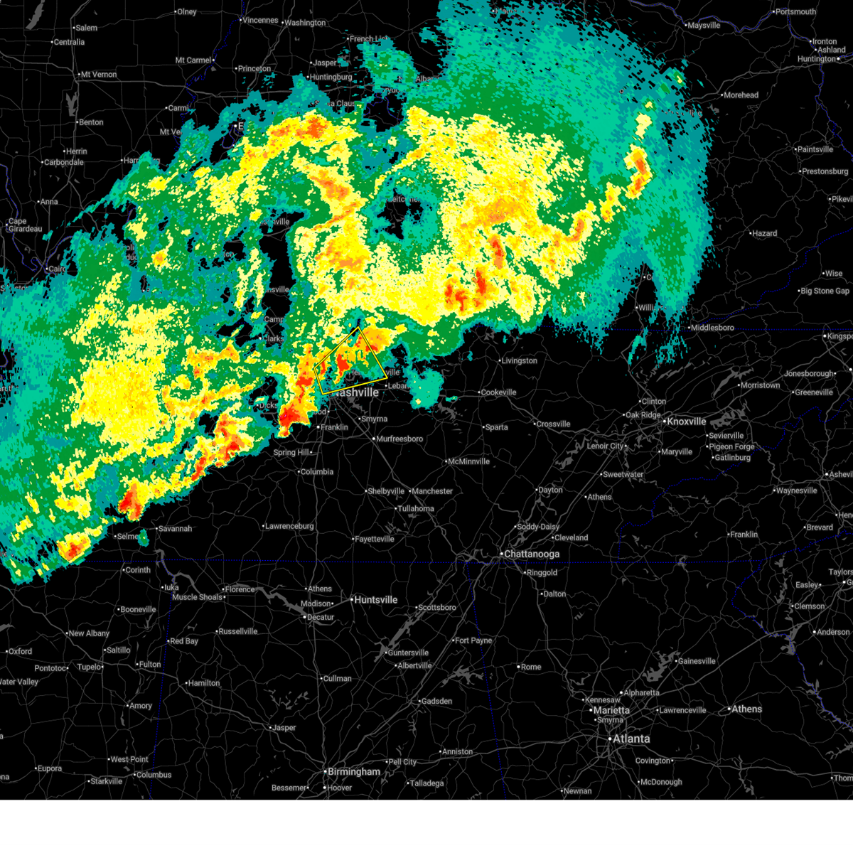 The storm which prompted the warning has weakened below severe limits, and no longer poses an immediate threat to life or property. therefore, the warning will be allowed to expire. a tornado watch remains in effect until 600 am cdt for middle tennessee. The storm which prompted the warning has weakened below severe limits, and no longer poses an immediate threat to life or property. therefore, the warning will be allowed to expire. a tornado watch remains in effect until 600 am cdt for middle tennessee.
|
| 4/3/2025 2:30 AM CDT |
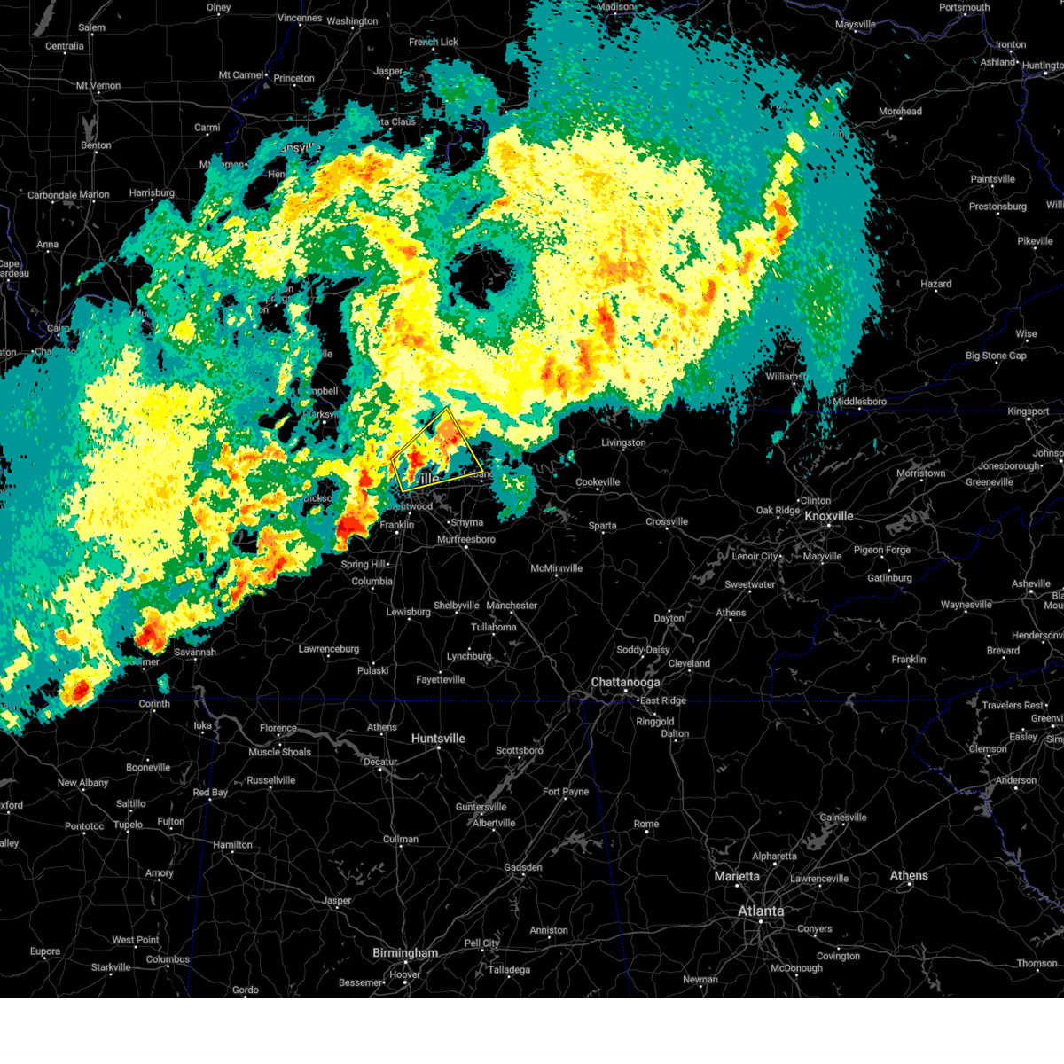 the severe thunderstorm warning has been cancelled and is no longer in effect the severe thunderstorm warning has been cancelled and is no longer in effect
|
| 4/3/2025 2:30 AM CDT |
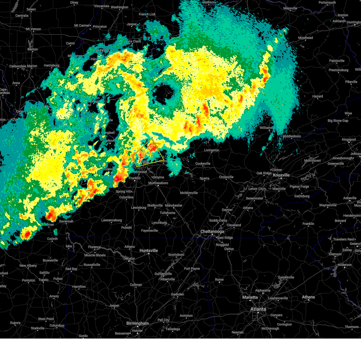 At 229 am cdt, a severe thunderstorm was located near gallatin, moving northeast at 45 mph (radar indicated). Hazards include 60 mph wind gusts and quarter size hail. Hail damage to vehicles is expected. expect wind damage to roofs, siding, and trees. locations impacted include, green hill, madison, portland, ridgetop, hermitage, goodlettsville, millersville, gallatin, nashville, white house, whites creek, lakewood, hendersonville, cottontown, old hickory, joelton, mount juliet, greenbrier, cross plains, and lebanon. this includes the following highways, interstate 40 between mile markers 206 and 208. interstate 65 between mile markers 85 and 112. Interstate 24 between mile markers 34 and 49. At 229 am cdt, a severe thunderstorm was located near gallatin, moving northeast at 45 mph (radar indicated). Hazards include 60 mph wind gusts and quarter size hail. Hail damage to vehicles is expected. expect wind damage to roofs, siding, and trees. locations impacted include, green hill, madison, portland, ridgetop, hermitage, goodlettsville, millersville, gallatin, nashville, white house, whites creek, lakewood, hendersonville, cottontown, old hickory, joelton, mount juliet, greenbrier, cross plains, and lebanon. this includes the following highways, interstate 40 between mile markers 206 and 208. interstate 65 between mile markers 85 and 112. Interstate 24 between mile markers 34 and 49.
|
| 4/3/2025 2:16 AM CDT |
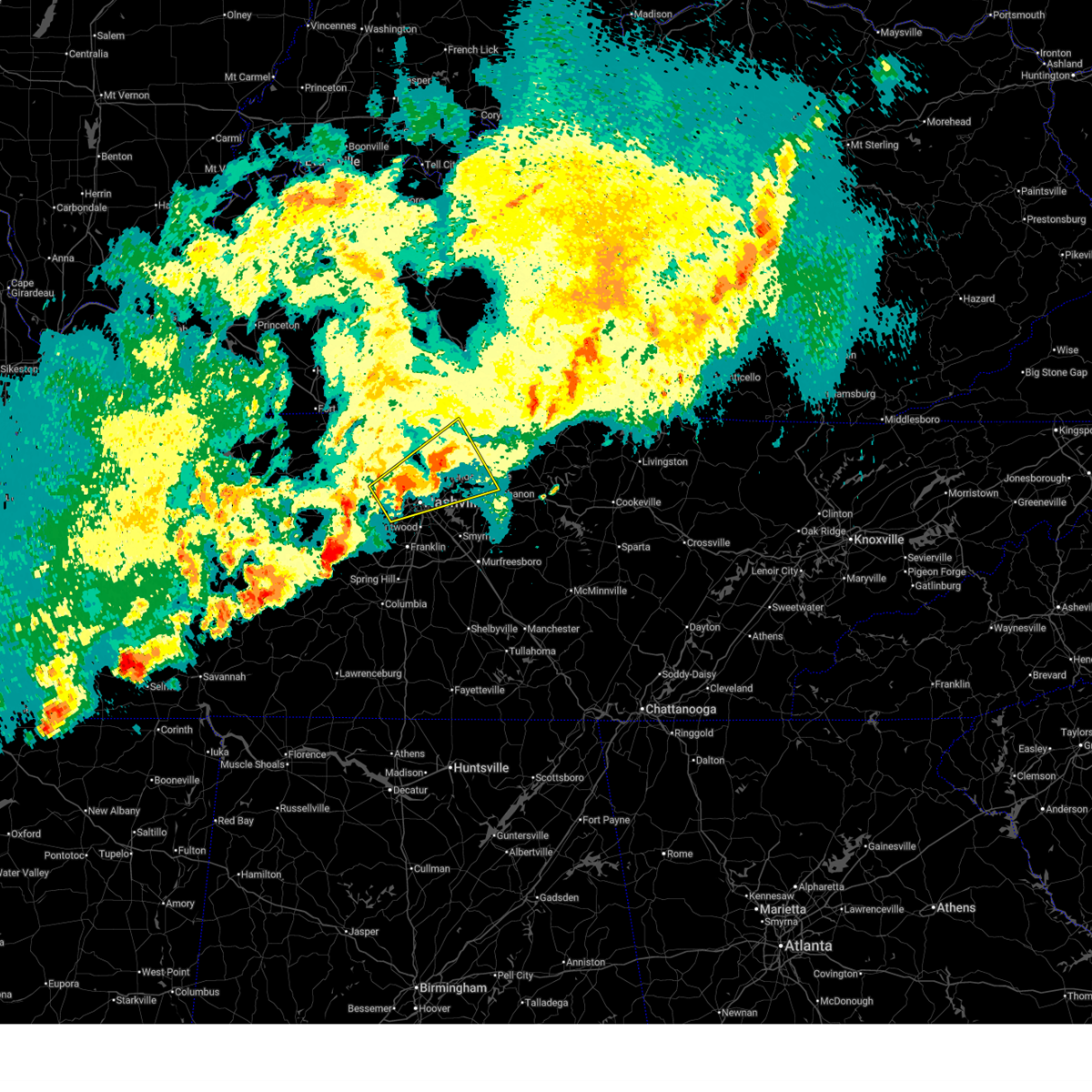 At 216 am cdt, a severe thunderstorm was located over goodlettsville, or 12 miles northeast of nashville, moving northeast at 45 mph (radar indicated). Hazards include 60 mph wind gusts and quarter size hail. Hail damage to vehicles is expected. expect wind damage to roofs, siding, and trees. locations impacted include, madison, portland, hermitage, belle meade, millersville, gallatin, hendersonville, greenbrier, berry hill, cottontown, mount juliet, ashland city, green hill, ridgetop, goodlettsville, bells bend, nashville, white house, whites creek, and bellevue. this includes the following highways, interstate 40 between mile markers 195 and 226. interstate 65 between mile markers 80 and 113. Interstate 24 between mile markers 31 and 52. At 216 am cdt, a severe thunderstorm was located over goodlettsville, or 12 miles northeast of nashville, moving northeast at 45 mph (radar indicated). Hazards include 60 mph wind gusts and quarter size hail. Hail damage to vehicles is expected. expect wind damage to roofs, siding, and trees. locations impacted include, madison, portland, hermitage, belle meade, millersville, gallatin, hendersonville, greenbrier, berry hill, cottontown, mount juliet, ashland city, green hill, ridgetop, goodlettsville, bells bend, nashville, white house, whites creek, and bellevue. this includes the following highways, interstate 40 between mile markers 195 and 226. interstate 65 between mile markers 80 and 113. Interstate 24 between mile markers 31 and 52.
|
| 4/3/2025 2:16 AM CDT |
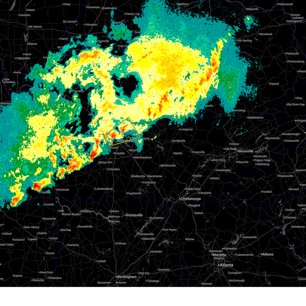 the severe thunderstorm warning has been cancelled and is no longer in effect the severe thunderstorm warning has been cancelled and is no longer in effect
|
| 4/3/2025 2:00 AM CDT |
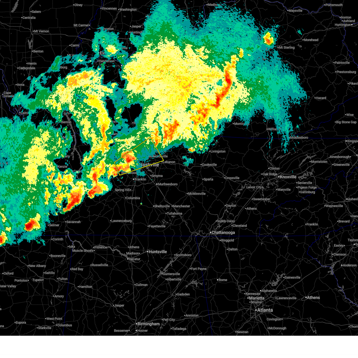 Svrohx the national weather service in nashville has issued a * severe thunderstorm warning for, davidson county in middle tennessee, east central dickson county in middle tennessee, western sumner county in middle tennessee, northwestern williamson county in middle tennessee, northwestern wilson county in middle tennessee, cheatham county in middle tennessee, southeastern robertson county in middle tennessee, * until 245 am cdt. * at 200 am cdt, a severe thunderstorm was located near joelton, or 8 miles northwest of nashville, moving northeast at 45 mph (radar indicated). Hazards include 60 mph wind gusts and quarter size hail. Hail damage to vehicles is expected. Expect wind damage to roofs, siding, and trees. Svrohx the national weather service in nashville has issued a * severe thunderstorm warning for, davidson county in middle tennessee, east central dickson county in middle tennessee, western sumner county in middle tennessee, northwestern williamson county in middle tennessee, northwestern wilson county in middle tennessee, cheatham county in middle tennessee, southeastern robertson county in middle tennessee, * until 245 am cdt. * at 200 am cdt, a severe thunderstorm was located near joelton, or 8 miles northwest of nashville, moving northeast at 45 mph (radar indicated). Hazards include 60 mph wind gusts and quarter size hail. Hail damage to vehicles is expected. Expect wind damage to roofs, siding, and trees.
|
| 4/3/2025 1:32 AM CDT |
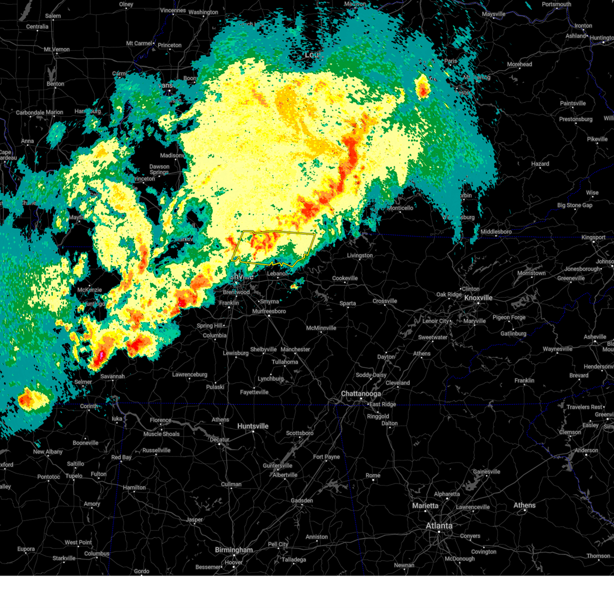 the severe thunderstorm warning has been cancelled and is no longer in effect the severe thunderstorm warning has been cancelled and is no longer in effect
|
| 4/3/2025 12:54 AM CDT |
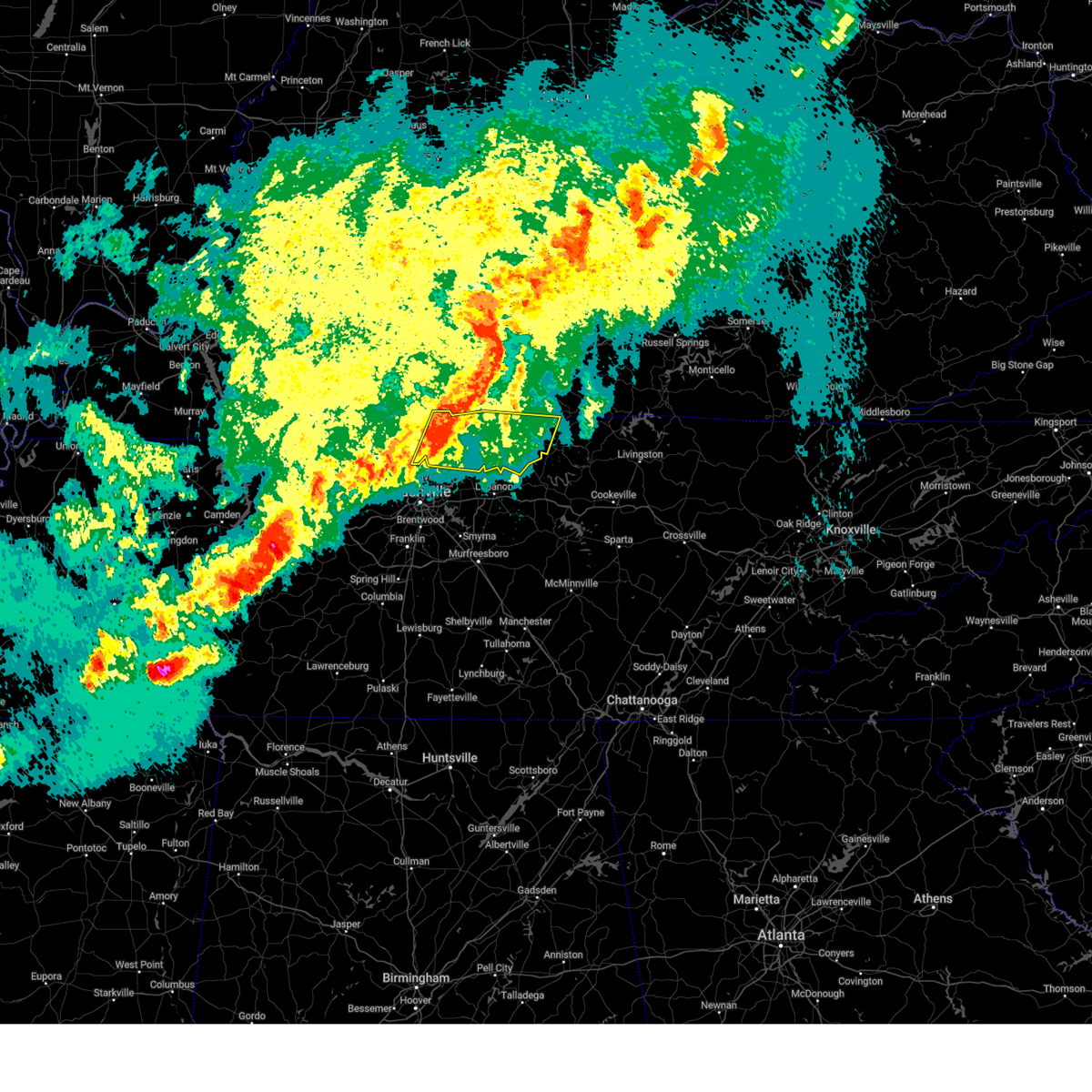 Svrohx the national weather service in nashville has issued a * severe thunderstorm warning for, sumner county in middle tennessee, macon county in middle tennessee, trousdale county in middle tennessee, eastern robertson county in middle tennessee, * until 200 am cdt. * at 1254 am cdt, severe thunderstorms were located along a line extending from 7 miles north of portland to near joelton, moving east at 45 mph (radar indicated). Hazards include 60 mph wind gusts and nickel size hail. expect damage to roofs, siding, and trees Svrohx the national weather service in nashville has issued a * severe thunderstorm warning for, sumner county in middle tennessee, macon county in middle tennessee, trousdale county in middle tennessee, eastern robertson county in middle tennessee, * until 200 am cdt. * at 1254 am cdt, severe thunderstorms were located along a line extending from 7 miles north of portland to near joelton, moving east at 45 mph (radar indicated). Hazards include 60 mph wind gusts and nickel size hail. expect damage to roofs, siding, and trees
|
| 4/3/2025 12:46 AM CDT |
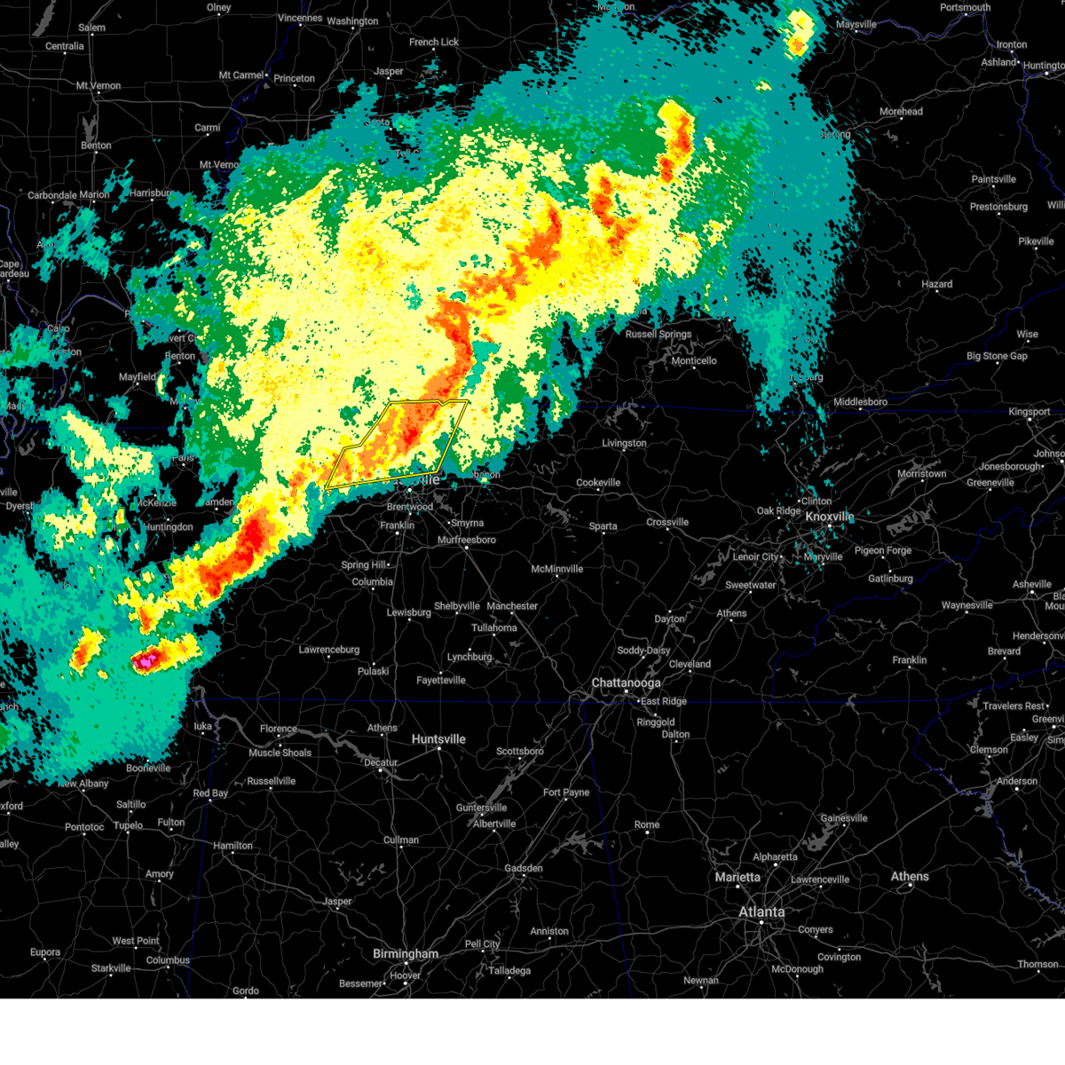 At 1246 am cdt, severe thunderstorms were located along a line extending from 9 miles north of portland to near ashland city, moving east at 50 mph (radar indicated). Hazards include 60 mph wind gusts and quarter size hail. Hail damage to vehicles is expected. expect wind damage to roofs, siding, and trees. locations impacted include, madison, charlotte, portland, ridgetop, cheatham dam, goodlettsville, mitchellville, millersville, white house, whites creek, hendersonville, greenbrier, cottontown, orlinda, pleasant view, cross plains, beaman park, springfield, old hickory, and ashland city. this includes the following highways, interstate 65 between mile markers 91 and 121. Interstate 24 between mile markers 20 and 43. At 1246 am cdt, severe thunderstorms were located along a line extending from 9 miles north of portland to near ashland city, moving east at 50 mph (radar indicated). Hazards include 60 mph wind gusts and quarter size hail. Hail damage to vehicles is expected. expect wind damage to roofs, siding, and trees. locations impacted include, madison, charlotte, portland, ridgetop, cheatham dam, goodlettsville, mitchellville, millersville, white house, whites creek, hendersonville, greenbrier, cottontown, orlinda, pleasant view, cross plains, beaman park, springfield, old hickory, and ashland city. this includes the following highways, interstate 65 between mile markers 91 and 121. Interstate 24 between mile markers 20 and 43.
|
| 4/3/2025 12:32 AM CDT |
 the severe thunderstorm warning has been cancelled and is no longer in effect the severe thunderstorm warning has been cancelled and is no longer in effect
|
| 4/3/2025 12:32 AM CDT |
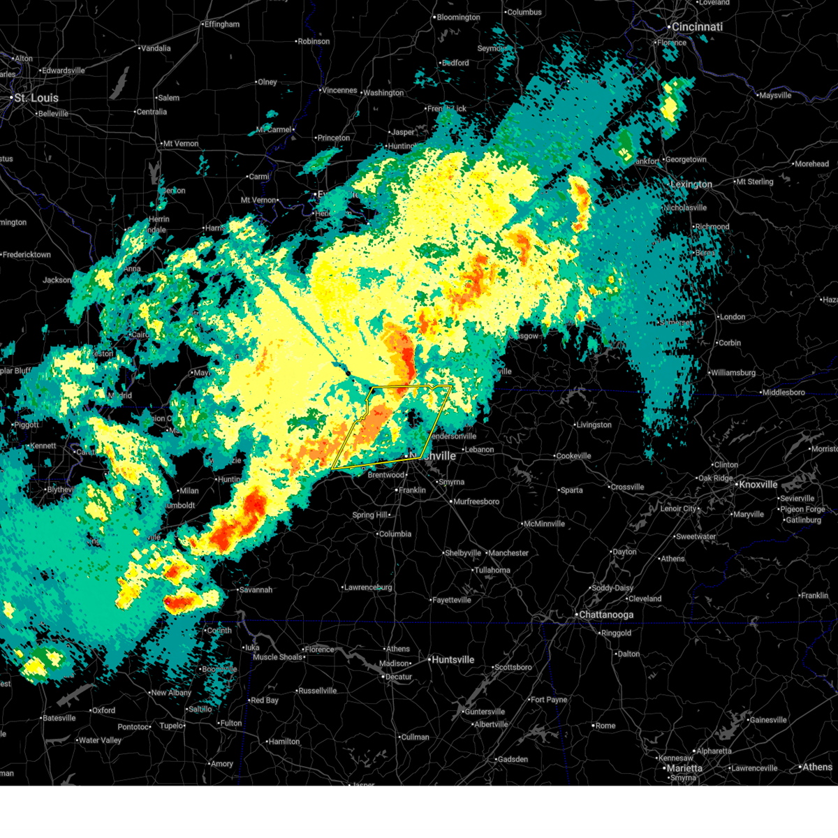 At 1231 am cdt, severe thunderstorms were located along a line extending from 8 miles north of cross plains to 7 miles northwest of white bluff, moving east at 50 mph (radar indicated). Hazards include 60 mph wind gusts and quarter size hail. Hail damage to vehicles is expected. expect wind damage to roofs, siding, and trees. locations impacted include, madison, charlotte, portland, millersville, hendersonville, greenbrier, cottontown, orlinda, pleasant view, cedar hill, ashland city, white bluff, ridgetop, cheatham dam, goodlettsville, adams, mitchellville, bells bend, nashville, and white house. this includes the following highways, interstate 40 between mile markers 201 and 212. interstate 65 between mile markers 82 and 121. Interstate 24 between mile markers 18 and 49. At 1231 am cdt, severe thunderstorms were located along a line extending from 8 miles north of cross plains to 7 miles northwest of white bluff, moving east at 50 mph (radar indicated). Hazards include 60 mph wind gusts and quarter size hail. Hail damage to vehicles is expected. expect wind damage to roofs, siding, and trees. locations impacted include, madison, charlotte, portland, millersville, hendersonville, greenbrier, cottontown, orlinda, pleasant view, cedar hill, ashland city, white bluff, ridgetop, cheatham dam, goodlettsville, adams, mitchellville, bells bend, nashville, and white house. this includes the following highways, interstate 40 between mile markers 201 and 212. interstate 65 between mile markers 82 and 121. Interstate 24 between mile markers 18 and 49.
|
| 4/3/2025 12:07 AM CDT |
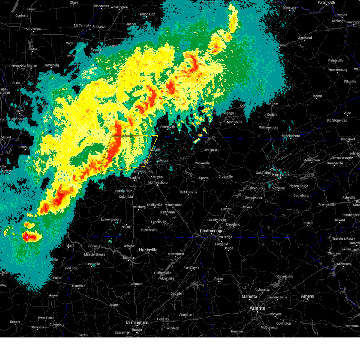 Svrohx the national weather service in nashville has issued a * severe thunderstorm warning for, central davidson county in middle tennessee, dickson county in middle tennessee, eastern montgomery county in middle tennessee, western sumner county in middle tennessee, cheatham county in middle tennessee, robertson county in middle tennessee, * until 100 am cdt. * at 1206 am cdt, severe thunderstorms were located along a line extending from near guthrie to 8 miles northwest of dickson, moving east at 50 mph (radar indicated). Hazards include 60 mph wind gusts and quarter size hail. Hail damage to vehicles is expected. Expect wind damage to roofs, siding, and trees. Svrohx the national weather service in nashville has issued a * severe thunderstorm warning for, central davidson county in middle tennessee, dickson county in middle tennessee, eastern montgomery county in middle tennessee, western sumner county in middle tennessee, cheatham county in middle tennessee, robertson county in middle tennessee, * until 100 am cdt. * at 1206 am cdt, severe thunderstorms were located along a line extending from near guthrie to 8 miles northwest of dickson, moving east at 50 mph (radar indicated). Hazards include 60 mph wind gusts and quarter size hail. Hail damage to vehicles is expected. Expect wind damage to roofs, siding, and trees.
|
| 4/2/2025 7:15 PM CDT |
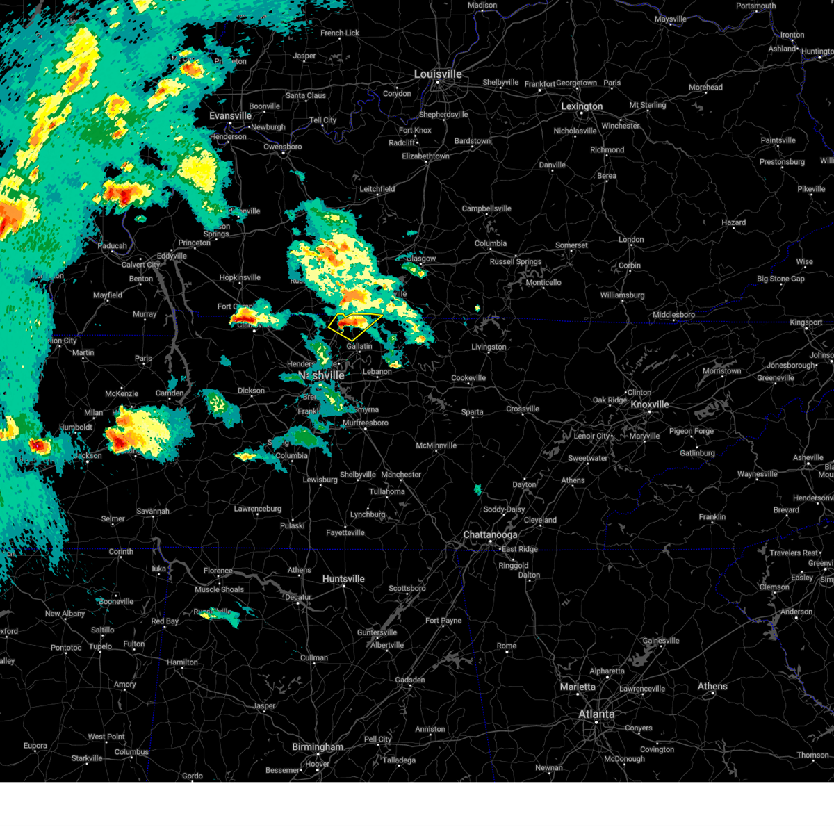 the severe thunderstorm warning has been cancelled and is no longer in effect the severe thunderstorm warning has been cancelled and is no longer in effect
|
| 4/2/2025 7:05 PM CDT |
 The storm which prompted the warning has moved out of the area. therefore, the warning will be allowed to expire. a tornado watch remains in effect until midnight cdt for middle tennessee. to report severe weather, contact your nearest law enforcement agency. they will relay your report to the national weather service nashville. The storm which prompted the warning has moved out of the area. therefore, the warning will be allowed to expire. a tornado watch remains in effect until midnight cdt for middle tennessee. to report severe weather, contact your nearest law enforcement agency. they will relay your report to the national weather service nashville.
|
| 4/2/2025 6:55 PM CDT |
 At 655 pm cdt, a severe thunderstorm was located near cross plains, or 13 miles northwest of gallatin, moving northeast at 45 mph (radar indicated). Hazards include 60 mph wind gusts and quarter size hail. Hail damage to vehicles is expected. expect wind damage to roofs, siding, and trees. locations impacted include, cross plains and orlinda. This includes interstate 65 between mile markers 112 and 114. At 655 pm cdt, a severe thunderstorm was located near cross plains, or 13 miles northwest of gallatin, moving northeast at 45 mph (radar indicated). Hazards include 60 mph wind gusts and quarter size hail. Hail damage to vehicles is expected. expect wind damage to roofs, siding, and trees. locations impacted include, cross plains and orlinda. This includes interstate 65 between mile markers 112 and 114.
|
| 4/2/2025 6:54 PM CDT |
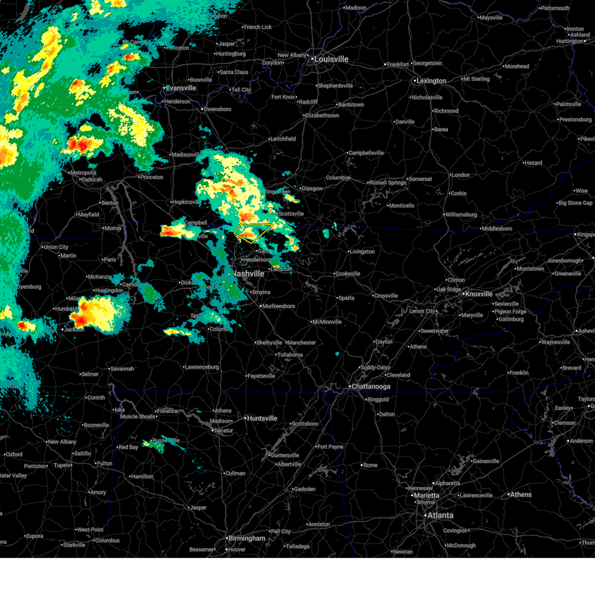 Svrohx the national weather service in nashville has issued a * severe thunderstorm warning for, northwestern sumner county in middle tennessee, northeastern robertson county in middle tennessee, * until 730 pm cdt. * at 653 pm cdt, a severe thunderstorm was located near cross plains, or 13 miles northwest of gallatin, moving northeast at 50 mph (radar indicated). Hazards include 60 mph wind gusts and quarter size hail. Hail damage to vehicles is expected. Expect wind damage to roofs, siding, and trees. Svrohx the national weather service in nashville has issued a * severe thunderstorm warning for, northwestern sumner county in middle tennessee, northeastern robertson county in middle tennessee, * until 730 pm cdt. * at 653 pm cdt, a severe thunderstorm was located near cross plains, or 13 miles northwest of gallatin, moving northeast at 50 mph (radar indicated). Hazards include 60 mph wind gusts and quarter size hail. Hail damage to vehicles is expected. Expect wind damage to roofs, siding, and trees.
|
| 4/2/2025 6:40 PM CDT |
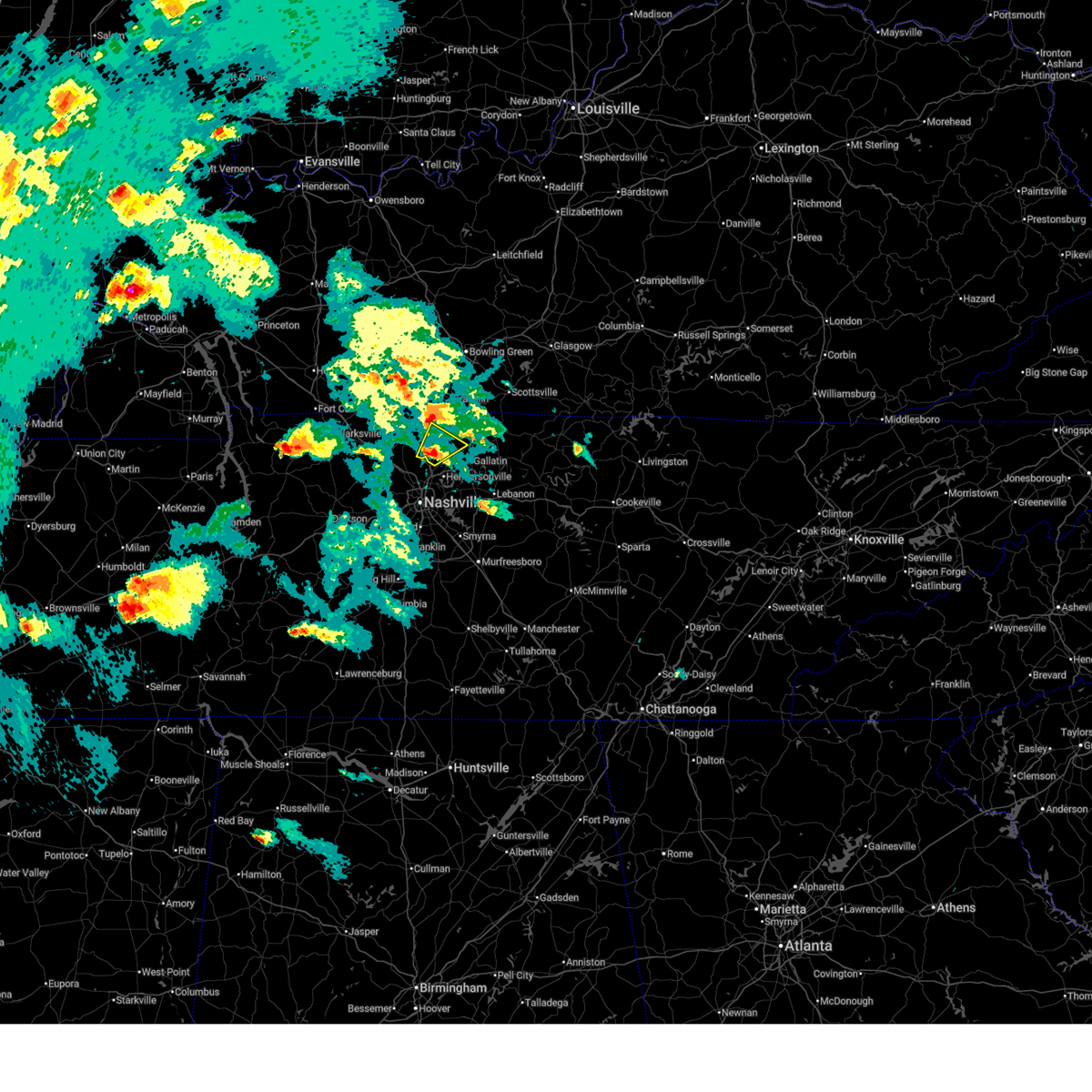 At 640 pm cdt, a severe thunderstorm was located over millersville, or 10 miles southeast of springfield, moving northeast at 50 mph (radar indicated). Hazards include 60 mph wind gusts and quarter size hail. Hail damage to vehicles is expected. expect wind damage to roofs, siding, and trees. locations impacted include, greenbrier, cottontown, cross plains, millersville, white house, ridgetop, orlinda, and goodlettsville. This includes interstate 65 between mile markers 101 and 114. At 640 pm cdt, a severe thunderstorm was located over millersville, or 10 miles southeast of springfield, moving northeast at 50 mph (radar indicated). Hazards include 60 mph wind gusts and quarter size hail. Hail damage to vehicles is expected. expect wind damage to roofs, siding, and trees. locations impacted include, greenbrier, cottontown, cross plains, millersville, white house, ridgetop, orlinda, and goodlettsville. This includes interstate 65 between mile markers 101 and 114.
|
| 4/2/2025 6:40 PM CDT |
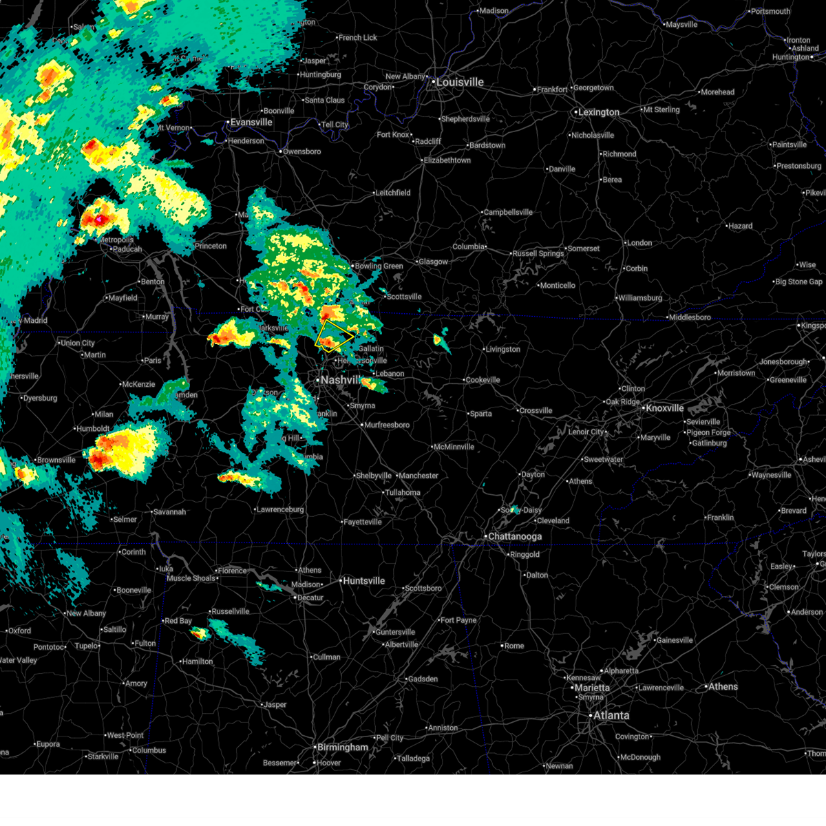 the severe thunderstorm warning has been cancelled and is no longer in effect the severe thunderstorm warning has been cancelled and is no longer in effect
|
| 4/2/2025 6:27 PM CDT |
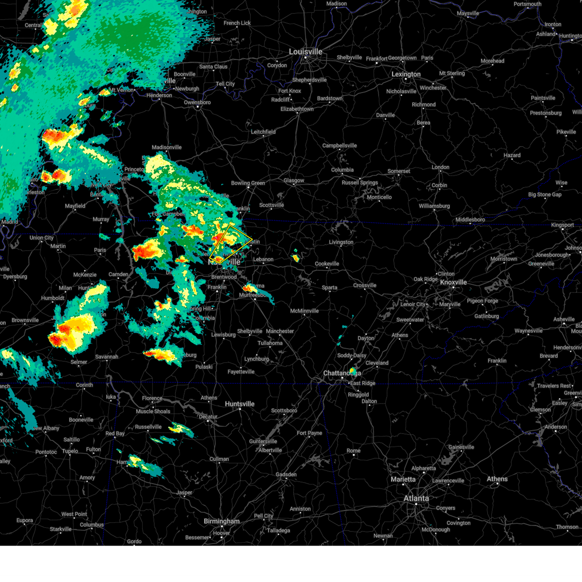 Svrohx the national weather service in nashville has issued a * severe thunderstorm warning for, northwestern davidson county in middle tennessee, southwestern sumner county in middle tennessee, eastern robertson county in middle tennessee, * until 715 pm cdt. * at 627 pm cdt, a severe thunderstorm was located over joelton, or 8 miles north of nashville, moving northeast at 50 mph (radar indicated). Hazards include 60 mph wind gusts and quarter size hail. Hail damage to vehicles is expected. Expect wind damage to roofs, siding, and trees. Svrohx the national weather service in nashville has issued a * severe thunderstorm warning for, northwestern davidson county in middle tennessee, southwestern sumner county in middle tennessee, eastern robertson county in middle tennessee, * until 715 pm cdt. * at 627 pm cdt, a severe thunderstorm was located over joelton, or 8 miles north of nashville, moving northeast at 50 mph (radar indicated). Hazards include 60 mph wind gusts and quarter size hail. Hail damage to vehicles is expected. Expect wind damage to roofs, siding, and trees.
|
| 4/2/2025 6:21 PM CDT |
 Svrohx the national weather service in nashville has issued a * severe thunderstorm warning for, northwestern sumner county in middle tennessee, robertson county in middle tennessee, * until 700 pm cdt. * at 621 pm cdt, a severe thunderstorm was located near coopertown, or near springfield, moving northeast at 45 mph (radar indicated). Hazards include golf ball size hail and 60 mph wind gusts. People and animals outdoors will be injured. expect hail damage to roofs, siding, windows, and vehicles. Expect wind damage to roofs, siding, and trees. Svrohx the national weather service in nashville has issued a * severe thunderstorm warning for, northwestern sumner county in middle tennessee, robertson county in middle tennessee, * until 700 pm cdt. * at 621 pm cdt, a severe thunderstorm was located near coopertown, or near springfield, moving northeast at 45 mph (radar indicated). Hazards include golf ball size hail and 60 mph wind gusts. People and animals outdoors will be injured. expect hail damage to roofs, siding, windows, and vehicles. Expect wind damage to roofs, siding, and trees.
|
| 4/2/2025 4:54 PM CDT |
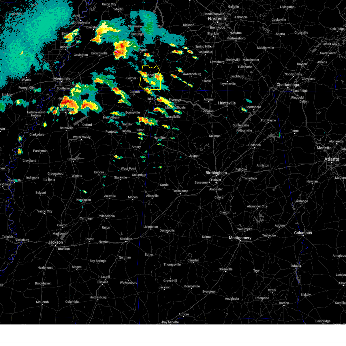 the severe thunderstorm warning has been cancelled and is no longer in effect the severe thunderstorm warning has been cancelled and is no longer in effect
|
| 4/2/2025 4:51 PM CDT |
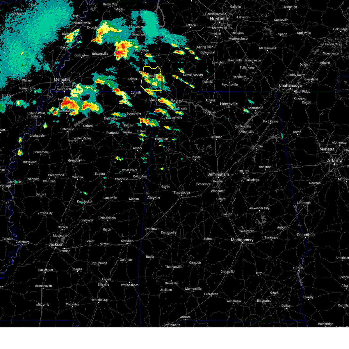 the severe thunderstorm warning has been cancelled and is no longer in effect the severe thunderstorm warning has been cancelled and is no longer in effect
|
| 4/2/2025 4:51 PM CDT |
 At 450 pm cdt, a severe thunderstorm was located near savannah, moving north at 55 mph (radar indicated). Hazards include 60 mph wind gusts and quarter size hail. Hail damage to vehicles is expected. expect wind damage to roofs, siding, and trees. Locations impacted include, shiloh national military park, saltillo, walnut grove, pickwick dam, right, hamburg, pineflat, crump, phillips, bruton branch, pickwick landing state park, hinkle, hurley, walkertown, olivehill, cerro gordo, red sulphur springs, chambers, counce, and lowryville. At 450 pm cdt, a severe thunderstorm was located near savannah, moving north at 55 mph (radar indicated). Hazards include 60 mph wind gusts and quarter size hail. Hail damage to vehicles is expected. expect wind damage to roofs, siding, and trees. Locations impacted include, shiloh national military park, saltillo, walnut grove, pickwick dam, right, hamburg, pineflat, crump, phillips, bruton branch, pickwick landing state park, hinkle, hurley, walkertown, olivehill, cerro gordo, red sulphur springs, chambers, counce, and lowryville.
|
| 4/2/2025 4:34 PM CDT |
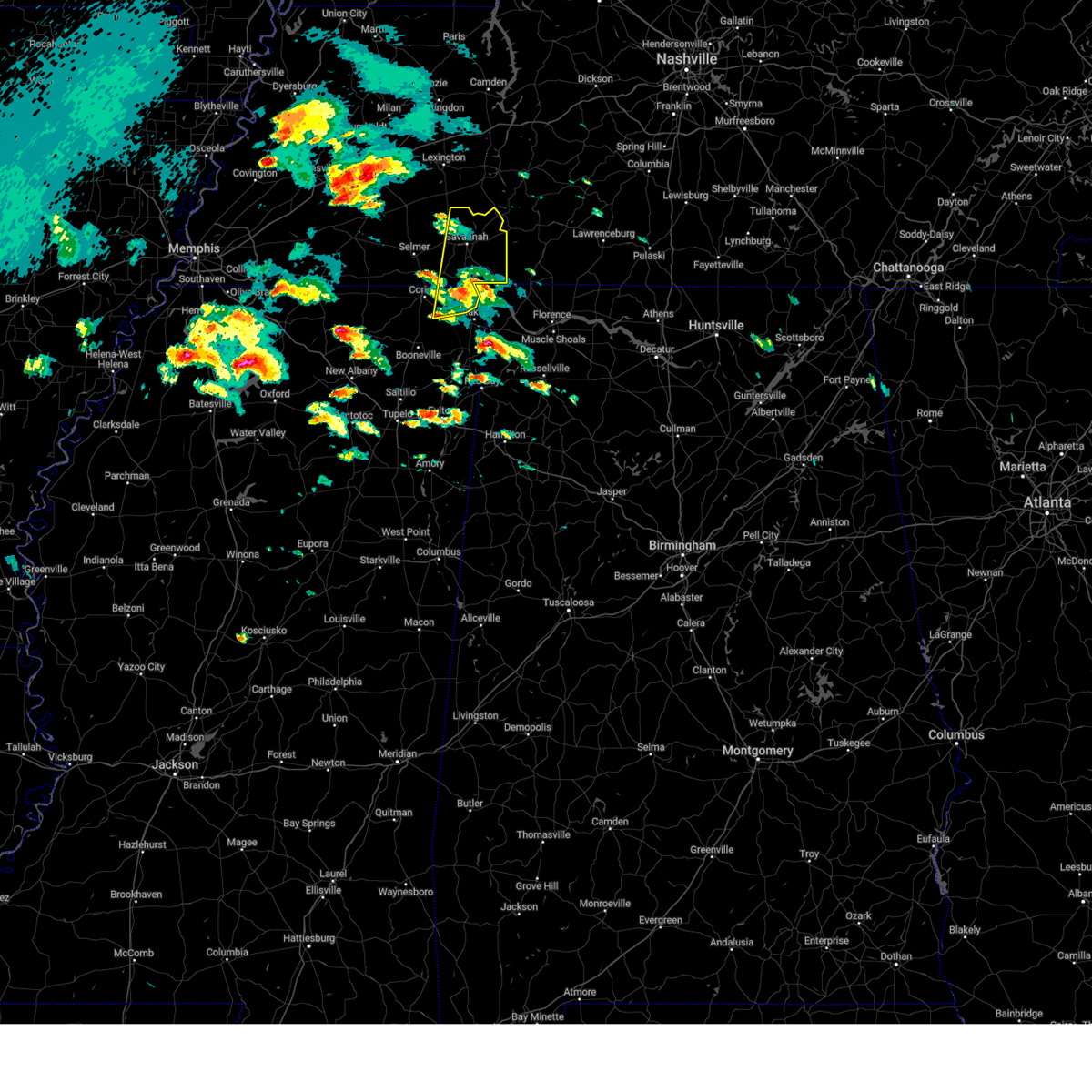 At 434 pm cdt, a severe thunderstorm was located over pickwick landing state park, moving north at 55 mph (radar indicated). Hazards include 60 mph wind gusts and quarter size hail. Hail damage to vehicles is expected. expect wind damage to roofs, siding, and trees. Locations impacted include, pickwick dam, crump, bruton branch, pickwick landing state park, hurley, walkertown, cerro gordo, chambers, mount vinson, damon, savannah, childers hill, center star, kendrick, morris chapel, swift, shiloh, farmington, coffee landing, and shiloh national military park. At 434 pm cdt, a severe thunderstorm was located over pickwick landing state park, moving north at 55 mph (radar indicated). Hazards include 60 mph wind gusts and quarter size hail. Hail damage to vehicles is expected. expect wind damage to roofs, siding, and trees. Locations impacted include, pickwick dam, crump, bruton branch, pickwick landing state park, hurley, walkertown, cerro gordo, chambers, mount vinson, damon, savannah, childers hill, center star, kendrick, morris chapel, swift, shiloh, farmington, coffee landing, and shiloh national military park.
|
| 4/2/2025 4:22 PM CDT |
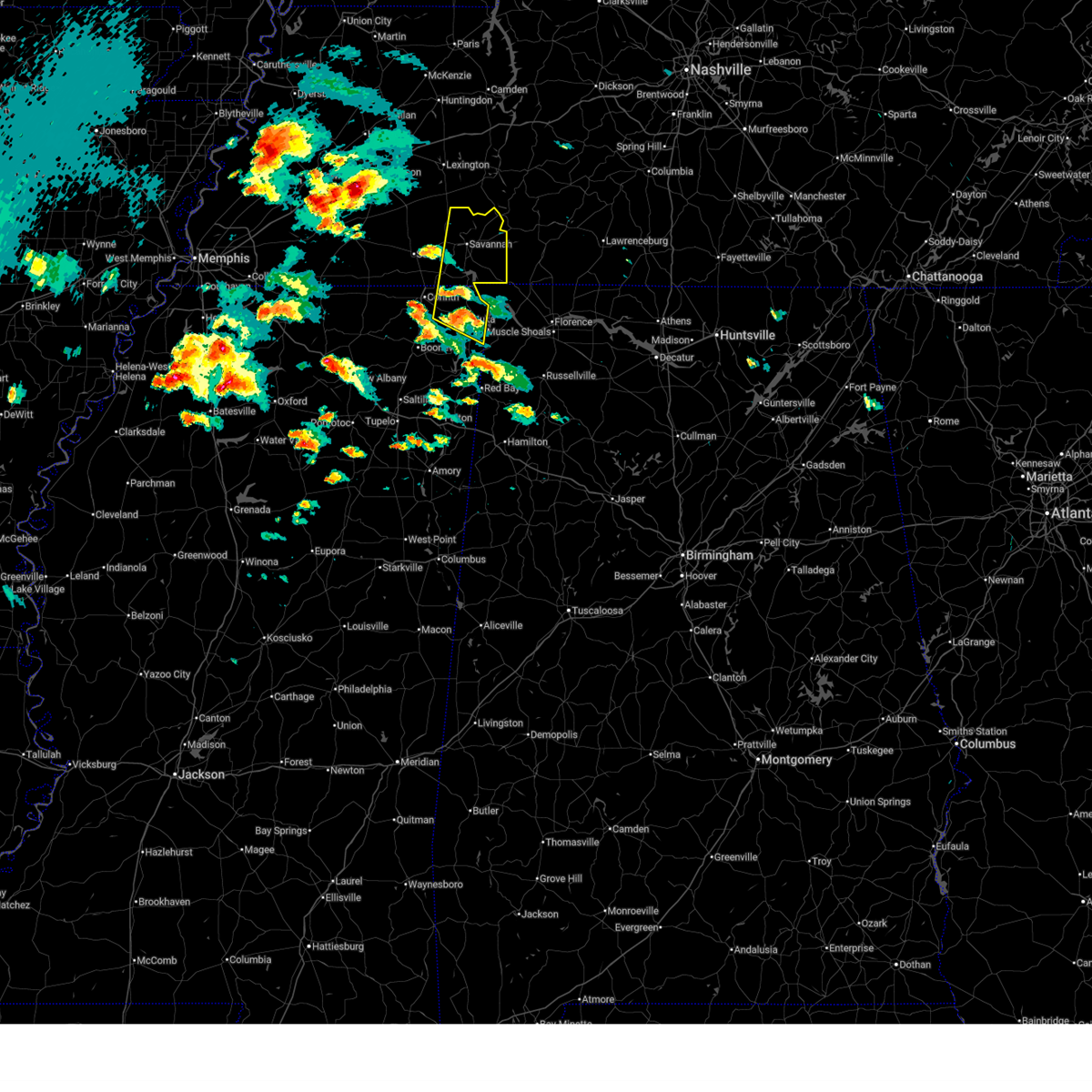 Svrmeg the national weather service in memphis has issued a * severe thunderstorm warning for, northern tishomingo county in northeastern mississippi, northeastern alcorn county in northeastern mississippi, southeastern mcnairy county in west tennessee, hardin county in west tennessee, * until 515 pm cdt. * at 422 pm cdt, a severe thunderstorm was located over burnsville, or near iuka, moving north at 55 mph (radar indicated). Hazards include 60 mph wind gusts and quarter size hail. Hail damage to vehicles is expected. Expect wind damage to roofs, siding, and trees. Svrmeg the national weather service in memphis has issued a * severe thunderstorm warning for, northern tishomingo county in northeastern mississippi, northeastern alcorn county in northeastern mississippi, southeastern mcnairy county in west tennessee, hardin county in west tennessee, * until 515 pm cdt. * at 422 pm cdt, a severe thunderstorm was located over burnsville, or near iuka, moving north at 55 mph (radar indicated). Hazards include 60 mph wind gusts and quarter size hail. Hail damage to vehicles is expected. Expect wind damage to roofs, siding, and trees.
|
| 3/31/2025 1:15 AM CDT |
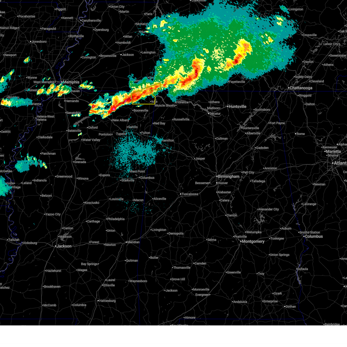 Svrmeg the national weather service in memphis has issued a * severe thunderstorm warning for, northern tishomingo county in northeastern mississippi, eastern alcorn county in northeastern mississippi, southern hardin county in west tennessee, * until 200 am cdt. * at 113 am cdt, a severe thunderstorm was located near glen, or near corinth, moving east at 50 mph (radar indicated. at 111 am, quarter sized hail was reported in pickwick, tn). Hazards include 60 mph wind gusts and quarter size hail. Hail damage to vehicles is expected. Expect wind damage to roofs, siding, and trees. Svrmeg the national weather service in memphis has issued a * severe thunderstorm warning for, northern tishomingo county in northeastern mississippi, eastern alcorn county in northeastern mississippi, southern hardin county in west tennessee, * until 200 am cdt. * at 113 am cdt, a severe thunderstorm was located near glen, or near corinth, moving east at 50 mph (radar indicated. at 111 am, quarter sized hail was reported in pickwick, tn). Hazards include 60 mph wind gusts and quarter size hail. Hail damage to vehicles is expected. Expect wind damage to roofs, siding, and trees.
|
| 3/31/2025 12:56 AM CDT |
 At 1256 am cdt, severe thunderstorms were located along a line extending from 7 miles west of lawrenceburg to near hinkle, moving east at 45 mph (radar indicated). Hazards include 60 mph wind gusts and half dollar size hail. Hail damage to vehicles is expected. expect wind damage to roofs, siding, and trees. Locations impacted include, chalybeate, pickwick dam, guys, bruton branch, pickwick landing state park, acton, hazard switch, hurley, theo, walkertown, corinth, tiplersville, chambers, bacon springs, kossuth, hightown, damon, michie, caffey, and crumtown. At 1256 am cdt, severe thunderstorms were located along a line extending from 7 miles west of lawrenceburg to near hinkle, moving east at 45 mph (radar indicated). Hazards include 60 mph wind gusts and half dollar size hail. Hail damage to vehicles is expected. expect wind damage to roofs, siding, and trees. Locations impacted include, chalybeate, pickwick dam, guys, bruton branch, pickwick landing state park, acton, hazard switch, hurley, theo, walkertown, corinth, tiplersville, chambers, bacon springs, kossuth, hightown, damon, michie, caffey, and crumtown.
|
| 3/31/2025 12:56 AM CDT |
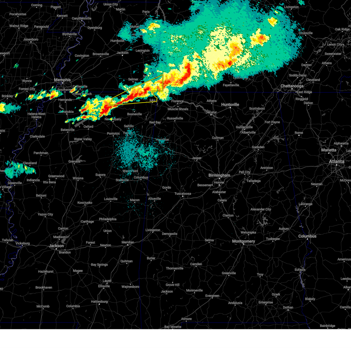 the severe thunderstorm warning has been cancelled and is no longer in effect the severe thunderstorm warning has been cancelled and is no longer in effect
|
| 3/31/2025 12:31 AM CDT |
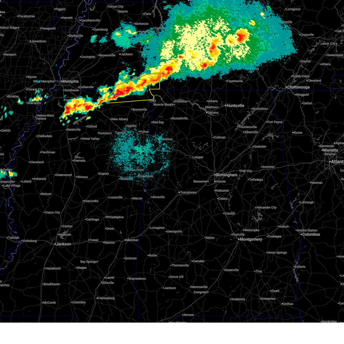 Svrmeg the national weather service in memphis has issued a * severe thunderstorm warning for, northern tippah county in northeastern mississippi, northern tishomingo county in northeastern mississippi, alcorn county in northeastern mississippi, southeastern hardeman county in west tennessee, southern mcnairy county in west tennessee, hardin county in west tennessee, * until 115 am cdt. * at 1231 am cdt, severe thunderstorms were located along a line extending from near waynesboro to near ripley, moving east at 45 mph (radar indicated). Hazards include 60 mph wind gusts and half dollar size hail. Hail damage to vehicles is expected. Expect wind damage to roofs, siding, and trees. Svrmeg the national weather service in memphis has issued a * severe thunderstorm warning for, northern tippah county in northeastern mississippi, northern tishomingo county in northeastern mississippi, alcorn county in northeastern mississippi, southeastern hardeman county in west tennessee, southern mcnairy county in west tennessee, hardin county in west tennessee, * until 115 am cdt. * at 1231 am cdt, severe thunderstorms were located along a line extending from near waynesboro to near ripley, moving east at 45 mph (radar indicated). Hazards include 60 mph wind gusts and half dollar size hail. Hail damage to vehicles is expected. Expect wind damage to roofs, siding, and trees.
|
| 3/31/2025 12:15 AM CDT |
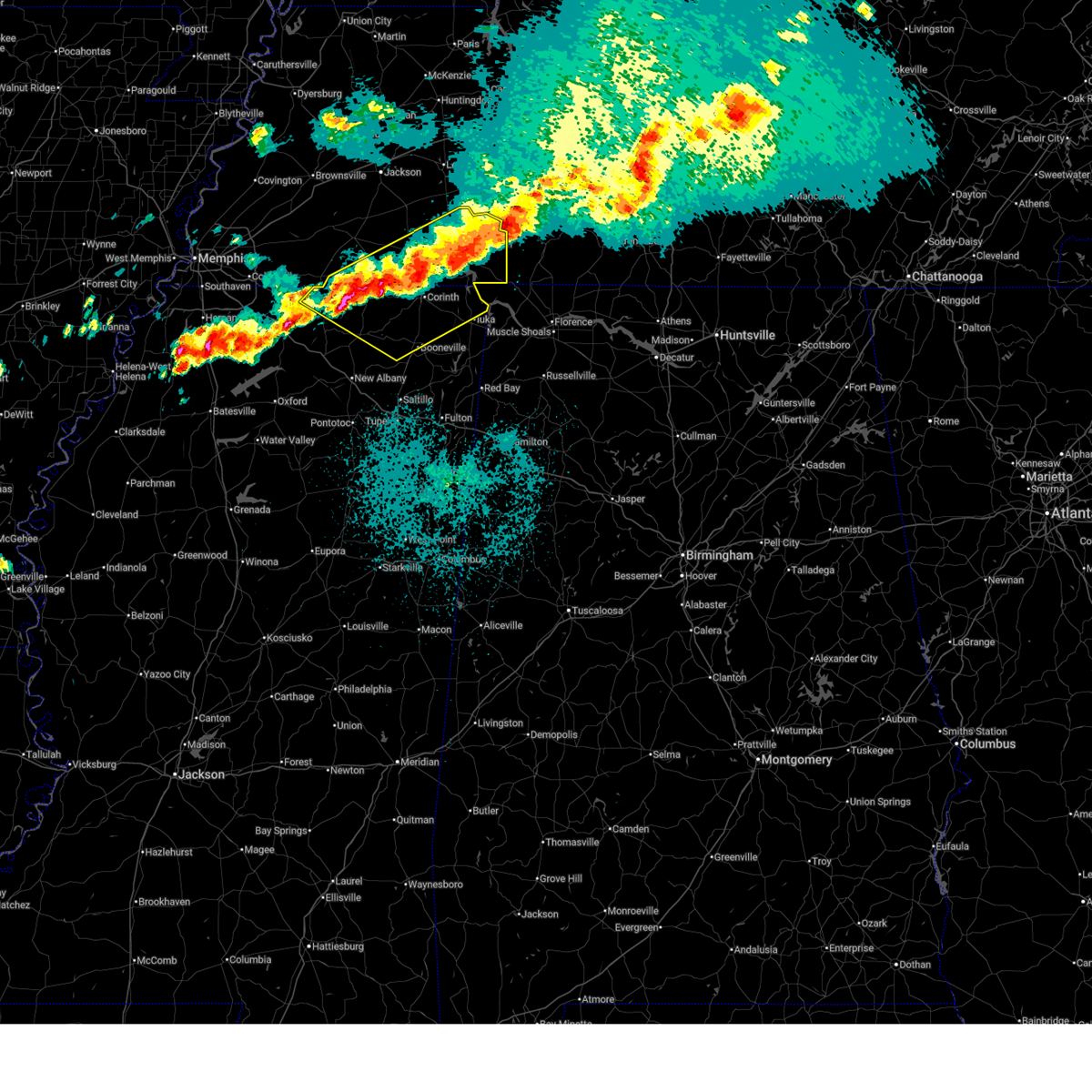 At 1215 am cdt, severe thunderstorms were located along a line extending from 6 miles southeast of olive hill to near pineflat to 6 miles north of ripley, moving southeast at 45 mph (public). Hazards include 60 mph wind gusts and quarter size hail. Hail damage to vehicles is expected. expect wind damage to roofs, siding, and trees. Locations impacted include, murry, brody, selmer, pickwick dam, crump, bruton branch, pickwick landing state park, acton, theo, walkertown, cerro gordo, rogers springs, kossuth, hightown, new lawton, martin camp, savannah, lisbon, caffey, and crumtown. At 1215 am cdt, severe thunderstorms were located along a line extending from 6 miles southeast of olive hill to near pineflat to 6 miles north of ripley, moving southeast at 45 mph (public). Hazards include 60 mph wind gusts and quarter size hail. Hail damage to vehicles is expected. expect wind damage to roofs, siding, and trees. Locations impacted include, murry, brody, selmer, pickwick dam, crump, bruton branch, pickwick landing state park, acton, theo, walkertown, cerro gordo, rogers springs, kossuth, hightown, new lawton, martin camp, savannah, lisbon, caffey, and crumtown.
|
| 3/30/2025 11:58 PM CDT |
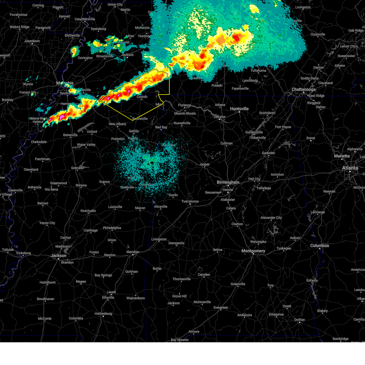 the severe thunderstorm warning has been cancelled and is no longer in effect the severe thunderstorm warning has been cancelled and is no longer in effect
|
| 3/30/2025 11:58 PM CDT |
 At 1157 pm cdt, severe thunderstorms were located along a line extending from 6 miles northeast of savannah to 7 miles south of selmer to near canaan, moving east at 30 mph (radar indicated). Hazards include 60 mph wind gusts and half dollar size hail. Hail damage to vehicles is expected. expect wind damage to roofs, siding, and trees. Locations impacted include, murry, brody, selmer, pickwick dam, crump, bruton branch, pickwick landing state park, acton, theo, walkertown, cerro gordo, rogers springs, kossuth, hightown, new lawton, martin camp, savannah, lisbon, caffey, and crumtown. At 1157 pm cdt, severe thunderstorms were located along a line extending from 6 miles northeast of savannah to 7 miles south of selmer to near canaan, moving east at 30 mph (radar indicated). Hazards include 60 mph wind gusts and half dollar size hail. Hail damage to vehicles is expected. expect wind damage to roofs, siding, and trees. Locations impacted include, murry, brody, selmer, pickwick dam, crump, bruton branch, pickwick landing state park, acton, theo, walkertown, cerro gordo, rogers springs, kossuth, hightown, new lawton, martin camp, savannah, lisbon, caffey, and crumtown.
|
| 3/30/2025 11:46 PM CDT |
 the severe thunderstorm warning has been cancelled and is no longer in effect the severe thunderstorm warning has been cancelled and is no longer in effect
|
| 3/30/2025 11:46 PM CDT |
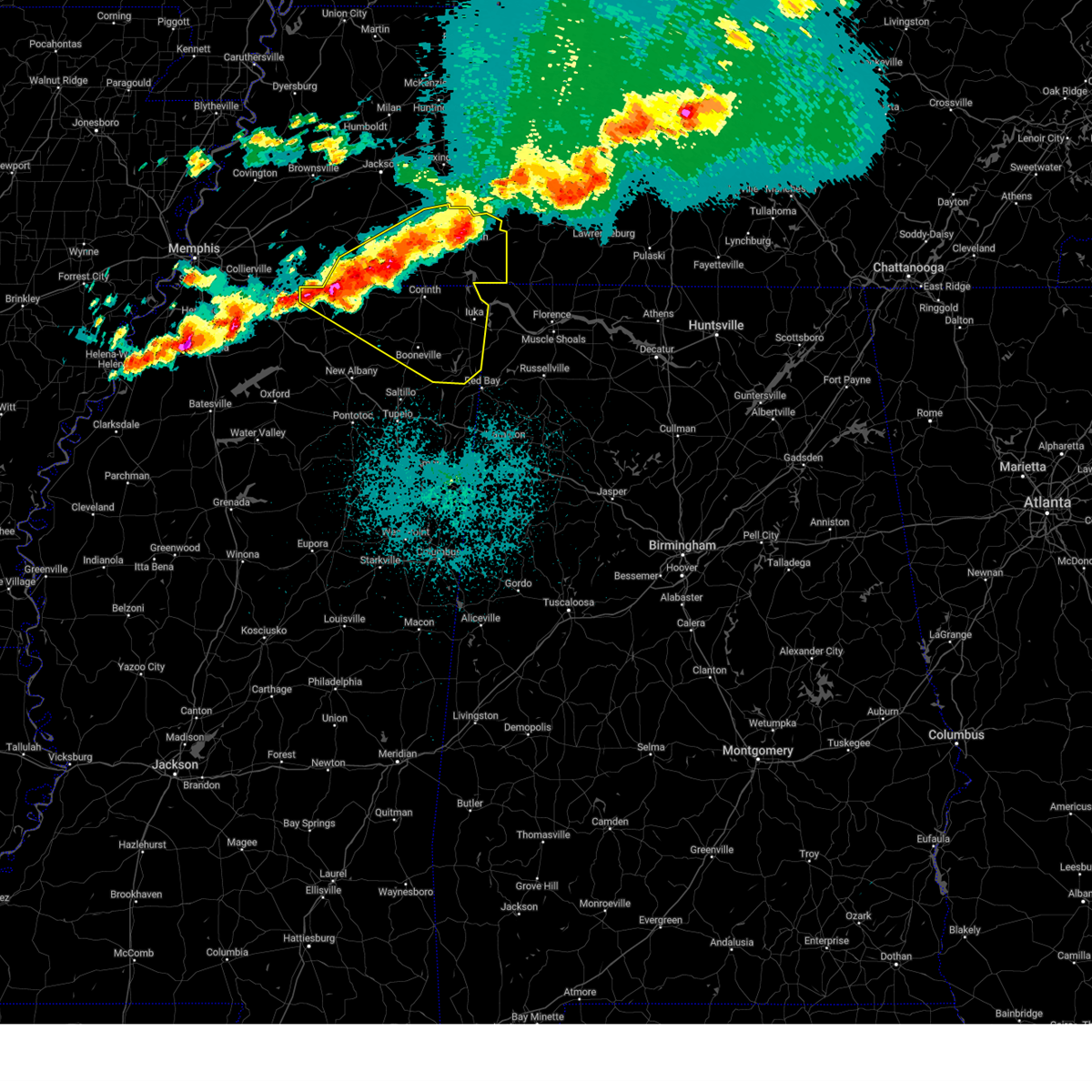 At 1146 pm cdt, severe thunderstorms were located along a line extending from near olive hill to near corinth to near ripley, moving southeast at 45 mph (radar indicated). Hazards include 60 mph wind gusts and half dollar size hail. Hail damage to vehicles is expected. expect wind damage to roofs, siding, and trees. Locations impacted include, murry, brody, selmer, pickwick dam, belmont, masseyville, blythe crossing, crump, bruton branch, pickwick landing state park, acton, theo, walkertown, petertown, cerro gordo, neil, rogers springs, kossuth, hightown, and hornsby. At 1146 pm cdt, severe thunderstorms were located along a line extending from near olive hill to near corinth to near ripley, moving southeast at 45 mph (radar indicated). Hazards include 60 mph wind gusts and half dollar size hail. Hail damage to vehicles is expected. expect wind damage to roofs, siding, and trees. Locations impacted include, murry, brody, selmer, pickwick dam, belmont, masseyville, blythe crossing, crump, bruton branch, pickwick landing state park, acton, theo, walkertown, petertown, cerro gordo, neil, rogers springs, kossuth, hightown, and hornsby.
|
| 3/30/2025 11:30 PM CDT |
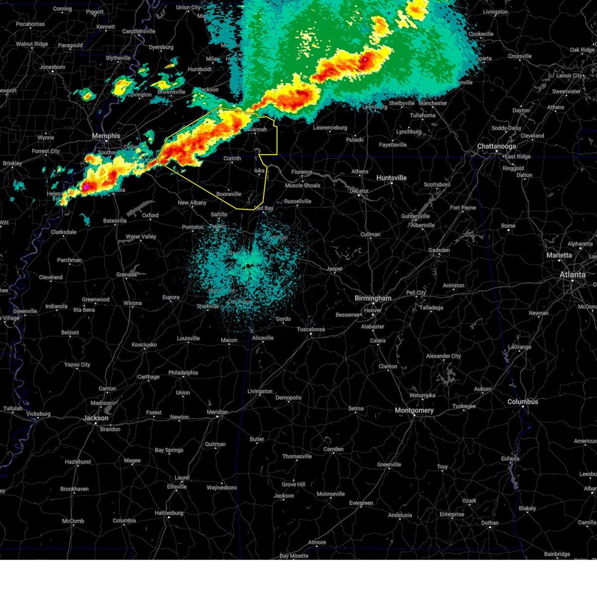 Svrmeg the national weather service in memphis has issued a * severe thunderstorm warning for, north central marshall county in northwestern mississippi, tippah county in northeastern mississippi, northern benton county in northeastern mississippi, tishomingo county in northeastern mississippi, prentiss county in northeastern mississippi, alcorn county in northeastern mississippi, southeastern fayette county in west tennessee, hardeman county in west tennessee, mcnairy county in west tennessee, hardin county in west tennessee, chester county in west tennessee, * until 1230 am cdt. * at 1130 pm cdt, severe thunderstorms were located along a line extending from near morris chapel to big hill pond state park to near gravestown, moving southeast at 45 mph (radar indicated). Hazards include 60 mph wind gusts and half dollar size hail. Hail damage to vehicles is expected. Expect wind damage to roofs, siding, and trees. Svrmeg the national weather service in memphis has issued a * severe thunderstorm warning for, north central marshall county in northwestern mississippi, tippah county in northeastern mississippi, northern benton county in northeastern mississippi, tishomingo county in northeastern mississippi, prentiss county in northeastern mississippi, alcorn county in northeastern mississippi, southeastern fayette county in west tennessee, hardeman county in west tennessee, mcnairy county in west tennessee, hardin county in west tennessee, chester county in west tennessee, * until 1230 am cdt. * at 1130 pm cdt, severe thunderstorms were located along a line extending from near morris chapel to big hill pond state park to near gravestown, moving southeast at 45 mph (radar indicated). Hazards include 60 mph wind gusts and half dollar size hail. Hail damage to vehicles is expected. Expect wind damage to roofs, siding, and trees.
|
| 3/30/2025 11:21 PM CDT |
 At 1121 pm cdt, a severe thunderstorm was located near lafayette, moving east at 45 mph (radar indicated). Hazards include 70 mph wind gusts and penny size hail. Expect considerable tree damage. damage is likely to mobile homes, roofs, and outbuildings. locations impacted include, red boiling springs, bethpage, goodlettsville, hartsville, dixon springs, oak grove, pleasant shade, millersville, gallatin, bledsoe creek state park, dickerson chapel recreation area, hendersonville, carthage, cottontown, lafayette, westmoreland, south carthage, white house, and mount juliet. this includes the following highways, interstate 65 between mile markers 93 and 102. Interstate 24 between mile markers 38 and 41. At 1121 pm cdt, a severe thunderstorm was located near lafayette, moving east at 45 mph (radar indicated). Hazards include 70 mph wind gusts and penny size hail. Expect considerable tree damage. damage is likely to mobile homes, roofs, and outbuildings. locations impacted include, red boiling springs, bethpage, goodlettsville, hartsville, dixon springs, oak grove, pleasant shade, millersville, gallatin, bledsoe creek state park, dickerson chapel recreation area, hendersonville, carthage, cottontown, lafayette, westmoreland, south carthage, white house, and mount juliet. this includes the following highways, interstate 65 between mile markers 93 and 102. Interstate 24 between mile markers 38 and 41.
|
| 3/30/2025 11:21 PM CDT |
 the severe thunderstorm warning has been cancelled and is no longer in effect the severe thunderstorm warning has been cancelled and is no longer in effect
|
| 3/30/2025 10:45 PM CDT |
 Svrohx the national weather service in nashville has issued a * severe thunderstorm warning for, northern smith county in middle tennessee, northeastern davidson county in middle tennessee, sumner county in middle tennessee, northern wilson county in middle tennessee, macon county in middle tennessee, trousdale county in middle tennessee, southeastern robertson county in middle tennessee, * until 1145 pm cdt. * at 1044 pm cdt, a severe thunderstorm was located over portland, or 13 miles north of gallatin, moving east at 55 mph (radar indicated). Hazards include 70 mph wind gusts and penny size hail. Expect considerable tree damage. Damage is likely to mobile homes, roofs, and outbuildings. Svrohx the national weather service in nashville has issued a * severe thunderstorm warning for, northern smith county in middle tennessee, northeastern davidson county in middle tennessee, sumner county in middle tennessee, northern wilson county in middle tennessee, macon county in middle tennessee, trousdale county in middle tennessee, southeastern robertson county in middle tennessee, * until 1145 pm cdt. * at 1044 pm cdt, a severe thunderstorm was located over portland, or 13 miles north of gallatin, moving east at 55 mph (radar indicated). Hazards include 70 mph wind gusts and penny size hail. Expect considerable tree damage. Damage is likely to mobile homes, roofs, and outbuildings.
|
| 3/30/2025 10:36 PM CDT |
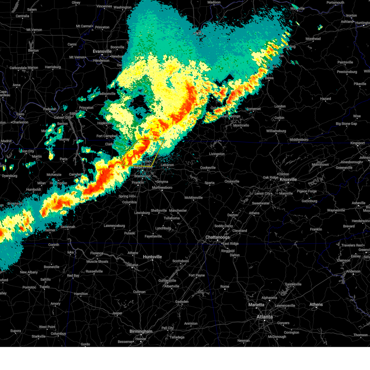 At 1036 pm cdt, severe thunderstorms were located along a line extending from near portland to near ashland city, moving east at 40 mph (radar indicated). Hazards include 60 mph wind gusts and penny size hail. Expect damage to roofs, siding, and trees. locations impacted include, madison, portland, ridgetop, goodlettsville, mitchellville, millersville, white house, whites creek, lakewood, hendersonville, greenbrier, cottontown, orlinda, pleasant view, cross plains, beaman park, springfield, old hickory, ashland city, and coopertown. this includes the following highways, interstate 65 between mile markers 89 and 121. Interstate 24 between mile markers 20 and 44. At 1036 pm cdt, severe thunderstorms were located along a line extending from near portland to near ashland city, moving east at 40 mph (radar indicated). Hazards include 60 mph wind gusts and penny size hail. Expect damage to roofs, siding, and trees. locations impacted include, madison, portland, ridgetop, goodlettsville, mitchellville, millersville, white house, whites creek, lakewood, hendersonville, greenbrier, cottontown, orlinda, pleasant view, cross plains, beaman park, springfield, old hickory, ashland city, and coopertown. this includes the following highways, interstate 65 between mile markers 89 and 121. Interstate 24 between mile markers 20 and 44.
|
| 3/30/2025 10:06 PM CDT |
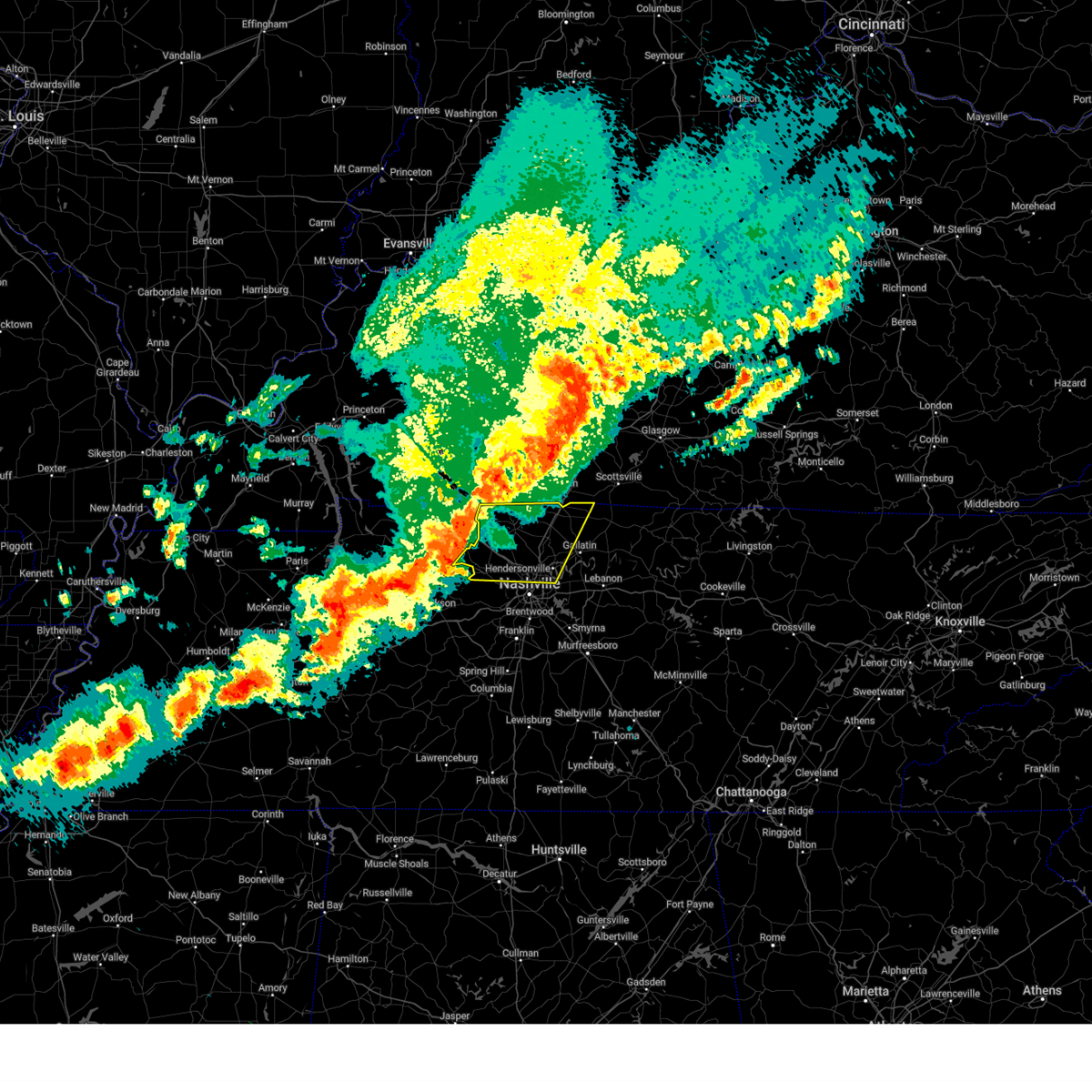 Svrohx the national weather service in nashville has issued a * severe thunderstorm warning for, northern davidson county in middle tennessee, western sumner county in middle tennessee, northern cheatham county in middle tennessee, robertson county in middle tennessee, * until 1100 pm cdt. * at 1005 pm cdt, severe thunderstorms were located along a line extending from 6 miles east of guthrie to 14 miles north of white bluff, moving east at 55 mph (radar indicated). Hazards include 60 mph wind gusts and penny size hail. expect damage to roofs, siding, and trees Svrohx the national weather service in nashville has issued a * severe thunderstorm warning for, northern davidson county in middle tennessee, western sumner county in middle tennessee, northern cheatham county in middle tennessee, robertson county in middle tennessee, * until 1100 pm cdt. * at 1005 pm cdt, severe thunderstorms were located along a line extending from 6 miles east of guthrie to 14 miles north of white bluff, moving east at 55 mph (radar indicated). Hazards include 60 mph wind gusts and penny size hail. expect damage to roofs, siding, and trees
|
| 3/15/2025 1:29 PM CDT |
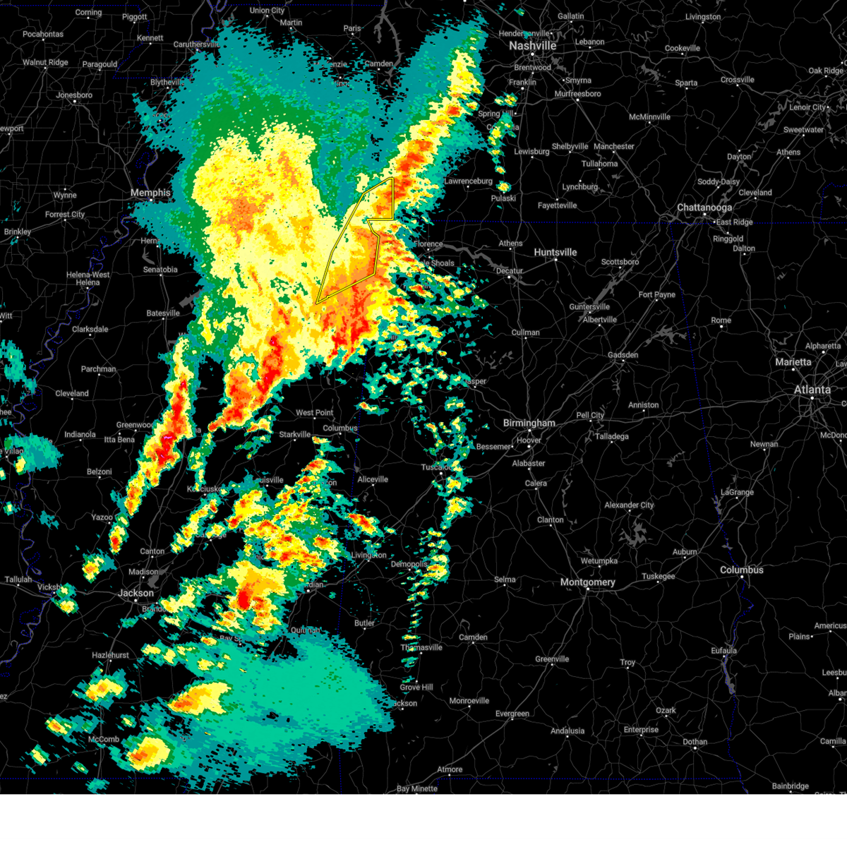 The storms which prompted the warning have moved out of the warned area. therefore, the warning will be allowed to expire. however, gusty winds are still possible with these thunderstorms. a tornado watch remains in effect until 600 pm cdt for northeastern mississippi. The storms which prompted the warning have moved out of the warned area. therefore, the warning will be allowed to expire. however, gusty winds are still possible with these thunderstorms. a tornado watch remains in effect until 600 pm cdt for northeastern mississippi.
|
| 3/15/2025 1:10 PM CDT |
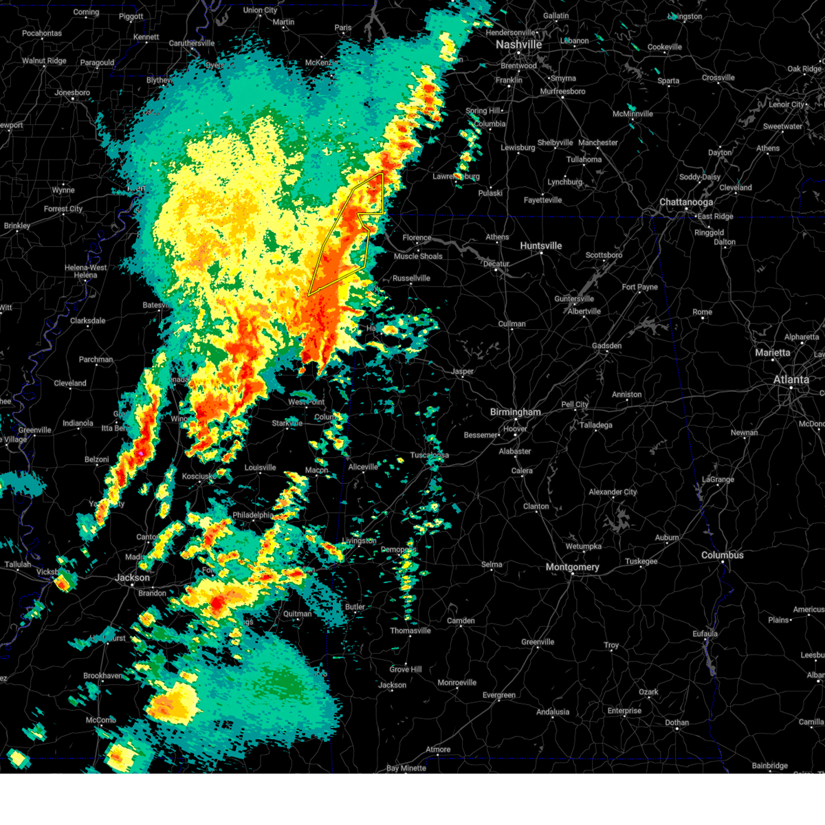 the severe thunderstorm warning has been cancelled and is no longer in effect the severe thunderstorm warning has been cancelled and is no longer in effect
|
| 3/15/2025 1:10 PM CDT |
 At 109 pm cdt, severe thunderstorms were located along a line extending from pineflat to near burton, moving northeast at 55 mph (radar indicated). Hazards include 60 mph wind gusts and half dollar size hail. Hail damage to vehicles is expected. expect wind damage to roofs, siding, and trees. Locations impacted include, iuka, walnut grove, oldham, doskie, j p coleman state park, pickwick dam, thrasher, paden, pineflat, blythe crossing, bruton branch, thrashers, pickwick landing state park, glen, carter branch, burton, hazard switch, walker siding, holcut, and olivehill. At 109 pm cdt, severe thunderstorms were located along a line extending from pineflat to near burton, moving northeast at 55 mph (radar indicated). Hazards include 60 mph wind gusts and half dollar size hail. Hail damage to vehicles is expected. expect wind damage to roofs, siding, and trees. Locations impacted include, iuka, walnut grove, oldham, doskie, j p coleman state park, pickwick dam, thrasher, paden, pineflat, blythe crossing, bruton branch, thrashers, pickwick landing state park, glen, carter branch, burton, hazard switch, walker siding, holcut, and olivehill.
|
| 3/15/2025 12:57 PM CDT |
 At 1256 pm cdt, severe thunderstorms were located along a line extending from near hinkle to near pratts friendship, moving east at 50 mph (radar indicated). Hazards include 60 mph wind gusts and half dollar size hail. Hail damage to vehicles is expected. expect wind damage to roofs, siding, and trees. Locations impacted include, iuka, pickwick dam, thrasher, blythe crossing, guys, rienzi, bruton branch, thrashers, pickwick landing state park, carter branch, acton, hazard switch, walkertown, midway, hobo station, petertown, corinth, pratts friendship, neil, and chambers. At 1256 pm cdt, severe thunderstorms were located along a line extending from near hinkle to near pratts friendship, moving east at 50 mph (radar indicated). Hazards include 60 mph wind gusts and half dollar size hail. Hail damage to vehicles is expected. expect wind damage to roofs, siding, and trees. Locations impacted include, iuka, pickwick dam, thrasher, blythe crossing, guys, rienzi, bruton branch, thrashers, pickwick landing state park, carter branch, acton, hazard switch, walkertown, midway, hobo station, petertown, corinth, pratts friendship, neil, and chambers.
|
| 3/15/2025 12:57 PM CDT |
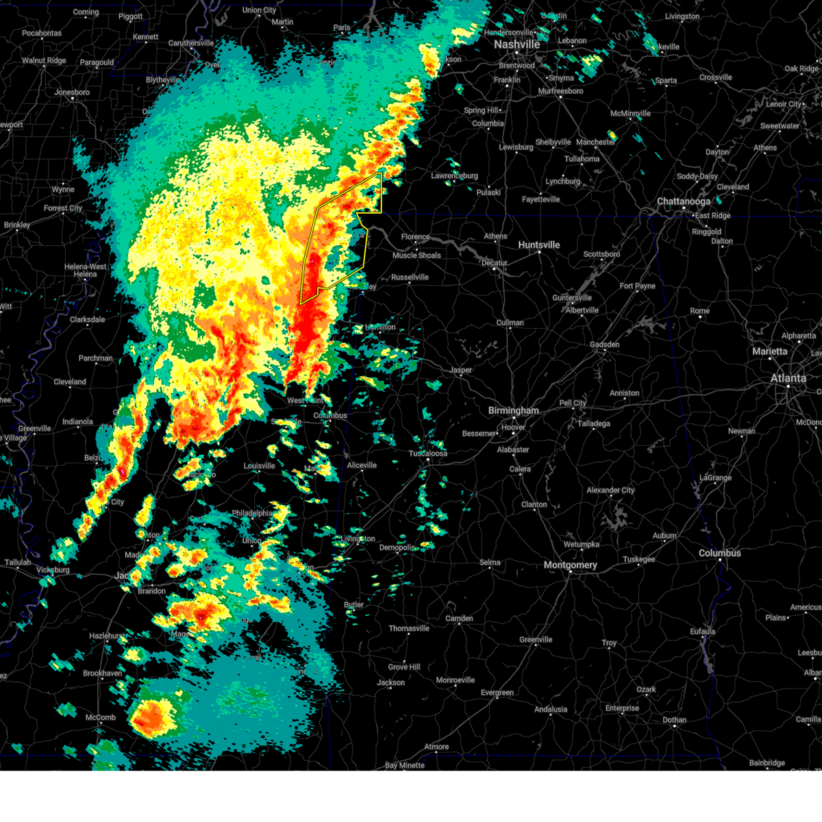 the severe thunderstorm warning has been cancelled and is no longer in effect the severe thunderstorm warning has been cancelled and is no longer in effect
|
| 3/15/2025 12:41 PM CDT |
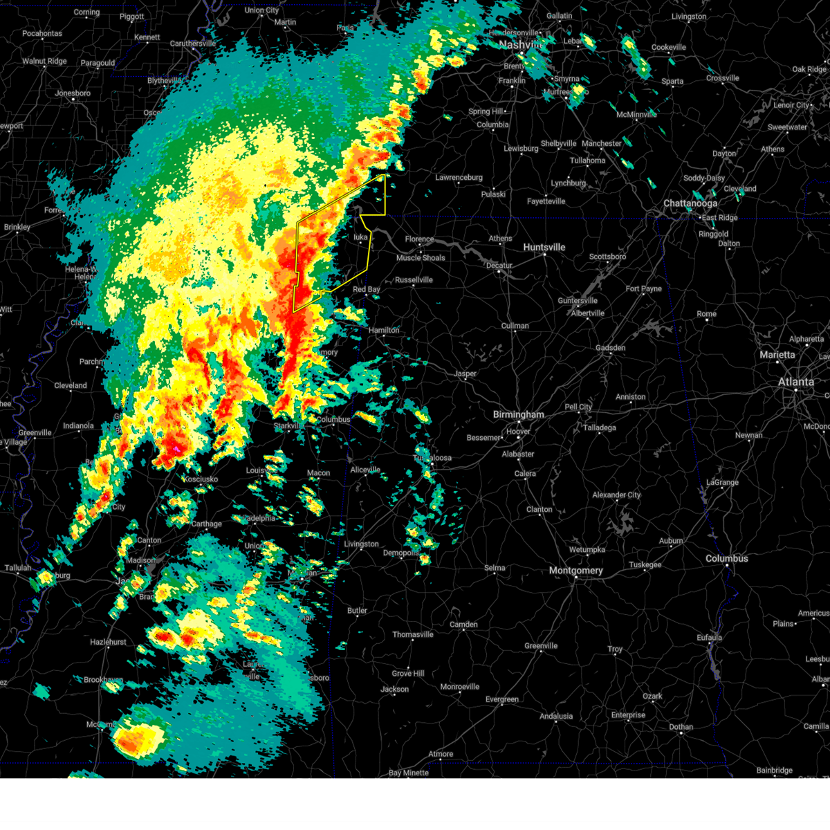 Svrmeg the national weather service in memphis has issued a * severe thunderstorm warning for, northern lee county in northeastern mississippi, southeastern tippah county in northeastern mississippi, tishomingo county in northeastern mississippi, prentiss county in northeastern mississippi, alcorn county in northeastern mississippi, southeastern mcnairy county in west tennessee, southern hardin county in west tennessee, * until 130 pm cdt. * at 1241 pm cdt, severe thunderstorms were located along a line extending from near jumpertown to near saltillo, moving northeast at 65 mph (radar indicated). Hazards include 60 mph wind gusts and half dollar size hail. Hail damage to vehicles is expected. Expect wind damage to roofs, siding, and trees. Svrmeg the national weather service in memphis has issued a * severe thunderstorm warning for, northern lee county in northeastern mississippi, southeastern tippah county in northeastern mississippi, tishomingo county in northeastern mississippi, prentiss county in northeastern mississippi, alcorn county in northeastern mississippi, southeastern mcnairy county in west tennessee, southern hardin county in west tennessee, * until 130 pm cdt. * at 1241 pm cdt, severe thunderstorms were located along a line extending from near jumpertown to near saltillo, moving northeast at 65 mph (radar indicated). Hazards include 60 mph wind gusts and half dollar size hail. Hail damage to vehicles is expected. Expect wind damage to roofs, siding, and trees.
|
| 3/15/2025 4:50 AM CDT |
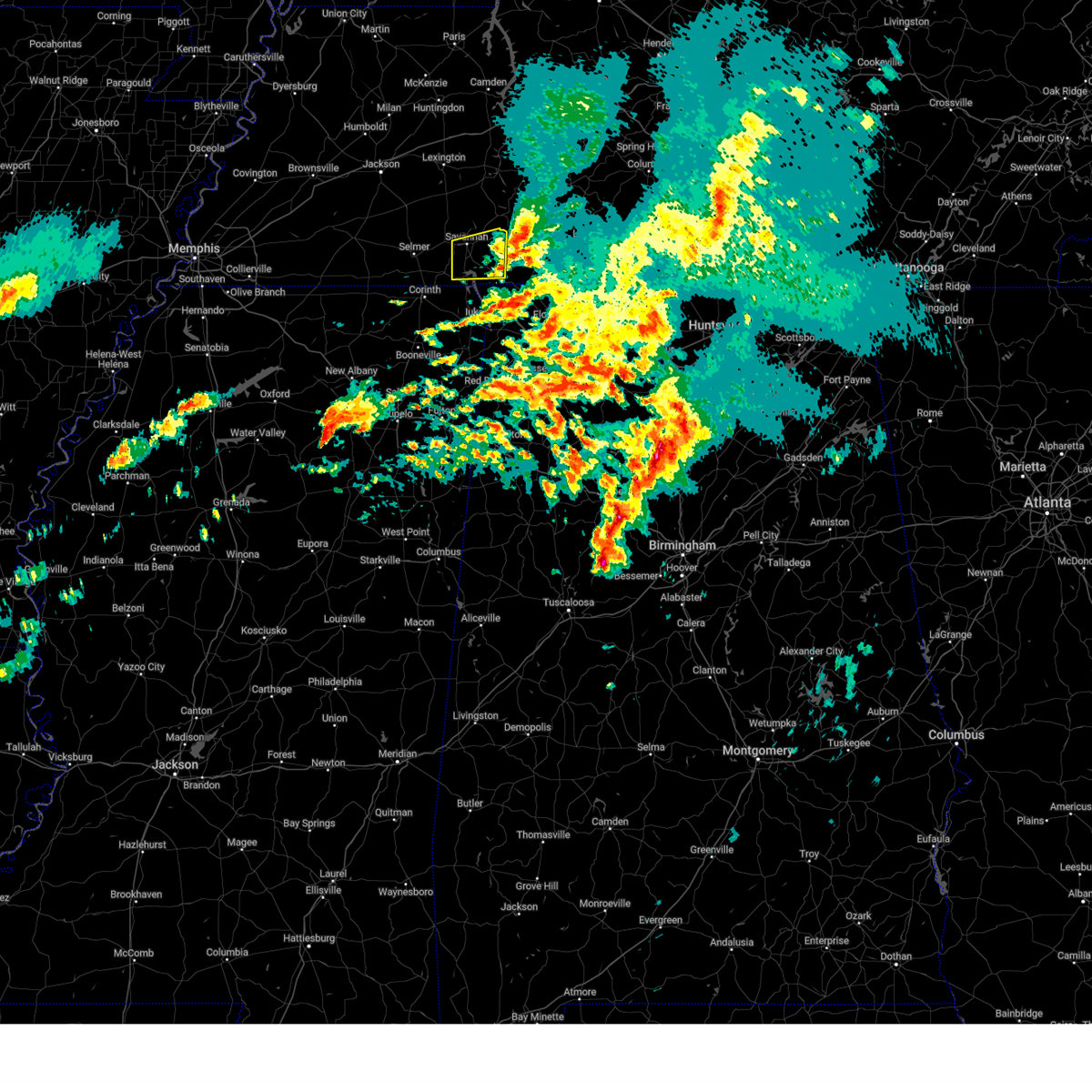 The storm which prompted the warning has weakened below severe limits, and has exited the warned area. therefore, the warning will be allowed to expire. a tornado watch remains in effect until 600 am cdt for west tennessee. The storm which prompted the warning has weakened below severe limits, and has exited the warned area. therefore, the warning will be allowed to expire. a tornado watch remains in effect until 600 am cdt for west tennessee.
|
| 3/15/2025 4:23 AM CDT |
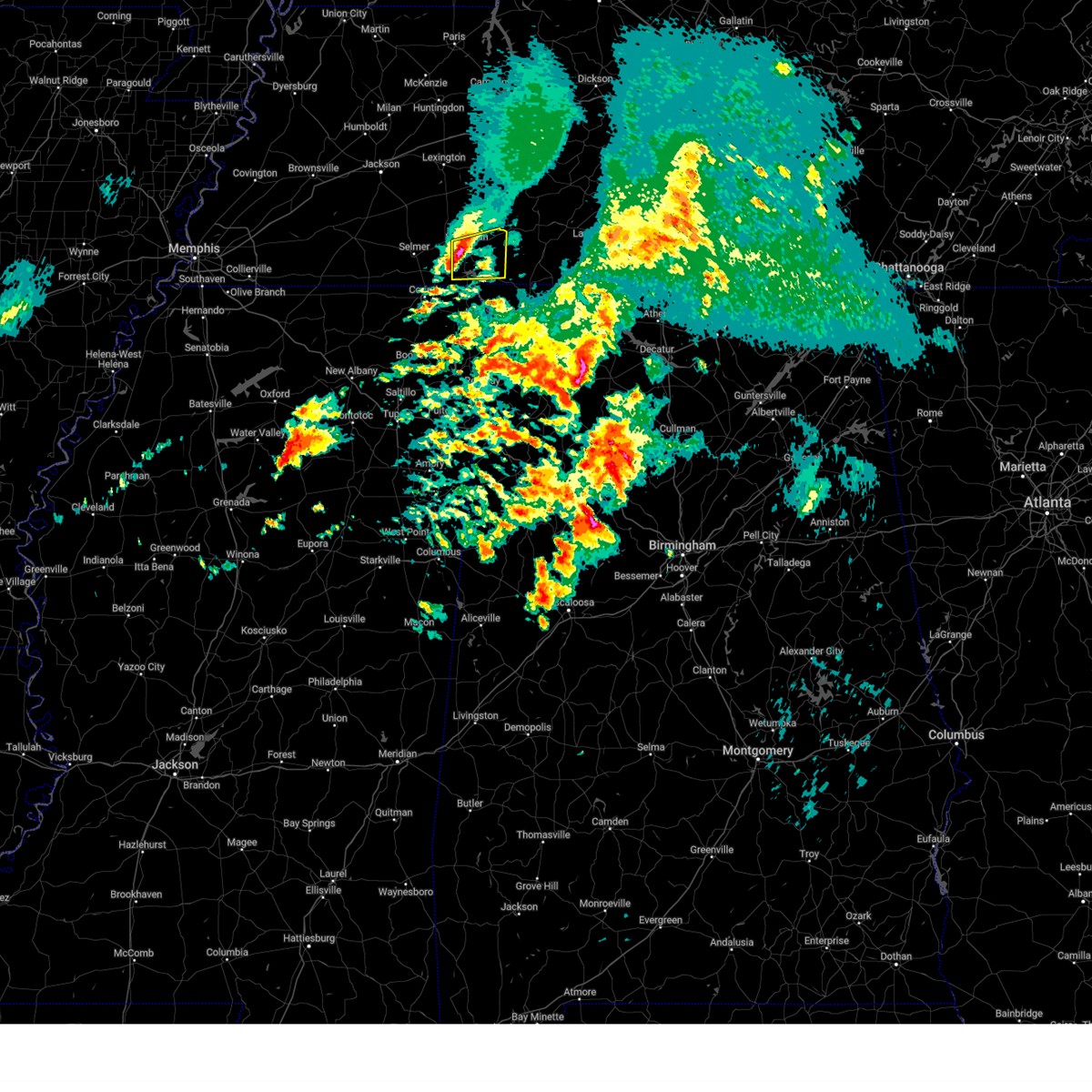 the severe thunderstorm warning has been cancelled and is no longer in effect the severe thunderstorm warning has been cancelled and is no longer in effect
|
| 3/15/2025 4:23 AM CDT |
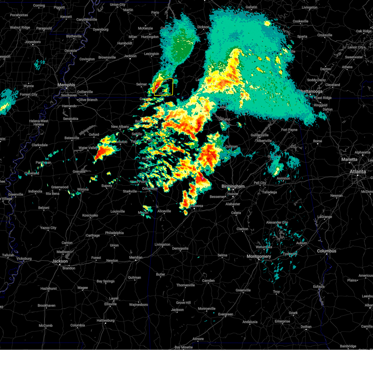 At 423 am cdt, a severe thunderstorm was located near savannah, moving east at 50 mph (radar indicated). Hazards include 60 mph wind gusts and quarter size hail. Hail damage to vehicles is expected. expect wind damage to roofs, siding, and trees. Locations impacted include, counce, lowryville, walnut grove, savannah, olive hill, pickwick dam, hamburg, pollards mill, crump, phillips, bruton branch, childers hill, pickwick landing state park, center star, maddox, walkertown, olivehill, and bucktown. At 423 am cdt, a severe thunderstorm was located near savannah, moving east at 50 mph (radar indicated). Hazards include 60 mph wind gusts and quarter size hail. Hail damage to vehicles is expected. expect wind damage to roofs, siding, and trees. Locations impacted include, counce, lowryville, walnut grove, savannah, olive hill, pickwick dam, hamburg, pollards mill, crump, phillips, bruton branch, childers hill, pickwick landing state park, center star, maddox, walkertown, olivehill, and bucktown.
|
| 3/15/2025 4:14 AM CDT |
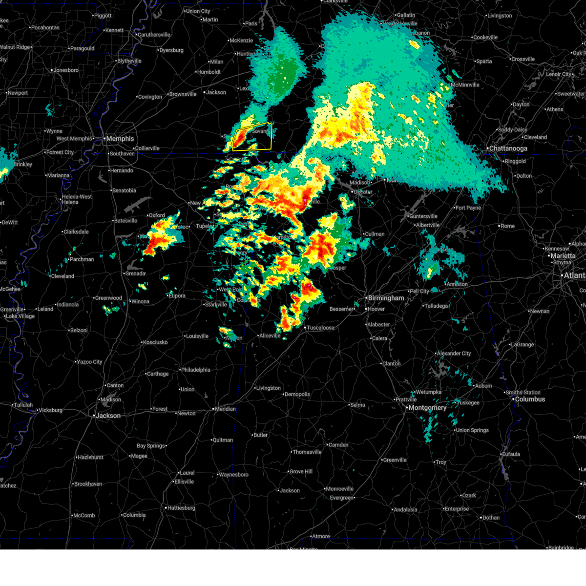 At 414 am cdt, a severe thunderstorm was located over shiloh, or 8 miles northwest of pickwick landing state park, moving east at 45 mph (radar indicated). Hazards include ping pong ball size hail and 60 mph wind gusts. People and animals outdoors will be injured. expect hail damage to roofs, siding, windows, and vehicles. expect wind damage to roofs, siding, and trees. Locations impacted include, shiloh national military park, walnut grove, pickwick dam, pebble hill, hamburg, crump, phillips, bruton branch, tulu, pickwick landing state park, hurley, walkertown, olivehill, chambers, counce, lowryville, mount vinson, savannah, olive hill, and michie. At 414 am cdt, a severe thunderstorm was located over shiloh, or 8 miles northwest of pickwick landing state park, moving east at 45 mph (radar indicated). Hazards include ping pong ball size hail and 60 mph wind gusts. People and animals outdoors will be injured. expect hail damage to roofs, siding, windows, and vehicles. expect wind damage to roofs, siding, and trees. Locations impacted include, shiloh national military park, walnut grove, pickwick dam, pebble hill, hamburg, crump, phillips, bruton branch, tulu, pickwick landing state park, hurley, walkertown, olivehill, chambers, counce, lowryville, mount vinson, savannah, olive hill, and michie.
|
| 3/15/2025 4:08 AM CDT |
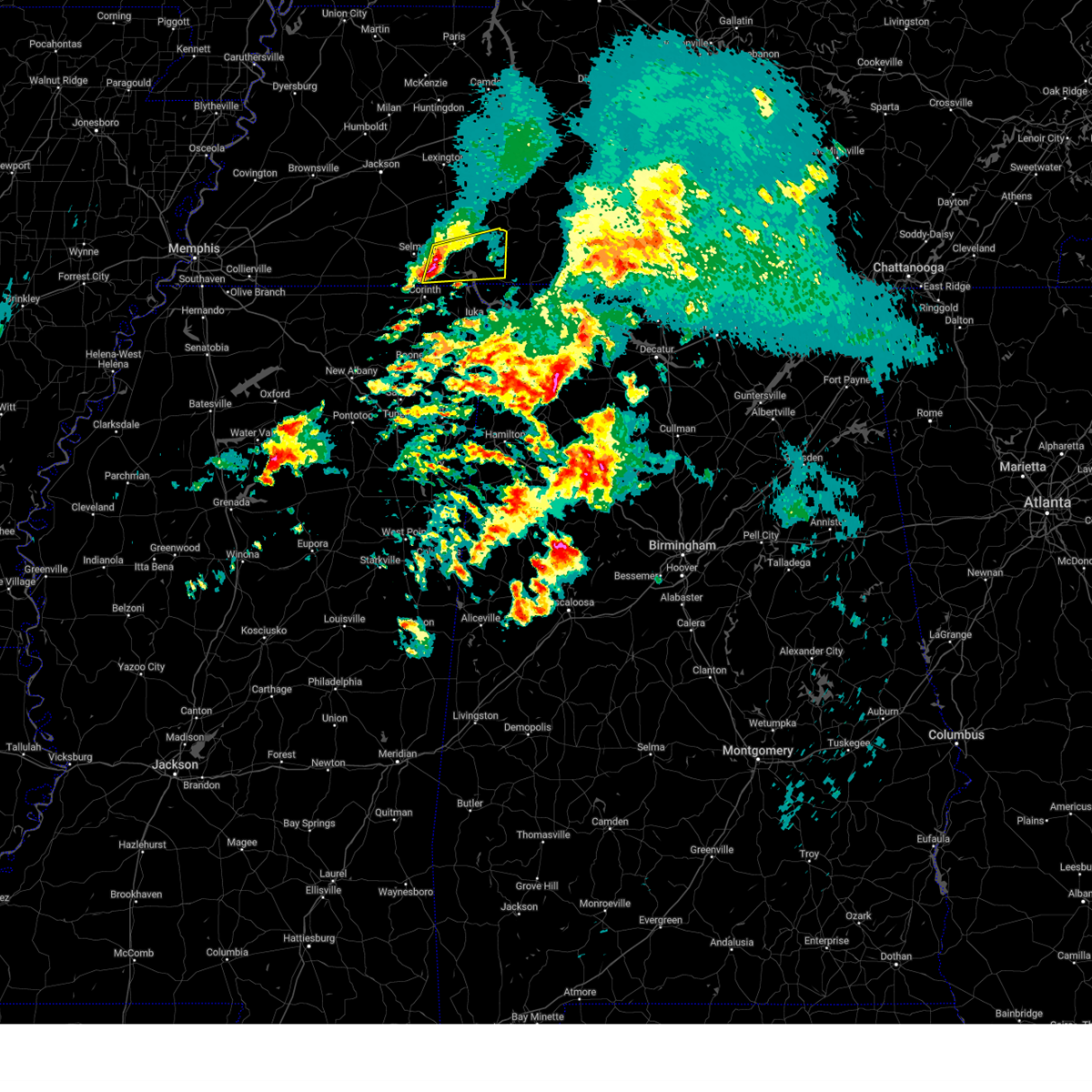 Svrmeg the national weather service in memphis has issued a * severe thunderstorm warning for, southeastern mcnairy county in west tennessee, hardin county in west tennessee, * until 500 am cdt. * at 408 am cdt, a severe thunderstorm was located near shiloh, or 10 miles northeast of corinth, moving east at 45 mph (radar indicated). Hazards include 60 mph wind gusts and quarter size hail. Hail damage to vehicles is expected. Expect wind damage to roofs, siding, and trees. Svrmeg the national weather service in memphis has issued a * severe thunderstorm warning for, southeastern mcnairy county in west tennessee, hardin county in west tennessee, * until 500 am cdt. * at 408 am cdt, a severe thunderstorm was located near shiloh, or 10 miles northeast of corinth, moving east at 45 mph (radar indicated). Hazards include 60 mph wind gusts and quarter size hail. Hail damage to vehicles is expected. Expect wind damage to roofs, siding, and trees.
|
| 9/24/2024 2:11 PM CDT |
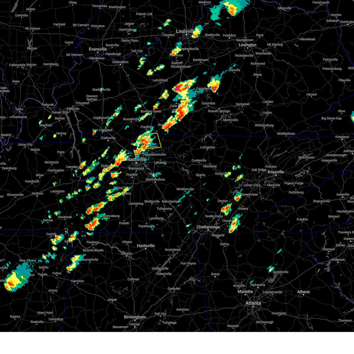 At 211 pm cdt, a severe thunderstorm was located near cross plains, or 12 miles northwest of gallatin, moving northeast at 35 mph (radar indicated). Hazards include 60 mph wind gusts and penny size hail. Expect damage to roofs, siding, and trees. locations impacted include, gallatin, white house, cross plains, portland, orlinda, mitchellville, cottontown, black jack, bethpage, and oak grove. This includes interstate 65 between mile markers 110 and 121. At 211 pm cdt, a severe thunderstorm was located near cross plains, or 12 miles northwest of gallatin, moving northeast at 35 mph (radar indicated). Hazards include 60 mph wind gusts and penny size hail. Expect damage to roofs, siding, and trees. locations impacted include, gallatin, white house, cross plains, portland, orlinda, mitchellville, cottontown, black jack, bethpage, and oak grove. This includes interstate 65 between mile markers 110 and 121.
|
| 9/24/2024 1:57 PM CDT |
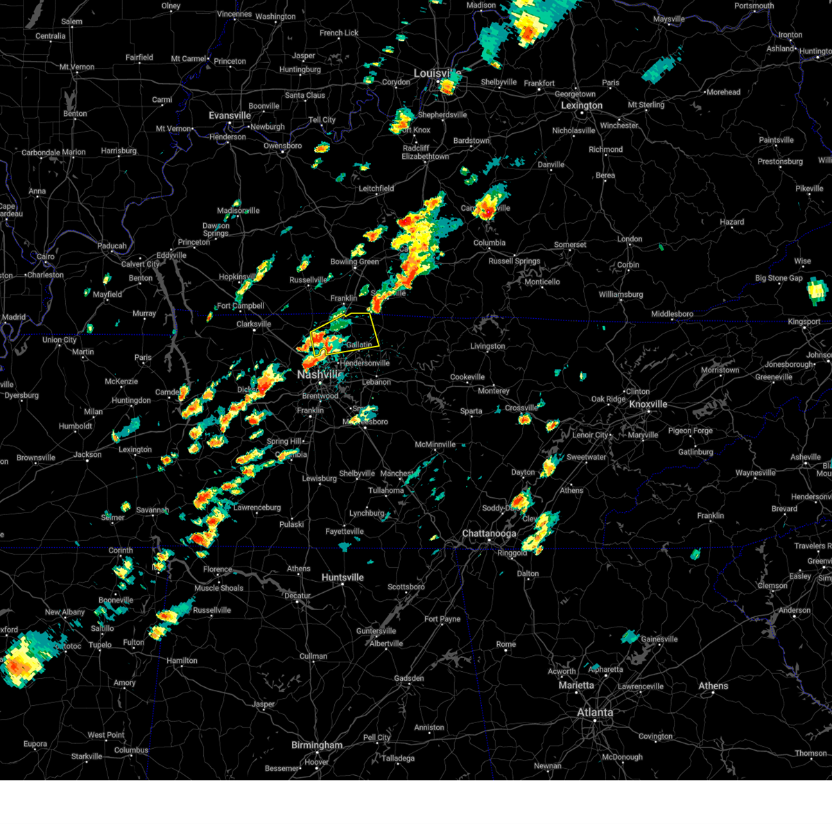 Svrohx the national weather service in nashville has issued a * severe thunderstorm warning for, sumner county in middle tennessee, eastern robertson county in middle tennessee, * until 230 pm cdt. * at 157 pm cdt, a severe thunderstorm was located near white house, or 7 miles east of springfield, moving northeast at 35 mph (radar indicated). Hazards include 60 mph wind gusts and penny size hail. expect damage to roofs, siding, and trees Svrohx the national weather service in nashville has issued a * severe thunderstorm warning for, sumner county in middle tennessee, eastern robertson county in middle tennessee, * until 230 pm cdt. * at 157 pm cdt, a severe thunderstorm was located near white house, or 7 miles east of springfield, moving northeast at 35 mph (radar indicated). Hazards include 60 mph wind gusts and penny size hail. expect damage to roofs, siding, and trees
|
| 9/24/2024 1:40 PM CDT |
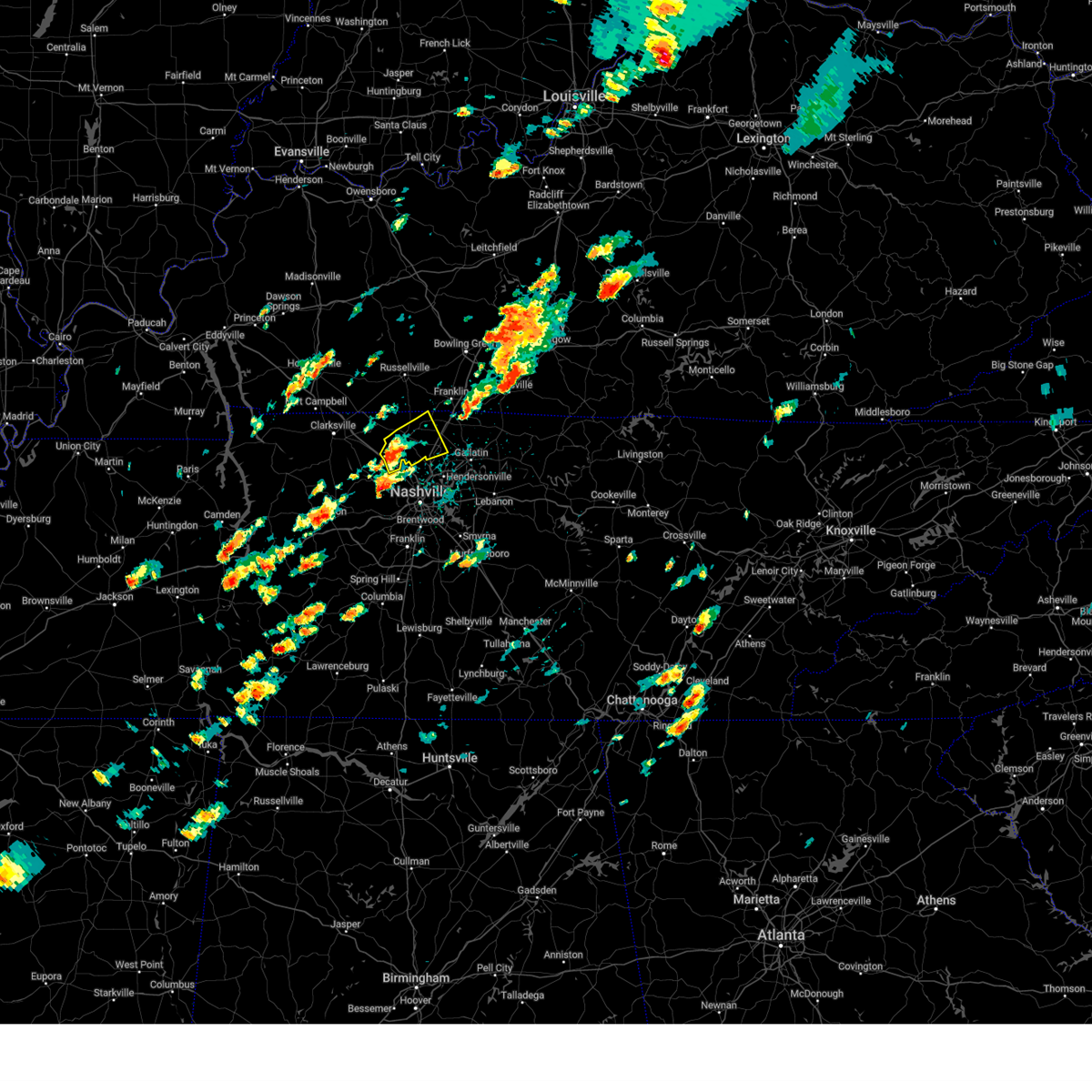 At 140 pm cdt, a severe thunderstorm was located over coopertown, or near springfield, moving northeast at 35 mph (radar indicated). Hazards include 60 mph wind gusts and penny size hail. Expect damage to roofs, siding, and trees. locations impacted include, springfield, white house, millersville, greenbrier, coopertown, ridgetop, cross plains, pleasant view, and orlinda. this includes the following highways, interstate 65 between mile markers 103 and 111. Interstate 24 between mile markers 24 and 31. At 140 pm cdt, a severe thunderstorm was located over coopertown, or near springfield, moving northeast at 35 mph (radar indicated). Hazards include 60 mph wind gusts and penny size hail. Expect damage to roofs, siding, and trees. locations impacted include, springfield, white house, millersville, greenbrier, coopertown, ridgetop, cross plains, pleasant view, and orlinda. this includes the following highways, interstate 65 between mile markers 103 and 111. Interstate 24 between mile markers 24 and 31.
|
| 9/24/2024 1:24 PM CDT |
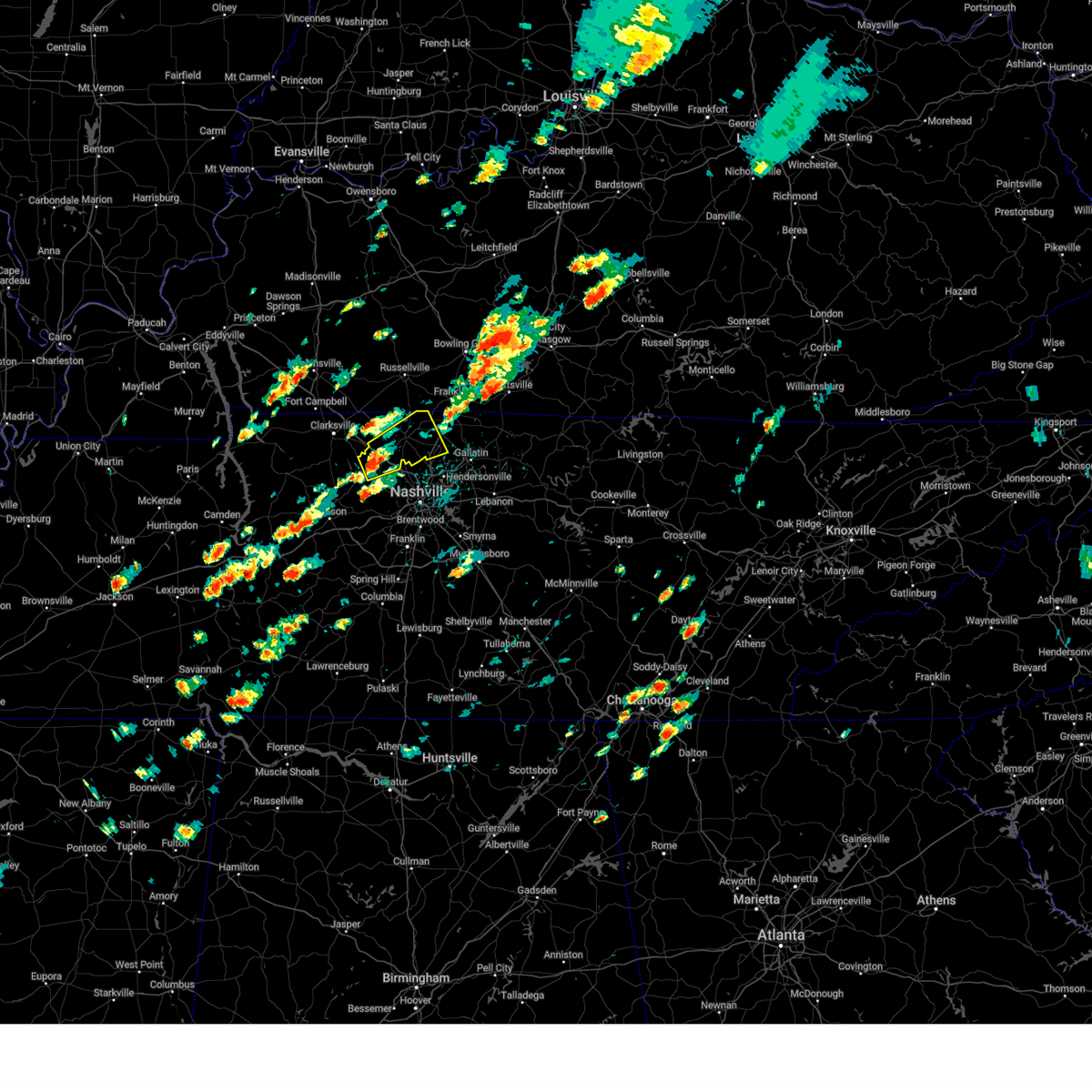 Svrohx the national weather service in nashville has issued a * severe thunderstorm warning for, west central sumner county in middle tennessee, northeastern cheatham county in middle tennessee, robertson county in middle tennessee, * until 200 pm cdt. * at 124 pm cdt, a severe thunderstorm was located near coopertown, or 9 miles north of ashland city, moving northeast at 35 mph (radar indicated). Hazards include 60 mph wind gusts and penny size hail. expect damage to roofs, siding, and trees Svrohx the national weather service in nashville has issued a * severe thunderstorm warning for, west central sumner county in middle tennessee, northeastern cheatham county in middle tennessee, robertson county in middle tennessee, * until 200 pm cdt. * at 124 pm cdt, a severe thunderstorm was located near coopertown, or 9 miles north of ashland city, moving northeast at 35 mph (radar indicated). Hazards include 60 mph wind gusts and penny size hail. expect damage to roofs, siding, and trees
|
| 7/30/2024 2:41 PM CDT |
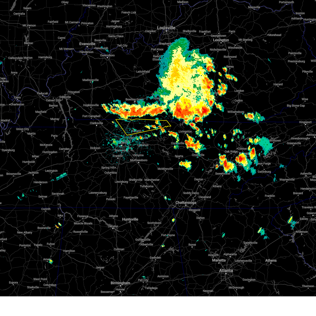 Svrohx the national weather service in nashville has issued a * severe thunderstorm warning for, sumner county in middle tennessee, northwestern clay county in middle tennessee, macon county in middle tennessee, northwestern trousdale county in middle tennessee, eastern robertson county in middle tennessee, * until 315 pm cdt. * at 241 pm cdt, severe thunderstorms were located along a line extending from 10 miles northwest of cross plains to 12 miles northwest of red boiling springs, moving southeast at 35 mph (radar indicated). Hazards include 60 mph wind gusts. expect damage to roofs, siding, and trees Svrohx the national weather service in nashville has issued a * severe thunderstorm warning for, sumner county in middle tennessee, northwestern clay county in middle tennessee, macon county in middle tennessee, northwestern trousdale county in middle tennessee, eastern robertson county in middle tennessee, * until 315 pm cdt. * at 241 pm cdt, severe thunderstorms were located along a line extending from 10 miles northwest of cross plains to 12 miles northwest of red boiling springs, moving southeast at 35 mph (radar indicated). Hazards include 60 mph wind gusts. expect damage to roofs, siding, and trees
|
| 7/4/2024 6:23 PM CDT |
 The storm which prompted the warning has weakened below severe limits, and no longer poses an immediate threat to life or property. therefore, the warning will be allowed to expire. The storm which prompted the warning has weakened below severe limits, and no longer poses an immediate threat to life or property. therefore, the warning will be allowed to expire.
|
| 7/4/2024 6:17 PM CDT |
 At 616 pm cdt, a severe thunderstorm was located near greenbrier, or near springfield, moving southeast at 20 mph (trained weather spotters). Hazards include 60 mph wind gusts. Expect damage to roofs, siding, and trees. locations impacted include, springfield, hendersonville, goodlettsville, white house, millersville, greenbrier, ridgetop, cross plains, and cottontown. This includes interstate 65 between mile markers 100 and 112. At 616 pm cdt, a severe thunderstorm was located near greenbrier, or near springfield, moving southeast at 20 mph (trained weather spotters). Hazards include 60 mph wind gusts. Expect damage to roofs, siding, and trees. locations impacted include, springfield, hendersonville, goodlettsville, white house, millersville, greenbrier, ridgetop, cross plains, and cottontown. This includes interstate 65 between mile markers 100 and 112.
|
| 7/4/2024 5:59 PM CDT |
 Svrohx the national weather service in nashville has issued a * severe thunderstorm warning for, western sumner county in middle tennessee, central robertson county in middle tennessee, * until 630 pm cdt. * at 559 pm cdt, a severe thunderstorm was located near springfield, moving east at 30 mph (radar indicated). Hazards include 60 mph wind gusts. expect damage to roofs, siding, and trees Svrohx the national weather service in nashville has issued a * severe thunderstorm warning for, western sumner county in middle tennessee, central robertson county in middle tennessee, * until 630 pm cdt. * at 559 pm cdt, a severe thunderstorm was located near springfield, moving east at 30 mph (radar indicated). Hazards include 60 mph wind gusts. expect damage to roofs, siding, and trees
|
| 6/26/2024 5:53 PM CDT |
 the severe thunderstorm warning has been cancelled and is no longer in effect the severe thunderstorm warning has been cancelled and is no longer in effect
|
| 6/26/2024 5:53 PM CDT |
 At 552 pm cdt, severe thunderstorms were located along a line extending from near portland to near hartsville, moving northeast at 30 mph (radar indicated). Hazards include 60 mph wind gusts. Expect damage to roofs, siding, and trees. locations impacted include, lafayette, hartsville, westmoreland, cross plains, portland, orlinda, mitchellville, bethpage, and oak grove. This includes interstate 65 between mile markers 113 and 120. At 552 pm cdt, severe thunderstorms were located along a line extending from near portland to near hartsville, moving northeast at 30 mph (radar indicated). Hazards include 60 mph wind gusts. Expect damage to roofs, siding, and trees. locations impacted include, lafayette, hartsville, westmoreland, cross plains, portland, orlinda, mitchellville, bethpage, and oak grove. This includes interstate 65 between mile markers 113 and 120.
|
| 6/26/2024 5:28 PM CDT |
 Svrohx the national weather service in nashville has issued a * severe thunderstorm warning for, sumner county in middle tennessee, northwestern wilson county in middle tennessee, macon county in middle tennessee, trousdale county in middle tennessee, northeastern robertson county in middle tennessee, * until 630 pm cdt. * at 527 pm cdt, severe thunderstorms were located along a line extending from cross plains to near lebanon, moving northeast at 35 mph. these storms have blown down trees and power lines across the nashville metro area (public). Hazards include 60 mph wind gusts. expect damage to roofs, siding, and trees Svrohx the national weather service in nashville has issued a * severe thunderstorm warning for, sumner county in middle tennessee, northwestern wilson county in middle tennessee, macon county in middle tennessee, trousdale county in middle tennessee, northeastern robertson county in middle tennessee, * until 630 pm cdt. * at 527 pm cdt, severe thunderstorms were located along a line extending from cross plains to near lebanon, moving northeast at 35 mph. these storms have blown down trees and power lines across the nashville metro area (public). Hazards include 60 mph wind gusts. expect damage to roofs, siding, and trees
|
| 6/26/2024 5:13 PM CDT |
 At 512 pm cdt, severe thunderstorms were located along a line extending from millersville to rural hill, moving northeast at 35 mph (radar indicated). Hazards include 60 mph wind gusts. Expect damage to roofs, siding, and trees. locations impacted include, gallatin, lebanon, madison, hendersonville, smyrna, la vergne, mount juliet, goodlettsville, white house, millersville, greenbrier, lakewood, ridgetop, cross plains, hermitage, rural hill, belinda city, old hickory, orlinda, and green hill. this includes the following highways, interstate 40 between mile markers 219 and 242. interstate 65 between mile markers 92 and 118. Interstate 840 between mile markers 64 and 76. At 512 pm cdt, severe thunderstorms were located along a line extending from millersville to rural hill, moving northeast at 35 mph (radar indicated). Hazards include 60 mph wind gusts. Expect damage to roofs, siding, and trees. locations impacted include, gallatin, lebanon, madison, hendersonville, smyrna, la vergne, mount juliet, goodlettsville, white house, millersville, greenbrier, lakewood, ridgetop, cross plains, hermitage, rural hill, belinda city, old hickory, orlinda, and green hill. this includes the following highways, interstate 40 between mile markers 219 and 242. interstate 65 between mile markers 92 and 118. Interstate 840 between mile markers 64 and 76.
|
| 6/26/2024 4:56 PM CDT |
 Svrohx the national weather service in nashville has issued a * severe thunderstorm warning for, eastern davidson county in middle tennessee, northwestern rutherford county in middle tennessee, western sumner county in middle tennessee, western wilson county in middle tennessee, eastern robertson county in middle tennessee, * until 530 pm cdt. * at 456 pm cdt, severe thunderstorms were located along a line extending from near joelton to la vergne, moving northeast at 35 mph (radar indicated). Hazards include 60 mph wind gusts. expect damage to roofs, siding, and trees Svrohx the national weather service in nashville has issued a * severe thunderstorm warning for, eastern davidson county in middle tennessee, northwestern rutherford county in middle tennessee, western sumner county in middle tennessee, western wilson county in middle tennessee, eastern robertson county in middle tennessee, * until 530 pm cdt. * at 456 pm cdt, severe thunderstorms were located along a line extending from near joelton to la vergne, moving northeast at 35 mph (radar indicated). Hazards include 60 mph wind gusts. expect damage to roofs, siding, and trees
|
| 5/27/2024 2:23 AM CDT |
 The storm which prompted the warning has weakened below severe limits, and has exited the warned area. therefore, the warning will be allowed to expire. a tornado watch remains in effect until 500 am cdt for west tennessee. a tornado watch also remains in effect until 800 am cdt for northeastern mississippi. The storm which prompted the warning has weakened below severe limits, and has exited the warned area. therefore, the warning will be allowed to expire. a tornado watch remains in effect until 500 am cdt for west tennessee. a tornado watch also remains in effect until 800 am cdt for northeastern mississippi.
|
| 5/27/2024 2:12 AM CDT |
 the severe thunderstorm warning has been cancelled and is no longer in effect the severe thunderstorm warning has been cancelled and is no longer in effect
|
| 5/27/2024 2:12 AM CDT |
 At 211 am cdt, a severe thunderstorm was located over st. florian, or near florence, moving east at 80 mph (radar indicated). Hazards include 60 mph wind gusts and nickel size hail. Expect damage to roofs, siding, and trees. Locations impacted include, corinth, booneville, savannah, iuka, pickwick landing state park, j p coleman state park, tishomingo state park, adamsville, belmont, burnsville, jumpertown, glen, sardis, tishomingo, pickwick dam, thrashers, midway, morris chapel, shiloh, and walnut grove. At 211 am cdt, a severe thunderstorm was located over st. florian, or near florence, moving east at 80 mph (radar indicated). Hazards include 60 mph wind gusts and nickel size hail. Expect damage to roofs, siding, and trees. Locations impacted include, corinth, booneville, savannah, iuka, pickwick landing state park, j p coleman state park, tishomingo state park, adamsville, belmont, burnsville, jumpertown, glen, sardis, tishomingo, pickwick dam, thrashers, midway, morris chapel, shiloh, and walnut grove.
|
| 5/27/2024 1:58 AM CDT |
 At 158 am cdt, a severe thunderstorm was located 10 miles southeast of walnut grove, or 13 miles east of j p coleman state park, moving east at 80 mph (radar indicated). Hazards include 60 mph wind gusts and nickel size hail. Expect damage to roofs, siding, and trees. Locations impacted include, corinth, booneville, savannah, selmer, iuka, pickwick landing state park, j p coleman state park, big hill pond state park, tishomingo state park, adamsville, belmont, burnsville, jumpertown, glen, sardis, tishomingo, pickwick dam, theo, pineflat, and hinkle. At 158 am cdt, a severe thunderstorm was located 10 miles southeast of walnut grove, or 13 miles east of j p coleman state park, moving east at 80 mph (radar indicated). Hazards include 60 mph wind gusts and nickel size hail. Expect damage to roofs, siding, and trees. Locations impacted include, corinth, booneville, savannah, selmer, iuka, pickwick landing state park, j p coleman state park, big hill pond state park, tishomingo state park, adamsville, belmont, burnsville, jumpertown, glen, sardis, tishomingo, pickwick dam, theo, pineflat, and hinkle.
|
| 5/27/2024 1:58 AM CDT |
 the severe thunderstorm warning has been cancelled and is no longer in effect the severe thunderstorm warning has been cancelled and is no longer in effect
|
| 5/27/2024 1:49 AM CDT |
 the severe thunderstorm warning has been cancelled and is no longer in effect the severe thunderstorm warning has been cancelled and is no longer in effect
|
| 5/27/2024 1:49 AM CDT |
 At 148 am cdt, a severe thunderstorm was located near pickwick landing state park, moving east at 80 mph (radar indicated). Hazards include 70 mph wind gusts and nickel size hail. Expect considerable tree damage. damage is likely to mobile homes, roofs, and outbuildings. Locations impacted include, corinth, booneville, savannah, selmer, iuka, pickwick landing state park, j p coleman state park, big hill pond state park, tishomingo state park, adamsville, belmont, burnsville, jumpertown, glen, sardis, tishomingo, pickwick dam, theo, pocahontas, and pineflat. At 148 am cdt, a severe thunderstorm was located near pickwick landing state park, moving east at 80 mph (radar indicated). Hazards include 70 mph wind gusts and nickel size hail. Expect considerable tree damage. damage is likely to mobile homes, roofs, and outbuildings. Locations impacted include, corinth, booneville, savannah, selmer, iuka, pickwick landing state park, j p coleman state park, big hill pond state park, tishomingo state park, adamsville, belmont, burnsville, jumpertown, glen, sardis, tishomingo, pickwick dam, theo, pocahontas, and pineflat.
|
| 5/27/2024 1:26 AM CDT |
 Svrmeg the national weather service in memphis has issued a * severe thunderstorm warning for, northern tippah county in northeastern mississippi, northeastern benton county in northeastern mississippi, tishomingo county in northeastern mississippi, northern prentiss county in northeastern mississippi, alcorn county in northeastern mississippi, southeastern henderson county in west tennessee, southeastern hardeman county in west tennessee, mcnairy county in west tennessee, hardin county in west tennessee, chester county in west tennessee, southern decatur county in west tennessee, * until 230 am cdt. * at 126 am cdt, a severe thunderstorm was located near selmer, moving east at 80 mph (radar indicated). Hazards include 70 mph wind gusts and nickel size hail. Expect considerable tree damage. Damage is likely to mobile homes, roofs, and outbuildings. Svrmeg the national weather service in memphis has issued a * severe thunderstorm warning for, northern tippah county in northeastern mississippi, northeastern benton county in northeastern mississippi, tishomingo county in northeastern mississippi, northern prentiss county in northeastern mississippi, alcorn county in northeastern mississippi, southeastern henderson county in west tennessee, southeastern hardeman county in west tennessee, mcnairy county in west tennessee, hardin county in west tennessee, chester county in west tennessee, southern decatur county in west tennessee, * until 230 am cdt. * at 126 am cdt, a severe thunderstorm was located near selmer, moving east at 80 mph (radar indicated). Hazards include 70 mph wind gusts and nickel size hail. Expect considerable tree damage. Damage is likely to mobile homes, roofs, and outbuildings.
|
| 5/26/2024 1:53 PM CDT |
 Svrohx the national weather service in nashville has issued a * severe thunderstorm warning for, davidson county in middle tennessee, northwestern rutherford county in middle tennessee, sumner county in middle tennessee, northern williamson county in middle tennessee, wilson county in middle tennessee, cheatham county in middle tennessee, western macon county in middle tennessee, trousdale county in middle tennessee, robertson county in middle tennessee, * until 300 pm cdt. * at 153 pm cdt, severe thunderstorms were located along a line extending from near springfield to 6 miles west of dickson, moving east at 50 mph (radar indicated). Hazards include 60 mph wind gusts and nickel size hail. expect damage to roofs, siding, and trees Svrohx the national weather service in nashville has issued a * severe thunderstorm warning for, davidson county in middle tennessee, northwestern rutherford county in middle tennessee, sumner county in middle tennessee, northern williamson county in middle tennessee, wilson county in middle tennessee, cheatham county in middle tennessee, western macon county in middle tennessee, trousdale county in middle tennessee, robertson county in middle tennessee, * until 300 pm cdt. * at 153 pm cdt, severe thunderstorms were located along a line extending from near springfield to 6 miles west of dickson, moving east at 50 mph (radar indicated). Hazards include 60 mph wind gusts and nickel size hail. expect damage to roofs, siding, and trees
|
| 5/26/2024 1:37 PM CDT |
 At 137 pm cdt, a severe thunderstorm was located near white house, or 7 miles east of springfield, moving east at 40 mph (radar indicated). Hazards include 60 mph wind gusts and quarter size hail. Hail damage to vehicles is expected. expect wind damage to roofs, siding, and trees. locations impacted include, springfield, white house, millersville, greenbrier, westmoreland, ridgetop, cross plains, portland, orlinda, mitchellville, bethpage, oak grove, and cottontown. This includes interstate 65 between mile markers 103 and 120. At 137 pm cdt, a severe thunderstorm was located near white house, or 7 miles east of springfield, moving east at 40 mph (radar indicated). Hazards include 60 mph wind gusts and quarter size hail. Hail damage to vehicles is expected. expect wind damage to roofs, siding, and trees. locations impacted include, springfield, white house, millersville, greenbrier, westmoreland, ridgetop, cross plains, portland, orlinda, mitchellville, bethpage, oak grove, and cottontown. This includes interstate 65 between mile markers 103 and 120.
|
| 5/26/2024 1:26 PM CDT |
 At 126 pm cdt, a severe thunderstorm was located near springfield, moving east at 40 mph (emergency management). Hazards include ping pong ball size hail and 60 mph wind gusts. People and animals outdoors will be injured. expect hail damage to roofs, siding, windows, and vehicles. expect wind damage to roofs, siding, and trees. locations impacted include, springfield, white house, millersville, greenbrier, coopertown, westmoreland, ridgetop, cross plains, portland, orlinda, mitchellville, bethpage, oak grove, and cottontown. This includes interstate 65 between mile markers 103 and 120. At 126 pm cdt, a severe thunderstorm was located near springfield, moving east at 40 mph (emergency management). Hazards include ping pong ball size hail and 60 mph wind gusts. People and animals outdoors will be injured. expect hail damage to roofs, siding, windows, and vehicles. expect wind damage to roofs, siding, and trees. locations impacted include, springfield, white house, millersville, greenbrier, coopertown, westmoreland, ridgetop, cross plains, portland, orlinda, mitchellville, bethpage, oak grove, and cottontown. This includes interstate 65 between mile markers 103 and 120.
|
| 5/26/2024 1:18 PM CDT |
 At 117 pm cdt, a severe thunderstorm was located near springfield, moving east at 40 mph (emergency management). Hazards include ping pong ball size hail and 60 mph wind gusts. People and animals outdoors will be injured. expect hail damage to roofs, siding, windows, and vehicles. expect wind damage to roofs, siding, and trees. locations impacted include, springfield, white house, millersville, greenbrier, coopertown, westmoreland, ridgetop, cross plains, portland, orlinda, adams, cedar hill, mitchellville, bethpage, oak grove, and cottontown. this includes the following highways, interstate 65 between mile markers 103 and 120. Interstate 24 between mile markers 18 and 26. At 117 pm cdt, a severe thunderstorm was located near springfield, moving east at 40 mph (emergency management). Hazards include ping pong ball size hail and 60 mph wind gusts. People and animals outdoors will be injured. expect hail damage to roofs, siding, windows, and vehicles. expect wind damage to roofs, siding, and trees. locations impacted include, springfield, white house, millersville, greenbrier, coopertown, westmoreland, ridgetop, cross plains, portland, orlinda, adams, cedar hill, mitchellville, bethpage, oak grove, and cottontown. this includes the following highways, interstate 65 between mile markers 103 and 120. Interstate 24 between mile markers 18 and 26.
|
| 5/26/2024 1:11 PM CDT |
 Svrohx the national weather service in nashville has issued a * severe thunderstorm warning for, northern sumner county in middle tennessee, robertson county in middle tennessee, * until 215 pm cdt. * at 110 pm cdt, a severe thunderstorm was located 7 miles north of coopertown, or 8 miles west of springfield, moving east at 40 mph (radar indicated). Hazards include 60 mph wind gusts and quarter size hail. Hail damage to vehicles is expected. Expect wind damage to roofs, siding, and trees. Svrohx the national weather service in nashville has issued a * severe thunderstorm warning for, northern sumner county in middle tennessee, robertson county in middle tennessee, * until 215 pm cdt. * at 110 pm cdt, a severe thunderstorm was located 7 miles north of coopertown, or 8 miles west of springfield, moving east at 40 mph (radar indicated). Hazards include 60 mph wind gusts and quarter size hail. Hail damage to vehicles is expected. Expect wind damage to roofs, siding, and trees.
|
| 5/26/2024 10:17 AM CDT |
 At 1017 am cdt, severe thunderstorms were located along a line extending from near scottsville to near portland to near greenbrier, moving east at 65 mph (radar indicated). Hazards include 60 mph wind gusts and nickel size hail. Expect damage to roofs, siding, and trees. locations impacted include, gallatin, lebanon, springfield, lafayette, carthage, hartsville, hendersonville, mount juliet, goodlettsville, white house, millersville, greenbrier, coopertown, westmoreland, ridgetop, cross plains, red boiling springs, portland, pleasant view, and south carthage. this includes the following highways, interstate 65 between mile markers 98 and 121. Interstate 24 between mile markers 18 and 28. At 1017 am cdt, severe thunderstorms were located along a line extending from near scottsville to near portland to near greenbrier, moving east at 65 mph (radar indicated). Hazards include 60 mph wind gusts and nickel size hail. Expect damage to roofs, siding, and trees. locations impacted include, gallatin, lebanon, springfield, lafayette, carthage, hartsville, hendersonville, mount juliet, goodlettsville, white house, millersville, greenbrier, coopertown, westmoreland, ridgetop, cross plains, red boiling springs, portland, pleasant view, and south carthage. this includes the following highways, interstate 65 between mile markers 98 and 121. Interstate 24 between mile markers 18 and 28.
|
| 5/26/2024 10:17 AM CDT |
 the severe thunderstorm warning has been cancelled and is no longer in effect the severe thunderstorm warning has been cancelled and is no longer in effect
|
| 5/26/2024 10:01 AM CDT |
 the severe thunderstorm warning has been cancelled and is no longer in effect the severe thunderstorm warning has been cancelled and is no longer in effect
|
| 5/26/2024 10:01 AM CDT |
 At 1000 am cdt, severe thunderstorms were located along a line extending from 12 miles north of portland to near white house to 9 miles southeast of clarksville, moving east at 65 mph (radar indicated). Hazards include 70 mph wind gusts and nickel size hail. Expect considerable tree damage. damage is likely to mobile homes, roofs, and outbuildings. locations impacted include, clarksville, gallatin, lebanon, springfield, ashland city, lafayette, carthage, hartsville, madison, hendersonville, mount juliet, goodlettsville, white house, millersville, greenbrier, coopertown, lakewood, westmoreland, ridgetop, and cross plains. this includes the following highways, interstate 65 between mile markers 92 and 121. Interstate 24 between mile markers 1 and 42. At 1000 am cdt, severe thunderstorms were located along a line extending from 12 miles north of portland to near white house to 9 miles southeast of clarksville, moving east at 65 mph (radar indicated). Hazards include 70 mph wind gusts and nickel size hail. Expect considerable tree damage. damage is likely to mobile homes, roofs, and outbuildings. locations impacted include, clarksville, gallatin, lebanon, springfield, ashland city, lafayette, carthage, hartsville, madison, hendersonville, mount juliet, goodlettsville, white house, millersville, greenbrier, coopertown, lakewood, westmoreland, ridgetop, and cross plains. this includes the following highways, interstate 65 between mile markers 92 and 121. Interstate 24 between mile markers 1 and 42.
|
| 5/26/2024 9:51 AM CDT |
 Svrohx the national weather service in nashville has issued a * severe thunderstorm warning for, smith county in middle tennessee, northern davidson county in middle tennessee, northeastern dickson county in middle tennessee, montgomery county in middle tennessee, sumner county in middle tennessee, southeastern stewart county in middle tennessee, northern wilson county in middle tennessee, northeastern houston county in middle tennessee, northern cheatham county in middle tennessee, macon county in middle tennessee, trousdale county in middle tennessee, robertson county in middle tennessee, * until 1045 am cdt. * at 951 am cdt, severe thunderstorms were located along a line extending from 12 miles north of cross plains to near coopertown to 13 miles northeast of erin, moving east at 65 mph (radar indicated). Hazards include 70 mph wind gusts and nickel size hail. Expect considerable tree damage. Damage is likely to mobile homes, roofs, and outbuildings. Svrohx the national weather service in nashville has issued a * severe thunderstorm warning for, smith county in middle tennessee, northern davidson county in middle tennessee, northeastern dickson county in middle tennessee, montgomery county in middle tennessee, sumner county in middle tennessee, southeastern stewart county in middle tennessee, northern wilson county in middle tennessee, northeastern houston county in middle tennessee, northern cheatham county in middle tennessee, macon county in middle tennessee, trousdale county in middle tennessee, robertson county in middle tennessee, * until 1045 am cdt. * at 951 am cdt, severe thunderstorms were located along a line extending from 12 miles north of cross plains to near coopertown to 13 miles northeast of erin, moving east at 65 mph (radar indicated). Hazards include 70 mph wind gusts and nickel size hail. Expect considerable tree damage. Damage is likely to mobile homes, roofs, and outbuildings.
|
| 5/14/2024 3:05 PM CDT |
 the severe thunderstorm warning has been cancelled and is no longer in effect the severe thunderstorm warning has been cancelled and is no longer in effect
|
| 5/14/2024 2:44 PM CDT |
 Svrmeg the national weather service in memphis has issued a * severe thunderstorm warning for, northern tishomingo county in northeastern mississippi, northeastern alcorn county in northeastern mississippi, southeastern mcnairy county in west tennessee, southern hardin county in west tennessee, * until 330 pm cdt. * at 243 pm cdt, a severe thunderstorm was located over corinth, moving east at 35 mph (radar indicated). Hazards include 60 mph wind gusts and quarter size hail. Hail damage to vehicles is expected. Expect wind damage to roofs, siding, and trees. Svrmeg the national weather service in memphis has issued a * severe thunderstorm warning for, northern tishomingo county in northeastern mississippi, northeastern alcorn county in northeastern mississippi, southeastern mcnairy county in west tennessee, southern hardin county in west tennessee, * until 330 pm cdt. * at 243 pm cdt, a severe thunderstorm was located over corinth, moving east at 35 mph (radar indicated). Hazards include 60 mph wind gusts and quarter size hail. Hail damage to vehicles is expected. Expect wind damage to roofs, siding, and trees.
|
| 5/9/2024 1:44 AM CDT |
 the severe thunderstorm warning has been cancelled and is no longer in effect the severe thunderstorm warning has been cancelled and is no longer in effect
|
| 5/9/2024 1:32 AM CDT |
 At 131 am cdt, a severe thunderstorm was located near goodlettsville, or 9 miles north of nashville, moving northeast at 40 mph (radar indicated). Hazards include 60 mph wind gusts and quarter size hail. Hail damage to vehicles is expected. expect wind damage to roofs, siding, and trees. locations impacted include, gallatin, madison, hendersonville, mount juliet, goodlettsville, white house, millersville, greenbrier, lakewood, ridgetop, old hickory, joelton, cottontown, and green hill. this includes the following highways, interstate 65 between mile markers 89 and 105. Interstate 24 between mile markers 33 and 43. At 131 am cdt, a severe thunderstorm was located near goodlettsville, or 9 miles north of nashville, moving northeast at 40 mph (radar indicated). Hazards include 60 mph wind gusts and quarter size hail. Hail damage to vehicles is expected. expect wind damage to roofs, siding, and trees. locations impacted include, gallatin, madison, hendersonville, mount juliet, goodlettsville, white house, millersville, greenbrier, lakewood, ridgetop, old hickory, joelton, cottontown, and green hill. this includes the following highways, interstate 65 between mile markers 89 and 105. Interstate 24 between mile markers 33 and 43.
|
| 5/9/2024 1:27 AM CDT |
 Svrohx the national weather service in nashville has issued a * severe thunderstorm warning for, northern sumner county in middle tennessee, macon county in middle tennessee, northeastern robertson county in middle tennessee, * until 200 am cdt. * at 126 am cdt, a severe thunderstorm was located near portland, or 16 miles north of gallatin, moving east at 50 mph (radar indicated). Hazards include 60 mph wind gusts and quarter size hail. Hail damage to vehicles is expected. Expect wind damage to roofs, siding, and trees. Svrohx the national weather service in nashville has issued a * severe thunderstorm warning for, northern sumner county in middle tennessee, macon county in middle tennessee, northeastern robertson county in middle tennessee, * until 200 am cdt. * at 126 am cdt, a severe thunderstorm was located near portland, or 16 miles north of gallatin, moving east at 50 mph (radar indicated). Hazards include 60 mph wind gusts and quarter size hail. Hail damage to vehicles is expected. Expect wind damage to roofs, siding, and trees.
|
| 5/9/2024 1:21 AM CDT |
 At 121 am cdt, a severe thunderstorm was located near joelton, or 8 miles east of ashland city, moving northeast at 40 mph (radar indicated). Hazards include 60 mph wind gusts and half dollar size hail. Hail damage to vehicles is expected. expect wind damage to roofs, siding, and trees. locations impacted include, gallatin, madison, hendersonville, mount juliet, goodlettsville, white house, millersville, greenbrier, lakewood, ridgetop, old hickory, joelton, whites creek, cottontown, beaman park, and green hill. this includes the following highways, interstate 65 between mile markers 88 and 105. Interstate 24 between mile markers 32 and 44. At 121 am cdt, a severe thunderstorm was located near joelton, or 8 miles east of ashland city, moving northeast at 40 mph (radar indicated). Hazards include 60 mph wind gusts and half dollar size hail. Hail damage to vehicles is expected. expect wind damage to roofs, siding, and trees. locations impacted include, gallatin, madison, hendersonville, mount juliet, goodlettsville, white house, millersville, greenbrier, lakewood, ridgetop, old hickory, joelton, whites creek, cottontown, beaman park, and green hill. this includes the following highways, interstate 65 between mile markers 88 and 105. Interstate 24 between mile markers 32 and 44.
|
| 5/9/2024 1:21 AM CDT |
 the severe thunderstorm warning has been cancelled and is no longer in effect the severe thunderstorm warning has been cancelled and is no longer in effect
|
| 5/9/2024 1:14 AM CDT |
 Svrohx the national weather service in nashville has issued a * severe thunderstorm warning for, northern davidson county in middle tennessee, southwestern sumner county in middle tennessee, northwestern wilson county in middle tennessee, northeastern cheatham county in middle tennessee, southeastern robertson county in middle tennessee, * until 200 am cdt. * at 114 am cdt, a severe thunderstorm was located near ashland city, moving northeast at 40 mph (radar indicated). Hazards include 60 mph wind gusts and quarter size hail. Hail damage to vehicles is expected. Expect wind damage to roofs, siding, and trees. Svrohx the national weather service in nashville has issued a * severe thunderstorm warning for, northern davidson county in middle tennessee, southwestern sumner county in middle tennessee, northwestern wilson county in middle tennessee, northeastern cheatham county in middle tennessee, southeastern robertson county in middle tennessee, * until 200 am cdt. * at 114 am cdt, a severe thunderstorm was located near ashland city, moving northeast at 40 mph (radar indicated). Hazards include 60 mph wind gusts and quarter size hail. Hail damage to vehicles is expected. Expect wind damage to roofs, siding, and trees.
|
| 5/8/2024 5:39 PM CDT |
 Svrohx the national weather service in nashville has issued a * severe thunderstorm warning for, central sumner county in middle tennessee, northeastern wilson county in middle tennessee, southwestern macon county in middle tennessee, trousdale county in middle tennessee, * until 615 pm cdt. * at 538 pm cdt, a severe thunderstorm was located near gallatin, moving east at 35 mph (radar indicated). Hazards include 70 mph wind gusts and quarter size hail. Hail damage to vehicles is expected. expect considerable tree damage. Wind damage is also likely to mobile homes, roofs, and outbuildings. Svrohx the national weather service in nashville has issued a * severe thunderstorm warning for, central sumner county in middle tennessee, northeastern wilson county in middle tennessee, southwestern macon county in middle tennessee, trousdale county in middle tennessee, * until 615 pm cdt. * at 538 pm cdt, a severe thunderstorm was located near gallatin, moving east at 35 mph (radar indicated). Hazards include 70 mph wind gusts and quarter size hail. Hail damage to vehicles is expected. expect considerable tree damage. Wind damage is also likely to mobile homes, roofs, and outbuildings.
|
| 5/8/2024 5:35 PM CDT |
 the tornado warning has been cancelled and is no longer in effect the tornado warning has been cancelled and is no longer in effect
|
| 5/8/2024 5:27 PM CDT |
 At 526 pm cdt, a severe thunderstorm was located near cross plains, or 14 miles northwest of gallatin, moving northeast at 20 mph (radar indicated). Hazards include golf ball size hail and 70 mph wind gusts. People and animals outdoors will be injured. expect hail damage to roofs, siding, windows, and vehicles. expect considerable tree damage. wind damage is also likely to mobile homes, roofs, and outbuildings. locations impacted include, white house, cross plains, portland, orlinda, mitchellville, and black jack. This includes interstate 65 between mile markers 107 and 120. At 526 pm cdt, a severe thunderstorm was located near cross plains, or 14 miles northwest of gallatin, moving northeast at 20 mph (radar indicated). Hazards include golf ball size hail and 70 mph wind gusts. People and animals outdoors will be injured. expect hail damage to roofs, siding, windows, and vehicles. expect considerable tree damage. wind damage is also likely to mobile homes, roofs, and outbuildings. locations impacted include, white house, cross plains, portland, orlinda, mitchellville, and black jack. This includes interstate 65 between mile markers 107 and 120.
|
| 5/8/2024 5:23 PM CDT |
 Svrohx the national weather service in nashville has issued a * severe thunderstorm warning for, southwestern sumner county in middle tennessee, southeastern robertson county in middle tennessee, * until 600 pm cdt. * at 522 pm cdt, a severe thunderstorm was located over white house, or 12 miles east of springfield, moving east at 15 mph (radar indicated). Hazards include 70 mph wind gusts and quarter size hail. Hail damage to vehicles is expected. expect considerable tree damage. Wind damage is also likely to mobile homes, roofs, and outbuildings. Svrohx the national weather service in nashville has issued a * severe thunderstorm warning for, southwestern sumner county in middle tennessee, southeastern robertson county in middle tennessee, * until 600 pm cdt. * at 522 pm cdt, a severe thunderstorm was located over white house, or 12 miles east of springfield, moving east at 15 mph (radar indicated). Hazards include 70 mph wind gusts and quarter size hail. Hail damage to vehicles is expected. expect considerable tree damage. Wind damage is also likely to mobile homes, roofs, and outbuildings.
|
| 5/8/2024 5:23 PM CDT |
 Torohx the national weather service in nashville has issued a * tornado warning for, northeastern davidson county in middle tennessee, southwestern sumner county in middle tennessee, southeastern robertson county in middle tennessee, * until 600 pm cdt. * at 522 pm cdt, a severe thunderstorm capable of producing a tornado was located near greenbrier, or 7 miles south of springfield, moving east at 30 mph (radar indicated rotation). Hazards include tornado and quarter size hail. Flying debris will be dangerous to those caught without shelter. mobile homes will be damaged or destroyed. damage to roofs, windows, and vehicles will occur. Tree damage is likely. Torohx the national weather service in nashville has issued a * tornado warning for, northeastern davidson county in middle tennessee, southwestern sumner county in middle tennessee, southeastern robertson county in middle tennessee, * until 600 pm cdt. * at 522 pm cdt, a severe thunderstorm capable of producing a tornado was located near greenbrier, or 7 miles south of springfield, moving east at 30 mph (radar indicated rotation). Hazards include tornado and quarter size hail. Flying debris will be dangerous to those caught without shelter. mobile homes will be damaged or destroyed. damage to roofs, windows, and vehicles will occur. Tree damage is likely.
|
| 5/8/2024 5:20 PM CDT |
 At 520 pm cdt, a severe thunderstorm was located over cross plains, or 13 miles east of springfield, moving northeast at 20 mph (radar indicated). Hazards include golf ball size hail and 70 mph wind gusts. People and animals outdoors will be injured. expect hail damage to roofs, siding, windows, and vehicles. expect considerable tree damage. wind damage is also likely to mobile homes, roofs, and outbuildings. locations impacted include, white house, cross plains, portland, orlinda, mitchellville, and black jack. This includes interstate 65 between mile markers 107 and 120. At 520 pm cdt, a severe thunderstorm was located over cross plains, or 13 miles east of springfield, moving northeast at 20 mph (radar indicated). Hazards include golf ball size hail and 70 mph wind gusts. People and animals outdoors will be injured. expect hail damage to roofs, siding, windows, and vehicles. expect considerable tree damage. wind damage is also likely to mobile homes, roofs, and outbuildings. locations impacted include, white house, cross plains, portland, orlinda, mitchellville, and black jack. This includes interstate 65 between mile markers 107 and 120.
|
| 5/8/2024 5:08 PM CDT |
 Svrohx the national weather service in nashville has issued a * severe thunderstorm warning for, northwestern sumner county in middle tennessee, east central robertson county in middle tennessee, * until 545 pm cdt. * at 507 pm cdt, a severe thunderstorm was located over white house, or 9 miles east of springfield, moving northeast at 20 mph (radar indicated). Hazards include golf ball size hail and 60 mph wind gusts. People and animals outdoors will be injured. expect hail damage to roofs, siding, windows, and vehicles. Expect wind damage to roofs, siding, and trees. Svrohx the national weather service in nashville has issued a * severe thunderstorm warning for, northwestern sumner county in middle tennessee, east central robertson county in middle tennessee, * until 545 pm cdt. * at 507 pm cdt, a severe thunderstorm was located over white house, or 9 miles east of springfield, moving northeast at 20 mph (radar indicated). Hazards include golf ball size hail and 60 mph wind gusts. People and animals outdoors will be injured. expect hail damage to roofs, siding, windows, and vehicles. Expect wind damage to roofs, siding, and trees.
|
| 5/8/2024 3:58 PM CDT |
 Svrohx the national weather service in nashville has issued a * severe thunderstorm warning for, northeastern sumner county in middle tennessee, northwestern macon county in middle tennessee, * until 445 pm cdt. * at 357 pm cdt, a severe thunderstorm was located near portland, or 11 miles north of gallatin, moving east at 25 mph (radar indicated). Hazards include 60 mph wind gusts and half dollar size hail. Hail damage to vehicles is expected. Expect wind damage to roofs, siding, and trees. Svrohx the national weather service in nashville has issued a * severe thunderstorm warning for, northeastern sumner county in middle tennessee, northwestern macon county in middle tennessee, * until 445 pm cdt. * at 357 pm cdt, a severe thunderstorm was located near portland, or 11 miles north of gallatin, moving east at 25 mph (radar indicated). Hazards include 60 mph wind gusts and half dollar size hail. Hail damage to vehicles is expected. Expect wind damage to roofs, siding, and trees.
|
| 5/8/2024 3:49 PM CDT |
 At 349 pm cdt, a severe thunderstorm capable of producing a tornado was located over portland, or 14 miles northwest of gallatin, moving northeast at 30 mph (radar indicated rotation). Hazards include tornado and quarter size hail. Flying debris will be dangerous to those caught without shelter. mobile homes will be damaged or destroyed. damage to roofs, windows, and vehicles will occur. tree damage is likely. this dangerous storm will be near, portland around 355 pm cdt. other locations impacted by this tornadic thunderstorm include mitchellville and orlinda. This includes interstate 65 between mile markers 111 and 120. At 349 pm cdt, a severe thunderstorm capable of producing a tornado was located over portland, or 14 miles northwest of gallatin, moving northeast at 30 mph (radar indicated rotation). Hazards include tornado and quarter size hail. Flying debris will be dangerous to those caught without shelter. mobile homes will be damaged or destroyed. damage to roofs, windows, and vehicles will occur. tree damage is likely. this dangerous storm will be near, portland around 355 pm cdt. other locations impacted by this tornadic thunderstorm include mitchellville and orlinda. This includes interstate 65 between mile markers 111 and 120.
|
| 5/8/2024 3:37 PM CDT |
 Torohx the national weather service in nashville has issued a * tornado warning for, northwestern sumner county in middle tennessee, northeastern robertson county in middle tennessee, * until 400 pm cdt. * at 336 pm cdt, a severe thunderstorm capable of producing a tornado was located over cross plains, or 11 miles east of springfield, moving northeast at 30 mph (radar indicated rotation). Hazards include tornado and quarter size hail. Flying debris will be dangerous to those caught without shelter. mobile homes will be damaged or destroyed. damage to roofs, windows, and vehicles will occur. tree damage is likely. this dangerous storm will be near, cross plains around 340 pm cdt. portland around 345 pm cdt. other locations impacted by this tornadic thunderstorm include orlinda and mitchellville. This includes interstate 65 between mile markers 108 and 120. Torohx the national weather service in nashville has issued a * tornado warning for, northwestern sumner county in middle tennessee, northeastern robertson county in middle tennessee, * until 400 pm cdt. * at 336 pm cdt, a severe thunderstorm capable of producing a tornado was located over cross plains, or 11 miles east of springfield, moving northeast at 30 mph (radar indicated rotation). Hazards include tornado and quarter size hail. Flying debris will be dangerous to those caught without shelter. mobile homes will be damaged or destroyed. damage to roofs, windows, and vehicles will occur. tree damage is likely. this dangerous storm will be near, cross plains around 340 pm cdt. portland around 345 pm cdt. other locations impacted by this tornadic thunderstorm include orlinda and mitchellville. This includes interstate 65 between mile markers 108 and 120.
|
| 5/8/2024 6:17 AM CDT |
 At 617 am cdt, severe thunderstorms were located along a line extending from near portland to near greenbrier, moving east at 40 mph (radar indicated). Hazards include 60 mph wind gusts and quarter size hail. Hail damage to vehicles is expected. expect wind damage to roofs, siding, and trees. locations impacted include, springfield, hendersonville, goodlettsville, white house, millersville, greenbrier, ridgetop, cross plains, orlinda, and cottontown. This includes interstate 65 between mile markers 99 and 118. At 617 am cdt, severe thunderstorms were located along a line extending from near portland to near greenbrier, moving east at 40 mph (radar indicated). Hazards include 60 mph wind gusts and quarter size hail. Hail damage to vehicles is expected. expect wind damage to roofs, siding, and trees. locations impacted include, springfield, hendersonville, goodlettsville, white house, millersville, greenbrier, ridgetop, cross plains, orlinda, and cottontown. This includes interstate 65 between mile markers 99 and 118.
|
| 5/8/2024 5:55 AM CDT |
 Svrohx the national weather service in nashville has issued a * severe thunderstorm warning for, western sumner county in middle tennessee, central robertson county in middle tennessee, * until 630 am cdt. * at 555 am cdt, a severe thunderstorm was located near springfield, moving southeast at 40 mph (radar indicated). Hazards include 60 mph wind gusts and quarter size hail. Hail damage to vehicles is expected. Expect wind damage to roofs, siding, and trees. Svrohx the national weather service in nashville has issued a * severe thunderstorm warning for, western sumner county in middle tennessee, central robertson county in middle tennessee, * until 630 am cdt. * at 555 am cdt, a severe thunderstorm was located near springfield, moving southeast at 40 mph (radar indicated). Hazards include 60 mph wind gusts and quarter size hail. Hail damage to vehicles is expected. Expect wind damage to roofs, siding, and trees.
|
| 4/2/2024 6:37 PM CDT |
 The storm which prompted the warning has weakened below severe limits, and no longer poses an immediate threat to life or property. therefore, the warning will be allowed to expire. however, small hail and gusty winds are still possible with this thunderstorm and a special weather statement for strong thunderstorms is in effect. . a tornado watch remains in effect until 900 pm cdt for middle tennessee. The storm which prompted the warning has weakened below severe limits, and no longer poses an immediate threat to life or property. therefore, the warning will be allowed to expire. however, small hail and gusty winds are still possible with this thunderstorm and a special weather statement for strong thunderstorms is in effect. . a tornado watch remains in effect until 900 pm cdt for middle tennessee.
|
| 4/2/2024 6:19 PM CDT |
 At 619 pm cdt, a severe thunderstorm was located near greenbrier, or near springfield, moving east at 50 mph (radar indicated). Hazards include 60 mph wind gusts and penny size hail. Expect damage to roofs, siding, and trees. locations impacted include, springfield, white house, millersville, greenbrier, ridgetop, cross plains, portland, orlinda, cottontown, and black jack. This includes interstate 65 between mile markers 102 and 121. At 619 pm cdt, a severe thunderstorm was located near greenbrier, or near springfield, moving east at 50 mph (radar indicated). Hazards include 60 mph wind gusts and penny size hail. Expect damage to roofs, siding, and trees. locations impacted include, springfield, white house, millersville, greenbrier, ridgetop, cross plains, portland, orlinda, cottontown, and black jack. This includes interstate 65 between mile markers 102 and 121.
|
| 4/2/2024 6:19 PM CDT |
 the severe thunderstorm warning has been cancelled and is no longer in effect the severe thunderstorm warning has been cancelled and is no longer in effect
|
| 4/2/2024 6:07 PM CDT |
 Svrohx the national weather service in nashville has issued a * severe thunderstorm warning for, north central davidson county in middle tennessee, northwestern sumner county in middle tennessee, northeastern cheatham county in middle tennessee, robertson county in middle tennessee, * until 645 pm cdt. * at 607 pm cdt, a severe thunderstorm was located over coopertown, or near springfield, moving east at 50 mph (radar indicated). Hazards include 60 mph wind gusts and penny size hail. expect damage to roofs, siding, and trees Svrohx the national weather service in nashville has issued a * severe thunderstorm warning for, north central davidson county in middle tennessee, northwestern sumner county in middle tennessee, northeastern cheatham county in middle tennessee, robertson county in middle tennessee, * until 645 pm cdt. * at 607 pm cdt, a severe thunderstorm was located over coopertown, or near springfield, moving east at 50 mph (radar indicated). Hazards include 60 mph wind gusts and penny size hail. expect damage to roofs, siding, and trees
|
| 3/14/2024 8:05 PM CDT |
 The storms which prompted the warning have moved out of the area. therefore, the warning will be allowed to expire. however, small hail is still possible with these thunderstorms. The storms which prompted the warning have moved out of the area. therefore, the warning will be allowed to expire. however, small hail is still possible with these thunderstorms.
|
| 3/14/2024 7:58 PM CDT |
 At 757 pm cdt, severe thunderstorms were located along a line extending from 9 miles northwest of olive hill to near savannah, moving northeast at 50 mph (radar indicated). Hazards include 60 mph wind gusts and quarter size hail. Hail damage to vehicles is expected. expect wind damage to roofs, siding, and trees. Locations impacted include, savannah, pickwick landing state park, adamsville, sardis, pickwick dam, olive hill, morris chapel, shiloh, montgomery, crump, saltillo, milledgeville, right, hamburg, phillips, bruton branch, hinkle, pleasant grove, hurley, and red walnut. At 757 pm cdt, severe thunderstorms were located along a line extending from 9 miles northwest of olive hill to near savannah, moving northeast at 50 mph (radar indicated). Hazards include 60 mph wind gusts and quarter size hail. Hail damage to vehicles is expected. expect wind damage to roofs, siding, and trees. Locations impacted include, savannah, pickwick landing state park, adamsville, sardis, pickwick dam, olive hill, morris chapel, shiloh, montgomery, crump, saltillo, milledgeville, right, hamburg, phillips, bruton branch, hinkle, pleasant grove, hurley, and red walnut.
|
| 3/14/2024 7:58 PM CDT |
 the severe thunderstorm warning has been cancelled and is no longer in effect the severe thunderstorm warning has been cancelled and is no longer in effect
|
| 3/14/2024 7:47 PM CDT |
 At 746 pm cdt, severe thunderstorms were located along a line extending from near morris chapel to savannah to shiloh, moving northeast at 55 mph (radar indicated). Hazards include 60 mph wind gusts and quarter size hail. Hail damage to vehicles is expected. expect wind damage to roofs, siding, and trees. Locations impacted include, savannah, pickwick landing state park, adamsville, sardis, pickwick dam, morris chapel, shiloh, olive hill, montgomery, crump, michie, saltillo, stantonville, milledgeville, bruton branch, acton, pleasant grove, hurley, walkertown, and cerro gordo. At 746 pm cdt, severe thunderstorms were located along a line extending from near morris chapel to savannah to shiloh, moving northeast at 55 mph (radar indicated). Hazards include 60 mph wind gusts and quarter size hail. Hail damage to vehicles is expected. expect wind damage to roofs, siding, and trees. Locations impacted include, savannah, pickwick landing state park, adamsville, sardis, pickwick dam, morris chapel, shiloh, olive hill, montgomery, crump, michie, saltillo, stantonville, milledgeville, bruton branch, acton, pleasant grove, hurley, walkertown, and cerro gordo.
|
| 3/14/2024 7:47 PM CDT |
 the severe thunderstorm warning has been cancelled and is no longer in effect the severe thunderstorm warning has been cancelled and is no longer in effect
|
| 3/14/2024 7:35 PM CDT |
 Svrmeg the national weather service in memphis has issued a * severe thunderstorm warning for, southeastern henderson county in west tennessee, mcnairy county in west tennessee, hardin county in west tennessee, east central chester county in west tennessee, southern decatur county in west tennessee, * until 815 pm cdt. * at 734 pm cdt, severe thunderstorms were located along a line extending from near adamsville to near shiloh to 6 miles north of corinth, moving northeast at 50 mph (radar indicated). Hazards include 60 mph wind gusts and quarter size hail. Hail damage to vehicles is expected. Expect wind damage to roofs, siding, and trees. Svrmeg the national weather service in memphis has issued a * severe thunderstorm warning for, southeastern henderson county in west tennessee, mcnairy county in west tennessee, hardin county in west tennessee, east central chester county in west tennessee, southern decatur county in west tennessee, * until 815 pm cdt. * at 734 pm cdt, severe thunderstorms were located along a line extending from near adamsville to near shiloh to 6 miles north of corinth, moving northeast at 50 mph (radar indicated). Hazards include 60 mph wind gusts and quarter size hail. Hail damage to vehicles is expected. Expect wind damage to roofs, siding, and trees.
|
| 12/9/2023 4:32 PM CST |
 At 431 pm cst, a confirmed large and extremely dangerous tornado was located near springfield, moving east at 35 mph. this is a particularly dangerous situation. take cover now! (public confirmed tornado). Hazards include damaging tornado. You are in a life-threatening situation. flying debris may be deadly to those caught without shelter. mobile homes will be destroyed. considerable damage to homes, businesses, and vehicles is likely and complete destruction is possible. the tornado will be near, white house and cross plains around 435 pm cst. portland around 500 pm cst. other locations impacted by this tornadic thunderstorm include mitchellville, orlinda, and black jack. This includes interstate 65 between mile markers 105 and 120. At 431 pm cst, a confirmed large and extremely dangerous tornado was located near springfield, moving east at 35 mph. this is a particularly dangerous situation. take cover now! (public confirmed tornado). Hazards include damaging tornado. You are in a life-threatening situation. flying debris may be deadly to those caught without shelter. mobile homes will be destroyed. considerable damage to homes, businesses, and vehicles is likely and complete destruction is possible. the tornado will be near, white house and cross plains around 435 pm cst. portland around 500 pm cst. other locations impacted by this tornadic thunderstorm include mitchellville, orlinda, and black jack. This includes interstate 65 between mile markers 105 and 120.
|
| 12/9/2023 4:21 PM CST |
 At 421 pm cst, a confirmed large and extremely dangerous tornado was located over springfield, moving east at 35 mph. this is a particularly dangerous situation. take cover now! (radar confirmed tornado). Hazards include damaging tornado. You are in a life-threatening situation. flying debris may be deadly to those caught without shelter. mobile homes will be destroyed. considerable damage to homes, businesses, and vehicles is likely and complete destruction is possible. the tornado will be near, springfield and greenbrier around 425 pm cst. white house and cross plains around 430 pm cst. portland around 450 pm cst. other locations impacted by this tornadic thunderstorm include mitchellville, orlinda, and black jack. This includes interstate 65 between mile markers 105 and 120. At 421 pm cst, a confirmed large and extremely dangerous tornado was located over springfield, moving east at 35 mph. this is a particularly dangerous situation. take cover now! (radar confirmed tornado). Hazards include damaging tornado. You are in a life-threatening situation. flying debris may be deadly to those caught without shelter. mobile homes will be destroyed. considerable damage to homes, businesses, and vehicles is likely and complete destruction is possible. the tornado will be near, springfield and greenbrier around 425 pm cst. white house and cross plains around 430 pm cst. portland around 450 pm cst. other locations impacted by this tornadic thunderstorm include mitchellville, orlinda, and black jack. This includes interstate 65 between mile markers 105 and 120.
|
| 8/13/2023 3:27 PM CDT |
 At 326 pm cdt, severe thunderstorms were located along a line extending from near greenbrier to near brentwood, moving east at 40 mph (radar indicated). Hazards include 60 mph wind gusts. Expect damage to roofs, siding, and trees. locations impacted include, murfreesboro, franklin, gallatin, lebanon, springfield, nashville, madison, hendersonville, smyrna, brentwood, la vergne, mount juliet, goodlettsville, white house, millersville, greenbrier, nolensville, forest hills, oak hill and coopertown. this includes the following highways, interstate 40 between mile markers 192 and 232. interstate 65 between mile markers 63 and 109. interstate 24 near mile marker 28, and between mile markers 32 and 74. interstate 840 between mile markers 53 and 72. hail threat, radar indicated max hail size, <. 75 in wind threat, radar indicated max wind gust, 60 mph. At 326 pm cdt, severe thunderstorms were located along a line extending from near greenbrier to near brentwood, moving east at 40 mph (radar indicated). Hazards include 60 mph wind gusts. Expect damage to roofs, siding, and trees. locations impacted include, murfreesboro, franklin, gallatin, lebanon, springfield, nashville, madison, hendersonville, smyrna, brentwood, la vergne, mount juliet, goodlettsville, white house, millersville, greenbrier, nolensville, forest hills, oak hill and coopertown. this includes the following highways, interstate 40 between mile markers 192 and 232. interstate 65 between mile markers 63 and 109. interstate 24 near mile marker 28, and between mile markers 32 and 74. interstate 840 between mile markers 53 and 72. hail threat, radar indicated max hail size, <. 75 in wind threat, radar indicated max wind gust, 60 mph.
|
| 8/13/2023 3:13 PM CDT |
 At 312 pm cdt, severe thunderstorms were located along a line extending from 6 miles southwest of coopertown to 8 miles west of franklin, moving east at 40 mph (radar indicated). Hazards include 60 mph wind gusts. Expect damage to roofs, siding, and trees. locations impacted include, murfreesboro, franklin, gallatin, lebanon, springfield, ashland city, nashville, madison, hendersonville, smyrna, brentwood, la vergne, mount juliet, goodlettsville, white house, millersville, greenbrier, nolensville, forest hills and oak hill. this includes the following highways, interstate 40 between mile markers 182 and 232. interstate 65 between mile markers 63 and 109. interstate 24 between mile markers 22 and 74. interstate 840 between mile markers 7 and 16, and between mile markers 53 and 72. hail threat, radar indicated max hail size, <. 75 in wind threat, radar indicated max wind gust, 60 mph. At 312 pm cdt, severe thunderstorms were located along a line extending from 6 miles southwest of coopertown to 8 miles west of franklin, moving east at 40 mph (radar indicated). Hazards include 60 mph wind gusts. Expect damage to roofs, siding, and trees. locations impacted include, murfreesboro, franklin, gallatin, lebanon, springfield, ashland city, nashville, madison, hendersonville, smyrna, brentwood, la vergne, mount juliet, goodlettsville, white house, millersville, greenbrier, nolensville, forest hills and oak hill. this includes the following highways, interstate 40 between mile markers 182 and 232. interstate 65 between mile markers 63 and 109. interstate 24 between mile markers 22 and 74. interstate 840 between mile markers 7 and 16, and between mile markers 53 and 72. hail threat, radar indicated max hail size, <. 75 in wind threat, radar indicated max wind gust, 60 mph.
|
| 8/13/2023 2:57 PM CDT |
 At 257 pm cdt, severe thunderstorms were located along a line extending from 10 miles northwest of ashland city to near fairview, moving east at 40 mph (radar indicated). Hazards include 60 mph wind gusts. expect damage to roofs, siding, and trees At 257 pm cdt, severe thunderstorms were located along a line extending from 10 miles northwest of ashland city to near fairview, moving east at 40 mph (radar indicated). Hazards include 60 mph wind gusts. expect damage to roofs, siding, and trees
|
| 8/12/2023 11:37 AM CDT |
 At 1136 am cdt, severe thunderstorms were located along a line extending from 6 miles northwest of gallatin to near hermitage, moving east at 35 mph (radar indicated). Hazards include 60 mph wind gusts. Expect damage to roofs, siding, and trees. locations impacted include, gallatin, lebanon, nashville, madison, hendersonville, mount juliet, goodlettsville, white house, millersville, lakewood, hermitage, rural hill, belinda city, old hickory, green hill, whites creek, cottontown and percy priest lake. this includes the following highways, interstate 40 between mile markers 207 and 208, and between mile markers 215 and 230. interstate 65 between mile markers 85 and 101. interstate 24 between mile markers 39 and 49. hail threat, radar indicated max hail size, <. 75 in wind threat, radar indicated max wind gust, 60 mph. At 1136 am cdt, severe thunderstorms were located along a line extending from 6 miles northwest of gallatin to near hermitage, moving east at 35 mph (radar indicated). Hazards include 60 mph wind gusts. Expect damage to roofs, siding, and trees. locations impacted include, gallatin, lebanon, nashville, madison, hendersonville, mount juliet, goodlettsville, white house, millersville, lakewood, hermitage, rural hill, belinda city, old hickory, green hill, whites creek, cottontown and percy priest lake. this includes the following highways, interstate 40 between mile markers 207 and 208, and between mile markers 215 and 230. interstate 65 between mile markers 85 and 101. interstate 24 between mile markers 39 and 49. hail threat, radar indicated max hail size, <. 75 in wind threat, radar indicated max wind gust, 60 mph.
|
| 8/12/2023 11:19 AM CDT |
 At 1118 am cdt, severe thunderstorms were located along a line extending from near greenbrier to near joelton, moving east at 35 mph (radar indicated). Hazards include 60 mph wind gusts. Expect damage to roofs, siding, and trees. locations impacted include, gallatin, lebanon, springfield, nashville, madison, hendersonville, mount juliet, goodlettsville, white house, millersville, greenbrier, lakewood, ridgetop, hermitage, rural hill, belinda city, old hickory, joelton, green hill and whites creek. this includes the following highways, interstate 40 between mile markers 207 and 208, and between mile markers 215 and 230. interstate 65 between mile markers 85 and 108. interstate 24 between mile markers 33 and 49. hail threat, radar indicated max hail size, <. 75 in wind threat, radar indicated max wind gust, 60 mph. At 1118 am cdt, severe thunderstorms were located along a line extending from near greenbrier to near joelton, moving east at 35 mph (radar indicated). Hazards include 60 mph wind gusts. Expect damage to roofs, siding, and trees. locations impacted include, gallatin, lebanon, springfield, nashville, madison, hendersonville, mount juliet, goodlettsville, white house, millersville, greenbrier, lakewood, ridgetop, hermitage, rural hill, belinda city, old hickory, joelton, green hill and whites creek. this includes the following highways, interstate 40 between mile markers 207 and 208, and between mile markers 215 and 230. interstate 65 between mile markers 85 and 108. interstate 24 between mile markers 33 and 49. hail threat, radar indicated max hail size, <. 75 in wind threat, radar indicated max wind gust, 60 mph.
|
| 8/12/2023 11:07 AM CDT |
 At 1106 am cdt, a severe thunderstorm was located near joelton, or 8 miles northeast of ashland city, moving east at 35 mph (radar indicated). Hazards include 60 mph wind gusts. expect damage to roofs, siding, and trees At 1106 am cdt, a severe thunderstorm was located near joelton, or 8 miles northeast of ashland city, moving east at 35 mph (radar indicated). Hazards include 60 mph wind gusts. expect damage to roofs, siding, and trees
|
| 8/9/2023 2:26 PM CDT |
 The severe thunderstorm warning for northern tishomingo, northeastern alcorn, southeastern mcnairy and southern hardin counties will expire at 230 pm cdt, the storm which prompted the warning has moved out of the area. therefore, the warning will be allowed to expire. a severe thunderstorm watch remains in effect until 800 pm cdt for northeastern mississippi, and west tennessee. The severe thunderstorm warning for northern tishomingo, northeastern alcorn, southeastern mcnairy and southern hardin counties will expire at 230 pm cdt, the storm which prompted the warning has moved out of the area. therefore, the warning will be allowed to expire. a severe thunderstorm watch remains in effect until 800 pm cdt for northeastern mississippi, and west tennessee.
|
| 8/9/2023 2:13 PM CDT |
 At 212 pm cdt, a severe thunderstorm was located over pineflat, or near j p coleman state park, moving east at 45 mph (radar indicated). Hazards include 60 mph wind gusts. Expect damage to roofs, siding, and trees. locations impacted include, corinth, iuka, j p coleman state park, pickwick landing state park, burnsville, glen, walnut grove, pickwick dam, pineflat, shiloh, farmington, michie, stantonville, doskie, pebble hill, strickland, hamburg, blythe crossing, bruton branch and tulu. hail threat, radar indicated max hail size, <. 75 in wind threat, radar indicated max wind gust, 60 mph. At 212 pm cdt, a severe thunderstorm was located over pineflat, or near j p coleman state park, moving east at 45 mph (radar indicated). Hazards include 60 mph wind gusts. Expect damage to roofs, siding, and trees. locations impacted include, corinth, iuka, j p coleman state park, pickwick landing state park, burnsville, glen, walnut grove, pickwick dam, pineflat, shiloh, farmington, michie, stantonville, doskie, pebble hill, strickland, hamburg, blythe crossing, bruton branch and tulu. hail threat, radar indicated max hail size, <. 75 in wind threat, radar indicated max wind gust, 60 mph.
|
| 8/9/2023 2:12 PM CDT | Reported tree dow in hardin county TN, 8.6 miles E of Walnut Grove, TN |
| 8/9/2023 1:51 PM CDT |
 At 149 pm cdt, a severe thunderstorm was located near corinth, moving east at 45 mph (radar indicated). Hazards include 60 mph wind gusts and nickel size hail. expect damage to roofs, siding, and trees At 149 pm cdt, a severe thunderstorm was located near corinth, moving east at 45 mph (radar indicated). Hazards include 60 mph wind gusts and nickel size hail. expect damage to roofs, siding, and trees
|
| 7/21/2023 3:38 PM CDT |
 At 335 pm cdt, severe thunderstorms were located along a line extending from near mifflin to near savannah to near pineflat, moving east at 50 mph (public). Hazards include 60 mph wind gusts. Expect damage to roofs, siding, and trees. locations impacted include, lexington, savannah, pickwick landing state park, sardis, pickwick dam, reagan, walnut grove, olive hill, montgomery, scotts hill, saltillo, milledgeville, enville, bruton branch, rock hill, pleasant grove, middle fork, hinson springs, cerro gordo and thurman. hail threat, radar indicated max hail size, <. 75 in wind threat, radar indicated max wind gust, 60 mph. At 335 pm cdt, severe thunderstorms were located along a line extending from near mifflin to near savannah to near pineflat, moving east at 50 mph (public). Hazards include 60 mph wind gusts. Expect damage to roofs, siding, and trees. locations impacted include, lexington, savannah, pickwick landing state park, sardis, pickwick dam, reagan, walnut grove, olive hill, montgomery, scotts hill, saltillo, milledgeville, enville, bruton branch, rock hill, pleasant grove, middle fork, hinson springs, cerro gordo and thurman. hail threat, radar indicated max hail size, <. 75 in wind threat, radar indicated max wind gust, 60 mph.
|
| 7/21/2023 3:21 PM CDT |
 At 320 pm cdt, severe thunderstorms were located along a line extending from near mifflin to near shiloh to near corinth, moving east at 50 mph (public). Hazards include 60 mph wind gusts. Expect damage to roofs, siding, and trees. locations impacted include, lexington, savannah, henderson, selmer, pickwick landing state park, parsons, adamsville, decaturville, sardis, pickwick dam, masseyville, reagan, jacks creek, mifflin, morris chapel, shiloh, walnut grove, olive hill, darden and montgomery. hail threat, radar indicated max hail size, <. 75 in wind threat, radar indicated max wind gust, 60 mph. At 320 pm cdt, severe thunderstorms were located along a line extending from near mifflin to near shiloh to near corinth, moving east at 50 mph (public). Hazards include 60 mph wind gusts. Expect damage to roofs, siding, and trees. locations impacted include, lexington, savannah, henderson, selmer, pickwick landing state park, parsons, adamsville, decaturville, sardis, pickwick dam, masseyville, reagan, jacks creek, mifflin, morris chapel, shiloh, walnut grove, olive hill, darden and montgomery. hail threat, radar indicated max hail size, <. 75 in wind threat, radar indicated max wind gust, 60 mph.
|
| 7/21/2023 3:10 PM CDT |
 At 309 pm cdt, severe thunderstorms were located along a line extending from near bemis to near selmer to near theo, moving east at 50 mph (public). Hazards include 60 mph wind gusts. Expect damage to roofs, siding, and trees. locations impacted include, jackson, corinth, lexington, savannah, henderson, selmer, pickwick landing state park, j p coleman state park, chickasaw state park, chickasaw state forest, big hill pond state park, parsons, adamsville, decaturville, sardis, silerton, pickwick dam, masseyville, reagan and theo. hail threat, radar indicated max hail size, <. 75 in wind threat, radar indicated max wind gust, 60 mph. At 309 pm cdt, severe thunderstorms were located along a line extending from near bemis to near selmer to near theo, moving east at 50 mph (public). Hazards include 60 mph wind gusts. Expect damage to roofs, siding, and trees. locations impacted include, jackson, corinth, lexington, savannah, henderson, selmer, pickwick landing state park, j p coleman state park, chickasaw state park, chickasaw state forest, big hill pond state park, parsons, adamsville, decaturville, sardis, silerton, pickwick dam, masseyville, reagan and theo. hail threat, radar indicated max hail size, <. 75 in wind threat, radar indicated max wind gust, 60 mph.
|
| 7/21/2023 2:54 PM CDT |
 At 253 pm cdt, severe thunderstorms were located along a line extending from 7 miles north of mercer to 8 miles south of masseyville to 7 miles southwest of pocahontas, moving east at 50 mph (public). Hazards include 60 mph wind gusts and penny size hail. expect damage to roofs, siding, and trees At 253 pm cdt, severe thunderstorms were located along a line extending from 7 miles north of mercer to 8 miles south of masseyville to 7 miles southwest of pocahontas, moving east at 50 mph (public). Hazards include 60 mph wind gusts and penny size hail. expect damage to roofs, siding, and trees
|
| 7/20/2023 1:01 PM CDT |
 At 101 pm cdt, a severe thunderstorm was located near hendersonville, or 7 miles southwest of gallatin, moving southeast at 45 mph (radar indicated). Hazards include 70 mph wind gusts and nickel size hail. Expect considerable tree damage. damage is likely to mobile homes, roofs, and outbuildings. locations impacted include, gallatin, madison, hendersonville, mount juliet, goodlettsville, white house, millersville, greenbrier, lakewood, ridgetop, hermitage, old hickory, rural hill, green hill, bledsoe creek state park and cottontown. this includes the following highways, interstate 40 between mile markers 220 and 226. interstate 65 between mile markers 91 and 110. interstate 24 between mile markers 36 and 39. thunderstorm damage threat, considerable hail threat, radar indicated max hail size, 0. 88 in wind threat, radar indicated max wind gust, 70 mph. At 101 pm cdt, a severe thunderstorm was located near hendersonville, or 7 miles southwest of gallatin, moving southeast at 45 mph (radar indicated). Hazards include 70 mph wind gusts and nickel size hail. Expect considerable tree damage. damage is likely to mobile homes, roofs, and outbuildings. locations impacted include, gallatin, madison, hendersonville, mount juliet, goodlettsville, white house, millersville, greenbrier, lakewood, ridgetop, hermitage, old hickory, rural hill, green hill, bledsoe creek state park and cottontown. this includes the following highways, interstate 40 between mile markers 220 and 226. interstate 65 between mile markers 91 and 110. interstate 24 between mile markers 36 and 39. thunderstorm damage threat, considerable hail threat, radar indicated max hail size, 0. 88 in wind threat, radar indicated max wind gust, 70 mph.
|
| 7/20/2023 1:00 PM CDT |
 At 1259 pm cdt, a severe thunderstorm was located over hendersonville, or 9 miles west of gallatin, moving southeast at 45 mph (radar indicated). Hazards include 70 mph wind gusts and nickel size hail. Expect considerable tree damage. damage is likely to mobile homes, roofs, and outbuildings. locations impacted include, gallatin, lebanon, nashville, madison, hendersonville, mount juliet, goodlettsville, white house, millersville, greenbrier, lakewood, ridgetop, cross plains, hermitage, belinda city, old hickory, joelton, rural hill, bledsoe creek state park and cottontown. this includes the following highways, interstate 40 between mile markers 207 and 231. interstate 65 between mile markers 82 and 116. interstate 24 between mile markers 35 and 55. thunderstorm damage threat, considerable hail threat, radar indicated max hail size, 0. 88 in wind threat, radar indicated max wind gust, 70 mph. At 1259 pm cdt, a severe thunderstorm was located over hendersonville, or 9 miles west of gallatin, moving southeast at 45 mph (radar indicated). Hazards include 70 mph wind gusts and nickel size hail. Expect considerable tree damage. damage is likely to mobile homes, roofs, and outbuildings. locations impacted include, gallatin, lebanon, nashville, madison, hendersonville, mount juliet, goodlettsville, white house, millersville, greenbrier, lakewood, ridgetop, cross plains, hermitage, belinda city, old hickory, joelton, rural hill, bledsoe creek state park and cottontown. this includes the following highways, interstate 40 between mile markers 207 and 231. interstate 65 between mile markers 82 and 116. interstate 24 between mile markers 35 and 55. thunderstorm damage threat, considerable hail threat, radar indicated max hail size, 0. 88 in wind threat, radar indicated max wind gust, 70 mph.
|
| 7/20/2023 12:41 PM CDT |
 At 1241 pm cdt, a severe thunderstorm was located over greenbrier, or near springfield, moving southeast at 50 mph. this is a destructive storm for the greenbrier area (radar indicated). Hazards include 80 mph wind gusts and nickel size hail. Flying debris will be dangerous to those caught without shelter. mobile homes will be heavily damaged. expect considerable damage to roofs, windows, and vehicles. Extensive tree damage and power outages are likely. At 1241 pm cdt, a severe thunderstorm was located over greenbrier, or near springfield, moving southeast at 50 mph. this is a destructive storm for the greenbrier area (radar indicated). Hazards include 80 mph wind gusts and nickel size hail. Flying debris will be dangerous to those caught without shelter. mobile homes will be heavily damaged. expect considerable damage to roofs, windows, and vehicles. Extensive tree damage and power outages are likely.
|
| 7/20/2023 12:36 PM CDT |
 At 1236 pm cdt, a severe thunderstorm was located over springfield, moving southeast at 45 mph (radar indicated). Hazards include 70 mph wind gusts and nickel size hail. Expect considerable tree damage. Damage is likely to mobile homes, roofs, and outbuildings. At 1236 pm cdt, a severe thunderstorm was located over springfield, moving southeast at 45 mph (radar indicated). Hazards include 70 mph wind gusts and nickel size hail. Expect considerable tree damage. Damage is likely to mobile homes, roofs, and outbuildings.
|
| 7/18/2023 7:06 PM CDT |
 The severe thunderstorm warning for northeastern tishomingo, southeastern mcnairy and hardin counties will expire at 715 pm cdt, the storm which prompted the warning has moved out of the area. therefore, the warning will be allowed to expire. a severe thunderstorm watch remains in effect until midnight cdt for northeastern mississippi, and west tennessee. The severe thunderstorm warning for northeastern tishomingo, southeastern mcnairy and hardin counties will expire at 715 pm cdt, the storm which prompted the warning has moved out of the area. therefore, the warning will be allowed to expire. a severe thunderstorm watch remains in effect until midnight cdt for northeastern mississippi, and west tennessee.
|
| 7/18/2023 6:37 PM CDT |
 At 637 pm cdt, a severe thunderstorm was located over adamsville, or 8 miles west of savannah, moving southeast at 60 mph (radar indicated). Hazards include 60 mph wind gusts and penny size hail. expect damage to roofs, siding, and trees At 637 pm cdt, a severe thunderstorm was located over adamsville, or 8 miles west of savannah, moving southeast at 60 mph (radar indicated). Hazards include 60 mph wind gusts and penny size hail. expect damage to roofs, siding, and trees
|
| 7/18/2023 4:19 PM CDT |
 At 419 pm cdt, a severe thunderstorm was located near decaturville, or 17 miles southeast of lexington, moving southeast at 50 mph (radar indicated). Hazards include 60 mph wind gusts and penny size hail. expect damage to roofs, siding, and trees At 419 pm cdt, a severe thunderstorm was located near decaturville, or 17 miles southeast of lexington, moving southeast at 50 mph (radar indicated). Hazards include 60 mph wind gusts and penny size hail. expect damage to roofs, siding, and trees
|
| 7/18/2023 4:13 PM CDT |
 At 413 pm cdt, severe thunderstorms were located along a line extending from 7 miles northeast of portland to near hendersonville to forest hills, moving east at 50 mph (radar indicated). Hazards include 60 mph wind gusts and penny size hail. expect damage to roofs, siding, and trees At 413 pm cdt, severe thunderstorms were located along a line extending from 7 miles northeast of portland to near hendersonville to forest hills, moving east at 50 mph (radar indicated). Hazards include 60 mph wind gusts and penny size hail. expect damage to roofs, siding, and trees
|
| 7/18/2023 3:43 PM CDT |
 At 343 pm cdt, severe thunderstorms were located along a line extending from near cross plains to near nashville to burns, moving east at 50 mph (radar indicated). Hazards include 70 mph wind gusts and quarter size hail. Hail damage to vehicles is expected. expect considerable tree damage. wind damage is also likely to mobile homes, roofs, and outbuildings. locations impacted include, franklin, gallatin, lebanon, springfield, ashland city, nashville, madison, hendersonville, smyrna, brentwood, la vergne, mount juliet, goodlettsville, white house, millersville, greenbrier, nolensville, forest hills, oak hill and coopertown. this includes the following highways, interstate 40 between mile markers 191 and 243. interstate 65 between mile markers 66 and 121. interstate 24 between mile markers 31 and 65. interstate 840 between mile markers 64 and 76. thunderstorm damage threat, considerable hail threat, radar indicated max hail size, 1. 00 in wind threat, radar indicated max wind gust, 70 mph. At 343 pm cdt, severe thunderstorms were located along a line extending from near cross plains to near nashville to burns, moving east at 50 mph (radar indicated). Hazards include 70 mph wind gusts and quarter size hail. Hail damage to vehicles is expected. expect considerable tree damage. wind damage is also likely to mobile homes, roofs, and outbuildings. locations impacted include, franklin, gallatin, lebanon, springfield, ashland city, nashville, madison, hendersonville, smyrna, brentwood, la vergne, mount juliet, goodlettsville, white house, millersville, greenbrier, nolensville, forest hills, oak hill and coopertown. this includes the following highways, interstate 40 between mile markers 191 and 243. interstate 65 between mile markers 66 and 121. interstate 24 between mile markers 31 and 65. interstate 840 between mile markers 64 and 76. thunderstorm damage threat, considerable hail threat, radar indicated max hail size, 1. 00 in wind threat, radar indicated max wind gust, 70 mph.
|
| 7/18/2023 3:21 PM CDT |
 At 320 pm cdt, severe thunderstorms were located along a line extending from 10 miles south of russellville to near ashland city to 7 miles northeast of mcewen, moving east at 50 mph (radar indicated). Hazards include 70 mph wind gusts and penny size hail. Expect considerable tree damage. Damage is likely to mobile homes, roofs, and outbuildings. At 320 pm cdt, severe thunderstorms were located along a line extending from 10 miles south of russellville to near ashland city to 7 miles northeast of mcewen, moving east at 50 mph (radar indicated). Hazards include 70 mph wind gusts and penny size hail. Expect considerable tree damage. Damage is likely to mobile homes, roofs, and outbuildings.
|
| 7/8/2023 4:27 PM CDT |
 At 427 pm cdt, severe thunderstorms were located along a line extending from near portland to near lafayette, and are nearly stationary (radar indicated). Hazards include 60 mph wind gusts and penny size hail. expect damage to roofs, siding, and trees At 427 pm cdt, severe thunderstorms were located along a line extending from near portland to near lafayette, and are nearly stationary (radar indicated). Hazards include 60 mph wind gusts and penny size hail. expect damage to roofs, siding, and trees
|
| 7/1/2023 1:43 PM CDT |
 At 142 pm cdt, a severe thunderstorm was located near portland, or 8 miles north of gallatin, moving east at 45 mph (radar indicated). Hazards include 60 mph wind gusts. Expect damage to roofs, siding, and trees. locations impacted include, gallatin, hendersonville, goodlettsville, white house, millersville, cross plains, portland, orlinda, mitchellville, bethpage, oak grove, bledsoe creek state park and cottontown. this includes interstate 65 between mile markers 99 and 121. hail threat, radar indicated max hail size, <. 75 in wind threat, radar indicated max wind gust, 60 mph. At 142 pm cdt, a severe thunderstorm was located near portland, or 8 miles north of gallatin, moving east at 45 mph (radar indicated). Hazards include 60 mph wind gusts. Expect damage to roofs, siding, and trees. locations impacted include, gallatin, hendersonville, goodlettsville, white house, millersville, cross plains, portland, orlinda, mitchellville, bethpage, oak grove, bledsoe creek state park and cottontown. this includes interstate 65 between mile markers 99 and 121. hail threat, radar indicated max hail size, <. 75 in wind threat, radar indicated max wind gust, 60 mph.
|
| 7/1/2023 1:29 PM CDT |
 At 129 pm cdt, a severe thunderstorm was located over white house, or 12 miles east of springfield, moving east at 45 mph (radar indicated). Hazards include 60 mph wind gusts. expect damage to roofs, siding, and trees At 129 pm cdt, a severe thunderstorm was located over white house, or 12 miles east of springfield, moving east at 45 mph (radar indicated). Hazards include 60 mph wind gusts. expect damage to roofs, siding, and trees
|
| 7/1/2023 1:16 PM CDT |
 At 116 pm cdt, a severe thunderstorm was located over greenbrier, or near springfield, moving east at 45 mph (radar indicated). Hazards include 60 mph wind gusts and penny size hail. Expect damage to roofs, siding, and trees. locations impacted include, springfield, hendersonville, goodlettsville, white house, millersville, greenbrier, coopertown, ridgetop, cross plains, pleasant view, orlinda, cedar hill and cottontown. this includes the following highways, interstate 65 between mile markers 98 and 118. interstate 24 between mile markers 25 and 32. hail threat, radar indicated max hail size, 0. 75 in wind threat, radar indicated max wind gust, 60 mph. At 116 pm cdt, a severe thunderstorm was located over greenbrier, or near springfield, moving east at 45 mph (radar indicated). Hazards include 60 mph wind gusts and penny size hail. Expect damage to roofs, siding, and trees. locations impacted include, springfield, hendersonville, goodlettsville, white house, millersville, greenbrier, coopertown, ridgetop, cross plains, pleasant view, orlinda, cedar hill and cottontown. this includes the following highways, interstate 65 between mile markers 98 and 118. interstate 24 between mile markers 25 and 32. hail threat, radar indicated max hail size, 0. 75 in wind threat, radar indicated max wind gust, 60 mph.
|
| 7/1/2023 1:00 PM CDT |
 At 100 pm cdt, a severe thunderstorm was located near coopertown, or 11 miles north of ashland city, moving east at 45 mph (radar indicated). Hazards include 60 mph wind gusts and penny size hail. expect damage to roofs, siding, and trees At 100 pm cdt, a severe thunderstorm was located near coopertown, or 11 miles north of ashland city, moving east at 45 mph (radar indicated). Hazards include 60 mph wind gusts and penny size hail. expect damage to roofs, siding, and trees
|
| 6/30/2023 8:24 PM CDT | At 824 pm cdt, a severe thunderstorm was located near hendersonville, or near gallatin, moving southeast at 30 mph (radar indicated). Hazards include 60 mph wind gusts and quarter size hail. Hail damage to vehicles is expected. expect wind damage to roofs, siding, and trees. locations impacted include, gallatin, lebanon, springfield, madison, hendersonville, mount juliet, goodlettsville, white house, millersville, greenbrier, lakewood, ridgetop, hermitage, old hickory, green hill, bledsoe creek state park and cottontown. this includes interstate 65 between mile markers 92 and 108. hail threat, radar indicated max hail size, 1. 00 in wind threat, radar indicated max wind gust, 60 mph. |
| 6/30/2023 8:11 PM CDT |
 At 811 pm cdt, a severe thunderstorm was located near white house, or 7 miles northwest of gallatin, moving southeast at 30 mph (radar indicated). Hazards include 60 mph wind gusts and quarter size hail. Hail damage to vehicles is expected. Expect wind damage to roofs, siding, and trees. At 811 pm cdt, a severe thunderstorm was located near white house, or 7 miles northwest of gallatin, moving southeast at 30 mph (radar indicated). Hazards include 60 mph wind gusts and quarter size hail. Hail damage to vehicles is expected. Expect wind damage to roofs, siding, and trees.
|
| 6/30/2023 7:56 PM CDT |
 At 756 pm cdt, a severe thunderstorm was located over cross plains, or 9 miles east of springfield, moving southeast at 35 mph (radar indicated). Hazards include 70 mph wind gusts and quarter size hail. Hail damage to vehicles is expected. expect considerable tree damage. wind damage is also likely to mobile homes, roofs, and outbuildings. locations impacted include, springfield, white house, millersville, greenbrier, ridgetop, cross plains, orlinda, cottontown and black jack. this includes interstate 65 between mile markers 101 and 121. thunderstorm damage threat, considerable hail threat, radar indicated max hail size, 1. 00 in wind threat, radar indicated max wind gust, 70 mph. At 756 pm cdt, a severe thunderstorm was located over cross plains, or 9 miles east of springfield, moving southeast at 35 mph (radar indicated). Hazards include 70 mph wind gusts and quarter size hail. Hail damage to vehicles is expected. expect considerable tree damage. wind damage is also likely to mobile homes, roofs, and outbuildings. locations impacted include, springfield, white house, millersville, greenbrier, ridgetop, cross plains, orlinda, cottontown and black jack. this includes interstate 65 between mile markers 101 and 121. thunderstorm damage threat, considerable hail threat, radar indicated max hail size, 1. 00 in wind threat, radar indicated max wind gust, 70 mph.
|
| 6/30/2023 7:39 PM CDT |
 At 739 pm cdt, a severe thunderstorm was located near springfield, moving southeast at 35 mph (radar indicated). Hazards include 70 mph wind gusts and ping pong ball size hail. People and animals outdoors will be injured. expect hail damage to roofs, siding, windows, and vehicles. expect considerable tree damage. wind damage is also likely to mobile homes, roofs, and outbuildings. locations impacted include, springfield, white house, millersville, greenbrier, coopertown, ridgetop, cross plains, orlinda, adams, cedar hill, cottontown and black jack. this includes interstate 65 between mile markers 101 and 121. thunderstorm damage threat, considerable hail threat, radar indicated max hail size, 1. 50 in wind threat, radar indicated max wind gust, 70 mph. At 739 pm cdt, a severe thunderstorm was located near springfield, moving southeast at 35 mph (radar indicated). Hazards include 70 mph wind gusts and ping pong ball size hail. People and animals outdoors will be injured. expect hail damage to roofs, siding, windows, and vehicles. expect considerable tree damage. wind damage is also likely to mobile homes, roofs, and outbuildings. locations impacted include, springfield, white house, millersville, greenbrier, coopertown, ridgetop, cross plains, orlinda, adams, cedar hill, cottontown and black jack. this includes interstate 65 between mile markers 101 and 121. thunderstorm damage threat, considerable hail threat, radar indicated max hail size, 1. 50 in wind threat, radar indicated max wind gust, 70 mph.
|
| 6/30/2023 7:34 PM CDT |
 At 734 pm cdt, a severe thunderstorm was located 9 miles north of springfield, moving southeast at 35 mph (radar indicated). Hazards include ping pong ball size hail and 60 mph wind gusts. People and animals outdoors will be injured. expect hail damage to roofs, siding, windows, and vehicles. Expect wind damage to roofs, siding, and trees. At 734 pm cdt, a severe thunderstorm was located 9 miles north of springfield, moving southeast at 35 mph (radar indicated). Hazards include ping pong ball size hail and 60 mph wind gusts. People and animals outdoors will be injured. expect hail damage to roofs, siding, windows, and vehicles. Expect wind damage to roofs, siding, and trees.
|
| 6/29/2023 11:30 AM CDT |
 At 1129 am cdt, severe thunderstorms were located along a line extending from near memphis junction to 6 miles southwest of russellville, moving south at 35 mph (radar indicated). Hazards include 60 mph wind gusts and nickel size hail. expect damage to roofs, siding, and trees At 1129 am cdt, severe thunderstorms were located along a line extending from near memphis junction to 6 miles southwest of russellville, moving south at 35 mph (radar indicated). Hazards include 60 mph wind gusts and nickel size hail. expect damage to roofs, siding, and trees
|
| 6/26/2023 1:24 AM CDT |
 At 124 am cdt, a severe thunderstorm was located 7 miles southwest of westmoreland, or 10 miles northeast of gallatin, moving east at 50 mph (radar indicated). Hazards include 60 mph wind gusts and quarter size hail. Hail damage to vehicles is expected. expect wind damage to roofs, siding, and trees. locations impacted include, gallatin, hendersonville, goodlettsville, white house, millersville, cross plains, portland, orlinda, cottontown, bethpage, oak grove and bledsoe creek state park. this includes interstate 65 between mile markers 98 and 118. hail threat, radar indicated max hail size, 1. 00 in wind threat, radar indicated max wind gust, 60 mph. At 124 am cdt, a severe thunderstorm was located 7 miles southwest of westmoreland, or 10 miles northeast of gallatin, moving east at 50 mph (radar indicated). Hazards include 60 mph wind gusts and quarter size hail. Hail damage to vehicles is expected. expect wind damage to roofs, siding, and trees. locations impacted include, gallatin, hendersonville, goodlettsville, white house, millersville, cross plains, portland, orlinda, cottontown, bethpage, oak grove and bledsoe creek state park. this includes interstate 65 between mile markers 98 and 118. hail threat, radar indicated max hail size, 1. 00 in wind threat, radar indicated max wind gust, 60 mph.
|
| 6/26/2023 1:08 AM CDT |
 At 108 am cdt, a severe thunderstorm was located 7 miles southeast of portland, or 11 miles north of gallatin, moving east at 60 mph (radar indicated). Hazards include 60 mph wind gusts and quarter size hail. Hail damage to vehicles is expected. Expect wind damage to roofs, siding, and trees. At 108 am cdt, a severe thunderstorm was located 7 miles southeast of portland, or 11 miles north of gallatin, moving east at 60 mph (radar indicated). Hazards include 60 mph wind gusts and quarter size hail. Hail damage to vehicles is expected. Expect wind damage to roofs, siding, and trees.
|
| 6/25/2023 7:53 PM CDT |
 At 753 pm cdt, a severe thunderstorm was located near ripley, moving southeast at 65 mph (radar indicated). Hazards include 70 mph wind gusts. Expect considerable tree damage. Damage is likely to mobile homes, roofs, and outbuildings. At 753 pm cdt, a severe thunderstorm was located near ripley, moving southeast at 65 mph (radar indicated). Hazards include 70 mph wind gusts. Expect considerable tree damage. Damage is likely to mobile homes, roofs, and outbuildings.
|
| 6/11/2023 6:28 PM CDT |
 At 627 pm cdt, a severe thunderstorm was located near pickwick dam, or near pickwick landing state park, moving southeast at 25 mph (radar indicated). Hazards include 60 mph wind gusts and quarter size hail. Hail damage to vehicles is expected. expect wind damage to roofs, siding, and trees. locations impacted include, iuka, j p coleman state park, pickwick landing state park, walnut grove, pickwick dam, pineflat, michie, bacon springs, counce, damon, doskie, southside, hamburg, pollards mill, bruton branch, childers hill, winn springs, red sulphur springs and pittsburg landing. hail threat, radar indicated max hail size, 1. 00 in wind threat, radar indicated max wind gust, 60 mph. At 627 pm cdt, a severe thunderstorm was located near pickwick dam, or near pickwick landing state park, moving southeast at 25 mph (radar indicated). Hazards include 60 mph wind gusts and quarter size hail. Hail damage to vehicles is expected. expect wind damage to roofs, siding, and trees. locations impacted include, iuka, j p coleman state park, pickwick landing state park, walnut grove, pickwick dam, pineflat, michie, bacon springs, counce, damon, doskie, southside, hamburg, pollards mill, bruton branch, childers hill, winn springs, red sulphur springs and pittsburg landing. hail threat, radar indicated max hail size, 1. 00 in wind threat, radar indicated max wind gust, 60 mph.
|
| 6/11/2023 6:14 PM CDT |
 At 614 pm cdt, a severe thunderstorm was located near shiloh, or 9 miles northeast of corinth, moving southeast at 35 mph (radar indicated). Hazards include 60 mph wind gusts and quarter size hail. Hail damage to vehicles is expected. Expect wind damage to roofs, siding, and trees. At 614 pm cdt, a severe thunderstorm was located near shiloh, or 9 miles northeast of corinth, moving southeast at 35 mph (radar indicated). Hazards include 60 mph wind gusts and quarter size hail. Hail damage to vehicles is expected. Expect wind damage to roofs, siding, and trees.
|
| 3/24/2023 11:13 PM CDT |
 At 1112 pm cdt, severe thunderstorms were located along a line extending from 8 miles northwest of portland to 6 miles north of hendersonville, moving northeast at 45 mph (radar indicated). Hazards include 60 mph wind gusts. expect damage to roofs, siding, and trees At 1112 pm cdt, severe thunderstorms were located along a line extending from 8 miles northwest of portland to 6 miles north of hendersonville, moving northeast at 45 mph (radar indicated). Hazards include 60 mph wind gusts. expect damage to roofs, siding, and trees
|
| 3/24/2023 10:52 PM CDT |
 At 1052 pm cdt, severe thunderstorms were located along a line extending from 6 miles south of russellville to near springfield to near madison, moving east at 65 mph (radar indicated). Hazards include 70 mph wind gusts. Expect considerable tree damage. damage is likely to mobile homes, roofs, and outbuildings. locations impacted include, gallatin, springfield, goodlettsville, white house, millersville, greenbrier, coopertown, ridgetop, cross plains, portland, joelton, orlinda, mitchellville, cottontown and black jack. this includes the following highways, interstate 65 between mile markers 98 and 121. interstate 24 between mile markers 32 and 39. thunderstorm damage threat, considerable hail threat, radar indicated max hail size, <. 75 in wind threat, radar indicated max wind gust, 70 mph. At 1052 pm cdt, severe thunderstorms were located along a line extending from 6 miles south of russellville to near springfield to near madison, moving east at 65 mph (radar indicated). Hazards include 70 mph wind gusts. Expect considerable tree damage. damage is likely to mobile homes, roofs, and outbuildings. locations impacted include, gallatin, springfield, goodlettsville, white house, millersville, greenbrier, coopertown, ridgetop, cross plains, portland, joelton, orlinda, mitchellville, cottontown and black jack. this includes the following highways, interstate 65 between mile markers 98 and 121. interstate 24 between mile markers 32 and 39. thunderstorm damage threat, considerable hail threat, radar indicated max hail size, <. 75 in wind threat, radar indicated max wind gust, 70 mph.
|
| 3/24/2023 10:35 PM CDT |
 At 1034 pm cdt, severe thunderstorms were located along a line extending from near guthrie to 9 miles west of coopertown to near ashland city, moving east at 65 mph (radar indicated). Hazards include 70 mph wind gusts. Expect considerable tree damage. Damage is likely to mobile homes, roofs, and outbuildings. At 1034 pm cdt, severe thunderstorms were located along a line extending from near guthrie to 9 miles west of coopertown to near ashland city, moving east at 65 mph (radar indicated). Hazards include 70 mph wind gusts. Expect considerable tree damage. Damage is likely to mobile homes, roofs, and outbuildings.
|
| 3/3/2023 11:53 AM CST |
 At 1152 am cst, a severe thunderstorm was located near portland, or 12 miles north of gallatin, moving northeast at 65 mph (radar indicated). Hazards include 70 mph wind gusts. Expect considerable tree damage. damage is likely to mobile homes, roofs, and outbuildings. locations impacted include, gallatin, hendersonville, white house, portland, mitchellville, cottontown and oak grove. thunderstorm damage threat, considerable hail threat, radar indicated max hail size, <. 75 in wind threat, radar indicated max wind gust, 70 mph. At 1152 am cst, a severe thunderstorm was located near portland, or 12 miles north of gallatin, moving northeast at 65 mph (radar indicated). Hazards include 70 mph wind gusts. Expect considerable tree damage. damage is likely to mobile homes, roofs, and outbuildings. locations impacted include, gallatin, hendersonville, white house, portland, mitchellville, cottontown and oak grove. thunderstorm damage threat, considerable hail threat, radar indicated max hail size, <. 75 in wind threat, radar indicated max wind gust, 70 mph.
|
| 3/3/2023 11:49 AM CST |
 At 1148 am cst, a severe thunderstorm was located near portland, or 9 miles north of gallatin, moving northeast at 65 mph (radar indicated). Hazards include 70 mph wind gusts. Expect considerable tree damage. Damage is likely to mobile homes, roofs, and outbuildings. At 1148 am cst, a severe thunderstorm was located near portland, or 9 miles north of gallatin, moving northeast at 65 mph (radar indicated). Hazards include 70 mph wind gusts. Expect considerable tree damage. Damage is likely to mobile homes, roofs, and outbuildings.
|
| 2/16/2023 3:07 PM CST |
 The tornado warning for southeastern hardin county will expire at 315 pm cst, the storm which prompted the warning has moved out of the area. therefore, the warning will be allowed to expire. a tornado watch remains in effect until 700 pm cst for west tennessee. The tornado warning for southeastern hardin county will expire at 315 pm cst, the storm which prompted the warning has moved out of the area. therefore, the warning will be allowed to expire. a tornado watch remains in effect until 700 pm cst for west tennessee.
|
| 2/16/2023 2:55 PM CST |
 At 255 pm cst, a severe thunderstorm capable of producing a tornado was located near j p coleman state park, moving east at 40 mph (radar indicated rotation). Hazards include tornado. Flying debris will be dangerous to those caught without shelter. mobile homes will be damaged or destroyed. damage to roofs, windows, and vehicles will occur. tree damage is likely. Locations impacted include, walnut grove and pollards mill. At 255 pm cst, a severe thunderstorm capable of producing a tornado was located near j p coleman state park, moving east at 40 mph (radar indicated rotation). Hazards include tornado. Flying debris will be dangerous to those caught without shelter. mobile homes will be damaged or destroyed. damage to roofs, windows, and vehicles will occur. tree damage is likely. Locations impacted include, walnut grove and pollards mill.
|
| 2/16/2023 2:43 PM CST |
 At 242 pm cst, a severe thunderstorm capable of producing a tornado was located near pineflat, or near j p coleman state park, moving east at 40 mph (radar indicated rotation). Hazards include tornado. Flying debris will be dangerous to those caught without shelter. mobile homes will be damaged or destroyed. damage to roofs, windows, and vehicles will occur. tree damage is likely. Locations impacted include, j p coleman state park, walnut grove, pineflat, damon, doskie, pollards mill, winn springs and red sulphur springs. At 242 pm cst, a severe thunderstorm capable of producing a tornado was located near pineflat, or near j p coleman state park, moving east at 40 mph (radar indicated rotation). Hazards include tornado. Flying debris will be dangerous to those caught without shelter. mobile homes will be damaged or destroyed. damage to roofs, windows, and vehicles will occur. tree damage is likely. Locations impacted include, j p coleman state park, walnut grove, pineflat, damon, doskie, pollards mill, winn springs and red sulphur springs.
|
| 2/16/2023 2:30 PM CST |
 At 230 pm cst, a severe thunderstorm capable of producing a tornado was located near glen, or 7 miles southeast of corinth, moving east at 40 mph (radar indicated rotation). Hazards include tornado. Flying debris will be dangerous to those caught without shelter. mobile homes will be damaged or destroyed. damage to roofs, windows, and vehicles will occur. tree damage is likely. Locations impacted include, j p coleman state park, glen, walnut grove, pineflat, farmington, damon, doskie, kendrick, strickland, pollards mill, winn springs and red sulphur springs. At 230 pm cst, a severe thunderstorm capable of producing a tornado was located near glen, or 7 miles southeast of corinth, moving east at 40 mph (radar indicated rotation). Hazards include tornado. Flying debris will be dangerous to those caught without shelter. mobile homes will be damaged or destroyed. damage to roofs, windows, and vehicles will occur. tree damage is likely. Locations impacted include, j p coleman state park, glen, walnut grove, pineflat, farmington, damon, doskie, kendrick, strickland, pollards mill, winn springs and red sulphur springs.
|
| 2/16/2023 2:13 PM CST |
 At 213 pm cst, a severe thunderstorm capable of producing a tornado was located near corinth, moving east at 40 mph (radar indicated rotation). Hazards include tornado. Flying debris will be dangerous to those caught without shelter. mobile homes will be damaged or destroyed. damage to roofs, windows, and vehicles will occur. Tree damage is likely. At 213 pm cst, a severe thunderstorm capable of producing a tornado was located near corinth, moving east at 40 mph (radar indicated rotation). Hazards include tornado. Flying debris will be dangerous to those caught without shelter. mobile homes will be damaged or destroyed. damage to roofs, windows, and vehicles will occur. Tree damage is likely.
|
| 1/3/2023 9:37 AM CST |
 At 937 am cst, severe thunderstorms were located along a line extending from 6 miles northwest of hinkle to near jumpertown to near new harmony, moving east at 45 mph (radar indicated). Hazards include 60 mph wind gusts. expect damage to roofs, siding, and trees At 937 am cst, severe thunderstorms were located along a line extending from 6 miles northwest of hinkle to near jumpertown to near new harmony, moving east at 45 mph (radar indicated). Hazards include 60 mph wind gusts. expect damage to roofs, siding, and trees
|
| 11/29/2022 6:42 PM CST |
 At 642 pm cst, a severe thunderstorm was located over white house, or 12 miles east of springfield, moving northeast at 65 mph (radar indicated). Hazards include 60 mph wind gusts and quarter size hail. Hail damage to vehicles is expected. expect wind damage to roofs, siding, and trees. locations impacted include, white house, cross plains, portland, orlinda and mitchellville. this includes interstate 65 between mile markers 107 and 120. hail threat, radar indicated max hail size, 1. 00 in wind threat, radar indicated max wind gust, 60 mph. At 642 pm cst, a severe thunderstorm was located over white house, or 12 miles east of springfield, moving northeast at 65 mph (radar indicated). Hazards include 60 mph wind gusts and quarter size hail. Hail damage to vehicles is expected. expect wind damage to roofs, siding, and trees. locations impacted include, white house, cross plains, portland, orlinda and mitchellville. this includes interstate 65 between mile markers 107 and 120. hail threat, radar indicated max hail size, 1. 00 in wind threat, radar indicated max wind gust, 60 mph.
|
| 11/29/2022 6:29 PM CST |
 At 628 pm cst, a severe thunderstorm was located near joelton, or 9 miles south of springfield, moving northeast at 65 mph (radar indicated). Hazards include 60 mph wind gusts and quarter size hail. Hail damage to vehicles is expected. Expect wind damage to roofs, siding, and trees. At 628 pm cst, a severe thunderstorm was located near joelton, or 9 miles south of springfield, moving northeast at 65 mph (radar indicated). Hazards include 60 mph wind gusts and quarter size hail. Hail damage to vehicles is expected. Expect wind damage to roofs, siding, and trees.
|
| 8/29/2022 3:02 PM CDT |
 At 301 pm cdt, a severe thunderstorm was located over goodlettsville, or 12 miles southeast of springfield, moving east at 10 mph (radar indicated). Hazards include 60 mph wind gusts. Expect damage to roofs, siding, and trees. locations impacted include, madison, hendersonville, goodlettsville, white house, millersville, greenbrier, ridgetop and whites creek. this includes the following highways, interstate 65 between mile markers 92 and 110. interstate 24 between mile markers 36 and 42. hail threat, radar indicated max hail size, <. 75 in wind threat, radar indicated max wind gust, 60 mph. At 301 pm cdt, a severe thunderstorm was located over goodlettsville, or 12 miles southeast of springfield, moving east at 10 mph (radar indicated). Hazards include 60 mph wind gusts. Expect damage to roofs, siding, and trees. locations impacted include, madison, hendersonville, goodlettsville, white house, millersville, greenbrier, ridgetop and whites creek. this includes the following highways, interstate 65 between mile markers 92 and 110. interstate 24 between mile markers 36 and 42. hail threat, radar indicated max hail size, <. 75 in wind threat, radar indicated max wind gust, 60 mph.
|
| 8/29/2022 2:50 PM CDT |
 At 250 pm cdt, a severe thunderstorm was located near ridgetop, or 11 miles southeast of springfield, moving east at 15 mph (radar indicated). Hazards include 60 mph wind gusts. expect damage to roofs, siding, and trees At 250 pm cdt, a severe thunderstorm was located near ridgetop, or 11 miles southeast of springfield, moving east at 15 mph (radar indicated). Hazards include 60 mph wind gusts. expect damage to roofs, siding, and trees
|
| 7/21/2022 2:14 AM CDT |
 At 214 am cdt, a severe thunderstorm was located near cross plains, or 14 miles northwest of gallatin, moving east at 35 mph (radar indicated). Hazards include 60 mph wind gusts. expect damage to roofs, siding, and trees At 214 am cdt, a severe thunderstorm was located near cross plains, or 14 miles northwest of gallatin, moving east at 35 mph (radar indicated). Hazards include 60 mph wind gusts. expect damage to roofs, siding, and trees
|
| 7/12/2022 4:10 PM CDT |
 At 409 pm cdt, a severe thunderstorm was located near portland, or 11 miles north of gallatin, moving southeast at 15 mph (radar indicated). Hazards include 60 mph wind gusts and nickel size hail. Expect damage to roofs, siding, and trees. locations impacted include, gallatin, westmoreland, portland, oak grove and cottontown. hail threat, radar indicated max hail size, 0. 88 in wind threat, radar indicated max wind gust, 60 mph. At 409 pm cdt, a severe thunderstorm was located near portland, or 11 miles north of gallatin, moving southeast at 15 mph (radar indicated). Hazards include 60 mph wind gusts and nickel size hail. Expect damage to roofs, siding, and trees. locations impacted include, gallatin, westmoreland, portland, oak grove and cottontown. hail threat, radar indicated max hail size, 0. 88 in wind threat, radar indicated max wind gust, 60 mph.
|
| 7/12/2022 3:56 PM CDT |
 At 356 pm cdt, a severe thunderstorm was located near portland, or 13 miles northwest of gallatin, moving southeast at 15 mph (radar indicated). Hazards include 60 mph wind gusts and nickel size hail. expect damage to roofs, siding, and trees At 356 pm cdt, a severe thunderstorm was located near portland, or 13 miles northwest of gallatin, moving southeast at 15 mph (radar indicated). Hazards include 60 mph wind gusts and nickel size hail. expect damage to roofs, siding, and trees
|
| 7/7/2022 2:50 PM CDT |
 At 250 pm cdt, severe thunderstorms were located along a line extending from westmoreland to near millersville, moving east at 15 mph (radar indicated). Hazards include 60 mph wind gusts and penny size hail. Expect damage to roofs, siding, and trees. locations impacted include, gallatin, hartsville, westmoreland, cottontown, bethpage, oak grove and bledsoe creek state park. hail threat, radar indicated max hail size, 0. 75 in wind threat, radar indicated max wind gust, 60 mph. At 250 pm cdt, severe thunderstorms were located along a line extending from westmoreland to near millersville, moving east at 15 mph (radar indicated). Hazards include 60 mph wind gusts and penny size hail. Expect damage to roofs, siding, and trees. locations impacted include, gallatin, hartsville, westmoreland, cottontown, bethpage, oak grove and bledsoe creek state park. hail threat, radar indicated max hail size, 0. 75 in wind threat, radar indicated max wind gust, 60 mph.
|
| 7/7/2022 2:36 PM CDT |
 At 236 pm cdt, severe thunderstorms were located along a line extending from near westmoreland to millersville, moving east at 15 mph (radar indicated). Hazards include 60 mph wind gusts and penny size hail. expect damage to roofs, siding, and trees At 236 pm cdt, severe thunderstorms were located along a line extending from near westmoreland to millersville, moving east at 15 mph (radar indicated). Hazards include 60 mph wind gusts and penny size hail. expect damage to roofs, siding, and trees
|
| 7/7/2022 2:29 PM CDT |
 At 229 pm cdt, a severe thunderstorm was located over millersville, or 11 miles southeast of springfield, moving east at 15 mph (radar indicated). Hazards include 60 mph wind gusts and penny size hail. Expect damage to roofs, siding, and trees. locations impacted include, springfield, hendersonville, goodlettsville, white house, millersville, greenbrier, coopertown, ridgetop, joelton and cottontown. this includes the following highways, interstate 65 between mile markers 95 and 110. interstate 24 between mile markers 33 and 39. hail threat, radar indicated max hail size, 0. 75 in wind threat, radar indicated max wind gust, 60 mph. At 229 pm cdt, a severe thunderstorm was located over millersville, or 11 miles southeast of springfield, moving east at 15 mph (radar indicated). Hazards include 60 mph wind gusts and penny size hail. Expect damage to roofs, siding, and trees. locations impacted include, springfield, hendersonville, goodlettsville, white house, millersville, greenbrier, coopertown, ridgetop, joelton and cottontown. this includes the following highways, interstate 65 between mile markers 95 and 110. interstate 24 between mile markers 33 and 39. hail threat, radar indicated max hail size, 0. 75 in wind threat, radar indicated max wind gust, 60 mph.
|
| 7/7/2022 2:13 PM CDT |
 At 213 pm cdt, a severe thunderstorm was located over ridgetop, or 7 miles southeast of springfield, moving east at 15 mph (radar indicated). Hazards include 60 mph wind gusts and penny size hail. expect damage to roofs, siding, and trees At 213 pm cdt, a severe thunderstorm was located over ridgetop, or 7 miles southeast of springfield, moving east at 15 mph (radar indicated). Hazards include 60 mph wind gusts and penny size hail. expect damage to roofs, siding, and trees
|
| 6/17/2022 12:37 PM CDT |
 The severe thunderstorm warning for northeastern tishomingo and southwestern hardin counties will expire at 1245 pm cdt, the storm which prompted the warning has weakened below severe limits, and no longer poses an immediate threat to life or property. therefore, the warning will be allowed to expire. however small hail is still possible with this thunderstorm. The severe thunderstorm warning for northeastern tishomingo and southwestern hardin counties will expire at 1245 pm cdt, the storm which prompted the warning has weakened below severe limits, and no longer poses an immediate threat to life or property. therefore, the warning will be allowed to expire. however small hail is still possible with this thunderstorm.
|
| 6/17/2022 12:04 PM CDT |
 At 1204 pm cdt, a severe thunderstorm was located near savannah, moving south at 15 mph (radar indicated). Hazards include 60 mph wind gusts and quarter size hail. Hail damage to vehicles is expected. Expect wind damage to roofs, siding, and trees. At 1204 pm cdt, a severe thunderstorm was located near savannah, moving south at 15 mph (radar indicated). Hazards include 60 mph wind gusts and quarter size hail. Hail damage to vehicles is expected. Expect wind damage to roofs, siding, and trees.
|
| 6/17/2022 10:02 AM CDT |
 At 1001 am cdt, severe thunderstorms were located along a line extending from portland to nashville, moving east at 50 mph (radar indicated). Hazards include 60 mph wind gusts. expect damage to roofs, siding, and trees At 1001 am cdt, severe thunderstorms were located along a line extending from portland to nashville, moving east at 50 mph (radar indicated). Hazards include 60 mph wind gusts. expect damage to roofs, siding, and trees
|
| 6/17/2022 9:35 AM CDT |
 At 935 am cdt, severe thunderstorms were located along a line extending from 10 miles west of coopertown to 11 miles southeast of clarksville to near tennessee ridge, moving southeast at 55 mph (radar indicated). Hazards include 60 mph wind gusts. expect damage to roofs, siding, and trees At 935 am cdt, severe thunderstorms were located along a line extending from 10 miles west of coopertown to 11 miles southeast of clarksville to near tennessee ridge, moving southeast at 55 mph (radar indicated). Hazards include 60 mph wind gusts. expect damage to roofs, siding, and trees
|
| 6/7/2022 1:13 AM CDT |
 At 113 am cdt, severe thunderstorms were located along a line extending from portland to millersville, moving east at 25 mph (radar indicated). Hazards include 60 mph wind gusts and quarter size hail. Hail damage to vehicles is expected. Expect wind damage to roofs, siding, and trees. At 113 am cdt, severe thunderstorms were located along a line extending from portland to millersville, moving east at 25 mph (radar indicated). Hazards include 60 mph wind gusts and quarter size hail. Hail damage to vehicles is expected. Expect wind damage to roofs, siding, and trees.
|
| 6/7/2022 1:03 AM CDT |
 At 102 am cdt, a severe thunderstorm capable of producing a tornado was located over white house, or 9 miles east of springfield, moving east at 25 mph (radar indicated rotation). Hazards include tornado. Flying debris will be dangerous to those caught without shelter. mobile homes will be damaged or destroyed. damage to roofs, windows, and vehicles will occur. tree damage is likely. this dangerous storm will be near, portland around 130 am cdt. other locations impacted by this tornadic thunderstorm include cottontown. This includes interstate 65 between mile markers 103 and 115. At 102 am cdt, a severe thunderstorm capable of producing a tornado was located over white house, or 9 miles east of springfield, moving east at 25 mph (radar indicated rotation). Hazards include tornado. Flying debris will be dangerous to those caught without shelter. mobile homes will be damaged or destroyed. damage to roofs, windows, and vehicles will occur. tree damage is likely. this dangerous storm will be near, portland around 130 am cdt. other locations impacted by this tornadic thunderstorm include cottontown. This includes interstate 65 between mile markers 103 and 115.
|
| 6/7/2022 12:49 AM CDT |
 At 1248 am cdt, a severe thunderstorm capable of producing a tornado was located near springfield, moving east at 30 mph (radar indicated rotation). Hazards include tornado. Flying debris will be dangerous to those caught without shelter. mobile homes will be damaged or destroyed. damage to roofs, windows, and vehicles will occur. tree damage is likely. this dangerous storm will be near, millersville around 100 am cdt. cross plains around 105 am cdt. white house around 110 am cdt. portland around 115 am cdt. other locations impacted by this tornadic thunderstorm include cottontown, orlinda, mitchellville and black jack. This includes interstate 65 between mile markers 103 and 120. At 1248 am cdt, a severe thunderstorm capable of producing a tornado was located near springfield, moving east at 30 mph (radar indicated rotation). Hazards include tornado. Flying debris will be dangerous to those caught without shelter. mobile homes will be damaged or destroyed. damage to roofs, windows, and vehicles will occur. tree damage is likely. this dangerous storm will be near, millersville around 100 am cdt. cross plains around 105 am cdt. white house around 110 am cdt. portland around 115 am cdt. other locations impacted by this tornadic thunderstorm include cottontown, orlinda, mitchellville and black jack. This includes interstate 65 between mile markers 103 and 120.
|
| 6/7/2022 12:41 AM CDT |
 At 1240 am cdt, a severe thunderstorm was located over springfield, moving east at 40 mph (radar indicated). Hazards include 60 mph wind gusts and nickel size hail. expect damage to roofs, siding, and trees At 1240 am cdt, a severe thunderstorm was located over springfield, moving east at 40 mph (radar indicated). Hazards include 60 mph wind gusts and nickel size hail. expect damage to roofs, siding, and trees
|
| 4/13/2022 6:48 PM CDT |
 At 648 pm cdt, severe thunderstorms were located along a line extending from 11 miles northeast of parsons to 8 miles south of decaturville to near corinth, moving east at 45 mph (radar indicated). Hazards include 70 mph wind gusts. Expect considerable tree damage. damage is likely to mobile homes, roofs, and outbuildings. locations impacted include, savannah, pickwick landing state park, parsons, adamsville, decaturville, sardis, pickwick dam, morris chapel, shiloh, walnut grove, olive hill, darden, montgomery, crump, scotts hill, michie, guys, saltillo, stantonville and milledgeville. thunderstorm damage threat, considerable hail threat, radar indicated max hail size, <. 75 in wind threat, radar indicated max wind gust, 70 mph. At 648 pm cdt, severe thunderstorms were located along a line extending from 11 miles northeast of parsons to 8 miles south of decaturville to near corinth, moving east at 45 mph (radar indicated). Hazards include 70 mph wind gusts. Expect considerable tree damage. damage is likely to mobile homes, roofs, and outbuildings. locations impacted include, savannah, pickwick landing state park, parsons, adamsville, decaturville, sardis, pickwick dam, morris chapel, shiloh, walnut grove, olive hill, darden, montgomery, crump, scotts hill, michie, guys, saltillo, stantonville and milledgeville. thunderstorm damage threat, considerable hail threat, radar indicated max hail size, <. 75 in wind threat, radar indicated max wind gust, 70 mph.
|
| 4/13/2022 6:43 PM CDT |
 At 643 pm cdt, severe thunderstorms were located along a line extending from 13 miles west of scottsville to near portland to near nashville, moving east at 60 mph (radar indicated). Hazards include 60 mph wind gusts. Expect damage to roofs, siding, and trees. locations impacted include, gallatin, springfield, hendersonville, goodlettsville, white house, millersville, greenbrier, coopertown, ridgetop, cross plains, portland, pleasant view, orlinda, adams, cedar hill, mitchellville, oak grove, cottontown and black jack. this includes the following highways, interstate 65 between mile markers 98 and 121. interstate 24 between mile markers 18 and 33. hail threat, radar indicated max hail size, <. 75 in wind threat, radar indicated max wind gust, 60 mph. At 643 pm cdt, severe thunderstorms were located along a line extending from 13 miles west of scottsville to near portland to near nashville, moving east at 60 mph (radar indicated). Hazards include 60 mph wind gusts. Expect damage to roofs, siding, and trees. locations impacted include, gallatin, springfield, hendersonville, goodlettsville, white house, millersville, greenbrier, coopertown, ridgetop, cross plains, portland, pleasant view, orlinda, adams, cedar hill, mitchellville, oak grove, cottontown and black jack. this includes the following highways, interstate 65 between mile markers 98 and 121. interstate 24 between mile markers 18 and 33. hail threat, radar indicated max hail size, <. 75 in wind threat, radar indicated max wind gust, 60 mph.
|
| 4/13/2022 6:35 PM CDT |
 At 634 pm cdt, severe thunderstorms were located along a line extending from near natchez trace state park to sardis to near big hill pond state park, moving east at 45 mph (radar indicated). Hazards include 70 mph wind gusts. Expect considerable tree damage. damage is likely to mobile homes, roofs, and outbuildings. locations impacted include, lexington, savannah, henderson, selmer, pickwick landing state park, natchez trace state park, natchez trace state forest, big hill pond state park, parsons, adamsville, decaturville, sardis, pickwick dam, masseyville, reagan, bargerton, pocahontas, jacks creek, mifflin and wildersville. thunderstorm damage threat, considerable hail threat, radar indicated max hail size, <. 75 in wind threat, radar indicated max wind gust, 70 mph. At 634 pm cdt, severe thunderstorms were located along a line extending from near natchez trace state park to sardis to near big hill pond state park, moving east at 45 mph (radar indicated). Hazards include 70 mph wind gusts. Expect considerable tree damage. damage is likely to mobile homes, roofs, and outbuildings. locations impacted include, lexington, savannah, henderson, selmer, pickwick landing state park, natchez trace state park, natchez trace state forest, big hill pond state park, parsons, adamsville, decaturville, sardis, pickwick dam, masseyville, reagan, bargerton, pocahontas, jacks creek, mifflin and wildersville. thunderstorm damage threat, considerable hail threat, radar indicated max hail size, <. 75 in wind threat, radar indicated max wind gust, 70 mph.
|
| 4/13/2022 6:13 PM CDT |
 At 613 pm cdt, severe thunderstorms were located along a line extending from 11 miles south of russellville to 8 miles northwest of coopertown to near dickson, moving east at 60 mph (radar indicated). Hazards include 60 mph wind gusts. expect damage to roofs, siding, and trees At 613 pm cdt, severe thunderstorms were located along a line extending from 11 miles south of russellville to 8 miles northwest of coopertown to near dickson, moving east at 60 mph (radar indicated). Hazards include 60 mph wind gusts. expect damage to roofs, siding, and trees
|
| 4/13/2022 5:56 PM CDT |
 At 556 pm cdt, severe thunderstorms were located along a line extending from 8 miles southeast of milan to near chickasaw state park to near lagrange, moving east at 45 mph (radar indicated). Hazards include 60 mph wind gusts. expect damage to roofs, siding, and trees At 556 pm cdt, severe thunderstorms were located along a line extending from 8 miles southeast of milan to near chickasaw state park to near lagrange, moving east at 45 mph (radar indicated). Hazards include 60 mph wind gusts. expect damage to roofs, siding, and trees
|
| 3/30/2022 9:29 PM CDT |
 At 928 pm cdt, a severe thunderstorm was located over old hickory, or 10 miles northeast of nashville, moving northeast at 70 mph (radar indicated). Hazards include 60 mph wind gusts. expect damage to roofs, siding, and trees At 928 pm cdt, a severe thunderstorm was located over old hickory, or 10 miles northeast of nashville, moving northeast at 70 mph (radar indicated). Hazards include 60 mph wind gusts. expect damage to roofs, siding, and trees
|
| 3/30/2022 7:41 PM CDT |
 The severe thunderstorm warning for tishomingo, eastern prentiss, eastern alcorn, southeastern mcnairy and hardin counties will expire at 745 pm cdt, the storms which prompted the warning have moved out of the area. therefore, the warning will be allowed to expire. a tornado watch remains in effect until 900 pm cdt for northeastern mississippi, and western tennessee. The severe thunderstorm warning for tishomingo, eastern prentiss, eastern alcorn, southeastern mcnairy and hardin counties will expire at 745 pm cdt, the storms which prompted the warning have moved out of the area. therefore, the warning will be allowed to expire. a tornado watch remains in effect until 900 pm cdt for northeastern mississippi, and western tennessee.
|
| 3/30/2022 7:05 PM CDT |
 At 705 pm cdt, severe thunderstorms were located along a line extending from near savannah to near burnsville to 6 miles northeast of sandy springs, moving northeast at 50 mph (radar indicated). Hazards include 60 mph wind gusts. Expect damage to roofs, siding, and trees. Locations impacted include, savannah, iuka, pickwick landing state park, j p coleman state park, tishomingo state park, adamsville, belmont, burnsville, glen, tishomingo, pickwick dam, thrashers, midway, shiloh, walnut grove, pineflat, burton, leedy, olive hill and farmington. At 705 pm cdt, severe thunderstorms were located along a line extending from near savannah to near burnsville to 6 miles northeast of sandy springs, moving northeast at 50 mph (radar indicated). Hazards include 60 mph wind gusts. Expect damage to roofs, siding, and trees. Locations impacted include, savannah, iuka, pickwick landing state park, j p coleman state park, tishomingo state park, adamsville, belmont, burnsville, glen, tishomingo, pickwick dam, thrashers, midway, shiloh, walnut grove, pineflat, burton, leedy, olive hill and farmington.
|
| 3/30/2022 6:39 PM CDT |
 At 638 pm cdt, severe thunderstorms were located along a line extending from 7 miles southwest of shiloh to thrashers to near mantachie, moving northeast at 50 mph (radar indicated). Hazards include 60 mph wind gusts. expect damage to roofs, siding, and trees At 638 pm cdt, severe thunderstorms were located along a line extending from 7 miles southwest of shiloh to thrashers to near mantachie, moving northeast at 50 mph (radar indicated). Hazards include 60 mph wind gusts. expect damage to roofs, siding, and trees
|
| 2/22/2022 9:11 AM CST |
 At 911 am cst, a severe thunderstorm was located over springfield, moving east at 55 mph (radar indicated). Hazards include 60 mph wind gusts. Expect damage to roofs, siding, and trees. locations impacted include, gallatin, springfield, goodlettsville, white house, millersville, greenbrier, coopertown, ridgetop, cross plains, portland, orlinda, mitchellville, black jack and cottontown. this includes the following highways, interstate 65 between mile markers 99 and 121. interstate 24 near mile marker 26. hail threat, radar indicated max hail size, <. 75 in wind threat, radar indicated max wind gust, 60 mph. At 911 am cst, a severe thunderstorm was located over springfield, moving east at 55 mph (radar indicated). Hazards include 60 mph wind gusts. Expect damage to roofs, siding, and trees. locations impacted include, gallatin, springfield, goodlettsville, white house, millersville, greenbrier, coopertown, ridgetop, cross plains, portland, orlinda, mitchellville, black jack and cottontown. this includes the following highways, interstate 65 between mile markers 99 and 121. interstate 24 near mile marker 26. hail threat, radar indicated max hail size, <. 75 in wind threat, radar indicated max wind gust, 60 mph.
|
| 2/22/2022 8:59 AM CST |
 At 858 am cst, a severe thunderstorm was located near coopertown, or 12 miles north of ashland city, moving east at 55 mph (radar indicated). Hazards include 60 mph wind gusts. expect damage to roofs, siding, and trees At 858 am cst, a severe thunderstorm was located near coopertown, or 12 miles north of ashland city, moving east at 55 mph (radar indicated). Hazards include 60 mph wind gusts. expect damage to roofs, siding, and trees
|
| 12/6/2021 5:31 AM CST |
 At 530 am cst, severe thunderstorms were located along a line extending from portland to old hickory to near bellevue, moving east at 45 mph (radar indicated). Hazards include 60 mph wind gusts. Expect damage to roofs, siding, and trees. locations impacted include, gallatin, lebanon, nashville, madison, hendersonville, mount juliet, goodlettsville, white house, millersville, forest hills, oak hill, belle meade, lakewood, westmoreland, portland, hermitage, rural hill, antioch, belinda city and old hickory. this includes the following highways, interstate 40 between mile markers 203 and 234. interstate 65 between mile markers 77 and 100. interstate 24 between mile markers 42 and 59. hail threat, radar indicated max hail size, <. 75 in wind threat, radar indicated max wind gust, 60 mph. At 530 am cst, severe thunderstorms were located along a line extending from portland to old hickory to near bellevue, moving east at 45 mph (radar indicated). Hazards include 60 mph wind gusts. Expect damage to roofs, siding, and trees. locations impacted include, gallatin, lebanon, nashville, madison, hendersonville, mount juliet, goodlettsville, white house, millersville, forest hills, oak hill, belle meade, lakewood, westmoreland, portland, hermitage, rural hill, antioch, belinda city and old hickory. this includes the following highways, interstate 40 between mile markers 203 and 234. interstate 65 between mile markers 77 and 100. interstate 24 between mile markers 42 and 59. hail threat, radar indicated max hail size, <. 75 in wind threat, radar indicated max wind gust, 60 mph.
|
| 12/6/2021 5:09 AM CST |
 At 508 am cst, severe thunderstorms were located along a line extending from cross plains to joelton to white bluff, moving east at 55 mph (radar indicated). Hazards include 60 mph wind gusts. expect damage to roofs, siding, and trees At 508 am cst, severe thunderstorms were located along a line extending from cross plains to joelton to white bluff, moving east at 55 mph (radar indicated). Hazards include 60 mph wind gusts. expect damage to roofs, siding, and trees
|
| 8/25/2021 6:03 PM CDT |
 At 603 pm cdt, a severe thunderstorm was located near portland, or 16 miles northeast of springfield, moving southwest at 5 mph (radar indicated). Hazards include 60 mph wind gusts. expect damage to roofs, siding, and trees At 603 pm cdt, a severe thunderstorm was located near portland, or 16 miles northeast of springfield, moving southwest at 5 mph (radar indicated). Hazards include 60 mph wind gusts. expect damage to roofs, siding, and trees
|
| 5/6/2021 5:29 PM CDT |
 At 528 pm cdt, a severe thunderstorm was located near portland, or 10 miles north of gallatin, moving east at 35 mph (radar indicated). Hazards include 60 mph wind gusts. expect damage to roofs, siding, and trees At 528 pm cdt, a severe thunderstorm was located near portland, or 10 miles north of gallatin, moving east at 35 mph (radar indicated). Hazards include 60 mph wind gusts. expect damage to roofs, siding, and trees
|
| 5/6/2021 5:19 PM CDT |
 A severe thunderstorm warning remains in effect until 530 pm cdt for sumner and eastern robertson counties. at 518 pm cdt, severe thunderstorms were located along a line extending from 7 miles north of portland to near white house to near goodlettsville, moving east at 35 mph. hazard. 60 mph wind gusts. A severe thunderstorm warning remains in effect until 530 pm cdt for sumner and eastern robertson counties. at 518 pm cdt, severe thunderstorms were located along a line extending from 7 miles north of portland to near white house to near goodlettsville, moving east at 35 mph. hazard. 60 mph wind gusts.
|
| 5/6/2021 4:56 PM CDT |
 At 456 pm cdt, severe thunderstorms were located along a line extending from 10 miles southeast of russellville to near springfield to near coopertown, moving east at 35 mph (radar indicated). Hazards include 60 mph wind gusts. expect damage to roofs, siding, and trees At 456 pm cdt, severe thunderstorms were located along a line extending from 10 miles southeast of russellville to near springfield to near coopertown, moving east at 35 mph (radar indicated). Hazards include 60 mph wind gusts. expect damage to roofs, siding, and trees
|
| 5/4/2021 6:17 AM CDT |
 At 617 am cdt, a severe thunderstorm capable of producing a tornado was located near portland, or 14 miles north of gallatin, moving east at 45 mph. another possible tornado was located just east of white house, moving east at 45 mph (radar indicated rotation). Hazards include tornado. Flying debris will be dangerous to those caught without shelter. mobile homes will be damaged or destroyed. damage to roofs, windows, and vehicles will occur. tree damage is likely. this dangerous storm will be near, westmoreland around 640 am cdt. Other locations impacted by this tornadic thunderstorm include oak grove, bethpage and cottontown. At 617 am cdt, a severe thunderstorm capable of producing a tornado was located near portland, or 14 miles north of gallatin, moving east at 45 mph. another possible tornado was located just east of white house, moving east at 45 mph (radar indicated rotation). Hazards include tornado. Flying debris will be dangerous to those caught without shelter. mobile homes will be damaged or destroyed. damage to roofs, windows, and vehicles will occur. tree damage is likely. this dangerous storm will be near, westmoreland around 640 am cdt. Other locations impacted by this tornadic thunderstorm include oak grove, bethpage and cottontown.
|
| 5/4/2021 6:10 AM CDT |
 At 610 am cdt, a severe thunderstorm capable of producing a tornado was located near orlinda, or 14 miles northeast of springfield, moving east at 45 mph. another possible tornado was located near white house, moving east at 45 mph (radar indicated rotation). Hazards include tornado. Flying debris will be dangerous to those caught without shelter. mobile homes will be damaged or destroyed. damage to roofs, windows, and vehicles will occur. tree damage is likely. this dangerous storm will be near, portland around 620 am cdt. westmoreland around 640 am cdt. other locations impacted by this tornadic thunderstorm include oak grove, cottontown, orlinda and bethpage. This includes interstate 65 between mile markers 107 and 120. At 610 am cdt, a severe thunderstorm capable of producing a tornado was located near orlinda, or 14 miles northeast of springfield, moving east at 45 mph. another possible tornado was located near white house, moving east at 45 mph (radar indicated rotation). Hazards include tornado. Flying debris will be dangerous to those caught without shelter. mobile homes will be damaged or destroyed. damage to roofs, windows, and vehicles will occur. tree damage is likely. this dangerous storm will be near, portland around 620 am cdt. westmoreland around 640 am cdt. other locations impacted by this tornadic thunderstorm include oak grove, cottontown, orlinda and bethpage. This includes interstate 65 between mile markers 107 and 120.
|
| 5/4/2021 6:05 AM CDT |
 At 605 am cdt, severe thunderstorms were located along a line extending from near cross plains to bellevue, moving east at 40 mph (radar indicated). Hazards include 70 mph wind gusts and penny size hail. Expect considerable tree damage. damage is likely to mobile homes, roofs, and outbuildings. locations impacted include, springfield, nashville, madison, hendersonville, goodlettsville, white house, millersville, greenbrier, forest hills, oak hill, belle meade, lakewood, ridgetop, cross plains, portland, hermitage, bellevue, old hickory, joelton and orlinda. this includes the following highways, interstate 40 between mile markers 194 and 218. interstate 65 between mile markers 77 and 121. Interstate 24 between mile markers 34 and 57. At 605 am cdt, severe thunderstorms were located along a line extending from near cross plains to bellevue, moving east at 40 mph (radar indicated). Hazards include 70 mph wind gusts and penny size hail. Expect considerable tree damage. damage is likely to mobile homes, roofs, and outbuildings. locations impacted include, springfield, nashville, madison, hendersonville, goodlettsville, white house, millersville, greenbrier, forest hills, oak hill, belle meade, lakewood, ridgetop, cross plains, portland, hermitage, bellevue, old hickory, joelton and orlinda. this includes the following highways, interstate 40 between mile markers 194 and 218. interstate 65 between mile markers 77 and 121. Interstate 24 between mile markers 34 and 57.
|
| 5/4/2021 5:39 AM CDT |
 At 539 am cdt, severe thunderstorms were located along a line extending from 9 miles east of guthrie to near white bluff, moving east at 45 mph (radar indicated). Hazards include 60 mph wind gusts and penny size hail. expect damage to roofs, siding, and trees At 539 am cdt, severe thunderstorms were located along a line extending from 9 miles east of guthrie to near white bluff, moving east at 45 mph (radar indicated). Hazards include 60 mph wind gusts and penny size hail. expect damage to roofs, siding, and trees
|
| 4/9/2021 8:35 PM CDT |
 The severe thunderstorm warning for northwestern tishomingo, northeastern alcorn, southeastern mcnairy and southwestern hardin counties will expire at 845 pm cdt, the storm which prompted the warning has weakened below severe limits, and no longer poses an immediate threat to life or property. therefore, the warning will be allowed to expire. however heavy rain is still possible with this thunderstorm. a severe thunderstorm watch remains in effect until 1100 pm cdt for northeastern mississippi, and western tennessee. The severe thunderstorm warning for northwestern tishomingo, northeastern alcorn, southeastern mcnairy and southwestern hardin counties will expire at 845 pm cdt, the storm which prompted the warning has weakened below severe limits, and no longer poses an immediate threat to life or property. therefore, the warning will be allowed to expire. however heavy rain is still possible with this thunderstorm. a severe thunderstorm watch remains in effect until 1100 pm cdt for northeastern mississippi, and western tennessee.
|
| 4/9/2021 8:22 PM CDT |
 At 822 pm cdt, a severe thunderstorm was located over corinth, moving northeast at 20 mph (radar indicated). Hazards include two inch hail and 60 mph wind gusts. People and animals outdoors will be injured. expect hail damage to roofs, siding, windows, and vehicles. expect wind damage to roofs, siding, and trees. Locations impacted include, corinth, savannah, pickwick landing state park, adamsville, glen, pickwick dam, pineflat, morris chapel, shiloh, farmington, crump, eastview, michie, guys, stantonville, doskie, pebble hill, strickland, hamburg and wenasoga. At 822 pm cdt, a severe thunderstorm was located over corinth, moving northeast at 20 mph (radar indicated). Hazards include two inch hail and 60 mph wind gusts. People and animals outdoors will be injured. expect hail damage to roofs, siding, windows, and vehicles. expect wind damage to roofs, siding, and trees. Locations impacted include, corinth, savannah, pickwick landing state park, adamsville, glen, pickwick dam, pineflat, morris chapel, shiloh, farmington, crump, eastview, michie, guys, stantonville, doskie, pebble hill, strickland, hamburg and wenasoga.
|
| 4/9/2021 8:01 PM CDT |
 The national weather service in memphis has issued a * severe thunderstorm warning for. northwestern tishomingo county in northeastern mississippi. alcorn county in northeastern mississippi. southeastern mcnairy county in western tennessee. Southwestern hardin county in western tennessee. The national weather service in memphis has issued a * severe thunderstorm warning for. northwestern tishomingo county in northeastern mississippi. alcorn county in northeastern mississippi. southeastern mcnairy county in western tennessee. Southwestern hardin county in western tennessee.
|
| 4/9/2021 8:01 PM CDT |
 At 801 pm cdt, a severe thunderstorm was located near hinkle, or near corinth, moving northeast at 20 mph (radar indicated). Hazards include 60 mph wind gusts and quarter size hail. Hail damage to vehicles is expected. Expect wind damage to roofs, siding, and trees. At 801 pm cdt, a severe thunderstorm was located near hinkle, or near corinth, moving northeast at 20 mph (radar indicated). Hazards include 60 mph wind gusts and quarter size hail. Hail damage to vehicles is expected. Expect wind damage to roofs, siding, and trees.
|
| 3/28/2021 12:37 AM CDT |
 At 1237 am cdt, severe thunderstorms were located along a line extending from 6 miles north of linden to 6 miles northeast of cherokee, moving east at 50 mph (radar indicated). Hazards include 60 mph wind gusts. Expect damage to roofs, siding, and trees. Locations impacted include, pickwick landing state park, walnut grove, olive hill, pickwick dam, michie, guys, counce, lowryville, damon, southside, hamburg, pollards mill, bruton branch, tulu, childers hill, center star, acton, maddox, walkertown and olivehill. At 1237 am cdt, severe thunderstorms were located along a line extending from 6 miles north of linden to 6 miles northeast of cherokee, moving east at 50 mph (radar indicated). Hazards include 60 mph wind gusts. Expect damage to roofs, siding, and trees. Locations impacted include, pickwick landing state park, walnut grove, olive hill, pickwick dam, michie, guys, counce, lowryville, damon, southside, hamburg, pollards mill, bruton branch, tulu, childers hill, center star, acton, maddox, walkertown and olivehill.
|
| 3/27/2021 11:54 PM CDT |
 At 1154 pm cdt, severe thunderstorms were located along a line extending from near bargerton to near hinkle, moving east at 50 mph (radar indicated). Hazards include 60 mph wind gusts. expect damage to roofs, siding, and trees At 1154 pm cdt, severe thunderstorms were located along a line extending from near bargerton to near hinkle, moving east at 50 mph (radar indicated). Hazards include 60 mph wind gusts. expect damage to roofs, siding, and trees
|
| 3/25/2021 4:52 PM CDT |
 The severe thunderstorm warning for northeastern davidson, central sumner and northwestern wilson counties will expire at 500 pm cdt, the storm which prompted the warning has moved out of the area. therefore, the warning will be allowed to expire. a tornado watch remains in effect until 1100 pm cdt for middle tennessee. The severe thunderstorm warning for northeastern davidson, central sumner and northwestern wilson counties will expire at 500 pm cdt, the storm which prompted the warning has moved out of the area. therefore, the warning will be allowed to expire. a tornado watch remains in effect until 1100 pm cdt for middle tennessee.
|
| 3/25/2021 4:50 PM CDT |
 At 450 pm cdt, a severe thunderstorm was located near white house, or 7 miles northwest of gallatin, moving northeast at 70 mph (trained weather spotters). Hazards include 60 mph wind gusts and half dollar size hail. Hail damage to vehicles is expected. Expect wind damage to roofs, siding, and trees. At 450 pm cdt, a severe thunderstorm was located near white house, or 7 miles northwest of gallatin, moving northeast at 70 mph (trained weather spotters). Hazards include 60 mph wind gusts and half dollar size hail. Hail damage to vehicles is expected. Expect wind damage to roofs, siding, and trees.
|
| 3/25/2021 4:38 PM CDT |
 At 437 pm cdt, a severe thunderstorm was located over lakewood, or 7 miles northeast of nashville, moving northeast at 75 mph (trained weather spotters). Hazards include 60 mph wind gusts and half dollar size hail. Hail damage to vehicles is expected. expect wind damage to roofs, siding, and trees. locations impacted include, gallatin, madison, hendersonville, mount juliet, goodlettsville, white house, millersville, lakewood, portland, hermitage, old hickory, green hill, bledsoe creek state park and cottontown. sumner county covid-19 vaccine will also be impacted. this includes the following highways, interstate 40 between mile markers 214 and 222. interstate 65 between mile markers 86 and 98. Interstate 24 between mile markers 43 and 48. At 437 pm cdt, a severe thunderstorm was located over lakewood, or 7 miles northeast of nashville, moving northeast at 75 mph (trained weather spotters). Hazards include 60 mph wind gusts and half dollar size hail. Hail damage to vehicles is expected. expect wind damage to roofs, siding, and trees. locations impacted include, gallatin, madison, hendersonville, mount juliet, goodlettsville, white house, millersville, lakewood, portland, hermitage, old hickory, green hill, bledsoe creek state park and cottontown. sumner county covid-19 vaccine will also be impacted. this includes the following highways, interstate 40 between mile markers 214 and 222. interstate 65 between mile markers 86 and 98. Interstate 24 between mile markers 43 and 48.
|
| 3/25/2021 4:23 PM CDT |
 At 423 pm cdt, a severe thunderstorm was located near forest hills, or near franklin, moving northeast at 75 mph (trained weather spotters). Hazards include golf ball size hail and 70 mph wind gusts. People and animals outdoors will be injured. expect hail damage to roofs, siding, windows, and vehicles. expect considerable tree damage. Wind damage is also likely to mobile homes, roofs, and outbuildings. At 423 pm cdt, a severe thunderstorm was located near forest hills, or near franklin, moving northeast at 75 mph (trained weather spotters). Hazards include golf ball size hail and 70 mph wind gusts. People and animals outdoors will be injured. expect hail damage to roofs, siding, windows, and vehicles. expect considerable tree damage. Wind damage is also likely to mobile homes, roofs, and outbuildings.
|
| 2/28/2021 7:15 PM CST |
 At 715 pm cst, severe thunderstorms were located along a line extending from near westmoreland to near gallatin to millersville, moving east at 45 mph (radar indicated). Hazards include 60 mph wind gusts. expect damage to roofs, siding, and trees At 715 pm cst, severe thunderstorms were located along a line extending from near westmoreland to near gallatin to millersville, moving east at 45 mph (radar indicated). Hazards include 60 mph wind gusts. expect damage to roofs, siding, and trees
|
| 2/28/2021 7:03 PM CST |
 At 703 pm cst, a severe thunderstorm was located near white house, or 9 miles northwest of gallatin, moving east at 60 mph (radar indicated). Hazards include 60 mph wind gusts and penny size hail. Expect damage to roofs, siding, and trees. Locations impacted include, gallatin, hendersonville, goodlettsville, white house, westmoreland, portland, mitchellville, cottontown, bethpage, oak grove and bledsoe creek state park. At 703 pm cst, a severe thunderstorm was located near white house, or 9 miles northwest of gallatin, moving east at 60 mph (radar indicated). Hazards include 60 mph wind gusts and penny size hail. Expect damage to roofs, siding, and trees. Locations impacted include, gallatin, hendersonville, goodlettsville, white house, westmoreland, portland, mitchellville, cottontown, bethpage, oak grove and bledsoe creek state park.
|
| 2/28/2021 6:48 PM CST |
 At 647 pm cst, a severe thunderstorm was located near springfield, moving east at 55 mph (radar indicated). Hazards include 60 mph wind gusts and penny size hail. expect damage to roofs, siding, and trees At 647 pm cst, a severe thunderstorm was located near springfield, moving east at 55 mph (radar indicated). Hazards include 60 mph wind gusts and penny size hail. expect damage to roofs, siding, and trees
|
| 8/30/2020 5:39 PM CDT |
 At 539 pm cdt, a severe thunderstorm was located near portland, or 12 miles northwest of gallatin, moving east at 25 mph (radar indicated). Hazards include 60 mph wind gusts. Expect damage to roofs, siding, and trees. locations impacted include, cross plains, portland, orlinda, mitchellville and oak grove. This includes interstate 65 between mile markers 110 and 120. At 539 pm cdt, a severe thunderstorm was located near portland, or 12 miles northwest of gallatin, moving east at 25 mph (radar indicated). Hazards include 60 mph wind gusts. Expect damage to roofs, siding, and trees. locations impacted include, cross plains, portland, orlinda, mitchellville and oak grove. This includes interstate 65 between mile markers 110 and 120.
|
| 8/30/2020 5:23 PM CDT |
 At 522 pm cdt, a severe thunderstorm was located over cross plains, or 11 miles east of springfield, moving east at 25 mph (radar indicated). Hazards include 60 mph wind gusts. expect damage to roofs, siding, and trees At 522 pm cdt, a severe thunderstorm was located over cross plains, or 11 miles east of springfield, moving east at 25 mph (radar indicated). Hazards include 60 mph wind gusts. expect damage to roofs, siding, and trees
|
| 8/28/2020 11:05 AM CDT |
 The tornado warning for southeastern hardin county will expire at 1115 am cdt, the storm which prompted the warning has weakened below severe limits, and no longer appears capable of producing a tornado. therefore, the warning will be allowed to expire. a tornado watch remains in effect until 400 pm cdt for western tennessee. The tornado warning for southeastern hardin county will expire at 1115 am cdt, the storm which prompted the warning has weakened below severe limits, and no longer appears capable of producing a tornado. therefore, the warning will be allowed to expire. a tornado watch remains in effect until 400 pm cdt for western tennessee.
|
| 8/28/2020 11:01 AM CDT |
 At 1101 am cdt, doppler radar indicated a severe thunderstorm producing a tornado was located over walnut grove, or 9 miles east of pickwick landing state park, moving northeast at 45 mph (radar indicated rotation). Hazards include tornado. Flying debris will be dangerous to those caught without shelter. mobile homes will be damaged or destroyed. damage to roofs, windows, and vehicles will occur. tree damage is likely. Locations impacted include, walnut grove and pollards mill. At 1101 am cdt, doppler radar indicated a severe thunderstorm producing a tornado was located over walnut grove, or 9 miles east of pickwick landing state park, moving northeast at 45 mph (radar indicated rotation). Hazards include tornado. Flying debris will be dangerous to those caught without shelter. mobile homes will be damaged or destroyed. damage to roofs, windows, and vehicles will occur. tree damage is likely. Locations impacted include, walnut grove and pollards mill.
|
| 8/28/2020 10:52 AM CDT |
 At 1052 am cdt, doppler radar indicated a severe thunderstorm producing a tornado was located near j p coleman state park, moving northeast at 40 mph (radar indicated rotation). Hazards include tornado. Flying debris will be dangerous to those caught without shelter. mobile homes will be damaged or destroyed. damage to roofs, windows, and vehicles will occur. Tree damage is likely. At 1052 am cdt, doppler radar indicated a severe thunderstorm producing a tornado was located near j p coleman state park, moving northeast at 40 mph (radar indicated rotation). Hazards include tornado. Flying debris will be dangerous to those caught without shelter. mobile homes will be damaged or destroyed. damage to roofs, windows, and vehicles will occur. Tree damage is likely.
|
| 8/28/2020 10:36 AM CDT |
 At 1036 am cdt, doppler radar indicated a severe thunderstorm producing a tornado was located near burnsville, or 7 miles west of j p coleman state park, moving northeast at 40 mph (radar indicated rotation). Hazards include tornado. Flying debris will be dangerous to those caught without shelter. mobile homes will be damaged or destroyed. damage to roofs, windows, and vehicles will occur. Tree damage is likely. At 1036 am cdt, doppler radar indicated a severe thunderstorm producing a tornado was located near burnsville, or 7 miles west of j p coleman state park, moving northeast at 40 mph (radar indicated rotation). Hazards include tornado. Flying debris will be dangerous to those caught without shelter. mobile homes will be damaged or destroyed. damage to roofs, windows, and vehicles will occur. Tree damage is likely.
|
| 7/12/2020 10:25 AM CDT |
 The severe thunderstorm warning for northern tishomingo, northeastern alcorn, southeastern mcnairy and southern hardin counties will expire at 1030 am cdt, the storm which prompted the warning has weakened below severe limits, and no longer poses an immediate threat to life or property. therefore, the warning will be allowed to expire. however gusty winds are still possible with this thunderstorm. The severe thunderstorm warning for northern tishomingo, northeastern alcorn, southeastern mcnairy and southern hardin counties will expire at 1030 am cdt, the storm which prompted the warning has weakened below severe limits, and no longer poses an immediate threat to life or property. therefore, the warning will be allowed to expire. however gusty winds are still possible with this thunderstorm.
|
| 7/12/2020 10:07 AM CDT |
 At 1007 am cdt, a severe thunderstorm was located near pineflat, or near j p coleman state park, moving south at 35 mph (radar indicated). Hazards include 60 mph wind gusts. Expect damage to roofs, siding, and trees. Locations impacted include, corinth, iuka, j p coleman state park, pickwick landing state park, burnsville, glen, walnut grove, pickwick dam, pineflat, farmington, michie, oldham, doskie, pebble hill, strickland, hamburg, blythe crossing, bruton branch, tulu and jobes. At 1007 am cdt, a severe thunderstorm was located near pineflat, or near j p coleman state park, moving south at 35 mph (radar indicated). Hazards include 60 mph wind gusts. Expect damage to roofs, siding, and trees. Locations impacted include, corinth, iuka, j p coleman state park, pickwick landing state park, burnsville, glen, walnut grove, pickwick dam, pineflat, farmington, michie, oldham, doskie, pebble hill, strickland, hamburg, blythe crossing, bruton branch, tulu and jobes.
|
| 7/12/2020 9:54 AM CDT |
 At 953 am cdt, a severe thunderstorm was located near pickwick landing state park, moving southeast at 40 mph (radar indicated). Hazards include 60 mph wind gusts. Expect damage to roofs, siding, and trees. Locations impacted include, corinth, savannah, iuka, pickwick landing state park, j p coleman state park, adamsville, burnsville, glen, pickwick dam, shiloh, walnut grove, pineflat, olive hill, farmington, crump, michie, guys, stantonville, blythe crossing and bruton branch. At 953 am cdt, a severe thunderstorm was located near pickwick landing state park, moving southeast at 40 mph (radar indicated). Hazards include 60 mph wind gusts. Expect damage to roofs, siding, and trees. Locations impacted include, corinth, savannah, iuka, pickwick landing state park, j p coleman state park, adamsville, burnsville, glen, pickwick dam, shiloh, walnut grove, pineflat, olive hill, farmington, crump, michie, guys, stantonville, blythe crossing and bruton branch.
|
| 7/12/2020 9:38 AM CDT |
 At 937 am cdt, a severe thunderstorm was located over savannah, moving southeast at 40 mph (radar indicated). Hazards include 60 mph wind gusts. expect damage to roofs, siding, and trees At 937 am cdt, a severe thunderstorm was located over savannah, moving southeast at 40 mph (radar indicated). Hazards include 60 mph wind gusts. expect damage to roofs, siding, and trees
|
| 5/22/2020 6:19 PM CDT |
 The national weather service in memphis has issued a * severe thunderstorm warning for. southeastern henderson county in western tennessee. mcnairy county in western tennessee. hardin county in western tennessee. Southeastern chester county in western tennessee. The national weather service in memphis has issued a * severe thunderstorm warning for. southeastern henderson county in western tennessee. mcnairy county in western tennessee. hardin county in western tennessee. Southeastern chester county in western tennessee.
|
| 5/4/2020 8:21 PM CDT | Golf Ball sized hail reported 10.1 miles SW of Walnut Grove, TN, golf ball size hail reported in lutts |
| 5/4/2020 7:21 PM CDT | Golf Ball sized hail reported 10.1 miles SW of Walnut Grove, TN, golf ball size hail reported in lutts |
| 5/3/2020 5:03 PM CDT |
 At 503 pm cdt, severe thunderstorms were located along a line extending from 13 miles south of memphis junction to 8 miles east of portland to near gallatin, moving northeast at 65 mph. these are very dangerous storms (radar indicated). Hazards include 80 mph wind gusts and nickel size hail. Flying debris will be dangerous to those caught without shelter. mobile homes will be heavily damaged. expect considerable damage to roofs, windows, and vehicles. extensive tree damage and power outages are likely. Locations impacted include, gallatin, lebanon, springfield, hartsville, hendersonville, mount juliet, goodlettsville, white house, millersville, lakewood, westmoreland, cross plains, portland, hermitage, belinda city, old hickory, orlinda, mitchellville, bledsoe creek state park and dickerson chapel recreation area. At 503 pm cdt, severe thunderstorms were located along a line extending from 13 miles south of memphis junction to 8 miles east of portland to near gallatin, moving northeast at 65 mph. these are very dangerous storms (radar indicated). Hazards include 80 mph wind gusts and nickel size hail. Flying debris will be dangerous to those caught without shelter. mobile homes will be heavily damaged. expect considerable damage to roofs, windows, and vehicles. extensive tree damage and power outages are likely. Locations impacted include, gallatin, lebanon, springfield, hartsville, hendersonville, mount juliet, goodlettsville, white house, millersville, lakewood, westmoreland, cross plains, portland, hermitage, belinda city, old hickory, orlinda, mitchellville, bledsoe creek state park and dickerson chapel recreation area.
|
| 5/3/2020 4:43 PM CDT |
 At 443 pm cdt, severe thunderstorms were located along a line extending from near springfield to near white house to near hermitage, moving northeast at 65 mph (radar indicated). Hazards include 60 mph wind gusts and nickel size hail. expect damage to roofs, siding, and trees At 443 pm cdt, severe thunderstorms were located along a line extending from near springfield to near white house to near hermitage, moving northeast at 65 mph (radar indicated). Hazards include 60 mph wind gusts and nickel size hail. expect damage to roofs, siding, and trees
|
| 5/3/2020 4:43 PM CDT |
 The severe thunderstorm warning for southern hardin county will expire at 445 pm cdt, the storms which prompted the warning have moved out of the area. therefore, the warning will be allowed to expire. however small hail and gusty winds are still possible with these thunderstorms. a severe thunderstorm watch remains in effect until 600 pm cdt for west tennessee. The severe thunderstorm warning for southern hardin county will expire at 445 pm cdt, the storms which prompted the warning have moved out of the area. therefore, the warning will be allowed to expire. however small hail and gusty winds are still possible with these thunderstorms. a severe thunderstorm watch remains in effect until 600 pm cdt for west tennessee.
|
| 5/3/2020 4:28 PM CDT |
 At 428 pm cdt, severe thunderstorms were located along a line extending from near waynesboro to near pickwick landing state park, moving east at 55 mph (radar indicated). Hazards include 60 mph wind gusts and penny size hail. Expect damage to roofs, siding, and trees. Locations impacted include, pickwick landing state park, walnut grove, olive hill, pickwick dam, counce, lowryville, damon, hamburg, pollards mill, bruton branch, center star, maddox, olivehill, winn springs and red sulphur springs. At 428 pm cdt, severe thunderstorms were located along a line extending from near waynesboro to near pickwick landing state park, moving east at 55 mph (radar indicated). Hazards include 60 mph wind gusts and penny size hail. Expect damage to roofs, siding, and trees. Locations impacted include, pickwick landing state park, walnut grove, olive hill, pickwick dam, counce, lowryville, damon, hamburg, pollards mill, bruton branch, center star, maddox, olivehill, winn springs and red sulphur springs.
|
| 5/3/2020 4:15 PM CDT |
 At 415 pm cdt, severe thunderstorms were located along a line extending from 7 miles east of olive hill to near shiloh, moving east at 55 mph (radar indicated). Hazards include 60 mph wind gusts. expect damage to roofs, siding, and trees At 415 pm cdt, severe thunderstorms were located along a line extending from 7 miles east of olive hill to near shiloh, moving east at 55 mph (radar indicated). Hazards include 60 mph wind gusts. expect damage to roofs, siding, and trees
|
| 5/3/2020 4:11 PM CDT |
 At 411 pm cdt, severe thunderstorms were located along a line extending from near oak grove to 14 miles west of ashland city to near white bluff, moving east at 60 mph (radar indicated). Hazards include 70 mph wind gusts and penny size hail. Expect considerable tree damage. Damage is likely to mobile homes, roofs, and outbuildings. At 411 pm cdt, severe thunderstorms were located along a line extending from near oak grove to 14 miles west of ashland city to near white bluff, moving east at 60 mph (radar indicated). Hazards include 70 mph wind gusts and penny size hail. Expect considerable tree damage. Damage is likely to mobile homes, roofs, and outbuildings.
|
| 4/12/2020 11:54 PM CDT |
 At 1154 pm cdt, severe thunderstorms were located along a line extending from near wildersville to 6 miles east of sardis to 7 miles north of walnut grove, moving northeast at 65 mph (trained weather spotters. at 1150 pm cdt, a large tree was downed on highway 22 near hamburg road). Hazards include 60 mph wind gusts. Expect damage to roofs, siding, and trees. Locations impacted include, lexington, savannah, pickwick landing state park, natchez trace state forest, parsons, adamsville, decaturville, sardis, pickwick dam, reagan, morris chapel, shiloh, walnut grove, olive hill, darden, montgomery, crump, scotts hill, michie and saltillo. At 1154 pm cdt, severe thunderstorms were located along a line extending from near wildersville to 6 miles east of sardis to 7 miles north of walnut grove, moving northeast at 65 mph (trained weather spotters. at 1150 pm cdt, a large tree was downed on highway 22 near hamburg road). Hazards include 60 mph wind gusts. Expect damage to roofs, siding, and trees. Locations impacted include, lexington, savannah, pickwick landing state park, natchez trace state forest, parsons, adamsville, decaturville, sardis, pickwick dam, reagan, morris chapel, shiloh, walnut grove, olive hill, darden, montgomery, crump, scotts hill, michie and saltillo.
|
| 4/12/2020 11:46 PM CDT |
 At 1146 pm cdt, severe thunderstorms were located along a line extending from near lexington to near sardis to near pickwick landing state park, moving northeast at 65 mph (radar indicated). Hazards include 60 mph wind gusts. Expect damage to roofs, siding, and trees. Locations impacted include, lexington, savannah, pickwick landing state park, natchez trace state forest, parsons, adamsville, decaturville, sardis, pickwick dam, reagan, morris chapel, shiloh, walnut grove, olive hill, darden, montgomery, crump, scotts hill, michie and saltillo. At 1146 pm cdt, severe thunderstorms were located along a line extending from near lexington to near sardis to near pickwick landing state park, moving northeast at 65 mph (radar indicated). Hazards include 60 mph wind gusts. Expect damage to roofs, siding, and trees. Locations impacted include, lexington, savannah, pickwick landing state park, natchez trace state forest, parsons, adamsville, decaturville, sardis, pickwick dam, reagan, morris chapel, shiloh, walnut grove, olive hill, darden, montgomery, crump, scotts hill, michie and saltillo.
|
| 4/12/2020 11:32 PM CDT |
 At 1131 pm cdt, severe thunderstorms were located along a line extending from near mifflin to 7 miles northwest of adamsville to 6 miles east of corinth, moving northeast at 70 mph (radar indicated). Hazards include 60 mph wind gusts. Expect damage to roofs, siding, and trees. Locations impacted include, corinth, lexington, savannah, henderson, selmer, pickwick landing state park, natchez trace state forest, parsons, adamsville, decaturville, sardis, pickwick dam, masseyville, reagan, jacks creek, mifflin, morris chapel, shiloh, walnut grove and olive hill. At 1131 pm cdt, severe thunderstorms were located along a line extending from near mifflin to 7 miles northwest of adamsville to 6 miles east of corinth, moving northeast at 70 mph (radar indicated). Hazards include 60 mph wind gusts. Expect damage to roofs, siding, and trees. Locations impacted include, corinth, lexington, savannah, henderson, selmer, pickwick landing state park, natchez trace state forest, parsons, adamsville, decaturville, sardis, pickwick dam, masseyville, reagan, jacks creek, mifflin, morris chapel, shiloh, walnut grove and olive hill.
|
| 4/12/2020 11:09 PM CDT |
 At 1109 pm cdt, severe thunderstorms were located along a line extending from near bolivar to pocahontas to near jumpertown, moving northeast at 65 mph (radar indicated). Hazards include 60 mph wind gusts. expect damage to roofs, siding, and trees At 1109 pm cdt, severe thunderstorms were located along a line extending from near bolivar to pocahontas to near jumpertown, moving northeast at 65 mph (radar indicated). Hazards include 60 mph wind gusts. expect damage to roofs, siding, and trees
|
| 4/9/2020 1:10 AM CDT |
 The severe thunderstorm warning for northern tishomingo, northeastern alcorn, southern mcnairy and southern hardin counties will expire at 115 am cdt, the storm which prompted the warning has moved out of the area. therefore, the warning will be allowed to expire. a tornado watch remains in effect until 200 am cdt for western tennessee. The severe thunderstorm warning for northern tishomingo, northeastern alcorn, southern mcnairy and southern hardin counties will expire at 115 am cdt, the storm which prompted the warning has moved out of the area. therefore, the warning will be allowed to expire. a tornado watch remains in effect until 200 am cdt for western tennessee.
|
| 4/9/2020 12:31 AM CDT |
 At 1230 am cdt, a severe thunderstorm was located near shiloh, or 9 miles southeast of selmer, moving southeast at 40 mph (radar indicated). Hazards include 60 mph wind gusts and quarter size hail. Hail damage to vehicles is expected. Expect wind damage to roofs, siding, and trees. At 1230 am cdt, a severe thunderstorm was located near shiloh, or 9 miles southeast of selmer, moving southeast at 40 mph (radar indicated). Hazards include 60 mph wind gusts and quarter size hail. Hail damage to vehicles is expected. Expect wind damage to roofs, siding, and trees.
|
| 4/8/2020 10:02 PM CDT |
 At 1001 pm cdt, severe thunderstorms were located along a line extending from 7 miles southwest of westmoreland to near hendersonville, moving east at 50 mph (radar indicated). Hazards include 70 mph wind gusts and quarter size hail. Hail damage to vehicles is expected. expect considerable tree damage. wind damage is also likely to mobile homes, roofs, and outbuildings. locations impacted include, gallatin, lebanon, hendersonville, mount juliet, goodlettsville, westmoreland, portland, cottontown, bethpage, oak grove and bledsoe creek state park. this includes the following highways, interstate 40 between mile markers 229 and 233. Interstate 65 between mile markers 95 and 96. At 1001 pm cdt, severe thunderstorms were located along a line extending from 7 miles southwest of westmoreland to near hendersonville, moving east at 50 mph (radar indicated). Hazards include 70 mph wind gusts and quarter size hail. Hail damage to vehicles is expected. expect considerable tree damage. wind damage is also likely to mobile homes, roofs, and outbuildings. locations impacted include, gallatin, lebanon, hendersonville, mount juliet, goodlettsville, westmoreland, portland, cottontown, bethpage, oak grove and bledsoe creek state park. this includes the following highways, interstate 40 between mile markers 229 and 233. Interstate 65 between mile markers 95 and 96.
|
| 4/8/2020 9:36 PM CDT |
 At 936 pm cdt, severe thunderstorms were located along a line extending from near cross plains to near greenbrier, moving east at 50 mph (radar indicated). Hazards include 70 mph wind gusts and quarter size hail. Hail damage to vehicles is expected. expect considerable tree damage. Wind damage is also likely to mobile homes, roofs, and outbuildings. At 936 pm cdt, severe thunderstorms were located along a line extending from near cross plains to near greenbrier, moving east at 50 mph (radar indicated). Hazards include 70 mph wind gusts and quarter size hail. Hail damage to vehicles is expected. expect considerable tree damage. Wind damage is also likely to mobile homes, roofs, and outbuildings.
|
| 3/28/2020 10:40 PM CDT |
 At 1039 pm cdt, a severe thunderstorm was located near keownville, or 11 miles west of baldwyn, moving northeast at 60 mph (radar indicated). Hazards include 60 mph wind gusts and quarter size hail. Hail damage to vehicles is expected. Expect wind damage to roofs, siding, and trees. At 1039 pm cdt, a severe thunderstorm was located near keownville, or 11 miles west of baldwyn, moving northeast at 60 mph (radar indicated). Hazards include 60 mph wind gusts and quarter size hail. Hail damage to vehicles is expected. Expect wind damage to roofs, siding, and trees.
|
| 2/5/2020 5:02 PM CST |
 At 502 pm cst, a severe thunderstorm was located near iuka, moving east at 70 mph (radar indicated). Hazards include 60 mph wind gusts. Expect damage to roofs, siding, and trees. Locations impacted include, corinth, iuka, j p coleman state park, pickwick landing state park, tishomingo state park, burnsville, glen, tishomingo, walnut grove, pineflat, burton, midway, leedy, farmington, paden, oldham, doskie, thrasher, dennis and strickland. At 502 pm cst, a severe thunderstorm was located near iuka, moving east at 70 mph (radar indicated). Hazards include 60 mph wind gusts. Expect damage to roofs, siding, and trees. Locations impacted include, corinth, iuka, j p coleman state park, pickwick landing state park, tishomingo state park, burnsville, glen, tishomingo, walnut grove, pineflat, burton, midway, leedy, farmington, paden, oldham, doskie, thrasher, dennis and strickland.
|
| 2/5/2020 4:45 PM CST |
 At 445 pm cst, a severe thunderstorm was located over thrashers, or near booneville, moving east at 70 mph (radar indicated). Hazards include 60 mph wind gusts. expect damage to roofs, siding, and trees At 445 pm cst, a severe thunderstorm was located over thrashers, or near booneville, moving east at 70 mph (radar indicated). Hazards include 60 mph wind gusts. expect damage to roofs, siding, and trees
|
| 1/11/2020 5:43 PM CST |
 At 543 pm cst, a severe thunderstorm was located near cross plains, or 14 miles northeast of springfield, moving east at 50 mph (radar indicated). Hazards include 60 mph wind gusts. expect damage to roofs, siding, and trees At 543 pm cst, a severe thunderstorm was located near cross plains, or 14 miles northeast of springfield, moving east at 50 mph (radar indicated). Hazards include 60 mph wind gusts. expect damage to roofs, siding, and trees
|
| 1/11/2020 7:37 AM CST |
 At 736 am cst, a severe thunderstorm was located near walnut grove, or 11 miles northeast of pickwick landing state park, moving northeast at 65 mph (radar indicated). Hazards include 60 mph wind gusts. expect damage to roofs, siding, and trees At 736 am cst, a severe thunderstorm was located near walnut grove, or 11 miles northeast of pickwick landing state park, moving northeast at 65 mph (radar indicated). Hazards include 60 mph wind gusts. expect damage to roofs, siding, and trees
|
| 10/26/2019 1:42 PM CDT |
 At 141 pm cdt, a severe thunderstorm was located near camden, moving north at 65 mph (radar indicated). Hazards include 70 mph wind gusts. Expect considerable tree damage. Damage is likely to mobile homes, roofs, and outbuildings. At 141 pm cdt, a severe thunderstorm was located near camden, moving north at 65 mph (radar indicated). Hazards include 70 mph wind gusts. Expect considerable tree damage. Damage is likely to mobile homes, roofs, and outbuildings.
|
| 10/26/2019 12:58 PM CDT |
 At 1258 pm cdt, a severe thunderstorm was located near walnut grove, or 7 miles northeast of pickwick landing state park, moving north at 65 mph (radar indicated). Hazards include 70 mph wind gusts. Expect considerable tree damage. Damage is likely to mobile homes, roofs, and outbuildings. At 1258 pm cdt, a severe thunderstorm was located near walnut grove, or 7 miles northeast of pickwick landing state park, moving north at 65 mph (radar indicated). Hazards include 70 mph wind gusts. Expect considerable tree damage. Damage is likely to mobile homes, roofs, and outbuildings.
|
| 10/26/2019 12:34 PM CDT |
 At 1234 pm cdt, a severe thunderstorm was located near burton, or near tishomingo state park, moving north at 50 mph (radar indicated). Hazards include 60 mph wind gusts. expect damage to roofs, siding, and trees At 1234 pm cdt, a severe thunderstorm was located near burton, or near tishomingo state park, moving north at 50 mph (radar indicated). Hazards include 60 mph wind gusts. expect damage to roofs, siding, and trees
|
| 8/13/2019 8:36 PM CDT |
 At 836 pm cdt, a severe thunderstorm was located over savannah, moving east at 5 mph (radar indicated). Hazards include 60 mph wind gusts and quarter size hail. Hail damage to vehicles is expected. Expect wind damage to roofs, siding, and trees. At 836 pm cdt, a severe thunderstorm was located over savannah, moving east at 5 mph (radar indicated). Hazards include 60 mph wind gusts and quarter size hail. Hail damage to vehicles is expected. Expect wind damage to roofs, siding, and trees.
|
| 8/13/2019 3:05 PM CDT |
 At 305 pm cdt, a severe thunderstorm was located near white house, or 9 miles east of springfield, moving east at 45 mph (radar indicated). Hazards include 60 mph wind gusts and nickel size hail. Expect damage to roofs, siding, and trees. locations impacted include, springfield, white house, millersville, greenbrier, ridgetop, cross plains and orlinda. This includes interstate 65 between mile markers 102 and 117. At 305 pm cdt, a severe thunderstorm was located near white house, or 9 miles east of springfield, moving east at 45 mph (radar indicated). Hazards include 60 mph wind gusts and nickel size hail. Expect damage to roofs, siding, and trees. locations impacted include, springfield, white house, millersville, greenbrier, ridgetop, cross plains and orlinda. This includes interstate 65 between mile markers 102 and 117.
|
| 8/13/2019 3:00 PM CDT |
 The national weather service in nashville has issued a * severe thunderstorm warning for. northwestern sumner county in middle tennessee. central robertson county in middle tennessee. until 345 pm cdt. At 259 pm cdt, a severe thunderstorm was located near springfield,. The national weather service in nashville has issued a * severe thunderstorm warning for. northwestern sumner county in middle tennessee. central robertson county in middle tennessee. until 345 pm cdt. At 259 pm cdt, a severe thunderstorm was located near springfield,.
|
| 8/6/2019 7:58 PM CDT |
 The national weather service in nashville has issued a * severe thunderstorm warning for. central davidson county in middle tennessee. southern sumner county in middle tennessee. central wilson county in middle tennessee. East central cheatham county in middle tennessee. The national weather service in nashville has issued a * severe thunderstorm warning for. central davidson county in middle tennessee. southern sumner county in middle tennessee. central wilson county in middle tennessee. East central cheatham county in middle tennessee.
|
| 8/6/2019 7:26 PM CDT |
 At 726 pm cdt, a severe thunderstorm was located near guthrie, or 11 miles south of elkton, moving southeast at 50 mph (radar indicated). Hazards include 60 mph wind gusts and penny size hail. expect damage to roofs, siding, and trees At 726 pm cdt, a severe thunderstorm was located near guthrie, or 11 miles south of elkton, moving southeast at 50 mph (radar indicated). Hazards include 60 mph wind gusts and penny size hail. expect damage to roofs, siding, and trees
|
| 6/27/2019 6:31 PM CDT |
 At 630 pm cdt, severe thunderstorms were located along a line extending from near springfield to 7 miles southwest of westmoreland, moving north at 30 mph (radar indicated). Hazards include 60 mph wind gusts and penny size hail. Expect damage to roofs, siding, and trees. locations impacted include, gallatin, white house, millersville, greenbrier, ridgetop, cross plains, portland, orlinda, cottontown, bethpage, oak grove and bledsoe creek state park. This includes interstate 65 between mile markers 101 and 120. At 630 pm cdt, severe thunderstorms were located along a line extending from near springfield to 7 miles southwest of westmoreland, moving north at 30 mph (radar indicated). Hazards include 60 mph wind gusts and penny size hail. Expect damage to roofs, siding, and trees. locations impacted include, gallatin, white house, millersville, greenbrier, ridgetop, cross plains, portland, orlinda, cottontown, bethpage, oak grove and bledsoe creek state park. This includes interstate 65 between mile markers 101 and 120.
|
| 6/27/2019 6:05 PM CDT |
 At 605 pm cdt, severe thunderstorms were located along a line extending from near millersville to near lebanon, moving north at 35 mph (radar indicated). Hazards include 60 mph wind gusts and penny size hail. expect damage to roofs, siding, and trees At 605 pm cdt, severe thunderstorms were located along a line extending from near millersville to near lebanon, moving north at 35 mph (radar indicated). Hazards include 60 mph wind gusts and penny size hail. expect damage to roofs, siding, and trees
|
| 6/22/2019 6:56 PM CDT |
 The severe thunderstorm warning for northern tishomingo and southern hardin counties will expire at 700 pm cdt, the storm which prompted the warning has moved out of the area. therefore, the warning will be allowed to expire. The severe thunderstorm warning for northern tishomingo and southern hardin counties will expire at 700 pm cdt, the storm which prompted the warning has moved out of the area. therefore, the warning will be allowed to expire.
|
| 6/22/2019 6:30 PM CDT |
 At 629 pm cdt, a severe thunderstorm was located over pickwick dam, or over pickwick landing state park, moving east at 30 mph (radar indicated). Hazards include 60 mph wind gusts. Expect damage to roofs, siding, and trees. Locations impacted include, savannah, iuka, j p coleman state park, pickwick landing state park, adamsville, walnut grove, pickwick dam, pineflat, shiloh, doskie, hamburg, bruton branch, hurley, walkertown, red sulphur springs, bacon springs, counce, lowryville, damon and southside. At 629 pm cdt, a severe thunderstorm was located over pickwick dam, or over pickwick landing state park, moving east at 30 mph (radar indicated). Hazards include 60 mph wind gusts. Expect damage to roofs, siding, and trees. Locations impacted include, savannah, iuka, j p coleman state park, pickwick landing state park, adamsville, walnut grove, pickwick dam, pineflat, shiloh, doskie, hamburg, bruton branch, hurley, walkertown, red sulphur springs, bacon springs, counce, lowryville, damon and southside.
|
| 6/22/2019 6:17 PM CDT |
 At 617 pm cdt, a severe thunderstorm was located over shiloh, or 7 miles northwest of pickwick landing state park, moving southeast at 45 mph (radar indicated). Hazards include 60 mph wind gusts. expect damage to roofs, siding, and trees At 617 pm cdt, a severe thunderstorm was located over shiloh, or 7 miles northwest of pickwick landing state park, moving southeast at 45 mph (radar indicated). Hazards include 60 mph wind gusts. expect damage to roofs, siding, and trees
|
| 6/22/2019 4:53 PM CDT |
 The severe thunderstorm warning for sumner, northwestern wilson and southeastern robertson counties will expire at 500 pm cdt, the storms which prompted the warning have moved out of the area. therefore, the warning will be allowed to expire. to report severe weather, contact your nearest law enforcement agency. they will relay your report to the national weather service nashville. The severe thunderstorm warning for sumner, northwestern wilson and southeastern robertson counties will expire at 500 pm cdt, the storms which prompted the warning have moved out of the area. therefore, the warning will be allowed to expire. to report severe weather, contact your nearest law enforcement agency. they will relay your report to the national weather service nashville.
|
| 6/22/2019 4:28 PM CDT |
 At 417 pm cdt, severe thunderstorms were located along a line extending from near cross plains to near greenbrier, moving east at 45 mph (radar indicated). Hazards include 60 mph wind gusts. expect damage to roofs, siding, and trees At 417 pm cdt, severe thunderstorms were located along a line extending from near cross plains to near greenbrier, moving east at 45 mph (radar indicated). Hazards include 60 mph wind gusts. expect damage to roofs, siding, and trees
|
| 6/22/2019 4:17 PM CDT |
 At 417 pm cdt, severe thunderstorms were located along a line extending from near cross plains to near greenbrier, moving east at 45 mph (radar indicated). Hazards include 60 mph wind gusts. expect damage to roofs, siding, and trees At 417 pm cdt, severe thunderstorms were located along a line extending from near cross plains to near greenbrier, moving east at 45 mph (radar indicated). Hazards include 60 mph wind gusts. expect damage to roofs, siding, and trees
|
| 6/21/2019 7:57 PM CDT |
 At 741 pm cdt, severe thunderstorms were located along a line extending from near portland to near greenbrier to near joelton, moving east at 30 mph. these are very dangerous storms (radar indicated). Hazards include spotter reports of 80 mph wind gusts and half dollar size hail. Flying debris will be dangerous to those caught without shelter. mobile homes will be heavily damaged. expect considerable damage to roofs, windows, and vehicles. extensive tree damage and power outages are likely. locations impacted include, gallatin, lebanon, springfield, madison, hendersonville, mount juliet, goodlettsville, white house, millersville, greenbrier, coopertown, lakewood, westmoreland, ridgetop, cross plains, portland, hermitage, rural hill, belinda city and old hickory. this includes the following highways, interstate 40 between mile markers 217 and 234. interstate 65 between mile markers 86 and 121. interstate 24 between mile markers 22 and 47. Interstate 840 between mile markers 68 and 69, and near mile marker 71. At 741 pm cdt, severe thunderstorms were located along a line extending from near portland to near greenbrier to near joelton, moving east at 30 mph. these are very dangerous storms (radar indicated). Hazards include spotter reports of 80 mph wind gusts and half dollar size hail. Flying debris will be dangerous to those caught without shelter. mobile homes will be heavily damaged. expect considerable damage to roofs, windows, and vehicles. extensive tree damage and power outages are likely. locations impacted include, gallatin, lebanon, springfield, madison, hendersonville, mount juliet, goodlettsville, white house, millersville, greenbrier, coopertown, lakewood, westmoreland, ridgetop, cross plains, portland, hermitage, rural hill, belinda city and old hickory. this includes the following highways, interstate 40 between mile markers 217 and 234. interstate 65 between mile markers 86 and 121. interstate 24 between mile markers 22 and 47. Interstate 840 between mile markers 68 and 69, and near mile marker 71.
|
| 6/21/2019 7:41 PM CDT |
 At 741 pm cdt, severe thunderstorms were located along a line extending from near portland to near greenbrier to near joelton, moving east at 30 mph. these are very dangerous storms (radar indicated). Hazards include spotter reports of 80 mph wind gusts and half dollar size hail. Flying debris will be dangerous to those caught without shelter. mobile homes will be heavily damaged. expect considerable damage to roofs, windows, and vehicles. extensive tree damage and power outages are likely. locations impacted include, gallatin, lebanon, springfield, madison, hendersonville, mount juliet, goodlettsville, white house, millersville, greenbrier, coopertown, lakewood, westmoreland, ridgetop, cross plains, portland, hermitage, rural hill, belinda city and old hickory. this includes the following highways, interstate 40 between mile markers 217 and 234. interstate 65 between mile markers 86 and 121. interstate 24 between mile markers 22 and 47. Interstate 840 between mile markers 68 and 69, and near mile marker 71. At 741 pm cdt, severe thunderstorms were located along a line extending from near portland to near greenbrier to near joelton, moving east at 30 mph. these are very dangerous storms (radar indicated). Hazards include spotter reports of 80 mph wind gusts and half dollar size hail. Flying debris will be dangerous to those caught without shelter. mobile homes will be heavily damaged. expect considerable damage to roofs, windows, and vehicles. extensive tree damage and power outages are likely. locations impacted include, gallatin, lebanon, springfield, madison, hendersonville, mount juliet, goodlettsville, white house, millersville, greenbrier, coopertown, lakewood, westmoreland, ridgetop, cross plains, portland, hermitage, rural hill, belinda city and old hickory. this includes the following highways, interstate 40 between mile markers 217 and 234. interstate 65 between mile markers 86 and 121. interstate 24 between mile markers 22 and 47. Interstate 840 between mile markers 68 and 69, and near mile marker 71.
|
| 6/21/2019 7:29 PM CDT |
 At 729 pm cdt, severe thunderstorms were located along a line extending from 9 miles northwest of cross plains to springfield to near coopertown, moving east at 30 mph (radar indicated). Hazards include 70 mph wind gusts and ping pong ball size hail. People and animals outdoors will be injured. expect hail damage to roofs, siding, windows, and vehicles. expect considerable tree damage. Wind damage is also likely to mobile homes, roofs, and outbuildings. At 729 pm cdt, severe thunderstorms were located along a line extending from 9 miles northwest of cross plains to springfield to near coopertown, moving east at 30 mph (radar indicated). Hazards include 70 mph wind gusts and ping pong ball size hail. People and animals outdoors will be injured. expect hail damage to roofs, siding, windows, and vehicles. expect considerable tree damage. Wind damage is also likely to mobile homes, roofs, and outbuildings.
|
| 5/1/2019 4:23 PM CDT |
 At 423 pm cdt, a severe thunderstorm was located near pickwick landing state park, moving east at 20 mph (radar indicated). Hazards include 60 mph wind gusts and quarter size hail. Hail damage to vehicles is expected. expect wind damage to roofs, siding, and trees. Locations impacted include, pickwick landing state park, walnut grove, lowryville, center star, pollards mill, winn springs and bruton branch. At 423 pm cdt, a severe thunderstorm was located near pickwick landing state park, moving east at 20 mph (radar indicated). Hazards include 60 mph wind gusts and quarter size hail. Hail damage to vehicles is expected. expect wind damage to roofs, siding, and trees. Locations impacted include, pickwick landing state park, walnut grove, lowryville, center star, pollards mill, winn springs and bruton branch.
|
| 5/1/2019 4:12 PM CDT |
 At 412 pm cdt, a severe thunderstorm was located over pineflat, or near pickwick landing state park, moving east at 20 mph (radar indicated). Hazards include 60 mph wind gusts and quarter size hail. Hail damage to vehicles is expected. Expect wind damage to roofs, siding, and trees. At 412 pm cdt, a severe thunderstorm was located over pineflat, or near pickwick landing state park, moving east at 20 mph (radar indicated). Hazards include 60 mph wind gusts and quarter size hail. Hail damage to vehicles is expected. Expect wind damage to roofs, siding, and trees.
|
| 3/30/2019 6:46 PM CDT |
 At 646 pm cdt, severe thunderstorms were located along a line extending from near portland to madison, moving east at 65 mph (radar indicated). Hazards include 60 mph wind gusts. expect damage to roofs, siding, and trees At 646 pm cdt, severe thunderstorms were located along a line extending from near portland to madison, moving east at 65 mph (radar indicated). Hazards include 60 mph wind gusts. expect damage to roofs, siding, and trees
|
| 3/30/2019 6:15 PM CDT |
 At 615 pm cdt, a severe thunderstorm was located near springfield, moving east at 55 mph (radar indicated). Hazards include 60 mph wind gusts. Expect damage to roofs, siding, and trees. Locations impacted include, springfield, white house, greenbrier, coopertown, cross plains, portland, pleasant view, orlinda, adams, cedar hill and mitchellville. At 615 pm cdt, a severe thunderstorm was located near springfield, moving east at 55 mph (radar indicated). Hazards include 60 mph wind gusts. Expect damage to roofs, siding, and trees. Locations impacted include, springfield, white house, greenbrier, coopertown, cross plains, portland, pleasant view, orlinda, adams, cedar hill and mitchellville.
|
| 3/30/2019 6:08 PM CDT |
 At 608 pm cdt, a severe thunderstorm was located near springfield, moving east at 55 mph (radar indicated). Hazards include 60 mph wind gusts. expect damage to roofs, siding, and trees At 608 pm cdt, a severe thunderstorm was located near springfield, moving east at 55 mph (radar indicated). Hazards include 60 mph wind gusts. expect damage to roofs, siding, and trees
|
| 3/14/2019 12:28 PM CDT |
 At 1228 pm cdt, doppler radar indicated a severe thunderstorm producing a tornado was located near j p coleman state park, moving northeast at 40 mph (radar indicated rotation). Hazards include tornado and quarter size hail. Flying debris will be dangerous to those caught without shelter. mobile homes will be damaged or destroyed. damage to roofs, windows, and vehicles will occur. Tree damage is likely. At 1228 pm cdt, doppler radar indicated a severe thunderstorm producing a tornado was located near j p coleman state park, moving northeast at 40 mph (radar indicated rotation). Hazards include tornado and quarter size hail. Flying debris will be dangerous to those caught without shelter. mobile homes will be damaged or destroyed. damage to roofs, windows, and vehicles will occur. Tree damage is likely.
|
| 3/9/2019 2:00 PM CST |
 At 200 pm cst, a severe thunderstorm was located near corinth, moving northeast at 65 mph (radar indicated). Hazards include 60 mph wind gusts. expect damage to roofs, siding, and trees At 200 pm cst, a severe thunderstorm was located near corinth, moving northeast at 65 mph (radar indicated). Hazards include 60 mph wind gusts. expect damage to roofs, siding, and trees
|
| 2/23/2019 5:08 PM CST |
 At 508 pm cst, doppler radar indicated a severe thunderstorm producing a tornado was located over walnut grove, or 11 miles east of pickwick landing state park, moving northeast at 55 mph (radar indicated rotation). Hazards include tornado. Flying debris will be dangerous to those caught without shelter. mobile homes will be damaged or destroyed. damage to roofs, windows, and vehicles will occur. tree damage is likely. Locations impacted include, pickwick landing state park, walnut grove, lowryville, pollards mill, winn springs, bruton branch and red sulphur springs. At 508 pm cst, doppler radar indicated a severe thunderstorm producing a tornado was located over walnut grove, or 11 miles east of pickwick landing state park, moving northeast at 55 mph (radar indicated rotation). Hazards include tornado. Flying debris will be dangerous to those caught without shelter. mobile homes will be damaged or destroyed. damage to roofs, windows, and vehicles will occur. tree damage is likely. Locations impacted include, pickwick landing state park, walnut grove, lowryville, pollards mill, winn springs, bruton branch and red sulphur springs.
|
| 2/23/2019 4:53 PM CST |
 At 453 pm cst, doppler radar indicated a severe thunderstorm producing a tornado was located over j p coleman state park, moving northeast at 55 mph (radar indicated rotation). Hazards include tornado. Flying debris will be dangerous to those caught without shelter. mobile homes will be damaged or destroyed. damage to roofs, windows, and vehicles will occur. Tree damage is likely. At 453 pm cst, doppler radar indicated a severe thunderstorm producing a tornado was located over j p coleman state park, moving northeast at 55 mph (radar indicated rotation). Hazards include tornado. Flying debris will be dangerous to those caught without shelter. mobile homes will be damaged or destroyed. damage to roofs, windows, and vehicles will occur. Tree damage is likely.
|
| 12/31/2018 2:25 PM CST |
 At 224 pm cst, severe thunderstorms were located along a line extending from portland to near franklin, moving northeast at 60 mph (radar indicated). Hazards include 60 mph wind gusts. expect damage to roofs, siding, and trees At 224 pm cst, severe thunderstorms were located along a line extending from portland to near franklin, moving northeast at 60 mph (radar indicated). Hazards include 60 mph wind gusts. expect damage to roofs, siding, and trees
|
| 12/31/2018 1:57 PM CST |
 At 157 pm cst, severe thunderstorms were located along a line extending from 6 miles north of springfield to 11 miles southwest of fairview, moving east at 55 mph (radar indicated). Hazards include 60 mph wind gusts. expect damage to roofs, siding, and trees At 157 pm cst, severe thunderstorms were located along a line extending from 6 miles north of springfield to 11 miles southwest of fairview, moving east at 55 mph (radar indicated). Hazards include 60 mph wind gusts. expect damage to roofs, siding, and trees
|
| 11/5/2018 10:28 PM CST |
 At 1028 pm cst, doppler radar indicated a severe thunderstorm producing a tornado was located near walnut grove, or 9 miles northeast of pickwick landing state park, moving east at 50 mph (radar indicated rotation). Hazards include tornado. Flying debris will be dangerous to those caught without shelter. mobile homes will be damaged or destroyed. damage to roofs, windows, and vehicles will occur. Tree damage is likely. At 1028 pm cst, doppler radar indicated a severe thunderstorm producing a tornado was located near walnut grove, or 9 miles northeast of pickwick landing state park, moving east at 50 mph (radar indicated rotation). Hazards include tornado. Flying debris will be dangerous to those caught without shelter. mobile homes will be damaged or destroyed. damage to roofs, windows, and vehicles will occur. Tree damage is likely.
|
| 11/5/2018 10:03 PM CST |
 At 1003 pm cst, a severe thunderstorm capable of producing a tornado was located near ridgetop, or 9 miles southeast of springfield, moving east at 45 mph (radar indicated rotation). Hazards include tornado. Flying debris will be dangerous to those caught without shelter. mobile homes will be damaged or destroyed. damage to roofs, windows, and vehicles will occur. tree damage is likely. locations impacted include, gallatin, goodlettsville, white house, millersville, greenbrier, ridgetop, cross plains and cottontown. This includes interstate 65 between mile markers 99 and 116. At 1003 pm cst, a severe thunderstorm capable of producing a tornado was located near ridgetop, or 9 miles southeast of springfield, moving east at 45 mph (radar indicated rotation). Hazards include tornado. Flying debris will be dangerous to those caught without shelter. mobile homes will be damaged or destroyed. damage to roofs, windows, and vehicles will occur. tree damage is likely. locations impacted include, gallatin, goodlettsville, white house, millersville, greenbrier, ridgetop, cross plains and cottontown. This includes interstate 65 between mile markers 99 and 116.
|
| 11/5/2018 9:55 PM CST |
 At 955 pm cst, a severe thunderstorm capable of producing a tornado was located over pleasant view, or 8 miles southwest of springfield, moving east at 50 mph (radar indicated rotation). Hazards include tornado. Flying debris will be dangerous to those caught without shelter. mobile homes will be damaged or destroyed. damage to roofs, windows, and vehicles will occur. Tree damage is likely. At 955 pm cst, a severe thunderstorm capable of producing a tornado was located over pleasant view, or 8 miles southwest of springfield, moving east at 50 mph (radar indicated rotation). Hazards include tornado. Flying debris will be dangerous to those caught without shelter. mobile homes will be damaged or destroyed. damage to roofs, windows, and vehicles will occur. Tree damage is likely.
|
| 7/6/2018 1:11 PM CDT |
 At 111 pm cdt, severe thunderstorms were located along a line extending from 6 miles east of masseyville to near walnut grove, moving southwest at 20 mph (radar indicated). Hazards include 60 mph wind gusts and quarter size hail. Hail damage to vehicles is expected. Expect wind damage to roofs, siding, and trees. At 111 pm cdt, severe thunderstorms were located along a line extending from 6 miles east of masseyville to near walnut grove, moving southwest at 20 mph (radar indicated). Hazards include 60 mph wind gusts and quarter size hail. Hail damage to vehicles is expected. Expect wind damage to roofs, siding, and trees.
|
| 7/4/2018 9:28 PM CDT |
 At 928 pm cdt, a severe thunderstorm was located over pickwick dam, or over pickwick landing state park, moving west at 35 mph (radar indicated). Hazards include 60 mph wind gusts. Expect damage to roofs, siding, and trees. Locations impacted include, corinth, pickwick landing state park, walnut grove, pickwick dam, pineflat, shiloh, farmington, michie, guys, stantonville, pebble hill, hamburg, bruton branch, tulu, acton, hurley, walkertown, red sulphur springs, chambers and counce. At 928 pm cdt, a severe thunderstorm was located over pickwick dam, or over pickwick landing state park, moving west at 35 mph (radar indicated). Hazards include 60 mph wind gusts. Expect damage to roofs, siding, and trees. Locations impacted include, corinth, pickwick landing state park, walnut grove, pickwick dam, pineflat, shiloh, farmington, michie, guys, stantonville, pebble hill, hamburg, bruton branch, tulu, acton, hurley, walkertown, red sulphur springs, chambers and counce.
|
| 7/4/2018 9:00 PM CDT |
 The national weather service in memphis has issued a * severe thunderstorm warning for. northwestern tishomingo county in northeastern mississippi. northeastern alcorn county in northeastern mississippi. southeastern mcnairy county in southwestern tennessee. Southern hardin county in southwestern tennessee. The national weather service in memphis has issued a * severe thunderstorm warning for. northwestern tishomingo county in northeastern mississippi. northeastern alcorn county in northeastern mississippi. southeastern mcnairy county in southwestern tennessee. Southern hardin county in southwestern tennessee.
|
| 7/4/2018 9:00 PM CDT |
 At 859 pm cdt, a severe thunderstorm was located near walnut grove, or 16 miles east of pickwick landing state park, moving west at 35 mph (radar indicated). Hazards include 60 mph wind gusts. expect damage to roofs, siding, and trees At 859 pm cdt, a severe thunderstorm was located near walnut grove, or 16 miles east of pickwick landing state park, moving west at 35 mph (radar indicated). Hazards include 60 mph wind gusts. expect damage to roofs, siding, and trees
|
| 7/4/2018 8:30 PM CDT | Tree down on car... minor injuries reported. time estimated by rada in hardin county TN, 9.2 miles E of Walnut Grove, TN |
| 6/28/2018 10:49 PM CDT |
 At 1048 pm cdt, severe thunderstorms were located along a line extending from near holly grove to 7 miles north of olive hill, moving south at 45 mph (trained weather spotters). Hazards include 60 mph wind gusts. Expect damage to roofs, siding, and trees. Locations impacted include, jackson, humboldt, lexington, savannah, henderson, bolivar, selmer, pickwick landing state park, natchez trace state park, chickasaw state park, natchez trace state forest, chickasaw state forest, fairview, whiteville, alamo, bells, parsons, adamsville, three way and decaturville. At 1048 pm cdt, severe thunderstorms were located along a line extending from near holly grove to 7 miles north of olive hill, moving south at 45 mph (trained weather spotters). Hazards include 60 mph wind gusts. Expect damage to roofs, siding, and trees. Locations impacted include, jackson, humboldt, lexington, savannah, henderson, bolivar, selmer, pickwick landing state park, natchez trace state park, chickasaw state park, natchez trace state forest, chickasaw state forest, fairview, whiteville, alamo, bells, parsons, adamsville, three way and decaturville.
|
| 6/28/2018 10:27 PM CDT |
 At 1027 pm cdt, severe thunderstorms were located along a line extending from near alamo to decaturville, moving south at 50 mph (public). Hazards include 60 mph wind gusts. expect damage to roofs, siding, and trees At 1027 pm cdt, severe thunderstorms were located along a line extending from near alamo to decaturville, moving south at 50 mph (public). Hazards include 60 mph wind gusts. expect damage to roofs, siding, and trees
|
| 6/27/2018 4:39 PM CDT |
 At 439 pm cdt, severe thunderstorms were located along a line extending from near westmoreland to near gallatin, moving east at 50 mph (radar indicated). Hazards include 60 mph wind gusts and penny size hail. Expect damage to roofs, siding, and trees. Locations impacted include, gallatin, lafayette, hartsville, hendersonville, goodlettsville, white house, millersville, westmoreland, portland, mitchellville, bethpage, oak grove, bledsoe creek state park, dickerson chapel recreation area and cottontown. At 439 pm cdt, severe thunderstorms were located along a line extending from near westmoreland to near gallatin, moving east at 50 mph (radar indicated). Hazards include 60 mph wind gusts and penny size hail. Expect damage to roofs, siding, and trees. Locations impacted include, gallatin, lafayette, hartsville, hendersonville, goodlettsville, white house, millersville, westmoreland, portland, mitchellville, bethpage, oak grove, bledsoe creek state park, dickerson chapel recreation area and cottontown.
|
| 6/27/2018 4:24 PM CDT |
 At 424 pm cdt, severe thunderstorms were located along a line extending from near portland to near white house, moving east at 45 mph (radar indicated). Hazards include 60 mph wind gusts and penny size hail. expect damage to roofs, siding, and trees At 424 pm cdt, severe thunderstorms were located along a line extending from near portland to near white house, moving east at 45 mph (radar indicated). Hazards include 60 mph wind gusts and penny size hail. expect damage to roofs, siding, and trees
|
| 6/27/2018 4:08 PM CDT |
 At 407 pm cdt, a severe thunderstorm was located near orlinda, or 9 miles northeast of springfield, moving east at 30 mph (radar indicated). Hazards include 60 mph wind gusts. expect damage to roofs, siding, and trees At 407 pm cdt, a severe thunderstorm was located near orlinda, or 9 miles northeast of springfield, moving east at 30 mph (radar indicated). Hazards include 60 mph wind gusts. expect damage to roofs, siding, and trees
|
| 6/23/2018 10:22 AM CDT |
 The severe thunderstorm warning for hardin and southern decatur counties will expire at 1030 am cdt, the storm which prompted the warning has weakened below severe limits, and has exited the warned area. therefore, the warning will be allowed to expire. The severe thunderstorm warning for hardin and southern decatur counties will expire at 1030 am cdt, the storm which prompted the warning has weakened below severe limits, and has exited the warned area. therefore, the warning will be allowed to expire.
|
| 6/23/2018 10:03 AM CDT |
 At 1001 am cdt, a severe thunderstorm was located 9 miles southeast of sardis, or 11 miles northeast of savannah, moving east at 65 mph (radar indicated). Hazards include 60 mph wind gusts. Expect damage to roofs, siding, and trees. Locations impacted include, savannah, pickwick landing state park, adamsville, sardis, walnut grove, pickwick dam, olive hill, morris chapel, shiloh, crump, saltillo, milledgeville, right, hamburg, phillips, bruton branch, hinkle, pleasant grove, hurley and walkertown. At 1001 am cdt, a severe thunderstorm was located 9 miles southeast of sardis, or 11 miles northeast of savannah, moving east at 65 mph (radar indicated). Hazards include 60 mph wind gusts. Expect damage to roofs, siding, and trees. Locations impacted include, savannah, pickwick landing state park, adamsville, sardis, walnut grove, pickwick dam, olive hill, morris chapel, shiloh, crump, saltillo, milledgeville, right, hamburg, phillips, bruton branch, hinkle, pleasant grove, hurley and walkertown.
|
| 6/23/2018 9:35 AM CDT |
 At 935 am cdt, a severe thunderstorm was located near selmer, moving east at 60 mph (radar indicated). Hazards include 60 mph wind gusts. expect damage to roofs, siding, and trees At 935 am cdt, a severe thunderstorm was located near selmer, moving east at 60 mph (radar indicated). Hazards include 60 mph wind gusts. expect damage to roofs, siding, and trees
|
| 6/21/2018 7:10 PM CDT |
 At 709 pm cdt, a severe thunderstorm was located near j p coleman state park, moving east at 55 mph (radar indicated). Hazards include 70 mph wind gusts. Expect considerable tree damage. damage is likely to mobile homes, roofs, and outbuildings. Locations impacted include, corinth, j p coleman state park, pickwick landing state park, walnut grove, pickwick dam, pineflat, farmington, michie, bacon springs, counce, lowryville, damon, doskie, southside, hamburg, pollards mill, bruton branch, childers hill, kendrick and winn springs. At 709 pm cdt, a severe thunderstorm was located near j p coleman state park, moving east at 55 mph (radar indicated). Hazards include 70 mph wind gusts. Expect considerable tree damage. damage is likely to mobile homes, roofs, and outbuildings. Locations impacted include, corinth, j p coleman state park, pickwick landing state park, walnut grove, pickwick dam, pineflat, farmington, michie, bacon springs, counce, lowryville, damon, doskie, southside, hamburg, pollards mill, bruton branch, childers hill, kendrick and winn springs.
|
| 6/21/2018 7:07 PM CDT |
 At 706 pm cdt, a severe thunderstorm was located over pineflat, or near pickwick landing state park, moving east at 55 mph (radar indicated). Hazards include 70 mph wind gusts. Expect considerable tree damage. damage is likely to mobile homes, roofs, and outbuildings. Locations impacted include, corinth, j p coleman state park, pickwick landing state park, walnut grove, pickwick dam, pineflat, shiloh, farmington, eastview, michie, guys, ramer, doskie, pebble hill, hamburg, wenasoga, bruton branch, tulu, acton and chewalla. At 706 pm cdt, a severe thunderstorm was located over pineflat, or near pickwick landing state park, moving east at 55 mph (radar indicated). Hazards include 70 mph wind gusts. Expect considerable tree damage. damage is likely to mobile homes, roofs, and outbuildings. Locations impacted include, corinth, j p coleman state park, pickwick landing state park, walnut grove, pickwick dam, pineflat, shiloh, farmington, eastview, michie, guys, ramer, doskie, pebble hill, hamburg, wenasoga, bruton branch, tulu, acton and chewalla.
|
| 6/21/2018 7:05 PM CDT |
 At 705 pm cdt, a severe thunderstorm was located over pineflat, or near pickwick landing state park, moving east at 55 mph (radar indicated). Hazards include 70 mph wind gusts. Expect considerable tree damage. damage is likely to mobile homes, roofs, and outbuildings. Locations impacted include, corinth, j p coleman state park, pickwick landing state park, walnut grove, pickwick dam, pineflat, shiloh, farmington, eastview, michie, guys, ramer, doskie, pebble hill, hamburg, wenasoga, bruton branch, tulu, acton and chewalla. At 705 pm cdt, a severe thunderstorm was located over pineflat, or near pickwick landing state park, moving east at 55 mph (radar indicated). Hazards include 70 mph wind gusts. Expect considerable tree damage. damage is likely to mobile homes, roofs, and outbuildings. Locations impacted include, corinth, j p coleman state park, pickwick landing state park, walnut grove, pickwick dam, pineflat, shiloh, farmington, eastview, michie, guys, ramer, doskie, pebble hill, hamburg, wenasoga, bruton branch, tulu, acton and chewalla.
|
| 6/21/2018 6:44 PM CDT |
 At 644 pm cdt, a severe thunderstorm was located 7 miles northwest of corinth, moving east at 55 mph (radar indicated). Hazards include 60 mph wind gusts. expect damage to roofs, siding, and trees At 644 pm cdt, a severe thunderstorm was located 7 miles northwest of corinth, moving east at 55 mph (radar indicated). Hazards include 60 mph wind gusts. expect damage to roofs, siding, and trees
|
| 6/10/2018 3:43 PM CDT |
 At 342 pm cdt, a severe thunderstorm was located near white house, or 7 miles northwest of gallatin, moving south at 20 mph (radar indicated). Hazards include 60 mph wind gusts and penny size hail. Expect damage to roofs, siding, and trees. locations impacted include, gallatin, hendersonville, goodlettsville, white house, millersville, cross plains, portland, orlinda, cottontown and bledsoe creek state park. This includes interstate 65 between mile markers 101 and 102, and between mile markers 105 and 120. At 342 pm cdt, a severe thunderstorm was located near white house, or 7 miles northwest of gallatin, moving south at 20 mph (radar indicated). Hazards include 60 mph wind gusts and penny size hail. Expect damage to roofs, siding, and trees. locations impacted include, gallatin, hendersonville, goodlettsville, white house, millersville, cross plains, portland, orlinda, cottontown and bledsoe creek state park. This includes interstate 65 between mile markers 101 and 102, and between mile markers 105 and 120.
|
| 6/10/2018 3:28 PM CDT |
 At 328 pm cdt, a severe thunderstorm was located near cross plains, or 12 miles northwest of gallatin, moving south at 20 mph (radar indicated). Hazards include 60 mph wind gusts and penny size hail. expect damage to roofs, siding, and trees At 328 pm cdt, a severe thunderstorm was located near cross plains, or 12 miles northwest of gallatin, moving south at 20 mph (radar indicated). Hazards include 60 mph wind gusts and penny size hail. expect damage to roofs, siding, and trees
|
| 5/20/2018 6:15 PM CDT |
 At 613 pm cdt, several severe thunderstorms were located in the warned area, one just north of white house, one between gallatin and white house and another one just southwest of portland. the storms are generally moving north at 10 mph (radar indicated). Hazards include 60 mph wind gusts...quarter size hail...and torrential downpours. Hail damage to vehicles is expected. expect wind damage to roofs, siding, and trees. Localized flooding is also possible due to the slow movement of the storms. At 613 pm cdt, several severe thunderstorms were located in the warned area, one just north of white house, one between gallatin and white house and another one just southwest of portland. the storms are generally moving north at 10 mph (radar indicated). Hazards include 60 mph wind gusts...quarter size hail...and torrential downpours. Hail damage to vehicles is expected. expect wind damage to roofs, siding, and trees. Localized flooding is also possible due to the slow movement of the storms.
|
| 5/18/2018 8:09 PM CDT |
 The severe thunderstorm warning for northern sumner, northwestern macon and northeastern robertson counties will expire at 815 pm cdt, the storms which prompted the warning have weakened below severe limits, and have exited the warned area. therefore, the warning will be allowed to expire. The severe thunderstorm warning for northern sumner, northwestern macon and northeastern robertson counties will expire at 815 pm cdt, the storms which prompted the warning have weakened below severe limits, and have exited the warned area. therefore, the warning will be allowed to expire.
|
| 5/18/2018 7:52 PM CDT |
 At 752 pm cdt, severe thunderstorms were located along a line extending from near portland to near westmoreland, moving north at 15 mph (radar indicated). Hazards include 60 mph wind gusts and quarter size hail. Hail damage to vehicles is expected. expect wind damage to roofs, siding, and trees. severe thunderstorms will be near, portland around 755 pm cdt. westmoreland around 810 pm cdt. other locations impacted by these severe thunderstorms include oak grove, orlinda, bethpage and mitchellville. This includes interstate 65 between mile markers 112 and 120. At 752 pm cdt, severe thunderstorms were located along a line extending from near portland to near westmoreland, moving north at 15 mph (radar indicated). Hazards include 60 mph wind gusts and quarter size hail. Hail damage to vehicles is expected. expect wind damage to roofs, siding, and trees. severe thunderstorms will be near, portland around 755 pm cdt. westmoreland around 810 pm cdt. other locations impacted by these severe thunderstorms include oak grove, orlinda, bethpage and mitchellville. This includes interstate 65 between mile markers 112 and 120.
|
| 4/14/2018 8:46 AM CDT |
 At 845 am cdt, a severe thunderstorm was located 7 miles east of white house, or 8 miles northwest of gallatin, moving east at 35 mph (radar indicated). Hazards include 60 mph wind gusts. Expect damage to roofs, siding, and trees. Locations impacted include, gallatin, westmoreland, oak grove, bledsoe creek state park, cottontown and bethpage. At 845 am cdt, a severe thunderstorm was located 7 miles east of white house, or 8 miles northwest of gallatin, moving east at 35 mph (radar indicated). Hazards include 60 mph wind gusts. Expect damage to roofs, siding, and trees. Locations impacted include, gallatin, westmoreland, oak grove, bledsoe creek state park, cottontown and bethpage.
|
| 4/14/2018 8:31 AM CDT |
 At 831 am cdt, a severe thunderstorm was located over cross plains, or 10 miles east of springfield, moving east at 35 mph (radar indicated). Hazards include 60 mph wind gusts. expect damage to roofs, siding, and trees At 831 am cdt, a severe thunderstorm was located over cross plains, or 10 miles east of springfield, moving east at 35 mph (radar indicated). Hazards include 60 mph wind gusts. expect damage to roofs, siding, and trees
|
| 4/14/2018 6:28 AM CDT |
 At 628 am cdt, a severe thunderstorm was located near burnsville, or near j p coleman state park, moving east at 55 mph (radar indicated). Hazards include 60 mph wind gusts. expect damage to roofs, siding, and trees At 628 am cdt, a severe thunderstorm was located near burnsville, or near j p coleman state park, moving east at 55 mph (radar indicated). Hazards include 60 mph wind gusts. expect damage to roofs, siding, and trees
|
| 4/14/2018 6:28 AM CDT |
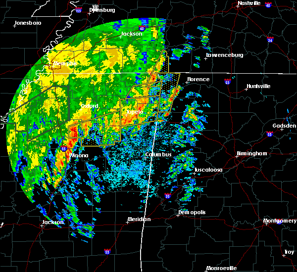 At 628 am cdt, a severe thunderstorm was located near burnsville, or near j p coleman state park, moving east at 55 mph (radar indicated). Hazards include 60 mph wind gusts. expect damage to roofs, siding, and trees At 628 am cdt, a severe thunderstorm was located near burnsville, or near j p coleman state park, moving east at 55 mph (radar indicated). Hazards include 60 mph wind gusts. expect damage to roofs, siding, and trees
|
| 4/14/2018 6:15 AM CDT |
 At 615 am cdt, a severe thunderstorm was located 9 miles northeast of walnut grove, or 15 miles southwest of waynesboro, moving east at 60 mph (radar indicated). Hazards include 60 mph wind gusts. Expect damage to roofs, siding, and trees. locations impacted include, corinth, iuka, j p coleman state park, pickwick landing state park, burnsville, glen, walnut grove, pickwick dam, pineflat, leedy, farmington, michie, doskie, strickland, hamburg, blythe crossing, bruton branch, jobes, hazard switch and walker siding. A tornado watch remains in effect until 800 am cdt for northeastern mississippi, and southwestern tennessee. At 615 am cdt, a severe thunderstorm was located 9 miles northeast of walnut grove, or 15 miles southwest of waynesboro, moving east at 60 mph (radar indicated). Hazards include 60 mph wind gusts. Expect damage to roofs, siding, and trees. locations impacted include, corinth, iuka, j p coleman state park, pickwick landing state park, burnsville, glen, walnut grove, pickwick dam, pineflat, leedy, farmington, michie, doskie, strickland, hamburg, blythe crossing, bruton branch, jobes, hazard switch and walker siding. A tornado watch remains in effect until 800 am cdt for northeastern mississippi, and southwestern tennessee.
|
| 4/14/2018 5:26 AM CDT |
 At 526 am cdt, a severe thunderstorm was located near theo, or 9 miles south of big hill pond state park, moving east at 65 mph (radar indicated). Hazards include 60 mph wind gusts. expect damage to roofs, siding, and trees At 526 am cdt, a severe thunderstorm was located near theo, or 9 miles south of big hill pond state park, moving east at 65 mph (radar indicated). Hazards include 60 mph wind gusts. expect damage to roofs, siding, and trees
|
| 4/3/2018 9:36 PM CDT |
 At 935 pm cdt, a severe thunderstorm was located near portland, or 14 miles north of gallatin, moving east at 70 mph (radar indicated). Hazards include 70 mph wind gusts and nickel size hail. Expect considerable tree damage. damage is likely to mobile homes, roofs, and outbuildings. Locations impacted include, lafayette, white house, westmoreland, portland, mitchellville, bethpage and oak grove. At 935 pm cdt, a severe thunderstorm was located near portland, or 14 miles north of gallatin, moving east at 70 mph (radar indicated). Hazards include 70 mph wind gusts and nickel size hail. Expect considerable tree damage. damage is likely to mobile homes, roofs, and outbuildings. Locations impacted include, lafayette, white house, westmoreland, portland, mitchellville, bethpage and oak grove.
|
| 4/3/2018 9:26 PM CDT |
 At 926 pm cdt, a severe thunderstorm was located near cross plains, or 12 miles northeast of springfield, moving east at 70 mph (radar indicated). Hazards include 60 mph wind gusts and nickel size hail. expect damage to roofs, siding, and trees At 926 pm cdt, a severe thunderstorm was located near cross plains, or 12 miles northeast of springfield, moving east at 70 mph (radar indicated). Hazards include 60 mph wind gusts and nickel size hail. expect damage to roofs, siding, and trees
|
| 3/19/2018 5:25 PM CDT |
 At 525 pm cdt, a severe thunderstorm was located near cross plains, or 8 miles northeast of springfield, moving east at 35 mph (radar indicated). Hazards include 60 mph wind gusts and nickel size hail. expect damage to roofs, siding, and trees At 525 pm cdt, a severe thunderstorm was located near cross plains, or 8 miles northeast of springfield, moving east at 35 mph (radar indicated). Hazards include 60 mph wind gusts and nickel size hail. expect damage to roofs, siding, and trees
|
| 2/24/2018 10:15 PM CST |
 At 1014 pm cst, a severe thunderstorm was located 8 miles southwest of westmoreland, or 9 miles northeast of gallatin, moving east at 35 mph (radar indicated). Hazards include 60 mph wind gusts and penny size hail. Expect damage to roofs, siding, and trees. this severe storm will be near, hartsville and westmoreland around 1030 pm cst. other locations impacted by this severe thunderstorm include oak grove, bledsoe creek state park, cottontown and bethpage. A tornado watch remains in effect until 200 am cst for middle tennessee. At 1014 pm cst, a severe thunderstorm was located 8 miles southwest of westmoreland, or 9 miles northeast of gallatin, moving east at 35 mph (radar indicated). Hazards include 60 mph wind gusts and penny size hail. Expect damage to roofs, siding, and trees. this severe storm will be near, hartsville and westmoreland around 1030 pm cst. other locations impacted by this severe thunderstorm include oak grove, bledsoe creek state park, cottontown and bethpage. A tornado watch remains in effect until 200 am cst for middle tennessee.
|
| 2/24/2018 9:59 PM CST |
 At 958 pm cst, a severe thunderstorm was located near white house, or 10 miles northwest of gallatin, moving east at 35 mph (radar indicated). Hazards include 60 mph wind gusts and penny size hail. Expect damage to roofs, siding, and trees. this severe thunderstorm will be near, gallatin around 1010 pm cst. hartsville and westmoreland around 1030 pm cst. other locations impacted by this severe thunderstorm include oak grove, bledsoe creek state park, cottontown and bethpage. A tornado watch remains in effect until 200 am cst for middle tennessee. At 958 pm cst, a severe thunderstorm was located near white house, or 10 miles northwest of gallatin, moving east at 35 mph (radar indicated). Hazards include 60 mph wind gusts and penny size hail. Expect damage to roofs, siding, and trees. this severe thunderstorm will be near, gallatin around 1010 pm cst. hartsville and westmoreland around 1030 pm cst. other locations impacted by this severe thunderstorm include oak grove, bledsoe creek state park, cottontown and bethpage. A tornado watch remains in effect until 200 am cst for middle tennessee.
|
| 2/24/2018 9:34 PM CST |
 At 933 pm cst, a severe thunderstorm was located over springfield, moving east at 50 mph (radar indicated). Hazards include 60 mph wind gusts. expect damage to roofs, siding, and trees At 933 pm cst, a severe thunderstorm was located over springfield, moving east at 50 mph (radar indicated). Hazards include 60 mph wind gusts. expect damage to roofs, siding, and trees
|
| 11/18/2017 4:38 PM CST |
 At 438 pm cst, severe thunderstorms were located along a line extending from portland to thompson`s station, moving east at 50 mph (radar indicated). Hazards include 70 mph wind gusts. Expect considerable tree damage. damage is likely to mobile homes, roofs, and outbuildings. Locations impacted include, murfreesboro, franklin, gallatin, lebanon, springfield, nashville, madison, hendersonville, smyrna, brentwood, la vergne, spring hill, mount juliet, goodlettsville, white house, millersville, greenbrier, nolensville, forest hills and oak hill. At 438 pm cst, severe thunderstorms were located along a line extending from portland to thompson`s station, moving east at 50 mph (radar indicated). Hazards include 70 mph wind gusts. Expect considerable tree damage. damage is likely to mobile homes, roofs, and outbuildings. Locations impacted include, murfreesboro, franklin, gallatin, lebanon, springfield, nashville, madison, hendersonville, smyrna, brentwood, la vergne, spring hill, mount juliet, goodlettsville, white house, millersville, greenbrier, nolensville, forest hills and oak hill.
|
| 11/18/2017 4:25 PM CST |
 At 424 pm cst, severe thunderstorms were located along a line extending from cross plains to leiper`s fork, moving east at 50 mph (radar indicated). Hazards include 70 mph wind gusts. Expect considerable tree damage. Damage is likely to mobile homes, roofs, and outbuildings. At 424 pm cst, severe thunderstorms were located along a line extending from cross plains to leiper`s fork, moving east at 50 mph (radar indicated). Hazards include 70 mph wind gusts. Expect considerable tree damage. Damage is likely to mobile homes, roofs, and outbuildings.
|
| 5/27/2017 11:48 PM CDT |
 At 1148 pm cdt, a severe thunderstorm was located near reagan, or 13 miles east of henderson, moving east at 65 mph (radar indicated). Hazards include 70 mph wind gusts and quarter size hail. Hail damage to vehicles is expected. expect considerable tree damage. wind damage is also likely to mobile homes, roofs, and outbuildings. locations impacted include, lexington, savannah, henderson, bolivar, selmer, pickwick landing state park, natchez trace state park, chickasaw state park, natchez trace state forest, chickasaw state forest, big hill pond state park, parsons, adamsville, decaturville, sardis, silerton, pickwick dam, masseyville, reagan and bargerton. A tornado watch remains in effect until 500 am cdt for western tennessee. At 1148 pm cdt, a severe thunderstorm was located near reagan, or 13 miles east of henderson, moving east at 65 mph (radar indicated). Hazards include 70 mph wind gusts and quarter size hail. Hail damage to vehicles is expected. expect considerable tree damage. wind damage is also likely to mobile homes, roofs, and outbuildings. locations impacted include, lexington, savannah, henderson, bolivar, selmer, pickwick landing state park, natchez trace state park, chickasaw state park, natchez trace state forest, chickasaw state forest, big hill pond state park, parsons, adamsville, decaturville, sardis, silerton, pickwick dam, masseyville, reagan and bargerton. A tornado watch remains in effect until 500 am cdt for western tennessee.
|
| 5/27/2017 11:23 PM CDT |
 At 1123 pm cdt, a severe thunderstorm was located over bemis, or near jackson, moving east at 65 mph (radar indicated). Hazards include quarter size hail. damage to vehicles is expected At 1123 pm cdt, a severe thunderstorm was located over bemis, or near jackson, moving east at 65 mph (radar indicated). Hazards include quarter size hail. damage to vehicles is expected
|
| 5/27/2017 7:15 PM CDT |
 At 715 pm cdt, a severe thunderstorm was located over gallatin, moving east at 50 mph (radar indicated). Hazards include 70 mph wind gusts and quarter size hail. Hail damage to vehicles is expected. expect considerable tree damage. Wind damage is also likely to mobile homes, roofs, and outbuildings. At 715 pm cdt, a severe thunderstorm was located over gallatin, moving east at 50 mph (radar indicated). Hazards include 70 mph wind gusts and quarter size hail. Hail damage to vehicles is expected. expect considerable tree damage. Wind damage is also likely to mobile homes, roofs, and outbuildings.
|
| 5/27/2017 6:51 PM CDT |
 At 651 pm cdt, a severe thunderstorm was located near greenbrier, or 7 miles east of springfield, moving southeast at 45 mph (radar indicated). Hazards include 70 mph wind gusts and quarter size hail. Hail damage to vehicles is expected. expect considerable tree damage. Wind damage is also likely to mobile homes, roofs, and outbuildings. At 651 pm cdt, a severe thunderstorm was located near greenbrier, or 7 miles east of springfield, moving southeast at 45 mph (radar indicated). Hazards include 70 mph wind gusts and quarter size hail. Hail damage to vehicles is expected. expect considerable tree damage. Wind damage is also likely to mobile homes, roofs, and outbuildings.
|
| 4/30/2017 3:29 PM CDT |
 At 329 pm cdt, severe thunderstorms were located along a line extending from 8 miles east of white house to 6 miles southeast of gallatin, moving northeast at 55 mph (radar indicated). Hazards include 60 mph wind gusts. expect damage to roofs, siding, and trees At 329 pm cdt, severe thunderstorms were located along a line extending from 8 miles east of white house to 6 miles southeast of gallatin, moving northeast at 55 mph (radar indicated). Hazards include 60 mph wind gusts. expect damage to roofs, siding, and trees
|
| 4/30/2017 3:21 PM CDT |
 At 321 pm cdt, severe thunderstorms were located along a line extending from near millersville to near mount juliet, moving northeast at 50 mph (radar indicated). Hazards include 60 mph wind gusts. Expect damage to roofs, siding, and trees. locations impacted include, gallatin, lebanon, hendersonville, mount juliet, white house, lakewood, hermitage, cottontown, percy priest lake and bledsoe creek state park. A tornado watch remains in effect until 700 pm cdt for middle tennessee. At 321 pm cdt, severe thunderstorms were located along a line extending from near millersville to near mount juliet, moving northeast at 50 mph (radar indicated). Hazards include 60 mph wind gusts. Expect damage to roofs, siding, and trees. locations impacted include, gallatin, lebanon, hendersonville, mount juliet, white house, lakewood, hermitage, cottontown, percy priest lake and bledsoe creek state park. A tornado watch remains in effect until 700 pm cdt for middle tennessee.
|
| 4/30/2017 3:04 PM CDT |
 At 304 pm cdt, severe thunderstorms were located along a line extending from near madison to near antioch, moving northeast at 50 mph (radar indicated). Hazards include 70 mph wind gusts. Expect considerable tree damage. Damage is likely to mobile homes, roofs, and outbuildings. At 304 pm cdt, severe thunderstorms were located along a line extending from near madison to near antioch, moving northeast at 50 mph (radar indicated). Hazards include 70 mph wind gusts. Expect considerable tree damage. Damage is likely to mobile homes, roofs, and outbuildings.
|
| 3/27/2017 8:00 PM CDT |
 At 800 pm cdt, a severe thunderstorm was located near pickwick landing state park, moving east at 25 mph (radar indicated). Hazards include 60 mph wind gusts and quarter size hail. Hail damage to vehicles is expected. expect wind damage to roofs, siding, and trees. Locations impacted include, walnut grove, shiloh, lowryville, center star, maddox, hurley, hamburg, pollards mill, bruton branch, pittsburg landing and childers hill. At 800 pm cdt, a severe thunderstorm was located near pickwick landing state park, moving east at 25 mph (radar indicated). Hazards include 60 mph wind gusts and quarter size hail. Hail damage to vehicles is expected. expect wind damage to roofs, siding, and trees. Locations impacted include, walnut grove, shiloh, lowryville, center star, maddox, hurley, hamburg, pollards mill, bruton branch, pittsburg landing and childers hill.
|
| 3/27/2017 7:37 PM CDT |
 At 737 pm cdt, a severe thunderstorm was located near shiloh, or 7 miles northwest of pickwick landing state park, moving east at 35 mph (radar indicated). Hazards include 60 mph wind gusts and half dollar size hail. Hail damage to vehicles is expected. Expect wind damage to roofs, siding, and trees. At 737 pm cdt, a severe thunderstorm was located near shiloh, or 7 miles northwest of pickwick landing state park, moving east at 35 mph (radar indicated). Hazards include 60 mph wind gusts and half dollar size hail. Hail damage to vehicles is expected. Expect wind damage to roofs, siding, and trees.
|
| 3/27/2017 4:39 PM CDT |
 The severe thunderstorm warning for sumner, north central wilson, southwestern macon and northwestern trousdale counties will expire at 445 pm cdt, the storm which prompted the warning has been replaced with a new severe thunderstorm warning. a severe thunderstorm watch remains in effect until 1000 pm cdt for middle tennessee. remember, a severe thunderstorm warning still remains in effect for sumner, trousdale, and macon counties. The severe thunderstorm warning for sumner, north central wilson, southwestern macon and northwestern trousdale counties will expire at 445 pm cdt, the storm which prompted the warning has been replaced with a new severe thunderstorm warning. a severe thunderstorm watch remains in effect until 1000 pm cdt for middle tennessee. remember, a severe thunderstorm warning still remains in effect for sumner, trousdale, and macon counties.
|
| 3/27/2017 4:28 PM CDT |
 At 427 pm cdt, a severe thunderstorm was located near gallatin, moving northeast at 45 mph (radar indicated). Hazards include 60 mph wind gusts and quarter size hail. Hail damage to vehicles is expected. expect wind damage to roofs, siding, and trees. Locations impacted include, gallatin, lafayette, white house, westmoreland, portland, mitchellville, cottontown, bethpage, oak grove and bledsoe creek state park. At 427 pm cdt, a severe thunderstorm was located near gallatin, moving northeast at 45 mph (radar indicated). Hazards include 60 mph wind gusts and quarter size hail. Hail damage to vehicles is expected. expect wind damage to roofs, siding, and trees. Locations impacted include, gallatin, lafayette, white house, westmoreland, portland, mitchellville, cottontown, bethpage, oak grove and bledsoe creek state park.
|
| 3/27/2017 4:19 PM CDT |
 At 418 pm cdt, a severe thunderstorm was located over gallatin, moving northeast at 50 mph (emergency management. radar indicated). Hazards include 70 mph wind gusts and quarter size hail. Hail damage to vehicles is expected. expect considerable tree damage. wind damage is also likely to mobile homes, roofs, and outbuildings. Locations impacted include, gallatin, lafayette, hendersonville, mount juliet, goodlettsville, white house, millersville, westmoreland, portland, mitchellville, bethpage, oak grove, bledsoe creek state park and cottontown. At 418 pm cdt, a severe thunderstorm was located over gallatin, moving northeast at 50 mph (emergency management. radar indicated). Hazards include 70 mph wind gusts and quarter size hail. Hail damage to vehicles is expected. expect considerable tree damage. wind damage is also likely to mobile homes, roofs, and outbuildings. Locations impacted include, gallatin, lafayette, hendersonville, mount juliet, goodlettsville, white house, millersville, westmoreland, portland, mitchellville, bethpage, oak grove, bledsoe creek state park and cottontown.
|
| 3/27/2017 4:14 PM CDT |
 At 413 pm cdt, a severe thunderstorm was located near gallatin, moving northeast at 45 mph (radar indicated). Hazards include 60 mph wind gusts and quarter size hail. Hail damage to vehicles is expected. Expect wind damage to roofs, siding, and trees. At 413 pm cdt, a severe thunderstorm was located near gallatin, moving northeast at 45 mph (radar indicated). Hazards include 60 mph wind gusts and quarter size hail. Hail damage to vehicles is expected. Expect wind damage to roofs, siding, and trees.
|
| 3/27/2017 4:07 PM CDT |
 At 406 pm cdt, a severe thunderstorm was located over hendersonville, or 8 miles west of gallatin, moving northeast at 50 mph (emergency management). Hazards include 60 mph wind gusts and quarter size hail. Hail damage to vehicles is expected. expect wind damage to roofs, siding, and trees. Locations impacted include, gallatin, madison, hendersonville, mount juliet, goodlettsville, white house, millersville, lakewood, cross plains, hermitage, old hickory, orlinda, bledsoe creek state park and cottontown. At 406 pm cdt, a severe thunderstorm was located over hendersonville, or 8 miles west of gallatin, moving northeast at 50 mph (emergency management). Hazards include 60 mph wind gusts and quarter size hail. Hail damage to vehicles is expected. expect wind damage to roofs, siding, and trees. Locations impacted include, gallatin, madison, hendersonville, mount juliet, goodlettsville, white house, millersville, lakewood, cross plains, hermitage, old hickory, orlinda, bledsoe creek state park and cottontown.
|
| 3/27/2017 3:52 PM CDT |
 At 352 pm cdt, a severe thunderstorm was located near nashville, moving northeast at 50 mph (radar indicated). Hazards include 70 mph wind gusts and quarter size hail. Hail damage to vehicles is expected. expect considerable tree damage. Wind damage is also likely to mobile homes, roofs, and outbuildings. At 352 pm cdt, a severe thunderstorm was located near nashville, moving northeast at 50 mph (radar indicated). Hazards include 70 mph wind gusts and quarter size hail. Hail damage to vehicles is expected. expect considerable tree damage. Wind damage is also likely to mobile homes, roofs, and outbuildings.
|
| 3/1/2017 10:21 AM CST |
 At 1021 am cst, a severe thunderstorm was located near walnut grove, or 13 miles northeast of pickwick landing state park, moving east at 60 mph (radar indicated). Hazards include 60 mph wind gusts. Expect damage to roofs, siding, and trees. Locations impacted include, pickwick landing state park, walnut grove, olive hill, pickwick dam, counce, lowryville, damon, southside, hamburg, pollards mill, bruton branch, childers hill, center star, maddox, walkertown, olivehill and winn springs. At 1021 am cst, a severe thunderstorm was located near walnut grove, or 13 miles northeast of pickwick landing state park, moving east at 60 mph (radar indicated). Hazards include 60 mph wind gusts. Expect damage to roofs, siding, and trees. Locations impacted include, pickwick landing state park, walnut grove, olive hill, pickwick dam, counce, lowryville, damon, southside, hamburg, pollards mill, bruton branch, childers hill, center star, maddox, walkertown, olivehill and winn springs.
|
| 3/1/2017 10:10 AM CST |
 At 1010 am cst, a severe thunderstorm was located near savannah, moving east at 75 mph (radar indicated). Hazards include 60 mph wind gusts. expect damage to roofs, siding, and trees At 1010 am cst, a severe thunderstorm was located near savannah, moving east at 75 mph (radar indicated). Hazards include 60 mph wind gusts. expect damage to roofs, siding, and trees
|
| 3/1/2017 6:55 AM CST |
 At 654 am cst, severe thunderstorms were located along a line extending from near springfield to near oak hill to near thompson`s station, moving east at 65 mph (radar indicated). Hazards include 70 mph wind gusts and nickel size hail. Expect considerable tree damage. Damage is likely to mobile homes, roofs, and outbuildings. At 654 am cst, severe thunderstorms were located along a line extending from near springfield to near oak hill to near thompson`s station, moving east at 65 mph (radar indicated). Hazards include 70 mph wind gusts and nickel size hail. Expect considerable tree damage. Damage is likely to mobile homes, roofs, and outbuildings.
|
| 12/17/2016 10:55 PM CST |
 At 1054 pm cst, a severe thunderstorm was located near jumpertown, or 10 miles northwest of booneville, moving northeast at 70 mph. these storms have broad rotation and may produce tornadoes (radar indicated). Hazards include 70 mph wind gusts. Expect considerable tree damage. Damage is likely to mobile homes, roofs, and outbuildings. At 1054 pm cst, a severe thunderstorm was located near jumpertown, or 10 miles northwest of booneville, moving northeast at 70 mph. these storms have broad rotation and may produce tornadoes (radar indicated). Hazards include 70 mph wind gusts. Expect considerable tree damage. Damage is likely to mobile homes, roofs, and outbuildings.
|
| 12/17/2016 10:33 PM CST |
 At 1031 pm cst, a severe thunderstorm was located near theo, or near big hill pond state park, moving northeast at 70 mph. storm spotters reported a funnel cloud with this storm along with 59 mph measured wind gust. this storm will be capable of producing tornadoes which will be monitored closely (radar indicated). Hazards include 60 mph wind gusts. expect damage to roofs, siding, and trees At 1031 pm cst, a severe thunderstorm was located near theo, or near big hill pond state park, moving northeast at 70 mph. storm spotters reported a funnel cloud with this storm along with 59 mph measured wind gust. this storm will be capable of producing tornadoes which will be monitored closely (radar indicated). Hazards include 60 mph wind gusts. expect damage to roofs, siding, and trees
|
| 8/26/2016 4:52 PM CDT |
 The severe thunderstorm warning for southern hardin county will expire at 500 pm cdt, the storm which prompted the warning has weakened below severe limits, and no longer pose an immediate threat to life or property. therefore, the warning will be allowed to expire. however gusty winds and heavy rain are still possible with this thunderstorm. to report severe weather, contact your nearest law enforcement agency. they will relay your report to the national weather service memphis. The severe thunderstorm warning for southern hardin county will expire at 500 pm cdt, the storm which prompted the warning has weakened below severe limits, and no longer pose an immediate threat to life or property. therefore, the warning will be allowed to expire. however gusty winds and heavy rain are still possible with this thunderstorm. to report severe weather, contact your nearest law enforcement agency. they will relay your report to the national weather service memphis.
|
| 8/26/2016 4:42 PM CDT |
 At 442 pm cdt, a severe thunderstorm was located over pineflat, or 7 miles southwest of pickwick landing state park, moving northwest at 35 mph (radar indicated). Hazards include 60 mph wind gusts and quarter size hail. Hail damage to vehicles is expected. expect wind damage to roofs, siding, and trees. Locations impacted include, savannah, pickwick landing state park, adamsville, shiloh, walnut grove, pickwick dam, crump, lowryville, pollards mill, red sulphur springs, hamburg, bruton branch, pittsburg landing, counce, childers hill, walkertown, damon, southside, winn springs and maddox. At 442 pm cdt, a severe thunderstorm was located over pineflat, or 7 miles southwest of pickwick landing state park, moving northwest at 35 mph (radar indicated). Hazards include 60 mph wind gusts and quarter size hail. Hail damage to vehicles is expected. expect wind damage to roofs, siding, and trees. Locations impacted include, savannah, pickwick landing state park, adamsville, shiloh, walnut grove, pickwick dam, crump, lowryville, pollards mill, red sulphur springs, hamburg, bruton branch, pittsburg landing, counce, childers hill, walkertown, damon, southside, winn springs and maddox.
|
| 8/26/2016 4:36 PM CDT |
 At 436 pm cdt, a severe thunderstorm was located near pineflat, or near j p coleman state park, moving northwest at 35 mph (radar indicated). Hazards include 60 mph wind gusts and quarter size hail. Hail damage to vehicles is expected. expect wind damage to roofs, siding, and trees. Locations impacted include, corinth, savannah, iuka, pickwick landing state park, j p coleman state park, adamsville, burnsville, shiloh, walnut grove, pickwick dam, pineflat, farmington, crump, eastview, michie, guys, stantonville, lowryville, pollards mill and old lawton. At 436 pm cdt, a severe thunderstorm was located near pineflat, or near j p coleman state park, moving northwest at 35 mph (radar indicated). Hazards include 60 mph wind gusts and quarter size hail. Hail damage to vehicles is expected. expect wind damage to roofs, siding, and trees. Locations impacted include, corinth, savannah, iuka, pickwick landing state park, j p coleman state park, adamsville, burnsville, shiloh, walnut grove, pickwick dam, pineflat, farmington, crump, eastview, michie, guys, stantonville, lowryville, pollards mill and old lawton.
|
| 8/26/2016 4:26 PM CDT |
 At 425 pm cdt, a severe thunderstorm was located near iuka, moving northwest at 35 mph (radar indicated). Hazards include 60 mph wind gusts and quarter size hail. Hail damage to vehicles is expected. expect wind damage to roofs, siding, and trees. Locations impacted include, corinth, savannah, iuka, pickwick landing state park, j p coleman state park, adamsville, burnsville, glen, shiloh, walnut grove, leedy, hinkle, pickwick dam, pineflat, midway, farmington, crump, eastview, michie and guys. At 425 pm cdt, a severe thunderstorm was located near iuka, moving northwest at 35 mph (radar indicated). Hazards include 60 mph wind gusts and quarter size hail. Hail damage to vehicles is expected. expect wind damage to roofs, siding, and trees. Locations impacted include, corinth, savannah, iuka, pickwick landing state park, j p coleman state park, adamsville, burnsville, glen, shiloh, walnut grove, leedy, hinkle, pickwick dam, pineflat, midway, farmington, crump, eastview, michie and guys.
|
| 8/26/2016 4:21 PM CDT |
 At 421 pm cdt, a severe thunderstorm was located over iuka, moving northwest at 35 mph (radar indicated). Hazards include 60 mph wind gusts and quarter size hail. Hail damage to vehicles is expected. expect wind damage to roofs, siding, and trees. Locations impacted include, corinth, booneville, savannah, baldwyn, iuka, pickwick landing state park, tishomingo state park, j p coleman state park, adamsville, belmont, burnsville, jumpertown, glen, tishomingo, shiloh, walnut grove, leedy, hinkle, burton and pickwick dam. At 421 pm cdt, a severe thunderstorm was located over iuka, moving northwest at 35 mph (radar indicated). Hazards include 60 mph wind gusts and quarter size hail. Hail damage to vehicles is expected. expect wind damage to roofs, siding, and trees. Locations impacted include, corinth, booneville, savannah, baldwyn, iuka, pickwick landing state park, tishomingo state park, j p coleman state park, adamsville, belmont, burnsville, jumpertown, glen, tishomingo, shiloh, walnut grove, leedy, hinkle, burton and pickwick dam.
|
| 8/26/2016 4:08 PM CDT |
 At 408 pm cdt, a severe thunderstorm was located near cherokee, or 8 miles southeast of iuka, moving northwest at 35 mph (radar indicated). Hazards include 60 mph wind gusts and quarter size hail. Hail damage to vehicles is expected. Expect wind damage to roofs, siding, and trees. At 408 pm cdt, a severe thunderstorm was located near cherokee, or 8 miles southeast of iuka, moving northwest at 35 mph (radar indicated). Hazards include 60 mph wind gusts and quarter size hail. Hail damage to vehicles is expected. Expect wind damage to roofs, siding, and trees.
|
| 7/8/2016 9:10 PM CDT |
 At 909 pm cdt, severe thunderstorms were located along a line extending from lafayette to thompson`s station, moving east at 60 mph (trained weather spotters. numerous trees and power lines have been blown down with these storms all across the nashville metro area). Hazards include 70 mph wind gusts and quarter size hail. Hail damage to vehicles is expected. expect considerable tree damage. wind damage is also likely to mobile homes, roofs, and outbuildings. Locations impacted include, murfreesboro, franklin, gallatin, lebanon, lafayette, carthage, hartsville, nashville, madison, hendersonville, smyrna, brentwood, la vergne, spring hill, mount juliet, goodlettsville, white house, nolensville, forest hills and oak hill. At 909 pm cdt, severe thunderstorms were located along a line extending from lafayette to thompson`s station, moving east at 60 mph (trained weather spotters. numerous trees and power lines have been blown down with these storms all across the nashville metro area). Hazards include 70 mph wind gusts and quarter size hail. Hail damage to vehicles is expected. expect considerable tree damage. wind damage is also likely to mobile homes, roofs, and outbuildings. Locations impacted include, murfreesboro, franklin, gallatin, lebanon, lafayette, carthage, hartsville, nashville, madison, hendersonville, smyrna, brentwood, la vergne, spring hill, mount juliet, goodlettsville, white house, nolensville, forest hills and oak hill.
|
| 7/8/2016 9:06 PM CDT |
 At 905 pm cdt, severe thunderstorms were located along a line extending from westmoreland to near thompson`s station, moving east at 45 mph (trained spotters. at 9 pm cdt...60 mph winds were estimated at the nws nashville office in old hickory. numerous trees and power lines have been blown down with these storms across the nashville metro area). Hazards include 60 mph wind gusts and quarter size hail. Hail damage to vehicles is expected. expect wind damage to roofs, siding, and trees. Locations impacted include, murfreesboro, franklin, gallatin, lebanon, lafayette, carthage, hartsville, nashville, madison, hendersonville, smyrna, brentwood, la vergne, spring hill, mount juliet, goodlettsville, white house, nolensville, forest hills and oak hill. At 905 pm cdt, severe thunderstorms were located along a line extending from westmoreland to near thompson`s station, moving east at 45 mph (trained spotters. at 9 pm cdt...60 mph winds were estimated at the nws nashville office in old hickory. numerous trees and power lines have been blown down with these storms across the nashville metro area). Hazards include 60 mph wind gusts and quarter size hail. Hail damage to vehicles is expected. expect wind damage to roofs, siding, and trees. Locations impacted include, murfreesboro, franklin, gallatin, lebanon, lafayette, carthage, hartsville, nashville, madison, hendersonville, smyrna, brentwood, la vergne, spring hill, mount juliet, goodlettsville, white house, nolensville, forest hills and oak hill.
|
| 7/8/2016 8:50 PM CDT |
 At 849 pm cdt, severe thunderstorms were located along a line extending from portland to near thompson`s station, moving east at 55 mph (radar indicated). Hazards include 60 mph wind gusts and quarter size hail. Hail damage to vehicles is expected. Expect wind damage to roofs, siding, and trees. At 849 pm cdt, severe thunderstorms were located along a line extending from portland to near thompson`s station, moving east at 55 mph (radar indicated). Hazards include 60 mph wind gusts and quarter size hail. Hail damage to vehicles is expected. Expect wind damage to roofs, siding, and trees.
|
| 7/8/2016 8:43 PM CDT |
 At 843 pm cdt, severe thunderstorms were located along a line extending from near portland to near fairview, moving east at 55 mph (radar indicated). Hazards include 60 mph wind gusts and quarter size hail. Hail damage to vehicles is expected. expect wind damage to roofs, siding, and trees. Locations impacted include, franklin, gallatin, springfield, ashland city, nashville, madison, hendersonville, brentwood, goodlettsville, white house, millersville, greenbrier, forest hills, oak hill, coopertown, white bluff, belle meade, kingston springs, lakewood and pegram. At 843 pm cdt, severe thunderstorms were located along a line extending from near portland to near fairview, moving east at 55 mph (radar indicated). Hazards include 60 mph wind gusts and quarter size hail. Hail damage to vehicles is expected. expect wind damage to roofs, siding, and trees. Locations impacted include, franklin, gallatin, springfield, ashland city, nashville, madison, hendersonville, brentwood, goodlettsville, white house, millersville, greenbrier, forest hills, oak hill, coopertown, white bluff, belle meade, kingston springs, lakewood and pegram.
|
| 7/8/2016 8:25 PM CDT |
 At 824 pm cdt, severe thunderstorms were located along a line extending from 1springfield to near white bluff, moving east at 45 mph (radar indicated). Hazards include 60 mph wind gusts and quarter size hail. Hail damage to vehicles is expected. Expect wind damage to roofs, siding, and trees. At 824 pm cdt, severe thunderstorms were located along a line extending from 1springfield to near white bluff, moving east at 45 mph (radar indicated). Hazards include 60 mph wind gusts and quarter size hail. Hail damage to vehicles is expected. Expect wind damage to roofs, siding, and trees.
|
| 7/7/2016 3:13 PM CDT |
 At 312 pm cdt, a severe thunderstorm was located near millersville, or 10 miles west of gallatin, moving southeast at 40 mph (radar indicated). Hazards include 60 mph wind gusts and penny size hail. Expect damage to roofs. siding. And trees. At 312 pm cdt, a severe thunderstorm was located near millersville, or 10 miles west of gallatin, moving southeast at 40 mph (radar indicated). Hazards include 60 mph wind gusts and penny size hail. Expect damage to roofs. siding. And trees.
|
| 7/7/2016 3:03 PM CDT |
 At 301 pm cdt, a severe thunderstorm was located near white house, or 9 miles northwest of gallatin, moving east at 45 mph (radar indicated. this storm has a history of wind damage in northwest robertson county). Hazards include 60 mph wind gusts and penny size hail. Expect damage to roofs. siding. and trees. Locations impacted include, gallatin, springfield, hendersonville, goodlettsville, white house, millersville, greenbrier, coopertown, ridgetop, cross plains, portland, orlinda, cedar hill, mitchellville, cottontown and oak grove. At 301 pm cdt, a severe thunderstorm was located near white house, or 9 miles northwest of gallatin, moving east at 45 mph (radar indicated. this storm has a history of wind damage in northwest robertson county). Hazards include 60 mph wind gusts and penny size hail. Expect damage to roofs. siding. and trees. Locations impacted include, gallatin, springfield, hendersonville, goodlettsville, white house, millersville, greenbrier, coopertown, ridgetop, cross plains, portland, orlinda, cedar hill, mitchellville, cottontown and oak grove.
|
| 7/7/2016 2:38 PM CDT |
 At 238 pm cdt, a severe thunderstorm was located near springfield, moving east at 50 mph (radar indicated). Hazards include 60 mph wind gusts and penny size hail. Expect damage to roofs. siding. And trees. At 238 pm cdt, a severe thunderstorm was located near springfield, moving east at 50 mph (radar indicated). Hazards include 60 mph wind gusts and penny size hail. Expect damage to roofs. siding. And trees.
|
| 7/7/2016 12:57 AM CDT |
 The severe thunderstorm warning for northeastern robertson and central sumner counties will expire at 100 am cdt, the storm which prompted the warning has weakened below severe limits, and no longer poses an immediate threat to life or property. therefore the warning will be allowed to expire. The severe thunderstorm warning for northeastern robertson and central sumner counties will expire at 100 am cdt, the storm which prompted the warning has weakened below severe limits, and no longer poses an immediate threat to life or property. therefore the warning will be allowed to expire.
|
| 7/7/2016 12:44 AM CDT |
 At 1243 am cdt, a severe thunderstorm was located 8 miles east of white house, or 8 miles northwest of gallatin, moving southeast at 35 mph (radar indicated). Hazards include 60 mph wind gusts. Expect damage to roofs. siding. and trees. Locations impacted include, gallatin, hendersonville, white house, cross plains, portland, orlinda and cottontown. At 1243 am cdt, a severe thunderstorm was located 8 miles east of white house, or 8 miles northwest of gallatin, moving southeast at 35 mph (radar indicated). Hazards include 60 mph wind gusts. Expect damage to roofs. siding. and trees. Locations impacted include, gallatin, hendersonville, white house, cross plains, portland, orlinda and cottontown.
|
| 7/7/2016 12:27 AM CDT |
 At 1226 am cdt, a severe thunderstorm was located over cross plains, or 13 miles east of springfield, moving southeast at 35 mph (radar indicated). Hazards include 70 mph wind gusts. Expect considerable tree damage. Damage is likely to mobile homes, roofs, and outbuildings. At 1226 am cdt, a severe thunderstorm was located over cross plains, or 13 miles east of springfield, moving southeast at 35 mph (radar indicated). Hazards include 70 mph wind gusts. Expect considerable tree damage. Damage is likely to mobile homes, roofs, and outbuildings.
|
| 7/6/2016 4:20 PM CDT |
 At 419 pm cdt, severe thunderstorms were located along a line extending from lafayette to oak hill, moving east at 55 mph (radar indicated). Hazards include 60 mph wind gusts and penny size hail. Expect damage to roofs. siding. and trees. Locations impacted include, gallatin, lebanon, lafayette, hartsville, nashville, madison, hendersonville, mount juliet, goodlettsville, white house, millersville, forest hills, oak hill, belle meade, lakewood, westmoreland, hermitage, belinda city, bellevue and old hickory. At 419 pm cdt, severe thunderstorms were located along a line extending from lafayette to oak hill, moving east at 55 mph (radar indicated). Hazards include 60 mph wind gusts and penny size hail. Expect damage to roofs. siding. and trees. Locations impacted include, gallatin, lebanon, lafayette, hartsville, nashville, madison, hendersonville, mount juliet, goodlettsville, white house, millersville, forest hills, oak hill, belle meade, lakewood, westmoreland, hermitage, belinda city, bellevue and old hickory.
|
| 7/6/2016 4:06 PM CDT |
 At 406 pm cdt, severe thunderstorms were located along a line extending from westmoreland to bellevue, moving east at 50 mph (radar indicated and spotter reported. at 350 pm cdt...trees were blown down in cross plains and ashland city with these storms. at 404 pm cdt, dime size hail was reported near portland). Hazards include 60 mph wind gusts and penny size hail. Expect damage to roofs. siding. and trees. Locations impacted include, gallatin, lebanon, springfield, lafayette, hartsville, nashville, madison, hendersonville, mount juliet, goodlettsville, white house, millersville, greenbrier, forest hills, oak hill, belle meade, lakewood, westmoreland, pegram and ridgetop. At 406 pm cdt, severe thunderstorms were located along a line extending from westmoreland to bellevue, moving east at 50 mph (radar indicated and spotter reported. at 350 pm cdt...trees were blown down in cross plains and ashland city with these storms. at 404 pm cdt, dime size hail was reported near portland). Hazards include 60 mph wind gusts and penny size hail. Expect damage to roofs. siding. and trees. Locations impacted include, gallatin, lebanon, springfield, lafayette, hartsville, nashville, madison, hendersonville, mount juliet, goodlettsville, white house, millersville, greenbrier, forest hills, oak hill, belle meade, lakewood, westmoreland, pegram and ridgetop.
|
| 7/6/2016 3:56 PM CDT |
 At 355 pm cdt, severe thunderstorms were located along a line extending from 8 miles northwest of westmoreland to pegram, moving east at 55 mph (radar indicated). Hazards include 60 mph wind gusts and penny size hail. Expect damage to roofs. siding. And trees. At 355 pm cdt, severe thunderstorms were located along a line extending from 8 miles northwest of westmoreland to pegram, moving east at 55 mph (radar indicated). Hazards include 60 mph wind gusts and penny size hail. Expect damage to roofs. siding. And trees.
|
| 7/6/2016 3:49 PM CDT |
 At 349 pm cdt, severe thunderstorms were located along a line extending from three springs to near white house, moving east at 60 mph (radar indicated). Hazards include 60 mph wind gusts and penny size hail. Expect damage to roofs. siding. and trees. Locations impacted include, gallatin, springfield, white house, millersville, greenbrier, westmoreland, ridgetop, cross plains, portland, orlinda, mitchellville, bledsoe creek state park, cottontown, bethpage, oak grove and black jack. At 349 pm cdt, severe thunderstorms were located along a line extending from three springs to near white house, moving east at 60 mph (radar indicated). Hazards include 60 mph wind gusts and penny size hail. Expect damage to roofs. siding. and trees. Locations impacted include, gallatin, springfield, white house, millersville, greenbrier, westmoreland, ridgetop, cross plains, portland, orlinda, mitchellville, bledsoe creek state park, cottontown, bethpage, oak grove and black jack.
|
| 7/6/2016 3:34 PM CDT |
 At 333 pm cdt, severe thunderstorms were located along a line extending from russellville to near greenbrier, moving east at 60 mph (radar indicated). Hazards include 60 mph wind gusts and penny size hail. Expect damage to roofs. siding. And trees. At 333 pm cdt, severe thunderstorms were located along a line extending from russellville to near greenbrier, moving east at 60 mph (radar indicated). Hazards include 60 mph wind gusts and penny size hail. Expect damage to roofs. siding. And trees.
|
| 6/16/2016 6:24 PM CDT |
 At 624 pm cdt, a severe thunderstorm was located near cross plains, or 14 miles northwest of gallatin, moving south at 35 mph (radar indicated). Hazards include 60 mph wind gusts. Expect damage to roofs. siding. and trees. Locations impacted include, springfield, white house, millersville, greenbrier, coopertown, cross plains, portland, orlinda, mitchellville, cottontown, bethpage, oak grove and black jack. At 624 pm cdt, a severe thunderstorm was located near cross plains, or 14 miles northwest of gallatin, moving south at 35 mph (radar indicated). Hazards include 60 mph wind gusts. Expect damage to roofs. siding. and trees. Locations impacted include, springfield, white house, millersville, greenbrier, coopertown, cross plains, portland, orlinda, mitchellville, cottontown, bethpage, oak grove and black jack.
|
| 6/16/2016 5:55 PM CDT |
 At 554 pm cdt, a severe thunderstorm was located 9 miles northwest of portland, or 18 miles southwest of bowling green, moving southeast at 40 mph (radar indicated). Hazards include 60 mph wind gusts. Expect damage to roofs. siding. And trees. At 554 pm cdt, a severe thunderstorm was located 9 miles northwest of portland, or 18 miles southwest of bowling green, moving southeast at 40 mph (radar indicated). Hazards include 60 mph wind gusts. Expect damage to roofs. siding. And trees.
|
| 6/15/2016 4:07 PM CDT |
 At 405 pm cdt, severe thunderstorms were located along a line extending from portland to goodlettsville to 6 miles northwest of belle meade, moving southeast at 35 mph (radar indicated). Hazards include 60 mph wind gusts. Expect damage to roofs. siding. and trees. Locations impacted include, gallatin, lebanon, springfield, nashville, madison, hendersonville, mount juliet, goodlettsville, white house, millersville, greenbrier, forest hills, oak hill, coopertown, belle meade, lakewood, westmoreland, ridgetop, cross plains and portland. At 405 pm cdt, severe thunderstorms were located along a line extending from portland to goodlettsville to 6 miles northwest of belle meade, moving southeast at 35 mph (radar indicated). Hazards include 60 mph wind gusts. Expect damage to roofs. siding. and trees. Locations impacted include, gallatin, lebanon, springfield, nashville, madison, hendersonville, mount juliet, goodlettsville, white house, millersville, greenbrier, forest hills, oak hill, coopertown, belle meade, lakewood, westmoreland, ridgetop, cross plains and portland.
|
| 6/15/2016 3:52 PM CDT |
 At 351 pm cdt, severe thunderstorms were located along a line extending from 6 miles west of cross plains to near joelton, moving east at 40 mph (radar indicated). Hazards include 60 mph wind gusts. Expect damage to roofs. siding. And trees. At 351 pm cdt, severe thunderstorms were located along a line extending from 6 miles west of cross plains to near joelton, moving east at 40 mph (radar indicated). Hazards include 60 mph wind gusts. Expect damage to roofs. siding. And trees.
|
| 5/10/2016 11:01 PM CDT |
 At 1101 pm cdt, severe thunderstorms were located along a line extending from near joelton to near millersville, moving east at 30 mph (radar indicated). Hazards include golf ball size hail and 60 mph wind gusts. People and animals outdoors will be injured. expect hail damage to roofs, siding, windows, and vehicles. expect wind damage to roofs, siding, and trees. Locations impacted include, springfield, ashland city, hendersonville, goodlettsville, white house, millersville, greenbrier, coopertown, ridgetop, joelton, pleasant view and cottontown. At 1101 pm cdt, severe thunderstorms were located along a line extending from near joelton to near millersville, moving east at 30 mph (radar indicated). Hazards include golf ball size hail and 60 mph wind gusts. People and animals outdoors will be injured. expect hail damage to roofs, siding, windows, and vehicles. expect wind damage to roofs, siding, and trees. Locations impacted include, springfield, ashland city, hendersonville, goodlettsville, white house, millersville, greenbrier, coopertown, ridgetop, joelton, pleasant view and cottontown.
|
| 5/10/2016 10:51 PM CDT |
 At 1050 pm cdt, severe thunderstorms were located along a line extending from near coopertown to millersville, moving east at 35 mph (radar indicated). Hazards include golf ball size hail. People and animals outdoors will be injured. Expect damage to roofs, siding, windows, and vehicles. At 1050 pm cdt, severe thunderstorms were located along a line extending from near coopertown to millersville, moving east at 35 mph (radar indicated). Hazards include golf ball size hail. People and animals outdoors will be injured. Expect damage to roofs, siding, windows, and vehicles.
|
| 5/10/2016 10:12 PM CDT |
 At 1011 pm cdt, a severe thunderstorm was located 7 miles northeast of white house, or 10 miles northwest of gallatin, moving east at 30 mph (radar indicated). Hazards include golf ball size hail. People and animals outdoors will be injured. Expect damage to roofs, siding, windows, and vehicles. At 1011 pm cdt, a severe thunderstorm was located 7 miles northeast of white house, or 10 miles northwest of gallatin, moving east at 30 mph (radar indicated). Hazards include golf ball size hail. People and animals outdoors will be injured. Expect damage to roofs, siding, windows, and vehicles.
|
| 5/10/2016 10:01 PM CDT |
 At 1000 pm cdt, a severe thunderstorm was located near white house, or 12 miles northwest of gallatin, moving east at 30 mph (radar indicated). Hazards include golf ball size hail and 60 mph wind gusts. People and animals outdoors will be injured. expect hail damage to roofs, siding, windows, and vehicles. expect wind damage to roofs, siding, and trees. locations impacted include, gallatin, white house, cross plains, portland, orlinda, cottontown and oak grove. nickel size hail was reported at cross plains. A tornado watch remains in effect until 1100 pm cdt for middle tennessee. At 1000 pm cdt, a severe thunderstorm was located near white house, or 12 miles northwest of gallatin, moving east at 30 mph (radar indicated). Hazards include golf ball size hail and 60 mph wind gusts. People and animals outdoors will be injured. expect hail damage to roofs, siding, windows, and vehicles. expect wind damage to roofs, siding, and trees. locations impacted include, gallatin, white house, cross plains, portland, orlinda, cottontown and oak grove. nickel size hail was reported at cross plains. A tornado watch remains in effect until 1100 pm cdt for middle tennessee.
|
| 5/10/2016 9:43 PM CDT |
 At 942 pm cdt, a severe thunderstorm was located near cross plains, or near springfield, moving east at 30 mph (radar indicated). Hazards include golf ball size hail and 60 mph wind gusts. People and animals outdoors will be injured. expect hail damage to roofs, siding, windows, and vehicles. Expect wind damage to roofs, siding, and trees. At 942 pm cdt, a severe thunderstorm was located near cross plains, or near springfield, moving east at 30 mph (radar indicated). Hazards include golf ball size hail and 60 mph wind gusts. People and animals outdoors will be injured. expect hail damage to roofs, siding, windows, and vehicles. Expect wind damage to roofs, siding, and trees.
|
| 5/10/2016 9:37 PM CDT |
 At 936 pm cdt, a severe thunderstorm was located near springfield, moving east at 20 mph (radar indicated). Hazards include quarter size hail. Damage to vehicles is expected. locations impacted include, springfield, white house, cross plains and orlinda. A tornado watch remains in effect until 1100 pm cdt for middle tennessee. At 936 pm cdt, a severe thunderstorm was located near springfield, moving east at 20 mph (radar indicated). Hazards include quarter size hail. Damage to vehicles is expected. locations impacted include, springfield, white house, cross plains and orlinda. A tornado watch remains in effect until 1100 pm cdt for middle tennessee.
|
| 5/10/2016 9:18 PM CDT |
 At 918 pm cdt, a severe thunderstorm was located near springfield, moving east at 25 mph (radar indicated). Hazards include quarter size hail. damage to vehicles is expected At 918 pm cdt, a severe thunderstorm was located near springfield, moving east at 25 mph (radar indicated). Hazards include quarter size hail. damage to vehicles is expected
|
| 3/31/2016 5:10 PM CDT |
 The severe thunderstorm warning for eastern hardin county will expire at 515 pm cdt, the storm which prompted the warning has moved out of the area. therefore the warning will be allowed to expire. a tornado watch remains in effect until 1000 pm cdt for western tennessee. The severe thunderstorm warning for eastern hardin county will expire at 515 pm cdt, the storm which prompted the warning has moved out of the area. therefore the warning will be allowed to expire. a tornado watch remains in effect until 1000 pm cdt for western tennessee.
|
| 3/31/2016 4:40 PM CDT |
 At 440 pm cdt, a severe thunderstorm was located over olive hill, or 13 miles east of savannah, moving east at 55 mph (radar indicated). Hazards include 60 mph wind gusts and quarter size hail. Hail damage to vehicles is expected. Expect wind damage to roofs, siding, and trees. At 440 pm cdt, a severe thunderstorm was located over olive hill, or 13 miles east of savannah, moving east at 55 mph (radar indicated). Hazards include 60 mph wind gusts and quarter size hail. Hail damage to vehicles is expected. Expect wind damage to roofs, siding, and trees.
|
| 12/23/2015 7:16 PM CST | Wayne county post office destroyed in lutts. multiple homes damaged and powerlines down. multiple injuries reported. report was relayed by lawrence co ema. likely torna in wayne county TN, 9.7 miles WSW of Walnut Grove, TN |
| 12/23/2015 7:02 PM CST | At 702 pm cst, a severe thunderstorm producing a tornado was located near walnut grove, or near j p coleman state park, moving northeast at 45 mph (radar indicated rotation). Hazards include tornado and quarter size hail. Flying debris will be dangerous to those caught without shelter. mobile homes will be damaged or destroyed. damage to roofs, windows and vehicles will occur. Tree damage is likely. |
| 12/23/2015 6:50 PM CST | At 650 pm cst, a severe thunderstorm producing a tornado was located near walnut grove, or 14 miles east of pickwick landing state park, moving east at 55 mph (radar indicated rotation). Hazards include tornado and quarter size hail. Flying debris will be dangerous to those caught without shelter. mobile homes will be damaged or destroyed. damage to roofs, windows and vehicles will occur. tree damage is likely. Locations impacted include, j p coleman state park, pickwick landing state park, pineflat, walnut grove, pickwick dam, lowryville, pollards mill, red sulphur springs, winn springs and bruton branch. |
| 12/23/2015 6:50 PM CST | At 650 pm cst, a severe thunderstorm producing a tornado was located near walnut grove, or 14 miles east of pickwick landing state park, moving east at 55 mph (radar indicated rotation). Hazards include tornado and quarter size hail. Flying debris will be dangerous to those caught without shelter. mobile homes will be damaged or destroyed. damage to roofs, windows and vehicles will occur. tree damage is likely. Locations impacted include, j p coleman state park, pickwick landing state park, pineflat, walnut grove, pickwick dam, lowryville, pollards mill, red sulphur springs, winn springs and bruton branch. |
| 12/23/2015 6:32 PM CST | At 632 pm cst, a severe thunderstorm producing a tornado was located over pickwick dam, or over pickwick landing state park, moving northeast at 50 mph (radar indicated rotation). Hazards include tornado and quarter size hail. Flying debris will be dangerous to those caught without shelter. mobile homes will be damaged or destroyed. damage to roofs, windows and vehicles will occur. tree damage is likely. Locations impacted include, corinth, j p coleman state park, pickwick landing state park, burnsville, glen, pineflat, walnut grove, pickwick dam, farmington, lowryville, jobes, pollards mill, kendrick, red sulphur springs, strickland, bruton branch, doskie, counce, damon and southside. |
| 12/23/2015 6:32 PM CST | At 632 pm cst, a severe thunderstorm producing a tornado was located over pickwick dam, or over pickwick landing state park, moving northeast at 50 mph (radar indicated rotation). Hazards include tornado and quarter size hail. Flying debris will be dangerous to those caught without shelter. mobile homes will be damaged or destroyed. damage to roofs, windows and vehicles will occur. tree damage is likely. Locations impacted include, corinth, j p coleman state park, pickwick landing state park, burnsville, glen, pineflat, walnut grove, pickwick dam, farmington, lowryville, jobes, pollards mill, kendrick, red sulphur springs, strickland, bruton branch, doskie, counce, damon and southside. |
| 12/23/2015 6:20 PM CST | At 619 pm cst, a severe thunderstorm producing a tornado was located near corinth, moving east at 55 mph (radar indicated rotation). Hazards include tornado and quarter size hail. Flying debris will be dangerous to those caught without shelter. mobile homes will be damaged or destroyed. damage to roofs, windows and vehicles will occur. Tree damage is likely. |
| 12/23/2015 6:20 PM CST | At 619 pm cst, a severe thunderstorm producing a tornado was located near corinth, moving east at 55 mph (radar indicated rotation). Hazards include tornado and quarter size hail. Flying debris will be dangerous to those caught without shelter. mobile homes will be damaged or destroyed. damage to roofs, windows and vehicles will occur. Tree damage is likely. |
| 7/28/2015 3:27 PM CDT |
 At 326 pm cdt, a severe thunderstorm was located near millersville, or 10 miles west of gallatin, moving southeast at 25 mph (radar indicated). Hazards include 60 mph wind gusts and penny size hail. Expect damage to roofs. siding and trees. this severe thunderstorm will be near, hendersonville around 335 pm cdt. madison around 340 pm cdt. lakewood and old hickory around 345 pm cdt. mount juliet around 350 pm cdt. hermitage around 355 pm cdt. lebanon around 400 pm cdt. Other locations impacted by this severe thunderstorm include cottontown. At 326 pm cdt, a severe thunderstorm was located near millersville, or 10 miles west of gallatin, moving southeast at 25 mph (radar indicated). Hazards include 60 mph wind gusts and penny size hail. Expect damage to roofs. siding and trees. this severe thunderstorm will be near, hendersonville around 335 pm cdt. madison around 340 pm cdt. lakewood and old hickory around 345 pm cdt. mount juliet around 350 pm cdt. hermitage around 355 pm cdt. lebanon around 400 pm cdt. Other locations impacted by this severe thunderstorm include cottontown.
|
| 7/14/2015 5:36 PM CDT |
 At 536 pm cdt, severe thunderstorms were located along a line extending from near savannah to near hinkle, moving southeast at 45 mph (radar indicated). Hazards include 60 mph wind gusts. Expect damage to roofs. Siding and trees. At 536 pm cdt, severe thunderstorms were located along a line extending from near savannah to near hinkle, moving southeast at 45 mph (radar indicated). Hazards include 60 mph wind gusts. Expect damage to roofs. Siding and trees.
|
| 7/14/2015 5:07 PM CDT |
 At 506 pm cdt, severe thunderstorms were located along a line extending from near mifflin to near masseyville to 8 miles southwest of pocahontas, moving southeast at 55 mph (radar indicated). Hazards include 60 mph wind gusts. Expect damage to roofs. Siding and trees. At 506 pm cdt, severe thunderstorms were located along a line extending from near mifflin to near masseyville to 8 miles southwest of pocahontas, moving southeast at 55 mph (radar indicated). Hazards include 60 mph wind gusts. Expect damage to roofs. Siding and trees.
|
| 6/26/2015 5:38 PM CDT | The severe thunderstorm warning for northeastern robertson and northwestern sumner counties will expire at 545 pm cdt, the storm which prompted the warning has weakened below severe limits, and no longer pose an immediate threat to life or property. therefore the warning will be allowed to expire. a severe thunderstorm watch remains in effect until 1000 pm cdt for central tennessee. |
| 6/26/2015 5:29 PM CDT | At 529 pm cdt, a severe thunderstorm was located near portland, or 14 miles northwest of gallatin, moving east at 25 mph (radar indicated). Hazards include 60 mph wind gusts. Expect damage to roofs. siding and trees. this severe storm will be near, portland around 535 pm cdt. Other locations impacted by this severe thunderstorm include orlinda and mitchellville. |
| 6/26/2015 5:05 PM CDT | At 505 pm cdt, a severe thunderstorm was located 7 miles northwest of cross plains, or 9 miles northeast of springfield, moving east at 30 mph (radar indicated). Hazards include 60 mph wind gusts and quarter size hail. Hail damage to vehicles is expected. expect wind damage to roofs, siding and trees. this severe thunderstorm will be near, cross plains around 515 pm cdt. white house around 520 pm cdt. portland around 530 pm cdt. Other locations impacted by this severe thunderstorm include orlinda and mitchellville. |
| 6/8/2015 2:23 PM CDT |
 The severe thunderstorm warning for central sumner and east central robertson counties will expire at 230 pm cdt, the storm which prompted the warning has weakened below severe limits, and no longer poses an immediate threat to life or property. The severe thunderstorm warning for central sumner and east central robertson counties will expire at 230 pm cdt, the storm which prompted the warning has weakened below severe limits, and no longer poses an immediate threat to life or property.
|
| 6/8/2015 2:10 PM CDT |
 At 209 pm cdt, a severe thunderstorm was located 6 miles east of white house, and moving east at 30 mph (radar indicated). Hazards include 60 mph wind gusts and quarter size hail. Hail damage to vehicles is expected. expect wind damage to roofs, siding and trees. The severe thunderstorm will affect mainly rural areas of central sumner and east central robertson counties. At 209 pm cdt, a severe thunderstorm was located 6 miles east of white house, and moving east at 30 mph (radar indicated). Hazards include 60 mph wind gusts and quarter size hail. Hail damage to vehicles is expected. expect wind damage to roofs, siding and trees. The severe thunderstorm will affect mainly rural areas of central sumner and east central robertson counties.
|
| 6/8/2015 1:56 PM CDT |
 At 154 pm cdt, a severe thunderstorm was located near white house, and moving east at 30 mph (radar indicated). Hazards include 60 mph wind gusts and quarter size hail. Hail damage to vehicles is expected. expect wind damage to roofs, siding and trees. the severe thunderstorm will be near, gallatin around 220 pm cdt. Other locations in the warning include cottontown. At 154 pm cdt, a severe thunderstorm was located near white house, and moving east at 30 mph (radar indicated). Hazards include 60 mph wind gusts and quarter size hail. Hail damage to vehicles is expected. expect wind damage to roofs, siding and trees. the severe thunderstorm will be near, gallatin around 220 pm cdt. Other locations in the warning include cottontown.
|
| 6/8/2015 1:29 PM CDT |
 At 128 pm cdt, a severe thunderstorm was located near springfield, and moving east at 40 mph (radar indicated). Hazards include 60 mph wind gusts and quarter size hail. Hail damage to vehicles is expected. expect wind damage to roofs, siding and trees. the severe thunderstorm will be near, greenbrier around 135 pm cdt. ridgetop around 140 pm cdt. cross plains and millersville around 145 pm cdt. white house around 150 pm cdt. Other locations in the warning include cottontown. At 128 pm cdt, a severe thunderstorm was located near springfield, and moving east at 40 mph (radar indicated). Hazards include 60 mph wind gusts and quarter size hail. Hail damage to vehicles is expected. expect wind damage to roofs, siding and trees. the severe thunderstorm will be near, greenbrier around 135 pm cdt. ridgetop around 140 pm cdt. cross plains and millersville around 145 pm cdt. white house around 150 pm cdt. Other locations in the warning include cottontown.
|
| 5/17/2015 5:20 PM CDT | At 518 pm cdt, a severe thunderstorm was located 6 miles northeast of hendersonville, and moving northeast at 35 mph (radar indicated). Hazards include 60 mph wind gusts. Expect damage to roofs. siding and trees. the severe thunderstorm will be near, gallatin around 525 pm cdt. other locations in the warning include cottontown. 75in. |
| 5/17/2015 5:10 PM CDT | At 507 pm cdt, a severe thunderstorm was located near hendersonville, and moving northeast at 35 mph (radar indicated). Hazards include 60 mph wind gusts. Expect damage to roofs. siding and trees. the severe thunderstorm will be near, gallatin around 525 pm cdt. other locations in the warning include cottontown. 75in. |
| 4/19/2015 3:58 PM CDT | At 351 pm cdt, a severe thunderstorm was located 5 miles west of gallatin, and moving northeast at 45 mph (radar indicated). Hazards include 60 mph wind gusts and penny size hail. Expect damage to roofs. siding and trees. the severe thunderstorm will affect mainly rural areas of northwestern wilson and sumner counties. 0. 75in. |
| 4/19/2015 3:33 PM CDT | this alert has expired |
| 4/10/2015 2:27 AM CDT | The national weather service in nashville has issued a * severe thunderstorm warning for. northwestern macon county in middle tennessee. northern sumner county in middle tennessee. until 300 am cdt * at 227 am cdt. A severe thunderstorm was located near portland. |
| 4/3/2015 2:06 PM CDT | A severe thunderstorm warning remains in effect for northern sumner and extreme northeastern robertson counties until 230 pm cdt. at 205 pm cdt. a severe thunderstorm was located 5 miles southeast of portland. and moving east at 60 mph. hazard. 60 mph wind gusts and quarter size hail. |
| 4/3/2015 1:00 PM CST | Quarter sized hail reported 1.1 miles ESE of Walnut Grove, TN |
| 4/3/2015 1:56 PM CDT | The national weather service in nashville has issued a * severe thunderstorm warning for. eastern robertson county in middle tennessee. northern sumner county in middle tennessee. until 230 pm cdt * at 155 pm cdt. A severe thunderstorm was located near cross. |
| 3/31/2015 8:25 PM CDT | The national weather service in memphis has issued a * severe thunderstorm warning for. northern tishomingo county in northeastern mississippi. southern hardin county in southwestern tennessee. southeastern mcnairy county in southwestern tennessee. Until 915 pm cdt. |
| 3/31/2015 8:25 PM CDT | The national weather service in memphis has issued a * severe thunderstorm warning for. northern tishomingo county in northeastern mississippi. southern hardin county in southwestern tennessee. southeastern mcnairy county in southwestern tennessee. Until 915 pm cdt. |
| 3/31/2015 7:39 PM CDT | The national weather service in memphis has issued a * severe thunderstorm warning for. northern tishomingo county in northeastern mississippi. southern hardin county in southwestern tennessee. southeastern mcnairy county in southwestern tennessee. Until 830 pm cdt. |
| 3/31/2015 7:39 PM CDT | The national weather service in memphis has issued a * severe thunderstorm warning for. northern tishomingo county in northeastern mississippi. southern hardin county in southwestern tennessee. southeastern mcnairy county in southwestern tennessee. Until 830 pm cdt. |
| 3/31/2015 6:54 PM CDT | The national weather service in memphis has issued a * severe thunderstorm warning for. northeastern alcorn county in northeastern mississippi. northwestern tishomingo county in northeastern mississippi. southern hardin county in southwestern tennessee. Southeastern mcnairy county in southwestern tennessee. |
| 3/31/2015 6:54 PM CDT | The national weather service in memphis has issued a * severe thunderstorm warning for. northeastern alcorn county in northeastern mississippi. northwestern tishomingo county in northeastern mississippi. southern hardin county in southwestern tennessee. Southeastern mcnairy county in southwestern tennessee. |
| 3/31/2015 6:21 PM CDT | The national weather service in memphis has issued a * severe thunderstorm warning for. northern tishomingo county in northeastern mississippi. southern hardin county in southwestern tennessee. southeastern mcnairy county in southwestern tennessee. Until 700 pm cdt. |
| 3/31/2015 6:21 PM CDT | The national weather service in memphis has issued a * severe thunderstorm warning for. northern tishomingo county in northeastern mississippi. southern hardin county in southwestern tennessee. southeastern mcnairy county in southwestern tennessee. Until 700 pm cdt. |
| 3/31/2015 6:06 PM CDT | A severe thunderstorm warning remains in effect until 630 pm cdt for northeastern alcorn. northern tishomingo. southern hardin and southeastern mcnairy counties. at 606 pm cdt. doppler radar indicated a severe thunderstorm producing large destructive hail up to tennis ball size and damaging winds in excess of 60 mph. this storm was located over pineflat. Or. |
| 3/31/2015 6:06 PM CDT | A severe thunderstorm warning remains in effect until 630 pm cdt for northeastern alcorn. northern tishomingo. southern hardin and southeastern mcnairy counties. at 606 pm cdt. doppler radar indicated a severe thunderstorm producing large destructive hail up to tennis ball size and damaging winds in excess of 60 mph. this storm was located over pineflat. Or. |
| 3/31/2015 6:00 PM CDT | A severe thunderstorm warning remains in effect until 630 pm cdt for northeastern alcorn. northern tishomingo. southern hardin and southeastern mcnairy counties. at 559 pm cdt. doppler radar indicated a severe thunderstorm producing large damaging hail up to golf ball size and damaging winds in excess of 60 mph. this storm was located over pineflat. Or near. |
| 3/31/2015 6:00 PM CDT | A severe thunderstorm warning remains in effect until 630 pm cdt for northeastern alcorn. northern tishomingo. southern hardin and southeastern mcnairy counties. at 559 pm cdt. doppler radar indicated a severe thunderstorm producing large damaging hail up to golf ball size and damaging winds in excess of 60 mph. this storm was located over pineflat. Or near. |
| 3/31/2015 5:47 PM CDT | The national weather service in memphis has issued a * severe thunderstorm warning for. northeastern alcorn county in northeastern mississippi. northern tishomingo county in northeastern mississippi. southern hardin county in southwestern tennessee. Southeastern mcnairy county in southwestern tennessee. |
| 3/31/2015 5:47 PM CDT | The national weather service in memphis has issued a * severe thunderstorm warning for. northeastern alcorn county in northeastern mississippi. northern tishomingo county in northeastern mississippi. southern hardin county in southwestern tennessee. Southeastern mcnairy county in southwestern tennessee. |
| 6/20/2013 1:30 PM CDT | 2 or 3 shallow rooted trees blown down across hwy 76 in sumner county TN, 1.5 miles E of Walnut Grove, TN |
| 7/19/2012 9:05 PM CDT | Trees down along hwy 25 in cottontown in sumner county TN, 1.1 miles ESE of Walnut Grove, TN |
| 7/6/2012 2:20 PM CDT | A few trees down near the walnut grove community in southeastern hardin count in hardin county TN, 1 miles W of Walnut Grove, TN |
| 6/11/2012 6:40 PM CDT | A tree was reported downed in the white house are in sumner county TN, 2.6 miles NNW of Walnut Grove, TN |
| 1/1/0001 12:00 AM | Trees blocking hwy 25 at halltown r in sumner county TN, 1.1 miles ESE of Walnut Grove, TN |
| 1/1/0001 12:00 AM | Trees down hwy 25 and 71 in sumner county TN, 1.5 miles SE of Walnut Grove, TN |
| 1/1/0001 12:00 AM | Trees down hwy 25 and 71 in sumner county TN, 1.5 miles SE of Walnut Grove, TN |
Hail Maps for Walnut Grove, TN
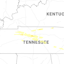


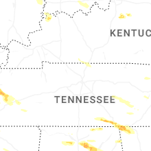
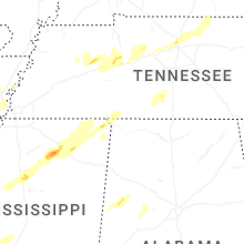


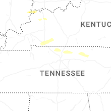


Connect with Interactive Hail Maps