| 7/10/2023 5:08 PM PDT |
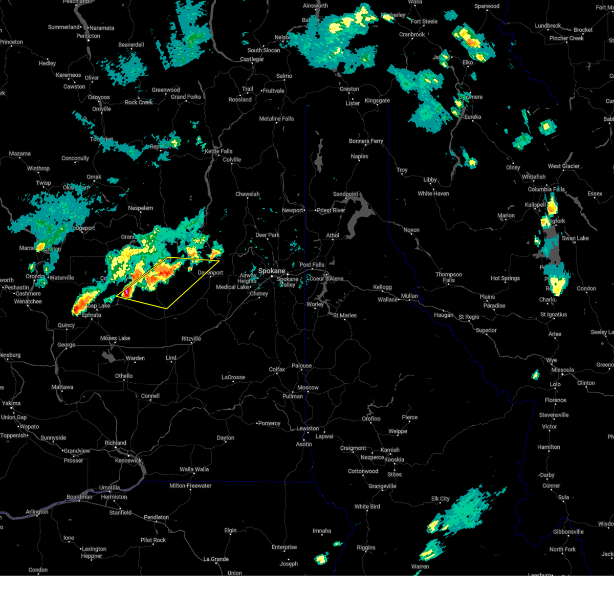 At 508 pm pdt, severe thunderstorms were located along a line extending from 20 miles west of davenport to 10 miles southeast of banks lake south, moving east at 20 mph (radar indicated). Hazards include 60 mph wind gusts and quarter size hail. Hail damage to vehicles is expected. Expect wind damage to roofs, siding, and trees. At 508 pm pdt, severe thunderstorms were located along a line extending from 20 miles west of davenport to 10 miles southeast of banks lake south, moving east at 20 mph (radar indicated). Hazards include 60 mph wind gusts and quarter size hail. Hail damage to vehicles is expected. Expect wind damage to roofs, siding, and trees.
|
| 7/10/2023 4:46 PM PDT |
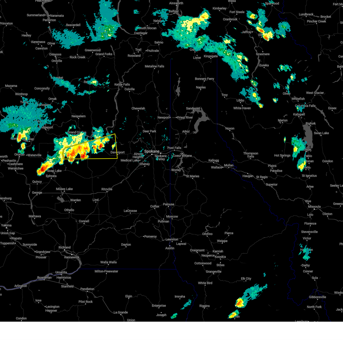 At 445 pm pdt, severe thunderstorms were located along a line extending from 18 miles northwest of davenport to near banks lake south, moving southeast at 10 mph (radar indicated). Hazards include 60 mph wind gusts and quarter size hail. Hail damage to vehicles is expected. expect wind damage to roofs, siding, and trees. locations impacted include, davenport, banks lake south, lincoln, wilbur, coulee city, almira, creston, hartline, govan, coffeepot lake, miles, telford, rocklyn, and sherman. this includes u. s. highway 2 in washington between mile markers 191 and 250. hail threat, radar indicated max hail size, 1. 00 in wind threat, radar indicated max wind gust, 60 mph. At 445 pm pdt, severe thunderstorms were located along a line extending from 18 miles northwest of davenport to near banks lake south, moving southeast at 10 mph (radar indicated). Hazards include 60 mph wind gusts and quarter size hail. Hail damage to vehicles is expected. expect wind damage to roofs, siding, and trees. locations impacted include, davenport, banks lake south, lincoln, wilbur, coulee city, almira, creston, hartline, govan, coffeepot lake, miles, telford, rocklyn, and sherman. this includes u. s. highway 2 in washington between mile markers 191 and 250. hail threat, radar indicated max hail size, 1. 00 in wind threat, radar indicated max wind gust, 60 mph.
|
| 7/10/2023 4:24 PM PDT |
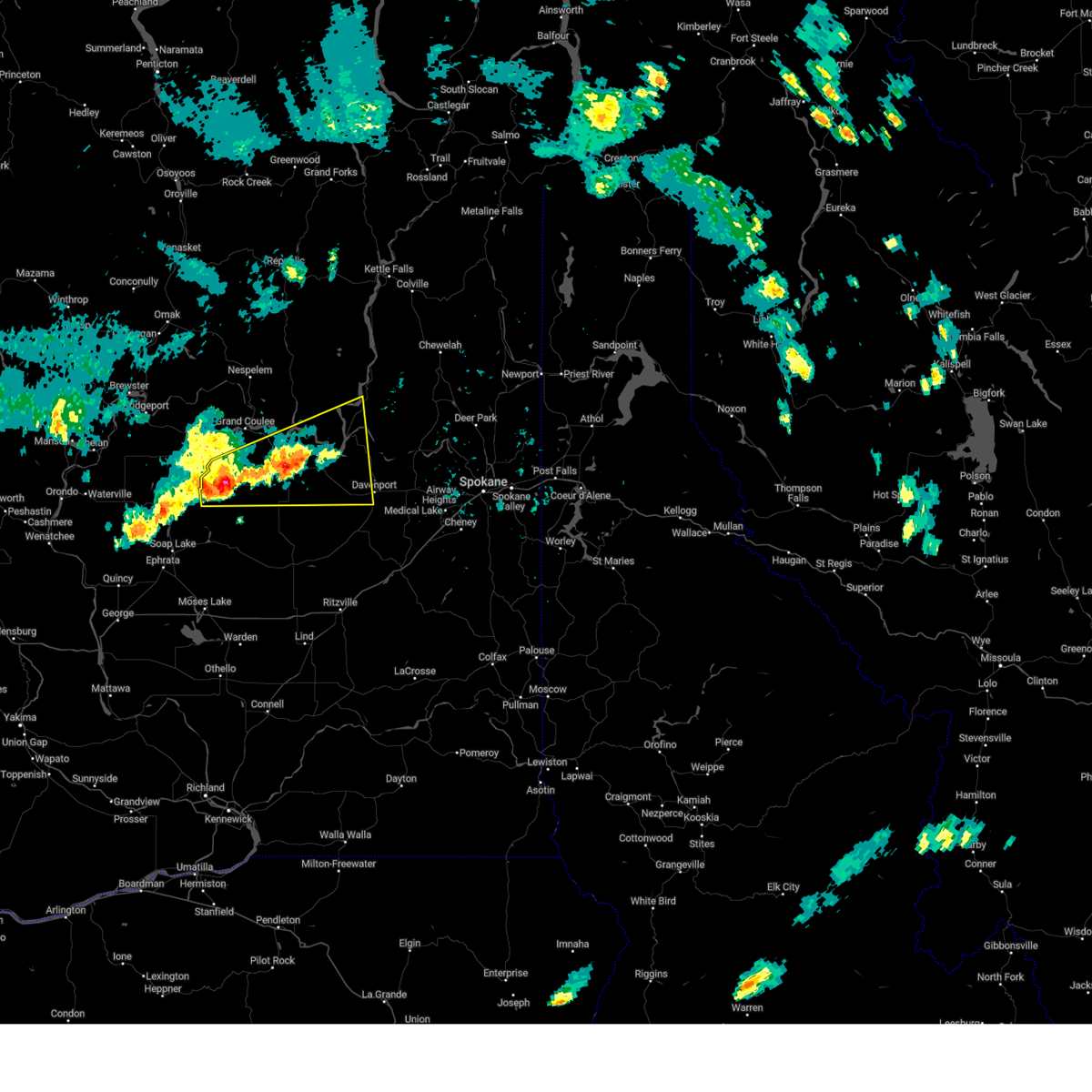 At 424 pm pdt, severe thunderstorms were located along a line extending from 24 miles northwest of davenport to near banks lake south, moving northeast at 30 mph (radar indicated). Hazards include 60 mph wind gusts and half dollar size hail. Hail damage to vehicles is expected. Expect wind damage to roofs, siding, and trees. At 424 pm pdt, severe thunderstorms were located along a line extending from 24 miles northwest of davenport to near banks lake south, moving northeast at 30 mph (radar indicated). Hazards include 60 mph wind gusts and half dollar size hail. Hail damage to vehicles is expected. Expect wind damage to roofs, siding, and trees.
|
| 7/10/2023 3:57 PM PDT |
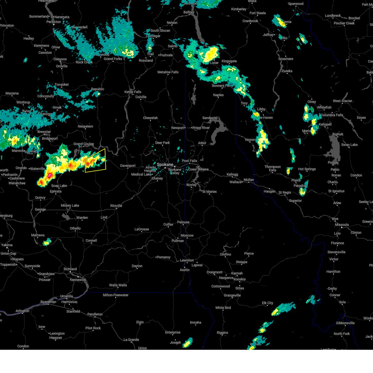 At 357 pm pdt, a severe thunderstorm was located 20 miles east of banks lake south, or 46 miles northeast of moses lake, moving northeast at 10 mph (radar indicated). Hazards include 60 mph wind gusts and quarter size hail. Hail damage to vehicles is expected. expect wind damage to roofs, siding, and trees. locations impacted include, wilbur, almira, sherman, and govan. this includes u. s. highway 2 in washington between mile markers 208 and 227. hail threat, radar indicated max hail size, 1. 00 in wind threat, radar indicated max wind gust, 60 mph. At 357 pm pdt, a severe thunderstorm was located 20 miles east of banks lake south, or 46 miles northeast of moses lake, moving northeast at 10 mph (radar indicated). Hazards include 60 mph wind gusts and quarter size hail. Hail damage to vehicles is expected. expect wind damage to roofs, siding, and trees. locations impacted include, wilbur, almira, sherman, and govan. this includes u. s. highway 2 in washington between mile markers 208 and 227. hail threat, radar indicated max hail size, 1. 00 in wind threat, radar indicated max wind gust, 60 mph.
|
| 7/10/2023 3:38 PM PDT |
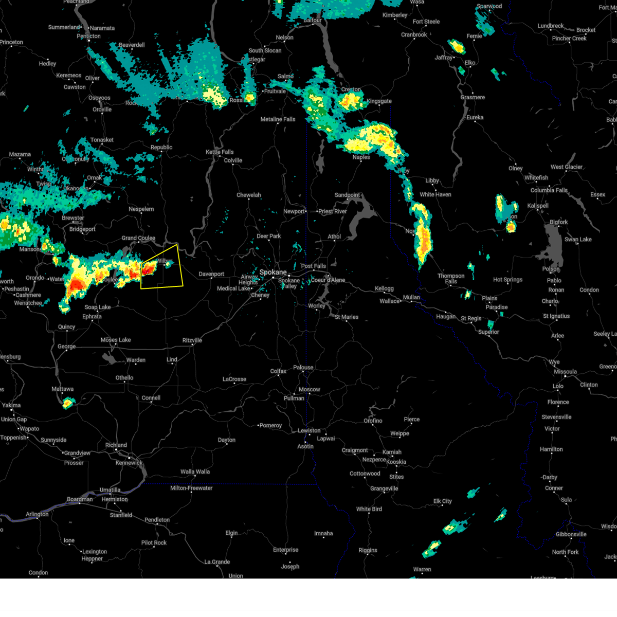 At 337 pm pdt, a severe thunderstorm was located 17 miles east of banks lake south, or 42 miles northeast of moses lake, moving east at 20 mph (radar indicated). Hazards include 60 mph wind gusts and half dollar size hail. Hail damage to vehicles is expected. Expect wind damage to roofs, siding, and trees. At 337 pm pdt, a severe thunderstorm was located 17 miles east of banks lake south, or 42 miles northeast of moses lake, moving east at 20 mph (radar indicated). Hazards include 60 mph wind gusts and half dollar size hail. Hail damage to vehicles is expected. Expect wind damage to roofs, siding, and trees.
|
| 6/26/2019 4:10 PM PDT |
Small branches torn off trees; gust estimated at 40mp in lincoln county WA, 1.3 miles N of Wilbur, WA
|
| 8/25/2013 8:30 PM PDT |
Large tree knocked down in sherman cemeter in lincoln county WA, 6.9 miles SW of Wilbur, WA
|
 At 508 pm pdt, severe thunderstorms were located along a line extending from 20 miles west of davenport to 10 miles southeast of banks lake south, moving east at 20 mph (radar indicated). Hazards include 60 mph wind gusts and quarter size hail. Hail damage to vehicles is expected. Expect wind damage to roofs, siding, and trees.
 At 445 pm pdt, severe thunderstorms were located along a line extending from 18 miles northwest of davenport to near banks lake south, moving southeast at 10 mph (radar indicated). Hazards include 60 mph wind gusts and quarter size hail. Hail damage to vehicles is expected. expect wind damage to roofs, siding, and trees. locations impacted include, davenport, banks lake south, lincoln, wilbur, coulee city, almira, creston, hartline, govan, coffeepot lake, miles, telford, rocklyn, and sherman. this includes u. s. highway 2 in washington between mile markers 191 and 250. hail threat, radar indicated max hail size, 1. 00 in wind threat, radar indicated max wind gust, 60 mph.
 At 424 pm pdt, severe thunderstorms were located along a line extending from 24 miles northwest of davenport to near banks lake south, moving northeast at 30 mph (radar indicated). Hazards include 60 mph wind gusts and half dollar size hail. Hail damage to vehicles is expected. Expect wind damage to roofs, siding, and trees.
 At 357 pm pdt, a severe thunderstorm was located 20 miles east of banks lake south, or 46 miles northeast of moses lake, moving northeast at 10 mph (radar indicated). Hazards include 60 mph wind gusts and quarter size hail. Hail damage to vehicles is expected. expect wind damage to roofs, siding, and trees. locations impacted include, wilbur, almira, sherman, and govan. this includes u. s. highway 2 in washington between mile markers 208 and 227. hail threat, radar indicated max hail size, 1. 00 in wind threat, radar indicated max wind gust, 60 mph.
 At 337 pm pdt, a severe thunderstorm was located 17 miles east of banks lake south, or 42 miles northeast of moses lake, moving east at 20 mph (radar indicated). Hazards include 60 mph wind gusts and half dollar size hail. Hail damage to vehicles is expected. Expect wind damage to roofs, siding, and trees.


Connect with Interactive Hail Maps