

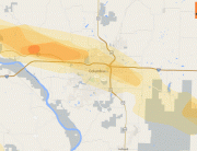
Hail Map for Roanoke, VA August 1, 2012
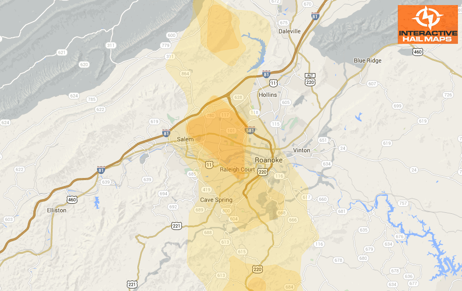
This is the hail map for the hail storm that hit in and around Roanoke, VA on August 1, 2012. The largest and most intense hail fell on the west side of the city. Use Interactive Hail Maps to find hail storms nationwide.
Cities Most Affected by Hail Storms of 8/1/2012
| Hail Size | Demographics of Zip Codes Affected | ||||||
|---|---|---|---|---|---|---|---|
| City | Count | Average | Largest | Pop Density | House Value | Income | Age |
| Roanoke, VA | 4 | 1.75 | 1.75 | 1225 | $98k | $40.8k | 40.1 |
| Minneota, MN | 1 | 1.75 | 1.75 | 14 | $64k | $37.2k | 43.1 |
| Porter, MN | 1 | 1.75 | 1.75 | 6 | $35k | $35.2k | 47.0 |
| Highmore, SD | 1 | 1.75 | 1.75 | 1 | $35k | $30.0k | 48.2 |
| Taunton, MN | 1 | 1.75 | 1.75 | 6 | $50k | $36.4k | 40.3 |
| Salem, VA | 1 | 1.75 | 1.75 | 344 | $104k | $40.5k | 42.1 |
| Lac Du Flambeau, WI | 1 | 1.75 | 1.75 | 21 | $129k | $30.1k | 37.4 |
| Ashland, WI | 1 | 1.75 | 1.75 | 42 | $66k | $33.2k | 40.1 |
Connect with Interactive Hail Maps