Hail Map for Thursday, June 1, 2017

Number of Impacted Households on 6/1/2017
0
Impacted by 1" or Larger Hail
0
Impacted by 1.75" or Larger Hail
0
Impacted by 2.5" or Larger Hail
Square Miles of Populated Area Impacted on 6/1/2017
0
Impacted by 1" or Larger Hail
0
Impacted by 1.75" or Larger Hail
0
Impacted by 2.5" or Larger Hail
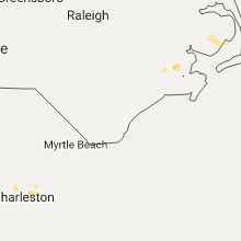
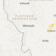
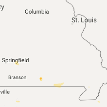
Regions Impacted by Hail on 6/1/2017
Cities Most Affected by Hail Storms of 6/1/2017
| Hail Size | Demographics of Zip Codes Affected | ||||||
|---|---|---|---|---|---|---|---|
| City | Count | Average | Largest | Pop Density | House Value | Income | Age |
| Port Orange, FL | 1 | 1.75 | 1.75 | 2156 | $104k | $40.3k | 50.2 |
Hail and Wind Damage Spotted on 6/1/2017
Filter by Report Type:Hail ReportsWind Reports
States Impacted
Georgia, Florida, Arkansas, Texas, Montana, Tennessee, Missouri, North Carolina, Wyoming, NebraskaGeorgia
| Local Time | Report Details |
|---|---|
| 3:05 PM EDT | Barn destroyed and camper damaged on the 100 block of rock hill school road. a gust of 44 mph was also measured in the same locatio in upson county GA, 56.3 miles S of Atlanta, GA |
| 5:14 PM EDT | Trees down on sr 45 north of damascus. time estimated by rada in early county GA, 70.3 miles NNW of Tallahassee, FL |
Florida
| Local Time | Report Details |
|---|---|
| 3:40 PM EDT | Golf Ball sized hail reported near Port Orange, FL, 44.4 miles NNE of Orlando, FL, port orange resident... per social media post... reports at least 1.75 inch hail - is possibly larger but cannot tell based on photo. time estimated from radar. |
| 3:51 PM EDT | Quarter sized hail reported near New Smyrna Beach, FL, 40.8 miles NNE of Orlando, FL, trained spotter vol-103 reports quarter size or slightly larger hail on airport road and pioneer road west of new smyrna beach. also reports winds of 55mph or greater.. |
| 4:05 PM EDT | Half Dollar sized hail reported near Port Orange, FL, 45.3 miles NNE of Orlando, FL, multple reports of half dollar sized hail... per social media posts. |
| 4:15 PM EDT | Media relayed report by public of 3 to 5 inch diameter tree branches down at east 12th and franklin st in jacksonvill in duval county FL, 1.6 miles NE of Jacksonville, FL |
| 4:35 PM EDT | Quarter sized hail reported near New Smyrna Beach, FL, 42.9 miles NE of Orlando, FL, per social media post... new smyrna beach resident measured quarter size hail |
| 4:43 PM EDT | Quarter sized hail reported near Jacksonville, FL, 8.9 miles N of Jacksonville, FL, hail of 1 inch in diameter observed at junction of i-295 and i-95. |
| 4:44 PM EDT | Downed tree knocked down a power line in oceanway. time of event determined with rada in duval county FL, 9.7 miles N of Jacksonville, FL |
| 4:45 PM EDT | Estimated thunderstorm wind gust of 60 mph was observed near junction of i-295 and i-9 in duval county FL, 8.9 miles N of Jacksonville, FL |
| 5:00 PM EDT | Thunderstorm wind gust of 60 mph and dime-sized hail was observed on zachary drive by off-duty nws employe in duval county FL, 11.8 miles N of Jacksonville, FL |
Arkansas
| Local Time | Report Details |
|---|---|
| 3:56 PM CDT | Ping Pong Ball sized hail reported near Fayetteville, AR, 48.8 miles NNE of Fort Smith, AR |
| 4:40 PM CDT | Power lines down along interstate 49 in benton county AR, 62.5 miles NNE of Fort Smith, AR |
Texas
| Local Time | Report Details |
|---|---|
| 4:07 PM CDT | Quarter sized hail reported near , , 49.9 miles ENE of Alpine, TX, pecos co sheriff department officials reported hail on hwy 385. |
Montana
| Local Time | Report Details |
|---|---|
| 3:20 PM MDT | Ping Pong Ball sized hail reported near Helena, MT, 73 miles SW of Great Falls, MT, ping pong ball sized hail reported briefly just north of macdonald pass. only pea sized hail now. |
| 3:45 PM MDT | Quarter sized hail reported near Marysville, MT, 70.2 miles SW of Great Falls, MT, quarter sized hail in birdseye. |
| 4:10 PM MDT | Winds estimated 60 mph or more... in addition to dime sized hail and very heavy rainfal in lewis and clark county MT, 50.2 miles SW of Great Falls, MT |
| 4:44 PM MDT | 60 mph thunderstorm wind gust in cascade at 444 pm. lots of rain. no hail. gusts of 35 to 40 mph no in cascade county MT, 24.7 miles SW of Great Falls, MT |
| 4:58 PM MDT | Thunderstorm gust of 60 to 70 mph...some trees down. very heavy rain caused localized street flooding. less than pea sized hail. lots of lightnin in cascade county MT, 24.7 miles SW of Great Falls, MT |
| 5:30 PM MDT | Rotted tree blown down by thunderstorm at corner of 13th ave sw and 14th st in great fall in cascade county MT, 0.9 miles ESE of Great Falls, MT |
| 5:40 PM MDT | Quarter sized hail reported near Great Falls, MT, 4.8 miles SSW of Great Falls, MT, quarter size hail reported in the big bend/fox farm area sw of great falls. |
| 6:05 PM MDT | Trained sportter on highway 87 near mile marker 33 reported wind gusts to at least 60 mph. dust is being kicked up... which is reducing visibilit in chouteau county MT, 31 miles NE of Great Falls, MT |
| 6:37 PM MDT | Storm damage reported in chouteau county MT, 48.5 miles NE of Great Falls, MT |
| 6:40 PM MDT | Trained spotter reports an estimated 60 to 70 mph wind gust along hwy 87. tree limbs of 3 in diameter also reported dow in chouteau county MT, 52.3 miles SW of Havre, MT |
| 9:40 PM MDT | Saco us-2 dot site in valley county MT, 35.3 miles WNW of Glasgow, MT |
Tennessee
| Local Time | Report Details |
|---|---|
| 5:55 PM CDT | Powerpole down on old union loop.via twitter and law enforcemen in henry county TN, 22.2 miles ENE of Mc Kenzie, TN |
Missouri
| Local Time | Report Details |
|---|---|
| 6:53 PM CDT | Tree down across grant and kearney street. unknown size tre in greene county MO, 2.2 miles NNW of Springfield, MO |
| 7:05 PM CDT | 12" tree broken off at entrance to the fairgrounds grant and norton. walking entrance has an even larger tree broken of in greene county MO, 2.8 miles N of Springfield, MO |
| 7:10 PM CDT | Three large trees down jean and lyon street 24" and large in greene county MO, 2.1 miles N of Springfield, MO |
| 7:13 PM CDT | Awning to caseys gas station partially blown of in greene county MO, 3 miles NNW of Springfield, MO |
| 7:15 PM CDT | Tree limbs down across from the humane societ in greene county MO, 3.9 miles NW of Springfield, MO |
| 7:16 PM CDT | Quarter sized hail reported near Willard, MO, 8.2 miles NNW of Springfield, MO, report from social media. |
North Carolina
| Local Time | Report Details |
|---|---|
| 8:03 PM EDT | Estimated wind gusts 60 to 65 mph on north lake road between fairfield and engelhard. also pea size hai in outer banks hyde county NC, 81.8 miles S of Virginia Beach, VA |
Wyoming
| Local Time | Report Details |
|---|---|
| 8:06 PM MDT | Buffalo airpor in johnson county WY, 60.5 miles W of Gillette, WY |
Nebraska
| Local Time | Report Details |
|---|---|
| 4:15 AM CDT | Several large limbs down in the midtown are in douglas county NE, 3.6 miles W of Omaha, NE |
| 4:20 AM CDT | Additional reports of large limbs and trees down in midtown area south towards i80 in douglas county NE, 3.6 miles W of Omaha, NE |


Connect with Interactive Hail Maps